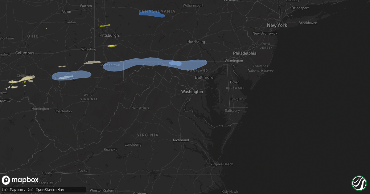
Hail Map in Maryland on April 19, 2025
Get this storm
April 19 map
$229
one time, instant access
Download today. No call, no setup
Keep the $229
Bought the map and want the full workflow? Apply the entire $229 to a subscription within 7 days. None of it is wasted.
Every map, not just this one
This buys you this map. Subscription and you get every map we run, in the markets you choose from a few cities to whole states to nationwide. Plus real-time alerts the moment a storm fires.
Contact data
Name, contact info, occupancy, even credit band for addresses in the footprint. You go from where it hit to who to call.
Become the source they trust
Unlimited branding weather history reports on demand. You already have the documented answer ready for the property owner, and you are the one who showed up with it.
Property data and RoofTrace estimates
Pull up any address you have got, its value and the exact code rules for that jurisdiction, straight from One Click Code. Then RoofTrace estimates the squares, pitch, and roof value, priced the way you price.
Storm reports in Maryland
Maryland
| Date | Description |
|---|---|
| 04/19/20251:35 PM CDT | At least six trees down on md-30 near manchester blocking the road. |
| 04/18/202510:05 PM CDT | Numerous trees blew down near rising sun... Including on us-1 conowingo road at md-276 jacob tome memorial highway. |
| 04/18/20259:58 PM CDT | Numerous trees blew down along little road. |
| 04/18/20259:57 PM CDT | Numerous trees blew down along mcnabb road. |
| 04/18/20259:57 PM CDT | Numerous trees blew down along mill green road. |
| 04/18/20259:56 PM CDT | Numerous trees blew down along delp road. |
| 04/18/20259:56 PM CDT | Numerous trees blew down along md-646 prospect road. |
| 04/18/20259:55 PM CDT | Numerous trees blew down on ridge road. |
| 04/18/20259:54 PM CDT | Reports of a number of trees and power lines down across street... Md. |
| 04/18/20259:54 PM CDT | Numerous trees blew down along grier nursery road. |
| 04/18/20259:45 PM CDT | Numerous reports of trees down in the northern portion of baltimore county. Some on cars and structures. Area near prettyboy reservoir has the most widespread damage. L |
| 04/18/20259:43 PM CDT | Reports of a number of trees and power lines down across white hall... Md |
| 04/18/20259:42 PM CDT | Numerous trees blew down near bentley springs... Including on md-45 york road at bee tree mill court. |
| 04/18/20259:41 PM CDT | Numerous trees blew down near bentley springs... Including on md-42 york road at bentley road. |
| 04/18/20259:38 PM CDT | A local report indicates 61 MPH wind near 4 NE Millers |
| 04/18/20259:35 PM CDT | At least six trees down on md-30 near manchester blocking the road. Corrected time. |
| 04/18/20259:32 PM CDT | Numerous trees blew down near manchester... Including on md-30 main street at michelle road. |
| 04/18/20259:28 PM CDT | Awos at carroll county regional airport |
| 04/18/20259:28 PM CDT | Awos at carroll county regional airport |
| 04/18/20259:24 PM CDT | Numerous trees blew down around uniontown... Including on md-832 old taneytown road at mayberry road. |
| 04/18/20259:24 PM CDT | Numerous trees blew down near linwood... Including on md-84 union bridge road at md-75 green valley road. |
| 04/18/20259:21 PM CDT | Reports of damage to a shed that was tossed in the thunderstorm winds |
| 04/18/20259:21 PM CDT | Reports of damage to a shed that was tossed in the thunderstorm winds. Also multiple reports of tree damage across northern carroll county. |
| 04/18/20259:15 PM CDT | Cwop station dw1771 |
| 04/18/20259:12 PM CDT | Maryland mesonet station thurmont 1 ne |
| 04/18/20259:12 PM CDT | Awos at camp david |
| 04/18/20259:12 PM CDT | Numerous tree limbs blew down between thurmont and new midway. |
| 04/18/20259:10 PM CDT | Numerous tree limbs blew down southeast of thurmont. |
| 04/18/20259:10 PM CDT | Numerous trees blew down near thurmont... Including on md-550 jimtown road east of us-15. |
| 04/18/20259:09 PM CDT | Mddot sensor md 64 at md 418 |
| 04/18/20259:06 PM CDT | Numerous trees blew down near smithsburg... Including on md-77 foxville road at herman hauver road. |
| 04/18/20259:05 PM CDT | Cwop station cw1323 |
| 04/18/20259:04 PM CDT | Personal weather station kmdhager64 |
| 04/18/20259:04 PM CDT | Measured on personal weather station |
| 04/18/20259:01 PM CDT | At least a dozen trees down across hagerstown. |
| 04/18/20259:01 PM CDT | Over a dozen trees down in thurmont to emmitsburg. Numerous roads closed. |
| 04/18/20259:00 PM CDT | Private weather station hgntc |
| 04/18/20259:00 PM CDT | A local report indicates 75 MPH wind near Hagerstown Rgnl Arpt |
| 04/18/20259:00 PM CDT | Extensive damage from hagerstown to smithsburg including numerous trees down... Roof damage... Shed destroyed |
| 04/18/20258:56 PM CDT | Numerous trees blew down near hagerstown... Including on i-81 at exit 7a/md-58 salem avenue. |
| 04/18/20258:53 PM CDT | Numerous trees blew down near conococheague... Including on eastbound i-70 dwight d. Eisenhower highway prior to exit 24/md-63 greencastle pike. |
| 04/18/20258:53 PM CDT | Numerous trees blew down near conococheague... Including on md-63 greencastle pike at mcgregor drive. |
| 04/18/20258:45 PM CDT | Numerous trees blew down near big pool... Including on westbound i-70 dwight d. Eisenhower highway prior to exit 12/md-56 big pool road. |
| 04/18/20258:36 PM CDT | Numerous trees blew down around hancock... Including on westbound i-70/us-40 dwight d. Eisenhower highway at exit 1a/i-68 national freeway. |
| 04/18/20258:35 PM CDT | Numerous trees blew down near hancock... Including on md-144 western pike near locher road. |
| 04/18/20258:29 PM CDT | Multiple large limbs down on property |
| 04/18/20258:12 PM CDT | *** 1 inj *** allegany county 911 call center took over 100 calls for trees... Wires... And poles down across the northern part of the county. |
| 04/18/20258:11 PM CDT | Over a hundred calls relating to storm damage. Trees down everywhere across the northern portion of the county. |
| 04/18/20258:08 PM CDT | 50 foot tall tree down on power line... Many branches down |
| 04/18/20258:06 PM CDT | Numerous trees blew down near luke... Including on md-135 maryland highway at north branch avenue. |
| 04/18/20258:03 PM CDT | Over a dozen trees snapped at the base on pochantas road. |
| 04/18/20258:00 PM CDT | A local report indicates 71 MPH wind near 1 W Mc Henry |
| 04/18/20258:00 PM CDT | Maryland mesonet site bittinger 3 ssw |
| 04/18/20257:55 PM CDT | Numerous trees and wires blew down in the grantsville area... Including on us-40 alternate/national pike at chestnut ridge road. |
| 04/18/20257:55 PM CDT | Structural damage to a home in friendsville with significant roof damage. Roof partially blown off. Power lines and poles laying on home. |
| 04/18/20257:55 PM CDT | Apprixomately 200 calls for storm related damage in the northern half of garrett county. |
| 04/18/20257:53 PM CDT | Significant damage to the salt dome at keyser's ridge. |
| 04/18/20257:53 PM CDT | A local report indicates 62 MPH wind near 5 W Grantsville |
| 04/18/20257:45 PM CDT | Numerous trees blew down in friendsville... Including on md-742/md-42 friendsville road at first avenue. |
| 04/18/20257:42 PM CDT | Numerous trees blew down near friendsville... Including on md-42 friendsville road at asher glade road. |
| 04/18/20257:42 PM CDT | Numerous calls received of tree damage in the friendsville area |
All States Impacted by Hail Map on April 19, 2025
Cities Impacted by Hail Map on April 19, 2025
- Tahlequah, OK
- Rose, OK
- Oaks, OK
- Twin Oaks, OK
- Kansas, OK
- Custer, MI
- Fountain, MI
- Branch, MI
- Irons, MI
- Bellevue, TX
- Bowie, TX
- Nocona, TX
- Mason, TX
- Voca, TX
- Fredonia, TX
- San Saba, TX
- Cherokee, TX
- Pontotoc, TX
- Birch Tree, MO
- Goldthwaite, TX
- Ellington, MO
- Loudonville, OH
- Lakeville, OH
- Big Prairie, OH
- Freedom, PA
- Fort Stockton, TX
- Iraan, TX
- Reynoldsville, PA
- Punxsutawney, PA
- Sykesville, PA
- Luthersburg, PA
- Stump Creek, PA
- Troutville, PA
- Rockton, PA
- Du Bois, PA
- Curwensville, PA
- Grampian, PA
- Mahaffey, PA
- Penfield, PA
- Clearfield, PA
- Frenchville, PA
- Hyde, PA
- Woodland, PA
- Mineral Springs, PA
- Bigler, PA
- West Decatur, PA
- Morrisdale, PA
- Wallaceton, PA
- Philipsburg, PA
- Ozona, TX
- Drifting, PA
- Kylertown, PA
- Allport, PA
- Winburne, PA
- Munson, PA
- Grassflat, PA
- Hawk Run, PA
- Midkiff, TX
- Lanse, PA
- Moshannon, PA
- Big Lake, TX
- McCamey, TX
- Sterling City, TX
- Bronte, TX
- Seaman, OH
- Blackwell, TX
- Winchester, OH
- Bainbridge, OH
- Hillsboro, OH
- Robert Lee, TX
- Peebles, OH
- Chillicothe, OH
- Waverly, OH
- Monongahela, PA
- Charleroi, PA
- Monessen, PA
- Donora, PA
- Belle Vernon, PA
- Maryneal, TX
- Roscoe, TX
- Sweetwater, TX
- Nolan, TX
- Piketon, OH
- Londonderry, OH
- South Bloomingville, OH
- Ray, OH
- Richmond Dale, OH
- Van Voorhis, PA
- Bentleyville, PA
- Smithton, PA
- West Newton, PA
- Mertzon, TX
- Rankin, TX
- Malta, OH
- Beverly, OH
- Mcconnelsville, OH
- Stockport, OH
- Waterford, OH
- Ovalo, TX
- Tuscola, TX
- Abilene, TX
- Moran, TX
- Breckenridge, TX
- Jacksboro, TX
- Lowell, OH
- Lawn, TX
- Winters, TX
- Baird, TX
- Clyde, TX
- Coolville, OH
- Little Hocking, OH
- Henrietta, TX
- Washington, WV
- Parkersburg, WV
- Belpre, OH
- Graysville, OH
- Woodsfield, OH
- Indiahoma, OK
- Waverly, WV
- Vienna, WV
- Garden City, TX
- Amesville, OH
- Athens, OH
- Cutler, OH
- Guysville, OH
- Fleming, OH
- Stewart, OH
- Vincent, OH
- Marietta, OH
- Williamstown, WV
- Mineral Wells, WV
- Whipple, OH
- Reno, OH
- Belmont, WV
- Newport, OH
- New Matamoras, OH
- Saint Marys, WV
- Friendly, WV
- Walker, WV
- Sistersville, WV
- Pennsboro, WV
- Harrisville, WV
- Petroleum, WV
- Cairo, WV
- Davisville, WV
- Middlebourne, WV
- Ellenboro, WV
- Alma, WV
- Hannibal, OH
- Sardis, OH
- New Martinsville, WV
- Clarington, OH
- Albany, TX
- Jacksonburg, WV
- West Union, WV
- Salem, WV
- Center Point, WV
- Chico, TX
- Sunset, TX
- Littleton, WV
- Cameron, WV
- Proctor, WV
- Glen Easton, WV
- Woodson, TX
- Wana, WV
- Burton, WV
- Aleppo, PA
- Hundred, WV
- Fairview, WV
- New Freeport, PA
- Montague, TX
- Graham, TX
- Saint Jo, TX
- Newcastle, TX
- Osage, WV
- Morgantown, WV
- Maidsville, WV
- Rivesville, WV
- Fairmont, WV
- Pursglove, WV
- Baxter, WV
- Granville, WV
- Bretz, WV
- Montana Mines, WV
- Kingwood, WV
- Reedsville, WV
- Arthurdale, WV
- Newburg, WV
- Masontown, WV
- Bruceton Mills, WV
- Albright, WV
- Independence, WV
- Gibbon Glade, PA
- Markleysburg, PA
- Farmington, PA
- Salisbury, PA
- Friendsville, MD
- Meyersdale, PA
- Terra Alta, WV
- Grantsville, MD
- Fort Hill, PA
- Addison, PA
- Accident, MD
- Confluence, PA
- Swanton, MD
- West Salisbury, PA
- McHenry, MD
- Frostburg, MD
- Oakland, MD
- Lonaconing, MD
- Boynton, PA
- Springs, PA
- Hyndman, PA
- Mount Savage, MD
- Wellersburg, PA
- Midlothian, MD
- Cumberland, MD
- Wilson, OK
- Ringling, OK
- Wingate, TX
- Merkel, TX
- Hico, TX
- Carlsbad, TX
- Overbrook, OK
- Comanche, TX
- Stephenville, TX
- Dyess Afb, TX
- Ellerslie, MD
- Corriganville, MD
- Bedford, PA
- Everett, PA
- Clearville, PA
- Flintstone, MD
- Artemas, PA
- Warfordsburg, PA
- Mercersburg, PA
- Little Orleans, MD
- Big Cove Tannery, PA
- Needmore, PA
- Berkeley Springs, WV
- Ridgeley, WV
- Oldtown, MD
- Hancock, MD
- Great Cacapon, WV
- Bluff Dale, TX
- Dublin, TX
- Tolar, TX
- Lone Grove, OK
- Burneyville, OK
- San Angelo, TX
- Tye, TX
- Coyanosa, TX
- Pecos, TX
- De Leon, TX
- Ardmore, OK
- Springer, OK
- Buffalo Gap, TX
- Granbury, TX
- Lipan, TX
- Weatherford, TX
- Loop, TX
- Seagraves, TX
- Brownfield, TX
- Crane, TX
- Imperial, TX
- Leon, OK
- Millsap, TX
- Mineral Wells, TX
- Muenster, TX
- Hagerstown, MD
- Clear Spring, MD
- Waynesboro, PA
- Greencastle, PA
- Big Pool, MD
- Hedgesville, WV
- Rouzerville, PA
- State Line, PA
- Blue Ridge Summit, PA
- Fairfield, PA
- Maugansville, MD
- Smithsburg, MD
- Cascade, MD
- Emmitsburg, MD
- Sabillasville, MD
- Gettysburg, PA
- Frederick, MD
- Boonsboro, MD
- Keymar, MD
- Falling Waters, WV
- Fairplay, MD
- Littlestown, PA
- Thurmont, MD
- Myersville, MD
- Woodsboro, MD
- Taneytown, MD
- Walkersville, MD
- Westminster, MD
- Funkstown, MD
- New Windsor, MD
- Rocky Ridge, MD
- Union Bridge, MD
- Williamsport, MD
- Hanover, PA
- New Freedom, PA
- Railroad, PA
- Glenville, PA
- Hampstead, MD
- Manchester, MD
- Freeland, MD
- Glen Rock, PA
- Finksburg, MD
- Parkton, MD
- Upperco, MD
- Sparks Glencoe, MD
- Reisterstown, MD
- Marietta, OK
- Roff, OK
- Gainesville, TX
- Ballinger, TX
- Norton, TX
- Perrin, TX
- Sulphur, OK
- Miles, TX
- Dougherty, OK
- Davis, OK
- New Park, PA
- White Hall, MD
- Shrewsbury, PA
- Stewartstown, PA
- Monkton, MD
- Ada, OK
- Thackerville, OK
- Ropesville, TX
- Wolfforth, TX
- Meadow, TX
- Santo, TX
- Konawa, OK
- Mill Creek, OK
- Tahoka, TX
- Poolville, TX
- Wilson, TX
- Lubbock, TX
- Sheffield, TX
- Dryden, TX
- Rowena, TX
- Springtown, TX
- Holdenville, OK
- Wewoka, OK
- Sasakwa, OK
- Madill, OK
- Maud, OK
- Tishomingo, OK
- Mannsville, OK
- Whitesboro, TX
- Paradise, TX
- Lebanon, OK
- Kingston, OK
- Bridgeport, TX
- Talpa, TX
- Coleman, TX
- Boynton, OK
- Council Hill, OK
- Checotah, OK
- Stonewall, OK
- Novice, TX
- Barnhart, TX
- Fitzhugh, OK
- Tupelo, OK
- Decatur, TX
- Gordonville, TX
- Centrahoma, OK
- Morris, OK
- Haskell, OK
- Mead, OK
- Burkett, TX
- Allen, OK
- Milburn, OK
- Alvord, TX
- Durant, OK
- Kenefic, OK
- Calvin, OK
- Coalgate, OK
- Calera, OK
- Coleman, OK
- Valera, TX
- Wapanucka, OK
- Caddo, OK
- Cross Plains, TX
- Brownwood, TX
- Goodfellow Afb, TX
- Vancourt, TX
- Wall, TX
- Eola, TX
- Mereta, TX
- Forestburg, TX
- Caney, OK
- Rising Star, TX
- Atoka, OK
- Ringgold, TX
- Cisco, TX
- Sonora, TX
- Santa Anna, TX
- May, TX
- Kiowa, OK
- Wardville, OK
- Paint Rock, TX
- Millersview, TX
- Eldorado, TX
- Pittsburg, OK
- Carbon, TX
- Gorman, TX
- Lane, OK
- Blanco, OK
- Eden, TX
- Goldsboro, TX
- Hartshorne, OK
- Stuart, OK
- Mcalester, OK
- Haileyville, OK
- Wilburton, OK
- Junction, TX
- Rocksprings, TX
- Menard, TX
- Bryson, TX
- Roosevelt, TX
- Melvin, TX
- Red Oak, OK
- Bangs, TX
- Monaca, PA
- Beaver, PA
- Rochester, PA
- Zelienople, PA
- Cranberry Township, PA
- Mars, PA
- Valencia, PA
- Evans City, PA
- Boyd, TX
- Lohn, TX
- Sanderson, TX
- Brackettville, TX
- Mountain Home, TX
- Leakey, TX
- Vanderpool, TX
- Hunt, TX
- Harper, TX
- Natural Dam, AR
- Medina, TX
- Farmington, AR
- Prairie Grove, AR
- Fayetteville, AR
- Pipe Creek, TX
- Bandera, TX
- Jadwin, MO
- Salem, MO


