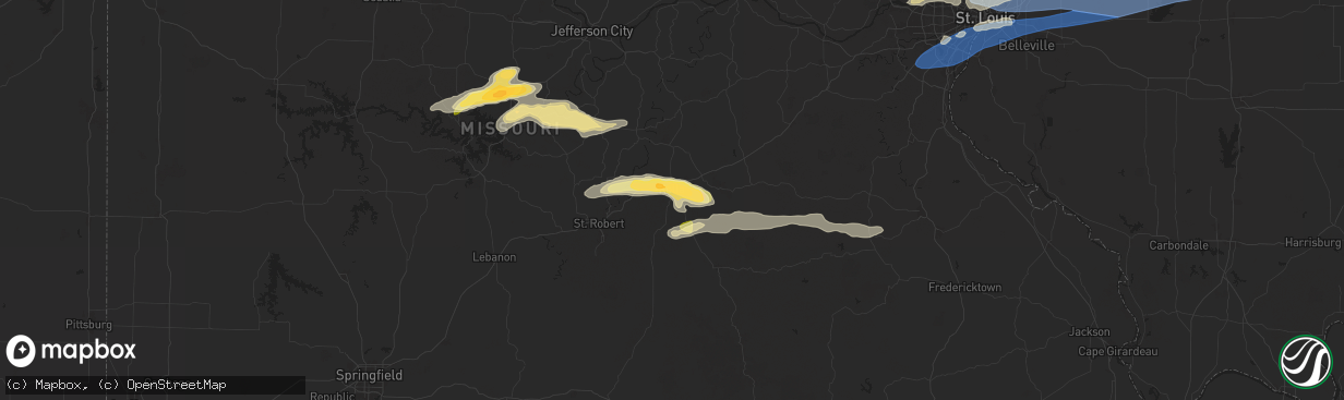
Hail Map in Rolla, MO on April 18, 2024
The weather event in Rolla, MO on April 18, 2024 includes Wind, Hail, and Tornado maps. 12 states and 753 cities were impacted and suffered possible damage. The total estimated number of properties impacted is 13,046.
Wind
Hail
Tornado
13,046
Estimated number of impacted properties by a 1.00" hail or larger0
Estimated number of impacted properties by a 1.75" hail or larger0
Estimated number of impacted properties by a 2.50" hail or largerStorm reports in Rolla, MO
Rolla, MO
| Date | Description |
|---|---|
| 04/18/20245:30 PM CDT | Comment on social media with picture of hailstone next to quarter. |
| 04/18/20245:02 PM CDT | Half dollar size hail. The hail storm itself lasted about 10 minutes downing twigs and leaves everywhere and leaving the ground covered with hail in its wake. |
| 04/18/20244:55 PM CDT | Public report of ping pong ball size hail on w 14th st south of interstate 44. |
| 04/18/20244:55 PM CDT | Public repor |
| 04/18/20244:55 PM CDT | Police reported multiple wires and some trees down in rolla. A 42 mph gust was also recorded just northeast of rolla. Time estimated via radar. |
| 04/18/20244:55 PM CDT | Image sent in of half-dollar sized hail. Time estimated via radar. |
| 04/18/20244:55 PM CDT | Tree uprooted just west of rolla city limits. Location estimated. Time estimated via radar. |
| 04/18/20244:55 PM CDT | Portion of a motel roof blown off. Reported by law enforcement and confirmed via images in nwschat. Time estimated via radar. |
| 04/18/20244:55 PM CDT | A local report indicates 1.25 inch wind near Rolla |
| 04/18/20244:55 PM CDT | A local report indicates 1.00 inch wind near 3 E Northwye |
| 04/18/20244:55 PM CDT | Multiple reports of lots of quarter sized hail falling for several minutes. |
All States Impacted by Hail Map on April 18, 2024
All Cities Impacted by Hail Map on April 18, 2024
- Wamego, KS
- Belvue, KS
- Onaga, KS
- Westmoreland, KS
- Rossville, KS
- Saint Marys, KS
- Delia, KS
- Emmett, KS
- Havensville, KS
- Mayetta, KS
- Soldier, KS
- Holton, KS
- Topeka, KS
- Silver Lake, KS
- Hoyt, KS
- Denison, KS
- Valley Falls, KS
- Meriden, KS
- Ozawkie, KS
- Oskaloosa, KS
- Grantville, KS
- Effingham, KS
- Winchester, KS
- Atchison, KS
- Cummings, KS
- Nortonville, KS
- Lancaster, KS
- Perry, KS
- Tonganoxie, KS
- Leavenworth, KS
- McLouth, KS
- Lawrence, KS
- Easton, KS
- Rushville, MO
- Saint Joseph, MO
- Wathena, KS
- Troy, KS
- De Kalb, MO
- Weston, MO
- Agency, MO
- Dearborn, MO
- Faucett, MO
- Elwood, KS
- Fort Leavenworth, KS
- Easton, MO
- Bonner Springs, KS
- Basehor, KS
- Lansing, KS
- Linwood, KS
- Platte City, MO
- Farley, MO
- Smithville, MO
- Camden Point, MO
- Kansas City, KS
- Gower, MO
- Edgerton, MO
- Waldron, MO
- Shawnee, KS
- Kansas City, MO
- Riverside, MO
- Stewartsville, MO
- Trimble, MO
- Marion, LA
- Bernice, LA
- Spearsville, LA
- Farmerville, LA
- Bastrop, LA
- Bonita, LA
- Mer Rouge, LA
- Jones, LA
- Oak Grove, LA
- Lake Providence, LA
- Huttig, AR
- Marceline, MO
- Salisbury, MO
- New Cambria, MO
- Clifton Hill, MO
- Huntsville, MO
- Wilmot, AR
- Callao, MO
- Eudora, AR
- Hamburg, AR
- Mayersville, MS
- Urich, MO
- Butler, MO
- Montrose, MO
- Rolling Fork, MS
- Clinton, MO
- Deepwater, MO
- Calhoun, MO
- Hollandale, MS
- Lincoln, MO
- Warsaw, MO
- Cole Camp, MO
- Columbia, MO
- Harrisburg, MO
- Stover, MO
- Perry, MO
- Hallsville, MO
- Centralia, MO
- Center, MO
- Versailles, MO
- Thompson, MO
- Mexico, MO
- Auxvasse, MO
- New London, MO
- Vandalia, MO
- Frankford, MO
- Curryville, MO
- Gravois Mills, MO
- Barnett, MO
- Rocky Mount, MO
- Louisiana, MO
- Bowling Green, MO
- Benton City, MO
- Martinsburg, MO
- Eldon, MO
- Cape Girardeau, MO
- Empire, AL
- Yazoo City, MS
- Wellsville, MO
- Pleasant Hill, IL
- Rockport, IL
- Wolf Lake, IL
- Jonesboro, IL
- Hanceville, AL
- Alto Pass, IL
- Jackson, MO
- Kaiser, MO
- Louise, MS
- Silver City, MS
- Lake Ozark, MO
- Osage Beach, MO
- Tuscumbia, MO
- Saint Elizabeth, MO
- Rush Hill, MO
- Laddonia, MO
- Thebes, IL
- Eugene, MO
- Latham, MO
- Middletown, MO
- Cullman, AL
- Linn Creek, MO
- Bremen, AL
- Nebo, IL
- Pittsfield, IL
- Pearl, IL
- Meta, MO
- McClure, IL
- Williamsburg, MO
- Brumley, MO
- Fortuna, MO
- Ulman, MO
- Montgomery City, MO
- Clarksville, MO
- Montreal, MO
- Pickens, MS
- Lexington, MS
- Benton, MS
- Olean, MO
- Russellville, MO
- Henley, MO
- Kampsville, IL
- White Hall, IL
- Hillview, IL
- Silex, MO
- Saint Thomas, MO
- Jefferson City, MO
- Iberia, MO
- Blountsville, AL
- Tamms, IL
- Bellflower, MO
- Dixon, MO
- California, MO
- New Florence, MO
- Eolia, MO
- Kingdom City, MO
- Troy, MO
- Elsberry, MO
- Newburg, MO
- Hamilton, TX
- Pulaski, IL
- Dongola, IL
- Olmsted, IL
- Ullin, IL
- Vienna, MO
- Vaughan, MS
- Warrenton, MO
- Richland, MO
- Crocker, MO
- Annada, MO
- Patterson, IL
- Cypress, IL
- Winchester, IL
- Roodhouse, IL
- Murrayville, IL
- Rolla, MO
- Belknap, IL
- Vienna, IL
- Jerome, MO
- New Market, AL
- Meridianville, AL
- Pottsville, TX
- Grand Chain, IL
- Windsor, MO
- Goodman, MS
- Wright City, MO
- Karnak, IL
- Greenfield, IL
- Palmyra, IL
- Modesto, IL
- Foristell, MO
- Hazel Green, AL
- Hamburg, IL
- Camden, MS
- Mullin, TX
- Saint James, MO
- Sedalia, MO
- Mora, MO
- Hettick, IL
- Goldthwaite, TX
- Richland Springs, TX
- Chesterfield, MO
- Ripley, TN
- Ionia, MO
- Green Ridge, MO
- Charleston, MO
- Cary, MS
- Rochelle, TX
- Carrollton, IL
- Wrights, IL
- Eldred, IL
- Fieldon, IL
- Evant, TX
- Barlow, KY
- Cairo, IL
- Cuba, MO
- Kevil, KY
- Saint Louis, MO
- Simpson, IL
- Grantsburg, IL
- Maryland Heights, MO
- Saint Ann, MO
- Bridgeton, MO
- La Center, KY
- Barry, IL
- New Canton, IL
- Licking, MO
- Salem, MO
- San Saba, TX
- Star, TX
- Steelville, MO
- Carlinville, IL
- Gustine, TX
- Girard, IL
- Hazelwood, MO
- Kane, IL
- Worden, IL
- Fenton, MO
- High Ridge, MO
- Leasburg, MO
- Eureka, MO
- Florissant, MO
- Cook Sta, MO
- Granite City, IL
- Cedar Hill, MO
- Hillsboro, MO
- Dittmer, MO
- Valley Park, MO
- Staunton, IL
- Bunker Hill, IL
- Metropolis, IL
- Holly Pond, AL
- Ranburne, AL
- Graham, AL
- Woodland, AL
- Waggoner, IL
- Golconda, IL
- Sullivan, MO
- Bourbon, MO
- Potosi, MO
- Collinsville, IL
- Moro, IL
- House Springs, MO
- Imperial, MO
- East Carondelet, IL
- Arnold, MO
- Columbia, IL
- Dupo, IL
- East Saint Louis, IL
- Belleville, IL
- Millstadt, IL
- Fairview Heights, IL
- Caseyville, IL
- Cherryville, MO
- Valmeyer, IL
- Barnhart, MO
- Venice, IL
- Madison, IL
- Mount Olive, IL
- Bowdon, GA
- Heflin, AL
- Nilwood, IL
- Satartia, MS
- Cadet, MO
- Blackwell, MO
- Bentonia, MS
- East Alton, IL
- Alton, IL
- Bethalto, IL
- Edwardsville, IL
- Saint Jacob, IL
- Glen Carbon, IL
- Troy, IL
- Maryville, IL
- O'Fallon, IL
- Lebanon, IL
- Marine, IL
- Sorento, IL
- Walshville, IL
- New Douglas, IL
- Hamel, IL
- Alhambra, IL
- Highland, IL
- Trenton, IL
- Pocahontas, IL
- Davisville, MO
- Aviston, IL
- Greenville, IL
- Breese, IL
- Jacksonville, IL
- Waterloo, IL
- Smithton, IL
- Lometa, TX
- Ashland City, TN
- White Bluff, TN
- Clarksville, TN
- Boss, MO
- Bunker, MO
- Dorsey, IL
- Raymond, IL
- Litchfield, IL
- Butler, IL
- Donnellson, IL
- Hillsboro, IL
- Panama, IL
- Summerfield, IL
- Sedalia, KY
- Flora, MS
- Madison, MS
- Canton, MS
- Freeburg, IL
- Belgrade, MO
- Fulton, KY
- Black, MO
- Bloomsdale, MO
- Festus, MO
- New Athens, IL
- Martin, TN
- Dresden, TN
- Pleasant View, TN
- Joelton, TN
- Springfield, TN
- Smithboro, IL
- Carlyle, IL
- Keyesport, IL
- Fillmore, IL
- Mulberry Grove, IL
- Vandalia, IL
- Coffeen, IL
- Ramsey, IL
- Nashville, IL
- Albers, IL
- Addieville, IL
- Germantown, IL
- Saint Libory, IL
- Marissa, IL
- Bartelso, IL
- Oakdale, IL
- Okawville, IL
- Mascoutah, IL
- New Baden, IL
- Bixby, MO
- Lesterville, MO
- Lenzburg, IL
- Fults, IL
- Lampasas, TX
- Caledonia, MO
- Palmersville, TN
- Dukedom, TN
- Red Bud, IL
- Prairie Du Rocher, IL
- Bismarck, MO
- Ironton, MO
- Greenbrier, TN
- Vernon, IL
- Alma, IL
- Patoka, IL
- Salem, IL
- Shobonier, IL
- Odin, IL
- Sandoval, IL
- Brownstown, IL
- Saint Peter, IL
- Kinmundy, IL
- Coulterville, IL
- Baldwin, IL
- Evansville, IL
- Sparta, IL
- Cowden, IL
- Farmington, KY
- Viburnum, MO
- Belleview, MO
- Oconee, IL
- Walsh, IL
- Ellis Grove, IL
- Irondale, MO
- Ashley, IL
- Richview, IL
- Du Bois, IL
- Hoyleton, IL
- Centralia, IL
- Hoffman, IL
- Cherokee, TX
- Arcadia, MO
- Fredericktown, MO
- Cutler, IL
- Chester, IL
- Percy, IL
- Steeleville, IL
- Annapolis, MO
- Mount Pulaski, IL
- Warrensburg, IL
- Decatur, IL
- Illiopolis, IL
- Niantic, IL
- Latham, IL
- Chestnut, IL
- Forsyth, IL
- Maroa, IL
- Oreana, IL
- Mason, IL
- Louisville, IL
- Flora, IL
- Farina, IL
- Xenia, IL
- Edgewood, IL
- Saint Elmo, IL
- Irvington, IL
- Walnut Hill, IL
- Woodlawn, IL
- Opdyke, IL
- Mount Vernon, IL
- Dix, IL
- Waltonville, IL
- Texico, IL
- Bluford, IL
- Kell, IL
- Iuka, IL
- Pinckneyville, IL
- Lakewood, IL
- Centerville, MO
- Valley Spring, TX
- Voca, TX
- Pontotoc, TX
- Fredonia, TX
- Argenta, IL
- Cisco, IL
- Cerro Gordo, IL
- Ingraham, IL
- Clay City, IL
- Sailor Springs, IL
- Keenes, IL
- Wayne City, IL
- Johnsonville, IL
- Sims, IL
- Bonnie, IL
- Campbell Hill, IL
- Adams, TN
- Milmine, IL
- Monticello, IL
- Noble, IL
- Newton, IL
- Barnhill, IL
- Fairfield, IL
- Geff, IL
- Marquand, MO
- Llano, TX
- Ewing, IL
- Art, TX
- Adairville, KY
- Vichy, MO
- Dieterich, IL
- Ava, IL
- Vergennes, IL
- Du Quoin, IL
- Belle Rive, IL
- Dahlgren, IL
- Springerton, IL
- Mill Shoals, IL
- Burnt Prairie, IL
- Carmi, IL
- Golden Gate, IL
- Ellery, IL
- Albion, IL
- Cisne, IL
- Mount Erie, IL
- Des Arc, MO
- Vulcan, MO
- Olney, IL
- Macedonia, IL
- Ellington, MO
- Crossville, IL
- Grayville, IL
- Mount Carmel, IL
- Browns, IL
- Winona, MO
- Castell, TX
- Patterson, MO
- Eldorado, IL
- Raleigh, IL
- Silva, MO
- Lodi, MO
- Caulfield, MO
- West Salem, IL
- Parkersburg, IL
- Poseyville, IN
- Griffin, IN
- Owensville, IN
- Cynthiana, IN
- Wildwood, MO
- Wood River, IL
- Roxana, IL
- Mountain Home, AR
- Norris City, IL
- Omaha, IL
- Broughton, IL
- Auburn, KY
- Bakersfield, MO
- Mason, TX
- Glenallen, MO
- Greenville, MO
- Clubb, MO
- Centertown, KY
- Lewis, IN
- Plainville, IN
- Linton, IN
- Jasonville, IN
- Lyons, IN
- Carlisle, IN
- Worthington, IN
- Sullivan, IN
- Dugger, IN
- Clay City, IN
- Sandborn, IN
- Edwardsport, IN
- Washington, IN
- Westphalia, IN
- Oaktown, IN
- Flat Rock, IL
- Hutsonville, IL
- Bicknell, IN
- Shelburn, IN
- Palestine, IL
- Oblong, IL
- Freelandville, IN
- Lawrenceville, IL
- Willow Hill, IL
- Fairbanks, IN
- Robinson, IL
- Coalmont, IN
- Bruceville, IN
- Farmersburg, IN
- Stoy, IL
- Hymera, IN
- Merom, IN
- West Liberty, IL
- Annapolis, IL
- West York, IL
- Sainte Marie, IL
- Sumner, IL
- Marble Hill, MO
- Fremont, MO
- Ridgeland, MS
- Van Buren, MO
- Jackson, MS
- Alton, MO
- Haubstadt, IN
- Fort Branch, IN
- Elberfeld, IN
- Lynnville, IN
- Princeton, IN
- Francisco, IN
- Oakland City, IN
- Wadesville, IN
- Zalma, MO
- Rockfield, KY
- Ellsinore, MO
- Mill Spring, MO
- Evansville, IN
- Norfork, AR
- Calico Rock, AR
- Freedom, IN
- Poland, IN
- Newberry, IN
- Coal City, IN
- Patricksburg, IN
- Bloomfield, IN
- Bowling Green, IN
- Switz City, IN
- Spencer, IN
- Elnora, IN
- Solsberry, IN
- Montgomery, IN
- Crane, IN
- Scotland, IN
- Odon, IN
- Loogootee, IN
- Boonville, IN
- Ridgway, IL
- Equality, IL
- Advance, MO
- Sturdivant, MO
- Williamsville, MO
- Bloomington, IN
- Owensburg, IN
- Springville, IN
- Shoals, IN
- Williams, IN
- Mitchell, IN
- Pineville, AR
- Hardinsburg, IN
- Fredericksburg, IN
- Murphysboro, IL
- Pomona, IL
- Altenburg, MO
- Grand Tower, IL
- Bedford, IN
- Orleans, IN
- West Baden Springs, IN
- Oolitic, IN
- Gosport, IN
- Avoca, IN
- Heltonville, IN
- Ellettsville, IN
- Tell City, IN
- Troy, IN
- Evanston, IN
- Melbourne, AR
- Salem, IN
- Lamar, IN
- Bell City, MO
- Tunnelton, IN
- Campbellsburg, IN
- Oran, MO
- Sikeston, MO
- Vanduser, MO
- Mount Pleasant, AR
- Guion, AR
- Truxton, MO
- Batesville, AR
- South Roxana, IL
- Cottage Hills, IL
- Truesdale, MO
- Batchtown, IL
- Shipman, IL
- Webster, KY
- Guston, KY
- Battletown, KY
- Brandenburg, KY
- Payneville, KY
- Fort Knox, KY
- Ekron, KY
- Vine Grove, KY
- New Middletown, IN
- Lanesville, IN
- Corydon, IN
- Muldraugh, KY
- Elizabeth, IN
- Clarksville, IN
- Mauckport, IN
- Laconia, IN
- Louisville, KY
- New Albany, IN
- West Point, KY
- Fairdale, KY
- Mount Washington, KY
- Taylorsville, KY
- Fisherville, KY
- Brooks, KY
- Shepherdsville, KY
- Jeffersonville, IN
- Masonic Home, KY
- Lebanon Junction, KY
- Glenview, KY
- Pewee Valley, KY
- Crestwood, KY
- Prospect, KY
- Simpsonville, KY
- Gorham, IL
- Shelbyville, KY
- Finchville, KY
- Smithfield, KY
- Eminence, KY
- Pleasureville, KY
- La Grange, KY
- Buckner, KY
- New Castle, KY
- Bradford, AR
- Pleasant Plains, AR
- Oil Trough, AR
- Paragould, AR
- Cardwell, MO
- Arbyrd, MO
- Trimble, TN
- Newbern, TN
- Leachville, AR
- Manila, AR
- Roland, AR
- Kenton, TN
- Little Rock, AR
- Rutherford, TN
- Bradford, TN
- Joiner, AR
- Trenton, TN
- Milan, TN
- Mabelvale, AR
- Henning, TN
- Burlison, TN
- Alexander, AR
- Bryant, AR
- Wilson, AR
- Drummonds, TN
- Munford, TN
- Brighton, TN
- Covington, TN
- Hensley, AR
- Redfield, AR
- Sheridan, AR
- Jefferson, AR
- Marvell, AR
- Holly Grove, AR
- Lexa, AR
- Helena, AR
- Bethel Springs, TN
- Selmer, TN
- Stantonville, TN
- Burnsville, MS
- Iuka, MS
- Cherokee, AL
- Tishomingo, MS
- Tuscumbia, AL
- Russellville, AL


