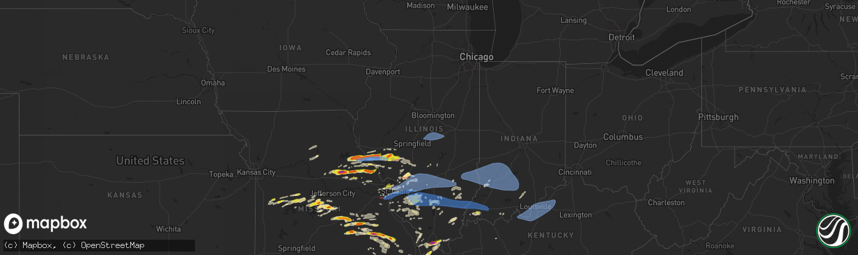
Hail Map in Illinois on April 18, 2024
The weather event in Illinois on April 18, 2024 includes Wind, Hail, and Tornado maps. 12 states and 753 cities were impacted and suffered possible damage. The total estimated number of properties impacted is 8,646.
Want more than just the map?
Turn this storm into a full workflow.
- Owner + property data so you know who to knock
- OnDemand branded weather history reports to win the "did we even have hail?" argument
- RoofTrace estimate so reps stop guessing numbers at the door
Bought this map? Upgrade within 7 days and we'll credit the $230. (10-15 min setup call)
Wind
Hail
Tornado
8,646
Estimated number of impacted properties by a 1.00" hail or larger3,226
Estimated number of impacted properties by a 1.75" hail or larger0
Estimated number of impacted properties by a 2.50" hail or largerStorm reports in Illinois
Illinois
| Date | Description |
|---|---|
| 04/18/20246:57 PM CDT | Numerous trees were blown down from riverton eastward. |
| 04/18/20246:57 PM CDT | Numerous tr |
| 04/18/20246:55 PM CDT | Tree debris was found off of i-64 at the okawville exit. Time estimated from radar. |
| 04/18/20246:55 PM CDT | Corrects previous tstm wnd dmg report from 2 sw hagerstown. Trees downed across illinois route 140 at 300 st and just east of hagerstown. Time estimated from radar. |
| 04/18/20246:55 PM CDT | A local report indicates 1.25 inch wind near Okawville |
| 04/18/20246:19 PM CDT | Report from mping: 3-inch tree limbs broken; power poles broken. |
| 04/18/20246:18 PM CDT | Power poles down. |
| 04/18/20246:18 PM CDT | Photo of a tree snapped in half at rustic acres jellystone park from social media. |
| 04/18/20246:18 PM CDT | Report from mping: 3-inch tree limbs broken; power poles broken. |
| 04/18/20246:15 PM CDT | Trees down... Trees in houses... And powerlines down. |
| 04/18/20246:15 PM CDT | Downed tree and powerlines. |
| 04/18/20246:14 PM CDT | Corrects previous tornado report from marine. Corrects previous tstm wnd dmg report from marine. Trees down... Trees in houses... And powerlines down. |
| 04/18/20246:14 PM CDT | Corrects previous tstm wnd dmg report from marine. Trees down... Trees in houses... And powerlines down. Nws survey team determined the damage was from a ef0 tornado. M |
| 04/18/20246:09 PM CDT | Tree damage |
| 04/18/20246:06 PM CDT | Power poles down. |
| 04/18/20246:05 PM CDT | Large tree blown over. |
| 04/18/20246:04 PM CDT | Report from mping: ping pong ball |
| 04/18/20246:02 PM CDT | Report from mping: trees uprooted or snapped; roof blown off. |
| 04/18/20246:01 PM CDT | Corrects previous tstm wnd dmg report from 1 s prairietown. Report from mping: trees uprooted or snapped; roof blown off. Nws survey team found ef1 damage with max wind |
| 04/18/20245:58 PM CDT | The tornado touched down near the western edge of the prairies of cahokia golf course and moved east for about 1.1 miles where it lifted near the intersection of carol |
| 04/18/20245:57 PM CDT | Report from mping: 3-inch tree limbs broken; power poles broken. |
| 04/18/20245:57 PM CDT | Report from mping: 1-inch tree limbs broken; shingles blown off. |
| 04/18/20245:52 PM CDT | A brief tornado touched down south of standard city where it damaged the roofs of 3 farm sheds. The tornado moved southeast across south standard city rd where it cause |
| 04/18/20245:52 PM CDT | Tree damage with winds up to 80 mph. Nws storm survey continues. |
| 04/18/20245:40 PM CDT | Location approximate... Time estimate from radar... Multiple trees and powerlines down. |
| 04/18/20245:36 PM CDT | Spotter reported a brief tornado touchdown. Storm survey did not find any damage so rated efu. |
| 04/18/20245:12 PM CDT | Video of a tornado taken from a business on palmyra rd from social media--time estimated from radar. |
| 04/18/20245:10 PM CDT | Tree down across highway 37 between cairo and mounds city. |
| 04/18/20244:46 PM CDT | Relayed via facebook. |
| 04/18/20244:45 PM CDT | Corrects previous hail report from 3 s cypress. Delayed report. Hail larger than golfballs. |
| 04/18/20244:40 PM CDT | Observer also reported a horizontal roll cloud. |
| 04/18/20244:37 PM CDT | A local report indicates 1.00 inch wind near Roodhouse |
| 04/18/20244:36 PM CDT | A local report indicates 1.00 inch wind near 1 NNE White Hall |
| 04/18/20243:54 PM CDT | Time estimate from radar. Also golf ball sized hail. |
| 04/18/20243:38 PM CDT | Corrects previous tstm wnd dmg report from 2 w nebo. In pleasant hill... A trampoline was thrown into power line... Then tossed 80 ft up into a tree. A 2.5 ft section o |
| 04/17/20248:42 PM CDT | Delayed report. Tree down at grange grove. |
| 04/17/20248:40 PM CDT | Report of a power line down into a tree. Kcmi gusted to 52 mph with storms. |
| 04/17/20248:35 PM CDT | Several large trees down. |
| 04/17/20248:18 PM CDT | Metal roof blown off a large building along us 45 at county road 620 north. Relayed via twitter. |
| 04/17/20248:15 PM CDT | A large tree fell onto a trailer home. |
| 04/17/20248:13 PM CDT | Measured 1 mile north of mile marker 100 on interstate 64. |
| 04/17/20247:53 PM CDT | Delayed report. Garage roof blown off. Four utility poles and multiple trees blown down. Time estimated by radar. |
| 04/17/20247:49 PM CDT | Delayed report. Large tree blown over. |
| 04/17/20247:49 PM CDT | Delayed report. Social media images show a destroyed grain bin and a damaged farm outbuilding. |
| 04/17/20247:49 PM CDT | Large tree snapped and numerous branches down. Pictures via social media. Time estimated from radar. |
| 04/17/20247:47 PM CDT | Delayed report. Semi blown over on interstate 72 at mile marker 150. |
| 04/17/20247:45 PM CDT | Power poles tilted over on route 48 between oreana and argenta. Time estimated from radar. |
| 04/17/20247:44 PM CDT | Tree down on highway 37 at gun creek. |
| 04/17/20247:43 PM CDT | A local report indicates 1.25 inch wind near Woodlawn |
| 04/17/20247:41 PM CDT | Corrects previous hail report from woodlawn. |
| 04/17/20247:38 PM CDT | Numerous power lin |
| 04/17/20247:38 PM CDT | Numerous power lines were blown down. |
| 04/17/20247:37 PM CDT | Delayed report. Semi blown over on emery road near route 51. |
| 04/17/20247:37 PM CDT | Nws storm damage survey confirmed an ef-1 tornado with estimated peak winds of 90 mph in macon county 3 miles north-northwest of forsyth. The damage path is 7 miles wit |
| 04/17/20247:35 PM CDT | Tree limbs down. |
| 04/17/20247:34 PM CDT | Delayed report. Semi blown over on interstate 72 at mile marker 139. |
| 04/17/20247:34 PM CDT | Delayed report. Semi blown over on i-72 at mile marker 139. |
| 04/17/20247:34 PM CDT | Marion county sheriffs office reported a tree on state route 161 extension at lincoln road. Time estimated by radar. |
| 04/17/20247:29 PM CDT | Delayed report. Roof blown off house. |
| 04/17/20247:25 PM CDT | Marion county sheriffs office reported a tree down on st. Peter road at i-57. Time estimated from radar. |
| 04/17/20247:22 PM CDT | Trees and limbs down. |
| 04/17/20247:22 PM CDT | Trees downed in the brownstown area. Time estimated from radar. |
| 04/17/20247:22 PM CDT | Nws storm survey damage survey confirmed an ef-1 tornado with estimated peak winds of 95 mph in southeast logan and northwest macon counties that moved southeast and th |
| 04/17/20247:20 PM CDT | A tree was blown down. |
| 04/17/20247:20 PM CDT | Nws storm damage survey confirmed an ef-0 tornado with estimated peak winds of 85 mph near latham... Il. The damage path length is 1.11 miles and max width of 200 yds. |
| 04/17/20247:20 PM CDT | A semi was overturned on route 121 near latham. Possible injuries. |
| 04/17/20247:20 PM CDT | The roof of a home was severely damaged. |
| 04/17/20247:20 PM CDT | Report from mping: 3-inch tree limbs broken; power poles broken. |
| 04/17/20247:19 PM CDT | A roof collapsed. |
| 04/17/20247:19 PM CDT | Corrects previous tstm wnd dmg report from 3 wsw latham. Several trees were down... But no structural damage was noted in this area. |
| 04/17/20247:18 PM CDT | Three power poles are leaning near the intersection of route 121 and 1842nd avenue. |
| 04/17/20247:18 PM CDT | Report from mping: trees uprooted or snapped; roof blown off. |
| 04/17/20247:02 PM CDT | A local report indicates 1.00 inch wind near 2 S Addieville |
All States Impacted by Hail Map on April 18, 2024
Cities Impacted by Hail Map on April 18, 2024
- Wamego, KS
- Belvue, KS
- Onaga, KS
- Westmoreland, KS
- Rossville, KS
- Saint Marys, KS
- Delia, KS
- Emmett, KS
- Havensville, KS
- Mayetta, KS
- Soldier, KS
- Holton, KS
- Topeka, KS
- Silver Lake, KS
- Hoyt, KS
- Denison, KS
- Valley Falls, KS
- Meriden, KS
- Ozawkie, KS
- Oskaloosa, KS
- Grantville, KS
- Effingham, KS
- Winchester, KS
- Atchison, KS
- Cummings, KS
- Nortonville, KS
- Lancaster, KS
- Perry, KS
- Tonganoxie, KS
- Leavenworth, KS
- McLouth, KS
- Lawrence, KS
- Easton, KS
- Rushville, MO
- Saint Joseph, MO
- Wathena, KS
- Troy, KS
- De Kalb, MO
- Weston, MO
- Agency, MO
- Dearborn, MO
- Faucett, MO
- Elwood, KS
- Fort Leavenworth, KS
- Easton, MO
- Bonner Springs, KS
- Basehor, KS
- Lansing, KS
- Linwood, KS
- Platte City, MO
- Farley, MO
- Smithville, MO
- Camden Point, MO
- Kansas City, KS
- Gower, MO
- Edgerton, MO
- Waldron, MO
- Shawnee, KS
- Kansas City, MO
- Riverside, MO
- Stewartsville, MO
- Trimble, MO
- Marion, LA
- Bernice, LA
- Spearsville, LA
- Farmerville, LA
- Bastrop, LA
- Bonita, LA
- Mer Rouge, LA
- Jones, LA
- Oak Grove, LA
- Lake Providence, LA
- Huttig, AR
- Marceline, MO
- Salisbury, MO
- New Cambria, MO
- Clifton Hill, MO
- Huntsville, MO
- Wilmot, AR
- Callao, MO
- Eudora, AR
- Hamburg, AR
- Mayersville, MS
- Urich, MO
- Butler, MO
- Montrose, MO
- Rolling Fork, MS
- Clinton, MO
- Deepwater, MO
- Calhoun, MO
- Hollandale, MS
- Lincoln, MO
- Warsaw, MO
- Cole Camp, MO
- Columbia, MO
- Harrisburg, MO
- Stover, MO
- Perry, MO
- Hallsville, MO
- Centralia, MO
- Center, MO
- Versailles, MO
- Thompson, MO
- Mexico, MO
- Auxvasse, MO
- New London, MO
- Vandalia, MO
- Frankford, MO
- Curryville, MO
- Gravois Mills, MO
- Barnett, MO
- Rocky Mount, MO
- Louisiana, MO
- Bowling Green, MO
- Benton City, MO
- Martinsburg, MO
- Eldon, MO
- Cape Girardeau, MO
- Empire, AL
- Yazoo City, MS
- Wellsville, MO
- Pleasant Hill, IL
- Rockport, IL
- Wolf Lake, IL
- Jonesboro, IL
- Hanceville, AL
- Alto Pass, IL
- Jackson, MO
- Kaiser, MO
- Louise, MS
- Silver City, MS
- Lake Ozark, MO
- Osage Beach, MO
- Tuscumbia, MO
- Saint Elizabeth, MO
- Rush Hill, MO
- Laddonia, MO
- Thebes, IL
- Eugene, MO
- Latham, MO
- Middletown, MO
- Cullman, AL
- Linn Creek, MO
- Bremen, AL
- Nebo, IL
- Pittsfield, IL
- Pearl, IL
- Meta, MO
- McClure, IL
- Williamsburg, MO
- Brumley, MO
- Fortuna, MO
- Ulman, MO
- Montgomery City, MO
- Clarksville, MO
- Montreal, MO
- Pickens, MS
- Lexington, MS
- Benton, MS
- Olean, MO
- Russellville, MO
- Henley, MO
- Kampsville, IL
- White Hall, IL
- Hillview, IL
- Silex, MO
- Saint Thomas, MO
- Jefferson City, MO
- Iberia, MO
- Blountsville, AL
- Tamms, IL
- Bellflower, MO
- Dixon, MO
- California, MO
- New Florence, MO
- Eolia, MO
- Kingdom City, MO
- Troy, MO
- Elsberry, MO
- Newburg, MO
- Hamilton, TX
- Pulaski, IL
- Dongola, IL
- Olmsted, IL
- Ullin, IL
- Vienna, MO
- Vaughan, MS
- Warrenton, MO
- Richland, MO
- Crocker, MO
- Annada, MO
- Patterson, IL
- Cypress, IL
- Winchester, IL
- Roodhouse, IL
- Murrayville, IL
- Rolla, MO
- Belknap, IL
- Vienna, IL
- Jerome, MO
- New Market, AL
- Meridianville, AL
- Pottsville, TX
- Grand Chain, IL
- Windsor, MO
- Goodman, MS
- Wright City, MO
- Karnak, IL
- Greenfield, IL
- Palmyra, IL
- Modesto, IL
- Foristell, MO
- Hazel Green, AL
- Hamburg, IL
- Camden, MS
- Mullin, TX
- Saint James, MO
- Sedalia, MO
- Mora, MO
- Hettick, IL
- Goldthwaite, TX
- Richland Springs, TX
- Chesterfield, MO
- Ripley, TN
- Ionia, MO
- Green Ridge, MO
- Charleston, MO
- Cary, MS
- Rochelle, TX
- Carrollton, IL
- Wrights, IL
- Eldred, IL
- Fieldon, IL
- Evant, TX
- Barlow, KY
- Cairo, IL
- Cuba, MO
- Kevil, KY
- Saint Louis, MO
- Simpson, IL
- Grantsburg, IL
- Maryland Heights, MO
- Saint Ann, MO
- Bridgeton, MO
- La Center, KY
- Barry, IL
- New Canton, IL
- Licking, MO
- Salem, MO
- San Saba, TX
- Star, TX
- Steelville, MO
- Carlinville, IL
- Gustine, TX
- Girard, IL
- Hazelwood, MO
- Kane, IL
- Worden, IL
- Fenton, MO
- High Ridge, MO
- Leasburg, MO
- Eureka, MO
- Florissant, MO
- Cook Sta, MO
- Granite City, IL
- Cedar Hill, MO
- Hillsboro, MO
- Dittmer, MO
- Valley Park, MO
- Staunton, IL
- Bunker Hill, IL
- Metropolis, IL
- Holly Pond, AL
- Ranburne, AL
- Graham, AL
- Woodland, AL
- Waggoner, IL
- Golconda, IL
- Sullivan, MO
- Bourbon, MO
- Potosi, MO
- Collinsville, IL
- Moro, IL
- House Springs, MO
- Imperial, MO
- East Carondelet, IL
- Arnold, MO
- Columbia, IL
- Dupo, IL
- East Saint Louis, IL
- Belleville, IL
- Millstadt, IL
- Fairview Heights, IL
- Caseyville, IL
- Cherryville, MO
- Valmeyer, IL
- Barnhart, MO
- Venice, IL
- Madison, IL
- Mount Olive, IL
- Bowdon, GA
- Heflin, AL
- Nilwood, IL
- Satartia, MS
- Cadet, MO
- Blackwell, MO
- Bentonia, MS
- East Alton, IL
- Alton, IL
- Bethalto, IL
- Edwardsville, IL
- Saint Jacob, IL
- Glen Carbon, IL
- Troy, IL
- Maryville, IL
- O'Fallon, IL
- Lebanon, IL
- Marine, IL
- Sorento, IL
- Walshville, IL
- New Douglas, IL
- Hamel, IL
- Alhambra, IL
- Highland, IL
- Trenton, IL
- Pocahontas, IL
- Davisville, MO
- Aviston, IL
- Greenville, IL
- Breese, IL
- Jacksonville, IL
- Waterloo, IL
- Smithton, IL
- Lometa, TX
- Ashland City, TN
- White Bluff, TN
- Clarksville, TN
- Boss, MO
- Bunker, MO
- Dorsey, IL
- Raymond, IL
- Litchfield, IL
- Butler, IL
- Donnellson, IL
- Hillsboro, IL
- Panama, IL
- Summerfield, IL
- Sedalia, KY
- Flora, MS
- Madison, MS
- Canton, MS
- Freeburg, IL
- Belgrade, MO
- Fulton, KY
- Black, MO
- Bloomsdale, MO
- Festus, MO
- New Athens, IL
- Martin, TN
- Dresden, TN
- Pleasant View, TN
- Joelton, TN
- Springfield, TN
- Smithboro, IL
- Carlyle, IL
- Keyesport, IL
- Fillmore, IL
- Mulberry Grove, IL
- Vandalia, IL
- Coffeen, IL
- Ramsey, IL
- Nashville, IL
- Albers, IL
- Addieville, IL
- Germantown, IL
- Saint Libory, IL
- Marissa, IL
- Bartelso, IL
- Oakdale, IL
- Okawville, IL
- Mascoutah, IL
- New Baden, IL
- Bixby, MO
- Lesterville, MO
- Lenzburg, IL
- Fults, IL
- Lampasas, TX
- Caledonia, MO
- Palmersville, TN
- Dukedom, TN
- Red Bud, IL
- Prairie Du Rocher, IL
- Bismarck, MO
- Ironton, MO
- Greenbrier, TN
- Vernon, IL
- Alma, IL
- Patoka, IL
- Salem, IL
- Shobonier, IL
- Odin, IL
- Sandoval, IL
- Brownstown, IL
- Saint Peter, IL
- Kinmundy, IL
- Coulterville, IL
- Baldwin, IL
- Evansville, IL
- Sparta, IL
- Cowden, IL
- Farmington, KY
- Viburnum, MO
- Belleview, MO
- Oconee, IL
- Walsh, IL
- Ellis Grove, IL
- Irondale, MO
- Ashley, IL
- Richview, IL
- Du Bois, IL
- Hoyleton, IL
- Centralia, IL
- Hoffman, IL
- Cherokee, TX
- Arcadia, MO
- Fredericktown, MO
- Cutler, IL
- Chester, IL
- Percy, IL
- Steeleville, IL
- Annapolis, MO
- Mount Pulaski, IL
- Warrensburg, IL
- Decatur, IL
- Illiopolis, IL
- Niantic, IL
- Latham, IL
- Chestnut, IL
- Forsyth, IL
- Maroa, IL
- Oreana, IL
- Mason, IL
- Louisville, IL
- Flora, IL
- Farina, IL
- Xenia, IL
- Edgewood, IL
- Saint Elmo, IL
- Irvington, IL
- Walnut Hill, IL
- Woodlawn, IL
- Opdyke, IL
- Mount Vernon, IL
- Dix, IL
- Waltonville, IL
- Texico, IL
- Bluford, IL
- Kell, IL
- Iuka, IL
- Pinckneyville, IL
- Lakewood, IL
- Centerville, MO
- Valley Spring, TX
- Voca, TX
- Pontotoc, TX
- Fredonia, TX
- Argenta, IL
- Cisco, IL
- Cerro Gordo, IL
- Ingraham, IL
- Clay City, IL
- Sailor Springs, IL
- Keenes, IL
- Wayne City, IL
- Johnsonville, IL
- Sims, IL
- Bonnie, IL
- Campbell Hill, IL
- Adams, TN
- Milmine, IL
- Monticello, IL
- Noble, IL
- Newton, IL
- Barnhill, IL
- Fairfield, IL
- Geff, IL
- Marquand, MO
- Llano, TX
- Ewing, IL
- Art, TX
- Adairville, KY
- Vichy, MO
- Dieterich, IL
- Ava, IL
- Vergennes, IL
- Du Quoin, IL
- Belle Rive, IL
- Dahlgren, IL
- Springerton, IL
- Mill Shoals, IL
- Burnt Prairie, IL
- Carmi, IL
- Golden Gate, IL
- Ellery, IL
- Albion, IL
- Cisne, IL
- Mount Erie, IL
- Des Arc, MO
- Vulcan, MO
- Olney, IL
- Macedonia, IL
- Ellington, MO
- Crossville, IL
- Grayville, IL
- Mount Carmel, IL
- Browns, IL
- Winona, MO
- Castell, TX
- Patterson, MO
- Eldorado, IL
- Raleigh, IL
- Silva, MO
- Lodi, MO
- Caulfield, MO
- West Salem, IL
- Parkersburg, IL
- Poseyville, IN
- Griffin, IN
- Owensville, IN
- Cynthiana, IN
- Wildwood, MO
- Wood River, IL
- Roxana, IL
- Mountain Home, AR
- Norris City, IL
- Omaha, IL
- Broughton, IL
- Auburn, KY
- Bakersfield, MO
- Mason, TX
- Glenallen, MO
- Greenville, MO
- Clubb, MO
- Centertown, KY
- Lewis, IN
- Plainville, IN
- Linton, IN
- Jasonville, IN
- Lyons, IN
- Carlisle, IN
- Worthington, IN
- Sullivan, IN
- Dugger, IN
- Clay City, IN
- Sandborn, IN
- Edwardsport, IN
- Washington, IN
- Westphalia, IN
- Oaktown, IN
- Flat Rock, IL
- Hutsonville, IL
- Bicknell, IN
- Shelburn, IN
- Palestine, IL
- Oblong, IL
- Freelandville, IN
- Lawrenceville, IL
- Willow Hill, IL
- Fairbanks, IN
- Robinson, IL
- Coalmont, IN
- Bruceville, IN
- Farmersburg, IN
- Stoy, IL
- Hymera, IN
- Merom, IN
- West Liberty, IL
- Annapolis, IL
- West York, IL
- Sainte Marie, IL
- Sumner, IL
- Marble Hill, MO
- Fremont, MO
- Ridgeland, MS
- Van Buren, MO
- Jackson, MS
- Alton, MO
- Haubstadt, IN
- Fort Branch, IN
- Elberfeld, IN
- Lynnville, IN
- Princeton, IN
- Francisco, IN
- Oakland City, IN
- Wadesville, IN
- Zalma, MO
- Rockfield, KY
- Ellsinore, MO
- Mill Spring, MO
- Evansville, IN
- Norfork, AR
- Calico Rock, AR
- Freedom, IN
- Poland, IN
- Newberry, IN
- Coal City, IN
- Patricksburg, IN
- Bloomfield, IN
- Bowling Green, IN
- Switz City, IN
- Spencer, IN
- Elnora, IN
- Solsberry, IN
- Montgomery, IN
- Crane, IN
- Scotland, IN
- Odon, IN
- Loogootee, IN
- Boonville, IN
- Ridgway, IL
- Equality, IL
- Advance, MO
- Sturdivant, MO
- Williamsville, MO
- Bloomington, IN
- Owensburg, IN
- Springville, IN
- Shoals, IN
- Williams, IN
- Mitchell, IN
- Pineville, AR
- Hardinsburg, IN
- Fredericksburg, IN
- Murphysboro, IL
- Pomona, IL
- Altenburg, MO
- Grand Tower, IL
- Bedford, IN
- Orleans, IN
- West Baden Springs, IN
- Oolitic, IN
- Gosport, IN
- Avoca, IN
- Heltonville, IN
- Ellettsville, IN
- Tell City, IN
- Troy, IN
- Evanston, IN
- Melbourne, AR
- Salem, IN
- Lamar, IN
- Bell City, MO
- Tunnelton, IN
- Campbellsburg, IN
- Oran, MO
- Sikeston, MO
- Vanduser, MO
- Mount Pleasant, AR
- Guion, AR
- Truxton, MO
- Batesville, AR
- South Roxana, IL
- Cottage Hills, IL
- Truesdale, MO
- Batchtown, IL
- Shipman, IL
- Webster, KY
- Guston, KY
- Battletown, KY
- Brandenburg, KY
- Payneville, KY
- Fort Knox, KY
- Ekron, KY
- Vine Grove, KY
- New Middletown, IN
- Lanesville, IN
- Corydon, IN
- Muldraugh, KY
- Elizabeth, IN
- Clarksville, IN
- Mauckport, IN
- Laconia, IN
- Louisville, KY
- New Albany, IN
- West Point, KY
- Fairdale, KY
- Mount Washington, KY
- Taylorsville, KY
- Fisherville, KY
- Brooks, KY
- Shepherdsville, KY
- Jeffersonville, IN
- Masonic Home, KY
- Lebanon Junction, KY
- Glenview, KY
- Pewee Valley, KY
- Crestwood, KY
- Prospect, KY
- Simpsonville, KY
- Gorham, IL
- Shelbyville, KY
- Finchville, KY
- Smithfield, KY
- Eminence, KY
- Pleasureville, KY
- La Grange, KY
- Buckner, KY
- New Castle, KY
- Bradford, AR
- Pleasant Plains, AR
- Oil Trough, AR
- Paragould, AR
- Cardwell, MO
- Arbyrd, MO
- Trimble, TN
- Newbern, TN
- Leachville, AR
- Manila, AR
- Roland, AR
- Kenton, TN
- Little Rock, AR
- Rutherford, TN
- Bradford, TN
- Joiner, AR
- Trenton, TN
- Milan, TN
- Mabelvale, AR
- Henning, TN
- Burlison, TN
- Alexander, AR
- Bryant, AR
- Wilson, AR
- Drummonds, TN
- Munford, TN
- Brighton, TN
- Covington, TN
- Hensley, AR
- Redfield, AR
- Sheridan, AR
- Jefferson, AR
- Marvell, AR
- Holly Grove, AR
- Lexa, AR
- Helena, AR
- Bethel Springs, TN
- Selmer, TN
- Stantonville, TN
- Burnsville, MS
- Iuka, MS
- Cherokee, AL
- Tishomingo, MS
- Tuscumbia, AL
- Russellville, AL


