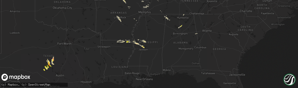
Hail Map in Mississippi on April 18, 2024
The weather event in Mississippi on April 18, 2024 includes Wind, Hail, and Tornado maps. 12 states and 753 cities were impacted and suffered possible damage. The total estimated number of properties impacted is 6,015.
Want more than just the map?
Turn this storm into a full workflow.
- Owner + property data so you know who to knock
- OnDemand branded weather history reports to win the "did we even have hail?" argument
- RoofTrace estimate so reps stop guessing numbers at the door
Bought this map? Upgrade within 7 days and we'll credit the $230. (10-15 min setup call)
Wind
Hail
Tornado
6,015
Estimated number of impacted properties by a 1.00" hail or larger0
Estimated number of impacted properties by a 1.75" hail or larger0
Estimated number of impacted properties by a 2.50" hail or largerStorm reports in Mississippi
Mississippi
| Date | Description |
|---|---|
| 04/18/20244:18 PM CDT | A few trees and a power line were blown down across roads in pickens. Pictures of the damage were relayed by broadcast media. |
| 04/18/20243:08 PM CDT | Local law enforcement reported several down power poles across midnight and the silver city area. |
| 04/18/202410:10 AM CDT | A tree was reported down near wynn rd by law enforcement. |
| 04/17/20247:00 PM CDT | Ping pong size hail reported near whisper lake. |
All States Impacted by Hail Map on April 18, 2024
Cities Impacted by Hail Map on April 18, 2024
- Wamego, KS
- Belvue, KS
- Onaga, KS
- Westmoreland, KS
- Rossville, KS
- Saint Marys, KS
- Delia, KS
- Emmett, KS
- Havensville, KS
- Mayetta, KS
- Soldier, KS
- Holton, KS
- Topeka, KS
- Silver Lake, KS
- Hoyt, KS
- Denison, KS
- Valley Falls, KS
- Meriden, KS
- Ozawkie, KS
- Oskaloosa, KS
- Grantville, KS
- Effingham, KS
- Winchester, KS
- Atchison, KS
- Cummings, KS
- Nortonville, KS
- Lancaster, KS
- Perry, KS
- Tonganoxie, KS
- Leavenworth, KS
- McLouth, KS
- Lawrence, KS
- Easton, KS
- Rushville, MO
- Saint Joseph, MO
- Wathena, KS
- Troy, KS
- De Kalb, MO
- Weston, MO
- Agency, MO
- Dearborn, MO
- Faucett, MO
- Elwood, KS
- Fort Leavenworth, KS
- Easton, MO
- Bonner Springs, KS
- Basehor, KS
- Lansing, KS
- Linwood, KS
- Platte City, MO
- Farley, MO
- Smithville, MO
- Camden Point, MO
- Kansas City, KS
- Gower, MO
- Edgerton, MO
- Waldron, MO
- Shawnee, KS
- Kansas City, MO
- Riverside, MO
- Stewartsville, MO
- Trimble, MO
- Marion, LA
- Bernice, LA
- Spearsville, LA
- Farmerville, LA
- Bastrop, LA
- Bonita, LA
- Mer Rouge, LA
- Jones, LA
- Oak Grove, LA
- Lake Providence, LA
- Huttig, AR
- Marceline, MO
- Salisbury, MO
- New Cambria, MO
- Clifton Hill, MO
- Huntsville, MO
- Wilmot, AR
- Callao, MO
- Eudora, AR
- Hamburg, AR
- Mayersville, MS
- Urich, MO
- Butler, MO
- Montrose, MO
- Rolling Fork, MS
- Clinton, MO
- Deepwater, MO
- Calhoun, MO
- Hollandale, MS
- Lincoln, MO
- Warsaw, MO
- Cole Camp, MO
- Columbia, MO
- Harrisburg, MO
- Stover, MO
- Perry, MO
- Hallsville, MO
- Centralia, MO
- Center, MO
- Versailles, MO
- Thompson, MO
- Mexico, MO
- Auxvasse, MO
- New London, MO
- Vandalia, MO
- Frankford, MO
- Curryville, MO
- Gravois Mills, MO
- Barnett, MO
- Rocky Mount, MO
- Louisiana, MO
- Bowling Green, MO
- Benton City, MO
- Martinsburg, MO
- Eldon, MO
- Cape Girardeau, MO
- Empire, AL
- Yazoo City, MS
- Wellsville, MO
- Pleasant Hill, IL
- Rockport, IL
- Wolf Lake, IL
- Jonesboro, IL
- Hanceville, AL
- Alto Pass, IL
- Jackson, MO
- Kaiser, MO
- Louise, MS
- Silver City, MS
- Lake Ozark, MO
- Osage Beach, MO
- Tuscumbia, MO
- Saint Elizabeth, MO
- Rush Hill, MO
- Laddonia, MO
- Thebes, IL
- Eugene, MO
- Latham, MO
- Middletown, MO
- Cullman, AL
- Linn Creek, MO
- Bremen, AL
- Nebo, IL
- Pittsfield, IL
- Pearl, IL
- Meta, MO
- McClure, IL
- Williamsburg, MO
- Brumley, MO
- Fortuna, MO
- Ulman, MO
- Montgomery City, MO
- Clarksville, MO
- Montreal, MO
- Pickens, MS
- Lexington, MS
- Benton, MS
- Olean, MO
- Russellville, MO
- Henley, MO
- Kampsville, IL
- White Hall, IL
- Hillview, IL
- Silex, MO
- Saint Thomas, MO
- Jefferson City, MO
- Iberia, MO
- Blountsville, AL
- Tamms, IL
- Bellflower, MO
- Dixon, MO
- California, MO
- New Florence, MO
- Eolia, MO
- Kingdom City, MO
- Troy, MO
- Elsberry, MO
- Newburg, MO
- Hamilton, TX
- Pulaski, IL
- Dongola, IL
- Olmsted, IL
- Ullin, IL
- Vienna, MO
- Vaughan, MS
- Warrenton, MO
- Richland, MO
- Crocker, MO
- Annada, MO
- Patterson, IL
- Cypress, IL
- Winchester, IL
- Roodhouse, IL
- Murrayville, IL
- Rolla, MO
- Belknap, IL
- Vienna, IL
- Jerome, MO
- New Market, AL
- Meridianville, AL
- Pottsville, TX
- Grand Chain, IL
- Windsor, MO
- Goodman, MS
- Wright City, MO
- Karnak, IL
- Greenfield, IL
- Palmyra, IL
- Modesto, IL
- Foristell, MO
- Hazel Green, AL
- Hamburg, IL
- Camden, MS
- Mullin, TX
- Saint James, MO
- Sedalia, MO
- Mora, MO
- Hettick, IL
- Goldthwaite, TX
- Richland Springs, TX
- Chesterfield, MO
- Ripley, TN
- Ionia, MO
- Green Ridge, MO
- Charleston, MO
- Cary, MS
- Rochelle, TX
- Carrollton, IL
- Wrights, IL
- Eldred, IL
- Fieldon, IL
- Evant, TX
- Barlow, KY
- Cairo, IL
- Cuba, MO
- Kevil, KY
- Saint Louis, MO
- Simpson, IL
- Grantsburg, IL
- Maryland Heights, MO
- Saint Ann, MO
- Bridgeton, MO
- La Center, KY
- Barry, IL
- New Canton, IL
- Licking, MO
- Salem, MO
- San Saba, TX
- Star, TX
- Steelville, MO
- Carlinville, IL
- Gustine, TX
- Girard, IL
- Hazelwood, MO
- Kane, IL
- Worden, IL
- Fenton, MO
- High Ridge, MO
- Leasburg, MO
- Eureka, MO
- Florissant, MO
- Cook Sta, MO
- Granite City, IL
- Cedar Hill, MO
- Hillsboro, MO
- Dittmer, MO
- Valley Park, MO
- Staunton, IL
- Bunker Hill, IL
- Metropolis, IL
- Holly Pond, AL
- Ranburne, AL
- Graham, AL
- Woodland, AL
- Waggoner, IL
- Golconda, IL
- Sullivan, MO
- Bourbon, MO
- Potosi, MO
- Collinsville, IL
- Moro, IL
- House Springs, MO
- Imperial, MO
- East Carondelet, IL
- Arnold, MO
- Columbia, IL
- Dupo, IL
- East Saint Louis, IL
- Belleville, IL
- Millstadt, IL
- Fairview Heights, IL
- Caseyville, IL
- Cherryville, MO
- Valmeyer, IL
- Barnhart, MO
- Venice, IL
- Madison, IL
- Mount Olive, IL
- Bowdon, GA
- Heflin, AL
- Nilwood, IL
- Satartia, MS
- Cadet, MO
- Blackwell, MO
- Bentonia, MS
- East Alton, IL
- Alton, IL
- Bethalto, IL
- Edwardsville, IL
- Saint Jacob, IL
- Glen Carbon, IL
- Troy, IL
- Maryville, IL
- O'Fallon, IL
- Lebanon, IL
- Marine, IL
- Sorento, IL
- Walshville, IL
- New Douglas, IL
- Hamel, IL
- Alhambra, IL
- Highland, IL
- Trenton, IL
- Pocahontas, IL
- Davisville, MO
- Aviston, IL
- Greenville, IL
- Breese, IL
- Jacksonville, IL
- Waterloo, IL
- Smithton, IL
- Lometa, TX
- Ashland City, TN
- White Bluff, TN
- Clarksville, TN
- Boss, MO
- Bunker, MO
- Dorsey, IL
- Raymond, IL
- Litchfield, IL
- Butler, IL
- Donnellson, IL
- Hillsboro, IL
- Panama, IL
- Summerfield, IL
- Sedalia, KY
- Flora, MS
- Madison, MS
- Canton, MS
- Freeburg, IL
- Belgrade, MO
- Fulton, KY
- Black, MO
- Bloomsdale, MO
- Festus, MO
- New Athens, IL
- Martin, TN
- Dresden, TN
- Pleasant View, TN
- Joelton, TN
- Springfield, TN
- Smithboro, IL
- Carlyle, IL
- Keyesport, IL
- Fillmore, IL
- Mulberry Grove, IL
- Vandalia, IL
- Coffeen, IL
- Ramsey, IL
- Nashville, IL
- Albers, IL
- Addieville, IL
- Germantown, IL
- Saint Libory, IL
- Marissa, IL
- Bartelso, IL
- Oakdale, IL
- Okawville, IL
- Mascoutah, IL
- New Baden, IL
- Bixby, MO
- Lesterville, MO
- Lenzburg, IL
- Fults, IL
- Lampasas, TX
- Caledonia, MO
- Palmersville, TN
- Dukedom, TN
- Red Bud, IL
- Prairie Du Rocher, IL
- Bismarck, MO
- Ironton, MO
- Greenbrier, TN
- Vernon, IL
- Alma, IL
- Patoka, IL
- Salem, IL
- Shobonier, IL
- Odin, IL
- Sandoval, IL
- Brownstown, IL
- Saint Peter, IL
- Kinmundy, IL
- Coulterville, IL
- Baldwin, IL
- Evansville, IL
- Sparta, IL
- Cowden, IL
- Farmington, KY
- Viburnum, MO
- Belleview, MO
- Oconee, IL
- Walsh, IL
- Ellis Grove, IL
- Irondale, MO
- Ashley, IL
- Richview, IL
- Du Bois, IL
- Hoyleton, IL
- Centralia, IL
- Hoffman, IL
- Cherokee, TX
- Arcadia, MO
- Fredericktown, MO
- Cutler, IL
- Chester, IL
- Percy, IL
- Steeleville, IL
- Annapolis, MO
- Mount Pulaski, IL
- Warrensburg, IL
- Decatur, IL
- Illiopolis, IL
- Niantic, IL
- Latham, IL
- Chestnut, IL
- Forsyth, IL
- Maroa, IL
- Oreana, IL
- Mason, IL
- Louisville, IL
- Flora, IL
- Farina, IL
- Xenia, IL
- Edgewood, IL
- Saint Elmo, IL
- Irvington, IL
- Walnut Hill, IL
- Woodlawn, IL
- Opdyke, IL
- Mount Vernon, IL
- Dix, IL
- Waltonville, IL
- Texico, IL
- Bluford, IL
- Kell, IL
- Iuka, IL
- Pinckneyville, IL
- Lakewood, IL
- Centerville, MO
- Valley Spring, TX
- Voca, TX
- Pontotoc, TX
- Fredonia, TX
- Argenta, IL
- Cisco, IL
- Cerro Gordo, IL
- Ingraham, IL
- Clay City, IL
- Sailor Springs, IL
- Keenes, IL
- Wayne City, IL
- Johnsonville, IL
- Sims, IL
- Bonnie, IL
- Campbell Hill, IL
- Adams, TN
- Milmine, IL
- Monticello, IL
- Noble, IL
- Newton, IL
- Barnhill, IL
- Fairfield, IL
- Geff, IL
- Marquand, MO
- Llano, TX
- Ewing, IL
- Art, TX
- Adairville, KY
- Vichy, MO
- Dieterich, IL
- Ava, IL
- Vergennes, IL
- Du Quoin, IL
- Belle Rive, IL
- Dahlgren, IL
- Springerton, IL
- Mill Shoals, IL
- Burnt Prairie, IL
- Carmi, IL
- Golden Gate, IL
- Ellery, IL
- Albion, IL
- Cisne, IL
- Mount Erie, IL
- Des Arc, MO
- Vulcan, MO
- Olney, IL
- Macedonia, IL
- Ellington, MO
- Crossville, IL
- Grayville, IL
- Mount Carmel, IL
- Browns, IL
- Winona, MO
- Castell, TX
- Patterson, MO
- Eldorado, IL
- Raleigh, IL
- Silva, MO
- Lodi, MO
- Caulfield, MO
- West Salem, IL
- Parkersburg, IL
- Poseyville, IN
- Griffin, IN
- Owensville, IN
- Cynthiana, IN
- Wildwood, MO
- Wood River, IL
- Roxana, IL
- Mountain Home, AR
- Norris City, IL
- Omaha, IL
- Broughton, IL
- Auburn, KY
- Bakersfield, MO
- Mason, TX
- Glenallen, MO
- Greenville, MO
- Clubb, MO
- Centertown, KY
- Lewis, IN
- Plainville, IN
- Linton, IN
- Jasonville, IN
- Lyons, IN
- Carlisle, IN
- Worthington, IN
- Sullivan, IN
- Dugger, IN
- Clay City, IN
- Sandborn, IN
- Edwardsport, IN
- Washington, IN
- Westphalia, IN
- Oaktown, IN
- Flat Rock, IL
- Hutsonville, IL
- Bicknell, IN
- Shelburn, IN
- Palestine, IL
- Oblong, IL
- Freelandville, IN
- Lawrenceville, IL
- Willow Hill, IL
- Fairbanks, IN
- Robinson, IL
- Coalmont, IN
- Bruceville, IN
- Farmersburg, IN
- Stoy, IL
- Hymera, IN
- Merom, IN
- West Liberty, IL
- Annapolis, IL
- West York, IL
- Sainte Marie, IL
- Sumner, IL
- Marble Hill, MO
- Fremont, MO
- Ridgeland, MS
- Van Buren, MO
- Jackson, MS
- Alton, MO
- Haubstadt, IN
- Fort Branch, IN
- Elberfeld, IN
- Lynnville, IN
- Princeton, IN
- Francisco, IN
- Oakland City, IN
- Wadesville, IN
- Zalma, MO
- Rockfield, KY
- Ellsinore, MO
- Mill Spring, MO
- Evansville, IN
- Norfork, AR
- Calico Rock, AR
- Freedom, IN
- Poland, IN
- Newberry, IN
- Coal City, IN
- Patricksburg, IN
- Bloomfield, IN
- Bowling Green, IN
- Switz City, IN
- Spencer, IN
- Elnora, IN
- Solsberry, IN
- Montgomery, IN
- Crane, IN
- Scotland, IN
- Odon, IN
- Loogootee, IN
- Boonville, IN
- Ridgway, IL
- Equality, IL
- Advance, MO
- Sturdivant, MO
- Williamsville, MO
- Bloomington, IN
- Owensburg, IN
- Springville, IN
- Shoals, IN
- Williams, IN
- Mitchell, IN
- Pineville, AR
- Hardinsburg, IN
- Fredericksburg, IN
- Murphysboro, IL
- Pomona, IL
- Altenburg, MO
- Grand Tower, IL
- Bedford, IN
- Orleans, IN
- West Baden Springs, IN
- Oolitic, IN
- Gosport, IN
- Avoca, IN
- Heltonville, IN
- Ellettsville, IN
- Tell City, IN
- Troy, IN
- Evanston, IN
- Melbourne, AR
- Salem, IN
- Lamar, IN
- Bell City, MO
- Tunnelton, IN
- Campbellsburg, IN
- Oran, MO
- Sikeston, MO
- Vanduser, MO
- Mount Pleasant, AR
- Guion, AR
- Truxton, MO
- Batesville, AR
- South Roxana, IL
- Cottage Hills, IL
- Truesdale, MO
- Batchtown, IL
- Shipman, IL
- Webster, KY
- Guston, KY
- Battletown, KY
- Brandenburg, KY
- Payneville, KY
- Fort Knox, KY
- Ekron, KY
- Vine Grove, KY
- New Middletown, IN
- Lanesville, IN
- Corydon, IN
- Muldraugh, KY
- Elizabeth, IN
- Clarksville, IN
- Mauckport, IN
- Laconia, IN
- Louisville, KY
- New Albany, IN
- West Point, KY
- Fairdale, KY
- Mount Washington, KY
- Taylorsville, KY
- Fisherville, KY
- Brooks, KY
- Shepherdsville, KY
- Jeffersonville, IN
- Masonic Home, KY
- Lebanon Junction, KY
- Glenview, KY
- Pewee Valley, KY
- Crestwood, KY
- Prospect, KY
- Simpsonville, KY
- Gorham, IL
- Shelbyville, KY
- Finchville, KY
- Smithfield, KY
- Eminence, KY
- Pleasureville, KY
- La Grange, KY
- Buckner, KY
- New Castle, KY
- Bradford, AR
- Pleasant Plains, AR
- Oil Trough, AR
- Paragould, AR
- Cardwell, MO
- Arbyrd, MO
- Trimble, TN
- Newbern, TN
- Leachville, AR
- Manila, AR
- Roland, AR
- Kenton, TN
- Little Rock, AR
- Rutherford, TN
- Bradford, TN
- Joiner, AR
- Trenton, TN
- Milan, TN
- Mabelvale, AR
- Henning, TN
- Burlison, TN
- Alexander, AR
- Bryant, AR
- Wilson, AR
- Drummonds, TN
- Munford, TN
- Brighton, TN
- Covington, TN
- Hensley, AR
- Redfield, AR
- Sheridan, AR
- Jefferson, AR
- Marvell, AR
- Holly Grove, AR
- Lexa, AR
- Helena, AR
- Bethel Springs, TN
- Selmer, TN
- Stantonville, TN
- Burnsville, MS
- Iuka, MS
- Cherokee, AL
- Tishomingo, MS
- Tuscumbia, AL
- Russellville, AL


