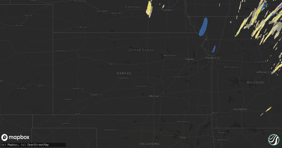
Hail Map in Kansas on April 16, 2024
Get this storm
April 16 map
$229
one time, instant access
Download today. No call, no setup
Keep the $229
Bought the map and want the full workflow? Apply the entire $229 to a subscription within 7 days. None of it is wasted.
Every map, not just this one
This buys you this map. Subscription and you get every map we run, in the markets you choose from a few cities to whole states to nationwide. Plus real-time alerts the moment a storm fires.
Contact data
Name, contact info, occupancy, even credit band for addresses in the footprint. You go from where it hit to who to call.
Become the source they trust
Unlimited branding weather history reports on demand. You already have the documented answer ready for the property owner, and you are the one who showed up with it.
Property data and RoofTrace estimates
Pull up any address you have got, its value and the exact code rules for that jurisdiction, straight from One Click Code. Then RoofTrace estimates the squares, pitch, and roof value, priced the way you price.
Storm reports in Kansas
Kansas
| Date | Description |
|---|---|
| 04/16/20241:53 PM CDT | An ef-0 rated tornado moved north across a part of northern smith county but produced very little damage. Peak winds were estimated at 65 mph along its nearly 7 mile pa |
| 04/16/20249:59 AM CDT | Mping report of tree damage on the northwest side of stanley. Time confirmed from radar. |
| 04/16/20249:59 AM CDT | Several reports of power lines down and power outages in the overland park area. Time estimated from radar. |
| 04/16/20249:55 AM CDT | Downed power lines and power outages near 72nd street. Time estimated from radar. |
| 04/16/20249:54 AM CDT | Tree damage reported on the west side of lenexa. Time estimated from radar. |
| 04/16/20249:51 AM CDT | Downed power lines and power outages east of hillsdale state park. Time estimated from radar. |
| 04/16/20247:34 AM CDT | Ef2 tornado with estimated 118 mph peak winds. 116 yard width with a 2.7 mile path length... Ending at 7:42 am 3 se of virgil. Most severe damage was to steel purlins t |
| 04/16/20247:20 AM CDT | Semi blown over near the intersection of highway 116 and highway 159. |
All States Impacted by Hail Map on April 16, 2024
Cities Impacted by Hail Map on April 16, 2024
- Fairmont, NE
- McCool Junction, NE
- York, NE
- Benedict, NE
- Waco, NE
- Stromsburg, NE
- Gresham, NE
- Geneva, NE
- Exeter, NE
- Andalusia, AL
- Red Level, AL
- Shelby, NE
- Greenville, AL
- Rising City, NE
- Columbus, NE
- Bellwood, NE
- Humphrey, NE
- Creston, NE
- Leigh, NE
- Stanton, NE
- Madison, NE
- Hoskins, NE
- Winside, NE
- David City, NE
- Norfolk, NE
- Oregon, MO
- Forest City, MO
- Mound City, MO
- Maitland, MO
- Fillmore, MO
- Highland, KS
- Skidmore, MO
- Graham, MO
- Maryville, MO
- Barnard, MO
- Bolckow, MO
- Burlington Junction, MO
- Clearmont, MO
- Pickering, MO
- Hopkins, MO
- Afton, IA
- Shannon City, IA
- Clarkson, NE
- Kansas City, MO
- Smithville, MO
- Mercer, MO
- Trimble, MO
- Plattsburg, MO
- Kearney, MO
- Corydon, IA
- Chariton, IA
- Millerton, IA
- Princeton, MO
- Platte Center, NE
- Dallas Center, IA
- Minburn, IA
- Bouton, IA
- Ethel, MO
- Elmer, MO
- Atlanta, MO
- La Plata, MO
- Kirksville, MO
- Schuyler, NE
- Lineville, IA
- Allerton, IA
- Russell, IA
- New Cambria, MO
- Williamson, IA
- Monroe, NE
- Green Castle, MO
- Novinger, MO
- Bevier, MO
- Columbia, IA
- Macon, MO
- Lovilia, IA
- Melrose, IA
- Gibbs, MO
- Worthington, MO
- Greentop, MO
- Glenwood, MO
- Unionville, MO
- Queen City, MO
- Coatsville, MO
- Pella, IA
- Knoxville, IA
- Brashear, MO
- Bloomfield, IA
- Livonia, MO
- Baring, MO
- Memphis, MO
- Lancaster, MO
- Hamilton, IA
- Bussey, IA
- Cairo, MO
- Jacksonville, MO
- Moulton, IA
- Clarence, MO
- Anabel, MO
- Drakesville, IA
- Hurdland, MO
- Excello, MO
- Callao, MO
- Sully, IA
- Edina, MO
- Reasnor, IA
- Downing, MO
- Floris, IA
- Ottumwa, IA
- Grinnell, IA
- Leonard, MO
- Lynnville, IA
- Kellogg, IA
- Novelty, MO
- Rutledge, MO
- Gilman, IA
- Montour, IA
- Arbela, MO
- New Sharon, IA
- Rose Hill, IA
- Montezuma, IA
- Barnes City, IA
- Lentner, MO
- Shelbina, MO
- Shelbyville, MO
- Bethel, MO
- La Belle, MO
- Chula, MO
- Laredo, MO
- Humphreys, MO
- Auxvasse, MO
- Columbia, MO
- Searsboro, IA
- Newark, MO
- Lewistown, MO
- Ewing, MO
- Galt, MO
- Milan, MO
- Philadelphia, MO
- Palmyra, MO
- Stoutsville, MO
- Perry, MO
- Middletown, MO
- Kingdom City, MO
- Wellsville, MO
- Madison, MO
- Morrison, MO
- Chamois, MO
- Emerson, NE
- Waterbury, NE
- Milton, IA
- Keosauqua, IA
- Cantril, IA
- Taylor, MO
- Newtown, MO
- Pollock, MO
- Maywood, MO
- La Grange, MO
- Linn, MO
- Hannibal, MO
- Monroe City, MO
- Center, MO
- Monticello, MO
- Canton, MO
- Vandalia, MO
- Curryville, MO
- Bowling Green, MO
- Seward, NE
- Bee, NE
- Williamstown, MO
- Williamsburg, MO
- Portland, MO
- Harris, MO
- Saint Patrick, MO
- Alexandria, MO
- Pleasant Dale, NE
- Garland, NE
- Hermann, MO
- Quincy, IL
- Ursa, IL
- Warsaw, IL
- Rhineland, MO
- Louisiana, MO
- New Florence, MO
- Malcolm, NE
- Raymond, NE
- Hurricane, WV
- Montgomery City, MO
- Jackson, NE
- Hubbard, NE
- Sod, WV
- Griffithsville, WV
- Sumerco, WV
- Yawkey, WV
- Chillicothe, MO
- Sutter, IL
- Howells, NE
- High Hill, MO
- Jonesburg, MO
- Warrenton, MO
- Truxton, MO
- Mexico, MO
- Le Mars, IA
- Hawk Point, MO
- Pittsfield, IL
- Rockport, IL
- Payson, IL
- Silex, MO
- Bellflower, MO
- Alkol, WV
- Orgas, WV
- Seth, WV
- Dodge, NE
- Drury, MO
- Vanzant, MO
- Cabool, MO
- Elk Creek, MO
- Solo, MO
- Houston, MO
- Yolyn, WV
- Quinwood, WV
- Troy, MO
- Green City, MO
- Tornado, WV
- Saint Albans, WV
- Wright City, MO
- Truesdale, MO
- Marthasville, MO
- Bland, MO
- Berger, MO
- Sioux Center, IA
- Maurice, IA
- Ireton, IA
- Hewett, WV
- Clothier, WV
- Jeffrey, WV
- Hull, IA
- Charleston, WV
- Rock Valley, IA
- Hawarden, IA
- Kenna, WV
- Jessieville, AR
- Exline, IA
- Centerville, IA
- Cincinnati, IA
- Smithers, WV
- Versailles, IL
- Rushville, IL
- Mount Sterling, IL
- Yukon, MO
- Eunice, MO
- Rockwell City, IA
- Williamsburg, WV
- Lewisburg, WV
- Crawley, WV
- Hattieville, AR
- Morrilton, AR
- Solgohachia, AR
- Moscow Mills, MO
- Udell, IA
- Unionville, IA
- Perryville, AR
- Paron, AR
- Eskdale, WV
- Foristell, MO
- Cedar Rapids, IA
- Marion, IA
- Hiawatha, IA
- Robins, IA
- Wentzville, MO
- Roland, AR
- Old Monroe, MO
- Mayflower, AR
- Winfield, MO
- Palmer, IA
- Poca, WV
- Springfield, AR
- South Charleston, WV
- Sullivan, MO
- Bourbon, MO
- Cleveland, AR
- Center Ridge, AR
- Avon, IL
- Bigelow, AR
- Maxwelton, WV
- Eldon, IA
- Rock Rapids, IA
- Doon, IA
- Agency, IA
- Leasburg, MO
- Steelville, MO
- Elkview, WV
- Washington, MO
- Hedrick, IA
- Boyden, IA
- George, IA
- Little Rock, IA
- Harrisburg, SD
- Emery, SD
- Chancellor, SD
- Freeman, SD
- Dallas, SD
- Armour, SD
- Canton, SD
- Gregory, SD
- Harrison, SD
- Parkston, SD
- Alvord, IA
- Delmont, SD
- Parker, SD
- Corsica, SD
- Inwood, IA
- Lennox, SD
- Platte, SD
- Marion, SD
- Olivet, SD
- Larchwood, IA
- Winner, SD
- Worthing, SD
- Burke, SD
- Maumelle, AR
- North Little Rock, AR
- Conway, AR
- Sherwood, AR
- Jacksonville, AR
- Vilonia, AR
- Lake Saint Louis, MO
- O'Fallon, MO
- Batavia, IA
- Selma, IA
- Potosi, MO
- Martinsburg, IA
- Sigourney, IA
- Libertyville, IA
- Fairfield, IA
- Gilmore City, IA
- Rolfe, IA
- Fletcher, MO
- Blackwell, MO
- Richwoods, MO
- De Soto, MO
- Ollie, IA
- Packwood, IA
- Richland, IA
- Cabot, AR
- Austin, AR
- Beebe, AR
- Hillsboro, MO
- Dittmer, MO
- El Paso, AR
- Quitman, AR
- Harper, IA
- South English, IA
- Keota, IA
- North English, IA
- Parnell, IA
- Wellman, IA
- Williamsburg, IA
- Kalona, IA
- Oxford, IA
- Kensett, AR
- Searcy, AR
- Higginson, AR
- Riverside, IA
- Iowa City, IA
- McRae, AR
- Garner, AR
- West Chester, IA
- Washington, IA
- Mount Sterling, IA
- Tiffin, IA
- North Liberty, IA
- Coralville, IA
- Luray, MO
- Bonaparte, IA
- Solon, IA
- Pangburn, AR
- Wilburn, AR
- Heber Springs, AR
- Kahoka, MO
- Farmington, IA
- Wayland, IA
- Brighton, IA
- West Point, IA
- Donnellson, IA
- Hillsboro, IA
- Salem, IA
- Swisher, IA
- Carthage, AR
- Sparkman, AR
- Bradford, AR
- Mount Pleasant, IA
- New London, IA
- Wyaconda, MO
- Wayland, MO
- Ainsworth, IA
- Crawfordsville, IA
- Sheridan, AR
- Newport, AR
- Leola, AR
- Marquand, MO
- Owensville, MO
- Steedman, MO
- Mokane, MO
- Mount Union, IA
- Yarmouth, IA
- Argyle, IA
- Mediapolis, IA
- Morning Sun, IA
- Scott, AR
- Amagon, AR
- Fisher, AR
- Grapevine, AR
- Columbus Junction, IA
- Lone Tree, IA
- Conesville, IA
- Nichols, IA
- McNeil, AR
- Magnolia, AR
- Waldo, AR
- Little Rock, AR
- Revere, MO
- Weiner, AR
- Wapello, IA
- Montrose, IA
- Fenton, IA
- Ringsted, IA
- Gorin, MO
- Fort Madison, IA
- Pine Bluff, AR
- Elizabeth, IL
- Stephens, AR
- West Branch, IA
- West Liberty, IA
- Oakville, IA
- New Boston, IL
- Apple River, IL
- Scales Mound, IL
- Shullsburg, WI
- Louann, AR
- Wever, IA
- Denmark, IA
- Danville, IA
- Burlington, IA
- West Burlington, IA
- Middletown, IA
- Hampton, AR
- Camden, AR
- Gratiot, WI
- Darlington, WI
- Illinois City, IL
- Sperry, IA
- Estherville, IA
- Muscatine, IA
- Blue Grass, IA
- Montpelier, IA
- Joy, IL
- Stockton, IL
- Argyle, WI
- South Wayne, WI
- Warren, IL
- Seaton, IL
- Keithsburg, IL
- Harrell, AR
- Taylor Ridge, IL
- Reynolds, IL
- Davenport, IA
- Walcott, IA
- Nora, IL
- Andalusia, IL
- Buffalo, IA
- Oquawka, IL
- Eldridge, IA
- Long Grove, IA
- De Witt, IA
- Camanche, IA
- Princeton, IA
- McCausland, IA
- Woodford, WI
- Aledo, IL
- Milan, IL
- Blanchardville, WI
- Browntown, WI
- Monticello, WI
- Sherrard, IL
- Matherville, IL
- Neoga, IL
- Viola, IL
- Trilla, IL
- Lerna, IL
- Orion, IL
- Lynn Center, IL
- Keokuk, IA
- Coal Valley, IL
- New Windsor, IL
- Nauvoo, IL
- Ashmore, IL
- Charleston, IL
- Geneseo, IL
- Colona, IL
- Kansas, IL
- Bryant, IA
- Clinton, IA
- Goose Lake, IA
- Low Moor, IA
- Cordova, IL
- Fulton, IL
- Thomson, IL
- Sabula, IA
- Savanna, IL
- Mount Carroll, IL
- Hillsdale, IL
- West Point, IL
- Mendon, IL
- Paris, IL
- Grady, AR
- Coatsburg, IL
- Loraine, IL
- Niota, IL
- Little York, IL
- Paloma, IL
- Erie, IL
- Hoopeston, IL
- Gould, AR
- Alexis, IL
- Lanark, IL
- Fowler, IL
- Stuttgart, AR
- Monmouth, IL
- Redmon, IL
- Brocton, IL
- Osco, IL
- Cambridge, IL
- Fenton, IL
- North Henderson, IL
- Atkinson, IL
- Moline, IL
- Morrison, IL
- Alpha, IL
- Prophetstown, IL
- Le Claire, IA
- Forreston, IL
- Ophiem, IL
- Woodhull, IL
- Rio, IL
- Andover, IL
- Lyndon, IL
- Shannon, IL
- Madison, WI
- Middleton, WI
- Baileyville, IL
- Freeport, IL
- Verona, WI
- Gerlaw, IL
- Annawan, IL
- Mineral, IL
- Albion, IL
- Bone Gap, IL
- West Salem, IL
- Tampico, IL
- Sheffield, IL
- New Bedford, IL
- Walnut, IL
- Deer Grove, IL
- Harmon, IL
- Amboy, IL
- Ohio, IL
- Dixon, IL
- Ashton, IL
- Franklin Grove, IL
- West Brooklyn, IL
- Steward, IL
- Rochelle, IL
- Victor, WV
- Lansing, WV
- Stockton, IA
- Virgil, KS
- Rowley, IA
- Independence, IA
- Winthrop, IA
- Corning, IA
- Anita, IA


