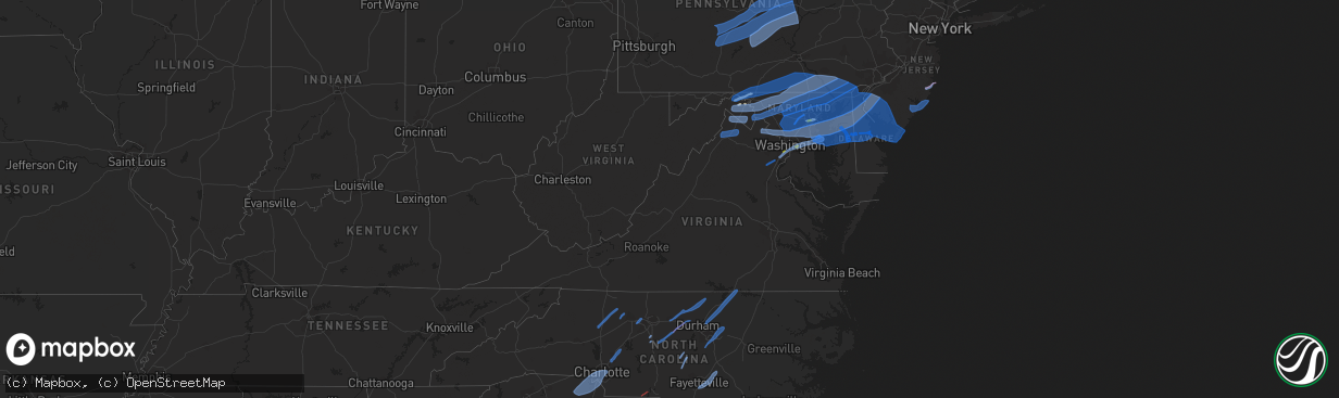
Hail Map in Virginia on April 13, 2020
The weather event in Virginia on April 13, 2020 includes Tornado, Wind, and Hail maps. 12 states and 659 cities were impacted and suffered possible damage. The total estimated number of properties impacted is 1,858.
Want more than just the map?
Turn this storm into a full workflow.
- Owner + property data so you know who to knock
- OnDemand branded weather history reports to win the "did we even have hail?" argument
- RoofTrace estimate so reps stop guessing numbers at the door
Bought this map? Upgrade within 7 days and we'll credit the $230. (10-15 min setup call)
Tornado
Wind
Hail
1,858
Estimated number of impacted properties by a 1.00" hail or larger0
Estimated number of impacted properties by a 1.75" hail or larger0
Estimated number of impacted properties by a 2.50" hail or largerStorm reports in Virginia
Virginia
| Date | Description |
|---|---|
| 04/13/202012:48 PM CDT | A local report indicates 59 MPH wind near LEESBURG EXEC ARPT |
| 04/13/202011:55 AM CDT | A local report indicates 1.00 inch wind near 1 N FRANCONIA |
| 04/13/20208:43 AM CDT | Tree down blocking brandon rd. |
| 04/13/20208:30 AM CDT | Trees down reported across prince george in several locations. |
| 04/13/20208:09 AM CDT | Tree down blocking the highway. |
| 04/13/20207:54 AM CDT | Trees and power lines down in bottoms bridge area. |
| 04/13/20206:54 AM CDT | At 1154 AM EDT, a severe thunderstorm was located 7 miles southwest of Paw Paw, moving east at 40 mph. HAZARD...60 mph wind gusts and quarter size hail. SOURCE...Radar indicated. IMPACT...Damaging winds will cause some trees and large branches to fall. This could injure those outdoors, as well as damage homes and vehicles. Roadways may become blocked by downed trees. Localized power outages are possible. Unsecured light objects may become projectiles. Locations impacted include... Martinsburg, Paw Paw, Greenwood, Berkeley Springs, Berkeley, Falling Waters, Great Cacapon, Clear Spring, Hedgesville, Pecktonville, Big Spring, Big Pool, Johnsons Mill, Tomahawk, Johnsontown, Valley View, Spohrs Crossroads, Fishers Bridge, Oakland and Rock Gap. |
| 04/13/20205:11 AM CDT | At 1011 AM EDT, a severe thunderstorm was located over Burgess, or 7 miles southeast of Hertford, moving northeast at 100 mph. HAZARD...60 mph wind gusts and penny size hail. SOURCE...Radar indicated. IMPACT...Expect damage to trees and powerlines. This severe thunderstorm will be near, Nixonton around 1015 AM EDT. Camden, Weeksville, Elizabeth City State University and Whitehall Shores around 1020 AM EDT. Indiantown, Shiloh and Old Trap around 1025 AM EDT. Currituck and Corolla around 1030 AM EDT. Knotts Island around 1035 AM EDT.Other locations impacted by this severe thunderstorm include BobWhite Fork, Holiday Island, Poplar Branch, Spot, Glen Cove, Gregory,Barco, Pasquotank, Jacocks and Spences Corner.People at Albemarle Medical Center should seek safe shelterimmediately! |
| 04/13/20204:38 AM CDT | At 937 AM EDT, a severe thunderstorm was located over Charles City, moving northeast at 70 mph. HAZARD...60 mph wind gusts and quarter size hail. SOURCE...Radar indicated. IMPACT...Minor damage to vehicles is possible. Expect wind damage to trees and powerlines. This severe thunderstorm will be near, New Kent and Barhamsville around 950 AM EDT. West Point around 955 AM EDT. Shacklefords and Little Plymouth around 1000 AM EDT. Glenns around 1005 AM EDT.Other locations impacted by this severe thunderstorm include HollyForks, Eltham, Chickahominy Shore, Gressit, Lanexa, Mattaponi,Colonial Downs, Sandybottom, Warren Mill and Diascund. |
| 04/13/20204:21 AM CDT | At 921 AM EDT, a severe thunderstorm was located near Petersburg, moving northeast at 55 mph. HAZARD...60 mph wind gusts and penny size hail. SOURCE...Radar indicated. IMPACT...Expect damage to trees and powerlines. This severe thunderstorm will be near, Disputanta around 925 AM EDT. Hopewell, Fort Lee and Prince George around 930 AM EDT. Garysville, Jordans Point and Burrowsville around 935 AM EDT. Charles City around 945 AM EDT.Other locations impacted by this severe thunderstorm include NewBohemia, Taylors Corner, Richard Bland College, Wayside, BirchettEstate, Prince George Golf, Brandon, Barnetts, Jordan Point CountryClub and New Hope.People at John Randolph Medical Center, Southside Regional MedicalCenter, and Tri-Cities ER should seek safe shelter immediately! |
| 04/13/20204:05 AM CDT | At 905 AM EDT, severe thunderstorms were located along a line extending from Stevensville to near Charles City, moving northeast at 40 mph. HAZARD...60 mph wind gusts. SOURCE...Radar indicated. IMPACT...Expect damage to trees and powerlines. Severe thunderstorms will be near, King And Queen Court House and Stevensville around 910 AM EDT. Center Cross and Dunnsville around 920 AM EDT. New Kent around 925 AM EDT. Sharps around 930 AM EDT. Farnham around 935 AM EDT. West Point around 940 AM EDT. Little Plymouth around 945 AM EDT.Other locations impacted by these severe thunderstorms includeEltham, Mountcastle, Upright, Ino, Cohoke, Dragonville, Rose Garden,Mattaponi, Colonial Downs and Tidewater. |
| 04/13/20203:53 AM CDT | At 853 AM EDT, a severe thunderstorm was located near Purdy, moving northeast at 50 mph. HAZARD...60 mph wind gusts and penny size hail. SOURCE...Radar indicated. IMPACT...Expect damage to trees and powerlines. This severe thunderstorm will be near, Dewitt around 905 AM EDT. Dinwiddie and Stony Creek around 910 AM EDT. Carson around 915 AM EDT. Petersburg around 930 AM EDT.Other locations impacted by this severe thunderstorm includePetersburg Airport, Templeton, Burgess, Cherry Hill, Reams, PleasantShade, Fields Crossroads, Wharfs Store, Huske and Butterworth. |
| 04/13/20203:46 AM CDT | At 845 AM EDT, severe thunderstorms were located along a line extending from near Bottoms Bridge to near Jordans Point, moving northeast at 35 mph. HAZARD...60 mph wind gusts. SOURCE...Radar indicated. IMPACT...Expect damage to trees and powerlines. Severe thunderstorms will be near, Bottoms Bridge around 850 AM EDT. Roxbury around 900 AM EDT. Tunstall around 905 AM EDT. Talleysville around 910 AM EDT. King William around 920 AM EDT.Other locations impacted by these severe thunderstorms includeQuinton, Wrights Corner, Colonial Downs, Lanesville, Browns Corner,Palls, Mountcastle, Orapax Farms, Elko and New Kent Airport. |
| 04/13/20202:24 AM CDT | At 723 AM EDT, severe thunderstorms were located along a line extending from Fredericksburg to near Montpelier, moving northeast at 60 mph. HAZARD...60 mph wind gusts. SOURCE...Radar indicated. IMPACT...Expect damage to trees and powerlines. Severe thunderstorms will be near, Bowling Green and Milford around 745 AM EDT. Fort A.p. Hill around 750 AM EDT. Port Royal around 755 AM EDT.Other locations impacted by these severe thunderstorms includeChilesburg, Rappahannock Academy, Golansville, Villboro, NancyWrights Corner, Guinea, Corbin, Cedar Fork, Ruther Glen and Woodford. |
| 04/13/20201:55 AM CDT | At 655 AM EDT, severe thunderstorms were located along a line extending from 6 miles north of Hadensville to Trenholm to near Hampden Sydney College, moving northeast at 60 mph. HAZARD...60 mph wind gusts. SOURCE...Radar indicated. IMPACT...Expect damage to trees and powerlines. Severe thunderstorms will be near, Louisa, Mineral and Trenholm around 700 AM EDT. Goochland and Bumpass around 705 AM EDT. Oilville, Jetersville and Gum Spring around 710 AM EDT. Amelia Courthouse, Morven and Tobaccoville around 715 AM EDT. Montpelier, Chula and Ballsville around 720 AM EDT. Powhatan and Macon around 725 AM EDT. Sabot around 735 AM EDT. Tuckahoe and Manakin around 740 AM EDT.Other locations impacted by these severe thunderstorms includeOrchid, Maidens, Three Square, Fine Creek Mills, Michaux, West View,Holly Hills, Wares Crossroads, Pemberton and Genito. |
| 04/13/20201:28 AM CDT | At 627 AM EDT, severe thunderstorms were located along a line extending from near Dillwyn to near Madisonville, moving northeast at 55 mph. HAZARD...60 mph wind gusts. SOURCE...Radar indicated. IMPACT...Expect damage to trees and powerlines. Severe thunderstorms will be near, Farmville, Longwood University and Duncan around 645 AM EDT. Columbia around 650 AM EDT. Guinea Mills around 655 AM EDT. Cumberland around 700 AM EDT. Sunnyside around 705 AM EDT. Cartersville and Lakeside Village around 715 AM EDT.Other locations impacted by these severe thunderstorms include RainesTavern, Briery Creek Lake, Trents Mill, Tuggle, Angola, Ashby,Briery, Oak Forest, Allens Mill and McRae.People at Centra Southside Community Hospital should seek safeshelter immediately! |
| 04/13/20201:25 AM CDT | At 624 AM EDT, severe thunderstorms were located along a line extending from near Prospect to near Alton, moving east at 50 mph. HAZARD...60 mph wind gusts. SOURCE...Radar indicated. IMPACT...Expect damage to roofs, siding, and trees. Locations impacted include... South Boston... Halifax... Keysville... Charlotte Court House... Phenix... Turbeville... and Redoak. |
| 04/13/202012:48 AM CDT | At 548 AM EDT, severe thunderstorms were located along a line extending from near Schuyler to near Spring Mills, moving northeast at 50 mph. HAZARD...60 mph wind gusts. SOURCE...Radar indicated. IMPACT...Expect damage to roofs, siding, and trees. Locations impacted include... Buckingham... Dillwyn... New Canton... Toga... Centenary... Sheppards... and Andersonville. |
All States Impacted by Hail Map on April 13, 2020
Cities Impacted by Hail Map on April 13, 2020
- Hedgesville, WV
- Folkston, GA
- Gainesville, FL
- Saint Augustine, FL
- Elkton, FL
- Live Oak, FL
- Mayo, FL
- Lake City, FL
- Georgetown, SC
- Falling Waters, WV
- Martinsburg, WV
- Waldo, FL
- Lee, FL
- Sanderson, FL
- Glen Saint Mary, FL
- Catonsville, MD
- Dundalk, MD
- Baltimore, MD
- Halethorpe, MD
- Hampton, FL
- Big Pool, MD
- Bryceville, FL
- White Springs, FL
- Wellborn, FL
- Day, FL
- Keystone Heights, FL
- Starke, FL
- Green Cove Springs, FL
- Saint George, GA
- Berkeley Springs, WV
- Clear Spring, MD
- Hagerstown, MD
- Waretown, NJ
- Forked River, NJ
- Barnegat, NJ
- Windsor Mill, MD
- Pikesville, MD
- Gwynn Oak, MD
- Columbia, MD
- Clarksville, MD
- Woodstock, MD
- Ellicott City, MD
- Quantico, VA
- Triangle, VA
- Dumfries, VA
- Woodbridge, VA
- Manassas, VA
- Aspers, PA
- Williamsport, MD
- Biglerville, PA
- York New Salem, PA
- Rouzerville, PA
- Fayetteville, PA
- Hancock, MD
- York Springs, PA
- Greencastle, PA
- Cascade, MD
- Spring Grove, PA
- York, PA
- Quincy, PA
- Red Lion, PA
- East Berlin, PA
- Dover, PA
- Smithsburg, MD
- Maugansville, MD
- New Oxford, PA
- Abbottstown, PA
- Fairfield, PA
- State Line, PA
- Chambersburg, PA
- Littlestown, PA
- Waynesboro, PA
- Sabillasville, MD
- Mercersburg, PA
- Thomasville, PA
- Blue Ridge Summit, PA
- Seven Valleys, PA
- Hanover, PA
- Wrightsville, PA
- Windsor, PA
- McSherrystown, PA
- Mont Alto, PA
- Orrtanna, PA
- Gettysburg, PA
- Emmitsburg, MD
- Fairplay, MD
- Hampstead, MD
- Pequea, PA
- Shrewsbury, PA
- Felton, PA
- Holtwood, PA
- Millersville, PA
- Keymar, MD
- Sharpsburg, MD
- Christiana, PA
- New Freedom, PA
- Parkton, MD
- Woodsboro, MD
- Rohrersville, MD
- Lancaster, PA
- Brogue, PA
- Freeland, MD
- Shepherdstown, WV
- Airville, PA
- Gerrardstown, WV
- Westminster, MD
- Dallastown, PA
- Walkersville, MD
- Fawn Grove, PA
- Stewartstown, PA
- Quarryville, PA
- Strasburg, PA
- Union Bridge, MD
- Glenville, PA
- New Providence, PA
- Inwood, WV
- Thurmont, MD
- Glen Rock, PA
- Paradise, PA
- New Park, PA
- Middletown, MD
- Railroad, PA
- Taneytown, MD
- Willow Street, PA
- New Windsor, MD
- Myersville, MD
- Boonsboro, MD
- Washington Boro, PA
- Conestoga, PA
- Frederick, MD
- Drumore, PA
- Keedysville, MD
- Kearneysville, WV
- Manchester, MD
- Rocky Ridge, MD
- Berryville, VA
- Stephenson, VA
- Summit Point, WV
- Bunker Hill, WV
- Charles Town, WV
- Ranson, WV
- Clear Brook, VA
- Winchester, VA
- Edgewater, MD
- District Heights, MD
- Capitol Heights, MD
- Washington, DC
- Bowie, MD
- Springfield, VA
- Temple Hills, MD
- Alexandria, VA
- Riva, MD
- Hyattsville, MD
- Annapolis, MD
- Fort Belvoir, VA
- Suitland, MD
- Stevensville, MD
- Oxon Hill, MD
- Lorton, VA
- Harwood, MD
- Upper Marlboro, MD
- Davidsonville, MD
- Boyce, VA
- Stephens City, VA
- Star Tannery, VA
- White Post, VA
- Middletown, VA
- Strasburg, VA
- Front Royal, VA
- Conowingo, MD
- Finksburg, MD
- Mount Airy, MD
- Peach Bottom, PA
- Brunswick, MD
- New Market, MD
- Cochranville, PA
- Delta, PA
- Upperco, MD
- Street, MD
- Lovettsville, VA
- Kirkwood, PA
- Jefferson, MD
- Whiteford, MD
- Atglen, PA
- Ijamsville, MD
- Harpers Ferry, WV
- Monkton, MD
- Pylesville, MD
- White Hall, MD
- Oxford, PA
- Knoxville, MD
- Millville, WV
- Jarrettsville, MD
- Monrovia, MD
- Lincoln University, PA
- Reisterstown, MD
- Sparks Glencoe, MD
- Purcellville, VA
- Nottingham, PA
- Elmer, NJ
- Leesburg, VA
- Hanover, MD
- Church Hill, MD
- Hartly, DE
- Garrett Park, MD
- Jessup, MD
- Rockville, MD
- Harmans, MD
- Penns Grove, NJ
- Monroeville, NJ
- Clayton, DE
- Massey, MD
- Dickerson, MD
- Centreville, MD
- Barclay, MD
- Glen Burnie, MD
- Still Pond, MD
- Kensington, MD
- Crofton, MD
- Middletown, DE
- Worton, MD
- Crumpton, MD
- Arnold, MD
- Pennsville, NJ
- Millersville, MD
- Chestertown, MD
- Boyds, MD
- Germantown, MD
- Earleville, MD
- Savage, MD
- Silver Spring, MD
- Odenton, MD
- Laurel, MD
- Odessa, DE
- Townsend, DE
- Sterling, VA
- Warwick, MD
- Sudlersville, MD
- Annapolis Junction, MD
- Pasadena, MD
- Elkridge, MD
- Fort George G Meade, MD
- Great Falls, VA
- Bridgeton, NJ
- Potomac, MD
- Curtis Bay, MD
- Gambrills, MD
- Linthicum Heights, MD
- Galena, MD
- Gibson Island, MD
- Georgetown, MD
- Rock Hall, MD
- Derwood, MD
- Woodstown, NJ
- Port Penn, DE
- Alloway, NJ
- Smyrna, DE
- Severn, MD
- Crownsville, MD
- Burtonsville, MD
- Sparrows Point, MD
- Kennedyville, MD
- Poolesville, MD
- Bethesda, MD
- Beltsville, MD
- Millington, MD
- Spencerville, MD
- Marydel, MD
- Ashburn, VA
- Severna Park, MD
- Salem, NJ
- Fort Howard, MD
- Gaithersburg, MD
- Pedricktown, NJ
- College Park, MD
- Cooksville, MD
- Cockeysville, MD
- Joppa, MD
- Glen Arm, MD
- Hydes, MD
- Owings Mills, MD
- Havre De Grace, MD
- Fork, MD
- Fulton, MD
- Stevenson, MD
- Newark, DE
- Perryman, MD
- Upper Falls, MD
- Perryville, MD
- Aberdeen, MD
- Marriottsville, MD
- Lutherville Timonium, MD
- Rising Sun, MD
- White Marsh, MD
- Brooklyn, MD
- Glenelg, MD
- Betterton, MD
- Damascus, MD
- Delaware City, DE
- Middle River, MD
- Dayton, MD
- Elkton, MD
- Cecilton, MD
- Bear, DE
- Chesapeake City, MD
- Port Deposit, MD
- Perry Point, MD
- Baldwin, MD
- Sandy Spring, MD
- Brookeville, MD
- Brinklow, MD
- North East, MD
- Olney, MD
- Kingsville, MD
- Rosedale, MD
- Saint Georges, DE
- New Castle, DE
- West Friendship, MD
- Belcamp, MD
- Montgomery Village, MD
- Nottingham, MD
- Edgewood, MD
- Fallston, MD
- Perry Hall, MD
- Landenberg, PA
- Aberdeen Proving Ground, MD
- Randallstown, MD
- Abingdon, MD
- Parkville, MD
- Gunpowder, MD
- Glenwood, MD
- Highland, MD
- Towson, MD
- Elk Mills, MD
- Ashton, MD
- Phoenix, MD
- Wilmington, DE
- Bel Air, MD
- Charlestown, MD
- Churchville, MD
- Essex, MD
- Hockessin, DE
- Woodbine, MD
- Sykesville, MD
- Glyndon, MD
- Hunt Valley, MD
- Kennett Square, PA
- Forest Hill, MD
- Toughkenamon, PA
- West Grove, PA
- Darlington, MD
- Colora, MD
- Avondale, PA
- Marydel, DE
- Frederica, DE
- Mauricetown, NJ
- Avalon, NJ
- Greenwich, NJ
- Cordova, MD
- Villas, NJ
- Cape May Court House, NJ
- Viola, DE
- Wye Mills, MD
- Woodside, DE
- Cedarville, NJ
- Cape May, NJ
- Sea Isle City, NJ
- Leesburg, NJ
- Ridgely, MD
- Millville, NJ
- Wildwood, NJ
- Felton, DE
- Vineland, NJ
- Delmont, NJ
- Rio Grande, NJ
- Dover, DE
- Queen Anne, MD
- Newport, NJ
- Ingleside, MD
- Cheswold, DE
- Magnolia, DE
- Port Norris, NJ
- Shiloh, NJ
- Cape May Point, NJ
- Chester, MD
- Queenstown, MD
- Dorchester, NJ
- Dover Afb, DE
- Milford, DE
- Camden Wyoming, DE
- Goldsboro, MD
- Greensboro, MD
- Hillsboro, MD
- Port Elizabeth, NJ
- Heislerville, NJ
- Fortescue, NJ
- Henderson, MD
- Grasonville, MD
- Harrington, DE
- Denton, MD
- Woodbine, NJ
- Stone Harbor, NJ
- East Smithfield, PA
- Gillett, PA
- Lawton, PA
- Hallstead, PA
- Granville Summit, PA
- Columbia Cross Roads, PA
- Stevensville, PA
- Binghamton, NY
- Troy, PA
- Spencer, NY
- Forksville, PA
- Montrose, PA
- Wysox, PA
- Wyalusing, PA
- Le Raysville, PA
- Ulster, PA
- Sayre, PA
- Milan, PA
- Waverly, NY
- Castle Creek, NY
- Nichols, NY
- Newark Valley, NY
- Candor, NY
- Vestal, NY
- Conklin, NY
- Athens, PA
- Maine, NY
- Erin, NY
- Johnson City, NY
- Wellsburg, NY
- Monroeton, PA
- Canton, PA
- Lowman, NY
- Kirkwood, NY
- Rome, PA
- Warren Center, PA
- Chemung, NY
- Towanda, PA
- Barton, NY
- Elmira, NY
- Little Meadows, PA
- Brackney, PA
- New Albany, PA
- Owego, NY
- Friendsville, PA
- Lockwood, NY
- Apalachin, NY
- Van Etten, NY
- Endicott, NY
- Glen Aubrey, NY
- Monticello, FL
- Greenville, FL
- Lamont, FL
- Tallahassee, FL
- Lloyd, FL
- Quitman, GA
- Perry, FL
- Jasper, FL
- Lakeland, GA
- Naylor, GA
- Homerville, GA
- Fargo, GA
- Waycross, GA
- Morven, NC
- Sunset Beach, NC
- Andrews, SC
- Hemingway, SC
- Myrtle Beach, SC
- Calabash, NC
- Pawleys Island, SC
- Gresham, SC
- Murrells Inlet, SC
- Conway, SC
- North Myrtle Beach, SC
- Longs, SC
- Little River, SC
- Gastonia, NC
- Fort Mill, SC
- York, SC
- Sharon, SC
- McConnells, SC
- Pineville, NC
- Charlotte, NC
- Rock Hill, SC
- Belmont, NC
- Clover, SC
- Whiteville, NC
- Hallsboro, NC
- Kernersville, NC
- Colfax, NC
- Winston Salem, NC
- Cedar Grove, NC
- Graham, NC
- Rougemont, NC
- Hurdle Mills, NC
- Burlington, NC
- Timberlake, NC
- Mebane, NC
- Oxford, NC
- Roxboro, NC
- Efland, NC
- Haw River, NC
- Randleman, NC
- Sophia, NC
- Asheboro, NC
- Snow Camp, NC
- Hillsborough, NC
- Bolivia, NC
- Oak Island, NC
- Wilmington, NC
- Southport, NC
- Carolina Beach, NC
- Kure Beach, NC
- Staley, NC
- Siler City, NC
- Ramseur, NC
- Liberty, NC
- Franklinville, NC
- Sanford, NC
- Cameron, NC
- Zebulon, NC
- Fuquay Varina, NC
- Apex, NC
- Knightdale, NC
- Garner, NC
- Youngsville, NC
- Raleigh, NC
- Wake Forest, NC
- Rolesville, NC
- Wendell, NC
- Durham, NC
- Middleburg, NC
- Manson, NC
- Boydton, VA
- Kittrell, NC
- Franklinton, NC
- Warrenton, NC
- Creedmoor, NC
- Henderson, NC
- Norlina, NC
- Bracey, VA
- Hampstead, NC
- Rocky Point, NC
- Burgaw, NC
- Currie, NC
- Stedman, NC
- Wade, NC
- Dunn, NC
- Godwin, NC
- Fayetteville, NC
- Hope Mills, NC
- Autryville, NC
- Salisbury, NC
- Rockwell, NC
- China Grove, NC
- Concord, NC
- Kannapolis, NC
- Olin, NC
- Hamptonville, NC
- East Bend, NC
- Boonville, NC
- Union Grove, NC
- Yadkinville, NC
- Harmony, NC
- Statesville, NC
- Pfafftown, NC
- Lewisville, NC
- Blanchard, PA
- Cogan Station, PA
- Montgomery, PA
- Lock Haven, PA
- Bellefonte, PA
- Williamsport, PA
- Howard, PA
- Osceola Mills, PA
- Warriors Mark, PA
- Julian, PA
- Fleming, PA
- Tyrone, PA
- Milesburg, PA
- Dysart, PA
- Smithmill, PA
- Loganton, PA
- Mill Hall, PA
- Sandy Ridge, PA
- Blandburg, PA
- Jersey Shore, PA
- State College, PA
- Linden, PA
- Port Matilda, PA
- Avis, PA
- Houtzdale, PA
- Allenwood, PA
- Philipsburg, PA
- Orviston, PA
- Lamar, PA
- Beech Creek, PA
- Beccaria, PA
- Fallentimber, PA
- Coalport, PA
- Spruce Creek, PA
- Hollidaysburg, PA
- Madisonburg, PA
- Reedsville, PA
- Tipton, PA
- Lewisburg, PA
- Bellwood, PA
- Alexandria, PA
- Millmont, PA
- Huntingdon, PA
- Woodward, PA
- Millheim, PA
- Altoona, PA
- New Columbia, PA
- Rebersburg, PA
- Aaronsburg, PA
- Boalsburg, PA
- Petersburg, PA
- Centre Hall, PA
- Belleville, PA
- Laurelton, PA
- Ashville, PA
- Milroy, PA
- Lemont, PA
- Spring Mills, PA
- Duncansville, PA
- Williamsburg, PA
- Pennsylvania Furnace, PA
- Mifflinburg, PA
- Coburn, PA
- Pine Grove Mills, PA
- McVeytown, PA
- Selinsgrove, PA
- Beaver Springs, PA
- Mill Creek, PA
- McAlisterville, PA
- Allensville, PA
- Lewistown, PA
- Beavertown, PA
- Middleburg, PA
- Mifflintown, PA
- Granville, PA
- Mifflin, PA
- Freeburg, PA
- McClure, PA
- Yeagertown, PA
- Winfield, PA
- New Berlin, PA
- Burnham, PA
- Mays Landing, NJ
- Port Republic, NJ
- Absecon, NJ
- Tuckerton, NJ
- Pleasantville, NJ
- Beach Haven, NJ
- Egg Harbor City, NJ
- Egg Harbor Township, NJ


