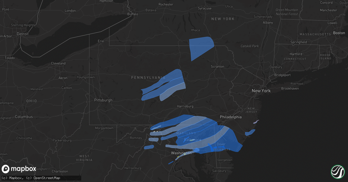
Hail Map in Pennsylvania on April 13, 2020
Get this storm
April 13 map
$229
one time, instant access
Download today. No call, no setup
Keep the $229
Bought the map and want the full workflow? Apply the entire $229 to a subscription within 7 days. None of it is wasted.
Every map, not just this one
This buys you this map. Subscription and you get every map we run, in the markets you choose from a few cities to whole states to nationwide. Plus real-time alerts the moment a storm fires.
Contact data
Name, contact info, occupancy, even credit band for addresses in the footprint. You go from where it hit to who to call.
Become the source they trust
Unlimited branding weather history reports on demand. You already have the documented answer ready for the property owner, and you are the one who showed up with it.
Property data and RoofTrace estimates
Pull up any address you have got, its value and the exact code rules for that jurisdiction, straight from One Click Code. Then RoofTrace estimates the squares, pitch, and roof value, priced the way you price.
Storm reports in Pennsylvania
Pennsylvania
| Date | Description |
|---|---|
| 04/13/20202:15 PM CDT | Tree down blocking roadway on craftmaster road. |
| 04/13/20201:48 PM CDT | Wires down on elmira street. |
| 04/13/20201:44 PM CDT | Trees and wires down in new providence |
| 04/13/20201:34 PM CDT | Trees and wires down north of montoursville |
| 04/13/20201:33 PM CDT | A couple of trees reported down along globe mills road in middlecreek township. |
| 04/13/20201:30 PM CDT | Trees and wires down in middleburg |
| 04/13/20201:00 PM CDT | Trees and wires down on williams road near ridgewood road. |
| 04/13/202012:56 PM CDT | Trees and wires down wallace st. At north east st. |
| 04/13/202012:41 PM CDT | Tree down across fish and game road near quail court in germany township. |
| 04/13/202012:35 PM CDT | Trees and wires down aross south harrison road |
| 04/13/202012:27 PM CDT | Trees down on egypt hollow road west of wingate. |
| 04/13/202012:21 PM CDT | Measured by personal wx station. Large solid wood picnic table blown across property. |
| 04/13/202012:16 PM CDT | Trees down on wires in port matilda |
| 04/13/202012:10 PM CDT | Trees and wires down east of quarryville |
| 04/13/202012:06 PM CDT | Trees down on wires near fort roberdeau historical site |
| 04/13/202012:06 PM CDT | Trees down along lyons road |
| 04/13/202012:04 PM CDT | Trees and wires down on mentzer gap road. |
| 04/13/202012:04 PM CDT | Trees down on mattern road in frankstown township. |
| 04/13/202012:02 PM CDT | Trees down in waynesboro. |
| 04/13/202011:49 AM CDT | Trees down on wires near almaden |
| 04/13/202011:38 AM CDT | Trees down on wires in beaverdale |
| 04/13/202011:23 AM CDT | Trees down in east conemaugh and franklin borough. |
| 04/13/202011:20 AM CDT | Trees and wires down near friedens. |
| 04/13/202011:17 AM CDT | Numerous trees and wires down around stoystown. |
| 04/13/202011:17 AM CDT | Trees and wires down near zimmerman. |
| 04/13/202010:38 AM CDT | Trees down on wires in beaverdale |
| 04/13/20207:45 AM CDT | At 1244 PM EDT, severe thunderstorms were located along a line extending from Jeffries to near Blandburg to 6 miles southeast of Prince Gallitzin State Park to Lilly, moving east at 50 mph. HAZARD...60 mph wind gusts and penny size hail. SOURCE...Radar indicated. IMPACT...Expect damage to trees, roofs, and siding. Severe thunderstorms will be near... Bellwood, Houtzdale, Woodland, Jeffries and South Philipsburg around 1250 PM EDT. Tyrone, Sandy Ridge, Birmingham, Tipton, North Philipsburg, Philipsburg, Osceola Mills, Bald Eagle and Chester Hill around 100 PM EDT. Port Matilda, Franklinville, Moshannon, Warriors Mark, Stormstown, Canoe Creek State Park, Williamsburg, Sinking Valley, Spruce Creek and Black Moshannon State Park around 110 PM EDT. State College, Huntingdon, Rock Springs, Ramblewood, Julian, Park Forest Village, Snow Shoe, Houserville, Clarence and Whipple Dam State Park around 120 PM EDT.Other locations impacted by these severe thunderstorms include WestDecatur, Tunnelhill, Ramey, Cassandra, Brisbin, McConnellstown,Howard, Petersburg, Alexandria and Unionville.For those driving on Interstate 80, this includes areas between theWoodland and Lamar exits, specifically from mile markers 126 to 170.This includes Interstate 99 from mile markers 26 to 85.This includes the following COVID-19 Test Sites... Mount Nittany Health...and UPMC. |
| 04/13/20206:48 AM CDT | At 1146 AM EDT, severe thunderstorms were located along a line extending from 7 miles northeast of Indiana to near South Connellsville, moving northeast at 60 mph. HAZARD...60 mph wind gusts and penny size hail. SOURCE...Radar indicated. IMPACT...Expect damage to trees, roofs, and siding. Locations impacted include... Johnstown, Somerset, Clearfield, Westmont, Windber, Ebensburg, Belmont, Nanty-Glo, Portage, Northern Cambria, Woodland, Curwensville, Geistown, Southmont, Berlin, Patton, Cresson, Gallitzin, Friedens and Hyde.This includes The Pennsylvania Turnpike from mile markers 101 to 129.This includes the following COVID-19 Test Sites... Med-Core. |
| 04/13/20206:18 AM CDT | At 1117 AM EDT, a severe thunderstorm was located over Masontown, or 10 miles west of Uniontown, moving northeast at 50 mph. HAZARD...Wind gusts to 70 mph. SOURCE...Radar. IMPACT...Trees snapped and uprooted. Power outages can be expected. Locations impacted include... Uniontown... Connellsville... Masontown... South Connellsville... Farmington... Fairdale... Point Marion... Fairchance... Isabella... Dunbar... Smithfield... Bobtown... |
| 04/12/20209:04 PM CDT | At 203 PM EDT, severe thunderstorms were located along a line extending from near Waterville to near McElhattan to near Woodward to near Belltown to Juniata Terrace, moving east at 40 mph. HAZARD...60 mph wind gusts and penny size hail. SOURCE...Radar indicated. IMPACT...Expect damage to trees, roofs, and siding. Severe thunderstorms will be near... McClure, Carroll, Laurelton Center, R.B. Winter State Park, Mcalisterville, Snyder-Middleswart State Park and Weikert around 210 PM EDT. Mifflinburg, Richfield, Forest Hill, Sand Bridge State Park, Beaver Springs, Cogan Station, Penns Creek, Collomsville, Ickesburg and Troxelville around 220 PM EDT. Montoursville, Williamsport, Vicksburg, Mount Pleasant Mills, Spruce Run Reservoir, Fremont, Duboistown, Meiserville, Linntown and Allenwood around 230 PM EDT. Lewisburg, Selinsgrove, Port Trevorton, Winfield, New Columbia, Muncy, Montgomery, Newport, Shamokin Dam and Hummels Wharf around 240 PM EDT.Other locations impacted by these severe thunderstorms includeWagner, West Milton, Mifflintown, Millerstown, Hartleton, GardenView, Oval, Loganton, New Berlin and Beavertown.For those driving on Interstate 80, this includes areas between theLock Haven and Milton-Williamsport exits, specifically from milemarkers 181 to 210.This includes Interstate 180 from mile markers 9 to 29.This includes the following COVID-19 Test Sites... Evangelical Hospital...and UPMC. |
| 04/12/20208:25 PM CDT | At 125 PM EDT, severe thunderstorms were located along a line extending from 7 miles northeast of Clarence to near Milesburg to Rock Springs to near Huntingdon, moving east at 45 mph. HAZARD...60 mph wind gusts and penny size hail. SOURCE...Radar indicated. IMPACT...Expect damage to trees, roofs, and siding. Severe thunderstorms will be near... Bellefonte, State College, Milesburg, Monument and Pleasant Gap around 130 PM EDT. Bald Eagle State Park, Allensville, Zion, Boalsburg, Lemont and Houserville around 140 PM EDT. Lock Haven, Lamar, Belleville, Potters Mills, Seven Mountains, Strodes Mills, Flemington, Castanea, Milroy and Dunnstown around 150 PM EDT. Lewistown, Juniata Terrace, Avis, Highland Park, Burnham, McElhattan, Poe Valley State Park, Yeagertown, Mackeyville and Reedsville around 200 PM EDT.Other locations impacted by these severe thunderstorms includeWagner, Barrville, Orviston, McCall Dam State Park, Longfellow, BeechCreek, McConnellstown, Siglerville, Howard and Petersburg.For those driving on Interstate 80, this includes areas between theSnow Shoe and Mile Run exits, specifically from mile markers 148 to195.This includes Interstate 99 from mile markers 67 to 85.This includes the following COVID-19 Test Sites... Mount Nittany Health. |
| 04/12/20208:20 PM CDT | At 119 PM EDT, severe thunderstorms were located along a line extending from near Boonsboro to near Brunswick to 6 miles south of Harpers Ferry, moving east at 45 mph. HAZARD...60 mph wind gusts. SOURCE...Radar indicated. IMPACT...Damaging winds will cause some trees and large branches to fall. This could injure those outdoors, as well as damage homes and vehicles. Roadways may become blocked by downed trees. Localized power outages are possible. Unsecured light objects may become projectiles. Locations impacted include... Germantown, Frederick, Gaithersburg, Olney, Westminster, Damascus, Thurmont, Poolesville, Emmitsburg, Harry Grove Stadium, Aspen Hill, Montgomery Village, Eldersburg, Ballenger Creek, Redland, Mount Airy, Taneytown, Hampstead, Brunswick and Walkersville. |
| 04/12/20208:06 PM CDT | At 106 PM EDT, severe thunderstorms were located along a line extending from near Fayetteville to Mount Lena, moving northeast at 55 mph. HAZARD...70 mph wind gusts and quarter size hail. SOURCE...Radar indicated. IMPACT...Hail damage to vehicles is expected. Expect considerable tree damage. Wind damage is also likely to mobile homes, roofs, and outbuildings. Locations impacted include... Hanover, Gettysburg, Hampton, Littlestown, Carroll Valley, McSherrystown, Lake Meade, Bonneauville, New Oxford, East Berlin, Lake Heritage, Cashtown, Aspers, Orrtanna, Biglerville, Abbottstown, Arendtsville, York Springs, Heidlersburg and Bendersville.This includes the following COVID-19 Test Sites... WellSpan Health. |
All States Impacted by Hail Map on April 13, 2020
Cities Impacted by Hail Map on April 13, 2020
- Hedgesville, WV
- Folkston, GA
- Gainesville, FL
- Saint Augustine, FL
- Elkton, FL
- Live Oak, FL
- Mayo, FL
- Lake City, FL
- Georgetown, SC
- Falling Waters, WV
- Martinsburg, WV
- Waldo, FL
- Lee, FL
- Sanderson, FL
- Glen Saint Mary, FL
- Catonsville, MD
- Dundalk, MD
- Baltimore, MD
- Halethorpe, MD
- Hampton, FL
- Big Pool, MD
- Bryceville, FL
- White Springs, FL
- Wellborn, FL
- Day, FL
- Keystone Heights, FL
- Starke, FL
- Green Cove Springs, FL
- Saint George, GA
- Berkeley Springs, WV
- Clear Spring, MD
- Hagerstown, MD
- Waretown, NJ
- Forked River, NJ
- Barnegat, NJ
- Windsor Mill, MD
- Pikesville, MD
- Gwynn Oak, MD
- Columbia, MD
- Clarksville, MD
- Woodstock, MD
- Ellicott City, MD
- Quantico, VA
- Triangle, VA
- Dumfries, VA
- Woodbridge, VA
- Manassas, VA
- Aspers, PA
- Williamsport, MD
- Biglerville, PA
- York New Salem, PA
- Rouzerville, PA
- Fayetteville, PA
- Hancock, MD
- York Springs, PA
- Greencastle, PA
- Cascade, MD
- Spring Grove, PA
- York, PA
- Quincy, PA
- Red Lion, PA
- East Berlin, PA
- Dover, PA
- Smithsburg, MD
- Maugansville, MD
- New Oxford, PA
- Abbottstown, PA
- Fairfield, PA
- State Line, PA
- Chambersburg, PA
- Littlestown, PA
- Waynesboro, PA
- Sabillasville, MD
- Mercersburg, PA
- Thomasville, PA
- Blue Ridge Summit, PA
- Seven Valleys, PA
- Hanover, PA
- Wrightsville, PA
- Windsor, PA
- McSherrystown, PA
- Mont Alto, PA
- Orrtanna, PA
- Gettysburg, PA
- Emmitsburg, MD
- Fairplay, MD
- Hampstead, MD
- Pequea, PA
- Shrewsbury, PA
- Felton, PA
- Holtwood, PA
- Millersville, PA
- Keymar, MD
- Sharpsburg, MD
- Christiana, PA
- New Freedom, PA
- Parkton, MD
- Woodsboro, MD
- Rohrersville, MD
- Lancaster, PA
- Brogue, PA
- Freeland, MD
- Shepherdstown, WV
- Airville, PA
- Gerrardstown, WV
- Westminster, MD
- Dallastown, PA
- Walkersville, MD
- Fawn Grove, PA
- Stewartstown, PA
- Quarryville, PA
- Strasburg, PA
- Union Bridge, MD
- Glenville, PA
- New Providence, PA
- Inwood, WV
- Thurmont, MD
- Glen Rock, PA
- Paradise, PA
- New Park, PA
- Middletown, MD
- Railroad, PA
- Taneytown, MD
- Willow Street, PA
- New Windsor, MD
- Myersville, MD
- Boonsboro, MD
- Washington Boro, PA
- Conestoga, PA
- Frederick, MD
- Drumore, PA
- Keedysville, MD
- Kearneysville, WV
- Manchester, MD
- Rocky Ridge, MD
- Berryville, VA
- Stephenson, VA
- Summit Point, WV
- Bunker Hill, WV
- Charles Town, WV
- Ranson, WV
- Clear Brook, VA
- Winchester, VA
- Edgewater, MD
- District Heights, MD
- Capitol Heights, MD
- Washington, DC
- Bowie, MD
- Springfield, VA
- Temple Hills, MD
- Alexandria, VA
- Riva, MD
- Hyattsville, MD
- Annapolis, MD
- Fort Belvoir, VA
- Suitland, MD
- Stevensville, MD
- Oxon Hill, MD
- Lorton, VA
- Harwood, MD
- Upper Marlboro, MD
- Davidsonville, MD
- Boyce, VA
- Stephens City, VA
- Star Tannery, VA
- White Post, VA
- Middletown, VA
- Strasburg, VA
- Front Royal, VA
- Conowingo, MD
- Finksburg, MD
- Mount Airy, MD
- Peach Bottom, PA
- Brunswick, MD
- New Market, MD
- Cochranville, PA
- Delta, PA
- Upperco, MD
- Street, MD
- Lovettsville, VA
- Kirkwood, PA
- Jefferson, MD
- Whiteford, MD
- Atglen, PA
- Ijamsville, MD
- Harpers Ferry, WV
- Monkton, MD
- Pylesville, MD
- White Hall, MD
- Oxford, PA
- Knoxville, MD
- Millville, WV
- Jarrettsville, MD
- Monrovia, MD
- Lincoln University, PA
- Reisterstown, MD
- Sparks Glencoe, MD
- Purcellville, VA
- Nottingham, PA
- Elmer, NJ
- Leesburg, VA
- Hanover, MD
- Church Hill, MD
- Hartly, DE
- Garrett Park, MD
- Jessup, MD
- Rockville, MD
- Harmans, MD
- Penns Grove, NJ
- Monroeville, NJ
- Clayton, DE
- Massey, MD
- Dickerson, MD
- Centreville, MD
- Barclay, MD
- Glen Burnie, MD
- Still Pond, MD
- Kensington, MD
- Crofton, MD
- Middletown, DE
- Worton, MD
- Crumpton, MD
- Arnold, MD
- Pennsville, NJ
- Millersville, MD
- Chestertown, MD
- Boyds, MD
- Germantown, MD
- Earleville, MD
- Savage, MD
- Silver Spring, MD
- Odenton, MD
- Laurel, MD
- Odessa, DE
- Townsend, DE
- Sterling, VA
- Warwick, MD
- Sudlersville, MD
- Annapolis Junction, MD
- Pasadena, MD
- Elkridge, MD
- Fort George G Meade, MD
- Great Falls, VA
- Bridgeton, NJ
- Potomac, MD
- Curtis Bay, MD
- Gambrills, MD
- Linthicum Heights, MD
- Galena, MD
- Gibson Island, MD
- Georgetown, MD
- Rock Hall, MD
- Derwood, MD
- Woodstown, NJ
- Port Penn, DE
- Alloway, NJ
- Smyrna, DE
- Severn, MD
- Crownsville, MD
- Burtonsville, MD
- Sparrows Point, MD
- Kennedyville, MD
- Poolesville, MD
- Bethesda, MD
- Beltsville, MD
- Millington, MD
- Spencerville, MD
- Marydel, MD
- Ashburn, VA
- Severna Park, MD
- Salem, NJ
- Fort Howard, MD
- Gaithersburg, MD
- Pedricktown, NJ
- College Park, MD
- Cooksville, MD
- Cockeysville, MD
- Joppa, MD
- Glen Arm, MD
- Hydes, MD
- Owings Mills, MD
- Havre De Grace, MD
- Fork, MD
- Fulton, MD
- Stevenson, MD
- Newark, DE
- Perryman, MD
- Upper Falls, MD
- Perryville, MD
- Aberdeen, MD
- Marriottsville, MD
- Lutherville Timonium, MD
- Rising Sun, MD
- White Marsh, MD
- Brooklyn, MD
- Glenelg, MD
- Betterton, MD
- Damascus, MD
- Delaware City, DE
- Middle River, MD
- Dayton, MD
- Elkton, MD
- Cecilton, MD
- Bear, DE
- Chesapeake City, MD
- Port Deposit, MD
- Perry Point, MD
- Baldwin, MD
- Sandy Spring, MD
- Brookeville, MD
- Brinklow, MD
- North East, MD
- Olney, MD
- Kingsville, MD
- Rosedale, MD
- Saint Georges, DE
- New Castle, DE
- West Friendship, MD
- Belcamp, MD
- Montgomery Village, MD
- Nottingham, MD
- Edgewood, MD
- Fallston, MD
- Perry Hall, MD
- Landenberg, PA
- Aberdeen Proving Ground, MD
- Randallstown, MD
- Abingdon, MD
- Parkville, MD
- Gunpowder, MD
- Glenwood, MD
- Highland, MD
- Towson, MD
- Elk Mills, MD
- Ashton, MD
- Phoenix, MD
- Wilmington, DE
- Bel Air, MD
- Charlestown, MD
- Churchville, MD
- Essex, MD
- Hockessin, DE
- Woodbine, MD
- Sykesville, MD
- Glyndon, MD
- Hunt Valley, MD
- Kennett Square, PA
- Forest Hill, MD
- Toughkenamon, PA
- West Grove, PA
- Darlington, MD
- Colora, MD
- Avondale, PA
- Marydel, DE
- Frederica, DE
- Mauricetown, NJ
- Avalon, NJ
- Greenwich, NJ
- Cordova, MD
- Villas, NJ
- Cape May Court House, NJ
- Viola, DE
- Wye Mills, MD
- Woodside, DE
- Cedarville, NJ
- Cape May, NJ
- Sea Isle City, NJ
- Leesburg, NJ
- Ridgely, MD
- Millville, NJ
- Wildwood, NJ
- Felton, DE
- Vineland, NJ
- Delmont, NJ
- Rio Grande, NJ
- Dover, DE
- Queen Anne, MD
- Newport, NJ
- Ingleside, MD
- Cheswold, DE
- Magnolia, DE
- Port Norris, NJ
- Shiloh, NJ
- Cape May Point, NJ
- Chester, MD
- Queenstown, MD
- Dorchester, NJ
- Dover Afb, DE
- Milford, DE
- Camden Wyoming, DE
- Goldsboro, MD
- Greensboro, MD
- Hillsboro, MD
- Port Elizabeth, NJ
- Heislerville, NJ
- Fortescue, NJ
- Henderson, MD
- Grasonville, MD
- Harrington, DE
- Denton, MD
- Woodbine, NJ
- Stone Harbor, NJ
- East Smithfield, PA
- Gillett, PA
- Lawton, PA
- Hallstead, PA
- Granville Summit, PA
- Columbia Cross Roads, PA
- Stevensville, PA
- Binghamton, NY
- Troy, PA
- Spencer, NY
- Forksville, PA
- Montrose, PA
- Wysox, PA
- Wyalusing, PA
- Le Raysville, PA
- Ulster, PA
- Sayre, PA
- Milan, PA
- Waverly, NY
- Castle Creek, NY
- Nichols, NY
- Newark Valley, NY
- Candor, NY
- Vestal, NY
- Conklin, NY
- Athens, PA
- Maine, NY
- Erin, NY
- Johnson City, NY
- Wellsburg, NY
- Monroeton, PA
- Canton, PA
- Lowman, NY
- Kirkwood, NY
- Rome, PA
- Warren Center, PA
- Chemung, NY
- Towanda, PA
- Barton, NY
- Elmira, NY
- Little Meadows, PA
- Brackney, PA
- New Albany, PA
- Owego, NY
- Friendsville, PA
- Lockwood, NY
- Apalachin, NY
- Van Etten, NY
- Endicott, NY
- Glen Aubrey, NY
- Monticello, FL
- Greenville, FL
- Lamont, FL
- Tallahassee, FL
- Lloyd, FL
- Quitman, GA
- Perry, FL
- Jasper, FL
- Lakeland, GA
- Naylor, GA
- Homerville, GA
- Fargo, GA
- Waycross, GA
- Morven, NC
- Sunset Beach, NC
- Andrews, SC
- Hemingway, SC
- Myrtle Beach, SC
- Calabash, NC
- Pawleys Island, SC
- Gresham, SC
- Murrells Inlet, SC
- Conway, SC
- North Myrtle Beach, SC
- Longs, SC
- Little River, SC
- Gastonia, NC
- Fort Mill, SC
- York, SC
- Sharon, SC
- McConnells, SC
- Pineville, NC
- Charlotte, NC
- Rock Hill, SC
- Belmont, NC
- Clover, SC
- Whiteville, NC
- Hallsboro, NC
- Kernersville, NC
- Colfax, NC
- Winston Salem, NC
- Cedar Grove, NC
- Graham, NC
- Rougemont, NC
- Hurdle Mills, NC
- Burlington, NC
- Timberlake, NC
- Mebane, NC
- Oxford, NC
- Roxboro, NC
- Efland, NC
- Haw River, NC
- Randleman, NC
- Sophia, NC
- Asheboro, NC
- Snow Camp, NC
- Hillsborough, NC
- Bolivia, NC
- Oak Island, NC
- Wilmington, NC
- Southport, NC
- Carolina Beach, NC
- Kure Beach, NC
- Staley, NC
- Siler City, NC
- Ramseur, NC
- Liberty, NC
- Franklinville, NC
- Sanford, NC
- Cameron, NC
- Zebulon, NC
- Fuquay Varina, NC
- Apex, NC
- Knightdale, NC
- Garner, NC
- Youngsville, NC
- Raleigh, NC
- Wake Forest, NC
- Rolesville, NC
- Wendell, NC
- Durham, NC
- Middleburg, NC
- Manson, NC
- Boydton, VA
- Kittrell, NC
- Franklinton, NC
- Warrenton, NC
- Creedmoor, NC
- Henderson, NC
- Norlina, NC
- Bracey, VA
- Hampstead, NC
- Rocky Point, NC
- Burgaw, NC
- Currie, NC
- Stedman, NC
- Wade, NC
- Dunn, NC
- Godwin, NC
- Fayetteville, NC
- Hope Mills, NC
- Autryville, NC
- Salisbury, NC
- Rockwell, NC
- China Grove, NC
- Concord, NC
- Kannapolis, NC
- Olin, NC
- Hamptonville, NC
- East Bend, NC
- Boonville, NC
- Union Grove, NC
- Yadkinville, NC
- Harmony, NC
- Statesville, NC
- Pfafftown, NC
- Lewisville, NC
- Blanchard, PA
- Cogan Station, PA
- Montgomery, PA
- Lock Haven, PA
- Bellefonte, PA
- Williamsport, PA
- Howard, PA
- Osceola Mills, PA
- Warriors Mark, PA
- Julian, PA
- Fleming, PA
- Tyrone, PA
- Milesburg, PA
- Dysart, PA
- Smithmill, PA
- Loganton, PA
- Mill Hall, PA
- Sandy Ridge, PA
- Blandburg, PA
- Jersey Shore, PA
- State College, PA
- Linden, PA
- Port Matilda, PA
- Avis, PA
- Houtzdale, PA
- Allenwood, PA
- Philipsburg, PA
- Orviston, PA
- Lamar, PA
- Beech Creek, PA
- Beccaria, PA
- Fallentimber, PA
- Coalport, PA
- Spruce Creek, PA
- Hollidaysburg, PA
- Madisonburg, PA
- Reedsville, PA
- Tipton, PA
- Lewisburg, PA
- Bellwood, PA
- Alexandria, PA
- Millmont, PA
- Huntingdon, PA
- Woodward, PA
- Millheim, PA
- Altoona, PA
- New Columbia, PA
- Rebersburg, PA
- Aaronsburg, PA
- Boalsburg, PA
- Petersburg, PA
- Centre Hall, PA
- Belleville, PA
- Laurelton, PA
- Ashville, PA
- Milroy, PA
- Lemont, PA
- Spring Mills, PA
- Duncansville, PA
- Williamsburg, PA
- Pennsylvania Furnace, PA
- Mifflinburg, PA
- Coburn, PA
- Pine Grove Mills, PA
- McVeytown, PA
- Selinsgrove, PA
- Beaver Springs, PA
- Mill Creek, PA
- McAlisterville, PA
- Allensville, PA
- Lewistown, PA
- Beavertown, PA
- Middleburg, PA
- Mifflintown, PA
- Granville, PA
- Mifflin, PA
- Freeburg, PA
- McClure, PA
- Yeagertown, PA
- Winfield, PA
- New Berlin, PA
- Burnham, PA
- Mays Landing, NJ
- Port Republic, NJ
- Absecon, NJ
- Tuckerton, NJ
- Pleasantville, NJ
- Beach Haven, NJ
- Egg Harbor City, NJ
- Egg Harbor Township, NJ


