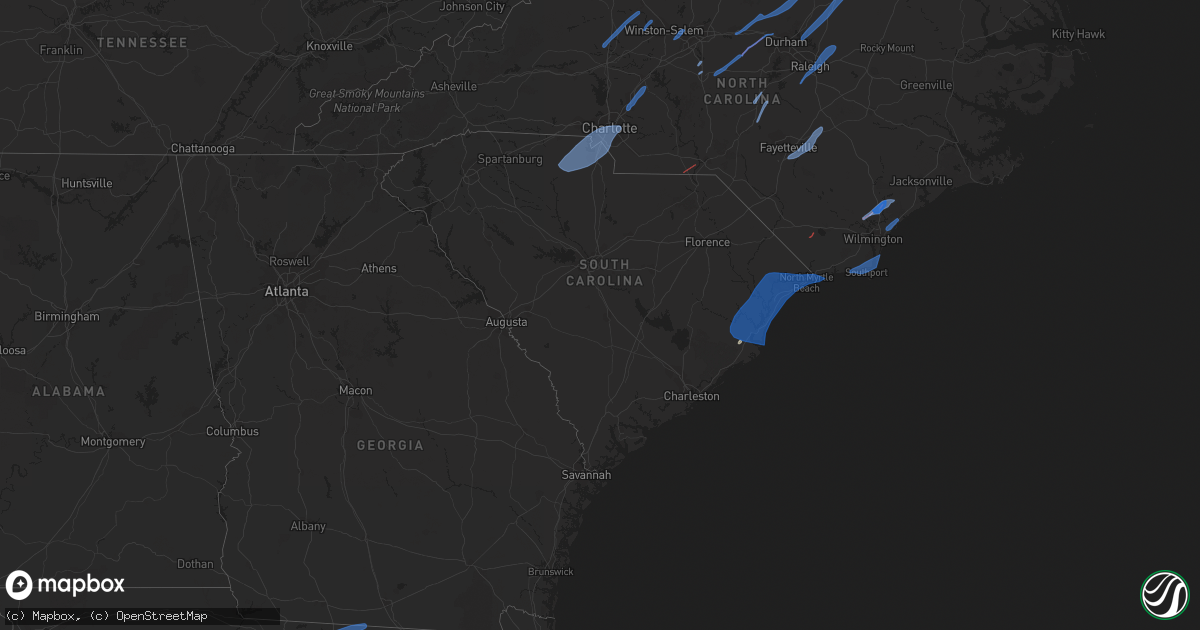
Hail Map in South Carolina on April 13, 2020
Get this storm
April 13 map
$229
one time, instant access
Download today. No call, no setup
Keep the $229
Bought the map and want the full workflow? Apply the entire $229 to a subscription within 7 days. None of it is wasted.
Every map, not just this one
This buys you this map. Subscription and you get every map we run, in the markets you choose from a few cities to whole states to nationwide. Plus real-time alerts the moment a storm fires.
Contact data
Name, contact info, occupancy, even credit band for addresses in the footprint. You go from where it hit to who to call.
Become the source they trust
Unlimited branding weather history reports on demand. You already have the documented answer ready for the property owner, and you are the one who showed up with it.
Property data and RoofTrace estimates
Pull up any address you have got, its value and the exact code rules for that jurisdiction, straight from One Click Code. Then RoofTrace estimates the squares, pitch, and roof value, priced the way you price.
Storm reports in South Carolina
South Carolina
| Date | Description |
|---|---|
| 04/13/20207:51 AM CDT | Tree snapped and fell on car in classic court. |
| 04/13/20207:40 AM CDT | Storm damage reported in longs off of 905 - trees down and trampoline damaged |
| 04/13/20207:39 AM CDT | Large limbs down near the park's beach pavilion area. Also... Minor roof damage to the nearby castle building. Tornado likely moved off the beach just ne of this area. |
| 04/13/20207:36 AM CDT | A member of the public reported several trees down around their property on airy hall. Roof damage was caused by falling trees. |
| 04/13/20207:35 AM CDT | Social media report of several large trees uprooted... Large branches down... And minor damage to homes. Most of the damage was between surfwatch dr and night heron par |
| 04/13/20207:35 AM CDT | A likely downburst snapped off trees and branches and uprooted trees in and around night heron park and an adjacent apartment complex. At the apartment complex a tree f |
| 04/13/20207:33 AM CDT | A national weather service damage survey team has confirmed an ef-1 tornado on the southwest side of the island. The tornado resulted in tree damage on a golf course an |
| 04/13/20207:32 AM CDT | A tin roof was partially blown and landed in trees. Time is estimated by radar. |
| 04/13/20207:32 AM CDT | Storm survey crew finds ef0 damage on lakeshore drive and trace drive |
| 04/13/20207:30 AM CDT | Possible tornado damage reported by media in pawley's island - multiple trees down/snapped |
| 04/13/20207:30 AM CDT | Scattered trees damaged with large limbs down and some uprooted near willbrook rd area west of hwy 17. |
| 04/13/20207:30 AM CDT | Tree damage reported at house in litchfield beach |
| 04/13/20207:30 AM CDT | Reports of trees on a residence at 239 folly rd... Georgetown. Time estimated by radar. |
| 04/13/20207:29 AM CDT | Reports of several large trees and branches down in neighborhood streets and yards... As well as damage to vehicles due to fallen trees along high hammock road... The b |
| 04/13/20207:28 AM CDT | A national weather service storm survey team has confirmed an ef-1 tornado on seabrook island. The tornado resulted in damage along a 1.25 mile long path on the southwe |
| 04/13/20207:22 AM CDT | Tree down at william parkway pkwy and shipyard dr. Time estimated via radar data. |
| 04/13/20207:20 AM CDT | Tree down and shed blown down on old magnolia drive in conway plantation |
| 04/13/20207:20 AM CDT | Possible tornado damage - tree down in yard and reported path cleared through woods behind home near county rd s22-20 and s22-119 |
| 04/13/20207:15 AM CDT | Storm survey crew finds ef1 damage near sampit |
| 04/13/20207:15 AM CDT | Storm survey confirms ef2 tornado. Tornado ripped off portions or large sections of roofs off of six homes. Numerous trees snapped off and uprooted along the path. A bo |
| 04/13/20207:15 AM CDT | Multiple damaged structures as well as multiple trees down or snapped off in the 1300 block of myrtle street on edisto island. Also... Colleton county fire-rescue emerg |
| 04/13/20207:15 AM CDT | A tin roof was partially blown and landed in trees. Time is estimated by radar. |
| 04/13/20207:10 AM CDT | Em reports trees and power lines down on kent rd... Nw of city of georgetown |
| 04/13/20207:02 AM CDT | A resident sent pictures of numerous trees snapped or blown down in the 1700 block of french santee road near jamestown. The resident also reported that a fence was blo |
| 04/13/20203:42 AM CDT | At 842 AM EDT, severe thunderstorms were located along a line extending from near Naval Weapons Station Charleston to 6 miles south of Folly Beach, moving east at 50 mph. HAZARD...70 mph wind gusts and penny size hail. SOURCE...Law enforcement. IMPACT...Expect considerable tree damage. Damage is likely to mobile homes, roofs, and outbuildings. Locations impacted include... North Charleston, Mount Pleasant, Goose Creek, Hanahan, McClellanville, Downtown Charleston, Daniel Island, Fort Sumter, James Island, West Ashley, Johns Island, Isle Of Palms, Folly Beach, Sullivan's Island and Kiawah Island.This warning includes... I-26 between mile markers 216 and 221. I-526 between mile markers 21 and 31. |
| 04/13/20203:15 AM CDT | At 815 AM EDT, a severe thunderstorm was located over Green Sea, or 16 miles southeast of Mullins, moving northeast at 65 mph. HAZARD...60 mph wind gusts. SOURCE...Radar indicated. IMPACT...Expect wind damage to trees and power lines. Locations impacted include... Myrtle Beach, Conway, North Myrtle Beach, Georgetown, DeBordieu Colony, Surfside Beach, Pawleys Island, Myrtle Beach Airport, Little River, Murrells Inlet, Little River Entrance, Socastee, Red Hill, Springmaid Pier, Garden City, North Myrtle Beach Airport, Cherry Grove Inlet, Horry, Loris and Johnsonville.People attending Conway Medical Center outdoor tent facilities,Georgetown Memorial outdoor tent facilities, and Grand Strand Healthoutdoor tent facilities should seek safe shelter immediately! |
| 04/13/20203:13 AM CDT | At 812 AM EDT, severe thunderstorms were located along a line extending from near Hilton Head Airport to Shellman Bluff, moving east at 50 mph. HAZARD...70 mph wind gusts and penny size hail. SOURCE...Trained weather spotters. IMPACT...Expect considerable tree damage. Damage is likely to mobile homes, roofs, and outbuildings. Locations impacted include... Hilton Head Island, Bluffton, Richmond Hill, Tybee Island, Darien, Bellinger Hill Area, Wilmington Island, Fort Pulaski National Monument, Midtown Savannah, Downtown Savannah, Coffee Bluff, Hunter Army Airfield, Jones, Montgomery and Garden City.The Savannah COVID-19 outside testing site is in the path of thisstorm. TAKE PRECAUTIONS NOW!This warning includes... I-16 between mile markers 165 and 168. I-516 between mile markers 3 and 7. I-95 in Georgia between mile markers 50 and 90. |
| 04/13/20202:53 AM CDT | At 752 AM EDT, a severe thunderstorm was located near Lumberton, moving northeast at 90 mph. HAZARD...70 mph wind gusts. SOURCE...Radar indicated. IMPACT...Expect considerable tree damage. Damage is likely to mobile homes, roofs, and outbuildings. Locations impacted include... Lumberton, Whiteville, Elizabethtown, Red Springs, Pembroke, Fairmont, St. Pauls, Chadbourn, Bladenboro, Rowland, Fair Bluff, Boardman, Rex, Ammon, Hestertown, Shannon, Southeastern Community College, White Oak, Smiths and Howellsville.People attending Bladen County Hospital outdoor tent facilitiesshould seek safe shelter immediately! |
| 04/13/20202:42 AM CDT | At 741 AM EDT, severe thunderstorms were located along a line extending from 7 miles southwest of Jamestown to near Magnolia Gardens to near Dale, moving east at 50 mph. HAZARD...70 mph wind gusts and penny size hail. SOURCE...Radar indicated. IMPACT...Expect considerable tree damage. Damage is likely to mobile homes, roofs, and outbuildings. Locations impacted include... North Charleston, Mount Pleasant, Summerville, Goose Creek, Hanahan, Beaufort, Moncks Corner, McClellanville, Edisto Beach, Fort Sumter, Downtown Charleston, West Ashley, Daniel Island, Naval Weapons Station Charleston and Johns Island.This warning includes... I-26 between mile markers 197 and 221. I-526 between mile markers 11 and 31. |
| 04/13/20202:41 AM CDT | At 740 AM EDT, a severe thunderstorm was located near Bonneau, or 7 miles northeast of Moncks Corner, moving northeast at 60 mph. HAZARD...60 mph wind gusts. SOURCE...Radar indicated. IMPACT...Expect wind damage to trees and power lines. Locations impacted include... Myrtle Beach, Georgetown, DeBordieu Colony, Surfside Beach, Pawleys Island, Socastee, Yawkey South Island, Springmaid Pier, Garden City, Murrells Inlet, Winyah Bay Entrance, Myrtle Beach Airport, Andrews, North Santee, Rhems, Pee Dee Crossroads, Oatland, Nesmith, Bucksport and Sampit.People attending Georgetown Memorial outdoor tent facilities shouldseek safe shelter immediately! |
| 04/13/20202:32 AM CDT | At 732 AM EDT, a severe thunderstorm was located near Minturn, or 11 miles north of Dillon, moving northeast at 90 mph. HAZARD...60 mph wind gusts. SOURCE...Radar indicated. IMPACT...Expect wind damage to trees and power lines. Locations impacted include... Lumberton, Red Springs, Pembroke, Fairmont, Maxton, St. Pauls, Rowland, Rex, Ammon, Butters, Hestertown, Shannon, Buie, Robeson Community College, Wakulla, White Oak, Elrod, Smiths, Howellsville and Raemon. |
| 04/13/20202:15 AM CDT | At 714 AM EDT, severe thunderstorms were located along a line extending from Blitchton to near Odum, moving east at 40 mph. HAZARD...70 mph wind gusts and penny size hail. SOURCE...Radar indicated. IMPACT...Expect considerable tree damage. Damage is likely to mobile homes, roofs, and outbuildings. Locations impacted include... Hinesville, Pooler, Richmond Hill, Glennville, Tybee Island, Darien, Ludowici, Tibet, Savannah International Airport, Fort Stewart, Wilmington Island, Fort Pulaski National Monument, Midtown Savannah, Downtown Savannah and Coffee Bluff.The Savannah COVID-19 outside testing site is in the path of thisstorm. TAKE PRECAUTIONS NOW!This warning includes... I-16 between mile markers 152 and 168. I-516 between mile markers 3 and 9. I-95 in Georgia between mile markers 50 and 112. |
| 04/13/20201:58 AM CDT | At 658 AM EDT, severe thunderstorms were located along a line extending from near Elliott to Manning, moving east at 50 mph. HAZARD...70 mph wind gusts and penny size hail. SOURCE...Radar indicated. IMPACT...Expect considerable tree damage. Damage is likely to mobile homes, roofs, and outbuildings. Locations impacted include... Woods Bay State Park, Elliott, Turbeville, Lynchburg, Shiloh and Gable.This includes Interstate 95 between mile markers 124 and 146. |
| 04/13/20201:58 AM CDT | At 658 AM EDT, a severe thunderstorm was located over Auburn, or 7 miles east of Hartsville, moving northeast at 75 mph. HAZARD...60 mph wind gusts and penny size hail. SOURCE...Radar indicated. IMPACT...Expect wind damage to trees and power lines. Locations impacted include... Florence, Bennettsville, Hartsville, Darlington, Timmonsville, Mccoll, Lamar, Quinby, Clio, Mont Clare, Brownsville, Lydia, Darlington Raceway, Swift Creek, Cartersville, Florence Darlington Technical College Main Campus, Oats, Chavistown, Floyd and Minturn. |
| 04/13/20201:58 AM CDT | At 657 AM EDT, severe thunderstorms were located along a line extending from 12 miles east of Seagrove to near Pinehurst to near Rockingham, moving northeast at 60 mph. HAZARD...60 mph wind gusts. SOURCE...Radar indicated. IMPACT...Expect damage to roofs, siding, and trees. Locations impacted include... Fayetteville, Sanford, Laurinburg, Southern Pines, Rockingham, Raeford, Lillington, Carthage, Fort Bragg and Pinehurst. |
| 04/13/20201:53 AM CDT | At 652 AM EDT, severe thunderstorms were located along a line extending from near Santee Cooper Regional Airport to near Cottageville to Tillman, moving east at 90 mph. HAZARD...70 mph wind gusts and penny size hail. SOURCE...Radar indicated. IMPACT...Expect considerable tree damage. Damage is likely to mobile homes, roofs, and outbuildings. Locations impacted include... North Charleston, Mount Pleasant, Summerville, Goose Creek, Hanahan, Beaufort, Moncks Corner, McClellanville, Edisto Beach, Fort Sumter, Downtown Charleston, West Ashley, Daniel Island, Givhans Ferry State Park and Naval Weapons Station Charleston.This warning includes... I-26 between mile markers 187 and 221. I-526 between mile markers 11 and 31. |
| 04/13/20201:46 AM CDT | At 646 AM EDT, severe thunderstorms were located along a line extending from 9 miles north of Cheraw Municipal Airport to near Clyde, moving east at 50 mph. HAZARD...70 mph wind gusts and penny size hail. SOURCE...Radar indicated. IMPACT...Expect considerable tree damage. Damage is likely to mobile homes, roofs, and outbuildings. Locations impacted include... Cheraw, Chesterfield, Carolina Sandhills Wildlife Refuge, Cheraw State Park, Northeastern Technical College, Cheraw Municipal Airport, Mcbee, Ruby, Patrick, Chesterfield Ruby Middle School, Cheraw Fish Hatchery, Alligator Fire Station, Middendorf, Bay Springs Fire Station and Chesterfield Detention Center. |
| 04/13/20201:39 AM CDT | At 639 AM EDT, severe thunderstorms were located along a line extending from near Clyde to near Elloree, moving east at 55 mph. HAZARD...70 mph wind gusts and penny size hail. SOURCE...Radar indicated. IMPACT...Expect considerable tree damage. Damage is likely to mobile homes, roofs, and outbuildings. Locations impacted include... Sumter, Bishopville, South Sumter, Shaw Air Base, Oakland, Elliott, Mulberry, Lee State Park, Sumter County Airport, Millwood, Poinsett State Park, Goodale State Park, Mayesville, Pinewood, Paxville, Cane Savannah, Lucknow, Dalzell, Dinkins Mill and Manville.This includes the following highways... Interstate 20 in South Carolina between mile markers 99 and 126. Interstate 95 between mile markers 126 and 131. |
| 04/13/20201:35 AM CDT | At 634 AM EDT, severe thunderstorms were located along a line extending from 6 miles northwest of Elloree to near Smoaks, moving northeast at 60 mph. HAZARD...70 mph wind gusts and penny size hail. SOURCE...Radar indicated. IMPACT...Expect considerable tree damage. Damage is likely to mobile homes, roofs, and outbuildings. Locations impacted include... Manning, Holly Hill, Summerton, Bowman, Elloree, Alcolu, Santee State Park, Santee Cooper Regional Airport, Santee, Eutawville, Vance, Poplar Creek Landing, Rimini, Stumphole Landing, Eautaw Springs, Blounts Landing, Lone Star, Low Falls Landing, St. Paul and Rocks Pond Campground and Marina.This includes the following highways... Interstate 26 between mile markers 157 and 169. Interstate 95 between mile markers 85 and 126. |
| 04/13/20201:32 AM CDT | At 631 AM EDT, a severe thunderstorm was located 8 miles southeast of Camden, moving northeast at 65 mph. HAZARD...60 mph wind gusts and penny size hail. SOURCE...Radar indicated. IMPACT...Expect wind damage to trees and power lines. Locations impacted include... Bennettsville, Hartsville, Darlington, Timmonsville, Mccoll, Lamar, Mont Clare, Lydia, Darlington Raceway, Swift Creek, Cartersville, Florence Darlington Technical College Main Campus, Oats, Chavistown, Floyd, North Hartsville, Dovesville, Auburn, Wallace and Clyde. |
| 04/13/20201:29 AM CDT | At 628 AM EDT, severe thunderstorms were located along a line extending from near Pulaski to 11 miles southwest of Mendes, moving east at 65 mph. HAZARD...60 mph wind gusts and penny size hail. SOURCE...Radar indicated. IMPACT...Expect damage to trees and powerlines. Locations impacted include... Statesboro, Reidsville, Metter, Glennville, Springfield, Claxton, Pembroke, Lanier, Rincon, Guyton, Brooklet, Hagan, Collins, Pulaski and Register.The Statesboro COVID-19 outside testing site is in the path of thisstorm. TAKE PRECAUTIONS NOW!This warning includes I-16 between mile markers 104 and 150. |
| 04/13/20201:04 AM CDT | At 604 AM EDT, severe thunderstorms were located along a line extending from near Liberty Hill to near Gaston, moving northeast at 45 mph. HAZARD...70 mph wind gusts and penny size hail. SOURCE...Radar indicated. IMPACT...Expect considerable tree damage. Damage is likely to mobile homes, roofs, and outbuildings. Locations impacted include... Columbia, Camden, McEntire Air Base, Lake Wateree Dam, St. Matthews, Eastover, Lugoff, Congaree National Park, Hopkins, Villages at Sandhill, Elgin, Horrel Hill, Sesquicentennial State Park, Lake Carolina, Sandy Run, Fort Jackson, Gadsden, Goodale State Park, Woodfield and North Towne Square Shopping Center.This includes the following highways... Interstate 20 in South Carolina between mile markers 77 and 101. Interstate 26 between mile markers 127 and 134. |
| 04/13/20201:02 AM CDT | At 601 AM EDT, a severe thunderstorm was located over Sandy Run, or 9 miles southeast of Cayce, moving northeast at 70 mph. HAZARD...70 mph wind gusts and penny size hail. SOURCE...Radar indicated. IMPACT...Expect considerable tree damage. Damage is likely to mobile homes, roofs, and outbuildings. Locations impacted include... Swansea, Wagener, Salley, Perry, Perry Airport, Thor and New Holland. |
| 04/13/202012:52 AM CDT | At 552 AM EDT, severe thunderstorms were located along a line extending from 8 miles southwest of Seagrove to near Ansonville to near Buford, moving northeast at 55 mph. HAZARD...60 mph wind gusts. SOURCE...Radar indicated. IMPACT...Expect damage to roofs, siding, and trees. Locations impacted include... Albemarle, Rockingham, Wadesboro, Troy, Carthage, Badin Lake, Pinehurst, Hamlet, Biscoe and Ansonville. |
| 04/13/202012:48 AM CDT | At 548 AM EDT, severe thunderstorms were located along a line extending from 14 miles southeast of Downtown Concord to near Lancaster, moving northeast at 60 mph. HAZARD...60 mph wind gusts. SOURCE...Radar indicated. IMPACT...Expect damage to trees and power lines. Locations impacted include... Monroe, Unionville, Wingate, Marshville, Mineral Springs, Fairview In Union County, Sturdivants, Trinity and New Salem. |
| 04/13/202012:34 AM CDT | At 533 AM EDT, severe thunderstorms were located along a line extending from near Jenkinsville to 9 miles southwest of Red Bank, moving northeast at 40 mph. HAZARD...70 mph wind gusts and penny size hail. SOURCE...Radar indicated. IMPACT...Expect considerable tree damage. Damage is likely to mobile homes, roofs, and outbuildings. Locations impacted include... Columbia, Lexington, West Columbia, Cayce, Irmo, Forest Acres, Springdale, St. Andrews, VC Summer Nuclear Station, Dentsville, Oak Grove, Highway 6 at Lake Murray Dam, Red Bank, South Congaree, Pine Ridge, Gaston, Arcadia Lakes, Columbia International University, Jenkinsville and Harbison State Forest.This includes the following highways... Interstate 126 between mile markers 0 and 3. Interstate 20 in South Carolina between mile markers 42 and 74. Interstate 26 between mile markers 88 and 127. Interstate 77 between mile markers 0 and 7, between mile markers 9and 12, and between mile markers 18 and 35. |
| 04/13/202012:33 AM CDT | At 532 AM EDT, severe thunderstorms were located along a line extending from 6 miles west of Barnwell to near Santa Claus, moving east at 60 mph. HAZARD...60 mph wind gusts and penny size hail. SOURCE...Radar indicated. IMPACT...Expect damage to trees and powerlines. Locations impacted include... Statesboro, Reidsville, Metter, Allendale, Sylvania, Springfield, Hampton, Claxton, Lake Warren State Park, Varnville, Estill, Fairfax, Guyton, Brooklet and Hagan.The Statesboro COVID-19 outside testing site is in the path of thisstorm. TAKE PRECAUTIONS NOW!This warning includes I-16 between mile markers 97 and 139. |
| 04/13/202012:21 AM CDT | At 521 AM EDT, severe thunderstorms were located along a line extending from 8 miles northwest of Ansonville to 6 miles east of Buford, moving northeast at 70 mph. HAZARD...60 mph wind gusts. SOURCE...Radar indicated. IMPACT...Expect damage to roofs, siding, and trees. Locations impacted include... Wadesboro, Ansonville, Polkton, Lilesville, Morven, Peachland, McFarlan, Blewett Falls Lake and White Store. |
| 04/13/202012:16 AM CDT | At 516 AM EDT, severe thunderstorms were located along a line extending from near Indian Land to near Winnsboro, moving northeast at 50 mph. HAZARD...70 mph wind gusts and nickel size hail. SOURCE...Radar indicated. IMPACT...Expect considerable tree damage. Damage is likely to mobile homes, roofs, and outbuildings. Locations impacted include... Lancaster, Winnsboro, Indian Land, Elgin, Fairfield County Airport, USC Lancaster, Irwin, Blackstock, Andrew Jackson State Park, Van Wyck, Lake Wateree State Park, Ridgeway, Lebanon Fire Station, Bell Town Fire Station, Arrowood Estates, Community of Almond Glen, Mitford, Faith Christian School, Carolina Commons Shopping Center and White Oak.This includes Interstate 77 between mile markers 34 and 51. |
| 04/13/202012:10 AM CDT | At 509 AM EDT, severe thunderstorms were located along a line extending from 5 miles east of Mocksville to 9 miles southeast of Chester, moving northeast at 60 mph. HAZARD...60 mph wind gusts. SOURCE...Radar indicated. IMPACT...Expect damage to trees and power lines. Locations impacted include... Rock Hill, Uptown Charlotte, Huntersville, Kannapolis, Downtown Concord, Monroe, Salisbury, Chester, Mocksville and Central Charlotte. |
| 04/13/202012:06 AM CDT | At 505 AM EDT, severe thunderstorms were located along a line extending from 7 miles northwest of Batesburg-Leesville to near Aiken Mall, moving northeast at 45 mph. HAZARD...70 mph wind gusts and penny size hail. SOURCE...Radar indicated. IMPACT...Expect considerable tree damage. Damage is likely to mobile homes, roofs, and outbuildings. Locations impacted include... Aiken, North Augusta, Lexington, Batesburg-Leesville, Aiken Mall, New Ellenton, Ridge Spring, USC Aiken, Dreher Island State Park, Citizens Park, Aiken Municipal Airport, Gloverville, Aiken State Park, Graniteville, Burnettown, Chapin, Gilbert, Summit, Little Mountain and Monetta.This includes the following highways... Interstate 20 in South Carolina between mile markers 6 and 50. Interstate 520 in South Carolina near mile marker 23. |
| 04/12/202011:58 PM CDT | At 457 AM EDT, severe thunderstorms were located along a line extending from near Hephzibah to near Herndon, moving east at 50 mph. HAZARD...70 mph wind gusts and penny size hail. SOURCE...Radar indicated. IMPACT...Expect considerable tree damage. Damage is likely to mobile homes, roofs, and outbuildings. Locations impacted include... North Augusta, Waynesboro, Savannah River Site, Fort Gordon, Augusta, Plant Vogtle, Clearwater, Belvedere, Hephzibah, Jackson, Sardis, Glendale, Gough, South Augusta, Midtown, Summerville, Augusta Mall, Daniel Field, Augusta Regional Airport and Augusta National Golf Club.This includes the following highways... Interstate 20 in Georgia between mile markers 196 and 201. Interstate 20 in South Carolina between mile markers 1 and 6. Interstate 520 in Georgia between mile markers 1 and 15. Interstate 520 in South Carolina between mile markers 16 and 23. |
| 04/12/202011:43 PM CDT | At 443 AM EDT, a severe thunderstorm was located 9 miles south of Greenwood, or 7 miles northeast of Troy, moving northeast at 65 mph. HAZARD...60 mph wind gusts. SOURCE...Radar indicated. IMPACT...Expect damage to trees and power lines. Locations impacted include... Greenwood, Ninety Six, Cross Hill, Waterloo, Troy, Lake Greenwood State Park, Lake Greenwood, Greenwood State Park, Ninety Six Historic Site and Promised Land. |
| 04/12/202011:41 PM CDT | At 440 AM EDT, severe thunderstorms were located along a line extending from near Carlisle to near Prosperity, moving northeast at 75 mph. HAZARD...70 mph wind gusts and penny size hail. SOURCE...Radar indicated. IMPACT...Expect considerable tree damage. Damage is likely to mobile homes, roofs, and outbuildings. Locations impacted include... Newberry, VC Summer Nuclear Station, Whitmire, Prosperity, Newberry College, Monticello, Newberry County Airport, Blair, Little Mountain, Pomaria, Silverstreet, US-176 and SC- 34 Crossroads, Henderson Island, Belfast Wildlife Management Area, Enoree Ranger District Office, Stoney Hill, Newberry County Detention Center, Fairview Fire Station, Mid- Carolina High School and Wyses Ferry.This includes Interstate 26 between mile markers 62 and 88. |
| 04/12/202011:20 PM CDT | At 420 AM EDT, severe thunderstorms were located along a line extending from near Mitchell to 6 miles east of East Dublin, moving east at 55 mph. HAZARD...70 mph wind gusts and penny size hail. SOURCE...Radar indicated. IMPACT...Expect considerable tree damage. Damage is likely to mobile homes, roofs, and outbuildings. Locations impacted include... North Augusta, Waynesboro, Fort Gordon, Augusta, Plant Vogtle, Martinez, Hephzibah, Sardis, Midville, Glendale, Gough, South Augusta, Midtown, Summerville, Augusta Mall, Daniel Field, Augusta Regional Airport, Village Plaza Shopping Center, Augusta National Golf Club and Alexander.This includes the following highways... Interstate 20 in Georgia between mile markers 195 and 201. Interstate 20 in South Carolina near mile marker 0. Interstate 520 in Georgia between mile markers 1 and 14. |
| 04/12/202011:13 PM CDT | At 411 AM EDT, strong to severe thunderstorms were located along a line extending from 11 miles southeast of Wilkesboro to 7 miles southeast of Shelby, moving northeast at 70 mph. Scattered pockets of wind damage will occur across the North Carolina Piedmont early this morning, including portions of the Charlotte metropolitan area. HAZARD...60 mph wind gusts. SOURCE...Radar indicated. IMPACT...Expect damage to trees and power lines. Locations impacted include... Gastonia, Charlotte, Huntersville, Kannapolis, Hickory, Concord, Salisbury, Statesville, Newton and Lincolnton. |
| 04/12/202011:09 PM CDT | At 408 AM EDT, severe thunderstorms were located along a line extending from Rayle to 6 miles west of Mitchell, moving northeast at 50 mph. HAZARD...70 mph wind gusts and penny size hail. SOURCE...Radar indicated. IMPACT...Expect considerable tree damage. Damage is likely to mobile homes, roofs, and outbuildings. Locations impacted include... Grovetown, Evans, Thomson, Martinez, Harlem, Lincolnton, Appling, Elijah Clark State Park, Riverwood, Mistletoe State Park, Wrightsboro, Thomson-McDuffie County Airport, Dearing, Arties Pond Public Fishing Area, Adamsville, Thomson Fire Department, McDuffie Regional Medical Center, Knox Scout Reservation, Double Branches and Autney.This includes Interstate 20 in Georgia between mile markers 167 and194. |
| 04/12/202010:23 PM CDT | At 321 AM EDT, heavy rain with embedded thunderstorms were located across the North Carolina foothills, from 4 miles northwest of Laurel Springs to 8 miles southeast of Forest City, moving northeast at 60 mph. Additional thundrestorms will move through the area early this morning. Scattered damaging wind gusts will occur with these storms. HAZARD...60 mph wind gusts. SOURCE...Radar indicated. IMPACT...Expect damage to trees and power lines. Locations impacted include... Hickory, Shelby, Lenoir, Morganton, Newton, Forest City, Taylorsville, St. Stephens, Conover and Longview. |
All States Impacted by Hail Map on April 13, 2020
Cities Impacted by Hail Map on April 13, 2020
- Hedgesville, WV
- Folkston, GA
- Gainesville, FL
- Saint Augustine, FL
- Elkton, FL
- Live Oak, FL
- Mayo, FL
- Lake City, FL
- Georgetown, SC
- Falling Waters, WV
- Martinsburg, WV
- Waldo, FL
- Lee, FL
- Sanderson, FL
- Glen Saint Mary, FL
- Catonsville, MD
- Dundalk, MD
- Baltimore, MD
- Halethorpe, MD
- Hampton, FL
- Big Pool, MD
- Bryceville, FL
- White Springs, FL
- Wellborn, FL
- Day, FL
- Keystone Heights, FL
- Starke, FL
- Green Cove Springs, FL
- Saint George, GA
- Berkeley Springs, WV
- Clear Spring, MD
- Hagerstown, MD
- Waretown, NJ
- Forked River, NJ
- Barnegat, NJ
- Windsor Mill, MD
- Pikesville, MD
- Gwynn Oak, MD
- Columbia, MD
- Clarksville, MD
- Woodstock, MD
- Ellicott City, MD
- Quantico, VA
- Triangle, VA
- Dumfries, VA
- Woodbridge, VA
- Manassas, VA
- Aspers, PA
- Williamsport, MD
- Biglerville, PA
- York New Salem, PA
- Rouzerville, PA
- Fayetteville, PA
- Hancock, MD
- York Springs, PA
- Greencastle, PA
- Cascade, MD
- Spring Grove, PA
- York, PA
- Quincy, PA
- Red Lion, PA
- East Berlin, PA
- Dover, PA
- Smithsburg, MD
- Maugansville, MD
- New Oxford, PA
- Abbottstown, PA
- Fairfield, PA
- State Line, PA
- Chambersburg, PA
- Littlestown, PA
- Waynesboro, PA
- Sabillasville, MD
- Mercersburg, PA
- Thomasville, PA
- Blue Ridge Summit, PA
- Seven Valleys, PA
- Hanover, PA
- Wrightsville, PA
- Windsor, PA
- McSherrystown, PA
- Mont Alto, PA
- Orrtanna, PA
- Gettysburg, PA
- Emmitsburg, MD
- Fairplay, MD
- Hampstead, MD
- Pequea, PA
- Shrewsbury, PA
- Felton, PA
- Holtwood, PA
- Millersville, PA
- Keymar, MD
- Sharpsburg, MD
- Christiana, PA
- New Freedom, PA
- Parkton, MD
- Woodsboro, MD
- Rohrersville, MD
- Lancaster, PA
- Brogue, PA
- Freeland, MD
- Shepherdstown, WV
- Airville, PA
- Gerrardstown, WV
- Westminster, MD
- Dallastown, PA
- Walkersville, MD
- Fawn Grove, PA
- Stewartstown, PA
- Quarryville, PA
- Strasburg, PA
- Union Bridge, MD
- Glenville, PA
- New Providence, PA
- Inwood, WV
- Thurmont, MD
- Glen Rock, PA
- Paradise, PA
- New Park, PA
- Middletown, MD
- Railroad, PA
- Taneytown, MD
- Willow Street, PA
- New Windsor, MD
- Myersville, MD
- Boonsboro, MD
- Washington Boro, PA
- Conestoga, PA
- Frederick, MD
- Drumore, PA
- Keedysville, MD
- Kearneysville, WV
- Manchester, MD
- Rocky Ridge, MD
- Berryville, VA
- Stephenson, VA
- Summit Point, WV
- Bunker Hill, WV
- Charles Town, WV
- Ranson, WV
- Clear Brook, VA
- Winchester, VA
- Edgewater, MD
- District Heights, MD
- Capitol Heights, MD
- Washington, DC
- Bowie, MD
- Springfield, VA
- Temple Hills, MD
- Alexandria, VA
- Riva, MD
- Hyattsville, MD
- Annapolis, MD
- Fort Belvoir, VA
- Suitland, MD
- Stevensville, MD
- Oxon Hill, MD
- Lorton, VA
- Harwood, MD
- Upper Marlboro, MD
- Davidsonville, MD
- Boyce, VA
- Stephens City, VA
- Star Tannery, VA
- White Post, VA
- Middletown, VA
- Strasburg, VA
- Front Royal, VA
- Conowingo, MD
- Finksburg, MD
- Mount Airy, MD
- Peach Bottom, PA
- Brunswick, MD
- New Market, MD
- Cochranville, PA
- Delta, PA
- Upperco, MD
- Street, MD
- Lovettsville, VA
- Kirkwood, PA
- Jefferson, MD
- Whiteford, MD
- Atglen, PA
- Ijamsville, MD
- Harpers Ferry, WV
- Monkton, MD
- Pylesville, MD
- White Hall, MD
- Oxford, PA
- Knoxville, MD
- Millville, WV
- Jarrettsville, MD
- Monrovia, MD
- Lincoln University, PA
- Reisterstown, MD
- Sparks Glencoe, MD
- Purcellville, VA
- Nottingham, PA
- Elmer, NJ
- Leesburg, VA
- Hanover, MD
- Church Hill, MD
- Hartly, DE
- Garrett Park, MD
- Jessup, MD
- Rockville, MD
- Harmans, MD
- Penns Grove, NJ
- Monroeville, NJ
- Clayton, DE
- Massey, MD
- Dickerson, MD
- Centreville, MD
- Barclay, MD
- Glen Burnie, MD
- Still Pond, MD
- Kensington, MD
- Crofton, MD
- Middletown, DE
- Worton, MD
- Crumpton, MD
- Arnold, MD
- Pennsville, NJ
- Millersville, MD
- Chestertown, MD
- Boyds, MD
- Germantown, MD
- Earleville, MD
- Savage, MD
- Silver Spring, MD
- Odenton, MD
- Laurel, MD
- Odessa, DE
- Townsend, DE
- Sterling, VA
- Warwick, MD
- Sudlersville, MD
- Annapolis Junction, MD
- Pasadena, MD
- Elkridge, MD
- Fort George G Meade, MD
- Great Falls, VA
- Bridgeton, NJ
- Potomac, MD
- Curtis Bay, MD
- Gambrills, MD
- Linthicum Heights, MD
- Galena, MD
- Gibson Island, MD
- Georgetown, MD
- Rock Hall, MD
- Derwood, MD
- Woodstown, NJ
- Port Penn, DE
- Alloway, NJ
- Smyrna, DE
- Severn, MD
- Crownsville, MD
- Burtonsville, MD
- Sparrows Point, MD
- Kennedyville, MD
- Poolesville, MD
- Bethesda, MD
- Beltsville, MD
- Millington, MD
- Spencerville, MD
- Marydel, MD
- Ashburn, VA
- Severna Park, MD
- Salem, NJ
- Fort Howard, MD
- Gaithersburg, MD
- Pedricktown, NJ
- College Park, MD
- Cooksville, MD
- Cockeysville, MD
- Joppa, MD
- Glen Arm, MD
- Hydes, MD
- Owings Mills, MD
- Havre De Grace, MD
- Fork, MD
- Fulton, MD
- Stevenson, MD
- Newark, DE
- Perryman, MD
- Upper Falls, MD
- Perryville, MD
- Aberdeen, MD
- Marriottsville, MD
- Lutherville Timonium, MD
- Rising Sun, MD
- White Marsh, MD
- Brooklyn, MD
- Glenelg, MD
- Betterton, MD
- Damascus, MD
- Delaware City, DE
- Middle River, MD
- Dayton, MD
- Elkton, MD
- Cecilton, MD
- Bear, DE
- Chesapeake City, MD
- Port Deposit, MD
- Perry Point, MD
- Baldwin, MD
- Sandy Spring, MD
- Brookeville, MD
- Brinklow, MD
- North East, MD
- Olney, MD
- Kingsville, MD
- Rosedale, MD
- Saint Georges, DE
- New Castle, DE
- West Friendship, MD
- Belcamp, MD
- Montgomery Village, MD
- Nottingham, MD
- Edgewood, MD
- Fallston, MD
- Perry Hall, MD
- Landenberg, PA
- Aberdeen Proving Ground, MD
- Randallstown, MD
- Abingdon, MD
- Parkville, MD
- Gunpowder, MD
- Glenwood, MD
- Highland, MD
- Towson, MD
- Elk Mills, MD
- Ashton, MD
- Phoenix, MD
- Wilmington, DE
- Bel Air, MD
- Charlestown, MD
- Churchville, MD
- Essex, MD
- Hockessin, DE
- Woodbine, MD
- Sykesville, MD
- Glyndon, MD
- Hunt Valley, MD
- Kennett Square, PA
- Forest Hill, MD
- Toughkenamon, PA
- West Grove, PA
- Darlington, MD
- Colora, MD
- Avondale, PA
- Marydel, DE
- Frederica, DE
- Mauricetown, NJ
- Avalon, NJ
- Greenwich, NJ
- Cordova, MD
- Villas, NJ
- Cape May Court House, NJ
- Viola, DE
- Wye Mills, MD
- Woodside, DE
- Cedarville, NJ
- Cape May, NJ
- Sea Isle City, NJ
- Leesburg, NJ
- Ridgely, MD
- Millville, NJ
- Wildwood, NJ
- Felton, DE
- Vineland, NJ
- Delmont, NJ
- Rio Grande, NJ
- Dover, DE
- Queen Anne, MD
- Newport, NJ
- Ingleside, MD
- Cheswold, DE
- Magnolia, DE
- Port Norris, NJ
- Shiloh, NJ
- Cape May Point, NJ
- Chester, MD
- Queenstown, MD
- Dorchester, NJ
- Dover Afb, DE
- Milford, DE
- Camden Wyoming, DE
- Goldsboro, MD
- Greensboro, MD
- Hillsboro, MD
- Port Elizabeth, NJ
- Heislerville, NJ
- Fortescue, NJ
- Henderson, MD
- Grasonville, MD
- Harrington, DE
- Denton, MD
- Woodbine, NJ
- Stone Harbor, NJ
- East Smithfield, PA
- Gillett, PA
- Lawton, PA
- Hallstead, PA
- Granville Summit, PA
- Columbia Cross Roads, PA
- Stevensville, PA
- Binghamton, NY
- Troy, PA
- Spencer, NY
- Forksville, PA
- Montrose, PA
- Wysox, PA
- Wyalusing, PA
- Le Raysville, PA
- Ulster, PA
- Sayre, PA
- Milan, PA
- Waverly, NY
- Castle Creek, NY
- Nichols, NY
- Newark Valley, NY
- Candor, NY
- Vestal, NY
- Conklin, NY
- Athens, PA
- Maine, NY
- Erin, NY
- Johnson City, NY
- Wellsburg, NY
- Monroeton, PA
- Canton, PA
- Lowman, NY
- Kirkwood, NY
- Rome, PA
- Warren Center, PA
- Chemung, NY
- Towanda, PA
- Barton, NY
- Elmira, NY
- Little Meadows, PA
- Brackney, PA
- New Albany, PA
- Owego, NY
- Friendsville, PA
- Lockwood, NY
- Apalachin, NY
- Van Etten, NY
- Endicott, NY
- Glen Aubrey, NY
- Monticello, FL
- Greenville, FL
- Lamont, FL
- Tallahassee, FL
- Lloyd, FL
- Quitman, GA
- Perry, FL
- Jasper, FL
- Lakeland, GA
- Naylor, GA
- Homerville, GA
- Fargo, GA
- Waycross, GA
- Morven, NC
- Sunset Beach, NC
- Andrews, SC
- Hemingway, SC
- Myrtle Beach, SC
- Calabash, NC
- Pawleys Island, SC
- Gresham, SC
- Murrells Inlet, SC
- Conway, SC
- North Myrtle Beach, SC
- Longs, SC
- Little River, SC
- Gastonia, NC
- Fort Mill, SC
- York, SC
- Sharon, SC
- McConnells, SC
- Pineville, NC
- Charlotte, NC
- Rock Hill, SC
- Belmont, NC
- Clover, SC
- Whiteville, NC
- Hallsboro, NC
- Kernersville, NC
- Colfax, NC
- Winston Salem, NC
- Cedar Grove, NC
- Graham, NC
- Rougemont, NC
- Hurdle Mills, NC
- Burlington, NC
- Timberlake, NC
- Mebane, NC
- Oxford, NC
- Roxboro, NC
- Efland, NC
- Haw River, NC
- Randleman, NC
- Sophia, NC
- Asheboro, NC
- Snow Camp, NC
- Hillsborough, NC
- Bolivia, NC
- Oak Island, NC
- Wilmington, NC
- Southport, NC
- Carolina Beach, NC
- Kure Beach, NC
- Staley, NC
- Siler City, NC
- Ramseur, NC
- Liberty, NC
- Franklinville, NC
- Sanford, NC
- Cameron, NC
- Zebulon, NC
- Fuquay Varina, NC
- Apex, NC
- Knightdale, NC
- Garner, NC
- Youngsville, NC
- Raleigh, NC
- Wake Forest, NC
- Rolesville, NC
- Wendell, NC
- Durham, NC
- Middleburg, NC
- Manson, NC
- Boydton, VA
- Kittrell, NC
- Franklinton, NC
- Warrenton, NC
- Creedmoor, NC
- Henderson, NC
- Norlina, NC
- Bracey, VA
- Hampstead, NC
- Rocky Point, NC
- Burgaw, NC
- Currie, NC
- Stedman, NC
- Wade, NC
- Dunn, NC
- Godwin, NC
- Fayetteville, NC
- Hope Mills, NC
- Autryville, NC
- Salisbury, NC
- Rockwell, NC
- China Grove, NC
- Concord, NC
- Kannapolis, NC
- Olin, NC
- Hamptonville, NC
- East Bend, NC
- Boonville, NC
- Union Grove, NC
- Yadkinville, NC
- Harmony, NC
- Statesville, NC
- Pfafftown, NC
- Lewisville, NC
- Blanchard, PA
- Cogan Station, PA
- Montgomery, PA
- Lock Haven, PA
- Bellefonte, PA
- Williamsport, PA
- Howard, PA
- Osceola Mills, PA
- Warriors Mark, PA
- Julian, PA
- Fleming, PA
- Tyrone, PA
- Milesburg, PA
- Dysart, PA
- Smithmill, PA
- Loganton, PA
- Mill Hall, PA
- Sandy Ridge, PA
- Blandburg, PA
- Jersey Shore, PA
- State College, PA
- Linden, PA
- Port Matilda, PA
- Avis, PA
- Houtzdale, PA
- Allenwood, PA
- Philipsburg, PA
- Orviston, PA
- Lamar, PA
- Beech Creek, PA
- Beccaria, PA
- Fallentimber, PA
- Coalport, PA
- Spruce Creek, PA
- Hollidaysburg, PA
- Madisonburg, PA
- Reedsville, PA
- Tipton, PA
- Lewisburg, PA
- Bellwood, PA
- Alexandria, PA
- Millmont, PA
- Huntingdon, PA
- Woodward, PA
- Millheim, PA
- Altoona, PA
- New Columbia, PA
- Rebersburg, PA
- Aaronsburg, PA
- Boalsburg, PA
- Petersburg, PA
- Centre Hall, PA
- Belleville, PA
- Laurelton, PA
- Ashville, PA
- Milroy, PA
- Lemont, PA
- Spring Mills, PA
- Duncansville, PA
- Williamsburg, PA
- Pennsylvania Furnace, PA
- Mifflinburg, PA
- Coburn, PA
- Pine Grove Mills, PA
- McVeytown, PA
- Selinsgrove, PA
- Beaver Springs, PA
- Mill Creek, PA
- McAlisterville, PA
- Allensville, PA
- Lewistown, PA
- Beavertown, PA
- Middleburg, PA
- Mifflintown, PA
- Granville, PA
- Mifflin, PA
- Freeburg, PA
- McClure, PA
- Yeagertown, PA
- Winfield, PA
- New Berlin, PA
- Burnham, PA
- Mays Landing, NJ
- Port Republic, NJ
- Absecon, NJ
- Tuckerton, NJ
- Pleasantville, NJ
- Beach Haven, NJ
- Egg Harbor City, NJ
- Egg Harbor Township, NJ


