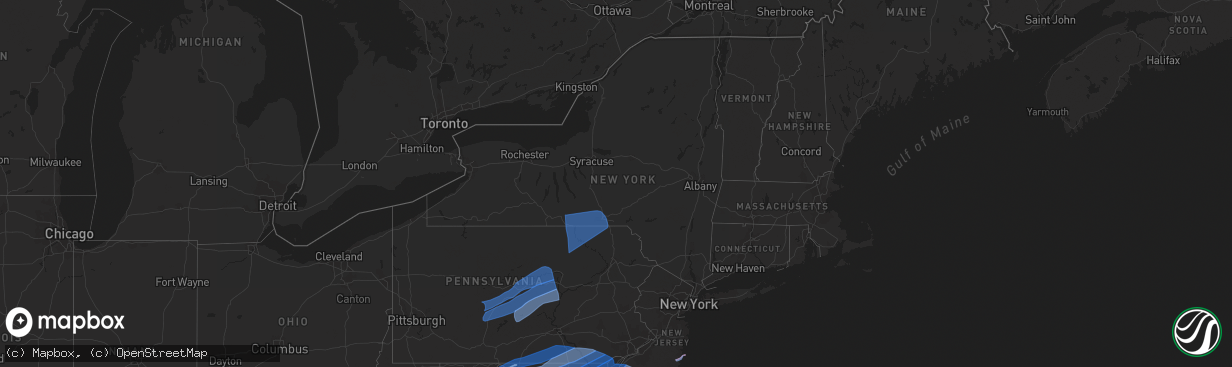
Hail Map in New York on April 13, 2020
The weather event in New York on April 13, 2020 includes Tornado, Wind, and Hail maps. 12 states and 659 cities were impacted and suffered possible damage. The total estimated number of properties impacted is 0.
Want more than just the map?
Turn this storm into a full workflow.
- Owner + property data so you know who to knock
- OnDemand branded weather history reports to win the "did we even have hail?" argument
- RoofTrace estimate so reps stop guessing numbers at the door
Bought this map? Upgrade within 7 days and we'll credit the $230. (10-15 min setup call)
Tornado
Wind
Hail
0
Estimated number of impacted properties by a 1.00" hail or larger0
Estimated number of impacted properties by a 1.75" hail or larger0
Estimated number of impacted properties by a 2.50" hail or largerStorm reports in New York
New York
| Date | Description |
|---|---|
| 04/13/20204:42 PM CDT | Downed tree on a house. |
| 04/13/20204:42 PM CDT | Downed transformer. |
| 04/13/20204:40 PM CDT | Roof damage at storage facility along route 50. |
| 04/13/20204:25 PM CDT | Tree down across county route 67 |
| 04/13/20204:06 PM CDT | Downed tree |
| 04/13/20204:06 PM CDT | Downed tree on the road. |
| 04/13/20204:00 PM CDT | Downed tree |
| 04/13/20204:00 PM CDT | Downed tree on the road. |
| 04/13/20203:20 PM CDT | Tree down |
| 04/13/20202:34 PM CDT | Trees down on powers rd. |
| 04/13/20202:34 PM CDT | Tree down on wires on stevens road. |
| 04/13/20202:33 PM CDT | Trees down on park avenue. |
| 04/13/20202:33 PM CDT | Tree down on wires on stevens road. |
| 04/13/20202:30 PM CDT | Tree and wires down on eldredge st and emmett st. |
| 04/13/20202:20 PM CDT | Tree down across roadway near watson blvd. And hayes avenue. |
| 04/13/20202:20 PM CDT | Trees down. |
| 04/13/20202:11 PM CDT | Powerlines down at hilton road and route 434. |
| 04/13/20201:23 PM CDT | Tree down on powerlines on wheaton road. |
| 04/13/202011:09 AM CDT | Wires down on mobile street. |
| 04/13/202011:04 AM CDT | Tree down on river road and steep bank road. |
| 04/13/202012:10 AM CDT | At 510 PM EDT, severe thunderstorms were located along a line extending from Cranberry Creek to near Fonda, moving east at 45 mph. HAZARD...60 mph wind gusts. SOURCE...Radar indicated. IMPACT...Expect damage to roofs, siding, and trees. Locations impacted include... Schenectady, Rotterdam, Saratoga Springs, Amsterdam, Gloversville, Johnstown, Scotia, Fonda, Glenville, Niskayuna, Milton, Ballston Spa, Broadalbin, Hagaman, Mayfield, Round Lake, Fort Johnson, Galway, Cranberry Creek and Northampton Beach Public Campground. |
| 04/12/202011:45 PM CDT | At 445 PM EDT, severe thunderstorms were located along a line extending from near Springfield to near Andes, moving east at 45 mph. HAZARD...60 mph wind gusts. SOURCE...Radar indicated. IMPACT...Expect damage to roofs, siding, and trees. Locations impacted include... Schenectady, Rotterdam, Scotia, Cobleskill, Hunter, Jefferson, Duanesburg, Westerlo, Berne, Altamont, Windham, Middleburgh, Gilboa, Summit, Schoharie, Richmondville, Prattsville, Sharon Springs, Delanson and Ames. |
| 04/12/202010:10 PM CDT | At 309 PM EDT, severe thunderstorms were located along a line extending from Milan to near Lincoln Falls, moving east-northeast at 40 mph. HAZARD...60 mph wind gusts. SOURCE...Radar indicated. IMPACT...Expect damage to roofs, siding, and trees. Locations impacted include... Falls, Vernon, Rush, Jackson, Towanda, Susquehanna, Tunkhannock, Wysox, Susquehanna Depot and Springville. |
| 04/12/202010:05 PM CDT | At 305 PM EDT, severe thunderstorms were located along a line extending from near Richford to near Berkshire to Lounsberry, moving east at 45 mph. HAZARD...60 mph wind gusts. SOURCE...Radar indicated. IMPACT...Expect damage to roofs, siding, and trees. Locations impacted include... Binghamton, Vestal, Johnson City, Endicott, Norwich, Kirkwood, Conklin, Maine, Guilford and Sanford. |
| 04/12/20209:41 PM CDT | At 240 PM EDT, severe thunderstorms were located along a line extending from near Lockwood to near Ridgebury to near Canton, moving east at 40 mph. HAZARD...60 mph wind gusts. SOURCE...Radar indicated. IMPACT...Expect damage to roofs, siding, and trees. Locations impacted include... Chemung, Barton, Sayre, Waverly, Owego, Athens, Towanda, Ridgebury, Canton and West Franklin. |
All States Impacted by Hail Map on April 13, 2020
Cities Impacted by Hail Map on April 13, 2020
- Hedgesville, WV
- Folkston, GA
- Gainesville, FL
- Saint Augustine, FL
- Elkton, FL
- Live Oak, FL
- Mayo, FL
- Lake City, FL
- Georgetown, SC
- Falling Waters, WV
- Martinsburg, WV
- Waldo, FL
- Lee, FL
- Sanderson, FL
- Glen Saint Mary, FL
- Catonsville, MD
- Dundalk, MD
- Baltimore, MD
- Halethorpe, MD
- Hampton, FL
- Big Pool, MD
- Bryceville, FL
- White Springs, FL
- Wellborn, FL
- Day, FL
- Keystone Heights, FL
- Starke, FL
- Green Cove Springs, FL
- Saint George, GA
- Berkeley Springs, WV
- Clear Spring, MD
- Hagerstown, MD
- Waretown, NJ
- Forked River, NJ
- Barnegat, NJ
- Windsor Mill, MD
- Pikesville, MD
- Gwynn Oak, MD
- Columbia, MD
- Clarksville, MD
- Woodstock, MD
- Ellicott City, MD
- Quantico, VA
- Triangle, VA
- Dumfries, VA
- Woodbridge, VA
- Manassas, VA
- Aspers, PA
- Williamsport, MD
- Biglerville, PA
- York New Salem, PA
- Rouzerville, PA
- Fayetteville, PA
- Hancock, MD
- York Springs, PA
- Greencastle, PA
- Cascade, MD
- Spring Grove, PA
- York, PA
- Quincy, PA
- Red Lion, PA
- East Berlin, PA
- Dover, PA
- Smithsburg, MD
- Maugansville, MD
- New Oxford, PA
- Abbottstown, PA
- Fairfield, PA
- State Line, PA
- Chambersburg, PA
- Littlestown, PA
- Waynesboro, PA
- Sabillasville, MD
- Mercersburg, PA
- Thomasville, PA
- Blue Ridge Summit, PA
- Seven Valleys, PA
- Hanover, PA
- Wrightsville, PA
- Windsor, PA
- McSherrystown, PA
- Mont Alto, PA
- Orrtanna, PA
- Gettysburg, PA
- Emmitsburg, MD
- Fairplay, MD
- Hampstead, MD
- Pequea, PA
- Shrewsbury, PA
- Felton, PA
- Holtwood, PA
- Millersville, PA
- Keymar, MD
- Sharpsburg, MD
- Christiana, PA
- New Freedom, PA
- Parkton, MD
- Woodsboro, MD
- Rohrersville, MD
- Lancaster, PA
- Brogue, PA
- Freeland, MD
- Shepherdstown, WV
- Airville, PA
- Gerrardstown, WV
- Westminster, MD
- Dallastown, PA
- Walkersville, MD
- Fawn Grove, PA
- Stewartstown, PA
- Quarryville, PA
- Strasburg, PA
- Union Bridge, MD
- Glenville, PA
- New Providence, PA
- Inwood, WV
- Thurmont, MD
- Glen Rock, PA
- Paradise, PA
- New Park, PA
- Middletown, MD
- Railroad, PA
- Taneytown, MD
- Willow Street, PA
- New Windsor, MD
- Myersville, MD
- Boonsboro, MD
- Washington Boro, PA
- Conestoga, PA
- Frederick, MD
- Drumore, PA
- Keedysville, MD
- Kearneysville, WV
- Manchester, MD
- Rocky Ridge, MD
- Berryville, VA
- Stephenson, VA
- Summit Point, WV
- Bunker Hill, WV
- Charles Town, WV
- Ranson, WV
- Clear Brook, VA
- Winchester, VA
- Edgewater, MD
- District Heights, MD
- Capitol Heights, MD
- Washington, DC
- Bowie, MD
- Springfield, VA
- Temple Hills, MD
- Alexandria, VA
- Riva, MD
- Hyattsville, MD
- Annapolis, MD
- Fort Belvoir, VA
- Suitland, MD
- Stevensville, MD
- Oxon Hill, MD
- Lorton, VA
- Harwood, MD
- Upper Marlboro, MD
- Davidsonville, MD
- Boyce, VA
- Stephens City, VA
- Star Tannery, VA
- White Post, VA
- Middletown, VA
- Strasburg, VA
- Front Royal, VA
- Conowingo, MD
- Finksburg, MD
- Mount Airy, MD
- Peach Bottom, PA
- Brunswick, MD
- New Market, MD
- Cochranville, PA
- Delta, PA
- Upperco, MD
- Street, MD
- Lovettsville, VA
- Kirkwood, PA
- Jefferson, MD
- Whiteford, MD
- Atglen, PA
- Ijamsville, MD
- Harpers Ferry, WV
- Monkton, MD
- Pylesville, MD
- White Hall, MD
- Oxford, PA
- Knoxville, MD
- Millville, WV
- Jarrettsville, MD
- Monrovia, MD
- Lincoln University, PA
- Reisterstown, MD
- Sparks Glencoe, MD
- Purcellville, VA
- Nottingham, PA
- Elmer, NJ
- Leesburg, VA
- Hanover, MD
- Church Hill, MD
- Hartly, DE
- Garrett Park, MD
- Jessup, MD
- Rockville, MD
- Harmans, MD
- Penns Grove, NJ
- Monroeville, NJ
- Clayton, DE
- Massey, MD
- Dickerson, MD
- Centreville, MD
- Barclay, MD
- Glen Burnie, MD
- Still Pond, MD
- Kensington, MD
- Crofton, MD
- Middletown, DE
- Worton, MD
- Crumpton, MD
- Arnold, MD
- Pennsville, NJ
- Millersville, MD
- Chestertown, MD
- Boyds, MD
- Germantown, MD
- Earleville, MD
- Savage, MD
- Silver Spring, MD
- Odenton, MD
- Laurel, MD
- Odessa, DE
- Townsend, DE
- Sterling, VA
- Warwick, MD
- Sudlersville, MD
- Annapolis Junction, MD
- Pasadena, MD
- Elkridge, MD
- Fort George G Meade, MD
- Great Falls, VA
- Bridgeton, NJ
- Potomac, MD
- Curtis Bay, MD
- Gambrills, MD
- Linthicum Heights, MD
- Galena, MD
- Gibson Island, MD
- Georgetown, MD
- Rock Hall, MD
- Derwood, MD
- Woodstown, NJ
- Port Penn, DE
- Alloway, NJ
- Smyrna, DE
- Severn, MD
- Crownsville, MD
- Burtonsville, MD
- Sparrows Point, MD
- Kennedyville, MD
- Poolesville, MD
- Bethesda, MD
- Beltsville, MD
- Millington, MD
- Spencerville, MD
- Marydel, MD
- Ashburn, VA
- Severna Park, MD
- Salem, NJ
- Fort Howard, MD
- Gaithersburg, MD
- Pedricktown, NJ
- College Park, MD
- Cooksville, MD
- Cockeysville, MD
- Joppa, MD
- Glen Arm, MD
- Hydes, MD
- Owings Mills, MD
- Havre De Grace, MD
- Fork, MD
- Fulton, MD
- Stevenson, MD
- Newark, DE
- Perryman, MD
- Upper Falls, MD
- Perryville, MD
- Aberdeen, MD
- Marriottsville, MD
- Lutherville Timonium, MD
- Rising Sun, MD
- White Marsh, MD
- Brooklyn, MD
- Glenelg, MD
- Betterton, MD
- Damascus, MD
- Delaware City, DE
- Middle River, MD
- Dayton, MD
- Elkton, MD
- Cecilton, MD
- Bear, DE
- Chesapeake City, MD
- Port Deposit, MD
- Perry Point, MD
- Baldwin, MD
- Sandy Spring, MD
- Brookeville, MD
- Brinklow, MD
- North East, MD
- Olney, MD
- Kingsville, MD
- Rosedale, MD
- Saint Georges, DE
- New Castle, DE
- West Friendship, MD
- Belcamp, MD
- Montgomery Village, MD
- Nottingham, MD
- Edgewood, MD
- Fallston, MD
- Perry Hall, MD
- Landenberg, PA
- Aberdeen Proving Ground, MD
- Randallstown, MD
- Abingdon, MD
- Parkville, MD
- Gunpowder, MD
- Glenwood, MD
- Highland, MD
- Towson, MD
- Elk Mills, MD
- Ashton, MD
- Phoenix, MD
- Wilmington, DE
- Bel Air, MD
- Charlestown, MD
- Churchville, MD
- Essex, MD
- Hockessin, DE
- Woodbine, MD
- Sykesville, MD
- Glyndon, MD
- Hunt Valley, MD
- Kennett Square, PA
- Forest Hill, MD
- Toughkenamon, PA
- West Grove, PA
- Darlington, MD
- Colora, MD
- Avondale, PA
- Marydel, DE
- Frederica, DE
- Mauricetown, NJ
- Avalon, NJ
- Greenwich, NJ
- Cordova, MD
- Villas, NJ
- Cape May Court House, NJ
- Viola, DE
- Wye Mills, MD
- Woodside, DE
- Cedarville, NJ
- Cape May, NJ
- Sea Isle City, NJ
- Leesburg, NJ
- Ridgely, MD
- Millville, NJ
- Wildwood, NJ
- Felton, DE
- Vineland, NJ
- Delmont, NJ
- Rio Grande, NJ
- Dover, DE
- Queen Anne, MD
- Newport, NJ
- Ingleside, MD
- Cheswold, DE
- Magnolia, DE
- Port Norris, NJ
- Shiloh, NJ
- Cape May Point, NJ
- Chester, MD
- Queenstown, MD
- Dorchester, NJ
- Dover Afb, DE
- Milford, DE
- Camden Wyoming, DE
- Goldsboro, MD
- Greensboro, MD
- Hillsboro, MD
- Port Elizabeth, NJ
- Heislerville, NJ
- Fortescue, NJ
- Henderson, MD
- Grasonville, MD
- Harrington, DE
- Denton, MD
- Woodbine, NJ
- Stone Harbor, NJ
- East Smithfield, PA
- Gillett, PA
- Lawton, PA
- Hallstead, PA
- Granville Summit, PA
- Columbia Cross Roads, PA
- Stevensville, PA
- Binghamton, NY
- Troy, PA
- Spencer, NY
- Forksville, PA
- Montrose, PA
- Wysox, PA
- Wyalusing, PA
- Le Raysville, PA
- Ulster, PA
- Sayre, PA
- Milan, PA
- Waverly, NY
- Castle Creek, NY
- Nichols, NY
- Newark Valley, NY
- Candor, NY
- Vestal, NY
- Conklin, NY
- Athens, PA
- Maine, NY
- Erin, NY
- Johnson City, NY
- Wellsburg, NY
- Monroeton, PA
- Canton, PA
- Lowman, NY
- Kirkwood, NY
- Rome, PA
- Warren Center, PA
- Chemung, NY
- Towanda, PA
- Barton, NY
- Elmira, NY
- Little Meadows, PA
- Brackney, PA
- New Albany, PA
- Owego, NY
- Friendsville, PA
- Lockwood, NY
- Apalachin, NY
- Van Etten, NY
- Endicott, NY
- Glen Aubrey, NY
- Monticello, FL
- Greenville, FL
- Lamont, FL
- Tallahassee, FL
- Lloyd, FL
- Quitman, GA
- Perry, FL
- Jasper, FL
- Lakeland, GA
- Naylor, GA
- Homerville, GA
- Fargo, GA
- Waycross, GA
- Morven, NC
- Sunset Beach, NC
- Andrews, SC
- Hemingway, SC
- Myrtle Beach, SC
- Calabash, NC
- Pawleys Island, SC
- Gresham, SC
- Murrells Inlet, SC
- Conway, SC
- North Myrtle Beach, SC
- Longs, SC
- Little River, SC
- Gastonia, NC
- Fort Mill, SC
- York, SC
- Sharon, SC
- McConnells, SC
- Pineville, NC
- Charlotte, NC
- Rock Hill, SC
- Belmont, NC
- Clover, SC
- Whiteville, NC
- Hallsboro, NC
- Kernersville, NC
- Colfax, NC
- Winston Salem, NC
- Cedar Grove, NC
- Graham, NC
- Rougemont, NC
- Hurdle Mills, NC
- Burlington, NC
- Timberlake, NC
- Mebane, NC
- Oxford, NC
- Roxboro, NC
- Efland, NC
- Haw River, NC
- Randleman, NC
- Sophia, NC
- Asheboro, NC
- Snow Camp, NC
- Hillsborough, NC
- Bolivia, NC
- Oak Island, NC
- Wilmington, NC
- Southport, NC
- Carolina Beach, NC
- Kure Beach, NC
- Staley, NC
- Siler City, NC
- Ramseur, NC
- Liberty, NC
- Franklinville, NC
- Sanford, NC
- Cameron, NC
- Zebulon, NC
- Fuquay Varina, NC
- Apex, NC
- Knightdale, NC
- Garner, NC
- Youngsville, NC
- Raleigh, NC
- Wake Forest, NC
- Rolesville, NC
- Wendell, NC
- Durham, NC
- Middleburg, NC
- Manson, NC
- Boydton, VA
- Kittrell, NC
- Franklinton, NC
- Warrenton, NC
- Creedmoor, NC
- Henderson, NC
- Norlina, NC
- Bracey, VA
- Hampstead, NC
- Rocky Point, NC
- Burgaw, NC
- Currie, NC
- Stedman, NC
- Wade, NC
- Dunn, NC
- Godwin, NC
- Fayetteville, NC
- Hope Mills, NC
- Autryville, NC
- Salisbury, NC
- Rockwell, NC
- China Grove, NC
- Concord, NC
- Kannapolis, NC
- Olin, NC
- Hamptonville, NC
- East Bend, NC
- Boonville, NC
- Union Grove, NC
- Yadkinville, NC
- Harmony, NC
- Statesville, NC
- Pfafftown, NC
- Lewisville, NC
- Blanchard, PA
- Cogan Station, PA
- Montgomery, PA
- Lock Haven, PA
- Bellefonte, PA
- Williamsport, PA
- Howard, PA
- Osceola Mills, PA
- Warriors Mark, PA
- Julian, PA
- Fleming, PA
- Tyrone, PA
- Milesburg, PA
- Dysart, PA
- Smithmill, PA
- Loganton, PA
- Mill Hall, PA
- Sandy Ridge, PA
- Blandburg, PA
- Jersey Shore, PA
- State College, PA
- Linden, PA
- Port Matilda, PA
- Avis, PA
- Houtzdale, PA
- Allenwood, PA
- Philipsburg, PA
- Orviston, PA
- Lamar, PA
- Beech Creek, PA
- Beccaria, PA
- Fallentimber, PA
- Coalport, PA
- Spruce Creek, PA
- Hollidaysburg, PA
- Madisonburg, PA
- Reedsville, PA
- Tipton, PA
- Lewisburg, PA
- Bellwood, PA
- Alexandria, PA
- Millmont, PA
- Huntingdon, PA
- Woodward, PA
- Millheim, PA
- Altoona, PA
- New Columbia, PA
- Rebersburg, PA
- Aaronsburg, PA
- Boalsburg, PA
- Petersburg, PA
- Centre Hall, PA
- Belleville, PA
- Laurelton, PA
- Ashville, PA
- Milroy, PA
- Lemont, PA
- Spring Mills, PA
- Duncansville, PA
- Williamsburg, PA
- Pennsylvania Furnace, PA
- Mifflinburg, PA
- Coburn, PA
- Pine Grove Mills, PA
- McVeytown, PA
- Selinsgrove, PA
- Beaver Springs, PA
- Mill Creek, PA
- McAlisterville, PA
- Allensville, PA
- Lewistown, PA
- Beavertown, PA
- Middleburg, PA
- Mifflintown, PA
- Granville, PA
- Mifflin, PA
- Freeburg, PA
- McClure, PA
- Yeagertown, PA
- Winfield, PA
- New Berlin, PA
- Burnham, PA
- Mays Landing, NJ
- Port Republic, NJ
- Absecon, NJ
- Tuckerton, NJ
- Pleasantville, NJ
- Beach Haven, NJ
- Egg Harbor City, NJ
- Egg Harbor Township, NJ


