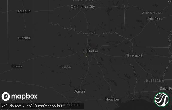
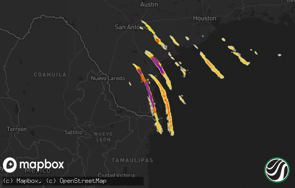
Hail Map in Texas on April 13, 2014
The weather event in Texas on April 13, 2014 includes Hail map. 10 states and 550 cities were impacted and suffered possible damage. The total estimated number of properties impacted is 69,995.

Hail
69,995
Estimated number of impacted properties by a 1.00" hail or larger1,798
Estimated number of impacted properties by a 1.75" hail or larger0
Estimated number of impacted properties by a 2.50" hail or largerStorm reports in Texas
Texas
| Date | Description |
|---|---|
| 04/13/20146:53 PM CDT | A local report indicates 1.75 inch wind near 10 S GOLDTHWAITE |
| 04/13/20146:35 PM CDT | Golfball hail covering the ground |
| 04/13/20146:33 PM CDT | 4 miles south of goldthwaite |
| 04/13/20146:20 PM CDT | Golfball hail covering the ground |
| 04/13/20145:54 PM CDT | A local report indicates 1.75 inch wind near 2 W RUCKER |
| 04/13/20145:42 PM CDT | A local report indicates 1.75 inch wind near GORMAN |
| 04/13/20145:15 PM CDT | A local report indicates 1.00 inch wind near 2 NNW TRICKHAM |
| 04/13/20145:00 PM CDT | *** 1 inj *** a tornado destroyed three mobile homes and uprooted trees. A total of eight structures were damaged with minor damage to lovelady high school. One injury |
| 04/13/20144:49 PM CDT | A local report indicates 1.00 inch wind near 2 W GRAFORD |
| 04/13/20144:45 PM CDT | *** 1 inj *** a tornado destroyed three mobile homes and uprooted trees. A total of eight structures were damaged with minor damage to lovelady high school. One injury |
| 04/13/20144:37 PM CDT | Quarter size hail reported 3 miles west of valera. |
| 04/13/20144:10 PM CDT | A local report indicates 1.50 inch wind near ATWELL |
| 04/13/20143:55 PM CDT | Roofs off of three buildings. Damage to a church. Vehicle flipped. |
| 04/13/20143:46 PM CDT | A weak ef0 tornado touched down north of pittsburg...damaging a few businesses along a 500 yard long path. Maximum winds with the tornado were estimated to be 70-75 mph |
| 04/13/20143:31 PM CDT | A local report indicates 1.25 inch wind near 12 S BAIRD |
| 04/13/20143:15 PM CDT | Numerous nickel and quater size hail nearly covering the ground. |
| 04/13/20142:48 PM CDT | Cedar gap area |
| 04/13/20142:26 PM CDT | At the intersection of rebecca lane and kala drive in abilene |
| 04/13/20146:59 AM CDT | Spotter report of quarter size hail north of grapeland. |
| 04/12/20148:48 PM CDT | Intersection of 195 and 201 south of killeen |
| 04/12/20147:45 PM CDT | A local report indicates 1.75 inch wind near BELLEVUE |
| 04/12/20147:25 PM CDT | A local report indicates 1.50 inch wind near 8 E LOMETA |
All States Impacted by Hail Map on April 13, 2014
Cities Impacted by Hail Map on April 13, 2014
- Goddard, KS
- Garden Plain, KS
- Andale, KS
- Chelsea, OK
- Claremore, OK
- Earlsboro, OK
- Shawnee, OK
- Seminole, OK
- Okemah, OK
- Bowie, TX
- Henrietta, TX
- Bellevue, TX
- Wewoka, OK
- Holdenville, OK
- Tobias, NE
- Tecumseh, OK
- Osage, OK
- Skiatook, OK
- Sperry, OK
- Prue, OK
- Cleveland, OK
- Hominy, OK
- Terlton, OK
- Ringling, OK
- Wilson, OK
- Healdton, OK
- Overbrook, OK
- Loco, OK
- Cecil, AR
- Charleston, AR
- Lavaca, AR
- Colwich, KS
- Wichita, KS
- Palmyra, NE
- Douglas, NE
- Panama, NE
- Bennet, NE
- Adams, NE
- Hickman, NE
- Unadilla, NE
- Lampasas, TX
- Ethel, MO
- Grapeland, TX
- Upland, NE
- Hildreth, NE
- Bloomington, NE
- Franklin, NE
- Goldthwaite, TX
- Washington, OK
- Norman, OK
- Brighton, IL
- Alton, IL
- Duncan, OK
- Foster, OK
- Rush Springs, OK
- Elmore City, OK
- Marlow, OK
- Walton, KS
- Newton, KS
- Valera, TX
- Murray, NE
- Union, NE
- Plattsmouth, NE
- Nehawka, NE
- Dublin, TX
- Atoka, OK
- Coalgate, OK
- Blackwell, OK
- New Cambria, MO
- Olpe, KS
- Madison, KS
- Oklahoma City, OK
- Ponca City, OK
- Peru, KS
- Niotaze, KS
- Mulberry, AR
- Council Grove, KS
- Wilsey, KS
- Plymouth, NE
- Jansen, NE
- Carbondale, KS
- Auburn, KS
- Wakarusa, KS
- Berryton, KS
- Overbrook, KS
- Topeka, KS
- Rock, KS
- Atlanta, KS
- Americus, KS
- Allen, KS
- Winfield, MO
- De Kalb, MS
- Saint George, KS
- Westmoreland, KS
- Marion, KS
- Mulhall, OK
- Covington, OK
- Perry, OK
- Orlando, OK
- Marland, OK
- Red Rock, OK
- Stillwater, OK
- Morrison, OK
- Billings, OK
- Ralston, OK
- Pawnee, OK
- Gorman, TX
- De Leon, TX
- Manhattan, KS
- Maize, KS
- Tuscola, TX
- Coyle, OK
- Guthrie, OK
- Bristow, OK
- Depew, OK
- Powersville, MO
- Unionville, MO
- Newalla, OK
- Brussels, IL
- Golden Eagle, IL
- Medford, OK
- Beggs, OK
- Mounds, OK
- Nocona, TX
- Benton, KS
- Andover, KS
- Edmond, OK
- Ladonia, TX
- Commerce, TX
- Klondike, TX
- Bruning, NE
- Latham, KS
- Strong City, KS
- Cedar Point, KS
- Lincolnville, KS
- Elmdale, KS
- Ripley, OK
- Saint Clair, MO
- Grenola, KS
- Comanche, OK
- Okmulgee, OK
- Noble, OK
- Rockdale, TX
- Le Roy, KS
- Fairfax, OK
- Shidler, OK
- Foley, MO
- Elsberry, MO
- Troy, MO
- Sumner, TX
- Arthur City, TX
- Bradley, OK
- Lindsay, OK
- Blanchard, OK
- Alex, OK
- Purcell, OK
- Union, MS
- Philadelphia, MS
- Collinsville, MS
- Blackwell, TX
- Daleville, MS
- Wolfe City, TX
- Williamsburg, KS
- Princeton, KS
- Carney, OK
- Tryon, OK
- Rising Star, TX
- Cisco, TX
- Desdemona, TX
- Carbon, TX
- Yates Center, KS
- Neosho Falls, KS
- Piqua, KS
- Belton, MO
- Stilwell, KS
- Cleveland, MO
- Peculiar, MO
- Louisburg, KS
- Bucyrus, KS
- High Hill, MO
- Bellflower, MO
- Severy, KS
- Eureka, KS
- Piedmont, KS
- Tishomingo, OK
- Holland, TX
- Albany, TX
- Kempner, TX
- Copperas Cove, TX
- Geneva, NE
- Godfrey, IL
- Abilene, TX
- Ovalo, TX
- Marietta, OK
- O'Fallon, MO
- Moscow Mills, MO
- White City, KS
- Woodbine, KS
- Bunch, OK
- Sallisaw, OK
- Benton, AR
- Traskwood, AR
- Maitland, MO
- Mound City, MO
- Hawk Point, MO
- Warrenton, MO
- Truxton, MO
- Durant, OK
- Breckenridge, TX
- Meriden, KS
- Ozawkie, KS
- Burlington, KS
- Wamego, KS
- Alma, KS
- Arcadia, OK
- Nardin, OK
- Braman, OK
- Fieldon, IL
- Independence, KS
- Neodesha, KS
- Mannsville, OK
- Mill Creek, OK
- Eskridge, KS
- Jones, OK
- Riley, KS
- Weleetka, OK
- Maud, OK
- Asher, OK
- Denver, MO
- Albany, MO
- Denison, TX
- Sadler, TX
- Pottsboro, TX
- Dexter, KS
- Maple City, KS
- Arkansas City, KS
- Whitesboro, TX
- Kingston, OK
- Lebanon, OK
- Coffeyville, KS
- Eagleville, MO
- Wilber, NE
- Douglass, KS
- Burden, KS
- Oxford, KS
- Winfield, KS
- Udall, KS
- Yale, OK
- Mannford, OK
- Maramec, OK
- Jennings, OK
- Emporia, KS
- Peabody, KS
- Clyde, TX
- Salado, TX
- Belton, TX
- Newkirk, OK
- Caldwell, KS
- South Haven, KS
- Wellington, KS
- Deer Creek, OK
- Wagoner, OK
- Elk City, KS
- Glenwood, IA
- Pacific Junction, IA
- Clarksville, TX
- Longton, KS
- Belle Plaine, KS
- Peck, KS
- Caney, OK
- Lane, OK
- Caddo, OK
- Cross Plains, TX
- Smithville, OK
- Collinsville, OK
- Ringgold, TX
- Cassoday, KS
- Bartlesville, OK
- Hastings, NE
- Moline, KS
- Fort Gibson, OK
- Hulbert, OK
- Tahlequah, OK
- Telephone, TX
- Burlington Junction, MO
- Elmo, MO
- Braddyville, IA
- Old Monroe, MO
- Milligan, NE
- Ohiowa, NE
- Western, NE
- Friend, NE
- Delia, KS
- Stroud, OK
- Worth, MO
- Bennington, OK
- Lometa, TX
- Savoy, TX
- Burns, KS
- Baird, TX
- Union, MO
- Bixby, OK
- Broken Arrow, OK
- Prague, OK
- Muenster, TX
- Sasakwa, OK
- Konawa, OK
- Ravenna, TX
- Bonham, TX
- Ardmore, OK
- Springer, OK
- Meridian, OK
- Gordonville, TX
- Dorchester, NE
- Bangs, TX
- Santa Anna, TX
- Coleman, TX
- Mullin, TX
- Falls City, NE
- Fairfax, MO
- Luther, OK
- Uniontown, AR
- Van Buren, AR
- Muldrow, OK
- Natural Dam, AR
- Cedarville, AR
- Rudy, AR
- Stilwell, OK
- Mcloud, OK
- Buckholts, TX
- Thorndale, TX
- Valley Center, KS
- Whitewater, KS
- Oologah, OK
- Talala, OK
- Fredonia, KS
- Wardville, OK
- Kiowa, OK
- Stringtown, OK
- Pittsburg, OK
- Brookesmith, TX
- Talpa, TX
- Brownwood, TX
- Grafton, IL
- Wingate, TX
- Herington, KS
- Hope, KS
- Lincoln, NE
- Murdock, NE
- Greenwood, NE
- Gretna, NE
- Waverly, NE
- Ashland, NE
- Alvo, NE
- Springfield, NE
- Gridley, KS
- Tulsa, OK
- Randolph, IA
- Junction City, KS
- Haysville, KS
- Clearwater, KS
- El Dorado, KS
- Garber, OK
- Antlers, OK
- Dwight, KS
- Wapanucka, OK
- Coleman, OK
- San Saba, TX
- Ballinger, TX
- Richland Springs, TX
- Tarkio, MO
- Chouteau, OK
- Mena, AR
- Little Rock, MS
- Bailey, MS
- Wanette, OK
- Macomb, OK
- Spencer, OK
- Harrah, OK
- Choctaw, OK
- Greenwich, KS
- Towanda, KS
- Maryville, MO
- Graham, MO
- Skidmore, MO
- Chandler, OK
- Davenport, OK
- Meeker, OK
- Naponee, NE
- Bells, TX
- Brookfield, MO
- Bucklin, MO
- New Boston, MO
- Thayer, KS
- Altoona, KS
- Hugo, OK
- Conway Springs, KS
- Adair, IL
- Boswell, OK
- Soper, OK
- Buffalo Gap, TX
- Humphreys, MO
- Milan, MO
- Blossom, TX
- Saint Jo, TX
- Potwin, KS
- Detroit, TX
- Cushing, OK
- Madill, OK
- Milburn, OK
- Kenefic, OK
- Bokchito, OK
- Trumbull, NE
- Porterville, MS
- Meridian, MS
- Lexington, OK
- Ravenwood, MO
- Pickering, MO
- Parnell, MO
- Stuart, OK
- Mcalester, OK
- Maple Hill, KS
- Paxico, KS
- Sulphur, OK
- Firth, NE
- Gainesville, TX
- Ochelata, OK
- Ramona, OK
- Barnsdall, OK
- Emmett, KS
- Saint Marys, KS
- Lawrence, KS
- Birch Run, MI
- Cherryvale, KS
- East Carondelet, IL
- Dupo, IL
- Lindsay, TX
- Montague, TX
- Wellsville, KS
- Admire, KS
- Perkins, OK
- Colony, KS
- Iola, KS
- Gentry, MO
- Martinsville, MO
- Brookston, TX
- Silex, MO
- Batchtown, IL
- Voss, TX
- Centralia, KS
- Corning, KS
- Liberty, KS
- Alta Vista, KS
- Harveyville, KS
- Burlingame, KS
- Howard, KS
- Toronto, KS
- Cambridge, KS
- Mulvane, KS
- Virgil, KS
- Fall River, KS
- Marshall, OK
- Douglas, OK
- Lucien, OK
- Glencoe, OK
- Vian, OK
- Wynona, OK
- Dustin, OK
- Wetumka, OK
- Galt, MO
- Tussy, OK
- Talihina, OK
- Bartlett, TX
- Eudora, KS
- Foristell, MO
- Wentzville, MO
- Wright City, MO
- Sedgwick, KS
- Burbank, OK
- Geuda Springs, KS
- Whitewright, TX
- Ector, TX
- Randolph, TX
- Trenton, TX
- Rattan, OK
- Sapulpa, OK
- Kincaid, KS
- Moran, KS
- Graham, OK
- Lone Grove, OK
- Cartwright, OK
- Colbert, OK
- Hennepin, OK
- Ratliff City, OK
- Hendrix, OK
- Burneyville, OK
- Clayton, OK
- Fairmont, NE
- Milano, TX
- Cameron, TX
- Callao, MO
- Salisbury, MO
- Caldwell, TX
- Gause, TX
- Snow, OK
- Dow, IL
- Bevier, MO
- Marceline, MO
- Exeter, NE
- Wayne, OK
- Redding, IA
- Grant City, MO
- Bauxite, AR
- De Kalb, TX
- Avery, TX
- Nashoba, OK
- Trenton, MO
- Bogata, TX
- Mountainburg, AR
- Chester, AR
- Alma, AR
- Medora, IL
- Dyer, AR
- Cedar Vale, KS
- Wellston, OK
- Davis, OK
- Paris, TX
- Drumright, OK
- Saint Paul, KS
- Erie, KS
- Benedict, KS
- Shenandoah, IA
- Burdick, KS
- Elk Falls, KS
- Cortland, NE
- Agra, OK
- Sedan, KS
- Ada, OK
- Annona, TX
- Hillsboro, KS
- Clinton, MO
- Blairstown, MO
- Urich, MO
- Killeen, TX
- Fort Hood, TX
- Ozark, AR
- Nolan, TX
- Dyess Afb, TX
- Stephenville, TX
- Graford, TX


