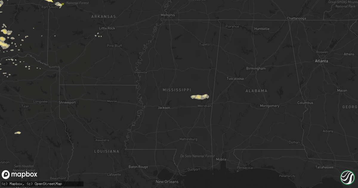
Hail Map in Mississippi on April 13, 2014
Get this storm
April 13 map
$229
one time, instant access
Download today. No call, no setup
Keep the $229
Bought the map and want the full workflow? Apply the entire $229 to a subscription within 7 days. None of it is wasted.
Every map, not just this one
This buys you this map. Subscription and you get every map we run, in the markets you choose from a few cities to whole states to nationwide. Plus real-time alerts the moment a storm fires.
Contact data
Name, contact info, occupancy, even credit band for addresses in the footprint. You go from where it hit to who to call.
Become the source they trust
Unlimited branding weather history reports on demand. You already have the documented answer ready for the property owner, and you are the one who showed up with it.
Property data and RoofTrace estimates
Pull up any address you have got, its value and the exact code rules for that jurisdiction, straight from One Click Code. Then RoofTrace estimates the squares, pitch, and roof value, priced the way you price.
Storm reports in Mississippi
Mississippi
| Date | Description |
|---|---|
| 04/13/20146:22 AM CDT | Few trees down along hwy 18 |
| 04/13/20146:10 AM CDT | 9-10 trees down. |
| 04/13/20145:07 AM CDT | Trees down |
| 04/13/20145:00 AM CDT | Small equipment shed destroyed...trees down...powerlines down |
| 04/13/20144:45 AM CDT | Trees down west of union along hwy 492. |
| 04/13/20144:30 AM CDT | Chicken house damaged and some trees down |
| 04/13/20144:20 AM CDT | Number of trees down |
| 04/13/20141:30 AM CDT | Trees down throughout tunica... One tree landed on three cars. 3 large metal sheds were blown over and more structual damage has been reported but not verified. |
| 04/13/20141:25 AM CDT | Large falling tree limb shattered window to a residence in tunica |
| 04/13/201412:35 AM CDT | A 58 mph wind gusts was recorded by the tunica awos at 1235 am. |
All States Impacted by Hail Map on April 13, 2014
Cities Impacted by Hail Map on April 13, 2014
- Goddard, KS
- Garden Plain, KS
- Andale, KS
- Chelsea, OK
- Claremore, OK
- Earlsboro, OK
- Shawnee, OK
- Seminole, OK
- Okemah, OK
- Bowie, TX
- Henrietta, TX
- Bellevue, TX
- Wewoka, OK
- Holdenville, OK
- Tobias, NE
- Tecumseh, OK
- Osage, OK
- Skiatook, OK
- Sperry, OK
- Prue, OK
- Cleveland, OK
- Hominy, OK
- Terlton, OK
- Ringling, OK
- Wilson, OK
- Healdton, OK
- Overbrook, OK
- Loco, OK
- Cecil, AR
- Charleston, AR
- Lavaca, AR
- Colwich, KS
- Wichita, KS
- Palmyra, NE
- Douglas, NE
- Panama, NE
- Bennet, NE
- Adams, NE
- Hickman, NE
- Unadilla, NE
- Lampasas, TX
- Ethel, MO
- Grapeland, TX
- Upland, NE
- Hildreth, NE
- Bloomington, NE
- Franklin, NE
- Goldthwaite, TX
- Washington, OK
- Norman, OK
- Brighton, IL
- Alton, IL
- Duncan, OK
- Foster, OK
- Rush Springs, OK
- Elmore City, OK
- Marlow, OK
- Walton, KS
- Newton, KS
- Valera, TX
- Murray, NE
- Union, NE
- Plattsmouth, NE
- Nehawka, NE
- Dublin, TX
- Atoka, OK
- Coalgate, OK
- Blackwell, OK
- New Cambria, MO
- Olpe, KS
- Madison, KS
- Oklahoma City, OK
- Ponca City, OK
- Peru, KS
- Niotaze, KS
- Mulberry, AR
- Council Grove, KS
- Wilsey, KS
- Plymouth, NE
- Jansen, NE
- Carbondale, KS
- Auburn, KS
- Wakarusa, KS
- Berryton, KS
- Overbrook, KS
- Topeka, KS
- Rock, KS
- Atlanta, KS
- Americus, KS
- Allen, KS
- Winfield, MO
- De Kalb, MS
- Saint George, KS
- Westmoreland, KS
- Marion, KS
- Mulhall, OK
- Covington, OK
- Perry, OK
- Orlando, OK
- Marland, OK
- Red Rock, OK
- Stillwater, OK
- Morrison, OK
- Billings, OK
- Ralston, OK
- Pawnee, OK
- Gorman, TX
- De Leon, TX
- Manhattan, KS
- Maize, KS
- Tuscola, TX
- Coyle, OK
- Guthrie, OK
- Bristow, OK
- Depew, OK
- Powersville, MO
- Unionville, MO
- Newalla, OK
- Brussels, IL
- Golden Eagle, IL
- Medford, OK
- Beggs, OK
- Mounds, OK
- Nocona, TX
- Benton, KS
- Andover, KS
- Edmond, OK
- Ladonia, TX
- Commerce, TX
- Klondike, TX
- Bruning, NE
- Latham, KS
- Strong City, KS
- Cedar Point, KS
- Lincolnville, KS
- Elmdale, KS
- Ripley, OK
- Saint Clair, MO
- Grenola, KS
- Comanche, OK
- Okmulgee, OK
- Noble, OK
- Rockdale, TX
- Le Roy, KS
- Fairfax, OK
- Shidler, OK
- Foley, MO
- Elsberry, MO
- Troy, MO
- Sumner, TX
- Arthur City, TX
- Bradley, OK
- Lindsay, OK
- Blanchard, OK
- Alex, OK
- Purcell, OK
- Union, MS
- Philadelphia, MS
- Collinsville, MS
- Blackwell, TX
- Daleville, MS
- Wolfe City, TX
- Williamsburg, KS
- Princeton, KS
- Carney, OK
- Tryon, OK
- Rising Star, TX
- Cisco, TX
- Desdemona, TX
- Carbon, TX
- Yates Center, KS
- Neosho Falls, KS
- Piqua, KS
- Belton, MO
- Stilwell, KS
- Cleveland, MO
- Peculiar, MO
- Louisburg, KS
- Bucyrus, KS
- High Hill, MO
- Bellflower, MO
- Severy, KS
- Eureka, KS
- Piedmont, KS
- Tishomingo, OK
- Holland, TX
- Albany, TX
- Kempner, TX
- Copperas Cove, TX
- Geneva, NE
- Godfrey, IL
- Abilene, TX
- Ovalo, TX
- Marietta, OK
- O'Fallon, MO
- Moscow Mills, MO
- White City, KS
- Woodbine, KS
- Bunch, OK
- Sallisaw, OK
- Benton, AR
- Traskwood, AR
- Maitland, MO
- Mound City, MO
- Hawk Point, MO
- Warrenton, MO
- Truxton, MO
- Durant, OK
- Breckenridge, TX
- Meriden, KS
- Ozawkie, KS
- Burlington, KS
- Wamego, KS
- Alma, KS
- Arcadia, OK
- Nardin, OK
- Braman, OK
- Fieldon, IL
- Independence, KS
- Neodesha, KS
- Mannsville, OK
- Mill Creek, OK
- Eskridge, KS
- Jones, OK
- Riley, KS
- Weleetka, OK
- Maud, OK
- Asher, OK
- Denver, MO
- Albany, MO
- Denison, TX
- Sadler, TX
- Pottsboro, TX
- Dexter, KS
- Maple City, KS
- Arkansas City, KS
- Whitesboro, TX
- Kingston, OK
- Lebanon, OK
- Coffeyville, KS
- Eagleville, MO
- Wilber, NE
- Douglass, KS
- Burden, KS
- Oxford, KS
- Winfield, KS
- Udall, KS
- Yale, OK
- Mannford, OK
- Maramec, OK
- Jennings, OK
- Emporia, KS
- Peabody, KS
- Clyde, TX
- Salado, TX
- Belton, TX
- Newkirk, OK
- Caldwell, KS
- South Haven, KS
- Wellington, KS
- Deer Creek, OK
- Wagoner, OK
- Elk City, KS
- Glenwood, IA
- Pacific Junction, IA
- Clarksville, TX
- Longton, KS
- Belle Plaine, KS
- Peck, KS
- Caney, OK
- Lane, OK
- Caddo, OK
- Cross Plains, TX
- Smithville, OK
- Collinsville, OK
- Ringgold, TX
- Cassoday, KS
- Bartlesville, OK
- Hastings, NE
- Moline, KS
- Fort Gibson, OK
- Hulbert, OK
- Tahlequah, OK
- Telephone, TX
- Burlington Junction, MO
- Elmo, MO
- Braddyville, IA
- Old Monroe, MO
- Milligan, NE
- Ohiowa, NE
- Western, NE
- Friend, NE
- Delia, KS
- Stroud, OK
- Worth, MO
- Bennington, OK
- Lometa, TX
- Savoy, TX
- Burns, KS
- Baird, TX
- Union, MO
- Bixby, OK
- Broken Arrow, OK
- Prague, OK
- Muenster, TX
- Sasakwa, OK
- Konawa, OK
- Ravenna, TX
- Bonham, TX
- Ardmore, OK
- Springer, OK
- Meridian, OK
- Gordonville, TX
- Dorchester, NE
- Bangs, TX
- Santa Anna, TX
- Coleman, TX
- Mullin, TX
- Falls City, NE
- Fairfax, MO
- Luther, OK
- Uniontown, AR
- Van Buren, AR
- Muldrow, OK
- Natural Dam, AR
- Cedarville, AR
- Rudy, AR
- Stilwell, OK
- Mcloud, OK
- Buckholts, TX
- Thorndale, TX
- Valley Center, KS
- Whitewater, KS
- Oologah, OK
- Talala, OK
- Fredonia, KS
- Wardville, OK
- Kiowa, OK
- Stringtown, OK
- Pittsburg, OK
- Brookesmith, TX
- Talpa, TX
- Brownwood, TX
- Grafton, IL
- Wingate, TX
- Herington, KS
- Hope, KS
- Lincoln, NE
- Murdock, NE
- Greenwood, NE
- Gretna, NE
- Waverly, NE
- Ashland, NE
- Alvo, NE
- Springfield, NE
- Gridley, KS
- Tulsa, OK
- Randolph, IA
- Junction City, KS
- Haysville, KS
- Clearwater, KS
- El Dorado, KS
- Garber, OK
- Antlers, OK
- Dwight, KS
- Wapanucka, OK
- Coleman, OK
- San Saba, TX
- Ballinger, TX
- Richland Springs, TX
- Tarkio, MO
- Chouteau, OK
- Mena, AR
- Little Rock, MS
- Bailey, MS
- Wanette, OK
- Macomb, OK
- Spencer, OK
- Harrah, OK
- Choctaw, OK
- Greenwich, KS
- Towanda, KS
- Maryville, MO
- Graham, MO
- Skidmore, MO
- Chandler, OK
- Davenport, OK
- Meeker, OK
- Naponee, NE
- Bells, TX
- Brookfield, MO
- Bucklin, MO
- New Boston, MO
- Thayer, KS
- Altoona, KS
- Hugo, OK
- Conway Springs, KS
- Adair, IL
- Boswell, OK
- Soper, OK
- Buffalo Gap, TX
- Humphreys, MO
- Milan, MO
- Blossom, TX
- Saint Jo, TX
- Potwin, KS
- Detroit, TX
- Cushing, OK
- Madill, OK
- Milburn, OK
- Kenefic, OK
- Bokchito, OK
- Trumbull, NE
- Porterville, MS
- Meridian, MS
- Lexington, OK
- Ravenwood, MO
- Pickering, MO
- Parnell, MO
- Stuart, OK
- Mcalester, OK
- Maple Hill, KS
- Paxico, KS
- Sulphur, OK
- Firth, NE
- Gainesville, TX
- Ochelata, OK
- Ramona, OK
- Barnsdall, OK
- Emmett, KS
- Saint Marys, KS
- Lawrence, KS
- Birch Run, MI
- Cherryvale, KS
- East Carondelet, IL
- Dupo, IL
- Lindsay, TX
- Montague, TX
- Wellsville, KS
- Admire, KS
- Perkins, OK
- Colony, KS
- Iola, KS
- Gentry, MO
- Martinsville, MO
- Brookston, TX
- Silex, MO
- Batchtown, IL
- Voss, TX
- Centralia, KS
- Corning, KS
- Liberty, KS
- Alta Vista, KS
- Harveyville, KS
- Burlingame, KS
- Howard, KS
- Toronto, KS
- Cambridge, KS
- Mulvane, KS
- Virgil, KS
- Fall River, KS
- Marshall, OK
- Douglas, OK
- Lucien, OK
- Glencoe, OK
- Vian, OK
- Wynona, OK
- Dustin, OK
- Wetumka, OK
- Galt, MO
- Tussy, OK
- Talihina, OK
- Bartlett, TX
- Eudora, KS
- Foristell, MO
- Wentzville, MO
- Wright City, MO
- Sedgwick, KS
- Burbank, OK
- Geuda Springs, KS
- Whitewright, TX
- Ector, TX
- Randolph, TX
- Trenton, TX
- Rattan, OK
- Sapulpa, OK
- Kincaid, KS
- Moran, KS
- Graham, OK
- Lone Grove, OK
- Cartwright, OK
- Colbert, OK
- Hennepin, OK
- Ratliff City, OK
- Hendrix, OK
- Burneyville, OK
- Clayton, OK
- Fairmont, NE
- Milano, TX
- Cameron, TX
- Callao, MO
- Salisbury, MO
- Caldwell, TX
- Gause, TX
- Snow, OK
- Dow, IL
- Bevier, MO
- Marceline, MO
- Exeter, NE
- Wayne, OK
- Redding, IA
- Grant City, MO
- Bauxite, AR
- De Kalb, TX
- Avery, TX
- Nashoba, OK
- Trenton, MO
- Bogata, TX
- Mountainburg, AR
- Chester, AR
- Alma, AR
- Medora, IL
- Dyer, AR
- Cedar Vale, KS
- Wellston, OK
- Davis, OK
- Paris, TX
- Drumright, OK
- Saint Paul, KS
- Erie, KS
- Benedict, KS
- Shenandoah, IA
- Burdick, KS
- Elk Falls, KS
- Cortland, NE
- Agra, OK
- Sedan, KS
- Ada, OK
- Annona, TX
- Hillsboro, KS
- Clinton, MO
- Blairstown, MO
- Urich, MO
- Killeen, TX
- Fort Hood, TX
- Ozark, AR
- Nolan, TX
- Dyess Afb, TX
- Stephenville, TX
- Graford, TX


