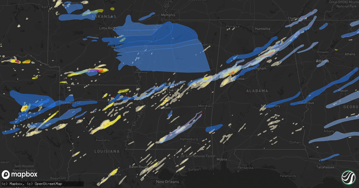
Hail Map in Mississippi on April 12, 2020
Get this storm
April 12 map
$229
one time, instant access
Download today. No call, no setup
Keep the $229
Bought the map and want the full workflow? Apply the entire $229 to a subscription within 7 days. None of it is wasted.
Every map, not just this one
This buys you this map. Subscription and you get every map we run, in the markets you choose from a few cities to whole states to nationwide. Plus real-time alerts the moment a storm fires.
Contact data
Name, contact info, occupancy, even credit band for addresses in the footprint. You go from where it hit to who to call.
Become the source they trust
Unlimited branding weather history reports on demand. You already have the documented answer ready for the property owner, and you are the one who showed up with it.
Property data and RoofTrace estimates
Pull up any address you have got, its value and the exact code rules for that jurisdiction, straight from One Click Code. Then RoofTrace estimates the squares, pitch, and roof value, priced the way you price.
Storm reports in Mississippi
Mississippi
| Date | Description |
|---|---|
| 04/12/20206:10 PM CDT | This tornado began along highway 18 to the southeast of rose hill in jasper county where it uprooted some trees. It then tracked northeast and crossed into clarke count |
| 04/12/20206:00 PM CDT | *** 1 fatal *** sheriffs office reported 1 fatality in northern walthall county. Numerous injuries. And many homes are flattened. This will continue to be updated later |
| 04/12/20205:47 PM CDT | Corrects previous tornado report from 2 s clarkdale. This ef1 tornado began along us 45... Uprooting trees as it tracked northward along the highway. Two homes sustaine |
| 04/12/20205:44 PM CDT | Damage to trees just west of hiedleberg. |
| 04/12/20205:35 PM CDT | This ef2 tornado began on the west side of stonewall along cr 320. In this area... A mobile home was destroyed... A wall of a church was collapsed... And several trees |
| 04/12/20205:34 PM CDT | Trees down with leaf and limb debris scattered all over in summerland on hwy 28. |
| 04/12/20205:29 PM CDT | Trees and power lines were reported down along hwy 61 near valley park. |
| 04/12/20205:22 PM CDT | This tornado began along cr 286 south of pachuta and tracked north northeastward across cr 289... Cr 288... Ms 18/512... Cr 310... Cr 3102... And cr 130 before ending a |
| 04/12/20205:15 PM CDT | Car flipped over on i-59 west of enterprise. |
| 04/12/20205:14 PM CDT | Several trees snapped with debris scattered all over the area on butler lane. |
| 04/12/20205:10 PM CDT | Many trees down across i-59. |
| 04/12/20205:03 PM CDT | Lots of tree damage on granby rd and homes damaged. |
| 04/12/20204:57 PM CDT | Trees down on bus. |
| 04/12/20204:56 PM CDT | Major damage trees... Bldgs.... Vehicles. |
| 04/12/20204:50 PM CDT | Extensive roof damage to store. |
| 04/12/20204:49 PM CDT | Picture and video of significant roofing loss at 3 livestock barns and surrounding tree damage near the intersection of jp parker road and ms highway 29 southwest of so |
| 04/12/20204:49 PM CDT | Partial roof damage... Mult trees snapped. |
| 04/12/20204:45 PM CDT | Several trees down and damage to shed in the backyard of a home in oakvale just off highway 43. |
| 04/12/20204:39 PM CDT | A tree was blown down onto and damaged a home in pelahatchie... And trees were blown down onto at least two roads around town. Two people were displaced from their home |
| 04/12/20204:32 PM CDT | Damage to homes and power poles. |
| 04/12/20204:32 PM CDT | Social media report of a tree down along hwy 18 southeast of brandon. Time and location estimated via radar. |
| 04/12/20204:30 PM CDT | Emergency manager reported quite a few homes damamged in northern walthall county north of hwy 44. |
| 04/12/20204:25 PM CDT | Damage to homes and power poles. |
| 04/12/20204:23 PM CDT | Destroyed building. |
| 04/12/20204:21 PM CDT | Damage to homes and power poles. |
| 04/12/20204:16 PM CDT | Major damage to trees and homes. |
| 04/12/20204:16 PM CDT | Social media report of quarter size hail along lynn creek road on the west side of brooksville. |
| 04/12/20204:14 PM CDT | Trees and structures damages. |
| 04/12/20203:57 PM CDT | Emergency manager reported 2 houses destroyed in northern walthall county. |
| 04/12/20203:52 PM CDT | Report from mping: trees uprooted or snapped; roof blown off. |
| 04/12/20203:46 PM CDT | *** 2 fatal *** this tornado began in far northeast walthall county and quickly moved across far southeast lawrence county... Where it began snapping large hardwood bra |
| 04/12/20203:42 PM CDT | Major structural damage to the soso first baptist church on frosty hinton rd. |
| 04/12/20203:42 PM CDT | Corrects previous tornado report from 3 n macon. Multiple reports of mobile homes flipped... Semi trucks rolled over... And power lines down just north of macon on hwy- |
| 04/12/20203:42 PM CDT | The ef-1 tornado touched down near the intersection of highway 388 and gavani rd where it uprooted several trees. It continued on a ne path before uprooting more trees |
| 04/12/20203:40 PM CDT | Tds began in northern walthall county at 2040z. |
| 04/12/20203:39 PM CDT | *** 2 fatal *** lsr time/location is for start point of tornado. Lsr covers walthall co. Segment. Tornado touched down on jefferson rd. Moved ne crossing hwy 27... Cont |
| 04/12/20203:34 PM CDT | Several trees down. |
| 04/12/20203:30 PM CDT | The tornado touched down north of macon along joes creek where it caused minor tree damage. It tracked ne towards macon lynn creek rd and continued to track over buggs |
| 04/12/20203:30 PM CDT | A porch was damaged and a metal roof pulled off of garage. |
| 04/12/20203:28 PM CDT | Social media picture of quarter size hail in yazoo city. |
| 04/12/20203:28 PM CDT | Several trees down. |
| 04/12/20203:23 PM CDT | Social media report of several trees down in the northern portion of the county. Time and location estimated via radar. |
| 04/12/20203:16 PM CDT | Social media report of ping pong ball size hail on the west side of madison. Time and location estimated via radar. |
| 04/12/20203:11 PM CDT | Tree down. |
| 04/12/20203:10 PM CDT | Several trees were reported down in the eastern portion of the county. |
| 04/12/20203:06 PM CDT | Several trees down. |
| 04/12/20203:05 PM CDT | Nickel to quarter size hail reported in clinton. |
| 04/12/20203:05 PM CDT | Scattered trees down in new albany. |
| 04/12/20203:04 PM CDT | Picture of a tree down along brooksville rd. |
| 04/12/20203:02 PM CDT | Several trees down along hwy 16. |
| 04/12/20202:47 PM CDT | A tornado briefly touched down in western choctaw county. This ef-0 tornado caused minor tree damage along mountain rd and weir panhandle rd. It lifted near lacey rd. P |
| 04/12/20202:39 PM CDT | Report from mping: trees uprooted or snapped; roof blown off. |
| 04/12/20202:21 PM CDT | Trees down. |
| 04/12/20202:11 PM CDT | Trees down. |
| 04/12/20202:06 PM CDT | This tornado touched down near county road 4101 and traveled to the northeast... Before making a turn to the north northeast. Along the path... It mainly snapped or upr |
| 04/12/20202:05 PM CDT | Numerous large branches broken. |
| 04/12/20201:46 PM CDT | This brief tornado caused minor damage to an outbuilding and downed a few trees along yellow bluff rd. A brief tornadic debris signature was noted with this storm. |
| 04/12/20201:30 PM CDT | A shed was destroyed and numerous trees were snapped west of the yazoo county airport. Relayed via social media. |
| 04/12/20201:25 PM CDT | Trees and utility poles were blown down on old five mile road. Possible tornado. |
| 04/12/20201:22 PM CDT | Picture of quarter size hail covering the ground in carthage. |
| 04/12/20201:22 PM CDT | Mult reports and video. |
| 04/12/20201:22 PM CDT | Building destroyed. |
| 04/12/20201:22 PM CDT | This tornado began just southwest of whites lane road snapping a couple of trees. The tornado continued northeast and destroyed two outbuildings and a shed just southwe |
| 04/12/20201:20 PM CDT | Multiple trees down around renfroe. |
| 04/12/20201:17 PM CDT | This tornado began just southwest of highway 16... Snapping a few trees. The tornado crossed highway 16 and snapped a couple of power poles. The tornado continued north |
| 04/12/20201:09 PM CDT | Multiple trees down along highway 16. |
| 04/12/20201:00 PM CDT | A swath of downed trees consistent with tornado damage was noted in satellite imagery in an area of the delta national forest inaccessible to damage survey teams due to |
| 04/12/20201:00 PM CDT | Several trees and power poles down in anguilla. |
| 04/12/202012:54 PM CDT | Roof blown off of home in egremont. Possible tornado. |
| 04/12/202012:40 PM CDT | Report of trees uprooted/snapped and roofs blown off of structures about 3 miles south of kosciusko. |
| 04/12/202011:15 AM CDT | Tree down on road 814 in plantersville. |
| 04/12/20207:35 AM CDT | At 1235 PM CDT, a severe thunderstorm was located near Myrleville, or 10 miles west of Canton, moving northeast at 80 mph. HAZARD...60 mph wind gusts and quarter size hail. SOURCE...Radar indicated. IMPACT...Hail damage to vehicles is expected. Expect wind damage to roofs, siding, and trees. This severe thunderstorm will be near... Way and Vaughan around 1245 PM CDT. Pickens around 1250 PM CDT. Goodman and Cameron around 1255 PM CDT. Newport around 100 PM CDT. Mcadams around 105 PM CDT. Kosciusko and Possumneck around 110 PM CDT.Other locations impacted by this severe thunderstorm include Sallis. |
| 04/12/20206:09 AM CDT | At 1109 PM CDT, severe thunderstorms were located along a line extending from near Bolivar to Pocahontas to near Jumpertown, moving northeast at 65 mph. HAZARD...60 mph wind gusts. SOURCE...Radar indicated. IMPACT...Expect damage to roofs, siding, and trees. Locations impacted include... Lexington, Savannah, Henderson, Selmer, Pickwick Landing State Park, Chickasaw State Park, Natchez Trace State Forest, Chickasaw State Forest, Big Hill Pond State Park, Parsons, Adamsville, Decaturville, Sardis, Silerton, Pickwick Dam, Masseyville, Reagan, Jacks Creek, Mifflin and Morris Chapel. |
| 04/12/20206:01 AM CDT | At 1101 PM CDT, severe thunderstorms were located along a line extending from 9 miles south of Ackerman to Renfroe to near Ludlow, moving east at 60 mph. HAZARD...60 mph wind gusts. SOURCE...Radar indicated. IMPACT...Expect damage to roofs, siding, and trees. Severe thunderstorms will be near... Philadelphia and Pearl River around 1115 PM CDT. Burnside and Stallo around 1120 PM CDT. Dixon around 1125 PM CDT. Nanih Waiya, Neshoba and Forestdale around 1130 PM CDT. Preston around 1135 PM CDT. Bluff Springs and House around 1140 PM CDT. Herbert Springs around 1145 PM CDT. De Kalb, Paulette and Cooksville around 1150 PM CDT.Other locations impacted by these severe thunderstorms includeNoxapater, Tucker, Shuqualak and Scooba. |
| 04/12/20205:50 AM CDT | At 1050 AM CDT, a severe thunderstorm was located near Gholson, or 9 miles northeast of Preston, moving northeast at 65 mph. HAZARD...Quarter size hail. SOURCE...Radar indicated. IMPACT...Damage to vehicles is expected. This severe thunderstorm will be near... Macon around 1100 AM CDT. Brooksville around 1105 AM CDT. Deerbrook and Prairie Point around 1110 AM CDT. Bigbee Valley around 1115 AM CDT.Other locations impacted by this severe thunderstorm includeShuqualak. |
| 04/12/20205:40 AM CDT | At 1040 PM CDT, severe thunderstorms were located along a line extending from near Pyland to near Eupora to near Poplar Creek, moving east at 65 mph. HAZARD...60 mph wind gusts. SOURCE...Radar indicated. IMPACT...Expect damage to roofs, siding, and trees. Severe thunderstorms will be near... Maben around 1045 PM CDT. Ackerman, Pheba and Chester around 1055 PM CDT. Griffith around 1100 PM CDT. Muldrow and Pala Alto around 1105 PM CDT. West Point, Craig Springs, Tibbee, Longview and Betheden around 1110 PM CDT. Waverly around 1115 PM CDT. Columbus, Columbus AFB, Oktoc, Kolola Springs and Sessums around 1120 PM CDT. Caledonia, Crawford and Steens around 1125 PM CDT.Other locations impacted by these severe thunderstorms includeSturgis, Weir and Artesia. |
| 04/12/20205:27 AM CDT | At 1027 PM CDT, severe thunderstorms were located along a line extending from near Emory to near Pickens to 7 miles southeast of Myrleville, moving east at 50 mph. HAZARD...60 mph wind gusts. SOURCE...Radar indicated. IMPACT...Expect damage to roofs, siding, and trees. Severe thunderstorms will be near... Cameron and Possumneck around 1035 PM CDT. Hesterville around 1040 PM CDT. Newport around 1045 PM CDT. Farmhaven, Thomastown and Mcadams around 1050 PM CDT. Singleton and Smyrna around 1100 PM CDT. Renfroe around 1105 PM CDT. Carthage, Tuscola and Zama around 1110 PM CDT. Edinburg around 1115 PM CDT.Other locations impacted by these severe thunderstorms include WalnutGrove, Ethel, Sallis, Redwater, Standing Pine, Lena and Mccool. |
| 04/12/20205:13 AM CDT | At 1013 PM CDT, severe thunderstorms were located along a line extending from Horseshoe Lake to near Barr to near Scobey, moving northeast at 75 mph. HAZARD...60 mph wind gusts. SOURCE...Radar indicated. IMPACT...Expect damage to roofs, siding, and trees. Locations impacted include... Southaven, Olive Branch, Horn Lake, Oxford, New Albany, Holly Springs, Pontotoc, Houston, Wall Doxey State Park, Bruce, Calhoun City, Vardaman, Byhalia, Derma, Blue Mountain, Ecru, Snow Lake Shores, Pittsboro, Slate Springs and Cambridge. |
| 04/12/20205:05 AM CDT | At 1004 PM CDT, severe thunderstorms were located along a line extending from near George Payne State Park to near Jefferson to near Sidon, moving east at 70 mph. HAZARD...60 mph wind gusts. SOURCE...Radar indicated. IMPACT...Expect damage to roofs, siding, and trees. Severe thunderstorms will be near... Winona, Duck Hill and Elliott around 1015 PM CDT. Sweatman around 1020 PM CDT. Vaiden and Lodi around 1025 PM CDT. Embry around 1030 PM CDT. Eupora, Kilmichael, Poplar Creek and Bellefontaine around 1035 PM CDT. Mathiston, Cumberland, Clarkson and Sherwood around 1045 PM CDT. Chester around 1050 PM CDT. Reform around 1055 PM CDT.Other locations impacted by these severe thunderstorms include FrenchCamp, Mantee and Walthall. |
| 04/12/20205:04 AM CDT | At 1003 PM CDT, a severe thunderstorm was located over Fruitdale, or 13 miles northeast of Leakesville, moving northeast at 85 mph. HAZARD...60 mph wind gusts and quarter size hail. SOURCE...Radar indicated. IMPACT...Hail damage to vehicles is expected. Expect wind damage to roofs, siding, and trees. Locations impacted include... Chatom, Saint Stephens, Wagarville, Deer Park, Tibbie, Fruitdale and McIntosh. |
| 04/12/20204:47 AM CDT | At 946 PM CDT, severe thunderstorms were located along a line extending from 6 miles east of McLain to 13 miles southwest of Lucedale to 8 miles east of Saucier, moving northeast at 55 mph. HAZARD...60 mph wind gusts and nickel size hail. SOURCE...Radar indicated. IMPACT...Expect damage to roofs, siding, and trees. Locations impacted include... Citronelle, Lucedale, Leakesville, Chunchula, Gulfcrest, Semmes, Tanner Williams and Wilmer. |
| 04/12/20204:44 AM CDT | At 944 PM CDT, severe thunderstorms were located along a line extending from near Isola to near Midnight to near Valley Park, moving east at 55 mph. HAZARD...60 mph wind gusts. SOURCE...Radar indicated. IMPACT...Expect damage to roofs, siding, and trees. Severe thunderstorms will be near... Belzoni and Midnight around 950 PM CDT. Yazoo City around 955 PM CDT. Thornton around 1000 PM CDT. Tchula, Phoenix and Tolarville around 1005 PM CDT. Coxburg around 1010 PM CDT. Ebenezer and Brozville around 1015 PM CDT. Franklin and Emory around 1020 PM CDT. Goodman, Pickens and Bowling Green around 1025 PM CDT.Other locations impacted by these severe thunderstorms include SilverCity, West, Eden, Satartia, Louise, Bentonia and Cruger. |
| 04/12/20204:36 AM CDT | At 936 PM CDT, severe thunderstorms were located along a line extending from Tutwiler to near Ruleville to Holly Ridge, moving east at 70 mph. HAZARD...70 mph wind gusts. SOURCE...Radar indicated. IMPACT...Expect considerable tree damage. Damage is likely to mobile homes, roofs, and outbuildings. Severe thunderstorms will be near... Sunnyside and Minter City around 945 PM CDT. Money around 950 PM CDT. Avalon around 955 PM CDT. Itta Bena, Leflore, Quito and Holcomb around 1000 PM CDT. Greenwood, Jefferson, Sidon and Bew Springs around 1005 PM CDT. Grenada and Seven Pines around 1010 PM CDT. Malmaison and Coila around 1015 PM CDT. North Carrollton around 1020 PM CDT.Other locations impacted by these severe thunderstorms includeSchlater, Morgan City and Carrollton. |
| 04/12/20204:30 AM CDT | At 930 PM CDT, severe thunderstorms were located along a line extending from State Line to 6 miles southwest of Fruitdale to near Leakesville, moving east at 55 mph. HAZARD...60 mph wind gusts and quarter size hail. SOURCE...Radar indicated. IMPACT...Hail damage to vehicles is expected. Expect wind damage to roofs, siding, and trees. Locations impacted include... Jackson, Grove Hill, Chatom, Leakesville, Saint Stephens, Wagarville, Leroy, Deer Park, Whatley, Tibbie, State Line, Fruitdale and McIntosh. |
| 04/12/20204:22 AM CDT | At 922 PM CDT, severe thunderstorms were located along a line extending from 6 miles northeast of Deeson to near Cleveland to near Greenville, moving east at 55 mph. HAZARD...60 mph wind gusts. SOURCE...Radar indicated. IMPACT...Expect damage to roofs, siding, and trees. Severe thunderstorms will be near... Ruleville and Drew around 940 PM CDT. Holly Ridge around 945 PM CDT. Indianola and Inverness around 950 PM CDT. Moorhead around 1000 PM CDT.Other locations impacted by these severe thunderstorms includeDoddsville. |
| 04/12/20204:09 AM CDT | At 908 PM CDT, a severe thunderstorm was located 8 miles west of Perkinston, or 10 miles southwest of Wiggins, moving northeast at 70 mph. HAZARD...60 mph wind gusts and quarter size hail. SOURCE...Radar indicated. IMPACT...Hail damage to vehicles is expected. Expect wind damage to roofs, siding, and trees. Locations impacted include... Wiggins, Perkinston, McHenry and McLain. |
| 04/12/20204:05 AM CDT | At 903 PM CDT, a severe thunderstorm was located over New Augusta, or 11 miles southwest of Richton, moving northeast at 70 mph. HAZARD...60 mph wind gusts and quarter size hail. SOURCE...Radar indicated. IMPACT...Hail damage to vehicles is expected. Expect wind damage to roofs, siding, and trees. Locations impacted include... Richton, Beaumont, New Augusta and State Line. |
| 04/12/20203:43 AM CDT | At 843 PM CDT, a severe thunderstorm was located 9 miles northeast of Ladelle, or 10 miles southeast of Monticello, moving east at 45 mph. HAZARD...60 mph wind gusts and quarter size hail. SOURCE...Radar indicated. IMPACT...Hail damage to vehicles is expected. Expect wind damage to roofs, siding, and trees. Locations impacted include... Monticello... Dermott... Arkansas City... Tillar... Jersey Point... Lucca Landing... McGehee... Ladelle... Prairie Grove... Jerome... Baxter... Enon... Halley... Masonville... Collins... McArthur... Selma... |
| 04/12/20203:40 AM CDT | At 840 PM CDT, a severe thunderstorm was located near Fort Adams, or 23 miles northeast of Simmesport, moving east at 75 mph. HAZARD...60 mph wind gusts and quarter size hail. SOURCE...Radar indicated. IMPACT...Hail damage to vehicles is expected. Expect wind damage to roofs, siding, and trees. Locations impacted include... Centreville, Woodville, Gloster, Fort Adams, Dolorosa and Crosby. |
| 04/12/20203:28 AM CDT | At 827 PM CDT, severe thunderstorms were located along a line extending from Estes to 7 miles northwest of Altheimer to near Cottondale to near Feenyville to 6 miles east of Herbine to near Warren, moving east at 65 mph. HAZARD...70 mph wind gusts and quarter size hail. SOURCE...Radar indicated. IMPACT...Hail damage to vehicles is expected. Expect considerable tree damage. Wind damage is also likely to mobile homes, roofs, and outbuildings. Locations impacted include... Pine Bluff... Monticello... Stuttgart... Dumas... Star City... Rohwer... England... Altheimer... Gould... Gillett... Holly Grove... Humphrey... Grady... Mitchellville... Humnoke... Almyra... Keo... St. Charles... Tillar... Watson... |
| 04/12/20203:20 AM CDT | At 820 PM CDT, a severe thunderstorm was located over Purvis, or 12 miles south of West Hattiesburg, moving northeast at 60 mph. HAZARD...60 mph wind gusts and quarter size hail. SOURCE...Radar indicated. IMPACT...Hail damage to vehicles is expected. Expect wind damage to roofs, siding, and trees. This severe thunderstorm will be near... Mclaurin around 830 PM CDT. Sunrise around 835 PM CDT. |
| 04/12/20202:20 AM CDT | At 720 AM CDT, a severe thunderstorm was located over Kelso, or near Rohwer, moving northeast at 50 mph. HAZARD...60 mph wind gusts and quarter size hail. SOURCE...Radar indicated. IMPACT...Hail damage to vehicles is expected. Expect wind damage to roofs, siding, and trees. Locations impacted include... Rohwer... Watson... Lucca Landing... Yancopin... Trusten Holder WMA... Kelso... |
| 04/12/20201:55 AM CDT | At 655 PM CDT, a severe thunderstorm was located near Suqualena, or 8 miles northwest of Meridian, moving northeast at 60 mph. HAZARD...60 mph wind gusts and quarter size hail. SOURCE...Radar indicated. IMPACT...Hail damage to vehicles is expected. Expect wind damage to roofs, siding, and trees. This severe thunderstorm will be near... Prismatic around 700 PM CDT. Meridian Station, Daleville and Blackwater around 705 PM CDT. Lauderdale around 710 PM CDT. Porterville and Tamola around 715 PM CDT. Electric Mills around 720 PM CDT. |
| 04/12/20201:39 AM CDT | At 639 PM CDT, severe thunderstorms were located along a line extending from near Winona to 7 miles north of Hesterville, moving northeast at 90 mph. HAZARD...60 mph wind gusts. SOURCE...Radar indicated. IMPACT...Expect damage to roofs, siding, and trees. Severe thunderstorms will be near... Duck Hill around 645 PM CDT. Kilmichael and Sweatman around 650 PM CDT. Eupora, Bellefontaine and Embry around 700 PM CDT. Clarkson around 705 PM CDT.Other locations impacted by these severe thunderstorms includeWalthall. |
| 04/12/20201:17 AM CDT | At 617 PM CDT, a severe thunderstorm was located near Pinola, moving northeast at 60 mph. HAZARD...Ping pong ball size hail and 60 mph wind gusts. SOURCE...Radar indicated. IMPACT...People and animals outdoors will be injured. Expect hail damage to roofs, siding, windows, and vehicles. Expect wind damage to roofs, siding, and trees. This severe thunderstorm will be near... Mendenhall around 625 PM CDT. Magee, Sanatorium and Martinville around 630 PM CDT. White Oak around 640 PM CDT. Raleigh around 645 PM CDT. Burns around 650 PM CDT. Pineville around 655 PM CDT.Other locations impacted by this severe thunderstorm includeSylvarena. |
| 04/12/20201:00 AM CDT | At 559 PM CDT, a severe thunderstorm was located near Raleigh, or 12 miles northeast of Magee, moving northeast at 55 mph. HAZARD...60 mph wind gusts and quarter size hail. SOURCE...Radar indicated. IMPACT...Hail damage to vehicles is expected. Expect wind damage to roofs, siding, and trees. This severe thunderstorm will be near... Burns around 605 PM CDT. Pineville around 615 PM CDT.Other locations impacted by this severe thunderstorm includeSylvarena. |
| 04/12/202012:58 AM CDT | At 557 PM CDT, a severe thunderstorm was located near Thornton, moving northeast at 65 mph. HAZARD...60 mph wind gusts. SOURCE...Radar indicated. IMPACT...Expect damage to roofs, siding, and trees. This severe thunderstorm will be near... Tchula around 605 PM CDT. Black Hawk and Seven Pines around 620 PM CDT. Coila around 625 PM CDT. North Carrollton around 630 PM CDT.Other locations impacted by this severe thunderstorm include MorganCity, Cruger and Carrollton. |
| 04/12/202012:56 AM CDT | At 556 PM CDT, severe thunderstorms were located along a line extending from near Yazoo City to 7 miles southwest of Little Yazoo, moving northeast at 65 mph. HAZARD...60 mph wind gusts. SOURCE...Radar indicated. IMPACT...Expect damage to roofs, siding, and trees. Severe thunderstorms will be near... Yazoo City around 600 PM CDT. Myrleville around 605 PM CDT. Benton, Tolarville and Coxburg around 610 PM CDT. Howard and Brozville around 615 PM CDT. Franklin, Lexington, Vaughan and Way around 620 PM CDT. Pickens around 625 PM CDT. Goodman, Bowling Green, Emory and Cameron around 630 PM CDT. Newport around 635 PM CDT.Other locations impacted by these severe thunderstorms include Eden,Sallis, West and Bentonia. |
| 04/12/202012:37 AM CDT | At 537 PM CDT, a severe thunderstorm was located over Hammond, moving northeast at 70 mph. HAZARD...60 mph wind gusts and quarter size hail. SOURCE...Radar indicated. IMPACT...Hail damage to vehicles is expected. Expect wind damage to roofs, siding, and trees. Locations impacted include... Hammond, Bogalusa, Covington, Franklinton, Ponchatoula, Folsom, Sun, Enon, Crossroads, Natalbany, Robert, Bush and Tickfaw. |
| 04/12/202012:04 AM CDT | At 504 PM CDT, a severe thunderstorm was located near Edinburg, moving northeast at 70 mph. HAZARD...60 mph wind gusts and quarter size hail. SOURCE...Radar indicated. IMPACT...Hail damage to vehicles is expected. Expect wind damage to roofs, siding, and trees. This severe thunderstorm will be near... Burnside and Stallo around 510 PM CDT. Nanih Waiya around 515 PM CDT.Other locations impacted by this severe thunderstorm includeNoxapater, Lena, Tucker, Walnut Grove and Standing Pine. |
| 04/11/202011:49 PM CDT | At 448 PM CDT, severe thunderstorms were located along a line extending from near Delhi to 7 miles southeast of Winnsboro, moving northeast at 80 mph. HAZARD...60 mph wind gusts and quarter size hail. SOURCE...Radar indicated. IMPACT...Hail damage to vehicles is expected. Expect wind damage to roofs, siding, and trees. Severe thunderstorms will be near... Monticello, Warden and Waverly around 455 PM CDT. Sondheimer around 500 PM CDT. Transylvania and Alsatia around 505 PM CDT. Fitler and Afton around 510 PM CDT. Tallulah, Onward and Mansford around 515 PM CDT. Eagle Bend around 525 PM CDT.Other locations impacted by these severe thunderstorms include Mound,Cary, Richmond and Epps. |
| 04/11/202011:30 PM CDT | At least 20 trees reported down across the county... Several of which fell on homes. |
| 04/11/202011:25 PM CDT | Social media picture of trees down at dewayne hayes campground. |
| 04/11/202011:25 PM CDT | Several trees down in the area with some roads blocked including highway 15...reported by neshoba so. |
| 04/11/202011:25 PM CDT | Numerous trees and large branches down west of greenwood springs. |
| 04/11/202011:25 PM CDT | At 425 PM CDT, a severe thunderstorm was located over Piney Woods, or near Star, moving northeast at 80 mph. HAZARD...60 mph wind gusts and nickel size hail. SOURCE...Radar indicated. IMPACT...Expect damage to roofs, siding, and trees. This severe thunderstorm will be near... Johns around 430 PM CDT. Pelahatchie around 440 PM CDT. Morton, Branch and Pulaski around 445 PM CDT. Forkville around 450 PM CDT.Other locations impacted by this severe thunderstorm includePolkville, D'Lo, Braxton and Puckett. |
| 04/11/202011:18 PM CDT | Tree down across crawford rd. |
| 04/11/202011:16 PM CDT | Tree down across bluff lake rd. |
| 04/11/202011:15 PM CDT | Tree down on road 814 in plantersville. |
| 04/11/202011:12 PM CDT | Tree down across watson rd. |
| 04/11/202011:09 PM CDT | Tree across cedar grove rd. |
| 04/11/202011:06 PM CDT | Trees down on powerlines in guntown. |
| 04/11/202011:05 PM CDT | A couple of trees knocked down on county road 168 in dumas. |
| 04/11/202011:05 PM CDT | Several trees down...reported by oktibbeha so. |
| 04/11/202011:05 PM CDT | Minor wind damage including possible small tree limbs broken or shingles blown off. Report relayed via mping. Time adjusted based on radar. |
| 04/11/202011:03 PM CDT | Tree across ennis rd. |
| 04/11/202011:00 PM CDT | A half dozen trees were knocked down on anderson road in eastern pontotoc county. |
| 04/11/202010:58 PM CDT | Tree down across wilson rd. |
| 04/11/202010:57 PM CDT | Mping report of minor wind damage including possible small tree limbs broken or shingles blown off with outflow boundary winds from decaying thunderstorms. |
| 04/11/202010:55 PM CDT | Tree across dunn rd. |
| 04/11/202010:54 PM CDT | Multiple trees down in the community of new alpine. |
| 04/11/202010:53 PM CDT | Tree across sturgis-maben rd. |
| 04/11/202010:51 PM CDT | Multiple trees down in bruce. Also... Widespread power outages throughout calhoun county. |
| 04/11/202010:51 PM CDT | Tree across tobe henry ln. |
| 04/11/202010:51 PM CDT | Tree down across harrell rd. |
| 04/11/202010:51 PM CDT | Tree across sturgis west point rd. |
| 04/11/202010:50 PM CDT | Multiple trees down on 336w in pontotoc |
| 04/11/202010:50 PM CDT | Tree down. |
| 04/11/202010:50 PM CDT | Tree across self creek rd. |
| 04/11/202010:50 PM CDT | Numerous trees down...reported by attala so. |
| 04/11/202010:50 PM CDT | Large tree down across highway 32. Four roads closed due to debris across the county. |
| 04/11/202010:46 PM CDT | Tree across maben starkville rd. |
| 04/11/202010:35 PM CDT | Trees and power lines knocked down in banner. Power meter knocked off a house. |
| 04/11/202010:35 PM CDT | At 334 PM CDT, a severe thunderstorm was located over Tremont, or 8 miles southeast of Fulton, moving east at 50 mph. HAZARD...60 mph wind gusts. SOURCE...Radar indicated. IMPACT...Expect damage to roofs, siding, and trees. Locations impacted include... Russellville, Red Bay, Phil Campbell, Belgreen, Vina, Hodges, Atwood, Tharptown, Duketon and Rockwood. |
| 04/11/202010:33 PM CDT | Relayed report from red cross. A tree is down on a house with a person trapped inside. |
| 04/11/202010:27 PM CDT | At 327 PM CDT, a severe thunderstorm was located near Yazoo City, moving northeast at 75 mph. HAZARD...60 mph wind gusts and quarter size hail. SOURCE...Radar indicated. IMPACT...Hail damage to vehicles is expected. Expect wind damage to roofs, siding, and trees. This severe thunderstorm will be near... Thornton and Coxburg around 340 PM CDT. Tolarville, Brozville and Howard around 345 PM CDT. Franklin and Lexington around 350 PM CDT. Bowling Green around 355 PM CDT. Emory around 400 PM CDT.Other locations impacted by this severe thunderstorm include Eden andWest. |
| 04/11/202010:26 PM CDT | Trees down all over the city of oxford and across lafayette county as well. Five homes were damaged across the county. |
| 04/11/202010:25 PM CDT | Large tree down. |
| 04/11/202010:23 PM CDT | Multiple power outages reported near looxahoma community due to downed powerlines. |
| 04/11/202010:20 PM CDT | Numerous trees down everywhere...blocking some roads...reported by montgomery so. |
| 04/11/202010:20 PM CDT | Trees and power lines down throughout the county including but not limited to along bright rd... East of jaybird... Hwy 305 near honey suckle way... Fogg rd... Benvorli |
| 04/11/202010:17 PM CDT | Widespread wind damage in winona including trees blown down across roads... Into power lines... And at least 2 onto houses which caused significant damage. Some power p |
| 04/11/202010:15 PM CDT | Multiple trees down across the entire county. Ema director reports trees down on houses and structures as well. |
| 04/11/202010:15 PM CDT | Trees and power lines down throughout the county including but not limited to along bright rd... East of jaybird... Hwy 305 near honey suckle way... Frogg rd... Benvorl |
| 04/11/202010:10 PM CDT | Numerous trees down...some blocking roads...reported by holmes so. |
| 04/11/202010:10 PM CDT | Three homes were damaged across tate county. |
| 04/11/202010:10 PM CDT | Numerous trees and powerlines down in the eudora community. |
| 04/11/202010:10 PM CDT | Several trees and power lines down...tree down on a residence...reported by carroll so. |
| 04/11/202010:07 PM CDT | At 307 PM CDT, a severe thunderstorm was located near Houston, moving east at 55 mph. HAZARD...60 mph wind gusts. SOURCE...Radar indicated. IMPACT...Expect damage to roofs, siding, and trees. Locations impacted include... Amory, Houston, Okolona, Shannon, Smithville, Tremont, New Salem, New Wren, Evergreen, Nettleton, Hatley, Turon, Egypt, Wren, Thelma, Leotis, Buena Vista, Cardsville, Van Vleet and Tilden. |
| 04/11/202010:05 PM CDT | Trees were knocked over destroying a mobile home in batesville. |
| 04/11/202010:05 PM CDT | At least 15 homes across the county were damaged by falling trees. |
| 04/11/202010:05 PM CDT | Widespread trees down...many roads including major roads blocked by downed trees...reported by grenada so. |
| 04/11/202010:04 PM CDT | At 304 PM CDT, a severe thunderstorm was located near Clinton, moving northeast at 70 mph. HAZARD...60 mph wind gusts and quarter size hail. SOURCE...Radar indicated. IMPACT...Hail damage to vehicles is expected. Expect wind damage to roofs, siding, and trees. This severe thunderstorm will be near... Pocahontas around 310 PM CDT. Ridgeland and Annandale around 315 PM CDT. Madison and Gluckstadt around 320 PM CDT. Canton around 325 PM CDT. Sharon around 330 PM CDT. Farmhaven around 335 PM CDT. Camden around 340 PM CDT. |
| 04/11/202010:00 PM CDT | *** 1 fatal *** 15-20 homes damaged or destroyed across the county... Many trees down. One fatality from trees falling on a mobile home. |
| 04/11/202010:00 PM CDT | Numerous trees and power lines down...some trees blocking roads...reported by yazoo so. |
| 04/11/202010:00 PM CDT | Power pole snapped and a couple of power poles knocked over along highway 32 east of charleston. |
| 04/11/20209:59 PM CDT | Tunica awos reported 60mph winds at the top of the hour. |
| 04/11/20209:54 PM CDT | At 254 PM CDT, a severe thunderstorm was located near Sharon, or near Canton, moving northeast at 50 mph. HAZARD...Quarter size hail. SOURCE...Radar indicated. IMPACT...Damage to vehicles is expected. This severe thunderstorm will be near... Farmhaven around 305 PM CDT. Carthage around 325 PM CDT. Singleton around 330 PM CDT. Renfroe around 335 PM CDT. Edinburg around 340 PM CDT.Other locations impacted by this severe thunderstorm include StandingPine and Redwater. |
| 04/11/20209:45 PM CDT | Some trees and power lines were blown down around the area. Time estimated from radar. |
| 04/11/20209:45 PM CDT | Trees were blown all over town from straight-line winds which came around 945 pm and lasted up to 10 minutes. One tree fell onto a home and trapped a family but there w |
| 04/11/20209:44 PM CDT | *** 1 inj *** corrects previous tstm wnd dmg report from moorhead. A tree was blown down onto and destroyed a mobile home near moorhead. An individual was trapped in th |
| 04/11/20209:40 PM CDT | Several trees down...reported by sunflower so. |
| 04/11/20209:38 PM CDT | Corrects previous tstm wnd dmg report from indianola. Several trees were blown down around the area... And some power lines were blown down along beaverdam road. |
| 04/11/20209:35 PM CDT | Trees and power lines down throughout the county including but not limited to along bright rd... East of jaybird... Hwy 305 near honey suckle way... Fogg rd... Benvorli |
| 04/11/20209:35 PM CDT | Trees on houses caused some structural damage. Severe winds blew off metal roofing and caused a brick wall of one business to collapse. |
| 04/11/20209:35 PM CDT | There was some wind damage to trees around the area. Time estimated from radar. |
| 04/11/20209:35 PM CDT | Widespread tree damage across the city of clarksdale. Several homes damaged by fallen trees. |
| 04/11/20209:35 PM CDT | Trees down at friars point. |
| 04/11/20209:34 PM CDT | 4 or 5 trees were blown down near the parchman penitentiary. Time estimated from radar. |
| 04/11/20209:33 PM CDT | There was a fair amount of tree damage and damage to four structures... Mostly around the drew area. Time estimated from radar. |
| 04/11/20209:30 PM CDT | Report of a large tree down near killebrew and bobo street in lyon... Ms. |
| 04/11/20209:27 PM CDT | At 227 PM CDT, severe thunderstorms were located along a line extending from 7 miles northeast of Kosciusko to near Smyrna to near Singleton, moving east at 65 mph. HAZARD...60 mph wind gusts and quarter size hail. SOURCE...Radar indicated. IMPACT...Hail damage to vehicles is expected. Expect wind damage to roofs, siding, and trees. Severe thunderstorms will be near... Zama around 240 PM CDT. Ackerman around 245 PM CDT. Louisville and Mcmillan around 250 PM CDT. Betheden around 300 PM CDT. Millcreek around 305 PM CDT.Other locations impacted by these severe thunderstorms include FrenchCamp, Mccool and Weir. |
| 04/11/20209:27 PM CDT | Trees were blown down along memorial drive... And light poles were broken on us highway 61 in cleveland. |
| 04/11/20209:27 PM CDT | Some small to large tree limbs were blown down around shaw... And the north facing tin wall of an old mechanic shop was torn off. No other damage was reported around to |
| 04/11/20209:27 PM CDT | Corrects previous tstm wnd dmg report from 1 wsw cleveland. A wall collapsed at parks elementary school and the roof was blown off. Nearby trees were also blown down. T |
| 04/11/20209:25 PM CDT | Some small to large tree limbs were blown down on the north side of cleveland. Worse tree damage was reported to the south. Time estimated from radar. |
| 04/11/20209:25 PM CDT | A tree was blown down onto a house in merigold. Time estimated from radar. |
| 04/11/20209:25 PM CDT | Corrects previous thunderstorm wind damage report. Tree damage in around cleveland was worse in a 2 block wide corridor of trees blown down including some on houses. |
| 04/11/20209:25 PM CDT | Several trees were blown onto and damaged houses and vehicles in boyle. There was also some shingle loss on homes in the area and some power lines blown down. Time esti |
| 04/11/20209:25 PM CDT | Around 1 dozen power poles were snapped at different locations along crosby road on the west side of merigold. Time estimated from radar. |
| 04/11/20209:23 PM CDT | 51kt gust at glh. |
| 04/11/20209:22 PM CDT | Trees and power lines down. |
| 04/11/20209:22 PM CDT | Some trees were blown down in shelby. Time estimated from radar. |
| 04/11/20209:17 PM CDT | Some small limbs were blown down at this location... But heard of more substantial wind damage in other portions of the county. Time is when outflow boundary reached th |
| 04/11/20209:13 PM CDT | Trees and power lines down. |
| 04/11/20209:10 PM CDT | A tree was blown down onto ms highway 1 in rosedale... And a tree was blown down onto a home. Time estimated from radar. |
| 04/11/20209:10 PM CDT | Corrects previous thunderstorm wind damage report from rosedale. Only small limbs were blown down near the post office. |
| 04/11/20208:55 PM CDT | Mobile home sustained heavy damage from downed tree. |
| 04/11/20208:55 PM CDT | Numerous trees and power lines downed. |
| 04/11/20208:46 PM CDT | Trees and power lines down on dyess bridge road. |
| 04/11/20208:43 PM CDT | Several trees reported down in richton. |
| 04/11/20208:29 PM CDT | Shingle and tin roof damage to residence. |
| 04/11/20208:29 PM CDT | Shingle and tin roof damage to residence. |
| 04/11/20208:11 PM CDT | Several trees reported down in runnelstown. |
| 04/11/20208:06 PM CDT | At 106 PM CDT, a severe thunderstorm was located near Ludlow, or 14 miles southwest of Carthage, moving northeast at 80 mph. HAZARD...60 mph wind gusts and quarter size hail. SOURCE...Radar indicated. IMPACT...Hail damage to vehicles is expected. Expect wind damage to roofs, siding, and trees. This severe thunderstorm will be near... Carthage around 115 PM CDT. Edinburg and Renfroe around 125 PM CDT. Pearl River around 130 PM CDT. Burnside around 135 PM CDT. Stallo around 140 PM CDT.Other locations impacted by this severe thunderstorm includeNoxapater, Standing Pine and Redwater. |
All States Impacted by Hail Map on April 12, 2020
Cities Impacted by Hail Map on April 12, 2020
- Rayville, LA
- Epps, LA
- Pioneer, LA
- Delhi, LA
- Monroe, LA
- Burkeville, TX
- Boaz, AL
- Pinola, MS
- Magee, MS
- Mendenhall, MS
- Raleigh, MS
- McRae Helena, GA
- Milan, GA
- Covington, LA
- Springfield, LA
- Robert, LA
- Ponchatoula, LA
- Folsom, LA
- Loranger, LA
- Hammond, LA
- Deridder, LA
- Rocky Ford, GA
- Sylvania, GA
- Kilgore, TX
- Longview, TX
- Gordo, AL
- Knoxville, AL
- Aliceville, AL
- Eutaw, AL
- Ralph, AL
- Mountainburg, AR
- Rudy, AR
- Alma, AR
- Roxton, TX
- Hardeeville, SC
- Henderson, TX
- Colquitt, GA
- Gonzales, LA
- Baton Rouge, LA
- Prairieville, LA
- Douglass, TX
- Allen, OK
- Noxapater, MS
- Louisville, MS
- Sikes, LA
- Cameron, TX
- Merryville, LA
- Lumberton, MS
- Purvis, MS
- Saint Martinville, LA
- New Iberia, LA
- Jeanerette, LA
- Loreauville, LA
- Hampton, AR
- Kosciusko, MS
- Pickens, MS
- Lexington, MS
- Durant, MS
- Columbia, LA
- Grayson, LA
- Pelsor, AR
- Dover, AR
- Wanette, OK
- Macomb, OK
- Berry, AL
- Echola, AL
- Elrod, AL
- Northport, AL
- El Dorado, AR
- West Monroe, LA
- Eros, LA
- Chatham, LA
- Calipatria, CA
- Stuttgart, AR
- Troy, AL
- Gallant, AL
- Altoona, AL
- Attalla, AL
- Davis, OK
- Wynnewood, OK
- Fort Smith, AR
- Watson, AR
- Monticello, AR
- Statesboro, GA
- Winnfield, LA
- Peterman, AL
- Coushatta, LA
- Pineland, SC
- Frankston, TX
- Brantley, AL
- Louann, AR
- Camden, AR
- Trion, GA
- Summerville, GA
- Palestine, TX
- Crockett, TX
- Grapeland, TX
- Walker, LA
- Dacula, GA
- Braselton, GA
- Auburn, GA
- Buford, GA
- Lawrenceville, GA
- Flowery Branch, GA
- Hoschton, GA
- McLain, MS
- Perkinston, MS
- Bogalusa, LA
- Carrollton, AL
- Buhl, AL
- Fayette, AL
- Reform, AL
- Coker, AL
- Kennedy, AL
- Shelbyville, TX
- Brandon, MS
- Ridgeland, MS
- Madison, MS
- Jackson, MS
- Maysville, OK
- Lindsay, OK
- Satartia, MS
- Center, TX
- Newellton, LA
- Tallulah, LA
- Saline, LA
- Jonesboro, LA
- Goldonna, LA
- Clayton, AL
- Eufaula, AL
- Shorterville, AL
- Abbeville, AL
- Clopton, AL
- Timpson, TX
- Cushing, TX
- Rusk, TX
- Alto, TX
- Smithdale, MS
- Liberty, MS
- Harrisville, MS
- Braxton, MS
- Sorrento, LA
- Kennard, TX
- Wayne, OK
- Purcell, OK
- Harrisonburg, LA
- Calhoun, LA
- Natchitoches, LA
- Lewisville, AR
- Desoto, TX
- Lancaster, TX
- Dallas, TX
- Duncanville, TX
- Cedar Hill, TX
- Flint, TX
- Tyler, TX
- Whitehouse, TX
- Thomasville, AL
- Clayton, LA
- Detroit, TX
- Bagwell, TX
- Steele, AL
- Remlap, AL
- Oneonta, AL
- Flora, MS
- Scurry, TX
- Kaufman, TX
- Colfax, LA
- Ratcliff, AR
- Ozark, AR
- Downsville, LA
- Farmerville, LA
- Elkhart, TX
- Tuscumbia, AL
- Talco, TX
- Seagoville, TX
- Ferris, TX
- Arnaudville, LA
- Sallis, MS
- Wills Point, TX
- Terrell, TX
- Franklinton, LA
- McNeil, AR
- Buckner, AR
- Waldo, AR
- Banks, AR
- Stamps, AR
- Stephens, AR
- Blossom, TX
- Pine Valley, CA
- Campo, CA
- Boulevard, CA
- Calvin, OK
- Bay Springs, MS
- Heidelberg, MS
- Laurel, MS
- Pinson, AL
- Morris, AL
- Cleveland, AL
- Mount Olive, AL
- Trafford, AL
- Locust Fork, AL
- Gardendale, AL
- Graysville, AL
- Poplarville, MS
- Ohatchee, AL
- Paris, TX
- Sumner, TX
- Nacogdoches, TX
- Tenaha, TX
- Mount Enterprise, TX
- Gary, TX
- Carthage, TX
- Garrison, TX
- Laughlin, NV
- Searchlight, NV
- Scooba, MS
- Hartshorne, OK
- Collins, MS
- Texarkana, AR
- Fouke, AR
- Sulphur, OK
- Canton, MS
- Dardanelle, AR
- Pottsville, AR
- Russellville, AR
- Atkins, AR
- Mount Pleasant, TX
- Tifton, GA
- Enigma, GA
- Buckholts, TX
- Wells, TX
- Clarksville, TX
- Cecil, AR
- Highland Home, AL
- Goshen, AL
- Luverne, AL
- Grady, AL
- Rutledge, AL
- Donaldsonville, LA
- Belle Rose, LA
- Plattenville, LA
- Fort Scott, KS
- Uniontown, KS
- Taylor, AR
- Mer Rouge, LA
- Bastrop, LA
- Kenefic, OK
- Durant, OK
- Bassfield, MS
- Prentiss, MS
- Estill, SC
- Millen, GA
- Garfield, GA
- Tishomingo, OK
- Milburn, OK
- Ashdown, AR
- McGehee, AR
- Tillar, AR
- Troup, TX
- Metter, GA
- Kaplan, LA
- Lamar, AR
- White Oak, TX
- Gladewater, TX
- Trout, LA
- Abbeville, GA
- Eastman, GA
- McCool, MS
- Philadelphia, MS
- Preston, MS
- Brooksville, MS
- Macon, MS
- Shuqualak, MS
- Claxton, GA
- Woodville, MS
- Samson, AL
- Kinston, AL
- Olla, LA
- Haughton, LA
- Benton, LA
- Collins, GA
- Lyons, GA
- Mulberry, AR
- Dyer, AR
- Booneville, AR
- Greenwood, AR
- Robeline, LA
- Holden, LA
- Livingston, LA
- French Settlement, LA
- De Kalb, TX
- Avery, TX
- Brookston, TX
- Honey Grove, TX
- Arthur City, TX
- Mapleton, KS
- Altheimer, AR
- Wabbaseka, AR
- Silver City, MS
- Alex, OK
- Blanchard, OK
- Jacksonville, TX
- Leakesville, MS
- Guild, TN
- Trenton, GA
- Ethelsville, AL
- Edwards, MS
- Starkville, MS
- Lena, MS
- Camden, MS
- Bolton, MS
- Morton, MS
- Oakman, AL
- Raymond, MS
- Columbus, MS
- Clinton, MS
- Carthage, MS
- Crawford, MS
- Tuscaloosa, AL
- Arlington, TX
- Kennedale, TX
- Fort Worth, TX
- Scott, LA
- Lafayette, LA
- Carencro, LA
- Duson, LA
- Breaux Bridge, LA
- Rayne, LA
- Morse, LA
- Gueydan, LA
- Crowley, LA
- Magnolia, MS
- Pollock, LA
- Dry Prong, LA
- Georgetown, LA
- Tullos, LA
- Millport, AL
- Lake Providence, LA
- Opp, AL
- Dickinson, AL
- Grove Hill, AL
- Vicksburg, MS
- Garland, KS
- Farlington, KS
- Arcadia, KS
- Red Oak, OK
- Carnesville, GA
- Boulder City, NV
- Muscle Shoals, AL
- Haynesville, LA
- Junction City, AR
- Quincy, FL
- Ramer, AL
- Port Allen, LA
- Apison, TN
- McDonald, TN
- Cleveland, TN
- Tupelo, OK
- Ridgeland, SC
- Carville, LA
- Geismar, LA
- Maurepas, LA
- Saint Gabriel, LA
- Albany, LA
- Denham Springs, LA
- Saint Amant, LA
- White Castle, LA
- Independence, LA
- Tickfaw, LA
- Carson, MS
- Seminary, MS
- Taylorsville, MS
- Bullard, TX
- Lowndesboro, AL
- Glenwood, AL
- Powderly, TX
- Silver Creek, MS
- Campti, LA
- Florala, AL
- Rush Springs, OK
- Fosters, AL
- Atoka, OK
- Bay Saint Louis, MS
- Stennis Space Center, MS
- Cataula, GA
- Twin City, GA
- Springville, AL
- Kimberly, AL
- Warrior, AL
- Birmingham, AL
- Portal, GA
- Mansfield, LA
- Pelican, LA
- Chauncey, GA
- Amite, LA
- Greensburg, LA
- Pine Grove, LA
- Humphrey, AR
- Bennington, OK
- Bokchito, OK
- Converse, LA
- Letohatchee, AL
- Hayneville, AL
- Benton, MS
- Tishomingo, MS
- Dennis, MS
- Ada, OK
- Grand Chenier, LA
- Maurice, LA
- Bradley, SC
- Rainbow City, AL
- Mayersville, MS
- Rolling Fork, MS
- Calion, AR
- Darrow, LA
- Townley, AL
- Marshallville, GA
- Booneville, MS
- Nauvoo, AL
- Shelby, MS
- Calera, OK
- Hendrix, OK
- Greenville, AL
- Mccomb, MS
- Tylertown, MS
- Summit, MS
- Jayess, MS
- Ruth, MS
- Oakwood, TX
- West, MS
- Vaiden, MS
- Tennille, GA
- Garnett, SC
- Clinton, LA
- Norwood, LA
- Hayden, AL
- Marthaville, LA
- Vaughan, MS
- Choudrant, LA
- Springer, OK
- Springfield, AR
- Hattieville, AR
- Solgohachia, AR
- Morrilton, AR
- Caddo, OK
- Lucedale, MS
- Wiggins, MS
- Doddridge, AR
- Sulphur Springs, TX
- Early Branch, SC
- Varnville, SC
- Fitzpatrick, AL
- Hattiesburg, MS
- Emerson, AR
- Hope Hull, AL
- Prattville, AL
- Montgomery, AL
- Bullhead City, AZ
- Rossville, GA
- Ringgold, GA
- Fort Oglethorpe, GA
- Singer, LA
- Sondheimer, LA
- La Place, LA
- Bradley, AR
- Harrell, AR
- Jersey, AR
- Garland City, AR
- Rosston, AR
- Thornton, AR
- Ozark, AL
- Skipperville, AL
- Rochelle, GA
- McCune, KS
- Houston, MS
- McIntyre, GA
- Toomsboro, GA
- Ivanhoe, TX
- Ravenna, TX
- Madill, OK
- Fort Valley, GA
- Chattanooga, TN
- Chickasha, OK
- Tillman, SC
- Altus, AR
- Clarksville, AR
- Adger, AL
- Albertville, AL
- Mulga, AL
- Quinton, AL
- Horton, AL
- Dawson, AL
- Crossville, AL
- Brookside, AL
- Bessemer, AL
- Adamsville, AL
- Blountsville, AL
- Geraldine, AL
- Dora, AL
- Ashville, AL
- Lincoln, AL
- Anniston, AL
- Brawley, CA
- Pembroke, GA
- Buckatunna, MS
- Millry, AL
- State Line, MS
- Yazoo City, MS
- Mound Valley, KS
- Parsons, KS
- Wilburton, OK
- Cherokee, AL
- Pollok, TX
- Ethel, MS
- Bentonia, MS
- Perry, GA
- Picayune, MS
- Lavaca, AR
- Carriere, MS
- Humnoke, AR
- Gadsden, AL
- Cooper, TX
- Marietta, TX
- Douglassville, TX
- Naples, TX
- Lapine, AL
- Honoraville, AL
- Sardis, MS
- Jackson, AL
- Sunflower, AL
- Leroy, AL
- McIntosh, AL
- Deer Park, AL
- Gainestown, AL
- Wagarville, AL
- Pearl River, LA
- Altamont, KS
- Chatom, AL
- Beaumont, MS
- Gaylesville, AL
- Odenville, AL
- Goodman, MS
- Gilbert, LA
- Winnsboro, LA
- Mathews, AL
- Tougaloo, MS
- Enterprise, LA
- Fort Gaines, GA
- Elba, AL
- Valley Park, MS
- Register, GA
- Annona, TX
- Hampton, SC
- Coffeyville, KS
- Jesup, GA
- McKenzie, AL
- Red Level, AL
- Springhill, LA
- Soperton, GA
- Swainsboro, GA
- Bristow, OK
- Oak Grove, LA
- Natchez, LA
- Cloutierville, LA
- Montgomery, LA
- Hornbeck, LA
- Plain Dealing, LA
- Oak Ridge, LA
- Fort Necessity, LA
- Lena, LA
- Atlanta, LA
- Beatrice, AL
- Vredenburgh, AL
- Pocola, OK
- Hartman, AR
- Coal Hill, AR
- Arp, TX
- Winona, TX
- Sumrall, MS
- Soso, MS
- Mount Olive, MS
- Dalton, GA
- Oak Vale, MS
- Baker, LA
- Greenwell Springs, LA
- Zachary, LA
- Pride, LA
- Petersburg, TX
- Slaughter, LA
- Cement, OK
- Anadarko, OK
- Mill Creek, OK
- Homer, GA
- Transylvania, LA
- Cary, MS
- Fletcher, OK
- Elgin, OK
- Duncan, MS
- Snow Lake, AR
- Mangham, LA
- Baskin, LA
- Caney, OK
- Mcloud, OK
- Tecumseh, OK
- Chatsworth, GA
- Cookville, TX
- Crandall, TX
- Charleston, AR
- Nettleton, MS
- Okolona, MS
- Shannon, MS
- Plantersville, MS
- Fulton, MS
- England, AR
- Westmorland, CA
- Minden, LA
- Ruleville, MS
- Tucker, AR
- Carbon Hill, AL
- Eldridge, AL
- Bankston, AL
- Seabrook, SC
- Springfield, GA
- Kiln, MS
- Slidell, LA
- Monticello, MS
- Richton, MS
- Telephone, TX
- La Fayette, GA
- Neely, MS
- Brooklyn, MS
- Sicily Island, LA
- Eastaboga, AL
- Pell City, AL
- Riverside, AL
- Ragland, AL
- Grand Prairie, TX
- Monroeville, AL
- Franklin, AL
- Deport, TX
- Pattonville, TX
- Paoli, OK
- Fort Payne, AL
- Collinsville, AL
- Price, TX
- Delaware, AR
- Knoxville, AR
- London, AR
- Magazine, AR
- Paris, AR
- Scranton, AR
- New Blaine, AR
- Subiaco, AR
- Danville, AR
- Casa, AR
- Waldron, AR
- Houston, AR
- Blue Mountain, AR
- Belleville, AR
- Perry, AR
- Perryville, AR
- Havana, AR
- Ola, AR
- Plumerville, AR
- Adona, AR
- Magnolia, AR
- Smackover, AR
- Mount Holly, AR
- Hot Springs National Park, AR
- Malvern, AR
- Traskwood, AR
- Ozone, AR
- El Paso, AR
- Vilonia, AR
- Potts Camp, MS
- Grady, AR
- Coahoma, MS
- Thaxton, MS
- Sledge, MS
- Marks, MS
- Ethel, AR
- Batesville, MS
- Pine Bluff, AR
- Holly Springs, MS
- Nesbit, MS
- Senatobia, MS
- Etta, MS
- Almyra, AR
- Myrtle, MS
- Lyon, MS
- Ashland, MS
- Saint Charles, AR
- Clarksdale, MS
- Waterford, MS
- Holly Grove, AR
- Olive Branch, MS
- Hickory Flat, MS
- Courtland, MS
- Mellwood, AR
- Lambert, MS
- Gillett, AR
- University, MS
- Abbeville, MS
- Blue Mountain, MS
- Crenshaw, MS
- Taylor, MS
- Coldwater, MS
- Hernando, MS
- Como, MS
- Red Banks, MS
- Oxford, MS
- New Albany, MS
- Byhalia, MS
- Elaine, AR
- De Witt, AR
- Belden, MS
- Star City, AR
- Tichnor, AR
- Gould, AR
- Crumrod, AR
- Enid, MS
- Alligator, MS
- Ecru, MS
- Yorktown, AR
- Randolph, MS
- Pope, MS
- Blue Springs, MS
- Water Valley, MS
- Vance, MS
- Oakland, MS
- Paris, MS
- Pontotoc, MS
- Marvell, AR
- Clarendon, AR
- Aubrey, AR
- Ulm, AR
- Scott, AR
- Casscoe, AR
- Dundee, MS
- Helena, AR
- Lonoke, AR
- Marianna, AR
- De Valls Bluff, AR
- West Helena, AR
- Hazen, AR
- Tunica, MS
- Carlisle, AR
- Roe, AR
- Poplar Grove, AR
- Lexa, AR
- Brinkley, AR
- Des Arc, AR
- Wheatley, AR
- Griffithville, AR
- Searcy, AR
- Biscoe, AR
- Robinsonville, MS
- Moro, AR
- Brickeys, AR
- Augusta, AR
- Itta Bena, MS
- Calhoun City, MS
- Cascilla, MS
- Cedarbluff, MS
- Sunflower, MS
- Glendora, MS
- Tutwiler, MS
- Maben, MS
- Mound Bayou, MS
- Merigold, MS
- Tupelo, MS
- Vardaman, MS
- Coila, MS
- Mathiston, MS
- Houlka, MS
- Bellefontaine, MS
- Duck Hill, MS
- Philipp, MS
- Mississippi State, MS
- Pickens, AR
- Banner, MS
- Winona, MS
- Moorhead, MS
- Stewart, MS
- Bruce, MS
- Drew, MS
- Rohwer, AR
- Shaw, MS
- Sidon, MS
- Pheba, MS
- Holcomb, MS
- Arkansas City, AR
- Parchman, MS
- Greenville, MS
- Benoit, MS
- Dumas, AR
- Greenwood, MS
- Grenada, MS
- Eupora, MS
- Scobey, MS
- Tillatoba, MS
- Sumner, MS
- Leland, MS
- Gore Springs, MS
- Doddsville, MS
- Pittsboro, MS
- McCarley, MS
- Walthall, MS
- Winchester, AR
- Ackerman, MS
- Weir, MS
- Boyle, MS
- Big Creek, MS
- Beulah, MS
- Derma, MS
- North Carrollton, MS
- Sturgis, MS
- Woodland, MS
- Carrollton, MS
- Gunnison, MS
- Cleveland, MS
- Schlater, MS
- Aberdeen, MS
- Kilmichael, MS
- Wilmar, AR
- Rosedale, MS
- Prairie, MS
- Dermott, AR
- Minter City, MS
- Indianola, MS
- West Point, MS
- Coffeeville, MS
- Charleston, MS
- Mantee, MS
- Sherrill, AR
- Sheridan, AR
- Southaven, MS
- Redfield, AR
- Friars Point, MS
- Jefferson, AR
- Lake Cormorant, MS
- White Hall, AR
- Horn Lake, MS
- Crocketts Bluff, AR
- Sarah, MS
- Walls, MS
- Cotton Plant, AR
- Colt, AR
- Forrest City, AR
- Palestine, AR
- Parkin, AR
- Wynne, AR
- Stringer, MS
- Pachuta, MS
- Enterprise, MS
- Paulding, MS
- Rose Hill, MS
- Vossburg, MS
- Foxworth, MS
- Quitman, MS
- Ellisville, MS
- Columbia, MS
- Kokomo, MS
- Waynesboro, MS
- Coffeeville, AL
- Silas, AL
- Frankville, AL
- Stonewall, MS
- Meridian, MS
- Louise, MS
- Florence, MS
- De Berry, TX
- Byars, OK
- Pauls Valley, OK
- Roff, OK
- Stratford, OK
- Bonita, LA
- Parrish, AL
- Lyerly, GA
- Cisco, GA
- Reliance, TN
- Ocoee, TN
- Old Fort, TN
- Benton, TN
- Jasper, AL
- Centre, AL
- Rocky Face, GA
- Cordova, AL
- Menlo, GA
- Leesburg, AL
- Crandall, GA
- Cedar Bluff, AL
- Fultondale, AL
- Fairfield, AL
- Docena, AL
- Brookwood, AL
- Pleasant Grove, AL
- Mentone, AL
- Langston, AL
- Empire, AL
- Crane Hill, AL
- Section, AL
- Holly Pond, AL
- Arab, AL
- Winfield, AL
- Guntersville, AL
- Hanceville, AL
- Cullman, AL
- Groveoak, AL
- Bremen, AL
- Auburn, AL
- Valley, AL
- Tallassee, AL
- Notasulga, AL
- Millbrook, AL
- Shorter, AL
- Wetumpka, AL
- Tuskegee, AL
- Opelika, AL
- Cusseta, AL
- Auburn University, AL
- Athens, TN
- Flat Rock, AL
- Ooltewah, TN
- Flintstone, GA
- Lookout Mountain, GA
- Rising Fawn, GA
- Riceville, TN
- Calhoun, TN
- Charleston, TN
- Chickamauga, GA
- Etowah, TN
- Wildwood, GA
- Higdon, AL
- Delano, TN
- Cedartown, GA
- White, GA
- Aragon, GA
- Cartersville, GA
- Waleska, GA
- Rockmart, GA
- Taylorsville, GA
- Ellijay, GA
- Cherry Log, GA
- Mineral Bluff, GA
- Morganton, GA
- Blue Ridge, GA
- Upatoi, GA
- Talbotton, GA
- Manchester, GA
- Barnesville, GA
- Gray, GA
- Salem, AL
- Waverly Hall, GA
- Woodland, GA
- The Rock, GA
- Monticello, GA
- Haddock, GA
- Shiloh, GA
- Union Springs, AL
- Seale, AL
- Smiths Station, AL
- Hurtsboro, AL
- Yatesville, GA
- Hamilton, GA
- Fortson, GA
- Thomaston, GA
- Juliette, GA
- Box Springs, GA
- Ellerslie, GA
- Phenix City, AL
- Greensboro, GA
- Midland, GA
- White Plains, GA
- Hillsboro, GA
- Columbus, GA
- Eatonton, GA
- Forsyth, GA
- Riverdale, GA
- Avondale Estates, GA
- Stone Mountain, GA
- Atlanta, GA
- Conley, GA
- Fairburn, GA
- Forest Park, GA
- Ellenwood, GA
- Decatur, GA
- Scottdale, GA
- Union City, GA
- Red Oak, GA
- Sparta, GA
- Knoxville, GA
- Warrenton, GA
- Musella, GA
- Macon, GA
- Norwood, GA
- Lizella, GA
- Milledgeville, GA
- Augusta, GA
- Girard, GA
- Cope, SC
- Midville, GA
- Ellaville, GA
- Wrens, GA
- Blythe, GA
- Jeffersonville, GA
- Louisville, GA
- North, SC
- Barnwell, SC
- Dublin, GA
- Cochran, GA
- Bartow, GA
- Ideal, GA
- Oglethorpe, GA
- Elko, GA
- Williston, SC
- Bamberg, SC
- Davisboro, GA
- Dry Branch, GA
- Harrison, GA
- Sardis, GA
- Warner Robins, GA
- Norway, SC
- Montrose, GA
- Olar, SC
- Martin, SC
- Montezuma, GA
- Blackville, SC
- Windsor, SC
- Hephzibah, GA
- Wadley, GA
- Jackson, SC
- Sandersville, GA
- Saint Matthews, SC
- Perkins, GA
- East Dublin, GA
- Orangeburg, SC
- Wrightsville, GA
- Bonaire, GA
- Keysville, GA
- Kathleen, GA
- Springfield, SC
- Danville, GA
- Denmark, SC
- Aiken, SC
- Neeses, SC
- Waynesboro, GA
- Irwinton, GA
- Cordova, SC
- Warthen, GA
- Gibson, GA
- Mitchell, GA
- Albany, GA
- Ty Ty, GA
- Newton, GA
- Savannah, GA
- Richmond Hill, GA
- Camilla, GA
- Damascus, GA
- Baxley, GA
- Leary, GA
- Alma, GA
- Ludowici, GA
- Allenhurst, GA
- West Green, GA
- Odum, GA
- Blakely, GA
- Omega, GA
- Screven, GA
- Willacoochee, GA
- Ocilla, GA
- Bristol, GA
- Nicholls, GA
- Doerun, GA
- Norman Park, GA
- Mershon, GA
- Ambrose, GA
- Riceboro, GA
- Sumner, GA
- Sale City, GA
- Hinesville, GA
- Midway, GA
- Alapaha, GA
- Douglas, GA
- Moultrie, GA
- Wray, GA
- Surrency, GA
- Baconton, GA
- Sylvester, GA
- Arlington, GA
- Poulan, GA
- De Soto, GA
- Rhine, GA
- Pitts, GA
- Warwick, GA
- Dawson, GA
- Oakfield, GA
- Arabi, GA
- Cordele, GA
- Leesburg, GA
- Smithville, GA
- Thomasville, GA
- Tallahassee, FL
- Boston, GA
- Cairo, GA
- Havana, FL
- Cave Spring, GA
- Rome, GA
- Piedmont, AL
- Weaver, AL
- Alexandria, AL
- Silver Creek, GA
- Lindale, GA
- Jacksonville, AL
- Rowesville, SC
- Cameron, SC
- Moncks Corner, SC
- Round O, SC
- Saint Stephen, SC
- Georgetown, SC
- Ruffin, SC
- Ladson, SC
- Murrells Inlet, SC
- Bonneau, SC
- Andrews, SC
- Jamestown, SC
- Cottageville, SC
- Goose Creek, SC
- Newington, GA
- Yemassee, SC
- Summerville, SC
- Ridgeville, SC
- Pawleys Island, SC
- Walterboro, SC
- Cordesville, SC
- Huger, SC
- Myrtle Beach, SC
- Tamassee, SC
- Tiger, GA
- Walhalla, SC
- Clayton, GA
- Sunset, SC
- Mountain Rest, SC
- Long Creek, SC
- Salem, SC
- Cleveland, GA
- Clemson, SC
- West Union, SC
- Central, SC
- Pickens, SC
- Norris, SC
- Martin, GA
- Alto, GA
- Eastanollee, GA
- Six Mile, SC
- Lula, GA
- Demorest, GA
- Baldwin, GA
- Seneca, SC
- Cornelia, GA
- Easley, SC
- Liberty, SC
- Toccoa, GA
- Mount Airy, GA
- Westminster, SC
- Conway, SC
- Travelers Rest, SC
- Greenville, SC
- Marietta, SC
- Cleveland, SC
- Blythewood, SC
- Columbia, SC
- Ridgeway, SC
- Irmo, SC
- Lexington, SC
- West Columbia, SC
- Lugoff, SC
- Elgin, SC
- McCormick, SC
- Greenwood, SC
- Chappells, SC
- Silverstreet, SC
- Ninety Six, SC
- Troy, SC
- Johns Island, SC
- Edisto Island, SC
- Barksdale Afb, LA
- Greenwood, LA
- Laneville, TX
- Princeton, LA
- Bethany, LA
- Marshall, TX
- Shreveport, LA
- Montalba, TX
- Beckville, TX
- Karnack, TX
- Tennessee Colony, TX
- Tatum, TX
- Bossier City, LA
- Waskom, TX
- Hallsville, TX
- Overton, TX
- Teague, TX
- Buffalo, TX
- Joaquin, TX
- Ringgold, LA
- Frierson, LA
- Elm Grove, LA
- Grand Cane, LA
- Gloster, LA
- Hall Summit, LA
- Keatchie, LA
- Logansport, LA
- Sibley, LA
- Dubberly, LA
- Heflin, LA
- Simsboro, LA
- Jamestown, LA
- Ruston, LA
- Gibsland, LA
- Arcadia, LA
- Bienville, LA
- Doyline, LA
- Ashland, LA
- Castor, LA
- Collinston, LA
- Lindale, TX
- Point, TX
- Van, TX
- Quitman, TX
- Alba, TX
- Big Sandy, TX
- Grand Saline, TX
- Hawkins, TX
- Diana, TX
- Harleton, TX
- Edgewood, TX
- Mineola, TX
- Gilmer, TX
- Fruitvale, TX
- Emory, TX
- Greenbrier, AR
- Damascus, AR
- Quitman, AR
- Rose Bud, AR
- Mount Vernon, AR


