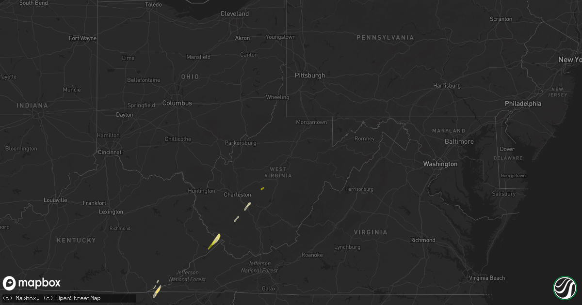
Hail Map in West Virginia on April 11, 2024
Get this storm
April 11 map
$229
one time, instant access
Download today. No call, no setup
Keep the $229
Bought the map and want the full workflow? Apply the entire $229 to a subscription within 7 days. None of it is wasted.
Every map, not just this one
This buys you this map. Subscription and you get every map we run, in the markets you choose from a few cities to whole states to nationwide. Plus real-time alerts the moment a storm fires.
Contact data
Name, contact info, occupancy, even credit band for addresses in the footprint. You go from where it hit to who to call.
Become the source they trust
Unlimited branding weather history reports on demand. You already have the documented answer ready for the property owner, and you are the one who showed up with it.
Property data and RoofTrace estimates
Pull up any address you have got, its value and the exact code rules for that jurisdiction, straight from One Click Code. Then RoofTrace estimates the squares, pitch, and roof value, priced the way you price.
Storm reports in West Virginia
West Virginia
| Date | Description |
|---|---|
| 04/11/20246:00 PM CDT | Mcdowell county 911 center reported tree down on hartwell cemetery rd in berwind resulting power outages in the area. |
| 04/11/20245:28 PM CDT | Two trees down on cr 40 between nebo and floe. Time estimated from radar. |
| 04/11/20245:26 PM CDT | Corrects time of previous tstm wnd dmg report from 6 nne clay. Two or three trees down on cr 46 in the ivydale area. Time estimated from radar. |
| 04/11/20245:15 PM CDT | A tree fell and hit a gas well in the 4900 block of big flint rd in west union. Report provided by doddridge county 911. |
| 04/11/20245:12 PM CDT | Local utility company reported power outages from fallen trees on nicholas rd off of clay maysel rd just west of clay... Wv. Time estimated by radar. |
| 04/11/20245:06 PM CDT | Local utility company reported power outages from fallen trees on pisgah ridge road in clay county. |
| 04/11/20244:45 PM CDT | Local utility company reported power outages from fallen trees on ranchland lane. Time estimated via radar. |
| 04/11/20244:26 PM CDT | Two or three trees down on cr 46 in the ivydale area. Time estimated from radar. |
| 04/11/20244:24 PM CDT | Fayette county 911 center reported a tree down in smithers on midland trail. Time estimated by radar. |
| 04/11/20244:20 PM CDT | Raleigh county 911 advised they had reports of a tree down blocking a lane on market rd near pinewood dr. Time estimated via radar. |
| 04/11/20244:20 PM CDT | Large tree down in the 600 block of range rd in harper... Wv. Report provided by raleigh county 911 center. Time estimated via radar. |
| 04/11/20244:16 PM CDT | Several trees down... Time estimated from radar. |
| 04/11/20244:15 PM CDT | Raleigh county 911 center advised that a tree is down in the 500 block of lake stephens rd near surveyor... Wv. Road is impassable. Time estimated via radar. |
| 04/11/20244:15 PM CDT | Raleigh county 911 advised that there are three large trees down on top of power lines. This is around the 9000 block of clear fork rd in dorothy... Wv near kostas ln. |
| 04/11/20244:15 PM CDT | Boone county 911 reported a tree down along blue pennant rd in whitesville... Wv. Time estimated from radar. |
| 04/11/20244:15 PM CDT | Boone county 911 center reported tree down involving phone/internet lines on ashford nellis rd in ashford... Wv. Time estimated via radar. |
| 04/11/20244:00 PM CDT | Boone county 911 center reported tree down in the area of rt. 85 and old river rd in madison... Wv. Time estimated by radar. |
| 04/11/20244:00 PM CDT | Boone county 911 had reports of a tree down blocking spruce laurel rd in clothier... Wv. |
| 04/11/20243:46 PM CDT | Upshur county 911 center reported a pine tree about 12 to 15 inches in diameter blocking shawnee dr near apartment buildings. |
| 04/11/20243:08 PM CDT | Mingo county 911 center received reports of a tree down blocking a lane of travel on coon branch rd in gilbert... Wv. Time estimated via radar. |
| 04/11/20242:54 PM CDT | Tree down... Time estimated from radar. |
| 04/11/20242:50 PM CDT | Multiple trees down near the west virginia and kentucky state line. |
All States Impacted by Hail Map on April 11, 2024
Cities Impacted by Hail Map on April 11, 2024
- Cedar Key, FL
- Saint Augustine, FL
- Clearwater Beach, FL
- Tampa, FL
- Mouthcard, KY
- Lick Creek, KY
- Fedscreek, KY
- Steele, KY
- Kimper, KY
- Phelps, KY
- Freeburn, KY
- Majestic, KY
- Matewan, WV
- Delbarton, WV
- Stopover, KY
- Madisonville, TN
- Vonore, TN
- Seth, WV
- Bim, WV
- Twilight, WV
- Wharton, WV
- Gallagher, WV
- Hansford, WV
- Eskdale, WV
- Montgomery, WV
- Cedar Grove, WV
- Handley, WV
- London, WV
- Clay, WV
- Ronda, NC
- Roaring River, NC
- Wilkesboro, NC
- Moravian Falls, NC
- North Wilkesboro, NC
- Bishop, TX
- Odem, TX
- Taft, TX
- Sinton, TX
- Kingsville, TX
- Ewing, VA
- Rose Hill, VA
- Wallins Creek, KY
- Tazewell, TN
- Harrogate, TN
- Harlan, KY
- Miracle, KY
- Mount Ulla, NC
- Callands, VA


