Hail Map on April 11, 2024
Get this storm
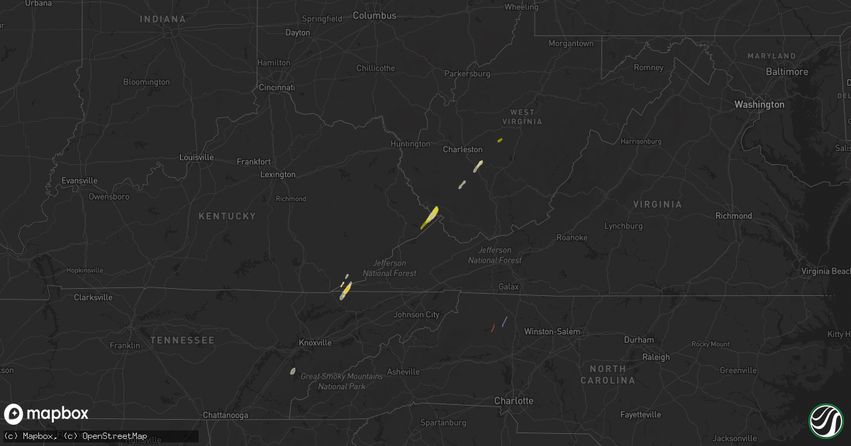
April 11 map
$229
one time, instant access
Download today. No call, no setup
Keep the $229
Bought the map and want the full workflow? Apply the entire $229 to a subscription within 7 days. None of it is wasted.
Every map, not just this one
This buys you this map. Subscription and you get every map we run, in the markets you choose from a few cities to whole states to nationwide. Plus real-time alerts the moment a storm fires.
Contact data
Name, contact info, occupancy, even credit band for addresses in the footprint. You go from where it hit to who to call.
Become the source they trust
Unlimited branding weather history reports on demand. You already have the documented answer ready for the property owner, and you are the one who showed up with it.
Property data and RoofTrace estimates
Pull up any address you have got, its value and the exact code rules for that jurisdiction, straight from One Click Code. Then RoofTrace estimates the squares, pitch, and roof value, priced the way you price.
States Impacted by Hail Map on April 11, 2024
Storm reports
North Carolina
| Date | Description |
|---|---|
| 04/11/20246:54 PM CDT | Numerous trees and power lines downed in a swath extending from harrisburg to the northeast of concord. |
| 04/11/20246:52 PM CDT | The tornado touched down just off of nc highway 801 in mount ulla at approximately 7:52 pm on april 11th... 2024 based on radar data via charlotte terminal doppler rada |
| 04/11/20246:49 PM CDT | Extensive damage to roof of mt. Ulla elementary school. |
| 04/11/20246:49 PM CDT | Trees down and wind damage to home. |
| 04/11/20246:42 PM CDT | A few trees blown down by thunderstorm winds in and around state road. A few trees downed across surry county... As well. |
| 04/11/20246:40 PM CDT | Tree on a structure on buckingham ln. |
| 04/11/20246:38 PM CDT | Social media report of a tree down along hwy 901 near i-77. |
| 04/11/20246:33 PM CDT | Thunderstorm winds blew down several trees down near rena road. |
| 04/11/20246:29 PM CDT | Power lines blown down by thunderstorms winds on hillcrest street. |
| 04/11/20246:21 PM CDT | Tree on a structure on chestnut st. |
| 04/11/20246:13 PM CDT | Trees blocking roadway on sulphur springs road. |
| 04/11/20246:12 PM CDT | Daniels lumber road impassable due to multiple trees and powerlines down on roadway. |
| 04/11/20246:10 PM CDT | Numerous trees downed around moravian falls. |
| 04/11/20246:05 PM CDT | A swath of trees down around cub creek church road. Possible tornado. |
| 04/11/20246:02 PM CDT | Powerlines down on daniels lumber rd. |
| 04/11/20245:55 PM CDT | Large limbs down on home on three forks church rd. |
| 04/11/20245:49 PM CDT | Measured by davis weather station at intersection of hwy 127 and devil track rd. Penny size hail also observed. |
| 04/11/20245:48 PM CDT | Thunderstorm winds blew a tree down on a house on james street. Possible tornado. |
| 04/11/20245:48 PM CDT | Winds damaged an apartment complex on oak hill road. Possible tornado. |
| 04/11/20245:48 PM CDT | Two churches damaged by thunderstorm winds. Possible tornado. |
| 04/11/20245:47 PM CDT | Power poles broken. |
| 04/11/20245:47 PM CDT | Swath of trees down near rose glen village. Possible tornado. |
| 04/11/20245:45 PM CDT | Nws survey confirms ef-1 tornado moved two miles north-northeast from this location ending at 36.15n/81.16w at 648 pm edt. The path width was 300 yards. Estimated peak |
| 04/11/20245:36 PM CDT | Multiple social media reports of trees down in a swath along hwy 18 between lenoir and boomer including the communities of kings creek and cedar rock. |
| 04/11/20245:35 PM CDT | Pictures of multiple trees down on h t road. |
| 04/11/20245:11 PM CDT | Tree on a house on george hildebran dr. Confirmed no injuries. |
| 04/11/20245:10 PM CDT | Trees and powerlines down on ronnie fox rd. |
| 04/11/20244:57 PM CDT | Trees down on shuffler road. |
| 04/10/202410:45 PM CDT | Powerlines downed along mexico road at nc-32... Virginia road. |
| 04/10/20249:30 PM CDT | Trees down across the road. |
| 04/10/20248:45 PM CDT | Tree and power line down on nc highway 700 nearly causing an accident. |
| 04/10/20248:15 PM CDT | Tree down blocking both lanes of traffic on sparrow rd in randleman... Nc. |
| 04/10/20248:12 PM CDT | Multiple trees reported down on battleground avenue north of greensboro... Nc. |
| 04/10/20248:00 PM CDT | One tree was reported down at the intersection of tarry church road and hwy 24/27. |
| 04/10/20248:00 PM CDT | The rockingham county 911 center reported that around 12 trees were down across the county during the 9:00 to 9:45 pm time frame crossing the entire county from west to |
| 04/10/20247:50 PM CDT | Report of tree down blocking jackson creed road near denton... Nc. |
| 04/10/20247:48 PM CDT | Tree down across double lanes of traffic on jackson creek rd... In denton. |
| 04/10/20247:40 PM CDT | Trees reported down in pfafftown. |
| 04/10/20247:37 PM CDT | Thunderstorm winds blew down a tree on tilley road. |
| 04/10/20247:36 PM CDT | Thunderstorm winds blew down a tree on sheppard mill road. |
| 04/10/20247:35 PM CDT | Multiple reports of trees and wired down in and around lexington... Nc. |
| 04/10/20247:32 PM CDT | Thunderstorm winds blew down a tree at the 3200 block of nc 89 highway w. |
| 04/10/20247:28 PM CDT | Trees reported down in lewisville... Nc. |
| 04/10/20247:23 PM CDT | Multiple trees reported down on ansonville polkton road. |
| 04/10/20247:22 PM CDT | Multiple trees reported down on mount vernon road. |
| 04/10/20247:20 PM CDT | Multiple trees reported down in tobaccoville... Nc. |
| 04/10/20247:18 PM CDT | Trees down on powerlines and transformer resulting in brush fire. |
| 04/10/20247:18 PM CDT | Trees down on beagle club rd. |
| 04/10/20247:18 PM CDT | Multiple trees down on cars. No injuries reported. |
| 04/10/20247:18 PM CDT | Powerlines down on roadway. |
| 04/10/20247:17 PM CDT | Power lines down at the intersection of ring road and nc highway 89 w. |
Kentucky
| Date | Description |
|---|---|
| 04/11/20243:50 PM CDT | Magoffin county highway garage reported a tree down between mm 1 and 2 on ky-867. Time estimated from radar. |
| 04/11/20242:50 PM CDT | Pike county highway garage reported several trees down along ky-2059 between mm 6 and 7. Time estimated from radar. |
| 04/11/20242:42 PM CDT | Pike county highway garage reported several trees down along ky-194 between mm 55 and 56. Time estimated from radar. |
| 04/11/20242:35 PM CDT | Pike county highway garage reported several trees down along ky-194 between mm 44 and 47. Time estimated from radar. |
Virginia
| Date | Description |
|---|---|
| 04/11/20246:49 PM CDT | Thunderstorm winds blew down several road signs into vehicles... Took a canopy off a gas station... Knocked down at least two power poles. |
| 04/11/20246:49 PM CDT | Thunderstorm winds downed trees along old galax pike... And also caused damage to at least one small barn. |
| 04/11/20245:00 PM CDT | Tree down in the 2100 block of tumbling creek road... In the far northwest corner of smyth county. The tree was blocking the entire roadway. |
| 04/11/20242:20 PM CDT | Social media photo showing hailstone larger than a quarter. Time estimated from radar. |
| 04/10/202411:55 PM CDT | Tree down on pepmeir hill rd near corbin. Time estimated. |
| 04/10/202411:26 PM CDT | A few trees down between midlothian and bon air. |
| 04/10/202411:25 PM CDT | Minor structural damage including a damaged shed along moses grandy trail. |
| 04/10/202411:00 PM CDT | Tree down on pridesville road northwest of amelia courthouse. Time estimated. |
| 04/10/202411:00 PM CDT | Several trees blew down near orange... Including on south almond street and along va-20 constitution highway. |
| 04/10/202410:52 PM CDT | Tree down on boydton plank road. Time estimated from radar data. |
| 04/10/202410:45 PM CDT | Trees down on duval road. Time estimated from radar data. |
| 04/10/202410:40 PM CDT | Numerous trees snapped and uprooted along cosby rd damaging outbuildings and fencing. |
| 04/10/202410:07 PM CDT | Tree down across highway. Commercial power is out at the 911 center. |
| 04/10/202410:07 PM CDT | Tree down. Time estimated from radar. |
| 04/10/202410:00 PM CDT | Numerous trees down and snapped at the kinderton country club. Winds estimated around 80 mph based on damage. |
| 04/10/20249:54 PM CDT | Tree down on spruce drive near railroad lane in the pamplin area. |
| 04/10/20249:45 PM CDT | Tree down in the 10700 block of stonewall road near appomattox... Or on stonewall road between mill pond road and meadow drive. |
| 04/10/20249:45 PM CDT | Tree down in the 5400 block of stage road in the concord area. |
| 04/10/20249:40 PM CDT | Several tress and wires blew down near shipman... Including on va-56 james river road... Va-639 craigtown road... And va-655 variety mills road. |
| 04/10/20249:30 PM CDT | 40-50 trees down in a concentrated area in the 1800 block of rocky mountain road near forest... Va. Multiple power lines down and roads blocked. Power out in the area. |
| 04/10/20249:29 PM CDT | Tree down on roadway. |
| 04/10/20249:24 PM CDT | Trees down across u.s. Highway 221 near its intersection with centerville road between bedford and forest. |
| 04/10/20249:18 PM CDT | Tree down across the road in the 800 block of r & l smith drive in danville. |
| 04/10/20249:15 PM CDT | Tree down on phoebe road in the 5400 block near its intersection with richmond highway. |
| 04/10/20249:15 PM CDT | Tree down across irish road blocking the road in the chatham area. |
| 04/10/20249:14 PM CDT | Several trees down across cascade road in the 8400 block. Several trees were blocking the road. |
| 04/10/20249:13 PM CDT | Power line down in the 200 block of davis road in the chatham area. |
| 04/10/20249:00 PM CDT | Multiple trees down on strawberry road near strawberry creek. |
| 04/10/20249:00 PM CDT | Tree down on a house in the 100 block of charlotte street in danville. |
| 04/10/20248:57 PM CDT | Tree down across the road in the 4700 block of berry hill road... Danville va. |
| 04/10/20248:56 PM CDT | Tree down across r & l smith drive near its intersection with big sky road and hunting hills road. |
| 04/10/20248:50 PM CDT | Tree down in the 2600 block of dillons fork road. |
| 04/10/20248:47 PM CDT | Power poles broken. |
| 04/10/20248:47 PM CDT | A local report indicates 68 MPH wind near 4 N Keeling |
| 04/10/20248:41 PM CDT | Power lines down at the intersection of round hill road and clarendon avenue nw in roanoke. |
| 04/10/20248:40 PM CDT | Large tree blocking the tunnel on witt road. |
| 04/10/20248:37 PM CDT | Tree and powerlines down on hunting hills rd. |
| 04/10/20248:31 PM CDT | At least one tree blown down by thunderstorm winds. |
| 04/10/20248:30 PM CDT | Tree down in the 2820 block of dillons fork road in the fieldale area. |
| 04/10/20248:29 PM CDT | Trees and power lines were down across dillons fork road at valley drive in the fieldale area blocking both lanes of the road. |
| 04/10/20248:27 PM CDT | Nws survey confirms ef-1 touched down 2 miles north-northwest of swansonville at 9:27 pm and trcked northeast to 3 miles north of swansonville. The tornado path length |
| 04/10/20248:24 PM CDT | Tree down near the entrance to the industrial park at the intersection of barrows mill road and nautica way in martinsville. |
| 04/10/20248:17 PM CDT | Tree down in the 2400 block of philpott drive in the bassett area. |
| 04/10/20248:12 PM CDT | At least one tree blown down by thunderstorm winds near glade hill. |
| 04/10/20248:11 PM CDT | Tree downed by thunderstorm winds... Blocking both lanes of barker road. |
| 04/10/20248:05 PM CDT | Tree downed by thunderstorm winds on middle creek road. |
| 04/10/20248:02 PM CDT | Thunderstorm winds blew down a tree across u.s. 220. |
| 04/10/20247:58 PM CDT | Two trees and power lines down in the 2800 block of dillons fork road in the fieldale area. |
| 04/10/20247:55 PM CDT | At least one tree blown down by thunderstorm winds near callaway. |
| 04/10/20247:54 PM CDT | Tree downed by thunderstorm winds... Blocking the entire road. |
| 04/10/20247:52 PM CDT | Tree downed by thunderstorm winds blocking applegate road. |
| 04/10/20247:52 PM CDT | Tree downed by thunderstorm winds on oak level road. |
| 04/10/20247:50 PM CDT | Tree downed by thunderstorm winds blocking both lanes of pine valley drive. |
| 04/10/20247:50 PM CDT | Tree downed by thunderstorm winds... Blocking both sides of philpott drive. |
| 04/10/20247:49 PM CDT | Tree downed by thunderstorm winds on old d and w road... Blocking one lane of traffic. |
| 04/10/20247:47 PM CDT | Tree downed by thunderstorm winds... Partially blocking rockford road. |
| 04/10/20247:47 PM CDT | Tree downed by thunderstorm winds near the intersection of smith road and jarrett drive. |
| 04/10/20247:47 PM CDT | Tree downed by thunderstorm winds blocking one lane on sunset drive. |
| 04/10/20247:46 PM CDT | Trees downed by thunderstorm winds onto power and telephone lines on stultz road. |
| 04/10/20247:30 PM CDT | Powerlines down on diamond hill road near goodview road. |
| 04/10/20247:30 PM CDT | Minor tree damage and a power line down on pole ridge road in the eastern part of patrick county va. |
| 04/10/20247:00 PM CDT | Thunderstorm winds blew the roof off a single-wide trailer home on turner spur road just east of fancy gap. |
West Virginia
| Date | Description |
|---|---|
| 04/11/20246:00 PM CDT | Mcdowell county 911 center reported tree down on hartwell cemetery rd in berwind resulting power outages in the area. |
| 04/11/20245:28 PM CDT | Two trees down on cr 40 between nebo and floe. Time estimated from radar. |
| 04/11/20245:26 PM CDT | Corrects time of previous tstm wnd dmg report from 6 nne clay. Two or three trees down on cr 46 in the ivydale area. Time estimated from radar. |
| 04/11/20245:15 PM CDT | A tree fell and hit a gas well in the 4900 block of big flint rd in west union. Report provided by doddridge county 911. |
| 04/11/20245:12 PM CDT | Local utility company reported power outages from fallen trees on nicholas rd off of clay maysel rd just west of clay... Wv. Time estimated by radar. |
| 04/11/20245:06 PM CDT | Local utility company reported power outages from fallen trees on pisgah ridge road in clay county. |
| 04/11/20244:45 PM CDT | Local utility company reported power outages from fallen trees on ranchland lane. Time estimated via radar. |
| 04/11/20244:26 PM CDT | Two or three trees down on cr 46 in the ivydale area. Time estimated from radar. |
| 04/11/20244:24 PM CDT | Fayette county 911 center reported a tree down in smithers on midland trail. Time estimated by radar. |
| 04/11/20244:20 PM CDT | Raleigh county 911 advised they had reports of a tree down blocking a lane on market rd near pinewood dr. Time estimated via radar. |
| 04/11/20244:20 PM CDT | Large tree down in the 600 block of range rd in harper... Wv. Report provided by raleigh county 911 center. Time estimated via radar. |
| 04/11/20244:16 PM CDT | Several trees down... Time estimated from radar. |
| 04/11/20244:15 PM CDT | Raleigh county 911 advised that there are three large trees down on top of power lines. This is around the 9000 block of clear fork rd in dorothy... Wv near kostas ln. |
| 04/11/20244:15 PM CDT | Raleigh county 911 center advised that a tree is down in the 500 block of lake stephens rd near surveyor... Wv. Road is impassable. Time estimated via radar. |
| 04/11/20244:15 PM CDT | Boone county 911 reported a tree down along blue pennant rd in whitesville... Wv. Time estimated from radar. |
| 04/11/20244:15 PM CDT | Boone county 911 center reported tree down involving phone/internet lines on ashford nellis rd in ashford... Wv. Time estimated via radar. |
| 04/11/20244:00 PM CDT | Boone county 911 center reported tree down in the area of rt. 85 and old river rd in madison... Wv. Time estimated by radar. |
| 04/11/20244:00 PM CDT | Boone county 911 had reports of a tree down blocking spruce laurel rd in clothier... Wv. |
| 04/11/20243:46 PM CDT | Upshur county 911 center reported a pine tree about 12 to 15 inches in diameter blocking shawnee dr near apartment buildings. |
| 04/11/20243:08 PM CDT | Mingo county 911 center received reports of a tree down blocking a lane of travel on coon branch rd in gilbert... Wv. Time estimated via radar. |
| 04/11/20242:54 PM CDT | Tree down... Time estimated from radar. |
| 04/11/20242:50 PM CDT | Multiple trees down near the west virginia and kentucky state line. |
Maryland
| Date | Description |
|---|---|
| 04/11/202412:57 AM CDT | Several power lines and trees down at the intersection of chancellors rd and horsehead rd. |
Florida
| Date | Description |
|---|---|
| 04/11/202412:40 PM CDT | Delayed report of 2 trees down in crescent city on route 17. Time estimated by radar. |
| 04/11/202412:05 PM CDT | Delayed report. Emergency management reported two trees down. One on freemont turn and another on frontier drive. Time estimated by radar. |
| 04/11/202412:00 PM CDT | Mesonet station 1829w fswn tampa international airport. |
| 04/11/202411:40 AM CDT | Branch fell on a car just south of junction road and east of us 17. Time estimated by radar. |
| 04/11/202411:40 AM CDT | Corrects previous tstm wnd dmg report from 1 sse crescent city. Delayed report of 2 trees down in crescent city on route 17. Time estimated by radar. |
| 04/11/202410:37 AM CDT | *** 1 inj *** nws damage survey results concluded that began along county road 13 and extended across portions of the trailmark and samara lakes neighborhoods in wester |
| 04/11/20249:38 AM CDT | Nassau county emergency management reports a powerline downed by strong winds across buccaneer trail near mcarthur estates. Time of damage based on radar data. |
| 04/11/20248:54 AM CDT | Tree down near hwy 19 and cr326 near gulf hammock. |
| 04/11/20248:40 AM CDT | Mesonet station 1057w 0.8 se cedar key |
| 04/11/20248:19 AM CDT | Trees and power lines down across the road. |
| 04/11/20247:25 AM CDT | Fallen trees or limbs resulted in a power outage. |
Tennessee
| Date | Description |
|---|---|
| 04/11/20244:06 PM CDT | A few trees down. |
| 04/11/20243:40 PM CDT | Few trees down. |
| 04/11/20243:25 PM CDT | Report from mping: quarter |
Ohio
| Date | Description |
|---|---|
| 04/11/20243:15 PM CDT | Lawrence co ohio 911 center advised there is a tree down completely blocking county rd 7 around the 300 block. |
Cities Impacted by Hail Map on April 11, 2024
- Cedar Key, FL
- Saint Augustine, FL
- Clearwater Beach, FL
- Tampa, FL
- Mouthcard, KY
- Lick Creek, KY
- Fedscreek, KY
- Steele, KY
- Kimper, KY
- Phelps, KY
- Freeburn, KY
- Majestic, KY
- Matewan, WV
- Delbarton, WV
- Stopover, KY
- Madisonville, TN
- Vonore, TN
- Seth, WV
- Bim, WV
- Twilight, WV
- Wharton, WV
- Gallagher, WV
- Hansford, WV
- Eskdale, WV
- Montgomery, WV
- Cedar Grove, WV
- Handley, WV
- London, WV
- Clay, WV
- Ronda, NC
- Roaring River, NC
- Wilkesboro, NC
- Moravian Falls, NC
- North Wilkesboro, NC
- Bishop, TX
- Odem, TX
- Taft, TX
- Sinton, TX
- Kingsville, TX
- Ewing, VA
- Rose Hill, VA
- Wallins Creek, KY
- Tazewell, TN
- Harrogate, TN
- Harlan, KY
- Miracle, KY
- Mount Ulla, NC
- Callands, VA