Hail Map in North Carolina on April 11, 2024
Get this storm
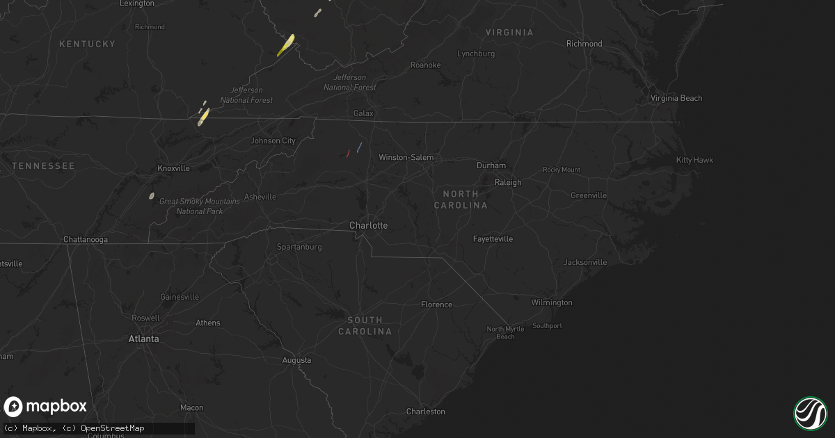
April 11 map
$229
one time, instant access
Download today. No call, no setup
Keep the $229
Bought the map and want the full workflow? Apply the entire $229 to a subscription within 7 days. None of it is wasted.
Every map, not just this one
This buys you this map. Subscription and you get every map we run, in the markets you choose from a few cities to whole states to nationwide. Plus real-time alerts the moment a storm fires.
Contact data
Name, contact info, occupancy, even credit band for addresses in the footprint. You go from where it hit to who to call.
Become the source they trust
Unlimited branding weather history reports on demand. You already have the documented answer ready for the property owner, and you are the one who showed up with it.
Property data and RoofTrace estimates
Pull up any address you have got, its value and the exact code rules for that jurisdiction, straight from One Click Code. Then RoofTrace estimates the squares, pitch, and roof value, priced the way you price.
Storm reports in North Carolina
North Carolina
| Date | Description |
|---|---|
| 04/11/20246:54 PM CDT | Numerous trees and power lines downed in a swath extending from harrisburg to the northeast of concord. |
| 04/11/20246:52 PM CDT | The tornado touched down just off of nc highway 801 in mount ulla at approximately 7:52 pm on april 11th... 2024 based on radar data via charlotte terminal doppler rada |
| 04/11/20246:49 PM CDT | Extensive damage to roof of mt. Ulla elementary school. |
| 04/11/20246:49 PM CDT | Trees down and wind damage to home. |
| 04/11/20246:42 PM CDT | A few trees blown down by thunderstorm winds in and around state road. A few trees downed across surry county... As well. |
| 04/11/20246:40 PM CDT | Tree on a structure on buckingham ln. |
| 04/11/20246:38 PM CDT | Social media report of a tree down along hwy 901 near i-77. |
| 04/11/20246:33 PM CDT | Thunderstorm winds blew down several trees down near rena road. |
| 04/11/20246:29 PM CDT | Power lines blown down by thunderstorms winds on hillcrest street. |
| 04/11/20246:21 PM CDT | Tree on a structure on chestnut st. |
| 04/11/20246:13 PM CDT | Trees blocking roadway on sulphur springs road. |
| 04/11/20246:12 PM CDT | Daniels lumber road impassable due to multiple trees and powerlines down on roadway. |
| 04/11/20246:10 PM CDT | Numerous trees downed around moravian falls. |
| 04/11/20246:05 PM CDT | A swath of trees down around cub creek church road. Possible tornado. |
| 04/11/20246:02 PM CDT | Powerlines down on daniels lumber rd. |
| 04/11/20245:55 PM CDT | Large limbs down on home on three forks church rd. |
| 04/11/20245:49 PM CDT | Measured by davis weather station at intersection of hwy 127 and devil track rd. Penny size hail also observed. |
| 04/11/20245:48 PM CDT | Two churches damaged by thunderstorm winds. Possible tornado. |
| 04/11/20245:48 PM CDT | Winds damaged an apartment complex on oak hill road. Possible tornado. |
| 04/11/20245:48 PM CDT | Thunderstorm winds blew a tree down on a house on james street. Possible tornado. |
| 04/11/20245:47 PM CDT | Swath of trees down near rose glen village. Possible tornado. |
| 04/11/20245:47 PM CDT | Power poles broken. |
| 04/11/20245:45 PM CDT | Nws survey confirms ef-1 tornado moved two miles north-northeast from this location ending at 36.15n/81.16w at 648 pm edt. The path width was 300 yards. Estimated peak |
| 04/11/20245:36 PM CDT | Multiple social media reports of trees down in a swath along hwy 18 between lenoir and boomer including the communities of kings creek and cedar rock. |
| 04/11/20245:35 PM CDT | Pictures of multiple trees down on h t road. |
| 04/11/20245:11 PM CDT | Tree on a house on george hildebran dr. Confirmed no injuries. |
| 04/11/20245:10 PM CDT | Trees and powerlines down on ronnie fox rd. |
| 04/11/20244:57 PM CDT | Trees down on shuffler road. |
| 04/10/202410:45 PM CDT | Powerlines downed along mexico road at nc-32... Virginia road. |
| 04/10/20249:30 PM CDT | Trees down across the road. |
| 04/10/20248:45 PM CDT | Tree and power line down on nc highway 700 nearly causing an accident. |
| 04/10/20248:15 PM CDT | Tree down blocking both lanes of traffic on sparrow rd in randleman... Nc. |
| 04/10/20248:12 PM CDT | Multiple trees reported down on battleground avenue north of greensboro... Nc. |
| 04/10/20248:00 PM CDT | One tree was reported down at the intersection of tarry church road and hwy 24/27. |
| 04/10/20248:00 PM CDT | The rockingham county 911 center reported that around 12 trees were down across the county during the 9:00 to 9:45 pm time frame crossing the entire county from west to |
| 04/10/20247:50 PM CDT | Report of tree down blocking jackson creed road near denton... Nc. |
| 04/10/20247:48 PM CDT | Tree down across double lanes of traffic on jackson creek rd... In denton. |
| 04/10/20247:40 PM CDT | Trees reported down in pfafftown. |
| 04/10/20247:37 PM CDT | Thunderstorm winds blew down a tree on tilley road. |
| 04/10/20247:36 PM CDT | Thunderstorm winds blew down a tree on sheppard mill road. |
| 04/10/20247:35 PM CDT | Multiple reports of trees and wired down in and around lexington... Nc. |
| 04/10/20247:32 PM CDT | Thunderstorm winds blew down a tree at the 3200 block of nc 89 highway w. |
| 04/10/20247:28 PM CDT | Trees reported down in lewisville... Nc. |
| 04/10/20247:23 PM CDT | Multiple trees reported down on ansonville polkton road. |
| 04/10/20247:22 PM CDT | Multiple trees reported down on mount vernon road. |
| 04/10/20247:20 PM CDT | Multiple trees reported down in tobaccoville... Nc. |
| 04/10/20247:18 PM CDT | Powerlines down on roadway. |
| 04/10/20247:18 PM CDT | Multiple trees down on cars. No injuries reported. |
| 04/10/20247:18 PM CDT | Trees down on beagle club rd. |
| 04/10/20247:18 PM CDT | Trees down on powerlines and transformer resulting in brush fire. |
| 04/10/20247:17 PM CDT | Power lines down at the intersection of ring road and nc highway 89 w. |
All States Impacted by Hail Map on April 11, 2024
Cities Impacted by Hail Map on April 11, 2024
- Cedar Key, FL
- Saint Augustine, FL
- Clearwater Beach, FL
- Tampa, FL
- Mouthcard, KY
- Lick Creek, KY
- Fedscreek, KY
- Steele, KY
- Kimper, KY
- Phelps, KY
- Freeburn, KY
- Majestic, KY
- Matewan, WV
- Delbarton, WV
- Stopover, KY
- Madisonville, TN
- Vonore, TN
- Seth, WV
- Bim, WV
- Twilight, WV
- Wharton, WV
- Gallagher, WV
- Hansford, WV
- Eskdale, WV
- Montgomery, WV
- Cedar Grove, WV
- Handley, WV
- London, WV
- Clay, WV
- Ronda, NC
- Roaring River, NC
- Wilkesboro, NC
- Moravian Falls, NC
- North Wilkesboro, NC
- Bishop, TX
- Odem, TX
- Taft, TX
- Sinton, TX
- Kingsville, TX
- Ewing, VA
- Rose Hill, VA
- Wallins Creek, KY
- Tazewell, TN
- Harrogate, TN
- Harlan, KY
- Miracle, KY
- Mount Ulla, NC
- Callands, VA


