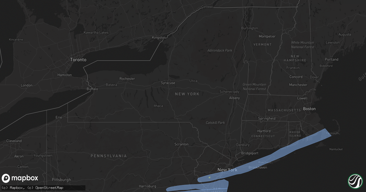
Hail Map in New York on April 9, 2020
Get this storm
April 9 map
$229
one time, instant access
Download today. No call, no setup
Keep the $229
Bought the map and want the full workflow? Apply the entire $229 to a subscription within 7 days. None of it is wasted.
Every map, not just this one
This buys you this map. Subscription and you get every map we run, in the markets you choose from a few cities to whole states to nationwide. Plus real-time alerts the moment a storm fires.
Contact data
Name, contact info, occupancy, even credit band for addresses in the footprint. You go from where it hit to who to call.
Become the source they trust
Unlimited branding weather history reports on demand. You already have the documented answer ready for the property owner, and you are the one who showed up with it.
Property data and RoofTrace estimates
Pull up any address you have got, its value and the exact code rules for that jurisdiction, straight from One Click Code. Then RoofTrace estimates the squares, pitch, and roof value, priced the way you price.
Storm reports in New York
New York
| Date | Description |
|---|---|
| 04/09/20201:24 PM CDT | Office of emergency management reports power lines down in wantagh... Ny along oakland ave. Time estimated by radar. |
| 04/09/202012:54 PM CDT | Mariners harbor mesonet |
| 04/08/202010:07 PM CDT | At 306 PM EDT, severe thunderstorms were located along a line extending from Waterford to 12 miles south of Mastic Beach, moving east at 70 mph. HAZARD...60 mph wind gusts. SOURCE...Radar indicated. IMPACT...Expect damage to trees and power lines. These severe thunderstorms will remain over mainly rural areas of central Suffolk County. |
| 04/08/20209:15 PM CDT | At 215 PM EDT, severe thunderstorms were located along a line extending from near Oyster Bay to Manasquan, moving east at 55 mph. HAZARD...60 mph wind gusts and quarter size hail. SOURCE...Radar indicated. IMPACT...Minor hail damage to vehicles is possible. Expect wind damage to trees and power lines. Severe thunderstorms will be near... Oyster Bay and Glen Cove around 220 PM EDT. Huntington and Huntington Station around 225 PM EDT. Northport and Commack around 230 PM EDT. Hauppauge and Brentwood around 235 PM EDT. Stony Brook and Ronkonkoma around 240 PM EDT. Patchogue and Port Jefferson around 245 PM EDT. Middle Island and Medford around 250 PM EDT. |
| 04/08/20208:23 PM CDT | At 123 PM EDT, severe thunderstorms were located along a line extending from near Bridgewater to Pennington to Langhorne, moving east at 70 mph. HAZARD...60 mph wind gusts and penny size hail. SOURCE...Radar indicated. IMPACT...Damage to roofs, siding, trees, and power lines is possible. Locations impacted include... Trenton, New Brunswick, Perth Amboy, Long Branch, Asbury Park, Somerville, Sandy Hook, Somerset, Edison, Middletown, Old Bridge, Howell, East Brunswick, Bridgewater, South Brunswick, Sayreville, North Brunswick, Marlboro, Manalapan and Ewing.People attending Covid-19 Drive through testing should seek safeshelter immediately!This includes the following highways... Garden State Parkway between mile markers 100 and 134. Interstate 195 in New Jersey between mile markers 0 and 8. Interstate 287 in New Jersey between mile markers 0 and 30. Interstate 295 in New Jersey between mile markers 60 and 76. Interstate 78 in New Jersey between mile markers 23 and 42. New Jersey Turnpike between exits 8A and 13. |
All States Impacted by Hail Map on April 9, 2020
Cities Impacted by Hail Map on April 9, 2020
- Cotulla, TX
- Big Wells, TX
- Crystal City, TX
- Lexington, TX
- San Saba, TX
- Ville Platte, LA
- Mamou, LA
- Oakdale, LA
- Pitkin, LA
- Glenmora, LA
- Houston, TX
- Humble, TX
- Crosby, TX
- Burnet, TX
- Leesville, LA
- Deridder, LA
- Valley Spring, TX
- Brady, TX
- Lohn, TX
- Rochelle, TX
- Huntsville, TX
- Willis, TX
- Conroe, TX
- Rio Grande City, TX
- Garciasville, TX
- Mission, TX
- Grulla, TX
- Bedias, TX
- Laredo, TX
- Zapata, TX
- Hebbronville, TX
- San Ygnacio, TX
- Castroville, TX
- Mico, TX
- San Antonio, TX
- Rio Medina, TX
- Hondo, TX
- Bush, LA
- Navasota, TX
- Falls City, TX
- Caldwell, TX
- Charlotte, TX
- Pleasanton, TX
- Jourdanton, TX
- Poteet, TX
- Goliad, TX
- Beeville, TX
- Kenedy, TX
- Dime Box, TX
- Oberlin, LA
- Elton, LA
- Port Barre, LA
- Opelousas, LA
- Miles, TX
- Picayune, MS
- Encinal, TX
- Asherton, TX
- Somerville, TX
- Washington, TX
- College Station, TX
- Brenham, TX
- Church Point, LA
- Eunice, LA
- Basile, LA
- Sunset, LA
- Arnaudville, LA
- Branch, LA
- Pearsall, TX
- Blanco, TX
- Kendalia, TX
- San Marcos, TX
- Spring Branch, TX
- Fischer, TX
- Wimberley, TX
- Canyon Lake, TX
- Montgomery, TX
- Spurger, TX
- Karnes City, TX
- Campbellton, TX
- Mason, TX
- Penitas, TX
- Catarina, TX
- D Hanis, TX
- Yancey, TX
- Dilley, TX
- Fredonia, TX
- Voca, TX
- Darrow, LA
- Donaldsonville, LA
- Geismar, LA
- Slidell, LA
- Boerne, TX
- Comfort, TX
- Richland Springs, TX
- Bartlett, TX
- Granger, TX
- Thorndale, TX
- Freer, TX
- Jasper, TX
- Brookeland, TX
- Iola, TX
- Fort Polk, LA
- Breaux Bridge, LA
- Grosse Tete, LA
- Saint Martinville, LA
- Maringouin, LA
- Plaquemine, LA
- Rockdale, TX
- Bryan, TX
- Chireno, TX
- Medina, TX
- White Castle, LA
- Iota, LA
- Llano, TX
- Buchanan Dam, TX
- Anderson, TX
- Lumberton, MS
- Pineland, TX
- Bronson, TX
- Hemphill, TX
- Pearl River, LA
- San Diego, TX
- Corrigan, TX
- Junction, TX
- San Augustine, TX
- Kempner, TX
- Hunt, TX
- Mountain Home, TX
- Castell, TX
- Oakhurst, TX
- Chester, TX
- Florence, TX
- Evans, LA
- Colmesneil, TX
- Cleveland, TX
- Wiergate, TX
- Kinder, LA
- Broaddus, TX
- Melvin, TX
- New Llano, LA
- Waller, TX
- Center Point, TX
- Jarrell, TX
- Dry Creek, LA
- Apple Springs, TX
- Merryville, LA
- Plantersville, TX
- Guerra, TX
- Killeen, TX
- Channelview, TX
- Highlands, TX
- Baytown, TX
- Call, TX
- Porter, TX
- Kingwood, TX
- Doss, TX
- Harper, TX
- Pontotoc, TX
- Lampasas, TX
- New Caney, TX
- Roma, TX
- Lometa, TX
- Carville, LA
- Kennard, TX
- Trinity, TX
- Burkeville, TX
- Hillsborough, NJ
- Hockley, TX
- Pinehurst, TX
- Cameron, TX
- Gause, TX
- Thrall, TX
- Buckholts, TX
- Hempstead, TX
- Splendora, TX
- Hutto, TX
- Davilla, TX
- Rogers, TX
- Snook, TX
- Liberty Hill, TX
- Taylor, TX
- Burton, TX
- Milano, TX
- Lyons, TX
- Salado, TX
- Chappell Hill, TX
- Spring, TX
- Magnolia, TX
- Georgetown, TX
- Belton, TX
- Holland, TX
- Tomball, TX
- Deer Park, TX
- La Porte, TX
- Conowingo, MD
- Newark, DE
- Wilmington, DE
- Port Deposit, MD
- Rising Sun, MD
- Elk Mills, MD
- Pennsville, NJ
- Penns Grove, NJ
- New Castle, DE
- Darlington, MD
- Colora, MD
- Elkton, MD
- Street, MD
- North East, MD
- Oxford, PA
- Garnet Valley, PA
- Voorhees, NJ
- Paulsboro, NJ
- Crum Lynne, PA
- Peach Bottom, PA
- Media, PA
- Medford, NJ
- Glendora, NJ
- Hockessin, DE
- Vincentown, NJ
- Philadelphia, PA
- Oaklyn, NJ
- Beachwood, NJ
- Cherry Hill, NJ
- Glenolden, PA
- Sharon Hill, PA
- Bridgeport, NJ
- Woodbury Heights, NJ
- Ridley Park, PA
- Gloucester City, NJ
- Bayville, NJ
- Kirkwood, PA
- Clementon, NJ
- Mickleton, NJ
- Toms River, NJ
- Folcroft, PA
- West Berlin, NJ
- Chester, PA
- Brookhaven, PA
- Swedesboro, NJ
- Somerdale, NJ
- Mount Laurel, NJ
- Folsom, PA
- Clarksboro, NJ
- Camden, NJ
- West Grove, PA
- Swarthmore, PA
- Seaside Heights, NJ
- Thorofare, NJ
- Lincoln University, PA
- Runnemede, NJ
- Woodlyn, PA
- Lanoka Harbor, NJ
- Manchester Township, NJ
- Sewell, NJ
- Pemberton, NJ
- Marlton, NJ
- National Park, NJ
- Gibbstown, NJ
- Prospect Park, PA
- Woodbury, NJ
- Chester Heights, PA
- Ocean Gate, NJ
- Magnolia, NJ
- Drumore, PA
- Island Heights, NJ
- Westville, NJ
- Bellmawr, NJ
- Stratford, NJ
- Mount Royal, NJ
- Yorklyn, DE
- Forked River, NJ
- Pine Beach, NJ
- Landenberg, PA
- Browns Mills, NJ
- Lawnside, NJ
- Chatsworth, NJ
- Holmes, PA
- Norwood, PA
- Barrington, NJ
- Avondale, PA
- Haddon Heights, NJ
- Seaside Park, NJ
- Quarryville, PA
- Mount Ephraim, NJ
- Montchanin, DE
- Glen Mills, PA
- Audubon, NJ
- Gibbsboro, NJ
- Cochranville, PA
- Claymont, DE
- Kennett Square, PA
- Morton, PA
- Toughkenamon, PA
- Aston, PA
- Mantua, NJ
- Essington, PA
- Blackwood, NJ
- Wenonah, NJ
- Rockland, DE
- Nottingham, PA
- Collingswood, NJ
- Marcus Hook, PA
- Haddonfield, NJ
- Wallingford, PA
- Chadds Ford, PA
- Conshohocken, PA
- Newtown Square, PA
- Brielle, NJ
- Strasburg, PA
- Bridgeport, PA
- Fairless Hills, PA
- Atglen, PA
- Malvern, PA
- Lancaster, PA
- Kinzers, PA
- Thorndale, PA
- Chesterfield, NJ
- Burlington, NJ
- Devon, PA
- Gladwyne, PA
- Exton, PA
- New Egypt, NJ
- Allentown, NJ
- Honey Brook, PA
- East Earl, PA
- Immaculata, PA
- Langhorne, PA
- Wayne, PA
- Leola, PA
- Smoketown, PA
- Wrightstown, NJ
- Narvon, PA
- Bradley Beach, NJ
- Manasquan, NJ
- Jackson, NJ
- Robbinsville, NJ
- Cheltenham, PA
- Oreland, PA
- Brick, NJ
- Plymouth Meeting, PA
- Lafayette Hill, PA
- Freehold, NJ
- Elverson, PA
- Glenside, PA
- Feasterville Trevose, PA
- Roebling, NJ
- Berwyn, PA
- King Of Prussia, PA
- Oaks, PA
- Bryn Mawr, PA
- Phoenixville, PA
- Sea Girt, NJ
- Willow Grove, PA
- Trenton, NJ
- Millstone Township, NJ
- Intercourse, PA
- Blue Bell, PA
- Bryn Athyn, PA
- Millersville, PA
- Bird In Hand, PA
- Christiana, PA
- Point Pleasant Beach, NJ
- Paradise, PA
- Levittown, PA
- Downingtown, PA
- Jenkintown, PA
- Avon By The Sea, NJ
- Glenmoore, PA
- Paoli, PA
- Flourtown, PA
- Morrisville, PA
- Farmingdale, NJ
- Chester Springs, PA
- Willow Street, PA
- New Holland, PA
- Elkins Park, PA
- Fort Washington, PA
- Bensalem, PA
- Allenwood, NJ
- Wyncote, PA
- Parkesburg, PA
- Howell, NJ
- Dresher, PA
- Ambler, PA
- Florence, NJ
- Bordentown, NJ
- West Chester, PA
- Spring Lake, NJ
- Coatesville, PA
- Cream Ridge, NJ
- Abington, PA
- Lakewood, NJ
- Gordonville, PA
- Huntingdon Valley, PA
- Gap, PA
- Ronks, PA
- Croydon, PA
- Belmar, NJ
- Bristol, PA
- Neptune, NJ
- Norristown, PA
- Villanova, PA
- Southampton, PA
- Columbus, NJ
- Cranbury, NJ
- Denver, PA
- Reinholds, PA
- Monmouth Beach, NJ
- Perkiomenville, PA
- Akron, PA
- Fort Monmouth, NJ
- Gwynedd, PA
- Warrington, PA
- Shrewsbury, NJ
- Marlboro, NJ
- Mohnton, PA
- Jamison, PA
- Leonardo, NJ
- Keansburg, NJ
- Fair Haven, NJ
- Monroe Township, NJ
- Matawan, NJ
- Stevens, PA
- Birdsboro, PA
- Port Monmouth, NJ
- Gilbertsville, PA
- Oakhurst, NJ
- Englishtown, NJ
- Morgantown, PA
- Ephrata, PA
- Titusville, NJ
- Princeton Junction, NJ
- Spotswood, NJ
- Little Silver, NJ
- Plainsboro, NJ
- Hatboro, PA
- Roosevelt, NJ
- Warminster, PA
- Long Branch, NJ
- Washington Crossing, PA
- Deal, NJ
- Pennington, NJ
- Princeton, NJ
- Furlong, PA
- Pottstown, PA
- Belford, NJ
- East Brunswick, NJ
- Royersford, PA
- Colts Neck, NJ
- Zieglerville, PA
- Lansdale, PA
- Middletown, NJ
- Allenhurst, NJ
- Keyport, NJ
- Holmdel, NJ
- Spring City, PA
- Souderton, PA
- Monmouth Junction, NJ
- Hazlet, NJ
- Hightstown, NJ
- Collegeville, PA
- Doylestown, PA
- Chalfont, PA
- Hatfield, PA
- Richboro, PA
- Newtown, PA
- Windsor, NJ
- Harleysville, PA
- Highlands, NJ
- Morganville, NJ
- Atlantic Highlands, NJ
- Lawrence Township, NJ
- Schwenksville, PA
- West Long Branch, NJ
- North Wales, PA
- Red Bank, NJ
- Rumson, NJ
- Asbury Park, NJ
- Eatontown, NJ
- Oceanport, NJ
- Boyertown, PA
- Horsham, PA
- Montgomeryville, PA
- Skippack, PA
- New Hope, PA
- Old Bridge, NJ
- Hilltown, PA
- Colmar, PA
- Terre Hill, PA
- Helmetta, NJ
- Line Lexington, PA
- Ocean Grove, NJ
- Douglassville, PA
- Dayton, NJ
- Lincroft, NJ
- Telford, PA
- East Setauket, NY
- North Babylon, NY
- Woodhaven, NY
- Coram, NY
- Old Bethpage, NY
- Water Mill, NY
- Northport, NY
- Pittstown, NJ
- Kew Gardens, NY
- Island Park, NY
- Middle Island, NY
- Colonia, NJ
- Edison, NJ
- Bethpage, NY
- Long Beach, NY
- West Kingston, RI
- Commack, NY
- Great River, NY
- Plymouth, MA
- Farmingdale, NY
- West Barnstable, MA
- Fresh Meadows, NY
- Iselin, NJ
- Ronkonkoma, NY
- Tiverton, RI
- Neshanic Station, NJ
- Dunellen, NJ
- Bellport, NY
- Portsmouth, RI
- Mineola, NY
- Shelter Island Heights, NY
- Manville, NJ
- North Brunswick, NJ
- Moriches, NY
- Rahway, NJ
- Brooklyn, NY
- Marstons Mills, MA
- Middletown, RI
- Mashpee, MA
- Saint James, NY
- Holtsville, NY
- Stony Brook, NY
- Cedarhurst, NY
- Garden City, NY
- Marion, MA
- Yaphank, NY
- Jamestown, RI
- Albertson, NY
- Jamaica, NY
- Hauppauge, NY
- Milltown, NJ
- Holbrook, NY
- Piscataway, NJ
- Stockton, NJ
- Clark, NJ
- Scotch Plains, NJ
- Belle Mead, NJ
- North Falmouth, MA
- Centerville, MA
- Oakland Gardens, NY
- Medford, NY
- Flushing, NY
- South Bound Brook, NJ
- Far Rockaway, NY
- Lynbrook, NY
- Roslyn Heights, NY
- Huntington Station, NY
- Jericho, NY
- Woodbridge, NJ
- Cutchogue, NY
- Manhasset, NY
- Middle Village, NY
- Acushnet, MA
- Brightwaters, NY
- Calverton, NY
- Kendall Park, NJ
- Port Jefferson Station, NY
- Raritan, NJ
- Stonington, CT
- Little Compton, RI
- Inwood, NY
- Wyandanch, NY
- Lawrence, NY
- Mattituck, NY
- Oakdale, NY
- East Marion, NY
- Cotuit, MA
- Avenel, NJ
- Mastic, NY
- Westerly, RI
- Bay Shore, NY
- Fairhaven, MA
- Roosevelt, NY
- Orient, NY
- North Dartmouth, MA
- Massapequa, NY
- Oceanside, NY
- Cataumet, MA
- Cold Spring Harbor, NY
- West Hempstead, NY
- Queens Village, NY
- Farmingville, NY
- Westfield, NJ
- Howard Beach, NY
- Syosset, NY
- Metuchen, NJ
- Sagamore Beach, MA
- Glen Oaks, NY
- Mount Sinai, NY
- Hempstead, NY
- Wantagh, NY
- Center Moriches, NY
- Islandia, NY
- Pipersville, PA
- Freeport, NY
- Wading River, NY
- East Islip, NY
- Skillman, NJ
- Sayreville, NJ
- Cambria Heights, NY
- Kingston, RI
- Fishers Island, NY
- Smithtown, NY
- East Sandwich, MA
- New Hyde Park, NY
- Hicksville, NY
- Baldwin, NY
- Southampton, NY
- Greenport, NY
- Keasbey, NJ
- Charlestown, RI
- Woodmere, NY
- Central Islip, NY
- Pocasset, MA
- Ozone Park, NY
- Onset, MA
- Levittown, NY
- Westport, MA
- Atlantic Beach, NY
- Fords, NJ
- Rockville Centre, NY
- Malverne, NY
- Nesconset, NY
- Rockaway Park, NY
- Saint Albans, NY
- Hampton Bays, NY
- Laurel, NY
- Woods Hole, MA
- East Wareham, MA
- Whitehouse Station, NJ
- Elizabeth, NJ
- South Amboy, NJ
- Deer Park, NY
- Lumberville, PA
- Merrick, NY
- New Bedford, MA
- Brentwood, NY
- Copiague, NY
- Parlin, NJ
- Brookhaven, NY
- East Rockaway, NY
- Elmont, NY
- Mystic, CT
- Arverne, NY
- Patchogue, NY
- Seaford, NY
- South Richmond Hill, NY
- South Ozone Park, NY
- Islip Terrace, NY
- Pawcatuck, CT
- East Northport, NY
- Port Jefferson, NY
- Southold, NY
- Highland Park, NJ
- New Brunswick, NJ
- Cuttyhunk, MA
- Greenlawn, NY
- Point Pleasant, PA
- Manorville, NY
- Lambertville, NJ
- Old Westbury, NY
- Hyannis, MA
- South Jamesport, NY
- Amityville, NY
- Shoreham, NY
- Perth Amboy, NJ
- Bradford, RI
- Newport, RI
- Fall River, MA
- Bayport, NY
- Melville, NY
- Linden, NJ
- Selden, NY
- Saunderstown, RI
- Bellmore, NY
- South River, NJ
- Centereach, NY
- Elizabethport, NJ
- Sound Beach, NY
- Frenchtown, NJ
- Rego Park, NY
- Somerville, NJ
- Cranford, NJ
- Somerset, NJ
- Richmond Hill, NY
- Carteret, NJ
- West Islip, NY
- East Meadow, NY
- Huntington, NY
- Floral Park, NY
- Rocky Point, NY
- Jamesport, NY
- Riverhead, NY
- Groton, CT
- Bayonne, NJ
- Westbury, NY
- East Quogue, NY
- Wakefield, RI
- Flagtown, NJ
- Blue Point, NY
- New Suffolk, NY
- East Hampton, NY
- Three Bridges, NJ
- Ridge, NY
- Lake Grove, NY
- West Sayville, NY
- Warren, NJ
- Buzzards Bay, MA
- Bridgewater, NJ
- Westport Point, MA
- Breezy Point, NY
- Plainview, NY
- Mattapoisett, MA
- Great Neck, NY
- Flemington, NJ
- Rosedale, NY
- Springfield Gardens, NY
- Port Reading, NJ
- Babylon, NY
- Carle Place, NY
- Peconic, NY
- Miller Place, NY
- Wareham, MA
- East Falmouth, MA
- Forest Hills, NY
- Shelter Island, NY
- Forestdale, MA
- Falmouth, MA
- Franklin Square, NY
- Narragansett, RI
- Ringoes, NJ
- South Dartmouth, MA
- Middlesex, NJ
- Glen Head, NY
- Hewlett, NY
- Sayville, NY
- Ridgewood, NY
- Osterville, MA
- South Plainfield, NJ
- Plainfield, NJ
- Franklin Park, NJ
- Sandwich, MA
- Sag Harbor, NY
- Islip, NY
- Lindenhurst, NY
- Kings Park, NY
- Williston Park, NY
- Woodbury, NY
- West Babylon, NY
- Sagamore, MA
- Staten Island, NY
- Sewaren, NJ
- Uniondale, NY
- Martinsville, NJ
- Little Neck, NY
- Roslyn, NY
- Shirley, NY
- Bellerose, NY
- Roselle, NJ
- Hopewell, NJ
- Valley Stream, NY
- Hollis, NY
- Bound Brook, NJ
- Massapequa Park, NY
- Bohemia, NY
- Rocky Hill, NJ
- Batesville, TX
- Huffman, TX


