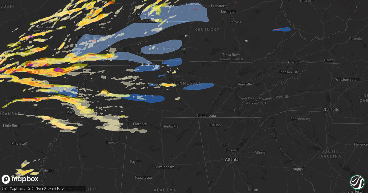
Hail Map in Tennessee on March 30, 2025
Get this storm
March 30 map
$229
one time, instant access
Download today. No call, no setup
Keep the $229
Bought the map and want the full workflow? Apply the entire $229 to a subscription within 7 days. None of it is wasted.
Every map, not just this one
This buys you this map. Subscription and you get every map we run, in the markets you choose from a few cities to whole states to nationwide. Plus real-time alerts the moment a storm fires.
Contact data
Name, contact info, occupancy, even credit band for addresses in the footprint. You go from where it hit to who to call.
Become the source they trust
Unlimited branding weather history reports on demand. You already have the documented answer ready for the property owner, and you are the one who showed up with it.
Property data and RoofTrace estimates
Pull up any address you have got, its value and the exact code rules for that jurisdiction, straight from One Click Code. Then RoofTrace estimates the squares, pitch, and roof value, priced the way you price.
Storm reports in Tennessee
Tennessee
| Date | Description |
|---|---|
| 03/30/20251:08 AM CDT | A local report indicates 1.00 inch wind near Pickwick Dam |
| 03/30/20251:05 AM CDT | Tspotter report of 3 large trees down and shingle damage to a home near locks creek/county lane east of readyville. Time is radar estimated. |
| 03/30/202512:12 AM CDT | Trees and powerlines down on highway 64 along the hardin county line. Time estimated via radar. |
| 03/30/202512:08 AM CDT | Cross bridges road unpassable due to damage in the area. Other reports of electrical poles down... Damage to structures and multiple trees down in maury county. Time is |
| 03/30/202512:05 AM CDT | Tspotter photos received of minor damage to roof of a home on fairview blvd |
| 03/30/202512:05 AM CDT | At least one home destroyed... Multiple homes damaged... And multiple power outages in the hampshire area. Time is radar estimated. |
| 03/30/202512:05 AM CDT | Trees down at the crossroad of hampshire pike and old state road near columbia. Time is radar estimated. |
| 03/30/202512:05 AM CDT | Tspotter photo received of 2 inch size hail between nolensville and smyrna. Time is radar estimated. |
| 03/30/202512:00 AM CDT | Tspotter photo received of 2 inch size hail southwest of nolensville. |
| 03/29/202511:43 PM CDT | Photo received of ping pong size hail on lena lane in franklin. |
| 03/29/202511:41 PM CDT | Quarter size hail near interstate 65 and highway 96 in franklin. |
| 03/29/202511:41 PM CDT | Tspotter report of quarter size hail at mckays mill in franklin. |
| 03/29/202511:40 PM CDT | Report from mping: ping pong ball |
| 03/29/202511:30 PM CDT | Report from mping: half dollar |
| 03/29/202511:20 PM CDT | A couple of trees down in linden. Times estimated via radar. |
| 03/29/202511:12 PM CDT | Tspotter report of groups of trees down and damage in the area of highway 100/840/pinewood road/liberty road. Time is radar estimated. |
| 03/29/202511:06 PM CDT | Fire at a substation near highway 100/pinewood. 776 power outages in the area. Time estimated on radar. |
| 03/29/202511:06 PM CDT | Multiple trees down on highway 100 east near the williamson county line. Time estimated on radar. |
| 03/29/202510:54 PM CDT | A local report indicates 1.00 inch wind near Somerville |
| 03/29/202510:37 PM CDT | Tree down on home on shady hill rd. |
| 03/29/202510:28 PM CDT | Report of tree on home on circle drive. Time estimated on radar. |
| 03/29/202510:20 PM CDT | Several reports coming in of quarter to half dollar sized hail in the bartlett/lakeland/arlington area. |
| 03/29/202510:19 PM CDT | Several reports of quarter to half dollar sized hail coming in from the bartlett/arlington area. |
| 03/29/202510:18 PM CDT | A local report indicates 1.00 inch wind near 3 S Blue Goose |
| 03/29/202510:10 PM CDT | A local report indicates 1.50 inch wind near Ellendale |
| 03/29/202510:10 PM CDT | Report of roof gone on a house. Time estimated by tornado debris signature on radar. |
| 03/29/202510:03 PM CDT | Report from mping: quarter |
| 03/29/202510:03 PM CDT | Just larger than quarter sized hail in jackson. |
| 03/29/20259:55 PM CDT | A local report indicates 1.00 inch wind near 2 ENE Dixonville |
| 03/29/20259:54 PM CDT | A local report indicates 1.25 inch wind near 3 NNE Jackson |
| 03/29/20259:36 PM CDT | Ems director reported just below golf ball size hail east of gadsden tn within crockett county. |
| 03/29/20259:12 PM CDT | Report of two trees down in the bumpus mills area. Time estimated from radar. |
| 03/29/20259:04 PM CDT | A local report indicates 1.00 inch wind near 2 W Burlison |
All States Impacted by Hail Map on March 30, 2025
Cities Impacted by Hail Map on March 30, 2025
- Coolidge, TX
- Dawson, TX
- Valley Mills, TX
- Clifton, TX
- Mexia, TX
- Wortham, TX
- Comanche, TX
- Streetman, TX
- Fairfield, TX
- San Saba, TX
- Lampasas, TX
- Foley, AL
- Kempner, TX
- Burnet, TX
- Florence, TX
- Bertram, TX
- Briggs, TX
- Copperas Cove, TX
- Jarrell, TX
- Georgetown, TX
- Bartlett, TX
- Liberty Hill, TX
- Granger, TX
- Vancleave, MS
- Moss Point, MS
- Holland, TX
- Buckholts, TX
- Thorndale, TX
- Breese, IL
- Germantown, IL
- Aviston, IL
- Albers, IL
- Cameron, TX
- Sainte Genevieve, MO
- Saint Mary, MO
- Bartelso, IL
- Chester, IL
- Ellis Grove, IL
- Walsh, IL
- Wasola, MO
- Brixey, MO
- Altamont, IL
- Windsor, IL
- Findlay, IL
- Salem, MO
- Thornfield, MO
- Sullivan, IL
- Dora, MO
- Drury, MO
- Gainesville, MO
- Cherryville, MO
- Festus, MO
- Mason, IL
- Mattoon, IL
- Beecher City, IL
- Valmeyer, IL
- Columbia, IL
- Millstadt, IL
- Davisville, MO
- Steelville, MO
- Viburnum, MO
- Potosi, MO
- Tuscola, IL
- Atwood, IL
- Hammond, IL
- Lovington, IL
- Ivesdale, IL
- Charleston, IL
- Greenup, IL
- Lerna, IL
- Toledo, IL
- Washington, MO
- Watson, IL
- Effingham, IL
- Teutopolis, IL
- Philo, IL
- Tolono, IL
- Urbana, IL
- Arcola, IL
- Humboldt, IL
- Bement, IL
- Sadorus, IL
- Pesotum, IL
- Champaign, IL
- Villa Grove, IL
- Savoy, IL
- Sidney, IL
- Saint Joseph, IL
- Ogden, IL
- Fithian, IL
- Homer, IL
- Royal, IL
- Armstrong, IL
- Belleville, IL
- Fisher, IL
- Foosland, IL
- Mahomet, IL
- Dewey, IL
- Rantoul, IL
- Ludlow, IL
- Paxton, IL
- Gibson City, IL
- Loda, IL
- Buckley, IL
- Melvin, IL
- Rankin, IL
- Cissna Park, IL
- Onarga, IL
- Gilman, IL
- Collison, IL
- Muncie, IL
- Penfield, IL
- Potomac, IL
- Danville, IL
- Rossville, IL
- Hoopeston, IL
- Oakwood, IL
- O'Fallon, IL
- Fairview Heights, IL
- Fults, IL
- Smithton, IL
- New Athens, IL
- Westfield, IL
- Ashmore, IL
- Cabool, MO
- Waterloo, IL
- Pinckneyville, IL
- Coulterville, IL
- Freeburg, IL
- Kansas, IL
- Sigel, IL
- Belgrade, MO
- Mineral Point, MO
- Houston, MO
- Watseka, IL
- Crescent City, IL
- Milford, IL
- Ashkum, IL
- Clifton, IL
- Martinton, IL
- Saint Anne, IL
- Papineau, IL
- Beaverville, IL
- Alvin, IL
- Henning, IL
- Wellington, IL
- Sheldon, IL
- Gifford, IL
- Thomasboro, IL
- Williamsport, IN
- Stockland, IL
- Ambia, IN
- West Lebanon, IN
- Bismarck, IL
- Defiance, MO
- Boss, MO
- Red Bud, IL
- Valles Mines, MO
- Bonne Terre, MO
- Nashville, IL
- Oakdale, IL
- Augusta, MO
- Saint Charles, MO
- Brooksville, FL
- De Soto, MO
- Cadet, MO
- Elk Creek, MO
- Eunice, MO
- Raymondville, MO
- Yukon, MO
- Solo, MO
- Stewardson, IL
- Shumway, IL
- Montrose, IL
- Edgewood, IL
- Tamaroa, IL
- Ashley, IL
- French Village, MO
- Bloomsdale, MO
- Harrison, AR
- Licking, MO
- Key Biscayne, FL
- Summersville, MO
- O'Fallon, MO
- Saint Peters, MO
- Blackwell, MO
- Alpena, AR
- Bixby, MO
- Cayuga, IN
- Perrysville, IN
- Frankfort, IL
- Mokena, IL
- New Lenox, IL
- Tinley Park, IL
- Orland Park, IL
- Oak Forest, IL
- Crestwood, IL
- Midlothian, IL
- Chicago, IL
- Alsip, IL
- Robbins, IL
- Palos Heights, IL
- Oak Lawn, IL
- Chicago Ridge, IL
- Burbank, IL
- Worth, IL
- Hazel Crest, IL
- Homewood, IL
- Country Club Hills, IL
- Hometown, IL
- Markham, IL
- Blue Island, IL
- Evergreen Park, IL
- Posen, IL
- Harvey, IL
- Riverdale, IL
- South Holland, IL
- Dolton, IL
- Lowell, IN
- Cedar Lake, IN
- Pembroke Township, IL
- Grant Park, IL
- Beecher, IL
- Momence, IL
- Lake Village, IN
- Schneider, IN
- Shelby, IN
- Demotte, IN
- Thayer, IN
- Hebron, IN
- Crown Point, IN
- Morocco, IN
- Donovan, IL
- Goodland, IN
- Kentland, IN
- Fowler, IN
- Boswell, IN
- Brook, IN
- Earl Park, IN
- Oxford, IN
- Pine Village, IN
- Remington, IN
- Rensselaer, IN
- Templeton, IN
- West Lafayette, IN
- Wolcott, IN
- Attica, IN
- Westpoint, IN
- Brookston, IN
- Chalmers, IN
- Lafayette, IN
- Otterbein, IN
- Lenzburg, IL
- Mascoutah, IL
- Calumet City, IL
- Hammond, IN
- Marissa, IL
- Addieville, IL
- Saint Libory, IL
- Chicago Heights, IL
- Steger, IL
- Crete, IL
- Schererville, IN
- Highland, IN
- Dyer, IN
- Munster, IN
- Lansing, IL
- Glenwood, IL
- Roby, MO
- Woodlawn, IL
- New Baden, IL
- Hartshorn, MO
- Eminence, MO
- Walnut Hill, IL
- Centralia, IL
- Yellville, AR
- Lead Hill, AR
- Park Hills, MO
- Plato, MO
- Miami, FL
- Miami Beach, FL
- Green Forest, AR
- Covington, IN
- Belleview, MO
- Caledonia, MO
- Casey, IL
- Kouts, IN
- Wheatfield, IN
- Monon, IN
- Reynolds, IN
- Francesville, IN
- Okawville, IL
- Monticello, IN
- Delphi, IN
- Battle Ground, IN
- Rockville, IN
- Bloomingdale, IN
- Marshall, IN
- Carbon, IN
- Waveland, IN
- Mecca, IN
- Hillsdale, IN
- Montezuma, IN
- Clinton, IN
- Dana, IN
- Crawfordsville, IN
- Greencastle, IN
- New Market, IN
- Roachdale, IN
- Ladoga, IN
- Russellville, IN
- Dix, IL
- Irondale, MO
- Salem, IL
- Kell, IL
- Iuka, IL
- Hoyleton, IL
- Prairie Du Rocher, IL
- Alhambra, IL
- Pocahontas, IL
- Highland, IL
- New Douglas, IL
- Mountain Home, AR
- Mount Vernon, IL
- Cantonment, FL
- Saint Louis, MO
- Pontiac, MO
- Farmington, MO
- Molino, FL
- Texico, IL
- Marine, IL
- Bismarck, MO
- Sparta, IL
- Baldwin, IL
- Bull Shoals, AR
- Flippin, AR
- Clarkridge, AR
- East Chicago, IN
- Griffith, IN
- Gary, IN
- Whiting, IN
- Boone Grove, IN
- Lake Station, IN
- Portage, IN
- Hobart, IN
- Valparaiso, IN
- Merrillville, IN
- La Crosse, IN
- Wanatah, IN
- Knox, IN
- Hanna, IN
- Modoc, IL
- Evansville, IL
- Tilden, IL
- Star City, IN
- North Judson, IN
- Buffalo, IN
- Yeoman, IN
- Medaryville, IN
- Winamac, IN
- San Pierre, IN
- Elizabeth, AR
- Kewanna, IN
- Monterey, IN
- Burnettsville, IN
- Ora, IN
- Rochester, IN
- Lucerne, IN
- Royal Center, IN
- Idaville, IN
- Logansport, IN
- Galveston, IN
- Twelve Mile, IN
- Walton, IN
- Flora, IN
- Camden, IN
- New Richmond, IN
- Peel, AR
- Marble Falls, AR
- Linden, IN
- Romney, IN
- Bunker, MO
- Centerville, MO
- Newton, IL
- Patoka, IL
- Oakland, AR
- Richview, IL
- Lesterville, MO
- Xenia, IL
- Seligman, MO
- Washburn, MO
- Kinmundy, IL
- Gassville, AR
- Cotter, AR
- Carlyle, IL
- Paris, IL
- Vernon, IL
- Henderson, AR
- Bainbridge, IN
- Colfax, IN
- Darlington, IN
- New Ross, IN
- Frankfort, IN
- Thorntown, IN
- Clarks Hill, IN
- Jamestown, IN
- Advance, IN
- Lebanon, IN
- North Salem, IN
- Johnsonville, IL
- Rinard, IL
- Odin, IL
- Black, MO
- Michigan City, IN
- Kingsford Heights, IN
- Hamlet, IN
- Beverly Shores, IN
- Westville, IN
- La Porte, IN
- Chesterton, IN
- Union Mills, IN
- New Buffalo, MI
- Rolling Prairie, IN
- Grovertown, IN
- Culver, IN
- Plymouth, IN
- Walkerton, IN
- North Liberty, IN
- Mill Creek, IN
- Argos, IN
- Tippecanoe, IN
- Macy, IN
- Peru, IN
- Grissom Arb, IN
- New Waverly, IN
- Denver, IN
- Bunker Hill, IN
- Onward, IN
- Akron, IN
- Mexico, IN
- Kirklin, IN
- Russiaville, IN
- Michigantown, IN
- Forest, IN
- Annapolis, IL
- Oblong, IL
- Martinsville, IL
- Yale, IL
- Everton, AR
- Willow Hill, IL
- Marshall, IL
- Dennison, IL
- Du Bois, IL
- Protem, MO
- Theodosia, MO
- Udall, MO
- Bakersfield, MO
- Sorento, IL
- Cassville, MO
- Aurora, MO
- Cape Fair, MO
- Shell Knob, MO
- Viola, AR
- Ellington, MO
- Galena, MO
- Moody, MO
- Louisville, IL
- Flora, IL
- Omaha, AR
- Caulfield, MO
- Midway, AR
- Mountain View, MO
- Lakeview, AR
- Isabella, MO
- West York, IL
- Clay City, IL
- Fort Worth, TX
- Naval Air Station Jrb, TX
- West Plains, MO
- Ironton, MO
- Fredericktown, MO
- Bourbon, IN
- Eagle Rock, MO
- Mammoth Spring, AR
- Salem, AR
- Arcadia, MO
- Lakeville, IN
- South Bend, IN
- Donnellson, IL
- Hillsboro, IL
- Gamaliel, AR
- Ingraham, IL
- Reeds Spring, MO
- Birch Tree, MO
- Saint Peter, IL
- Vandalia, IL
- Dieterich, IL
- Campbell Hill, IL
- Coffeen, IL
- Sturkie, AR
- Rockwood, IL
- Cutler, IL
- Gepp, AR
- Greenville, IL
- Ava, IL
- Du Quoin, IL
- Bridgman, MI
- Lakeside, MI
- New Carlisle, IN
- Saint Joseph, MI
- Baroda, MI
- Union Pier, MI
- Stevensville, MI
- Harbert, MI
- Three Oaks, MI
- Galien, MI
- Buchanan, MI
- Bremen, IN
- Sawyer, MI
- New Troy, MI
- Cassopolis, MI
- Sodus, MI
- Granger, IN
- Eau Claire, MI
- Wakarusa, IN
- Berrien Center, MI
- Berrien Springs, MI
- Niles, MI
- Mishawaka, IN
- Elkhart, IN
- Osceola, IN
- Dowagiac, MI
- Edwardsburg, MI
- Notre Dame, IN
- New Paris, IN
- Goshen, IN
- Bristol, IN
- Milford, IN
- Middlebury, IN
- Etna Green, IN
- Nappanee, IN
- Roann, IN
- Atwood, IN
- Leesburg, IN
- Claypool, IN
- Burket, IN
- Mentone, IN
- Syracuse, IN
- Winona Lake, IN
- North Webster, IN
- Pierceton, IN
- North Manchester, IN
- Millersburg, IN
- Warsaw, IN
- Silver Lake, IN
- Cromwell, IN
- Columbia City, IN
- South Whitley, IN
- Larwill, IN
- Laketon, IN
- Liberty Mills, IN
- Huntington, IN
- Wabash, IN
- Servia, IN
- Urbana, IN
- Lagro, IN
- Kempton, IN
- Sharpsville, IN
- Tipton, IN
- Kokomo, IN
- Vergennes, IL
- West Union, IL
- Spokane, MO
- Chestnutridge, MO
- Walnut Shade, MO
- Elkville, IL
- Dowell, IL
- Koshkonong, MO
- Thayer, MO
- Noble, IL
- Dundas, IL
- Golden, MO
- Shubuta, MS
- Farina, IL
- Terre Haute, IN
- Pyatt, AR
- West Terre Haute, IN
- Olney, IL
- West Liberty, IL
- Sesser, IL
- Scheller, IL
- Mulkeytown, IL
- Waltonville, IL
- Bonnie, IL
- Arlington, TX
- Opdyke, IL
- Belle Rive, IL
- Bluford, IL
- Keenes, IL
- Kimberling City, MO
- Berryville, AR
- Lampe, MO
- Norwood, MO
- Couch, MO
- Wiggins, MS
- Vanzant, MO
- Mountain Grove, MO
- Hartford, MI
- Squires, MO
- Fremont, MO
- Winona, MO
- Alton, MO
- Eureka Springs, AR
- Steeleville, IL
- Percy, IL
- Pensacola, FL
- Kimmell, IN
- Churubusco, IN
- Laotto, IN
- Avilla, IN
- Albion, IN
- Wawaka, IN
- Ligonier, IN
- Kendallville, IN
- Howe, IN
- Wolcottville, IN
- Topeka, IN
- Lagrange, IN
- Shipshewana, IN
- South Milford, IN
- Rome City, IN
- Constantine, MI
- Burr Oak, MI
- White Pigeon, MI
- Jones, MI
- Sturgis, MI
- Union, MI
- Benton Harbor, MI
- Lawton, MI
- Three Rivers, MI
- Decatur, MI
- Marcellus, MI
- Centreville, MI
- Mendon, MI
- Vandalia, MI
- Schoolcraft, MI
- Vicksburg, MI
- Kalamazoo, MI
- Watervliet, MI
- South Haven, MI
- Mattawan, MI
- Gobles, MI
- Douglas, MI
- Coloma, MI
- Grand Junction, MI
- Bloomingdale, MI
- Covert, MI
- Fennville, MI
- Lawrence, MI
- Pullman, MI
- Allegan, MI
- Saugatuck, MI
- Bangor, MI
- Portage, MI
- Paw Paw, MI
- Holland, MI
- Hamilton, MI
- Macatawa, MI
- Grand Haven, MI
- West Olive, MI
- Otsego, MI
- Wayne City, IL
- Robinson, IL
- Sumner, IL
- Palestine, IL
- Stoy, IL
- Branson, MO
- Brazil, IN
- Cory, IN
- Ravenden, AR
- Williamsville, MO
- Rosedale, IN
- Doniphan, MO
- Gatewood, MO
- Myrtle, MO
- Van Buren, MO
- Blue Eye, MO
- Quitman, MS
- Ava, MO
- Kirbyville, MO
- Hollister, MO
- Ridgedale, MO
- Hutsonville, IL
- Oak Grove, AR
- Staunton, IN
- Dorr, MI
- Allendale, MI
- Zeeland, MI
- Hudsonville, MI
- Hopkins, MI
- Coopersville, MI
- Byron Center, MI
- Jenison, MI
- Martin, MI
- Plainwell, MI
- Grandville, MI
- Wayland, MI
- Shelbyville, MI
- Leonidas, MI
- Scotts, MI
- Colon, MI
- Climax, MI
- Fulton, MI
- Athens, MI
- Galesburg, MI
- Sherwood, MI
- East Leroy, MI
- Battle Creek, MI
- Richland, MI
- Augusta, MI
- Hudson, IN
- Corunna, IN
- Butler, IN
- Auburn, IN
- Pleasant Lake, IN
- Waterloo, IN
- Garrett, IN
- Angola, IN
- Ashley, IN
- Pomona, MO
- Murphysboro, IL
- Fremont, IN
- Bronson, MI
- Hamilton, IN
- Orland, IN
- Montgomery, MI
- Coldwater, MI
- Union City, MI
- Perryville, MO
- Sullivan, IN
- Merom, IN
- Claremont, IL
- Bridgeport, IL
- Flat Rock, IL
- Reelsville, IN
- Greenville, MO
- Pocahontas, AR
- Grandin, MO
- Bradleyville, MO
- Cedarcreek, MO
- Milton, FL
- Poplar Bluff, MO
- Ellsinore, MO
- Mill Spring, MO
- Centerpoint, IN
- Farmersburg, IN
- Kissimmee, FL
- Camp, AR
- Glencoe, AR
- Shelburn, IN
- Fairbanks, IN
- Frohna, MO
- Wyoming, MI
- Caledonia, MI
- Marne, MI
- Grand Rapids, MI
- Comstock Park, MI
- Hickory Corners, MI
- Delton, MI
- Middleville, MI
- Alto, MI
- Ada, MI
- Hastings, MI
- Freeport, MI
- Dowling, MI
- Ceresco, MI
- Nashville, MI
- Bellevue, MI
- Homer, MI
- Marshall, MI
- Tekonsha, MI
- Reading, MI
- Quincy, MI
- Burlington, MI
- Allen, MI
- Camden, MI
- Hillsdale, MI
- Litchfield, MI
- Montpelier, OH
- Edon, OH
- Jonesville, MI
- Waldron, MI
- Pioneer, OH
- Osseo, MI
- Edgerton, OH
- Alvordton, OH
- Bryan, OH
- Lewis, IN
- Hymera, IN
- Jasonville, IN
- Coalmont, IN
- Saint Francisville, IL
- Lawrenceville, IL
- Vincennes, IN
- Oaktown, IN
- Silva, MO
- Carlisle, IN
- Hardy, AR
- Saint Joe, AR
- Western Grove, AR
- Valley Springs, AR
- Redford, MO
- Patton, MO
- Sedgewickville, MO
- Farrar, MO
- Cherokee Village, AR
- Rueter, MO
- Gulf Breeze, FL
- Poland, IN
- Noble, MO
- Kissee Mills, MO
- Jacob, IL
- Newaygo, MI
- Conklin, MI
- Ravenna, MI
- Grant, MI
- Nunica, MI
- Casnovia, MI
- Bailey, MI
- Spring Lake, MI
- Sparta, MI
- Cedar Springs, MI
- Sand Lake, MI
- Belmont, MI
- Kent City, MI
- Rockford, MI
- Howard City, MI
- Greenville, MI
- Belding, MI
- Lowell, MI
- Lake Odessa, MI
- Saranac, MI
- Clarksville, MI
- Woodland, MI
- Charlotte, MI
- Vermontville, MI
- Olivet, MI
- Eaton Rapids, MI
- Springport, MI
- Hanover, MI
- Horton, MI
- Albion, MI
- Spring Arbor, MI
- Concord, MI
- Parma, MI
- Edwardsport, IN
- Freelandville, IN
- Sandborn, IN
- Jerome, MI
- North Adams, MI
- Pittsford, MI
- Hudson, MI
- West Unity, OH
- Stryker, OH
- Gorham, IL
- Royalton, IL
- Warm Springs, AR
- Bruceville, IN
- Wheatland, IN
- Bicknell, IN
- Monroe City, IN
- Ragsdale, IN
- Fairdealing, MO
- Zeigler, IL
- Ash Flat, AR
- Westphalia, IN
- Williford, AR
- Friedheim, MO
- Oxly, MO
- Naylor, MO
- Clubb, MO
- Ravenden Springs, AR
- Neelyville, MO
- Harviell, MO
- Zalma, MO
- McGee, MO
- Glenallen, MO
- Marquand, MO
- Russellville, AR
- Wappapello, MO
- Linton, IN
- Clay City, IN
- Uniontown, MO
- Washington, IN
- Gowen, MI
- Morley, MI
- Stanton, MI
- Coral, MI
- Trufant, MI
- Pierson, MI
- Lakeview, MI
- Sidney, MI
- Crystal, MI
- Sheridan, MI
- Ionia, MI
- Fenwick, MI
- Orleans, MI
- Six Lakes, MI
- Carson City, MI
- Sunfield, MI
- Fowler, MI
- Pewamo, MI
- Lyons, MI
- Portland, MI
- Hubbardston, MI
- Westphalia, MI
- Muir, MI
- De Soto, IL
- Eagle, MI
- Potterville, MI
- Mulliken, MI
- Grand Ledge, MI
- Dimondale, MI
- Benton, IL
- Lansing, MI
- Mason, MI
- Pleasant Lake, MI
- Stockbridge, MI
- Holt, MI
- Jackson, MI
- Leslie, MI
- Rives Junction, MI
- Onondaga, MI
- Cement City, MI
- Brooklyn, MI
- Somerset Center, MI
- Napoleon, MI
- Adrian, MI
- Onsted, MI
- Michigan Center, MI
- Manitou Beach, MI
- Clarklake, MI
- Munith, MI
- Grass Lake, MI
- Clayton, MI
- Morenci, MI
- Fayette, OH
- Addison, MI
- Archbold, OH
- Powersite, MO
- Lyons, IN
- Elnora, IN
- Newberry, IN
- Bloomfield, IN
- Switz City, IN
- Plainville, IN
- Montgomery, IN
- Carbondale, IL
- Carterville, IL
- Hurst, IL
- Damascus, AR
- Springfield, AR
- Moore Haven, FL
- Okeechobee, FL
- West Frankfort, IL
- Norfork, AR
- Dugger, IN
- Qulin, MO
- Worthington, IN
- Broseley, MO
- Willow Springs, MO
- Calico Rock, AR
- Jerusalem, AR
- Hattieville, AR
- Imboden, AR
- Tecumseh, MO
- Zanoni, MO
- Bexar, AR
- Bowling Green, IN
- Coal City, IN
- Shoals, IN
- Mitchell, IN
- Maynard, AR
- Princeton, IN
- Francisco, IN
- Manchester, MI
- Tecumseh, MI
- Chelsea, MI
- Tipton, MI
- Britton, MI
- Clinton, MI
- Norvell, MI
- East Lansing, MI
- Williamston, MI
- Webberville, MI
- Gregory, MI
- Saline, MI
- Dansville, MI
- Okemos, MI
- Dexter, MI
- Howell, MI
- Pinckney, MI
- Ann Arbor, MI
- Dewitt, MI
- Bath, MI
- Perry, MI
- Haslett, MI
- Fowlerville, MI
- Saint Johns, MI
- Herrin, IL
- Owosso, MI
- Ovid, MI
- Perrinton, MI
- Maple Rapids, MI
- Laingsburg, MI
- Middleton, MI
- Riverdale, MI
- Alma, MI
- Elsie, MI
- Vestaburg, MI
- Ashley, MI
- Ithaca, MI
- Bannister, MI
- Pompeii, MI
- Blanchard, MI
- Edmore, MI
- Elwell, MI
- Sumner, MI
- North Star, MI
- Biggers, AR
- Corning, AR
- Datto, AR
- Bernie, MO
- Campbell, MO
- Fisk, MO
- Malden, MO
- Dexter, MO
- West Baden Springs, IN
- Quincy, IN
- Altenburg, MO
- Old Appleton, MO
- Oak Ridge, MO
- Melbourne, AR
- Pindall, AR
- Brownwood, MO
- Oran, MO
- Sturdivant, MO
- Advance, MO
- Pineville, AR
- Peace Valley, MO
- Saint Cloud, FL
- Gosport, IN
- Solsberry, IN
- Freedom, IN
- Spencer, IN
- Bee Branch, AR
- Buckner, IL
- Puxico, MO
- Dudley, MO
- Brockwell, AR
- Odon, IN
- Bell City, MO
- Orient, IL
- Christopher, IL
- Martinsville, IN
- Morgantown, IN
- Heltonville, IN
- Bedford, IN
- Norman, IN
- Nashville, IN
- Saint Louis, MI
- Shepherd, MI
- Midland, MI
- Mount Pleasant, MI
- Knobel, AR
- Saint Charles, MI
- Henderson, MI
- Wheeler, MI
- Oakley, MI
- Chesaning, MI
- Merrill, MI
- Breckenridge, MI
- Brant, MI
- Hemlock, MI
- Evansville, IN
- Chandler, IN
- Fenton, MI
- Corunna, MI
- Morrice, MI
- Lennon, MI
- Swartz Creek, MI
- Durand, MI
- Bancroft, MI
- Linden, MI
- Gaines, MI
- Byron, MI
- Vernon, MI
- Hartland, MI
- Holly, MI
- Highland, MI
- Brighton, MI
- Milford, MI
- South Lyon, MI
- Wixom, MI
- Northville, MI
- Plymouth, MI
- New Hudson, MI
- Milan, MI
- Whitmore Lake, MI
- Hamburg, MI
- Elberfeld, IN
- Willis, MI
- Canton, MI
- Maybee, MI
- Carleton, MI
- Ypsilanti, MI
- Belleville, MI
- New Boston, MI
- Logan, IL
- Thompsonville, IL
- Bloomington, IN
- Wadesville, IN
- Poseyville, IN
- New Harmony, IN
- Quitman, AR
- Lynnville, IN
- Clinton, AR
- Jackson, MO
- Cape Girardeau, MO
- Chaffee, MO
- Peach Orchard, AR
- Horseshoe Bend, AR
- Bloomfield, MO
- Sage, AR
- Mount Pleasant, AR
- Jasper, AR
- Guion, AR
- Franklin, AR
- Violet Hill, AR
- Freeman Spur, IL
- Tennyson, IN
- Essex, MO
- Broughton, IL
- McLeansboro, IL
- Rector, AR
- Piggott, AR
- Medora, IN
- Romulus, MI
- Westland, MI
- Wayne, MI
- Detroit, MI
- Novi, MI
- Garden City, MI
- Commerce Township, MI
- Walled Lake, MI
- Inkster, MI
- Livonia, MI
- Farmington, MI
- Oakland City, IN
- White Lake, MI
- Taylor, MI
- Waterford, MI
- West Bloomfield, MI
- Clarkston, MI
- Davisburg, MI
- Flushing, MI
- Grand Blanc, MI
- New Lothrop, MI
- Flint, MI
- Davison, MI
- Goodrich, MI
- Ortonville, MI
- Burton, MI
- Montrose, MI
- Burt, MI
- Clio, MI
- Freeland, MI
- Saginaw, MI
- Birch Run, MI
- Mount Morris, MI
- Columbus, IN
- Auburn, MI
- Bridgeport, MI
- Compton, AR
- Mountain View, AR
- Evening Shade, AR
- Sidney, AR
- Stendal, IN
- Heber Springs, AR
- Wilburn, AR
- Cave City, AR
- Wolf Lake, IL
- Cynthiana, IN
- Fort Branch, IN
- Haubstadt, IN
- Benton, MO
- Scott City, MO
- Velpen, IN
- Winslow, IN
- Parma, MO
- Batesville, AR
- Enfield, IL
- Poughkeepsie, AR
- Sikeston, MO
- Marion, IL
- Makanda, IL
- Alto Pass, IL
- Trafalgar, IN
- Mount Vernon, IN
- Thebes, IL
- Vanduser, MO
- Macedonia, IL
- Smithville, AR
- Sulphur Rock, AR
- Strawberry, AR
- Tamms, IL
- Cord, AR
- Alicia, AR
- Lynn, AR
- Saffell, AR
- Pollard, AR
- Greenway, AR
- Whitewater, MO
- Marble Hill, MO
- Canalou, MO
- Catron, MO
- Matthews, MO
- New Madrid, MO
- Cairo, IL
- Miller City, IL
- Charleston, MO
- Bertrand, MO
- Jonesboro, IL
- Ullin, IL
- McClure, IL
- Olive Branch, IL
- Dongola, IL
- Bringhurst, IN
- Buck Creek, IN
- Locust Grove, AR
- Marcella, AR
- Jasper, IN
- Holland, IN
- Huntingburg, IN
- Bay City, MI
- Carrollton, MI
- Munger, MI
- Pinconning, MI
- Kawkawlin, MI
- Millington, MI
- Essexville, MI
- University Center, MI
- Linwood, MI
- Frankenmuth, MI
- Reese, MI
- Vassar, MI
- Genesee, MI
- Metamora, MI
- Troy, MI
- Redford, MI
- Rochester, MI
- Berkley, MI
- Birmingham, MI
- Huntington Woods, MI
- Atlas, MI
- Columbiaville, MI
- Keego Harbor, MI
- Royal Oak, MI
- Otter Lake, MI
- Dearborn Heights, MI
- Lake Orion, MI
- Oak Park, MI
- Franklin, MI
- Utica, MI
- Southfield, MI
- Hadley, MI
- Leonard, MI
- Oakland, MI
- Clawson, MI
- Pontiac, MI
- Auburn Hills, MI
- Dryden, MI
- Bloomfield Hills, MI
- Lapeer, MI
- Oxford, MI
- Dearborn, MI
- Fostoria, MI
- Otisville, MI
- Riverview, MI
- Hazel Park, MI
- Hamtramck, MI
- Wyandotte, MI
- Warren, MI
- Ferndale, MI
- Allen Park, MI
- Ecorse, MI
- Southgate, MI
- Pleasant Ridge, MI
- Madison Heights, MI
- Lincoln Park, MI
- Trenton, MI
- Highland Park, MI
- Melvindale, MI
- Sterling Heights, MI
- River Rouge, MI
- Villa Ridge, IL
- Eldorado, IL
- Galatia, IL
- Raleigh, IL
- Dale, IL
- Pangburn, AR
- Judsonia, AR
- Floral, AR
- Pulaski, IL
- Nineveh, IN
- Taylorsville, IN
- Edinburgh, IN
- Drasco, AR
- Goreville, IL
- Palestine, TX
- Pittsburg, IL
- Mounds, IL
- La Center, KY
- Belknap, IL
- Barlow, KY
- Olmsted, IL
- Grand Chain, IL
- Karnak, IL
- Metropolis, IL
- Kevil, KY
- East Prairie, MO
- Cypress, IL
- Mound City, IL
- Saint Anthony, IN
- Dubois, IN
- Birdseye, IN
- Bardwell, KY
- Wickliffe, KY
- Anniston, MO
- Celestine, IN
- Holcomb, MO
- Saint Francis, AR
- Loogootee, IN
- Seymour, IN
- Owensburg, IN
- Springville, IN
- Avoca, IN
- Crane, IN
- Freetown, IN
- Williams, IN
- Oolitic, IN
- Scotland, IN
- Unionville, IN
- Franklin, IN
- Swifton, AR
- Eastpointe, MI
- Fraser, MI
- Grosse Pointe, MI
- Center Line, MI
- Clinton Township, MI
- Harper Woods, MI
- Saint Clair Shores, MI
- Roseville, MI
- Frankston, TX
- Capac, MI
- Mayville, MI
- Silverwood, MI
- Armada, MI
- Macomb, MI
- Attica, MI
- Imlay City, MI
- Allenton, MI
- Brown City, MI
- Kingston, MI
- Almont, MI
- North Branch, MI
- Caro, MI
- Washington, MI
- Clifford, MI
- Romeo, MI
- Ray, MI
- Fairgrove, MI
- Akron, MI
- Elizabethtown, IN
- Jonesville, IN
- Scipio, IN
- Saint Paul, IN
- Flat Rock, IN
- Manilla, IN
- Hope, IN
- Greensburg, IN
- Hartsville, IN
- Shelbyville, IN
- Clifford, IN
- Waldron, IN
- Rushville, IN
- Homer, IN
- Milroy, IN
- French Lick, IN
- Eckerty, IN
- Grantsburg, IL
- Golconda, IL
- Vienna, IL
- West Paducah, KY
- Owensville, IN
- Bradford, AR
- Brownstown, IN
- Hoxie, AR
- Powhatan, AR
- Ozark, IL
- Bald Knob, AR
- Tumbling Shoals, AR
- Delaplaine, AR
- Creal Springs, IL
- Walnut Ridge, AR
- Portia, AR
- Pleasant Plains, AR
- Thida, AR
- Oil Trough, AR
- Cash, AR
- Richmond, MI
- New Baltimore, MI
- New Haven, MI
- Memphis, MI
- Harrison Township, MI
- Mount Clemens, MI
- Emmett, MI
- Melvin, MI
- Marlette, MI
- Yale, MI
- Unionville, MI
- Cass City, MI
- Deford, MI
- Sebewaing, MI
- Gagetown, MI
- Gibson, MO
- Clarkton, MO
- Gideon, MO
- Laurel, IN
- Grammer, IN
- Glenwood, IN
- Westport, IN
- Connersville, IN
- Metamora, IN
- Batesville, IN
- Oldenburg, IN
- Osgood, IN
- Boonville, IN
- Bono, AR
- Smithland, KY
- Hampton, KY
- Paducah, KY
- Brookport, IL
- Tuckerman, AR
- Jacksonville, TX
- Branchville, IN
- Beech Grove, AR
- Fredericksburg, IN
- Hardinsburg, IN
- Milltown, IN
- Depauw, IN
- Paragould, AR
- Newark, AR
- Dale, IN
- Cannelburg, IN
- Newburgh, IN
- Bristow, IN
- Saint Meinrad, IN
- Newport, AR
- Rusk, TX
- Marengo, IN
- Lilbourn, MO
- Jonesboro, AR
- Portageville, MO
- Ubly, MI
- Elkton, MI
- Sandusky, MI
- Pigeon, MI
- Owendale, MI
- Peck, MI
- Snover, MI
- Decker, MI
- Bad Axe, MI
- Carsonville, MI
- Avoca, MI
- Applegate, MI
- Goodells, MI
- Croswell, MI
- North Street, MI
- Smiths Creek, MI
- East China, MI
- Saint Clair, MI
- Fair Haven, MI
- Columbus, MI
- Jeddo, MI
- Casco, MI
- Brookville, IN
- Sunman, IN
- Algonac, MI
- Harsens Island, MI
- Marine City, MI
- Liberty, IN
- Brownsville, IN
- Marion, KY
- Burna, KY
- Salem, KY
- Amagon, AR
- Gentryville, IN
- Ferdinand, IN
- Salem, IN
- English, IN
- Dupont, IN
- Butlerville, IN
- Lafe, AR
- Marmaduke, AR
- Pekin, IN
- Hanson, KY
- Deckerville, MI
- Minden City, MI
- Palms, MI
- Ruth, MI
- Forestville, MI
- Fort Gratiot, MI
- Port Sanilac, MI
- Lexington, MI
- Port Huron, MI
- Marysville, MI
- Brookland, AR
- Bath, IN
- Eaton, OH
- Cedar Grove, IN
- Camden, OH
- College Corner, OH
- New Trenton, IN
- West Harrison, IN
- West College Corner, IN
- Oxford, OH
- Weiner, AR
- Fisher, AR
- Sturgis, KY
- Rosiclare, IL
- Cave In Rock, IL
- Elizabethtown, IL
- Morganfield, KY
- Harrisburg, AR
- State University, AR
- Lake City, AR
- Bay, AR
- Henderson, KY
- Clinton, KY
- Philpot, KY
- Utica, KY
- Lincoln City, IN
- Columbus, KY
- Manitou, KY
- Madisonville, KY
- Arlington, KY
- Kennett, MO
- Somerville, OH
- West Alexandria, OH
- Lewisburg, OH
- Okeana, OH
- Hamilton, OH
- Middletown, OH
- New Lebanon, OH
- Brookville, OH
- Farmersville, OH
- Harrison, OH
- Clay, KY
- Trumann, AR
- Black Oak, AR
- Reed, KY
- Spottsville, KY
- Monette, AR
- Leachville, AR
- Manila, AR
- Owensboro, KY
- Rockport, IN
- Grandview, IN
- Santa Claus, IN
- Chrisney, IN
- Richland, IN
- Rumsey, KY
- Vero Beach, FL
- Beebe, AR
- Whitesville, KY
- Austin, AR
- Saint Croix, IN
- Bragg City, MO
- Hawesville, KY
- Reynolds Station, KY
- Caraway, AR
- Maceo, KY
- Lewisport, KY
- Fancy Farm, KY
- Mayfield, KY
- Wingo, KY
- Princeton, KY
- Providence, KY
- Nebo, KY
- Dixon, KY
- Corydon, KY
- Robards, KY
- Calhoun, KY
- Sebree, KY
- Slaughters, KY
- Waverly, KY
- Island, KY
- Bremen, KY
- Central City, KY
- Livermore, KY
- Sacramento, KY
- Centertown, KY
- Hebron, KY
- Addyston, OH
- Cincinnati, OH
- North Bend, OH
- Lamar, IN
- Evanston, IN
- Tell City, IN
- Troy, IN
- Cannelton, IN
- Hartford, KY
- Reklaw, TX
- Henderson, TX
- Laneville, TX
- Hickory, KY
- Seven Mile, OH
- Trenton, OH
- Melber, KY
- Boaz, KY
- Centerville, TX
- Schnellville, IN
- Marston, MO
- Hayti, MO
- McRae, AR
- Dell, AR
- Lepanto, AR
- Dyess, AR
- Etowah, AR
- Osceola, AR
- Marked Tree, AR
- Monroe, OH
- Mason, OH
- South Lebanon, OH
- Morrow, OH
- Kings Mills, OH
- Blanchester, OH
- West Chester, OH
- Lebanon, OH
- Maineville, OH
- Fairfield, OH
- Franklin, OH
- Oregonia, OH
- Clarksville, OH
- Springboro, OH
- Waynesville, OH
- Harveysburg, OH
- Wilmington, OH
- Midland, OH
- Pleasant Plain, OH
- Cushing, TX
- Cloverport, KY
- Union Star, KY
- Derby, IN
- Hardinsburg, KY
- Leopold, IN
- Stephensport, KY
- Battletown, KY
- Rhodelia, KY
- Payneville, KY
- Rome, IN
- Leavenworth, IN
- Fordsville, KY
- Falls Of Rough, KY
- Dundee, KY
- Webster, KY
- Augusta, AR
- Ridgely, TN
- Tiptonville, TN
- Cunningham, KY
- Symsonia, KY
- Dayton, OH
- Blytheville, AR
- Keiser, AR
- Des Arc, AR
- Luxora, AR
- Ripley, TN
- Wilson, AR
- Carthage, AR
- Tyronza, AR
- Mount Enterprise, TX
- Miamisburg, OH
- Bellbrook, OH
- Spring Valley, OH
- West Milton, OH
- Vandalia, OH
- Englewood, OH
- Clayton, OH
- Tipp City, OH
- Germantown, OH
- New Carlisle, OH
- Xenia, OH
- Medway, OH
- Troy, OH
- Springfield, OH
- North Hampton, OH
- Donnelsville, OH
- Alpha, OH
- Yellow Springs, OH
- Enon, OH
- Fairborn, OH
- Cedarville, OH
- Wilberforce, OH
- Joiner, AR
- South Charleston, OH
- Jamestown, OH
- Martinsville, OH
- Port William, OH
- New Vienna, OH
- Sabina, OH
- Obion, TN
- Hornbeak, TN
- Blevins, AR
- Ward, AR
- Griffithville, AR
- Guston, KY
- Laconia, IN
- Elizabeth, IN
- Mauckport, IN
- Central, IN
- Corydon, IN
- Brandenburg, KY
- Irvington, KY
- Harned, KY
- McDaniels, KY
- Elizabethtown, KY
- Rineyville, KY
- Cecilia, KY
- Hudson, KY
- Garfield, KY
- Leitchfield, KY
- Westview, KY
- Custer, KY
- West Point, KY
- Radcliff, KY
- Vine Grove, KY
- Fort Knox, KY
- Muldraugh, KY
- Ekron, KY
- Benton, KY
- Murray, KY
- Hardin, KY
- Dexter, KY
- Kirksey, KY
- Almo, KY
- Farmington, KY
- Hornersville, MO
- Long Branch, TX
- Rives, TN
- Troy, TN
- McCrory, AR
- Union City, TN
- Dyersburg, TN
- Newbern, TN
- Gilmore, AR
- Frenchmans Bayou, AR
- Bassett, AR
- Turrell, AR
- Fairdale, KY
- Cotton Plant, AR
- Louisville, KY
- Drummonds, TN
- Millington, TN
- Munford, TN
- Greenfield, OH
- Leesburg, OH
- Jeffersonville, OH
- Washington Court House, OH
- Hillsboro, OH
- South Solon, OH
- London, OH
- Mount Sterling, OH
- Bloomingburg, OH
- New Holland, OH
- South Vienna, OH
- West Jefferson, OH
- Mechanicsburg, OH
- Cadiz, KY
- Dover, TN
- Henning, TN
- Dyer, TN
- Kenton, TN
- Rutherford, TN
- Troup, TX
- Nacogdoches, TX
- Springville, TN
- Buchanan, TN
- Garrison, TX
- Timpson, TX
- Grove City, OH
- Orient, OH
- Ashville, OH
- Lockbourne, OH
- Commercial Point, OH
- Frankfort, OH
- Clarksburg, OH
- Harrisburg, OH
- Williamsport, OH
- Galloway, OH
- Columbus, OH
- Circleville, OH
- Mount Washington, KY
- Lebanon Junction, KY
- Shepherdsville, KY
- Brooks, KY
- Taylorsville, KY
- Boston, KY
- Bardstown, KY
- Coxs Creek, KY
- Clermont, KY
- Bumpus Mills, TN
- Herndon, KY
- La Fayette, KY
- Big Rock, TN
- Fort Campbell, KY
- Covington, TN
- Greenfield, TN
- Bradford, TN
- Brinkley, AR
- Mansfield, TN
- Bruceton, TN
- Hollow Rock, TN
- Earle, AR
- Gates, TN
- Burlison, TN
- Alto, TX
- Crockett, TX
- Wheatley, AR
- Big Sandy, TN
- Brighton, TN
- Atoka, TN
- Groveport, OH
- Canal Winchester, OH
- Goodwin, AR
- Palestine, AR
- Bloomfield, KY
- Fairfield, KY
- Willisburg, KY
- Springfield, KY
- Finchville, KY
- Fisherville, KY
- Shelbyville, KY
- Simpsonville, KY
- Mount Eden, KY
- Indian Mound, TN
- Woodlawn, TN
- Camden, TN
- Cub Run, KY
- Munfordville, KY
- Stewart, TN
- Bells, TN
- Oak Grove, KY
- McKenzie, TN
- Huntingdon, TN
- Brownsville, TN
- Forrest City, AR
- Gary, TX
- Marianna, AR
- Haynes, AR
- Dublin, OH
- Hilliard, OH
- Powell, OH
- Westerville, OH
- Elkton, KY
- Jackson, TN
- Crawfordsville, AR
- Prescott, AR
- Gadsden, TN
- Humboldt, TN
- Douglass, TX
- Eva, TN
- Cumberland City, TN
- Tennessee Ridge, TN
- Big Flat, AR
- Galena, OH
- Erin, TN
- Palmyra, TN
- Cumberland Furnace, TN
- Oakfield, TN
- Clarksville, TN
- Cunningham, TN
- Southside, TN
- Charlotte, TN
- Waverly, TN
- Denmark, TN
- Moro, AR
- Alamo, TN
- Sparkman, AR
- Buena Vista, TN
- Mason, TN
- Memphis, TN
- Arlington, TN
- Beech Bluff, TN
- McEwen, TN
- Cordova, TN
- Chapmansboro, TN
- Pleasant View, TN
- Ashland City, TN
- Adams, TN
- Springfield, TN
- Cedar Hill, TN
- Marion, AR
- Westport, TN
- Holladay, TN
- Tenaha, TX
- Stanton, TN
- Eads, TN
- Collierville, TN
- Luray, TN
- Lexington, TN
- Huron, TN
- Brickeys, AR
- Oakland, TN
- Somerville, TN
- Rossville, TN
- Lewisburg, KY
- Hurricane Mills, TN
- Crofton, KY
- Hopkinsville, KY
- Lobelville, TN
- Sugar Tree, TN
- Greenville, KY
- Hughes, AR
- Joaquin, TX
- Orlinda, TN
- Portland, TN
- Franklin, KY
- Cross Plains, TN
- Cottontown, TN
- Altheimer, AR
- Casscoe, AR
- Marvell, AR
- Humphrey, AR
- Lexa, AR
- Stuttgart, AR
- Almyra, AR
- Holly Grove, AR
- Aubrey, AR
- Germantown, TN
- Lake Cormorant, MS
- Southaven, MS
- Pine Bluff, AR
- Horn Lake, MS
- Walls, MS
- Grapevine, AR
- Scotts Hill, TN
- Williston, TN
- Darden, TN
- Parsons, TN
- Decaturville, TN
- White House, TN
- Moscow, TN
- Gallatin, TN
- Greenbrier, TN
- Dawson Springs, KY
- Medon, TN
- Pinson, TN
- Center, TX
- New Johnsonville, TN
- Tunica, MS
- Robinsonville, MS
- Linden, TN
- Trimble, TN
- Dickson, TN
- Whiteville, TN
- Bolivar, TN
- Henderson, TN
- Only, TN
- Nunnelly, TN
- Lyles, TN
- Bon Aqua, TN
- Fairview, TN
- Primm Springs, TN
- Adolphus, KY
- Scottsville, KY
- Westmoreland, TN
- Bethpage, TN
- Logansport, LA
- Reagan, TN
- Hornsby, TN
- Toone, TN
- Burns, TN
- Pegram, TN
- Nashville, TN
- Converse, LA
- Centerville, TN
- Hickory Valley, TN
- Bethel Springs, TN
- Finger, TN
- Grand Junction, TN
- Saulsbury, TN
- Franklin, TN
- Byhalia, MS
- Holly Springs, MS
- Coldwater, MS
- Center Ridge, AR
- Sarah, MS
- Michigan City, MS
- Lamar, MS
- Middleton, TN
- Hernando, MS
- Brentwood, TN
- Dundee, MS
- La Grange, TN
- Senatobia, MS
- Hohenwald, TN
- Pocahontas, TN
- Selmer, TN
- Walnut, MS
- Ashland, MS
- Mansfield, LA
- Nolensville, TN
- Arrington, TN
- College Grove, TN
- Smyrna, TN
- La Vergne, TN
- Annville, KY
- Falkner, MS
- Antioch, TN
- Mount Pleasant, TN
- Columbia, TN
- Shelbyville, TX
- Tiplersville, MS
- Thompsons Station, TN
- Manchester, KY
- Murfreesboro, TN
- Cotton Valley, LA
- Sarepta, LA
- Minden, LA
- Grapeland, TX
- Eagleville, TN
- Corinth, MS
- Sandoval, IL
- Ramer, TN
- O'Kean, AR
- Shongaloo, LA
- Pleasant Hill, LA
- Haynesville, LA
- Strong, AR
- Guys, TN
- Michie, TN
- Lebanon, TN
- Mount Juliet, TN
- Milton, TN
- Readyville, TN
- Woodbury, TN
- Lascassas, TN
- Liberty, TN
- Smithville, TN
- Dowelltown, TN
- Mcminnville, TN
- Emerson, AR
- Coushatta, LA
- Marthaville, LA
- Robeline, LA
- Pelican, LA
- Rockvale, TN
- Ripley, MS
- Gunlock, KY
- Hueysville, KY
- Prestonsburg, KY
- Langley, KY
- Garrett, KY
- Drift, KY
- Eastern, KY
- Printer, KY
- Banner, KY
- Dana, KY
- Martin, KY
- Harold, KY
- Natchitoches, LA
- Crossett, AR
- Shelbyville, TN
- El Dorado, AR
- Hickory Flat, MS
- Blue Mountain, MS
- Bell Buckle, TN
- Jersey, AR
- Burnsville, MS
- Counce, TN
- Hermitage, AR
- Campti, LA
- Walling, TN
- Rock Island, TN
- Pikeville, KY
- Kimper, KY
- Ivel, KY
- Grethel, KY
- Stanville, KY
- Betsy Layne, KY
- Sidney, KY
- Raccoon, KY
- Winnfield, LA
- Wartrace, TN
- Dumas, MS
- Wilmar, AR
- Fountain Hill, AR
- Kennard, TX
- Hamburg, AR
- Rienzi, MS
- Phyllis, KY
- Adamsville, TN
- Shiloh, TN
- Morris Chapel, TN
- Iuka, MS
- Saline, LA
- Goldonna, LA
- Booneville, MS
- Tillar, AR
- Monticello, AR
- Montgomery, LA
- Atlanta, LA
- Waterloo, AL
- Glen, MS
- Baldwyn, MS
- Cherokee, AL
- Savannah, TN
- Sparta, TN
- Quebeck, TN
- Doyle, TN
- Crossville, TN
- Natchez, LA
- Cloutierville, LA
- Dry Prong, LA
- Georgetown, LA
- Bon Wier, TX
- Many, LA
- Montrose, AR
- Zwolle, LA
- Noble, LA
- Dermott, AR
- Dodson, LA
- Colfax, LA
- McGehee, AR
- Tullos, LA
- Fisher, LA
- Florien, LA
- Sikes, LA
- Benoit, MS
- Olla, LA
- Merryville, LA
- Burkeville, TX
- Newton, TX
- Beulah, MS
- Apple Springs, TX
- Dry Creek, LA
- Lena, LA
- Shaw, MS
- Cleveland, MS
- Boyle, MS
- Pitkin, LA
- Mittie, LA
- Oakdale, LA
- Ragley, LA
- Reeves, LA
- Tishomingo, MS
- Grayson, LA
- Killen, AL
- Deridder, LA
- New Site, MS
- Marietta, MS
- Bentley, LA
- Dennis, MS
- Kelly, LA
- Kinder, LA
- Provencal, LA
- Pollock, LA
- Glenmora, LA
- Elmer, LA
- Belmont, MS
- Russellville, AL
- Oberlin, LA
- Melrose, LA
- Doddsville, MS
- Indianola, MS
- Lufkin, TX
- Pineville, LA
- Ball, LA
- Portland, AR
- Lake Village, AR
- Ruleville, MS
- Forest Hill, LA
- Buna, TX
- Groveton, TX
- Winnsboro, LA
- Columbia, LA
- Jena, LA
- Trout, LA
- Harrisonburg, LA
- Alexandria, LA
- Lecompte, LA
- Sunflower, MS
- Ville Platte, LA
- Gilbert, LA
- Schlater, MS
- Fort Necessity, LA
- Enterprise, LA
- Deville, LA
- Tuscumbia, AL
- Charleston, MS
- Philipp, MS
- Itta Bena, MS
- Moorhead, MS
- Hollandale, MS
- Jonesville, LA
- Boyce, LA
- Saint Joseph, LA
- Wisner, LA
- Greenwood, MS
- Greenville, MS
- Holcomb, MS
- Cascilla, MS
- Sugartown, LA
- Coffeeville, MS
- Mamou, LA
- Carrollton, MS
- Newellton, LA
- Hineston, LA
- Sicily Island, LA
- Grenada, MS
- Scobey, MS
- Belmont, LA
- Tillatoba, MS
- Singer, LA
- Dequincy, LA
- Westlake, LA
- Bruce, MS
- Isola, MS
- Belzoni, MS
- Sidon, MS
- Sulphur, LA
- Monterey, LA
- Longville, LA
- Hornbeck, LA
- Cameron, LA
- Red Bay, AL
- Opelousas, LA
- Woodworth, LA
- Washington, LA
- Lake Charles, LA
- Eunice, LA
- Basile, LA
- Coila, MS
- Water Valley, MS
- McCarley, MS
- Iowa, LA
- Bunkie, LA
- Tchula, MS
- Winona, MS
- Olive Branch, MS
- Church Point, LA
- Port Gibson, MS
- Hermanville, MS
- North Carrollton, MS
- Lexington, MS
- Plantersville, MS
- Tupelo, MS
- Pattison, MS
- Pittsboro, MS
- Calhoun City, MS
- Big Creek, MS
- Grand Chenier, LA
- Creole, LA
- Starks, LA
- Saltillo, MS
- Guntown, MS
- Mantachie, MS
- Leighton, AL
- Spencer, TN
- Plaucheville, LA
- Palmetto, LA
- Kilmichael, MS
- Vaiden, MS
- West, MS
- Vardaman, MS
- Houlka, MS
- Mooreville, MS
- Port Barre, LA
- Fulton, MS
- Mount Hope, AL
- Town Creek, AL
- Pleasant Hill, TN
- Mantee, MS
- Woodland, MS
- Eupora, MS
- Stewart, MS
- Maben, MS
- Mathiston, MS
- Okolona, MS
- Houston, MS
- Jennings, LA
- Durant, MS
- French Camp, MS
- Morganza, LA
- Melville, LA
- Fordoche, LA
- Como, MS
- Duck Hill, MS
- Canada, KY
- McAndrews, KY
- Ethel, MS
- Wesson, MS
- Hazlehurst, MS
- Egan, LA
- Evangeline, LA
- Iota, LA
- Pontotoc, MS
- West Point, MS
- Cedarbluff, MS
- Prairie, MS
- Shannon, MS
- Verona, MS
- Gueydan, LA
- Lake Arthur, LA
- Woodville, MS
- Kaplan, LA
- Jackson, MS
- Flowood, MS
- Richland, MS
- Pearl, MS
- Ecru, MS
- Belden, MS
- Blue Springs, MS
- Golden, MS
- Vina, AL
- Tremont, MS
- Nettleton, MS
- Aberdeen, MS
- Amory, MS
- Pheba, MS
- Abbeville, LA
- Tutwiler, MS
- Duson, LA
- Scott, LA
- Weir, MS
- Lacassine, LA
- Crowley, LA
- Ackerman, MS
- Louisville, MS
- McCool, MS
- Georgetown, MS
- Crystal Springs, MS
- Harrisville, MS
- Pinola, MS
- Hamilton, MS
- Braxton, MS
- Morse, LA
- Monticello, MS
- Jayess, MS
- Sturgis, MS
- Lafayette, LA
- Kosciusko, MS
- New Roads, LA
- Oscar, LA
- Jarreau, LA
- Ventress, LA
- Livonia, LA
- Carencro, LA
- Arnaudville, LA
- Lowndes, MO
- White Castle, LA
- Rayne, LA
- Branch, LA
- Plaquemine, LA
- Carville, LA
- Saint Gabriel, LA
- Baton Rouge, LA
- Prairieville, LA
- Caledonia, MS
- Greenwood Springs, MS
- Gattman, MS
- Sulligent, AL
- Youngsville, LA
- Maurice, LA
- Oak Vale, MS
- Glynn, LA
- Lakeland, LA
- Rougon, LA
- Erwinville, LA
- Zachary, LA
- Breaux Bridge, LA
- Silver Creek, MS
- Liberty, MS
- Greensburg, LA
- Osyka, MS
- Kentwood, LA
- Amite, LA
- Columbia, MS
- Clinton, LA
- Slaughter, LA
- Pride, LA
- Saint Martinville, LA
- Baker, LA
- Port Allen, LA
- Denham Springs, LA
- Madison, AL
- Kennedy, AL
- Huntsville, AL
- Broussard, LA
- Fayette, AL
- Greenwell Springs, LA
- Fluker, LA
- Roseland, LA
- Bankston, AL
- Berry, AL
- Owens Cross Roads, AL
- Walker, LA
- Pine Grove, LA
- Holden, LA
- New Iberia, LA
- Erath, LA
- Gurley, AL
- Brownsboro, AL
- Sunshine, LA
- Castalian Springs, TN
- Hendersonville, TN
- Old Hickory, TN
- Madison, TN
- Goodlettsville, TN
- Summertown, TN
- Hampshire, TN
- Culleoka, TN
- Lynnville, TN
- Lewisburg, TN
- Clifton, TN
- Waynesboro, TN
- Bath Springs, TN
- Cynthiana, KY
- Paris, KY
- Jeffersonville, IN
- Clarksville, IN
- New Middletown, IN
- Lanesville, IN
- New Albany, IN
- Masonic Home, KY
- Cerulean, KY
- Gracey, KY
- Belton, KY
- Dunmor, KY
- Morgantown, KY
- Sharon Grove, KY
- Pembroke, KY
- Trenton, KY
- Russellville, KY
- Auburn, KY
- Bowling Green, KY
- Rockfield, KY
- Jetson, KY
- Roundhill, KY
- Brownsville, KY
- Oakland, KY
- Smiths Grove, KY
- Alvaton, KY
- Woodburn, KY
- Urbana, OH
- Plain City, OH
- Catawba, OH
- Amlin, OH
- Reynoldsburg, OH
- Blacklick, OH


