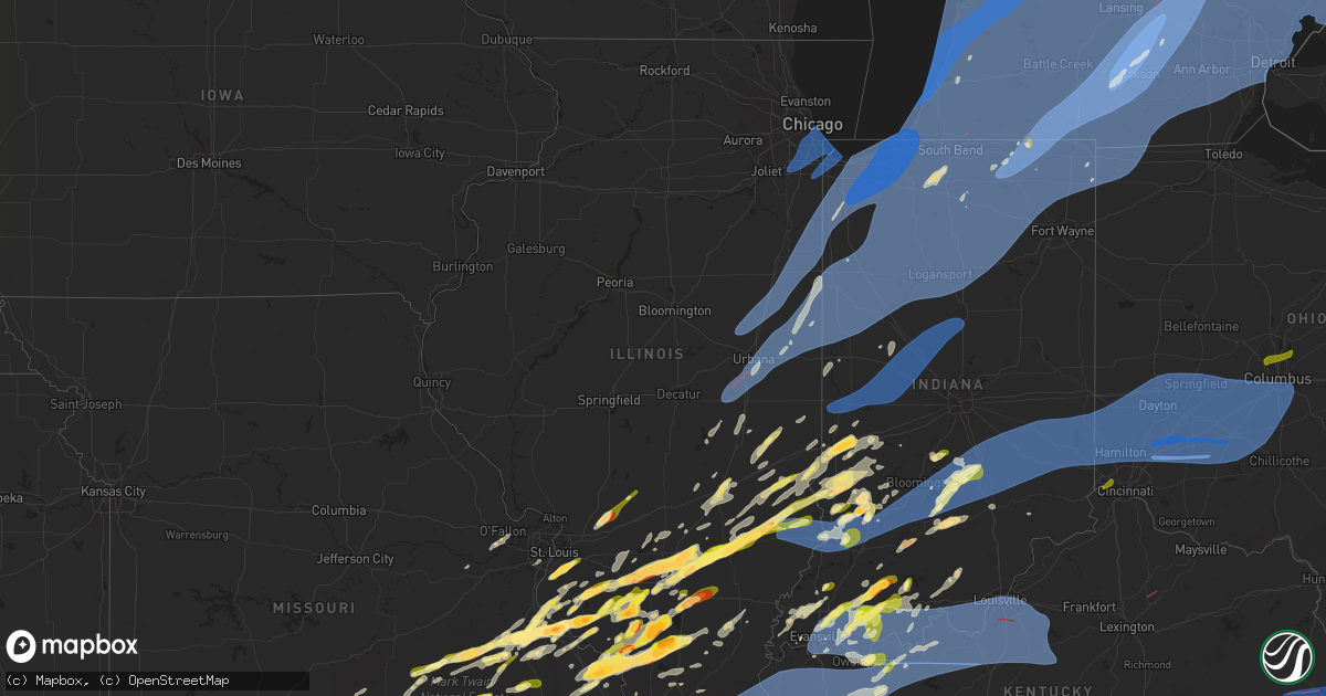
Hail Map in Illinois on March 30, 2025
Get this storm
March 30 map
$229
one time, instant access
Download today. No call, no setup
Keep the $229
Bought the map and want the full workflow? Apply the entire $229 to a subscription within 7 days. None of it is wasted.
Every map, not just this one
This buys you this map. Subscription and you get every map we run, in the markets you choose from a few cities to whole states to nationwide. Plus real-time alerts the moment a storm fires.
Contact data
Name, contact info, occupancy, even credit band for addresses in the footprint. You go from where it hit to who to call.
Become the source they trust
Unlimited branding weather history reports on demand. You already have the documented answer ready for the property owner, and you are the one who showed up with it.
Property data and RoofTrace estimates
Pull up any address you have got, its value and the exact code rules for that jurisdiction, straight from One Click Code. Then RoofTrace estimates the squares, pitch, and roof value, priced the way you price.
Storm reports in Illinois
Illinois
| Date | Description |
|---|---|
| 03/30/20256:30 PM CDT | Power poles snapped. |
| 03/30/20256:30 PM CDT | Damage to high school roof. |
| 03/30/20256:05 PM CDT | Ef-1 tornado. 105 mph. 18.2 mile track. Numerous trees snapped... Roof damage to homes and barns. Shrouded in 70-90 mph straight line winds to the south that eventually |
| 03/30/20255:38 PM CDT | A local report indicates 1.50 inch wind near Hurst |
| 03/30/20255:11 PM CDT | A local report indicates 1.50 inch wind near 2 SSW Christopher |
| 03/30/20254:51 PM CDT | Asos station klwv lawrenceville ap station elevation: 430 ft. |
| 03/30/20254:50 PM CDT | Time estimated from radar. |
| 03/30/20254:27 PM CDT | Report from mping: half dollar |
| 03/30/20254:20 PM CDT | A few powerlines blown down in robinson along with pea size hail. |
| 03/30/20254:20 PM CDT | A local report indicates 1.25 inch wind near 1 NNW Du Quoin |
| 03/30/20254:09 PM CDT | A local report indicates 1.00 inch wind near 2 N Vergennes |
| 03/30/20254:08 PM CDT | Hail fell for about 5 minutes and nearly covered the ground. |
| 03/30/20254:05 PM CDT | A local report indicates 1.00 inch wind near 3 E Dundas |
| 03/30/20254:03 PM CDT | Ping pong size hail south of flora with photos. |
| 03/30/20254:00 PM CDT | A local report indicates 1.50 inch wind near 1 WSW Sesser |
| 03/30/20254:00 PM CDT | Golf ball size hail lasted 8 minutes. |
| 03/30/20253:55 PM CDT | Tree blown down along with pea size hail. |
| 03/30/20253:49 PM CDT | A local report indicates 1.75 inch wind near 6 NW Pinckneyville |
| 03/30/20253:47 PM CDT | A local report indicates 1.00 inch wind near 6 SW Campbell Hill |
| 03/30/20253:45 PM CDT | A local report indicates 1.00 inch wind near Clay City |
| 03/30/20253:36 PM CDT | Via slack with picture of stones next to ruler - measured half dollar sized hail. |
| 03/30/20253:35 PM CDT | Photo from facebook of large hail in flora. |
| 03/30/20253:34 PM CDT | Via twitter. |
| 03/30/20253:31 PM CDT | Quarter to golf ball sized hail south and east of salem il. |
| 03/30/20253:19 PM CDT | Report from social media. |
| 03/30/20253:19 PM CDT | A local report indicates 1.00 inch wind near 1 SE Wamac |
| 03/30/20253:17 PM CDT | Large tree limb down. Time estimated from radar. |
| 03/30/20253:14 PM CDT | Report of golf balls falling in evansville. |
| 03/30/20253:14 PM CDT | Report of golf balls falling in evansville. |
| 03/30/20253:00 PM CDT | Broke siding. |
| 03/30/20252:53 PM CDT | Photos of hailstones compared to a quarter as well as wind driven hail damage to siding of a buiding. Siding has multiple quarter sized holes. |
| 03/30/20252:53 PM CDT | Picture of estimated golf ball sized hail east of salem. |
| 03/30/20252:53 PM CDT | A local report indicates 1.00 inch wind near Addieville |
| 03/30/20252:45 PM CDT | Private weather station reported reported 74 mph gust near ford heights. |
| 03/30/20252:45 PM CDT | 9 power poles broken and blown down. |
| 03/30/20252:44 PM CDT | A few scattered reports of tree branches downed in the east side... Calumet heights... Roseland... Burnside... Pullman... South deering... And riverdale community areas |
| 03/30/20252:40 PM CDT | Public report of small tree branches downed near 12th place and parnell avenue in west pullman community area |
| 03/30/20252:40 PM CDT | Public report of small tree branches downed near 12th place and parnell avenue in west pullman community area of chicago. Time estimated by radar. |
| 03/30/20252:39 PM CDT | Roof blown off building near sauk trail and holeman avenue in steger. Time estimated by radar. |
| 03/30/20252:34 PM CDT | Report east of new athens. |
| 03/30/20252:31 PM CDT | 1.5 inch diameter tree branch broken near chadbourn drive and 88th avenue in orland hills. Time estimated by radar. |
| 03/30/20252:31 PM CDT | Slack post of ping pong ball sized hail. |
| 03/30/20252:24 PM CDT | Private weather station reported 62 mph gust southeast of momence. |
| 03/30/20252:22 PM CDT | Report from mping: quarter |
| 03/30/20252:17 PM CDT | Private weather station reported 60 mph gust southeast of beaverville. |
| 03/30/20252:15 PM CDT | Indiana sign along route 9 near the indiana border damaged along with a farm shed. |
| 03/30/20252:10 PM CDT | Garage destroyed in danville near fairchild and griffin streets. |
| 03/30/20252:10 PM CDT | Damge to out building 0.5 mile ne of vermilion regional airport at 2400 north rd and 1950 east rd. Photo provided. |
| 03/30/20252:10 PM CDT | Trees and powerlines blown down. |
| 03/30/20252:09 PM CDT | 70 mph winds at route 1 near the iroquois and vermilion county border with nickel hail. |
| 03/30/20252:08 PM CDT | Damage shed from strong winds in bismarck. Facebook report. |
| 03/30/20252:07 PM CDT | Video showing half of large tree blowing down in backyard. |
| 03/30/20252:07 PM CDT | Wind gust of 62 mph with damage to chicken coop fence. Wind snapped old cedar posts off. |
| 03/30/20252:07 PM CDT | A local report indicates 70 MPH wind near Rossville |
| 03/30/20252:07 PM CDT | Tree branches blown down on power lines. About 25 percent of hoopeston without power. |
| 03/30/20252:07 PM CDT | Video on facebook showing tree falling down on a house in hoopeston from strong winds. |
| 03/30/20252:05 PM CDT | Measured wind gusts from 70 to 85 mph. Unofficial nearby report of 105 mph wind gust. |
| 03/30/20252:05 PM CDT | Tree blown down on a house near denmark rd and west newell rd. |
| 03/30/20252:00 PM CDT | House roof damage from strong winds on e 2430 north road. |
| 03/30/20251:58 PM CDT | Private weather station kilgilma8 reported 66 mph gust southwest of crescent city. |
| 03/30/20251:52 PM CDT | Report of downed power lines that caused a fire. The cause of the downed power lines was reported to be the thunderstorm. Time and location estimated by radar. |
| 03/30/20251:50 PM CDT | Power outages in homer from high winds. |
| 03/30/20251:50 PM CDT | A local report indicates 62 MPH wind near Ogden |
| 03/30/20251:49 PM CDT | Hail ranging in size from dimes to quarters fell for nearly 6 mins. |
| 03/30/20251:46 PM CDT | Kane county ema reports broken tree branch on power lines near fremont street and hill avenue in elgin. Time estimated by radar. |
| 03/30/20251:46 PM CDT | Kane county ema reports power lines downed along arrow street and austin avenue in carpentersville. Time estimated by radar. |
| 03/30/20251:45 PM CDT | Photo sent with 1 inch hail next to a quarter. Hail lasted for about 15 minutes and ponding of water. |
| 03/30/20251:45 PM CDT | Semi truck on west bound i-74 blown over near st joseph by high winds. |
| 03/30/20251:45 PM CDT | Some structural damage from high winds along with power outages. |
| 03/30/20251:45 PM CDT | Power outages from high thunderstorm wind gusts. |
| 03/30/20251:45 PM CDT | Morton building damaged by high winds. |
| 03/30/20251:45 PM CDT | At least 8-9 power poles blown down near royal. |
| 03/30/20251:43 PM CDT | Photo shows evergreen tree uprooted near sleepy hollow. Relayed by broadcast media... Time estimated by radar. |
| 03/30/20251:42 PM CDT | Report from mping: quarter |
| 03/30/20251:40 PM CDT | A local report indicates 1.00 inch wind near Effingham |
| 03/30/20251:40 PM CDT | Mesonet station fw0668 urbana station elevation: 748 ft. |
| 03/30/20251:40 PM CDT | Several trees blown down on the south side of windsor road... Between meadow brook park and philo rd. Time estimated from radar. |
| 03/30/20251:39 PM CDT | Public report 1.5 ne of columbia proper. |
| 03/30/20251:37 PM CDT | Kane county ema reports tree blocking eastbound lanes of highland avenue at coombs road west of elgin. Time estimated by radar. |
| 03/30/20251:36 PM CDT | Quarter sized hail in columbia. |
| 03/30/20251:35 PM CDT | Asos station kcmi willard arpt station elevation: 742 ft. |
| 03/30/20251:35 PM CDT | Largest hail between 1 and 1.5 inches in diameter. |
| 03/30/20251:35 PM CDT | 3 car crashes on southbound i-57 at mile marker 229 from high winds. |
| 03/30/20251:35 PM CDT | Pine tree broke off from high winds and landed on a car. |
| 03/30/20251:35 PM CDT | Several power poles and lines blown down west of 2.5 miles west of charleston. |
| 03/30/20251:33 PM CDT | Kane county ema reports fence damage along muirhead road west of elgin. Time estimated by radar. Of chicago. Time estimated by ra |
| 03/30/20251:33 PM CDT | Kane county ema reports fence damage along muirhead road west of elgin. Time estimated by radar. |
| 03/30/20251:30 PM CDT | Storage unit damaged on county road 900 just east of highway 45 1.5 miles nne of tolono. |
| 03/30/20251:30 PM CDT | Morton building collapsed at 1083 caty road 900 n 1.5 miles nne of tolono. Photos sent. |
| 03/30/20251:30 PM CDT | Building collapsed from high winds. |
| 03/30/20251:22 PM CDT | The tornado moved from the sw corner of champaign county to just north of tolono. It covered 12 miles in 12 minutes doing ef1 damage to outbuildings and trees. It was 2 |
| 03/30/20251:17 PM CDT | Photos of power poles down northwest of mattoon on near highway 33. |
| 03/30/20251:07 PM CDT | Downs trees and power lines and poles in sullivan via facebook post. |
| 03/30/202512:16 PM CDT | Doors of a farm outbuilding blown in and camper blown on its side. Pictures from slack. |
All States Impacted by Hail Map on March 30, 2025
Cities Impacted by Hail Map on March 30, 2025
- Coolidge, TX
- Dawson, TX
- Valley Mills, TX
- Clifton, TX
- Mexia, TX
- Wortham, TX
- Comanche, TX
- Streetman, TX
- Fairfield, TX
- San Saba, TX
- Lampasas, TX
- Foley, AL
- Kempner, TX
- Burnet, TX
- Florence, TX
- Bertram, TX
- Briggs, TX
- Copperas Cove, TX
- Jarrell, TX
- Georgetown, TX
- Bartlett, TX
- Liberty Hill, TX
- Granger, TX
- Vancleave, MS
- Moss Point, MS
- Holland, TX
- Buckholts, TX
- Thorndale, TX
- Breese, IL
- Germantown, IL
- Aviston, IL
- Albers, IL
- Cameron, TX
- Sainte Genevieve, MO
- Saint Mary, MO
- Bartelso, IL
- Chester, IL
- Ellis Grove, IL
- Walsh, IL
- Wasola, MO
- Brixey, MO
- Altamont, IL
- Windsor, IL
- Findlay, IL
- Salem, MO
- Thornfield, MO
- Sullivan, IL
- Dora, MO
- Drury, MO
- Gainesville, MO
- Cherryville, MO
- Festus, MO
- Mason, IL
- Mattoon, IL
- Beecher City, IL
- Valmeyer, IL
- Columbia, IL
- Millstadt, IL
- Davisville, MO
- Steelville, MO
- Viburnum, MO
- Potosi, MO
- Tuscola, IL
- Atwood, IL
- Hammond, IL
- Lovington, IL
- Ivesdale, IL
- Charleston, IL
- Greenup, IL
- Lerna, IL
- Toledo, IL
- Washington, MO
- Watson, IL
- Effingham, IL
- Teutopolis, IL
- Philo, IL
- Tolono, IL
- Urbana, IL
- Arcola, IL
- Humboldt, IL
- Bement, IL
- Sadorus, IL
- Pesotum, IL
- Champaign, IL
- Villa Grove, IL
- Savoy, IL
- Sidney, IL
- Saint Joseph, IL
- Ogden, IL
- Fithian, IL
- Homer, IL
- Royal, IL
- Armstrong, IL
- Belleville, IL
- Fisher, IL
- Foosland, IL
- Mahomet, IL
- Dewey, IL
- Rantoul, IL
- Ludlow, IL
- Paxton, IL
- Gibson City, IL
- Loda, IL
- Buckley, IL
- Melvin, IL
- Rankin, IL
- Cissna Park, IL
- Onarga, IL
- Gilman, IL
- Collison, IL
- Muncie, IL
- Penfield, IL
- Potomac, IL
- Danville, IL
- Rossville, IL
- Hoopeston, IL
- Oakwood, IL
- O'Fallon, IL
- Fairview Heights, IL
- Fults, IL
- Smithton, IL
- New Athens, IL
- Westfield, IL
- Ashmore, IL
- Cabool, MO
- Waterloo, IL
- Pinckneyville, IL
- Coulterville, IL
- Freeburg, IL
- Kansas, IL
- Sigel, IL
- Belgrade, MO
- Mineral Point, MO
- Houston, MO
- Watseka, IL
- Crescent City, IL
- Milford, IL
- Ashkum, IL
- Clifton, IL
- Martinton, IL
- Saint Anne, IL
- Papineau, IL
- Beaverville, IL
- Alvin, IL
- Henning, IL
- Wellington, IL
- Sheldon, IL
- Gifford, IL
- Thomasboro, IL
- Williamsport, IN
- Stockland, IL
- Ambia, IN
- West Lebanon, IN
- Bismarck, IL
- Defiance, MO
- Boss, MO
- Red Bud, IL
- Valles Mines, MO
- Bonne Terre, MO
- Nashville, IL
- Oakdale, IL
- Augusta, MO
- Saint Charles, MO
- Brooksville, FL
- De Soto, MO
- Cadet, MO
- Elk Creek, MO
- Eunice, MO
- Raymondville, MO
- Yukon, MO
- Solo, MO
- Stewardson, IL
- Shumway, IL
- Montrose, IL
- Edgewood, IL
- Tamaroa, IL
- Ashley, IL
- French Village, MO
- Bloomsdale, MO
- Harrison, AR
- Licking, MO
- Key Biscayne, FL
- Summersville, MO
- O'Fallon, MO
- Saint Peters, MO
- Blackwell, MO
- Alpena, AR
- Bixby, MO
- Cayuga, IN
- Perrysville, IN
- Frankfort, IL
- Mokena, IL
- New Lenox, IL
- Tinley Park, IL
- Orland Park, IL
- Oak Forest, IL
- Crestwood, IL
- Midlothian, IL
- Chicago, IL
- Alsip, IL
- Robbins, IL
- Palos Heights, IL
- Oak Lawn, IL
- Chicago Ridge, IL
- Burbank, IL
- Worth, IL
- Hazel Crest, IL
- Homewood, IL
- Country Club Hills, IL
- Hometown, IL
- Markham, IL
- Blue Island, IL
- Evergreen Park, IL
- Posen, IL
- Harvey, IL
- Riverdale, IL
- South Holland, IL
- Dolton, IL
- Lowell, IN
- Cedar Lake, IN
- Pembroke Township, IL
- Grant Park, IL
- Beecher, IL
- Momence, IL
- Lake Village, IN
- Schneider, IN
- Shelby, IN
- Demotte, IN
- Thayer, IN
- Hebron, IN
- Crown Point, IN
- Morocco, IN
- Donovan, IL
- Goodland, IN
- Kentland, IN
- Fowler, IN
- Boswell, IN
- Brook, IN
- Earl Park, IN
- Oxford, IN
- Pine Village, IN
- Remington, IN
- Rensselaer, IN
- Templeton, IN
- West Lafayette, IN
- Wolcott, IN
- Attica, IN
- Westpoint, IN
- Brookston, IN
- Chalmers, IN
- Lafayette, IN
- Otterbein, IN
- Lenzburg, IL
- Mascoutah, IL
- Calumet City, IL
- Hammond, IN
- Marissa, IL
- Addieville, IL
- Saint Libory, IL
- Chicago Heights, IL
- Steger, IL
- Crete, IL
- Schererville, IN
- Highland, IN
- Dyer, IN
- Munster, IN
- Lansing, IL
- Glenwood, IL
- Roby, MO
- Woodlawn, IL
- New Baden, IL
- Hartshorn, MO
- Eminence, MO
- Walnut Hill, IL
- Centralia, IL
- Yellville, AR
- Lead Hill, AR
- Park Hills, MO
- Plato, MO
- Miami, FL
- Miami Beach, FL
- Green Forest, AR
- Covington, IN
- Belleview, MO
- Caledonia, MO
- Casey, IL
- Kouts, IN
- Wheatfield, IN
- Monon, IN
- Reynolds, IN
- Francesville, IN
- Okawville, IL
- Monticello, IN
- Delphi, IN
- Battle Ground, IN
- Rockville, IN
- Bloomingdale, IN
- Marshall, IN
- Carbon, IN
- Waveland, IN
- Mecca, IN
- Hillsdale, IN
- Montezuma, IN
- Clinton, IN
- Dana, IN
- Crawfordsville, IN
- Greencastle, IN
- New Market, IN
- Roachdale, IN
- Ladoga, IN
- Russellville, IN
- Dix, IL
- Irondale, MO
- Salem, IL
- Kell, IL
- Iuka, IL
- Hoyleton, IL
- Prairie Du Rocher, IL
- Alhambra, IL
- Pocahontas, IL
- Highland, IL
- New Douglas, IL
- Mountain Home, AR
- Mount Vernon, IL
- Cantonment, FL
- Saint Louis, MO
- Pontiac, MO
- Farmington, MO
- Molino, FL
- Texico, IL
- Marine, IL
- Bismarck, MO
- Sparta, IL
- Baldwin, IL
- Bull Shoals, AR
- Flippin, AR
- Clarkridge, AR
- East Chicago, IN
- Griffith, IN
- Gary, IN
- Whiting, IN
- Boone Grove, IN
- Lake Station, IN
- Portage, IN
- Hobart, IN
- Valparaiso, IN
- Merrillville, IN
- La Crosse, IN
- Wanatah, IN
- Knox, IN
- Hanna, IN
- Modoc, IL
- Evansville, IL
- Tilden, IL
- Star City, IN
- North Judson, IN
- Buffalo, IN
- Yeoman, IN
- Medaryville, IN
- Winamac, IN
- San Pierre, IN
- Elizabeth, AR
- Kewanna, IN
- Monterey, IN
- Burnettsville, IN
- Ora, IN
- Rochester, IN
- Lucerne, IN
- Royal Center, IN
- Idaville, IN
- Logansport, IN
- Galveston, IN
- Twelve Mile, IN
- Walton, IN
- Flora, IN
- Camden, IN
- New Richmond, IN
- Peel, AR
- Marble Falls, AR
- Linden, IN
- Romney, IN
- Bunker, MO
- Centerville, MO
- Newton, IL
- Patoka, IL
- Oakland, AR
- Richview, IL
- Lesterville, MO
- Xenia, IL
- Seligman, MO
- Washburn, MO
- Kinmundy, IL
- Gassville, AR
- Cotter, AR
- Carlyle, IL
- Paris, IL
- Vernon, IL
- Henderson, AR
- Bainbridge, IN
- Colfax, IN
- Darlington, IN
- New Ross, IN
- Frankfort, IN
- Thorntown, IN
- Clarks Hill, IN
- Jamestown, IN
- Advance, IN
- Lebanon, IN
- North Salem, IN
- Johnsonville, IL
- Rinard, IL
- Odin, IL
- Black, MO
- Michigan City, IN
- Kingsford Heights, IN
- Hamlet, IN
- Beverly Shores, IN
- Westville, IN
- La Porte, IN
- Chesterton, IN
- Union Mills, IN
- New Buffalo, MI
- Rolling Prairie, IN
- Grovertown, IN
- Culver, IN
- Plymouth, IN
- Walkerton, IN
- North Liberty, IN
- Mill Creek, IN
- Argos, IN
- Tippecanoe, IN
- Macy, IN
- Peru, IN
- Grissom Arb, IN
- New Waverly, IN
- Denver, IN
- Bunker Hill, IN
- Onward, IN
- Akron, IN
- Mexico, IN
- Kirklin, IN
- Russiaville, IN
- Michigantown, IN
- Forest, IN
- Annapolis, IL
- Oblong, IL
- Martinsville, IL
- Yale, IL
- Everton, AR
- Willow Hill, IL
- Marshall, IL
- Dennison, IL
- Du Bois, IL
- Protem, MO
- Theodosia, MO
- Udall, MO
- Bakersfield, MO
- Sorento, IL
- Cassville, MO
- Aurora, MO
- Cape Fair, MO
- Shell Knob, MO
- Viola, AR
- Ellington, MO
- Galena, MO
- Moody, MO
- Louisville, IL
- Flora, IL
- Omaha, AR
- Caulfield, MO
- Midway, AR
- Mountain View, MO
- Lakeview, AR
- Isabella, MO
- West York, IL
- Clay City, IL
- Fort Worth, TX
- Naval Air Station Jrb, TX
- West Plains, MO
- Ironton, MO
- Fredericktown, MO
- Bourbon, IN
- Eagle Rock, MO
- Mammoth Spring, AR
- Salem, AR
- Arcadia, MO
- Lakeville, IN
- South Bend, IN
- Donnellson, IL
- Hillsboro, IL
- Gamaliel, AR
- Ingraham, IL
- Reeds Spring, MO
- Birch Tree, MO
- Saint Peter, IL
- Vandalia, IL
- Dieterich, IL
- Campbell Hill, IL
- Coffeen, IL
- Sturkie, AR
- Rockwood, IL
- Cutler, IL
- Gepp, AR
- Greenville, IL
- Ava, IL
- Du Quoin, IL
- Bridgman, MI
- Lakeside, MI
- New Carlisle, IN
- Saint Joseph, MI
- Baroda, MI
- Union Pier, MI
- Stevensville, MI
- Harbert, MI
- Three Oaks, MI
- Galien, MI
- Buchanan, MI
- Bremen, IN
- Sawyer, MI
- New Troy, MI
- Cassopolis, MI
- Sodus, MI
- Granger, IN
- Eau Claire, MI
- Wakarusa, IN
- Berrien Center, MI
- Berrien Springs, MI
- Niles, MI
- Mishawaka, IN
- Elkhart, IN
- Osceola, IN
- Dowagiac, MI
- Edwardsburg, MI
- Notre Dame, IN
- New Paris, IN
- Goshen, IN
- Bristol, IN
- Milford, IN
- Middlebury, IN
- Etna Green, IN
- Nappanee, IN
- Roann, IN
- Atwood, IN
- Leesburg, IN
- Claypool, IN
- Burket, IN
- Mentone, IN
- Syracuse, IN
- Winona Lake, IN
- North Webster, IN
- Pierceton, IN
- North Manchester, IN
- Millersburg, IN
- Warsaw, IN
- Silver Lake, IN
- Cromwell, IN
- Columbia City, IN
- South Whitley, IN
- Larwill, IN
- Laketon, IN
- Liberty Mills, IN
- Huntington, IN
- Wabash, IN
- Servia, IN
- Urbana, IN
- Lagro, IN
- Kempton, IN
- Sharpsville, IN
- Tipton, IN
- Kokomo, IN
- Vergennes, IL
- West Union, IL
- Spokane, MO
- Chestnutridge, MO
- Walnut Shade, MO
- Elkville, IL
- Dowell, IL
- Koshkonong, MO
- Thayer, MO
- Noble, IL
- Dundas, IL
- Golden, MO
- Shubuta, MS
- Farina, IL
- Terre Haute, IN
- Pyatt, AR
- West Terre Haute, IN
- Olney, IL
- West Liberty, IL
- Sesser, IL
- Scheller, IL
- Mulkeytown, IL
- Waltonville, IL
- Bonnie, IL
- Arlington, TX
- Opdyke, IL
- Belle Rive, IL
- Bluford, IL
- Keenes, IL
- Kimberling City, MO
- Berryville, AR
- Lampe, MO
- Norwood, MO
- Couch, MO
- Wiggins, MS
- Vanzant, MO
- Mountain Grove, MO
- Hartford, MI
- Squires, MO
- Fremont, MO
- Winona, MO
- Alton, MO
- Eureka Springs, AR
- Steeleville, IL
- Percy, IL
- Pensacola, FL
- Kimmell, IN
- Churubusco, IN
- Laotto, IN
- Avilla, IN
- Albion, IN
- Wawaka, IN
- Ligonier, IN
- Kendallville, IN
- Howe, IN
- Wolcottville, IN
- Topeka, IN
- Lagrange, IN
- Shipshewana, IN
- South Milford, IN
- Rome City, IN
- Constantine, MI
- Burr Oak, MI
- White Pigeon, MI
- Jones, MI
- Sturgis, MI
- Union, MI
- Benton Harbor, MI
- Lawton, MI
- Three Rivers, MI
- Decatur, MI
- Marcellus, MI
- Centreville, MI
- Mendon, MI
- Vandalia, MI
- Schoolcraft, MI
- Vicksburg, MI
- Kalamazoo, MI
- Watervliet, MI
- South Haven, MI
- Mattawan, MI
- Gobles, MI
- Douglas, MI
- Coloma, MI
- Grand Junction, MI
- Bloomingdale, MI
- Covert, MI
- Fennville, MI
- Lawrence, MI
- Pullman, MI
- Allegan, MI
- Saugatuck, MI
- Bangor, MI
- Portage, MI
- Paw Paw, MI
- Holland, MI
- Hamilton, MI
- Macatawa, MI
- Grand Haven, MI
- West Olive, MI
- Otsego, MI
- Wayne City, IL
- Robinson, IL
- Sumner, IL
- Palestine, IL
- Stoy, IL
- Branson, MO
- Brazil, IN
- Cory, IN
- Ravenden, AR
- Williamsville, MO
- Rosedale, IN
- Doniphan, MO
- Gatewood, MO
- Myrtle, MO
- Van Buren, MO
- Blue Eye, MO
- Quitman, MS
- Ava, MO
- Kirbyville, MO
- Hollister, MO
- Ridgedale, MO
- Hutsonville, IL
- Oak Grove, AR
- Staunton, IN
- Dorr, MI
- Allendale, MI
- Zeeland, MI
- Hudsonville, MI
- Hopkins, MI
- Coopersville, MI
- Byron Center, MI
- Jenison, MI
- Martin, MI
- Plainwell, MI
- Grandville, MI
- Wayland, MI
- Shelbyville, MI
- Leonidas, MI
- Scotts, MI
- Colon, MI
- Climax, MI
- Fulton, MI
- Athens, MI
- Galesburg, MI
- Sherwood, MI
- East Leroy, MI
- Battle Creek, MI
- Richland, MI
- Augusta, MI
- Hudson, IN
- Corunna, IN
- Butler, IN
- Auburn, IN
- Pleasant Lake, IN
- Waterloo, IN
- Garrett, IN
- Angola, IN
- Ashley, IN
- Pomona, MO
- Murphysboro, IL
- Fremont, IN
- Bronson, MI
- Hamilton, IN
- Orland, IN
- Montgomery, MI
- Coldwater, MI
- Union City, MI
- Perryville, MO
- Sullivan, IN
- Merom, IN
- Claremont, IL
- Bridgeport, IL
- Flat Rock, IL
- Reelsville, IN
- Greenville, MO
- Pocahontas, AR
- Grandin, MO
- Bradleyville, MO
- Cedarcreek, MO
- Milton, FL
- Poplar Bluff, MO
- Ellsinore, MO
- Mill Spring, MO
- Centerpoint, IN
- Farmersburg, IN
- Kissimmee, FL
- Camp, AR
- Glencoe, AR
- Shelburn, IN
- Fairbanks, IN
- Frohna, MO
- Wyoming, MI
- Caledonia, MI
- Marne, MI
- Grand Rapids, MI
- Comstock Park, MI
- Hickory Corners, MI
- Delton, MI
- Middleville, MI
- Alto, MI
- Ada, MI
- Hastings, MI
- Freeport, MI
- Dowling, MI
- Ceresco, MI
- Nashville, MI
- Bellevue, MI
- Homer, MI
- Marshall, MI
- Tekonsha, MI
- Reading, MI
- Quincy, MI
- Burlington, MI
- Allen, MI
- Camden, MI
- Hillsdale, MI
- Litchfield, MI
- Montpelier, OH
- Edon, OH
- Jonesville, MI
- Waldron, MI
- Pioneer, OH
- Osseo, MI
- Edgerton, OH
- Alvordton, OH
- Bryan, OH
- Lewis, IN
- Hymera, IN
- Jasonville, IN
- Coalmont, IN
- Saint Francisville, IL
- Lawrenceville, IL
- Vincennes, IN
- Oaktown, IN
- Silva, MO
- Carlisle, IN
- Hardy, AR
- Saint Joe, AR
- Western Grove, AR
- Valley Springs, AR
- Redford, MO
- Patton, MO
- Sedgewickville, MO
- Farrar, MO
- Cherokee Village, AR
- Rueter, MO
- Gulf Breeze, FL
- Poland, IN
- Noble, MO
- Kissee Mills, MO
- Jacob, IL
- Newaygo, MI
- Conklin, MI
- Ravenna, MI
- Grant, MI
- Nunica, MI
- Casnovia, MI
- Bailey, MI
- Spring Lake, MI
- Sparta, MI
- Cedar Springs, MI
- Sand Lake, MI
- Belmont, MI
- Kent City, MI
- Rockford, MI
- Howard City, MI
- Greenville, MI
- Belding, MI
- Lowell, MI
- Lake Odessa, MI
- Saranac, MI
- Clarksville, MI
- Woodland, MI
- Charlotte, MI
- Vermontville, MI
- Olivet, MI
- Eaton Rapids, MI
- Springport, MI
- Hanover, MI
- Horton, MI
- Albion, MI
- Spring Arbor, MI
- Concord, MI
- Parma, MI
- Edwardsport, IN
- Freelandville, IN
- Sandborn, IN
- Jerome, MI
- North Adams, MI
- Pittsford, MI
- Hudson, MI
- West Unity, OH
- Stryker, OH
- Gorham, IL
- Royalton, IL
- Warm Springs, AR
- Bruceville, IN
- Wheatland, IN
- Bicknell, IN
- Monroe City, IN
- Ragsdale, IN
- Fairdealing, MO
- Zeigler, IL
- Ash Flat, AR
- Westphalia, IN
- Williford, AR
- Friedheim, MO
- Oxly, MO
- Naylor, MO
- Clubb, MO
- Ravenden Springs, AR
- Neelyville, MO
- Harviell, MO
- Zalma, MO
- McGee, MO
- Glenallen, MO
- Marquand, MO
- Russellville, AR
- Wappapello, MO
- Linton, IN
- Clay City, IN
- Uniontown, MO
- Washington, IN
- Gowen, MI
- Morley, MI
- Stanton, MI
- Coral, MI
- Trufant, MI
- Pierson, MI
- Lakeview, MI
- Sidney, MI
- Crystal, MI
- Sheridan, MI
- Ionia, MI
- Fenwick, MI
- Orleans, MI
- Six Lakes, MI
- Carson City, MI
- Sunfield, MI
- Fowler, MI
- Pewamo, MI
- Lyons, MI
- Portland, MI
- Hubbardston, MI
- Westphalia, MI
- Muir, MI
- De Soto, IL
- Eagle, MI
- Potterville, MI
- Mulliken, MI
- Grand Ledge, MI
- Dimondale, MI
- Benton, IL
- Lansing, MI
- Mason, MI
- Pleasant Lake, MI
- Stockbridge, MI
- Holt, MI
- Jackson, MI
- Leslie, MI
- Rives Junction, MI
- Onondaga, MI
- Cement City, MI
- Brooklyn, MI
- Somerset Center, MI
- Napoleon, MI
- Adrian, MI
- Onsted, MI
- Michigan Center, MI
- Manitou Beach, MI
- Clarklake, MI
- Munith, MI
- Grass Lake, MI
- Clayton, MI
- Morenci, MI
- Fayette, OH
- Addison, MI
- Archbold, OH
- Powersite, MO
- Lyons, IN
- Elnora, IN
- Newberry, IN
- Bloomfield, IN
- Switz City, IN
- Plainville, IN
- Montgomery, IN
- Carbondale, IL
- Carterville, IL
- Hurst, IL
- Damascus, AR
- Springfield, AR
- Moore Haven, FL
- Okeechobee, FL
- West Frankfort, IL
- Norfork, AR
- Dugger, IN
- Qulin, MO
- Worthington, IN
- Broseley, MO
- Willow Springs, MO
- Calico Rock, AR
- Jerusalem, AR
- Hattieville, AR
- Imboden, AR
- Tecumseh, MO
- Zanoni, MO
- Bexar, AR
- Bowling Green, IN
- Coal City, IN
- Shoals, IN
- Mitchell, IN
- Maynard, AR
- Princeton, IN
- Francisco, IN
- Manchester, MI
- Tecumseh, MI
- Chelsea, MI
- Tipton, MI
- Britton, MI
- Clinton, MI
- Norvell, MI
- East Lansing, MI
- Williamston, MI
- Webberville, MI
- Gregory, MI
- Saline, MI
- Dansville, MI
- Okemos, MI
- Dexter, MI
- Howell, MI
- Pinckney, MI
- Ann Arbor, MI
- Dewitt, MI
- Bath, MI
- Perry, MI
- Haslett, MI
- Fowlerville, MI
- Saint Johns, MI
- Herrin, IL
- Owosso, MI
- Ovid, MI
- Perrinton, MI
- Maple Rapids, MI
- Laingsburg, MI
- Middleton, MI
- Riverdale, MI
- Alma, MI
- Elsie, MI
- Vestaburg, MI
- Ashley, MI
- Ithaca, MI
- Bannister, MI
- Pompeii, MI
- Blanchard, MI
- Edmore, MI
- Elwell, MI
- Sumner, MI
- North Star, MI
- Biggers, AR
- Corning, AR
- Datto, AR
- Bernie, MO
- Campbell, MO
- Fisk, MO
- Malden, MO
- Dexter, MO
- West Baden Springs, IN
- Quincy, IN
- Altenburg, MO
- Old Appleton, MO
- Oak Ridge, MO
- Melbourne, AR
- Pindall, AR
- Brownwood, MO
- Oran, MO
- Sturdivant, MO
- Advance, MO
- Pineville, AR
- Peace Valley, MO
- Saint Cloud, FL
- Gosport, IN
- Solsberry, IN
- Freedom, IN
- Spencer, IN
- Bee Branch, AR
- Buckner, IL
- Puxico, MO
- Dudley, MO
- Brockwell, AR
- Odon, IN
- Bell City, MO
- Orient, IL
- Christopher, IL
- Martinsville, IN
- Morgantown, IN
- Heltonville, IN
- Bedford, IN
- Norman, IN
- Nashville, IN
- Saint Louis, MI
- Shepherd, MI
- Midland, MI
- Mount Pleasant, MI
- Knobel, AR
- Saint Charles, MI
- Henderson, MI
- Wheeler, MI
- Oakley, MI
- Chesaning, MI
- Merrill, MI
- Breckenridge, MI
- Brant, MI
- Hemlock, MI
- Evansville, IN
- Chandler, IN
- Fenton, MI
- Corunna, MI
- Morrice, MI
- Lennon, MI
- Swartz Creek, MI
- Durand, MI
- Bancroft, MI
- Linden, MI
- Gaines, MI
- Byron, MI
- Vernon, MI
- Hartland, MI
- Holly, MI
- Highland, MI
- Brighton, MI
- Milford, MI
- South Lyon, MI
- Wixom, MI
- Northville, MI
- Plymouth, MI
- New Hudson, MI
- Milan, MI
- Whitmore Lake, MI
- Hamburg, MI
- Elberfeld, IN
- Willis, MI
- Canton, MI
- Maybee, MI
- Carleton, MI
- Ypsilanti, MI
- Belleville, MI
- New Boston, MI
- Logan, IL
- Thompsonville, IL
- Bloomington, IN
- Wadesville, IN
- Poseyville, IN
- New Harmony, IN
- Quitman, AR
- Lynnville, IN
- Clinton, AR
- Jackson, MO
- Cape Girardeau, MO
- Chaffee, MO
- Peach Orchard, AR
- Horseshoe Bend, AR
- Bloomfield, MO
- Sage, AR
- Mount Pleasant, AR
- Jasper, AR
- Guion, AR
- Franklin, AR
- Violet Hill, AR
- Freeman Spur, IL
- Tennyson, IN
- Essex, MO
- Broughton, IL
- McLeansboro, IL
- Rector, AR
- Piggott, AR
- Medora, IN
- Romulus, MI
- Westland, MI
- Wayne, MI
- Detroit, MI
- Novi, MI
- Garden City, MI
- Commerce Township, MI
- Walled Lake, MI
- Inkster, MI
- Livonia, MI
- Farmington, MI
- Oakland City, IN
- White Lake, MI
- Taylor, MI
- Waterford, MI
- West Bloomfield, MI
- Clarkston, MI
- Davisburg, MI
- Flushing, MI
- Grand Blanc, MI
- New Lothrop, MI
- Flint, MI
- Davison, MI
- Goodrich, MI
- Ortonville, MI
- Burton, MI
- Montrose, MI
- Burt, MI
- Clio, MI
- Freeland, MI
- Saginaw, MI
- Birch Run, MI
- Mount Morris, MI
- Columbus, IN
- Auburn, MI
- Bridgeport, MI
- Compton, AR
- Mountain View, AR
- Evening Shade, AR
- Sidney, AR
- Stendal, IN
- Heber Springs, AR
- Wilburn, AR
- Cave City, AR
- Wolf Lake, IL
- Cynthiana, IN
- Fort Branch, IN
- Haubstadt, IN
- Benton, MO
- Scott City, MO
- Velpen, IN
- Winslow, IN
- Parma, MO
- Batesville, AR
- Enfield, IL
- Poughkeepsie, AR
- Sikeston, MO
- Marion, IL
- Makanda, IL
- Alto Pass, IL
- Trafalgar, IN
- Mount Vernon, IN
- Thebes, IL
- Vanduser, MO
- Macedonia, IL
- Smithville, AR
- Sulphur Rock, AR
- Strawberry, AR
- Tamms, IL
- Cord, AR
- Alicia, AR
- Lynn, AR
- Saffell, AR
- Pollard, AR
- Greenway, AR
- Whitewater, MO
- Marble Hill, MO
- Canalou, MO
- Catron, MO
- Matthews, MO
- New Madrid, MO
- Cairo, IL
- Miller City, IL
- Charleston, MO
- Bertrand, MO
- Jonesboro, IL
- Ullin, IL
- McClure, IL
- Olive Branch, IL
- Dongola, IL
- Bringhurst, IN
- Buck Creek, IN
- Locust Grove, AR
- Marcella, AR
- Jasper, IN
- Holland, IN
- Huntingburg, IN
- Bay City, MI
- Carrollton, MI
- Munger, MI
- Pinconning, MI
- Kawkawlin, MI
- Millington, MI
- Essexville, MI
- University Center, MI
- Linwood, MI
- Frankenmuth, MI
- Reese, MI
- Vassar, MI
- Genesee, MI
- Metamora, MI
- Troy, MI
- Redford, MI
- Rochester, MI
- Berkley, MI
- Birmingham, MI
- Huntington Woods, MI
- Atlas, MI
- Columbiaville, MI
- Keego Harbor, MI
- Royal Oak, MI
- Otter Lake, MI
- Dearborn Heights, MI
- Lake Orion, MI
- Oak Park, MI
- Franklin, MI
- Utica, MI
- Southfield, MI
- Hadley, MI
- Leonard, MI
- Oakland, MI
- Clawson, MI
- Pontiac, MI
- Auburn Hills, MI
- Dryden, MI
- Bloomfield Hills, MI
- Lapeer, MI
- Oxford, MI
- Dearborn, MI
- Fostoria, MI
- Otisville, MI
- Riverview, MI
- Hazel Park, MI
- Hamtramck, MI
- Wyandotte, MI
- Warren, MI
- Ferndale, MI
- Allen Park, MI
- Ecorse, MI
- Southgate, MI
- Pleasant Ridge, MI
- Madison Heights, MI
- Lincoln Park, MI
- Trenton, MI
- Highland Park, MI
- Melvindale, MI
- Sterling Heights, MI
- River Rouge, MI
- Villa Ridge, IL
- Eldorado, IL
- Galatia, IL
- Raleigh, IL
- Dale, IL
- Pangburn, AR
- Judsonia, AR
- Floral, AR
- Pulaski, IL
- Nineveh, IN
- Taylorsville, IN
- Edinburgh, IN
- Drasco, AR
- Goreville, IL
- Palestine, TX
- Pittsburg, IL
- Mounds, IL
- La Center, KY
- Belknap, IL
- Barlow, KY
- Olmsted, IL
- Grand Chain, IL
- Karnak, IL
- Metropolis, IL
- Kevil, KY
- East Prairie, MO
- Cypress, IL
- Mound City, IL
- Saint Anthony, IN
- Dubois, IN
- Birdseye, IN
- Bardwell, KY
- Wickliffe, KY
- Anniston, MO
- Celestine, IN
- Holcomb, MO
- Saint Francis, AR
- Loogootee, IN
- Seymour, IN
- Owensburg, IN
- Springville, IN
- Avoca, IN
- Crane, IN
- Freetown, IN
- Williams, IN
- Oolitic, IN
- Scotland, IN
- Unionville, IN
- Franklin, IN
- Swifton, AR
- Eastpointe, MI
- Fraser, MI
- Grosse Pointe, MI
- Center Line, MI
- Clinton Township, MI
- Harper Woods, MI
- Saint Clair Shores, MI
- Roseville, MI
- Frankston, TX
- Capac, MI
- Mayville, MI
- Silverwood, MI
- Armada, MI
- Macomb, MI
- Attica, MI
- Imlay City, MI
- Allenton, MI
- Brown City, MI
- Kingston, MI
- Almont, MI
- North Branch, MI
- Caro, MI
- Washington, MI
- Clifford, MI
- Romeo, MI
- Ray, MI
- Fairgrove, MI
- Akron, MI
- Elizabethtown, IN
- Jonesville, IN
- Scipio, IN
- Saint Paul, IN
- Flat Rock, IN
- Manilla, IN
- Hope, IN
- Greensburg, IN
- Hartsville, IN
- Shelbyville, IN
- Clifford, IN
- Waldron, IN
- Rushville, IN
- Homer, IN
- Milroy, IN
- French Lick, IN
- Eckerty, IN
- Grantsburg, IL
- Golconda, IL
- Vienna, IL
- West Paducah, KY
- Owensville, IN
- Bradford, AR
- Brownstown, IN
- Hoxie, AR
- Powhatan, AR
- Ozark, IL
- Bald Knob, AR
- Tumbling Shoals, AR
- Delaplaine, AR
- Creal Springs, IL
- Walnut Ridge, AR
- Portia, AR
- Pleasant Plains, AR
- Thida, AR
- Oil Trough, AR
- Cash, AR
- Richmond, MI
- New Baltimore, MI
- New Haven, MI
- Memphis, MI
- Harrison Township, MI
- Mount Clemens, MI
- Emmett, MI
- Melvin, MI
- Marlette, MI
- Yale, MI
- Unionville, MI
- Cass City, MI
- Deford, MI
- Sebewaing, MI
- Gagetown, MI
- Gibson, MO
- Clarkton, MO
- Gideon, MO
- Laurel, IN
- Grammer, IN
- Glenwood, IN
- Westport, IN
- Connersville, IN
- Metamora, IN
- Batesville, IN
- Oldenburg, IN
- Osgood, IN
- Boonville, IN
- Bono, AR
- Smithland, KY
- Hampton, KY
- Paducah, KY
- Brookport, IL
- Tuckerman, AR
- Jacksonville, TX
- Branchville, IN
- Beech Grove, AR
- Fredericksburg, IN
- Hardinsburg, IN
- Milltown, IN
- Depauw, IN
- Paragould, AR
- Newark, AR
- Dale, IN
- Cannelburg, IN
- Newburgh, IN
- Bristow, IN
- Saint Meinrad, IN
- Newport, AR
- Rusk, TX
- Marengo, IN
- Lilbourn, MO
- Jonesboro, AR
- Portageville, MO
- Ubly, MI
- Elkton, MI
- Sandusky, MI
- Pigeon, MI
- Owendale, MI
- Peck, MI
- Snover, MI
- Decker, MI
- Bad Axe, MI
- Carsonville, MI
- Avoca, MI
- Applegate, MI
- Goodells, MI
- Croswell, MI
- North Street, MI
- Smiths Creek, MI
- East China, MI
- Saint Clair, MI
- Fair Haven, MI
- Columbus, MI
- Jeddo, MI
- Casco, MI
- Brookville, IN
- Sunman, IN
- Algonac, MI
- Harsens Island, MI
- Marine City, MI
- Liberty, IN
- Brownsville, IN
- Marion, KY
- Burna, KY
- Salem, KY
- Amagon, AR
- Gentryville, IN
- Ferdinand, IN
- Salem, IN
- English, IN
- Dupont, IN
- Butlerville, IN
- Lafe, AR
- Marmaduke, AR
- Pekin, IN
- Hanson, KY
- Deckerville, MI
- Minden City, MI
- Palms, MI
- Ruth, MI
- Forestville, MI
- Fort Gratiot, MI
- Port Sanilac, MI
- Lexington, MI
- Port Huron, MI
- Marysville, MI
- Brookland, AR
- Bath, IN
- Eaton, OH
- Cedar Grove, IN
- Camden, OH
- College Corner, OH
- New Trenton, IN
- West Harrison, IN
- West College Corner, IN
- Oxford, OH
- Weiner, AR
- Fisher, AR
- Sturgis, KY
- Rosiclare, IL
- Cave In Rock, IL
- Elizabethtown, IL
- Morganfield, KY
- Harrisburg, AR
- State University, AR
- Lake City, AR
- Bay, AR
- Henderson, KY
- Clinton, KY
- Philpot, KY
- Utica, KY
- Lincoln City, IN
- Columbus, KY
- Manitou, KY
- Madisonville, KY
- Arlington, KY
- Kennett, MO
- Somerville, OH
- West Alexandria, OH
- Lewisburg, OH
- Okeana, OH
- Hamilton, OH
- Middletown, OH
- New Lebanon, OH
- Brookville, OH
- Farmersville, OH
- Harrison, OH
- Clay, KY
- Trumann, AR
- Black Oak, AR
- Reed, KY
- Spottsville, KY
- Monette, AR
- Leachville, AR
- Manila, AR
- Owensboro, KY
- Rockport, IN
- Grandview, IN
- Santa Claus, IN
- Chrisney, IN
- Richland, IN
- Rumsey, KY
- Vero Beach, FL
- Beebe, AR
- Whitesville, KY
- Austin, AR
- Saint Croix, IN
- Bragg City, MO
- Hawesville, KY
- Reynolds Station, KY
- Caraway, AR
- Maceo, KY
- Lewisport, KY
- Fancy Farm, KY
- Mayfield, KY
- Wingo, KY
- Princeton, KY
- Providence, KY
- Nebo, KY
- Dixon, KY
- Corydon, KY
- Robards, KY
- Calhoun, KY
- Sebree, KY
- Slaughters, KY
- Waverly, KY
- Island, KY
- Bremen, KY
- Central City, KY
- Livermore, KY
- Sacramento, KY
- Centertown, KY
- Hebron, KY
- Addyston, OH
- Cincinnati, OH
- North Bend, OH
- Lamar, IN
- Evanston, IN
- Tell City, IN
- Troy, IN
- Cannelton, IN
- Hartford, KY
- Reklaw, TX
- Henderson, TX
- Laneville, TX
- Hickory, KY
- Seven Mile, OH
- Trenton, OH
- Melber, KY
- Boaz, KY
- Centerville, TX
- Schnellville, IN
- Marston, MO
- Hayti, MO
- McRae, AR
- Dell, AR
- Lepanto, AR
- Dyess, AR
- Etowah, AR
- Osceola, AR
- Marked Tree, AR
- Monroe, OH
- Mason, OH
- South Lebanon, OH
- Morrow, OH
- Kings Mills, OH
- Blanchester, OH
- West Chester, OH
- Lebanon, OH
- Maineville, OH
- Fairfield, OH
- Franklin, OH
- Oregonia, OH
- Clarksville, OH
- Springboro, OH
- Waynesville, OH
- Harveysburg, OH
- Wilmington, OH
- Midland, OH
- Pleasant Plain, OH
- Cushing, TX
- Cloverport, KY
- Union Star, KY
- Derby, IN
- Hardinsburg, KY
- Leopold, IN
- Stephensport, KY
- Battletown, KY
- Rhodelia, KY
- Payneville, KY
- Rome, IN
- Leavenworth, IN
- Fordsville, KY
- Falls Of Rough, KY
- Dundee, KY
- Webster, KY
- Augusta, AR
- Ridgely, TN
- Tiptonville, TN
- Cunningham, KY
- Symsonia, KY
- Dayton, OH
- Blytheville, AR
- Keiser, AR
- Des Arc, AR
- Luxora, AR
- Ripley, TN
- Wilson, AR
- Carthage, AR
- Tyronza, AR
- Mount Enterprise, TX
- Miamisburg, OH
- Bellbrook, OH
- Spring Valley, OH
- West Milton, OH
- Vandalia, OH
- Englewood, OH
- Clayton, OH
- Tipp City, OH
- Germantown, OH
- New Carlisle, OH
- Xenia, OH
- Medway, OH
- Troy, OH
- Springfield, OH
- North Hampton, OH
- Donnelsville, OH
- Alpha, OH
- Yellow Springs, OH
- Enon, OH
- Fairborn, OH
- Cedarville, OH
- Wilberforce, OH
- Joiner, AR
- South Charleston, OH
- Jamestown, OH
- Martinsville, OH
- Port William, OH
- New Vienna, OH
- Sabina, OH
- Obion, TN
- Hornbeak, TN
- Blevins, AR
- Ward, AR
- Griffithville, AR
- Guston, KY
- Laconia, IN
- Elizabeth, IN
- Mauckport, IN
- Central, IN
- Corydon, IN
- Brandenburg, KY
- Irvington, KY
- Harned, KY
- McDaniels, KY
- Elizabethtown, KY
- Rineyville, KY
- Cecilia, KY
- Hudson, KY
- Garfield, KY
- Leitchfield, KY
- Westview, KY
- Custer, KY
- West Point, KY
- Radcliff, KY
- Vine Grove, KY
- Fort Knox, KY
- Muldraugh, KY
- Ekron, KY
- Benton, KY
- Murray, KY
- Hardin, KY
- Dexter, KY
- Kirksey, KY
- Almo, KY
- Farmington, KY
- Hornersville, MO
- Long Branch, TX
- Rives, TN
- Troy, TN
- McCrory, AR
- Union City, TN
- Dyersburg, TN
- Newbern, TN
- Gilmore, AR
- Frenchmans Bayou, AR
- Bassett, AR
- Turrell, AR
- Fairdale, KY
- Cotton Plant, AR
- Louisville, KY
- Drummonds, TN
- Millington, TN
- Munford, TN
- Greenfield, OH
- Leesburg, OH
- Jeffersonville, OH
- Washington Court House, OH
- Hillsboro, OH
- South Solon, OH
- London, OH
- Mount Sterling, OH
- Bloomingburg, OH
- New Holland, OH
- South Vienna, OH
- West Jefferson, OH
- Mechanicsburg, OH
- Cadiz, KY
- Dover, TN
- Henning, TN
- Dyer, TN
- Kenton, TN
- Rutherford, TN
- Troup, TX
- Nacogdoches, TX
- Springville, TN
- Buchanan, TN
- Garrison, TX
- Timpson, TX
- Grove City, OH
- Orient, OH
- Ashville, OH
- Lockbourne, OH
- Commercial Point, OH
- Frankfort, OH
- Clarksburg, OH
- Harrisburg, OH
- Williamsport, OH
- Galloway, OH
- Columbus, OH
- Circleville, OH
- Mount Washington, KY
- Lebanon Junction, KY
- Shepherdsville, KY
- Brooks, KY
- Taylorsville, KY
- Boston, KY
- Bardstown, KY
- Coxs Creek, KY
- Clermont, KY
- Bumpus Mills, TN
- Herndon, KY
- La Fayette, KY
- Big Rock, TN
- Fort Campbell, KY
- Covington, TN
- Greenfield, TN
- Bradford, TN
- Brinkley, AR
- Mansfield, TN
- Bruceton, TN
- Hollow Rock, TN
- Earle, AR
- Gates, TN
- Burlison, TN
- Alto, TX
- Crockett, TX
- Wheatley, AR
- Big Sandy, TN
- Brighton, TN
- Atoka, TN
- Groveport, OH
- Canal Winchester, OH
- Goodwin, AR
- Palestine, AR
- Bloomfield, KY
- Fairfield, KY
- Willisburg, KY
- Springfield, KY
- Finchville, KY
- Fisherville, KY
- Shelbyville, KY
- Simpsonville, KY
- Mount Eden, KY
- Indian Mound, TN
- Woodlawn, TN
- Camden, TN
- Cub Run, KY
- Munfordville, KY
- Stewart, TN
- Bells, TN
- Oak Grove, KY
- McKenzie, TN
- Huntingdon, TN
- Brownsville, TN
- Forrest City, AR
- Gary, TX
- Marianna, AR
- Haynes, AR
- Dublin, OH
- Hilliard, OH
- Powell, OH
- Westerville, OH
- Elkton, KY
- Jackson, TN
- Crawfordsville, AR
- Prescott, AR
- Gadsden, TN
- Humboldt, TN
- Douglass, TX
- Eva, TN
- Cumberland City, TN
- Tennessee Ridge, TN
- Big Flat, AR
- Galena, OH
- Erin, TN
- Palmyra, TN
- Cumberland Furnace, TN
- Oakfield, TN
- Clarksville, TN
- Cunningham, TN
- Southside, TN
- Charlotte, TN
- Waverly, TN
- Denmark, TN
- Moro, AR
- Alamo, TN
- Sparkman, AR
- Buena Vista, TN
- Mason, TN
- Memphis, TN
- Arlington, TN
- Beech Bluff, TN
- McEwen, TN
- Cordova, TN
- Chapmansboro, TN
- Pleasant View, TN
- Ashland City, TN
- Adams, TN
- Springfield, TN
- Cedar Hill, TN
- Marion, AR
- Westport, TN
- Holladay, TN
- Tenaha, TX
- Stanton, TN
- Eads, TN
- Collierville, TN
- Luray, TN
- Lexington, TN
- Huron, TN
- Brickeys, AR
- Oakland, TN
- Somerville, TN
- Rossville, TN
- Lewisburg, KY
- Hurricane Mills, TN
- Crofton, KY
- Hopkinsville, KY
- Lobelville, TN
- Sugar Tree, TN
- Greenville, KY
- Hughes, AR
- Joaquin, TX
- Orlinda, TN
- Portland, TN
- Franklin, KY
- Cross Plains, TN
- Cottontown, TN
- Altheimer, AR
- Casscoe, AR
- Marvell, AR
- Humphrey, AR
- Lexa, AR
- Stuttgart, AR
- Almyra, AR
- Holly Grove, AR
- Aubrey, AR
- Germantown, TN
- Lake Cormorant, MS
- Southaven, MS
- Pine Bluff, AR
- Horn Lake, MS
- Walls, MS
- Grapevine, AR
- Scotts Hill, TN
- Williston, TN
- Darden, TN
- Parsons, TN
- Decaturville, TN
- White House, TN
- Moscow, TN
- Gallatin, TN
- Greenbrier, TN
- Dawson Springs, KY
- Medon, TN
- Pinson, TN
- Center, TX
- New Johnsonville, TN
- Tunica, MS
- Robinsonville, MS
- Linden, TN
- Trimble, TN
- Dickson, TN
- Whiteville, TN
- Bolivar, TN
- Henderson, TN
- Only, TN
- Nunnelly, TN
- Lyles, TN
- Bon Aqua, TN
- Fairview, TN
- Primm Springs, TN
- Adolphus, KY
- Scottsville, KY
- Westmoreland, TN
- Bethpage, TN
- Logansport, LA
- Reagan, TN
- Hornsby, TN
- Toone, TN
- Burns, TN
- Pegram, TN
- Nashville, TN
- Converse, LA
- Centerville, TN
- Hickory Valley, TN
- Bethel Springs, TN
- Finger, TN
- Grand Junction, TN
- Saulsbury, TN
- Franklin, TN
- Byhalia, MS
- Holly Springs, MS
- Coldwater, MS
- Center Ridge, AR
- Sarah, MS
- Michigan City, MS
- Lamar, MS
- Middleton, TN
- Hernando, MS
- Brentwood, TN
- Dundee, MS
- La Grange, TN
- Senatobia, MS
- Hohenwald, TN
- Pocahontas, TN
- Selmer, TN
- Walnut, MS
- Ashland, MS
- Mansfield, LA
- Nolensville, TN
- Arrington, TN
- College Grove, TN
- Smyrna, TN
- La Vergne, TN
- Annville, KY
- Falkner, MS
- Antioch, TN
- Mount Pleasant, TN
- Columbia, TN
- Shelbyville, TX
- Tiplersville, MS
- Thompsons Station, TN
- Manchester, KY
- Murfreesboro, TN
- Cotton Valley, LA
- Sarepta, LA
- Minden, LA
- Grapeland, TX
- Eagleville, TN
- Corinth, MS
- Sandoval, IL
- Ramer, TN
- O'Kean, AR
- Shongaloo, LA
- Pleasant Hill, LA
- Haynesville, LA
- Strong, AR
- Guys, TN
- Michie, TN
- Lebanon, TN
- Mount Juliet, TN
- Milton, TN
- Readyville, TN
- Woodbury, TN
- Lascassas, TN
- Liberty, TN
- Smithville, TN
- Dowelltown, TN
- Mcminnville, TN
- Emerson, AR
- Coushatta, LA
- Marthaville, LA
- Robeline, LA
- Pelican, LA
- Rockvale, TN
- Ripley, MS
- Gunlock, KY
- Hueysville, KY
- Prestonsburg, KY
- Langley, KY
- Garrett, KY
- Drift, KY
- Eastern, KY
- Printer, KY
- Banner, KY
- Dana, KY
- Martin, KY
- Harold, KY
- Natchitoches, LA
- Crossett, AR
- Shelbyville, TN
- El Dorado, AR
- Hickory Flat, MS
- Blue Mountain, MS
- Bell Buckle, TN
- Jersey, AR
- Burnsville, MS
- Counce, TN
- Hermitage, AR
- Campti, LA
- Walling, TN
- Rock Island, TN
- Pikeville, KY
- Kimper, KY
- Ivel, KY
- Grethel, KY
- Stanville, KY
- Betsy Layne, KY
- Sidney, KY
- Raccoon, KY
- Winnfield, LA
- Wartrace, TN
- Dumas, MS
- Wilmar, AR
- Fountain Hill, AR
- Kennard, TX
- Hamburg, AR
- Rienzi, MS
- Phyllis, KY
- Adamsville, TN
- Shiloh, TN
- Morris Chapel, TN
- Iuka, MS
- Saline, LA
- Goldonna, LA
- Booneville, MS
- Tillar, AR
- Monticello, AR
- Montgomery, LA
- Atlanta, LA
- Waterloo, AL
- Glen, MS
- Baldwyn, MS
- Cherokee, AL
- Savannah, TN
- Sparta, TN
- Quebeck, TN
- Doyle, TN
- Crossville, TN
- Natchez, LA
- Cloutierville, LA
- Dry Prong, LA
- Georgetown, LA
- Bon Wier, TX
- Many, LA
- Montrose, AR
- Zwolle, LA
- Noble, LA
- Dermott, AR
- Dodson, LA
- Colfax, LA
- McGehee, AR
- Tullos, LA
- Fisher, LA
- Florien, LA
- Sikes, LA
- Benoit, MS
- Olla, LA
- Merryville, LA
- Burkeville, TX
- Newton, TX
- Beulah, MS
- Apple Springs, TX
- Dry Creek, LA
- Lena, LA
- Shaw, MS
- Cleveland, MS
- Boyle, MS
- Pitkin, LA
- Mittie, LA
- Oakdale, LA
- Ragley, LA
- Reeves, LA
- Tishomingo, MS
- Grayson, LA
- Killen, AL
- Deridder, LA
- New Site, MS
- Marietta, MS
- Bentley, LA
- Dennis, MS
- Kelly, LA
- Kinder, LA
- Provencal, LA
- Pollock, LA
- Glenmora, LA
- Elmer, LA
- Belmont, MS
- Russellville, AL
- Oberlin, LA
- Melrose, LA
- Doddsville, MS
- Indianola, MS
- Lufkin, TX
- Pineville, LA
- Ball, LA
- Portland, AR
- Lake Village, AR
- Ruleville, MS
- Forest Hill, LA
- Buna, TX
- Groveton, TX
- Winnsboro, LA
- Columbia, LA
- Jena, LA
- Trout, LA
- Harrisonburg, LA
- Alexandria, LA
- Lecompte, LA
- Sunflower, MS
- Ville Platte, LA
- Gilbert, LA
- Schlater, MS
- Fort Necessity, LA
- Enterprise, LA
- Deville, LA
- Tuscumbia, AL
- Charleston, MS
- Philipp, MS
- Itta Bena, MS
- Moorhead, MS
- Hollandale, MS
- Jonesville, LA
- Boyce, LA
- Saint Joseph, LA
- Wisner, LA
- Greenwood, MS
- Greenville, MS
- Holcomb, MS
- Cascilla, MS
- Sugartown, LA
- Coffeeville, MS
- Mamou, LA
- Carrollton, MS
- Newellton, LA
- Hineston, LA
- Sicily Island, LA
- Grenada, MS
- Scobey, MS
- Belmont, LA
- Tillatoba, MS
- Singer, LA
- Dequincy, LA
- Westlake, LA
- Bruce, MS
- Isola, MS
- Belzoni, MS
- Sidon, MS
- Sulphur, LA
- Monterey, LA
- Longville, LA
- Hornbeck, LA
- Cameron, LA
- Red Bay, AL
- Opelousas, LA
- Woodworth, LA
- Washington, LA
- Lake Charles, LA
- Eunice, LA
- Basile, LA
- Coila, MS
- Water Valley, MS
- McCarley, MS
- Iowa, LA
- Bunkie, LA
- Tchula, MS
- Winona, MS
- Olive Branch, MS
- Church Point, LA
- Port Gibson, MS
- Hermanville, MS
- North Carrollton, MS
- Lexington, MS
- Plantersville, MS
- Tupelo, MS
- Pattison, MS
- Pittsboro, MS
- Calhoun City, MS
- Big Creek, MS
- Grand Chenier, LA
- Creole, LA
- Starks, LA
- Saltillo, MS
- Guntown, MS
- Mantachie, MS
- Leighton, AL
- Spencer, TN
- Plaucheville, LA
- Palmetto, LA
- Kilmichael, MS
- Vaiden, MS
- West, MS
- Vardaman, MS
- Houlka, MS
- Mooreville, MS
- Port Barre, LA
- Fulton, MS
- Mount Hope, AL
- Town Creek, AL
- Pleasant Hill, TN
- Mantee, MS
- Woodland, MS
- Eupora, MS
- Stewart, MS
- Maben, MS
- Mathiston, MS
- Okolona, MS
- Houston, MS
- Jennings, LA
- Durant, MS
- French Camp, MS
- Morganza, LA
- Melville, LA
- Fordoche, LA
- Como, MS
- Duck Hill, MS
- Canada, KY
- McAndrews, KY
- Ethel, MS
- Wesson, MS
- Hazlehurst, MS
- Egan, LA
- Evangeline, LA
- Iota, LA
- Pontotoc, MS
- West Point, MS
- Cedarbluff, MS
- Prairie, MS
- Shannon, MS
- Verona, MS
- Gueydan, LA
- Lake Arthur, LA
- Woodville, MS
- Kaplan, LA
- Jackson, MS
- Flowood, MS
- Richland, MS
- Pearl, MS
- Ecru, MS
- Belden, MS
- Blue Springs, MS
- Golden, MS
- Vina, AL
- Tremont, MS
- Nettleton, MS
- Aberdeen, MS
- Amory, MS
- Pheba, MS
- Abbeville, LA
- Tutwiler, MS
- Duson, LA
- Scott, LA
- Weir, MS
- Lacassine, LA
- Crowley, LA
- Ackerman, MS
- Louisville, MS
- McCool, MS
- Georgetown, MS
- Crystal Springs, MS
- Harrisville, MS
- Pinola, MS
- Hamilton, MS
- Braxton, MS
- Morse, LA
- Monticello, MS
- Jayess, MS
- Sturgis, MS
- Lafayette, LA
- Kosciusko, MS
- New Roads, LA
- Oscar, LA
- Jarreau, LA
- Ventress, LA
- Livonia, LA
- Carencro, LA
- Arnaudville, LA
- Lowndes, MO
- White Castle, LA
- Rayne, LA
- Branch, LA
- Plaquemine, LA
- Carville, LA
- Saint Gabriel, LA
- Baton Rouge, LA
- Prairieville, LA
- Caledonia, MS
- Greenwood Springs, MS
- Gattman, MS
- Sulligent, AL
- Youngsville, LA
- Maurice, LA
- Oak Vale, MS
- Glynn, LA
- Lakeland, LA
- Rougon, LA
- Erwinville, LA
- Zachary, LA
- Breaux Bridge, LA
- Silver Creek, MS
- Liberty, MS
- Greensburg, LA
- Osyka, MS
- Kentwood, LA
- Amite, LA
- Columbia, MS
- Clinton, LA
- Slaughter, LA
- Pride, LA
- Saint Martinville, LA
- Baker, LA
- Port Allen, LA
- Denham Springs, LA
- Madison, AL
- Kennedy, AL
- Huntsville, AL
- Broussard, LA
- Fayette, AL
- Greenwell Springs, LA
- Fluker, LA
- Roseland, LA
- Bankston, AL
- Berry, AL
- Owens Cross Roads, AL
- Walker, LA
- Pine Grove, LA
- Holden, LA
- New Iberia, LA
- Erath, LA
- Gurley, AL
- Brownsboro, AL
- Sunshine, LA
- Castalian Springs, TN
- Hendersonville, TN
- Old Hickory, TN
- Madison, TN
- Goodlettsville, TN
- Summertown, TN
- Hampshire, TN
- Culleoka, TN
- Lynnville, TN
- Lewisburg, TN
- Clifton, TN
- Waynesboro, TN
- Bath Springs, TN
- Cynthiana, KY
- Paris, KY
- Jeffersonville, IN
- Clarksville, IN
- New Middletown, IN
- Lanesville, IN
- New Albany, IN
- Masonic Home, KY
- Cerulean, KY
- Gracey, KY
- Belton, KY
- Dunmor, KY
- Morgantown, KY
- Sharon Grove, KY
- Pembroke, KY
- Trenton, KY
- Russellville, KY
- Auburn, KY
- Bowling Green, KY
- Rockfield, KY
- Jetson, KY
- Roundhill, KY
- Brownsville, KY
- Oakland, KY
- Smiths Grove, KY
- Alvaton, KY
- Woodburn, KY
- Urbana, OH
- Plain City, OH
- Catawba, OH
- Amlin, OH
- Reynoldsburg, OH
- Blacklick, OH


