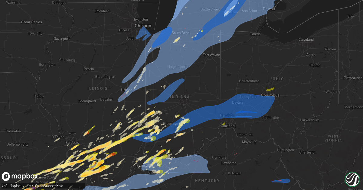
Hail Map in Indiana on March 30, 2025
Get this storm
March 30 map
$229
one time, instant access
Download today. No call, no setup
Keep the $229
Bought the map and want the full workflow? Apply the entire $229 to a subscription within 7 days. None of it is wasted.
Every map, not just this one
This buys you this map. Subscription and you get every map we run, in the markets you choose from a few cities to whole states to nationwide. Plus real-time alerts the moment a storm fires.
Contact data
Name, contact info, occupancy, even credit band for addresses in the footprint. You go from where it hit to who to call.
Become the source they trust
Unlimited branding weather history reports on demand. You already have the documented answer ready for the property owner, and you are the one who showed up with it.
Property data and RoofTrace estimates
Pull up any address you have got, its value and the exact code rules for that jurisdiction, straight from One Click Code. Then RoofTrace estimates the squares, pitch, and roof value, priced the way you price.
Storm reports in Indiana
Indiana
| Date | Description |
|---|---|
| 03/30/20256:55 PM CDT | Tree down across the road on horners chapel rd at palmyra rd in organ springs. |
| 03/30/20256:42 PM CDT | Very rough location. Time is estimated from radar. Location was given as southern parts of the county. Many trees and power lines down across the area from thunderstorm |
| 03/30/20256:40 PM CDT | A local report indicates 1.00 inch wind near Seymour |
| 03/30/20256:40 PM CDT | Very rough location. Location given as east side of rush county. Reports of limbs down and a basketball goal blown over. |
| 03/30/20256:34 PM CDT | A local report indicates 1.50 inch wind near 3 NE Maltersville |
| 03/30/20256:25 PM CDT | Downed trees. Tree bark gone off trees. |
| 03/30/20256:24 PM CDT | A local report indicates 1.00 inch wind near 4 WSW Columbus |
| 03/30/20256:20 PM CDT | A local report indicates 60 MPH wind near 1 NW Taylorsville |
| 03/30/20256:13 PM CDT | A local report indicates 60 MPH wind near 1 SSW Indianapolis Int' |
| 03/30/20256:05 PM CDT | West gate of the brown county state park......brown county....numerous tree tops taken out and trees toppled...unknown number at this time. |
| 03/30/20256:04 PM CDT | Mcsd reports power line and tree down...blocking west river rd in shoals. |
| 03/30/20256:00 PM CDT | Tree branches snapped. Trampoline thrown 100 yards. Time estimated from radar. |
| 03/30/20255:57 PM CDT | Pea to quarter size hail reported 2 miles northeast of the airport. |
| 03/30/20255:53 PM CDT | A local report indicates 1.00 inch wind near 4 SE Bedford |
| 03/30/20255:50 PM CDT | *** 1 inj *** a tree was blown onto a mobile home... Causing brief entrapment and a minor injury to an individual. |
| 03/30/20255:45 PM CDT | Large tree branches down onto a house at 206 w 10th st. |
| 03/30/20255:40 PM CDT | Delayed report...damage near lake monroe on in-446. A large tree over the roadway. Farm in the area was reported to have roof damage to a barn. Time estimated from rada |
| 03/30/20255:35 PM CDT | A local report indicates 1.00 inch wind near Spencer |
| 03/30/20255:26 PM CDT | A local report indicates 1.75 inch wind near Lyons |
| 03/30/20255:24 PM CDT | Delayed report. |
| 03/30/20255:18 PM CDT | Corrects previous tstm wnd dmg report from bicknell. Tree down onto a car from thunderstorm winds. |
| 03/30/20255:18 PM CDT | Tree blown down by thunderstorm winds. |
| 03/30/20255:18 PM CDT | Tree down onto a car from thunderstorm winds. |
| 03/30/20255:07 PM CDT | A local report indicates 70 MPH wind near Bicknell |
| 03/30/20255:04 PM CDT | Tree down at camp arthur rd and sr 550 north of bruceville reported to 911 center. |
| 03/30/20255:00 PM CDT | A local report indicates 1.00 inch wind near Carlisle |
| 03/30/20255:00 PM CDT | A local report indicates 1.00 inch wind near Sullivan |
| 03/30/20254:45 PM CDT | A local report indicates 1.00 inch wind near Fillmore |
| 03/30/20254:45 PM CDT | Approximate location. |
| 03/30/20254:39 PM CDT | Corrects previous hail report from 2 e terre haute. Approximate location. |
| 03/30/20254:37 PM CDT | Large tree uprooted across e washington center rd. |
| 03/30/20254:37 PM CDT | Corrects previous tstm wnd dmg report from angola. 2 to 3 ft diameter healthy pine tree down. Power poles damaged at trine university. |
| 03/30/20254:36 PM CDT | Measured wind gust via handheld anemometer. |
| 03/30/20254:35 PM CDT | Damage to billboard near i69. |
| 03/30/20254:35 PM CDT | Tree down onto a house. |
| 03/30/20254:30 PM CDT | Large tree uprooted. Shingles off house and in trees. Steel off barn roof. Wood impaled into the ground from another property. |
| 03/30/20254:25 PM CDT | Power poles and trees down. |
| 03/30/20254:25 PM CDT | Delayed report of damage to a house as well as damage to 3 sheds and a fence. Time estimated by radar. |
| 03/30/20254:19 PM CDT | Delayed report. A large limb fell down out of a tree. Time estimated by radar. |
| 03/30/20254:17 PM CDT | Near intersection of poplar and highway 46. |
| 03/30/20254:14 PM CDT | Report from mping: quarter |
| 03/30/20254:13 PM CDT | Several large trees uprooted. Moderate shingle damage. |
| 03/30/20254:11 PM CDT | Lost the roof on two barns. Winds destroyed an out building... Blew fuel tanks a long distance... Broke telephone poles in half. |
| 03/30/20254:11 PM CDT | *** 1 inj *** trailer home removed from its foundation |
| 03/30/20254:11 PM CDT | Several trees down on s. Walnut st. Between garden st. And east weninger. The alleyway heading west of there has trees damaged as well. Powerlines and pine tree downed |
| 03/30/20254:10 PM CDT | Nickle to quarter sized hail for about 4 minutes with 40-50 mph wind gusts |
| 03/30/20254:09 PM CDT | A local report indicates 1.00 inch wind near 2 E Terre Haute |
| 03/30/20254:09 PM CDT | Report relayed from wane 15. There was siding and roof damage at the noble county highway dept. Time estimated by radar. |
| 03/30/20254:05 PM CDT | Pea to quarter size hail at my location along us 41 near walmart in terre haute....40 mph wind... Torrential rain. |
| 03/30/20254:04 PM CDT | Numerous reports of trees and power lines down across whitley county. |
| 03/30/20254:04 PM CDT | *** 1 fatal *** corrects previous tstm wnd dmg report from 4 n millersburg. There was one confirmed fatality when thunderstorm winds blew over an amish buggy at the int |
| 03/30/20254:04 PM CDT | Truck and trailer overturned. |
| 03/30/20254:04 PM CDT | *** 2 fatal *** there were two fatalities when thunderstorm winds blew over an amish buggy at the intersection of sr-13 and cr 43. Time estimated by radar. |
| 03/30/20254:04 PM CDT | Photo received of tree down and some siding removed from a house. |
| 03/30/20254:00 PM CDT | Barn blown over. |
| 03/30/20253:58 PM CDT | Tree down in south whitley and 1/4 inch hail. |
| 03/30/20253:58 PM CDT | Several shingles blown off a roof. |
| 03/30/20253:57 PM CDT | Large rotten based tree snapped at base at cr 750 n and n cr 300 e. |
| 03/30/20253:57 PM CDT | Barn blow over into the road near the intersection of cr 33 and cr 34. Time estimated from radar. |
| 03/30/20253:57 PM CDT | Ham trained spotter reports 24-inch dia. Tree down just east of in26 and 350 w on the south side of the road. |
| 03/30/20253:56 PM CDT | Various large branches down... One tree uprooted on the se side of elkhart. |
| 03/30/20253:56 PM CDT | Significant structural damage to a building on sterling avenue between bar and ren streets. Reported via wbnd. |
| 03/30/20253:56 PM CDT | Tree down on parked vehicle. Lines down near epworth forest. |
| 03/30/20253:55 PM CDT | Estimated winds up to 70 mph at the corner of wolf street and frances avenue. Uprooted trees and broken tree branches in the area. |
| 03/30/20253:55 PM CDT | Multiple irrigation systems rolled and mangled in fields. Systems were still in one piece but rolled over. |
| 03/30/20253:54 PM CDT | There were 30 homes with trees on them around the city of elkhart. |
| 03/30/20253:54 PM CDT | Corrects previous non-tstm wnd gst report from 3 nw elkhart. Awos station kekm elkhart municipa. |
| 03/30/20253:50 PM CDT | Ema trained spotter reports 16-inch measured diameter tree down 100yds west of 950 w 150 s in howard county. |
| 03/30/20253:48 PM CDT | Numerous tree damage reports from the mishawaka area. There is roof damage and significant shingle loss from a building at smith and 8th... There are trees down blockin |
| 03/30/20253:48 PM CDT | Trees downed with debris in roadway around granger. One location was brick and waylan st... Another at brick and current st. |
| 03/30/20253:48 PM CDT | Numerous reports of trees down and branches down from mishawka high school to granger. Some instances of property damage such as shingles blown off of a church. |
| 03/30/20253:47 PM CDT | Semi trailers blown over at state road 13 at 500 south. No known injuries. |
| 03/30/20253:46 PM CDT | Drone footage of 8 power poles snapped or bent at the base on harrison rd between beacon dr and cedar wood ln. |
| 03/30/20253:45 PM CDT | Power pole snapped. |
| 03/30/20253:45 PM CDT | Large pine tree uprooted and down onto a small residential structure. |
| 03/30/20253:45 PM CDT | Metal hog barn roof torn off and thrown throughout two fields. |
| 03/30/20253:45 PM CDT | Trees blown down by thunderstorm winds. |
| 03/30/20253:45 PM CDT | Multiple large trees down. |
| 03/30/20253:45 PM CDT | Trees down... Large limbs and branches down... Had smaller hail... Lost power. |
| 03/30/20253:44 PM CDT | Corrects previous non-tstm wnd gst report from 3 wnw south bend. Asos station ksbn south bend international ap. |
| 03/30/20253:44 PM CDT | Numerous reports of limbs... Trees... And powerlines downed around kosciusko county. There was a tree down on a vehicle near epworth forest |
| 03/30/20253:44 PM CDT | Approx 6 in limb down. Clipped a house. Along with a partial fence blown over. Time estimated by radar. |
| 03/30/20253:42 PM CDT | Reported from facebook. Small tree limbs down. |
| 03/30/20253:42 PM CDT | From a private weather station near the st. Joe county fair grounds. |
| 03/30/20253:40 PM CDT | Trees down and large branches down near us 31 and new rd. |
| 03/30/20253:36 PM CDT | Power pole snapped. |
| 03/30/20253:35 PM CDT | Spotter reported major tree damage and some structural damage on s. Beech rd between sr-10 and 14b road. Siding is in the trees and on the road. There is a narrow path |
| 03/30/20253:32 PM CDT | Corrects previous non-tstm wnd gst report from 2 s grissom afb. Awos station kgus grissom afb peru. |
| 03/30/20253:31 PM CDT | Large tree limbs of varying health down... Some onto roadway and at least one onto the home. |
| 03/30/20253:30 PM CDT | Semi blown over on us 31 north of peru... In. Specific location not known. Unknown if driver was injured. |
| 03/30/20253:30 PM CDT | Trees down over the road. |
| 03/30/20253:30 PM CDT | 25 foot tall tree downed across a driveway. There was also a stacked stone wall failure. Time estimated by radar. |
| 03/30/20253:30 PM CDT | Numerous reports of tree damage around the county. Tree was reported downed on a home in plymouth at pretty view condos. Time for marshall county damage was likely betw |
| 03/30/20253:29 PM CDT | 5 foot radio tower blown down at fulton co. Indiana ema building about 10 minutes ago due to high winds. Location just east of the junction of state rd 25 and state rd |
| 03/30/20253:29 PM CDT | Large portion of a metal outbuilding roof and wall toppled into the street. |
| 03/30/20253:29 PM CDT | *** 1 inj *** mobile home demolished. Location approximate. |
| 03/30/20253:28 PM CDT | Trees down and a 58 mph gust was also measured in an anemometer. Time estimated by radar. |
| 03/30/20253:27 PM CDT | Two poles down and in road near intersection of sr 10 and sr 17. |
| 03/30/20253:25 PM CDT | Numerous reports of trees and powerlines down across the county |
| 03/30/20253:25 PM CDT | Numerous trees and powerlines downed across the area of fish lake. Debris on the roads... Some trees in houses. There are several large uprooted trees. There are severa |
| 03/30/20253:22 PM CDT | Nws survey confirms an ef-1 tornado developed 2 miles sw of ancilla college. The tornado tracked 3.3 miles northeast before dissipating and was 750 yards wide. Estimate |
| 03/30/20253:22 PM CDT | Barn roof blew off and was temporarily blocking road at e state rd 4 and sr 104. Time estimated by radar. |
| 03/30/20253:20 PM CDT | Trees downed in michigan city with estimated wind gust of 60 mph. There are power outages. A large branch was reported downed on maple street. |
| 03/30/20253:19 PM CDT | Numerous reports of damage... Including trees downed and roof blow off. Metal siding is hanging from power lines in one video... Damage to silo. Power is out. |
| 03/30/20253:17 PM CDT | Several trees reported down in la porte. |
| 03/30/20253:15 PM CDT | 400 block of laurel drive has trees on top of houses |
| 03/30/20253:15 PM CDT | Trees down on us 24 near georgetown. |
| 03/30/20253:15 PM CDT | Tree downed across the road... Large limbs downed. |
| 03/30/20253:15 PM CDT | Several big tree branches are down and this one fell on a house on avondale ave in trail creek. |
| 03/30/20253:15 PM CDT | There are numerous reports of tree damage and several reports of structural damage around cass county... In. Structural damage includes fencing downed and siding blown |
| 03/30/20253:14 PM CDT | Trees downed on holland street and water st. |
| 03/30/20253:14 PM CDT | Tree into a house on ridgeview way. No information on the tree size/health. |
| 03/30/20253:14 PM CDT | Trees downed on holland street and water st. Wn from mishawka high school to granger. Some instances of property damage such as shingles blow |
| 03/30/20253:14 PM CDT | Downed power lines. |
| 03/30/20253:14 PM CDT | Structural damage to a barn at 2450 e 475 s. Roof and siding blown off and strewn across road/field. Large limbs also downed. Time estimated based on radar. |
| 03/30/20253:14 PM CDT | Multiple trees down on us 35. |
| 03/30/20253:13 PM CDT | Delayed report...top edge of brick facade on front of a building extending above the roof line was damaged. |
| 03/30/20253:11 PM CDT | Large sections of roofing material blown off st peter lutheran church. |
| 03/30/20253:10 PM CDT | A local report indicates 60 MPH wind near 4 SW Seelyville |
| 03/30/20253:10 PM CDT | Power lines down across 421. |
| 03/30/20253:07 PM CDT | Lines down across highway 421. |
| 03/30/20253:04 PM CDT | Private weather station kinkouts6 reported 70 mph gust north of kouts. |
| 03/30/20253:04 PM CDT | Trained spotter reported multiple 6 inch diameter branches broken along us-6 between porter and valparaiso. Time estimated by radar... Location approximate. |
| 03/30/20253:02 PM CDT | Private weather station reported 64 mph gust southeast of kouts. |
| 03/30/20253:01 PM CDT | A local report indicates 64 MPH wind near 4 S Delphi |
| 03/30/20253:01 PM CDT | Public report of broken tree branches in northern valparaiso. Time estimated by radar. |
| 03/30/20253:00 PM CDT | Valparaiso porter county airport vpz awos reported 81 mph gust prior to data outage. |
| 03/30/20253:00 PM CDT | Three trees blown down by thunderstorm winds measured at 70 mph by an anemometer at the site. |
| 03/30/20253:00 PM CDT | Trained weather spotter reported 63 mph gust on handheld anemometer on county 1200s southeast of kouts. Time estimated by radar. |
| 03/30/20253:00 PM CDT | Trained spotter reported 80 mph gust in valparaiso. |
| 03/30/20253:00 PM CDT | Large tree snape in half 10 feet up. Also 3 12 foot diameter trees snapped at base. |
| 03/30/20253:00 PM CDT | Three trees blown down by thunderstorm winds measured at 70 mph by an anemometer at the site. |
| 03/30/20253:00 PM CDT | *** 1 fatal *** a semi truck rolled onto a person... Leading to a fatality. |
| 03/30/20252:59 PM CDT | Siding damaged by thunderstorm wind gusts. |
| 03/30/20252:56 PM CDT | Photo shows metal roof panels peeled from farm outbuilding along county 75e road south of valparaiso. Time estimated by radar. |
| 03/30/20252:56 PM CDT | Private weather station reported 75 mph gust northeast of winfield. |
| 03/30/20252:55 PM CDT | Rensselaer jasper county airport rzl awos reported 59 mph gust. |
| 03/30/20252:55 PM CDT | Lake county ema reports power poles snapped in gary. Time estimated by radar... Location approximate. |
| 03/30/20252:55 PM CDT | Corrects previous report from 2 wnw rensselaer. Rensselaer jasper county airport rzl awos reported 59 mph gust. |
| 03/30/20252:55 PM CDT | Gary airport gyy reported 74 mph gust. Winds sustained at 48 mph for 10 minutes. |
| 03/30/20252:55 PM CDT | Power lines downed in kouts. Time estimated by radar... Location approximate. |
| 03/30/20252:53 PM CDT | Trained spotter reports large branches broken near county 300s road and county 500w road southwest of valparaiso. Time estimated by radar. |
| 03/30/20252:53 PM CDT | Wxflow station cline avenue bridge. |
| 03/30/20252:53 PM CDT | Lake county ema reports power poles snapped in east chicago. Time estimated by radar... Location approximate. |
| 03/30/20252:53 PM CDT | Trained spotter reports 4 power poles snapped and downed power lines near boone grove high school southwest of valparaiso. Time estimated by radar. |
| 03/30/20252:53 PM CDT | Tree down. |
| 03/30/20252:53 PM CDT | Public report of shingle damage near lake of the four seasons. Time estimated by radar. |
| 03/30/20252:52 PM CDT | Tree branches broken and barn damaged near in-2 and county 350s road. Time estimated by radar. |
| 03/30/20252:51 PM CDT | Davis station. |
| 03/30/20252:51 PM CDT | Photo shows shingle damage to house in latitude subdivision west of lake of the four seasons in winfield. Time estimated by radar. |
| 03/30/20252:51 PM CDT | Private weather station reported 60 mph gust in munster. |
| 03/30/20252:51 PM CDT | Trees down. |
| 03/30/20252:50 PM CDT | Lake county ema reports power poles snapped in hammond. Time estimated by radar... Location approximate. |
| 03/30/20252:50 PM CDT | Lake county ema reports tree or large branch on house in highland. Time estimated by radar... Location approximate. |
| 03/30/20252:50 PM CDT | Report of several trees down some over 2 inches in diameter. Time estimated from radar. |
| 03/30/20252:50 PM CDT | Private weather station reported 71 mph gust between goodland and remington. |
| 03/30/20252:50 PM CDT | Considerable siding off a home. Time estimated from radar. |
| 03/30/20252:48 PM CDT | Lake county ema reports power poles snapped in dyer. Time estimated by radar... Location approximate. |
| 03/30/20252:48 PM CDT | Davis station measurement. |
| 03/30/20252:46 PM CDT | Measured at davis station wwtp. |
| 03/30/20252:45 PM CDT | Photo shows construction trailer overturned and broken into pieces along in-2 near clay street east of lowell. Time estimated by radar. |
| 03/30/20252:45 PM CDT | Time estimated from radar. Southwest corner of purdue university there are branches up to inch in diameter blown down by thunderstorm winds. |
| 03/30/20252:40 PM CDT | Large tree branches down onto house...no apparent damage. Damage to barn doors. Time estimated from radar. |
| 03/30/20252:39 PM CDT | Private weather station reported 62 mph gust in remington. Multiple other private weather stations reported gusts 55-60 mph in vicinity. |
| 03/30/20252:39 PM CDT | Lake county ema reports power poles snapped in lowell. Time estimated by radar... Location approximate. |
| 03/30/20252:38 PM CDT | Private weather station reported 63 mph gust north of remington. |
| 03/30/20252:38 PM CDT | Trained spotter reports bent power poles in roselawn along in-10 3 miles east of in-55. Time estimated by radar... Location approximate. |
| 03/30/20252:37 PM CDT | Trained spotter reports 12 inch diameter tree downed near county 400 e and county 1200 n. Time estimated by radar. |
| 03/30/20252:36 PM CDT | Trained spotter reports numerous trees uprooted and branches broken along in-55 north of in-10. Time estimated by radar... Location approximate. |
| 03/30/20252:35 PM CDT | Private weather station reported 62 mph gust east of fowler. |
| 03/30/20252:30 PM CDT | Corrects previous report from 2 n fowler. Benton county ema reports semi tipped over on in-55 north of fowler near 600n road. Time estimated by radar... Location approx |
| 03/30/20252:30 PM CDT | Benton county ema reports semi tipped over on in-55 north of fowler. Time estimated by radar... Location approximate. |
| 03/30/20252:30 PM CDT | Utility lines were blown down. Time estimated from radar. |
| 03/30/20252:29 PM CDT | Private weather station reported 59 mph gust near brook. |
| 03/30/20252:28 PM CDT | A national weather service storm survey determined an ef-0 tornado with peak winds near 75 mph developed near w 600 n about 2 miles west of us route 41 where it uproote |
| 03/30/20252:27 PM CDT | Private weather station reported 59 mph gust between boswell and oxford. |
| 03/30/20252:26 PM CDT | Davis weather station. |
| 03/30/20252:26 PM CDT | Photo shows metal roof panels peeled from farm outbuilding at benton county fairgrounds. Time estimated by radar. |
| 03/30/20252:26 PM CDT | Trees down. |
| 03/30/20252:10 PM CDT | A few structures sustained minor damage across the county. |
| 03/30/20251:30 PM CDT | Barn and tree damage across the county. |
| 03/29/20259:15 PM CDT | Report of flooding. |
| 03/29/20257:22 PM CDT | Complete collapse of barn roof... Shingles ripped from home roof... Trees downed. |
| 03/29/20257:21 PM CDT | Barn doors caved... Shingles ripped from home roof... Trees downed. |
| 03/29/20257:20 PM CDT | Tree down in the 900 block of leon prall road in otisco... In. |
| 03/29/20257:18 PM CDT | Delayed report...tree down blocking old 41 south of oaktown. |
| 03/29/20257:17 PM CDT | Report from mping: quarter |
| 03/29/20257:15 PM CDT | Multiple trees down in canaan. Halls ridge rd & lower dry fork rd. Reported by canaan firefighters. |
| 03/29/20257:11 PM CDT | Trees and power lines down between napoleon and delaware. Time estimated from radar. |
| 03/29/20257:11 PM CDT | Several trees downed in 8000 block of n spades rd. Time estimated by radar. |
| 03/29/20257:07 PM CDT | Numerous trees downed... Along with some property damage near county road 800 n and old michigan rd. Time estimated by radar. |
| 03/29/20257:02 PM CDT | A local report indicates 1.00 inch wind near Boonville |
All States Impacted by Hail Map on March 30, 2025
Cities Impacted by Hail Map on March 30, 2025
- Coolidge, TX
- Dawson, TX
- Valley Mills, TX
- Clifton, TX
- Mexia, TX
- Wortham, TX
- Comanche, TX
- Streetman, TX
- Fairfield, TX
- San Saba, TX
- Lampasas, TX
- Foley, AL
- Kempner, TX
- Burnet, TX
- Florence, TX
- Bertram, TX
- Briggs, TX
- Copperas Cove, TX
- Jarrell, TX
- Georgetown, TX
- Bartlett, TX
- Liberty Hill, TX
- Granger, TX
- Vancleave, MS
- Moss Point, MS
- Holland, TX
- Buckholts, TX
- Thorndale, TX
- Breese, IL
- Germantown, IL
- Aviston, IL
- Albers, IL
- Cameron, TX
- Sainte Genevieve, MO
- Saint Mary, MO
- Bartelso, IL
- Chester, IL
- Ellis Grove, IL
- Walsh, IL
- Wasola, MO
- Brixey, MO
- Altamont, IL
- Windsor, IL
- Findlay, IL
- Salem, MO
- Thornfield, MO
- Sullivan, IL
- Dora, MO
- Drury, MO
- Gainesville, MO
- Cherryville, MO
- Festus, MO
- Mason, IL
- Mattoon, IL
- Beecher City, IL
- Valmeyer, IL
- Columbia, IL
- Millstadt, IL
- Davisville, MO
- Steelville, MO
- Viburnum, MO
- Potosi, MO
- Tuscola, IL
- Atwood, IL
- Hammond, IL
- Lovington, IL
- Ivesdale, IL
- Charleston, IL
- Greenup, IL
- Lerna, IL
- Toledo, IL
- Washington, MO
- Watson, IL
- Effingham, IL
- Teutopolis, IL
- Philo, IL
- Tolono, IL
- Urbana, IL
- Arcola, IL
- Humboldt, IL
- Bement, IL
- Sadorus, IL
- Pesotum, IL
- Champaign, IL
- Villa Grove, IL
- Savoy, IL
- Sidney, IL
- Saint Joseph, IL
- Ogden, IL
- Fithian, IL
- Homer, IL
- Royal, IL
- Armstrong, IL
- Belleville, IL
- Fisher, IL
- Foosland, IL
- Mahomet, IL
- Dewey, IL
- Rantoul, IL
- Ludlow, IL
- Paxton, IL
- Gibson City, IL
- Loda, IL
- Buckley, IL
- Melvin, IL
- Rankin, IL
- Cissna Park, IL
- Onarga, IL
- Gilman, IL
- Collison, IL
- Muncie, IL
- Penfield, IL
- Potomac, IL
- Danville, IL
- Rossville, IL
- Hoopeston, IL
- Oakwood, IL
- O'Fallon, IL
- Fairview Heights, IL
- Fults, IL
- Smithton, IL
- New Athens, IL
- Westfield, IL
- Ashmore, IL
- Cabool, MO
- Waterloo, IL
- Pinckneyville, IL
- Coulterville, IL
- Freeburg, IL
- Kansas, IL
- Sigel, IL
- Belgrade, MO
- Mineral Point, MO
- Houston, MO
- Watseka, IL
- Crescent City, IL
- Milford, IL
- Ashkum, IL
- Clifton, IL
- Martinton, IL
- Saint Anne, IL
- Papineau, IL
- Beaverville, IL
- Alvin, IL
- Henning, IL
- Wellington, IL
- Sheldon, IL
- Gifford, IL
- Thomasboro, IL
- Williamsport, IN
- Stockland, IL
- Ambia, IN
- West Lebanon, IN
- Bismarck, IL
- Defiance, MO
- Boss, MO
- Red Bud, IL
- Valles Mines, MO
- Bonne Terre, MO
- Nashville, IL
- Oakdale, IL
- Augusta, MO
- Saint Charles, MO
- Brooksville, FL
- De Soto, MO
- Cadet, MO
- Elk Creek, MO
- Eunice, MO
- Raymondville, MO
- Yukon, MO
- Solo, MO
- Stewardson, IL
- Shumway, IL
- Montrose, IL
- Edgewood, IL
- Tamaroa, IL
- Ashley, IL
- French Village, MO
- Bloomsdale, MO
- Harrison, AR
- Licking, MO
- Key Biscayne, FL
- Summersville, MO
- O'Fallon, MO
- Saint Peters, MO
- Blackwell, MO
- Alpena, AR
- Bixby, MO
- Cayuga, IN
- Perrysville, IN
- Frankfort, IL
- Mokena, IL
- New Lenox, IL
- Tinley Park, IL
- Orland Park, IL
- Oak Forest, IL
- Crestwood, IL
- Midlothian, IL
- Chicago, IL
- Alsip, IL
- Robbins, IL
- Palos Heights, IL
- Oak Lawn, IL
- Chicago Ridge, IL
- Burbank, IL
- Worth, IL
- Hazel Crest, IL
- Homewood, IL
- Country Club Hills, IL
- Hometown, IL
- Markham, IL
- Blue Island, IL
- Evergreen Park, IL
- Posen, IL
- Harvey, IL
- Riverdale, IL
- South Holland, IL
- Dolton, IL
- Lowell, IN
- Cedar Lake, IN
- Pembroke Township, IL
- Grant Park, IL
- Beecher, IL
- Momence, IL
- Lake Village, IN
- Schneider, IN
- Shelby, IN
- Demotte, IN
- Thayer, IN
- Hebron, IN
- Crown Point, IN
- Morocco, IN
- Donovan, IL
- Goodland, IN
- Kentland, IN
- Fowler, IN
- Boswell, IN
- Brook, IN
- Earl Park, IN
- Oxford, IN
- Pine Village, IN
- Remington, IN
- Rensselaer, IN
- Templeton, IN
- West Lafayette, IN
- Wolcott, IN
- Attica, IN
- Westpoint, IN
- Brookston, IN
- Chalmers, IN
- Lafayette, IN
- Otterbein, IN
- Lenzburg, IL
- Mascoutah, IL
- Calumet City, IL
- Hammond, IN
- Marissa, IL
- Addieville, IL
- Saint Libory, IL
- Chicago Heights, IL
- Steger, IL
- Crete, IL
- Schererville, IN
- Highland, IN
- Dyer, IN
- Munster, IN
- Lansing, IL
- Glenwood, IL
- Roby, MO
- Woodlawn, IL
- New Baden, IL
- Hartshorn, MO
- Eminence, MO
- Walnut Hill, IL
- Centralia, IL
- Yellville, AR
- Lead Hill, AR
- Park Hills, MO
- Plato, MO
- Miami, FL
- Miami Beach, FL
- Green Forest, AR
- Covington, IN
- Belleview, MO
- Caledonia, MO
- Casey, IL
- Kouts, IN
- Wheatfield, IN
- Monon, IN
- Reynolds, IN
- Francesville, IN
- Okawville, IL
- Monticello, IN
- Delphi, IN
- Battle Ground, IN
- Rockville, IN
- Bloomingdale, IN
- Marshall, IN
- Carbon, IN
- Waveland, IN
- Mecca, IN
- Hillsdale, IN
- Montezuma, IN
- Clinton, IN
- Dana, IN
- Crawfordsville, IN
- Greencastle, IN
- New Market, IN
- Roachdale, IN
- Ladoga, IN
- Russellville, IN
- Dix, IL
- Irondale, MO
- Salem, IL
- Kell, IL
- Iuka, IL
- Hoyleton, IL
- Prairie Du Rocher, IL
- Alhambra, IL
- Pocahontas, IL
- Highland, IL
- New Douglas, IL
- Mountain Home, AR
- Mount Vernon, IL
- Cantonment, FL
- Saint Louis, MO
- Pontiac, MO
- Farmington, MO
- Molino, FL
- Texico, IL
- Marine, IL
- Bismarck, MO
- Sparta, IL
- Baldwin, IL
- Bull Shoals, AR
- Flippin, AR
- Clarkridge, AR
- East Chicago, IN
- Griffith, IN
- Gary, IN
- Whiting, IN
- Boone Grove, IN
- Lake Station, IN
- Portage, IN
- Hobart, IN
- Valparaiso, IN
- Merrillville, IN
- La Crosse, IN
- Wanatah, IN
- Knox, IN
- Hanna, IN
- Modoc, IL
- Evansville, IL
- Tilden, IL
- Star City, IN
- North Judson, IN
- Buffalo, IN
- Yeoman, IN
- Medaryville, IN
- Winamac, IN
- San Pierre, IN
- Elizabeth, AR
- Kewanna, IN
- Monterey, IN
- Burnettsville, IN
- Ora, IN
- Rochester, IN
- Lucerne, IN
- Royal Center, IN
- Idaville, IN
- Logansport, IN
- Galveston, IN
- Twelve Mile, IN
- Walton, IN
- Flora, IN
- Camden, IN
- New Richmond, IN
- Peel, AR
- Marble Falls, AR
- Linden, IN
- Romney, IN
- Bunker, MO
- Centerville, MO
- Newton, IL
- Patoka, IL
- Oakland, AR
- Richview, IL
- Lesterville, MO
- Xenia, IL
- Seligman, MO
- Washburn, MO
- Kinmundy, IL
- Gassville, AR
- Cotter, AR
- Carlyle, IL
- Paris, IL
- Vernon, IL
- Henderson, AR
- Bainbridge, IN
- Colfax, IN
- Darlington, IN
- New Ross, IN
- Frankfort, IN
- Thorntown, IN
- Clarks Hill, IN
- Jamestown, IN
- Advance, IN
- Lebanon, IN
- North Salem, IN
- Johnsonville, IL
- Rinard, IL
- Odin, IL
- Black, MO
- Michigan City, IN
- Kingsford Heights, IN
- Hamlet, IN
- Beverly Shores, IN
- Westville, IN
- La Porte, IN
- Chesterton, IN
- Union Mills, IN
- New Buffalo, MI
- Rolling Prairie, IN
- Grovertown, IN
- Culver, IN
- Plymouth, IN
- Walkerton, IN
- North Liberty, IN
- Mill Creek, IN
- Argos, IN
- Tippecanoe, IN
- Macy, IN
- Peru, IN
- Grissom Arb, IN
- New Waverly, IN
- Denver, IN
- Bunker Hill, IN
- Onward, IN
- Akron, IN
- Mexico, IN
- Kirklin, IN
- Russiaville, IN
- Michigantown, IN
- Forest, IN
- Annapolis, IL
- Oblong, IL
- Martinsville, IL
- Yale, IL
- Everton, AR
- Willow Hill, IL
- Marshall, IL
- Dennison, IL
- Du Bois, IL
- Protem, MO
- Theodosia, MO
- Udall, MO
- Bakersfield, MO
- Sorento, IL
- Cassville, MO
- Aurora, MO
- Cape Fair, MO
- Shell Knob, MO
- Viola, AR
- Ellington, MO
- Galena, MO
- Moody, MO
- Louisville, IL
- Flora, IL
- Omaha, AR
- Caulfield, MO
- Midway, AR
- Mountain View, MO
- Lakeview, AR
- Isabella, MO
- West York, IL
- Clay City, IL
- Fort Worth, TX
- Naval Air Station Jrb, TX
- West Plains, MO
- Ironton, MO
- Fredericktown, MO
- Bourbon, IN
- Eagle Rock, MO
- Mammoth Spring, AR
- Salem, AR
- Arcadia, MO
- Lakeville, IN
- South Bend, IN
- Donnellson, IL
- Hillsboro, IL
- Gamaliel, AR
- Ingraham, IL
- Reeds Spring, MO
- Birch Tree, MO
- Saint Peter, IL
- Vandalia, IL
- Dieterich, IL
- Campbell Hill, IL
- Coffeen, IL
- Sturkie, AR
- Rockwood, IL
- Cutler, IL
- Gepp, AR
- Greenville, IL
- Ava, IL
- Du Quoin, IL
- Bridgman, MI
- Lakeside, MI
- New Carlisle, IN
- Saint Joseph, MI
- Baroda, MI
- Union Pier, MI
- Stevensville, MI
- Harbert, MI
- Three Oaks, MI
- Galien, MI
- Buchanan, MI
- Bremen, IN
- Sawyer, MI
- New Troy, MI
- Cassopolis, MI
- Sodus, MI
- Granger, IN
- Eau Claire, MI
- Wakarusa, IN
- Berrien Center, MI
- Berrien Springs, MI
- Niles, MI
- Mishawaka, IN
- Elkhart, IN
- Osceola, IN
- Dowagiac, MI
- Edwardsburg, MI
- Notre Dame, IN
- New Paris, IN
- Goshen, IN
- Bristol, IN
- Milford, IN
- Middlebury, IN
- Etna Green, IN
- Nappanee, IN
- Roann, IN
- Atwood, IN
- Leesburg, IN
- Claypool, IN
- Burket, IN
- Mentone, IN
- Syracuse, IN
- Winona Lake, IN
- North Webster, IN
- Pierceton, IN
- North Manchester, IN
- Millersburg, IN
- Warsaw, IN
- Silver Lake, IN
- Cromwell, IN
- Columbia City, IN
- South Whitley, IN
- Larwill, IN
- Laketon, IN
- Liberty Mills, IN
- Huntington, IN
- Wabash, IN
- Servia, IN
- Urbana, IN
- Lagro, IN
- Kempton, IN
- Sharpsville, IN
- Tipton, IN
- Kokomo, IN
- Vergennes, IL
- West Union, IL
- Spokane, MO
- Chestnutridge, MO
- Walnut Shade, MO
- Elkville, IL
- Dowell, IL
- Koshkonong, MO
- Thayer, MO
- Noble, IL
- Dundas, IL
- Golden, MO
- Shubuta, MS
- Farina, IL
- Terre Haute, IN
- Pyatt, AR
- West Terre Haute, IN
- Olney, IL
- West Liberty, IL
- Sesser, IL
- Scheller, IL
- Mulkeytown, IL
- Waltonville, IL
- Bonnie, IL
- Arlington, TX
- Opdyke, IL
- Belle Rive, IL
- Bluford, IL
- Keenes, IL
- Kimberling City, MO
- Berryville, AR
- Lampe, MO
- Norwood, MO
- Couch, MO
- Wiggins, MS
- Vanzant, MO
- Mountain Grove, MO
- Hartford, MI
- Squires, MO
- Fremont, MO
- Winona, MO
- Alton, MO
- Eureka Springs, AR
- Steeleville, IL
- Percy, IL
- Pensacola, FL
- Kimmell, IN
- Churubusco, IN
- Laotto, IN
- Avilla, IN
- Albion, IN
- Wawaka, IN
- Ligonier, IN
- Kendallville, IN
- Howe, IN
- Wolcottville, IN
- Topeka, IN
- Lagrange, IN
- Shipshewana, IN
- South Milford, IN
- Rome City, IN
- Constantine, MI
- Burr Oak, MI
- White Pigeon, MI
- Jones, MI
- Sturgis, MI
- Union, MI
- Benton Harbor, MI
- Lawton, MI
- Three Rivers, MI
- Decatur, MI
- Marcellus, MI
- Centreville, MI
- Mendon, MI
- Vandalia, MI
- Schoolcraft, MI
- Vicksburg, MI
- Kalamazoo, MI
- Watervliet, MI
- South Haven, MI
- Mattawan, MI
- Gobles, MI
- Douglas, MI
- Coloma, MI
- Grand Junction, MI
- Bloomingdale, MI
- Covert, MI
- Fennville, MI
- Lawrence, MI
- Pullman, MI
- Allegan, MI
- Saugatuck, MI
- Bangor, MI
- Portage, MI
- Paw Paw, MI
- Holland, MI
- Hamilton, MI
- Macatawa, MI
- Grand Haven, MI
- West Olive, MI
- Otsego, MI
- Wayne City, IL
- Robinson, IL
- Sumner, IL
- Palestine, IL
- Stoy, IL
- Branson, MO
- Brazil, IN
- Cory, IN
- Ravenden, AR
- Williamsville, MO
- Rosedale, IN
- Doniphan, MO
- Gatewood, MO
- Myrtle, MO
- Van Buren, MO
- Blue Eye, MO
- Quitman, MS
- Ava, MO
- Kirbyville, MO
- Hollister, MO
- Ridgedale, MO
- Hutsonville, IL
- Oak Grove, AR
- Staunton, IN
- Dorr, MI
- Allendale, MI
- Zeeland, MI
- Hudsonville, MI
- Hopkins, MI
- Coopersville, MI
- Byron Center, MI
- Jenison, MI
- Martin, MI
- Plainwell, MI
- Grandville, MI
- Wayland, MI
- Shelbyville, MI
- Leonidas, MI
- Scotts, MI
- Colon, MI
- Climax, MI
- Fulton, MI
- Athens, MI
- Galesburg, MI
- Sherwood, MI
- East Leroy, MI
- Battle Creek, MI
- Richland, MI
- Augusta, MI
- Hudson, IN
- Corunna, IN
- Butler, IN
- Auburn, IN
- Pleasant Lake, IN
- Waterloo, IN
- Garrett, IN
- Angola, IN
- Ashley, IN
- Pomona, MO
- Murphysboro, IL
- Fremont, IN
- Bronson, MI
- Hamilton, IN
- Orland, IN
- Montgomery, MI
- Coldwater, MI
- Union City, MI
- Perryville, MO
- Sullivan, IN
- Merom, IN
- Claremont, IL
- Bridgeport, IL
- Flat Rock, IL
- Reelsville, IN
- Greenville, MO
- Pocahontas, AR
- Grandin, MO
- Bradleyville, MO
- Cedarcreek, MO
- Milton, FL
- Poplar Bluff, MO
- Ellsinore, MO
- Mill Spring, MO
- Centerpoint, IN
- Farmersburg, IN
- Kissimmee, FL
- Camp, AR
- Glencoe, AR
- Shelburn, IN
- Fairbanks, IN
- Frohna, MO
- Wyoming, MI
- Caledonia, MI
- Marne, MI
- Grand Rapids, MI
- Comstock Park, MI
- Hickory Corners, MI
- Delton, MI
- Middleville, MI
- Alto, MI
- Ada, MI
- Hastings, MI
- Freeport, MI
- Dowling, MI
- Ceresco, MI
- Nashville, MI
- Bellevue, MI
- Homer, MI
- Marshall, MI
- Tekonsha, MI
- Reading, MI
- Quincy, MI
- Burlington, MI
- Allen, MI
- Camden, MI
- Hillsdale, MI
- Litchfield, MI
- Montpelier, OH
- Edon, OH
- Jonesville, MI
- Waldron, MI
- Pioneer, OH
- Osseo, MI
- Edgerton, OH
- Alvordton, OH
- Bryan, OH
- Lewis, IN
- Hymera, IN
- Jasonville, IN
- Coalmont, IN
- Saint Francisville, IL
- Lawrenceville, IL
- Vincennes, IN
- Oaktown, IN
- Silva, MO
- Carlisle, IN
- Hardy, AR
- Saint Joe, AR
- Western Grove, AR
- Valley Springs, AR
- Redford, MO
- Patton, MO
- Sedgewickville, MO
- Farrar, MO
- Cherokee Village, AR
- Rueter, MO
- Gulf Breeze, FL
- Poland, IN
- Noble, MO
- Kissee Mills, MO
- Jacob, IL
- Newaygo, MI
- Conklin, MI
- Ravenna, MI
- Grant, MI
- Nunica, MI
- Casnovia, MI
- Bailey, MI
- Spring Lake, MI
- Sparta, MI
- Cedar Springs, MI
- Sand Lake, MI
- Belmont, MI
- Kent City, MI
- Rockford, MI
- Howard City, MI
- Greenville, MI
- Belding, MI
- Lowell, MI
- Lake Odessa, MI
- Saranac, MI
- Clarksville, MI
- Woodland, MI
- Charlotte, MI
- Vermontville, MI
- Olivet, MI
- Eaton Rapids, MI
- Springport, MI
- Hanover, MI
- Horton, MI
- Albion, MI
- Spring Arbor, MI
- Concord, MI
- Parma, MI
- Edwardsport, IN
- Freelandville, IN
- Sandborn, IN
- Jerome, MI
- North Adams, MI
- Pittsford, MI
- Hudson, MI
- West Unity, OH
- Stryker, OH
- Gorham, IL
- Royalton, IL
- Warm Springs, AR
- Bruceville, IN
- Wheatland, IN
- Bicknell, IN
- Monroe City, IN
- Ragsdale, IN
- Fairdealing, MO
- Zeigler, IL
- Ash Flat, AR
- Westphalia, IN
- Williford, AR
- Friedheim, MO
- Oxly, MO
- Naylor, MO
- Clubb, MO
- Ravenden Springs, AR
- Neelyville, MO
- Harviell, MO
- Zalma, MO
- McGee, MO
- Glenallen, MO
- Marquand, MO
- Russellville, AR
- Wappapello, MO
- Linton, IN
- Clay City, IN
- Uniontown, MO
- Washington, IN
- Gowen, MI
- Morley, MI
- Stanton, MI
- Coral, MI
- Trufant, MI
- Pierson, MI
- Lakeview, MI
- Sidney, MI
- Crystal, MI
- Sheridan, MI
- Ionia, MI
- Fenwick, MI
- Orleans, MI
- Six Lakes, MI
- Carson City, MI
- Sunfield, MI
- Fowler, MI
- Pewamo, MI
- Lyons, MI
- Portland, MI
- Hubbardston, MI
- Westphalia, MI
- Muir, MI
- De Soto, IL
- Eagle, MI
- Potterville, MI
- Mulliken, MI
- Grand Ledge, MI
- Dimondale, MI
- Benton, IL
- Lansing, MI
- Mason, MI
- Pleasant Lake, MI
- Stockbridge, MI
- Holt, MI
- Jackson, MI
- Leslie, MI
- Rives Junction, MI
- Onondaga, MI
- Cement City, MI
- Brooklyn, MI
- Somerset Center, MI
- Napoleon, MI
- Adrian, MI
- Onsted, MI
- Michigan Center, MI
- Manitou Beach, MI
- Clarklake, MI
- Munith, MI
- Grass Lake, MI
- Clayton, MI
- Morenci, MI
- Fayette, OH
- Addison, MI
- Archbold, OH
- Powersite, MO
- Lyons, IN
- Elnora, IN
- Newberry, IN
- Bloomfield, IN
- Switz City, IN
- Plainville, IN
- Montgomery, IN
- Carbondale, IL
- Carterville, IL
- Hurst, IL
- Damascus, AR
- Springfield, AR
- Moore Haven, FL
- Okeechobee, FL
- West Frankfort, IL
- Norfork, AR
- Dugger, IN
- Qulin, MO
- Worthington, IN
- Broseley, MO
- Willow Springs, MO
- Calico Rock, AR
- Jerusalem, AR
- Hattieville, AR
- Imboden, AR
- Tecumseh, MO
- Zanoni, MO
- Bexar, AR
- Bowling Green, IN
- Coal City, IN
- Shoals, IN
- Mitchell, IN
- Maynard, AR
- Princeton, IN
- Francisco, IN
- Manchester, MI
- Tecumseh, MI
- Chelsea, MI
- Tipton, MI
- Britton, MI
- Clinton, MI
- Norvell, MI
- East Lansing, MI
- Williamston, MI
- Webberville, MI
- Gregory, MI
- Saline, MI
- Dansville, MI
- Okemos, MI
- Dexter, MI
- Howell, MI
- Pinckney, MI
- Ann Arbor, MI
- Dewitt, MI
- Bath, MI
- Perry, MI
- Haslett, MI
- Fowlerville, MI
- Saint Johns, MI
- Herrin, IL
- Owosso, MI
- Ovid, MI
- Perrinton, MI
- Maple Rapids, MI
- Laingsburg, MI
- Middleton, MI
- Riverdale, MI
- Alma, MI
- Elsie, MI
- Vestaburg, MI
- Ashley, MI
- Ithaca, MI
- Bannister, MI
- Pompeii, MI
- Blanchard, MI
- Edmore, MI
- Elwell, MI
- Sumner, MI
- North Star, MI
- Biggers, AR
- Corning, AR
- Datto, AR
- Bernie, MO
- Campbell, MO
- Fisk, MO
- Malden, MO
- Dexter, MO
- West Baden Springs, IN
- Quincy, IN
- Altenburg, MO
- Old Appleton, MO
- Oak Ridge, MO
- Melbourne, AR
- Pindall, AR
- Brownwood, MO
- Oran, MO
- Sturdivant, MO
- Advance, MO
- Pineville, AR
- Peace Valley, MO
- Saint Cloud, FL
- Gosport, IN
- Solsberry, IN
- Freedom, IN
- Spencer, IN
- Bee Branch, AR
- Buckner, IL
- Puxico, MO
- Dudley, MO
- Brockwell, AR
- Odon, IN
- Bell City, MO
- Orient, IL
- Christopher, IL
- Martinsville, IN
- Morgantown, IN
- Heltonville, IN
- Bedford, IN
- Norman, IN
- Nashville, IN
- Saint Louis, MI
- Shepherd, MI
- Midland, MI
- Mount Pleasant, MI
- Knobel, AR
- Saint Charles, MI
- Henderson, MI
- Wheeler, MI
- Oakley, MI
- Chesaning, MI
- Merrill, MI
- Breckenridge, MI
- Brant, MI
- Hemlock, MI
- Evansville, IN
- Chandler, IN
- Fenton, MI
- Corunna, MI
- Morrice, MI
- Lennon, MI
- Swartz Creek, MI
- Durand, MI
- Bancroft, MI
- Linden, MI
- Gaines, MI
- Byron, MI
- Vernon, MI
- Hartland, MI
- Holly, MI
- Highland, MI
- Brighton, MI
- Milford, MI
- South Lyon, MI
- Wixom, MI
- Northville, MI
- Plymouth, MI
- New Hudson, MI
- Milan, MI
- Whitmore Lake, MI
- Hamburg, MI
- Elberfeld, IN
- Willis, MI
- Canton, MI
- Maybee, MI
- Carleton, MI
- Ypsilanti, MI
- Belleville, MI
- New Boston, MI
- Logan, IL
- Thompsonville, IL
- Bloomington, IN
- Wadesville, IN
- Poseyville, IN
- New Harmony, IN
- Quitman, AR
- Lynnville, IN
- Clinton, AR
- Jackson, MO
- Cape Girardeau, MO
- Chaffee, MO
- Peach Orchard, AR
- Horseshoe Bend, AR
- Bloomfield, MO
- Sage, AR
- Mount Pleasant, AR
- Jasper, AR
- Guion, AR
- Franklin, AR
- Violet Hill, AR
- Freeman Spur, IL
- Tennyson, IN
- Essex, MO
- Broughton, IL
- McLeansboro, IL
- Rector, AR
- Piggott, AR
- Medora, IN
- Romulus, MI
- Westland, MI
- Wayne, MI
- Detroit, MI
- Novi, MI
- Garden City, MI
- Commerce Township, MI
- Walled Lake, MI
- Inkster, MI
- Livonia, MI
- Farmington, MI
- Oakland City, IN
- White Lake, MI
- Taylor, MI
- Waterford, MI
- West Bloomfield, MI
- Clarkston, MI
- Davisburg, MI
- Flushing, MI
- Grand Blanc, MI
- New Lothrop, MI
- Flint, MI
- Davison, MI
- Goodrich, MI
- Ortonville, MI
- Burton, MI
- Montrose, MI
- Burt, MI
- Clio, MI
- Freeland, MI
- Saginaw, MI
- Birch Run, MI
- Mount Morris, MI
- Columbus, IN
- Auburn, MI
- Bridgeport, MI
- Compton, AR
- Mountain View, AR
- Evening Shade, AR
- Sidney, AR
- Stendal, IN
- Heber Springs, AR
- Wilburn, AR
- Cave City, AR
- Wolf Lake, IL
- Cynthiana, IN
- Fort Branch, IN
- Haubstadt, IN
- Benton, MO
- Scott City, MO
- Velpen, IN
- Winslow, IN
- Parma, MO
- Batesville, AR
- Enfield, IL
- Poughkeepsie, AR
- Sikeston, MO
- Marion, IL
- Makanda, IL
- Alto Pass, IL
- Trafalgar, IN
- Mount Vernon, IN
- Thebes, IL
- Vanduser, MO
- Macedonia, IL
- Smithville, AR
- Sulphur Rock, AR
- Strawberry, AR
- Tamms, IL
- Cord, AR
- Alicia, AR
- Lynn, AR
- Saffell, AR
- Pollard, AR
- Greenway, AR
- Whitewater, MO
- Marble Hill, MO
- Canalou, MO
- Catron, MO
- Matthews, MO
- New Madrid, MO
- Cairo, IL
- Miller City, IL
- Charleston, MO
- Bertrand, MO
- Jonesboro, IL
- Ullin, IL
- McClure, IL
- Olive Branch, IL
- Dongola, IL
- Bringhurst, IN
- Buck Creek, IN
- Locust Grove, AR
- Marcella, AR
- Jasper, IN
- Holland, IN
- Huntingburg, IN
- Bay City, MI
- Carrollton, MI
- Munger, MI
- Pinconning, MI
- Kawkawlin, MI
- Millington, MI
- Essexville, MI
- University Center, MI
- Linwood, MI
- Frankenmuth, MI
- Reese, MI
- Vassar, MI
- Genesee, MI
- Metamora, MI
- Troy, MI
- Redford, MI
- Rochester, MI
- Berkley, MI
- Birmingham, MI
- Huntington Woods, MI
- Atlas, MI
- Columbiaville, MI
- Keego Harbor, MI
- Royal Oak, MI
- Otter Lake, MI
- Dearborn Heights, MI
- Lake Orion, MI
- Oak Park, MI
- Franklin, MI
- Utica, MI
- Southfield, MI
- Hadley, MI
- Leonard, MI
- Oakland, MI
- Clawson, MI
- Pontiac, MI
- Auburn Hills, MI
- Dryden, MI
- Bloomfield Hills, MI
- Lapeer, MI
- Oxford, MI
- Dearborn, MI
- Fostoria, MI
- Otisville, MI
- Riverview, MI
- Hazel Park, MI
- Hamtramck, MI
- Wyandotte, MI
- Warren, MI
- Ferndale, MI
- Allen Park, MI
- Ecorse, MI
- Southgate, MI
- Pleasant Ridge, MI
- Madison Heights, MI
- Lincoln Park, MI
- Trenton, MI
- Highland Park, MI
- Melvindale, MI
- Sterling Heights, MI
- River Rouge, MI
- Villa Ridge, IL
- Eldorado, IL
- Galatia, IL
- Raleigh, IL
- Dale, IL
- Pangburn, AR
- Judsonia, AR
- Floral, AR
- Pulaski, IL
- Nineveh, IN
- Taylorsville, IN
- Edinburgh, IN
- Drasco, AR
- Goreville, IL
- Palestine, TX
- Pittsburg, IL
- Mounds, IL
- La Center, KY
- Belknap, IL
- Barlow, KY
- Olmsted, IL
- Grand Chain, IL
- Karnak, IL
- Metropolis, IL
- Kevil, KY
- East Prairie, MO
- Cypress, IL
- Mound City, IL
- Saint Anthony, IN
- Dubois, IN
- Birdseye, IN
- Bardwell, KY
- Wickliffe, KY
- Anniston, MO
- Celestine, IN
- Holcomb, MO
- Saint Francis, AR
- Loogootee, IN
- Seymour, IN
- Owensburg, IN
- Springville, IN
- Avoca, IN
- Crane, IN
- Freetown, IN
- Williams, IN
- Oolitic, IN
- Scotland, IN
- Unionville, IN
- Franklin, IN
- Swifton, AR
- Eastpointe, MI
- Fraser, MI
- Grosse Pointe, MI
- Center Line, MI
- Clinton Township, MI
- Harper Woods, MI
- Saint Clair Shores, MI
- Roseville, MI
- Frankston, TX
- Capac, MI
- Mayville, MI
- Silverwood, MI
- Armada, MI
- Macomb, MI
- Attica, MI
- Imlay City, MI
- Allenton, MI
- Brown City, MI
- Kingston, MI
- Almont, MI
- North Branch, MI
- Caro, MI
- Washington, MI
- Clifford, MI
- Romeo, MI
- Ray, MI
- Fairgrove, MI
- Akron, MI
- Elizabethtown, IN
- Jonesville, IN
- Scipio, IN
- Saint Paul, IN
- Flat Rock, IN
- Manilla, IN
- Hope, IN
- Greensburg, IN
- Hartsville, IN
- Shelbyville, IN
- Clifford, IN
- Waldron, IN
- Rushville, IN
- Homer, IN
- Milroy, IN
- French Lick, IN
- Eckerty, IN
- Grantsburg, IL
- Golconda, IL
- Vienna, IL
- West Paducah, KY
- Owensville, IN
- Bradford, AR
- Brownstown, IN
- Hoxie, AR
- Powhatan, AR
- Ozark, IL
- Bald Knob, AR
- Tumbling Shoals, AR
- Delaplaine, AR
- Creal Springs, IL
- Walnut Ridge, AR
- Portia, AR
- Pleasant Plains, AR
- Thida, AR
- Oil Trough, AR
- Cash, AR
- Richmond, MI
- New Baltimore, MI
- New Haven, MI
- Memphis, MI
- Harrison Township, MI
- Mount Clemens, MI
- Emmett, MI
- Melvin, MI
- Marlette, MI
- Yale, MI
- Unionville, MI
- Cass City, MI
- Deford, MI
- Sebewaing, MI
- Gagetown, MI
- Gibson, MO
- Clarkton, MO
- Gideon, MO
- Laurel, IN
- Grammer, IN
- Glenwood, IN
- Westport, IN
- Connersville, IN
- Metamora, IN
- Batesville, IN
- Oldenburg, IN
- Osgood, IN
- Boonville, IN
- Bono, AR
- Smithland, KY
- Hampton, KY
- Paducah, KY
- Brookport, IL
- Tuckerman, AR
- Jacksonville, TX
- Branchville, IN
- Beech Grove, AR
- Fredericksburg, IN
- Hardinsburg, IN
- Milltown, IN
- Depauw, IN
- Paragould, AR
- Newark, AR
- Dale, IN
- Cannelburg, IN
- Newburgh, IN
- Bristow, IN
- Saint Meinrad, IN
- Newport, AR
- Rusk, TX
- Marengo, IN
- Lilbourn, MO
- Jonesboro, AR
- Portageville, MO
- Ubly, MI
- Elkton, MI
- Sandusky, MI
- Pigeon, MI
- Owendale, MI
- Peck, MI
- Snover, MI
- Decker, MI
- Bad Axe, MI
- Carsonville, MI
- Avoca, MI
- Applegate, MI
- Goodells, MI
- Croswell, MI
- North Street, MI
- Smiths Creek, MI
- East China, MI
- Saint Clair, MI
- Fair Haven, MI
- Columbus, MI
- Jeddo, MI
- Casco, MI
- Brookville, IN
- Sunman, IN
- Algonac, MI
- Harsens Island, MI
- Marine City, MI
- Liberty, IN
- Brownsville, IN
- Marion, KY
- Burna, KY
- Salem, KY
- Amagon, AR
- Gentryville, IN
- Ferdinand, IN
- Salem, IN
- English, IN
- Dupont, IN
- Butlerville, IN
- Lafe, AR
- Marmaduke, AR
- Pekin, IN
- Hanson, KY
- Deckerville, MI
- Minden City, MI
- Palms, MI
- Ruth, MI
- Forestville, MI
- Fort Gratiot, MI
- Port Sanilac, MI
- Lexington, MI
- Port Huron, MI
- Marysville, MI
- Brookland, AR
- Bath, IN
- Eaton, OH
- Cedar Grove, IN
- Camden, OH
- College Corner, OH
- New Trenton, IN
- West Harrison, IN
- West College Corner, IN
- Oxford, OH
- Weiner, AR
- Fisher, AR
- Sturgis, KY
- Rosiclare, IL
- Cave In Rock, IL
- Elizabethtown, IL
- Morganfield, KY
- Harrisburg, AR
- State University, AR
- Lake City, AR
- Bay, AR
- Henderson, KY
- Clinton, KY
- Philpot, KY
- Utica, KY
- Lincoln City, IN
- Columbus, KY
- Manitou, KY
- Madisonville, KY
- Arlington, KY
- Kennett, MO
- Somerville, OH
- West Alexandria, OH
- Lewisburg, OH
- Okeana, OH
- Hamilton, OH
- Middletown, OH
- New Lebanon, OH
- Brookville, OH
- Farmersville, OH
- Harrison, OH
- Clay, KY
- Trumann, AR
- Black Oak, AR
- Reed, KY
- Spottsville, KY
- Monette, AR
- Leachville, AR
- Manila, AR
- Owensboro, KY
- Rockport, IN
- Grandview, IN
- Santa Claus, IN
- Chrisney, IN
- Richland, IN
- Rumsey, KY
- Vero Beach, FL
- Beebe, AR
- Whitesville, KY
- Austin, AR
- Saint Croix, IN
- Bragg City, MO
- Hawesville, KY
- Reynolds Station, KY
- Caraway, AR
- Maceo, KY
- Lewisport, KY
- Fancy Farm, KY
- Mayfield, KY
- Wingo, KY
- Princeton, KY
- Providence, KY
- Nebo, KY
- Dixon, KY
- Corydon, KY
- Robards, KY
- Calhoun, KY
- Sebree, KY
- Slaughters, KY
- Waverly, KY
- Island, KY
- Bremen, KY
- Central City, KY
- Livermore, KY
- Sacramento, KY
- Centertown, KY
- Hebron, KY
- Addyston, OH
- Cincinnati, OH
- North Bend, OH
- Lamar, IN
- Evanston, IN
- Tell City, IN
- Troy, IN
- Cannelton, IN
- Hartford, KY
- Reklaw, TX
- Henderson, TX
- Laneville, TX
- Hickory, KY
- Seven Mile, OH
- Trenton, OH
- Melber, KY
- Boaz, KY
- Centerville, TX
- Schnellville, IN
- Marston, MO
- Hayti, MO
- McRae, AR
- Dell, AR
- Lepanto, AR
- Dyess, AR
- Etowah, AR
- Osceola, AR
- Marked Tree, AR
- Monroe, OH
- Mason, OH
- South Lebanon, OH
- Morrow, OH
- Kings Mills, OH
- Blanchester, OH
- West Chester, OH
- Lebanon, OH
- Maineville, OH
- Fairfield, OH
- Franklin, OH
- Oregonia, OH
- Clarksville, OH
- Springboro, OH
- Waynesville, OH
- Harveysburg, OH
- Wilmington, OH
- Midland, OH
- Pleasant Plain, OH
- Cushing, TX
- Cloverport, KY
- Union Star, KY
- Derby, IN
- Hardinsburg, KY
- Leopold, IN
- Stephensport, KY
- Battletown, KY
- Rhodelia, KY
- Payneville, KY
- Rome, IN
- Leavenworth, IN
- Fordsville, KY
- Falls Of Rough, KY
- Dundee, KY
- Webster, KY
- Augusta, AR
- Ridgely, TN
- Tiptonville, TN
- Cunningham, KY
- Symsonia, KY
- Dayton, OH
- Blytheville, AR
- Keiser, AR
- Des Arc, AR
- Luxora, AR
- Ripley, TN
- Wilson, AR
- Carthage, AR
- Tyronza, AR
- Mount Enterprise, TX
- Miamisburg, OH
- Bellbrook, OH
- Spring Valley, OH
- West Milton, OH
- Vandalia, OH
- Englewood, OH
- Clayton, OH
- Tipp City, OH
- Germantown, OH
- New Carlisle, OH
- Xenia, OH
- Medway, OH
- Troy, OH
- Springfield, OH
- North Hampton, OH
- Donnelsville, OH
- Alpha, OH
- Yellow Springs, OH
- Enon, OH
- Fairborn, OH
- Cedarville, OH
- Wilberforce, OH
- Joiner, AR
- South Charleston, OH
- Jamestown, OH
- Martinsville, OH
- Port William, OH
- New Vienna, OH
- Sabina, OH
- Obion, TN
- Hornbeak, TN
- Blevins, AR
- Ward, AR
- Griffithville, AR
- Guston, KY
- Laconia, IN
- Elizabeth, IN
- Mauckport, IN
- Central, IN
- Corydon, IN
- Brandenburg, KY
- Irvington, KY
- Harned, KY
- McDaniels, KY
- Elizabethtown, KY
- Rineyville, KY
- Cecilia, KY
- Hudson, KY
- Garfield, KY
- Leitchfield, KY
- Westview, KY
- Custer, KY
- West Point, KY
- Radcliff, KY
- Vine Grove, KY
- Fort Knox, KY
- Muldraugh, KY
- Ekron, KY
- Benton, KY
- Murray, KY
- Hardin, KY
- Dexter, KY
- Kirksey, KY
- Almo, KY
- Farmington, KY
- Hornersville, MO
- Long Branch, TX
- Rives, TN
- Troy, TN
- McCrory, AR
- Union City, TN
- Dyersburg, TN
- Newbern, TN
- Gilmore, AR
- Frenchmans Bayou, AR
- Bassett, AR
- Turrell, AR
- Fairdale, KY
- Cotton Plant, AR
- Louisville, KY
- Drummonds, TN
- Millington, TN
- Munford, TN
- Greenfield, OH
- Leesburg, OH
- Jeffersonville, OH
- Washington Court House, OH
- Hillsboro, OH
- South Solon, OH
- London, OH
- Mount Sterling, OH
- Bloomingburg, OH
- New Holland, OH
- South Vienna, OH
- West Jefferson, OH
- Mechanicsburg, OH
- Cadiz, KY
- Dover, TN
- Henning, TN
- Dyer, TN
- Kenton, TN
- Rutherford, TN
- Troup, TX
- Nacogdoches, TX
- Springville, TN
- Buchanan, TN
- Garrison, TX
- Timpson, TX
- Grove City, OH
- Orient, OH
- Ashville, OH
- Lockbourne, OH
- Commercial Point, OH
- Frankfort, OH
- Clarksburg, OH
- Harrisburg, OH
- Williamsport, OH
- Galloway, OH
- Columbus, OH
- Circleville, OH
- Mount Washington, KY
- Lebanon Junction, KY
- Shepherdsville, KY
- Brooks, KY
- Taylorsville, KY
- Boston, KY
- Bardstown, KY
- Coxs Creek, KY
- Clermont, KY
- Bumpus Mills, TN
- Herndon, KY
- La Fayette, KY
- Big Rock, TN
- Fort Campbell, KY
- Covington, TN
- Greenfield, TN
- Bradford, TN
- Brinkley, AR
- Mansfield, TN
- Bruceton, TN
- Hollow Rock, TN
- Earle, AR
- Gates, TN
- Burlison, TN
- Alto, TX
- Crockett, TX
- Wheatley, AR
- Big Sandy, TN
- Brighton, TN
- Atoka, TN
- Groveport, OH
- Canal Winchester, OH
- Goodwin, AR
- Palestine, AR
- Bloomfield, KY
- Fairfield, KY
- Willisburg, KY
- Springfield, KY
- Finchville, KY
- Fisherville, KY
- Shelbyville, KY
- Simpsonville, KY
- Mount Eden, KY
- Indian Mound, TN
- Woodlawn, TN
- Camden, TN
- Cub Run, KY
- Munfordville, KY
- Stewart, TN
- Bells, TN
- Oak Grove, KY
- McKenzie, TN
- Huntingdon, TN
- Brownsville, TN
- Forrest City, AR
- Gary, TX
- Marianna, AR
- Haynes, AR
- Dublin, OH
- Hilliard, OH
- Powell, OH
- Westerville, OH
- Elkton, KY
- Jackson, TN
- Crawfordsville, AR
- Prescott, AR
- Gadsden, TN
- Humboldt, TN
- Douglass, TX
- Eva, TN
- Cumberland City, TN
- Tennessee Ridge, TN
- Big Flat, AR
- Galena, OH
- Erin, TN
- Palmyra, TN
- Cumberland Furnace, TN
- Oakfield, TN
- Clarksville, TN
- Cunningham, TN
- Southside, TN
- Charlotte, TN
- Waverly, TN
- Denmark, TN
- Moro, AR
- Alamo, TN
- Sparkman, AR
- Buena Vista, TN
- Mason, TN
- Memphis, TN
- Arlington, TN
- Beech Bluff, TN
- McEwen, TN
- Cordova, TN
- Chapmansboro, TN
- Pleasant View, TN
- Ashland City, TN
- Adams, TN
- Springfield, TN
- Cedar Hill, TN
- Marion, AR
- Westport, TN
- Holladay, TN
- Tenaha, TX
- Stanton, TN
- Eads, TN
- Collierville, TN
- Luray, TN
- Lexington, TN
- Huron, TN
- Brickeys, AR
- Oakland, TN
- Somerville, TN
- Rossville, TN
- Lewisburg, KY
- Hurricane Mills, TN
- Crofton, KY
- Hopkinsville, KY
- Lobelville, TN
- Sugar Tree, TN
- Greenville, KY
- Hughes, AR
- Joaquin, TX
- Orlinda, TN
- Portland, TN
- Franklin, KY
- Cross Plains, TN
- Cottontown, TN
- Altheimer, AR
- Casscoe, AR
- Marvell, AR
- Humphrey, AR
- Lexa, AR
- Stuttgart, AR
- Almyra, AR
- Holly Grove, AR
- Aubrey, AR
- Germantown, TN
- Lake Cormorant, MS
- Southaven, MS
- Pine Bluff, AR
- Horn Lake, MS
- Walls, MS
- Grapevine, AR
- Scotts Hill, TN
- Williston, TN
- Darden, TN
- Parsons, TN
- Decaturville, TN
- White House, TN
- Moscow, TN
- Gallatin, TN
- Greenbrier, TN
- Dawson Springs, KY
- Medon, TN
- Pinson, TN
- Center, TX
- New Johnsonville, TN
- Tunica, MS
- Robinsonville, MS
- Linden, TN
- Trimble, TN
- Dickson, TN
- Whiteville, TN
- Bolivar, TN
- Henderson, TN
- Only, TN
- Nunnelly, TN
- Lyles, TN
- Bon Aqua, TN
- Fairview, TN
- Primm Springs, TN
- Adolphus, KY
- Scottsville, KY
- Westmoreland, TN
- Bethpage, TN
- Logansport, LA
- Reagan, TN
- Hornsby, TN
- Toone, TN
- Burns, TN
- Pegram, TN
- Nashville, TN
- Converse, LA
- Centerville, TN
- Hickory Valley, TN
- Bethel Springs, TN
- Finger, TN
- Grand Junction, TN
- Saulsbury, TN
- Franklin, TN
- Byhalia, MS
- Holly Springs, MS
- Coldwater, MS
- Center Ridge, AR
- Sarah, MS
- Michigan City, MS
- Lamar, MS
- Middleton, TN
- Hernando, MS
- Brentwood, TN
- Dundee, MS
- La Grange, TN
- Senatobia, MS
- Hohenwald, TN
- Pocahontas, TN
- Selmer, TN
- Walnut, MS
- Ashland, MS
- Mansfield, LA
- Nolensville, TN
- Arrington, TN
- College Grove, TN
- Smyrna, TN
- La Vergne, TN
- Annville, KY
- Falkner, MS
- Antioch, TN
- Mount Pleasant, TN
- Columbia, TN
- Shelbyville, TX
- Tiplersville, MS
- Thompsons Station, TN
- Manchester, KY
- Murfreesboro, TN
- Cotton Valley, LA
- Sarepta, LA
- Minden, LA
- Grapeland, TX
- Eagleville, TN
- Corinth, MS
- Sandoval, IL
- Ramer, TN
- O'Kean, AR
- Shongaloo, LA
- Pleasant Hill, LA
- Haynesville, LA
- Strong, AR
- Guys, TN
- Michie, TN
- Lebanon, TN
- Mount Juliet, TN
- Milton, TN
- Readyville, TN
- Woodbury, TN
- Lascassas, TN
- Liberty, TN
- Smithville, TN
- Dowelltown, TN
- Mcminnville, TN
- Emerson, AR
- Coushatta, LA
- Marthaville, LA
- Robeline, LA
- Pelican, LA
- Rockvale, TN
- Ripley, MS
- Gunlock, KY
- Hueysville, KY
- Prestonsburg, KY
- Langley, KY
- Garrett, KY
- Drift, KY
- Eastern, KY
- Printer, KY
- Banner, KY
- Dana, KY
- Martin, KY
- Harold, KY
- Natchitoches, LA
- Crossett, AR
- Shelbyville, TN
- El Dorado, AR
- Hickory Flat, MS
- Blue Mountain, MS
- Bell Buckle, TN
- Jersey, AR
- Burnsville, MS
- Counce, TN
- Hermitage, AR
- Campti, LA
- Walling, TN
- Rock Island, TN
- Pikeville, KY
- Kimper, KY
- Ivel, KY
- Grethel, KY
- Stanville, KY
- Betsy Layne, KY
- Sidney, KY
- Raccoon, KY
- Winnfield, LA
- Wartrace, TN
- Dumas, MS
- Wilmar, AR
- Fountain Hill, AR
- Kennard, TX
- Hamburg, AR
- Rienzi, MS
- Phyllis, KY
- Adamsville, TN
- Shiloh, TN
- Morris Chapel, TN
- Iuka, MS
- Saline, LA
- Goldonna, LA
- Booneville, MS
- Tillar, AR
- Monticello, AR
- Montgomery, LA
- Atlanta, LA
- Waterloo, AL
- Glen, MS
- Baldwyn, MS
- Cherokee, AL
- Savannah, TN
- Sparta, TN
- Quebeck, TN
- Doyle, TN
- Crossville, TN
- Natchez, LA
- Cloutierville, LA
- Dry Prong, LA
- Georgetown, LA
- Bon Wier, TX
- Many, LA
- Montrose, AR
- Zwolle, LA
- Noble, LA
- Dermott, AR
- Dodson, LA
- Colfax, LA
- McGehee, AR
- Tullos, LA
- Fisher, LA
- Florien, LA
- Sikes, LA
- Benoit, MS
- Olla, LA
- Merryville, LA
- Burkeville, TX
- Newton, TX
- Beulah, MS
- Apple Springs, TX
- Dry Creek, LA
- Lena, LA
- Shaw, MS
- Cleveland, MS
- Boyle, MS
- Pitkin, LA
- Mittie, LA
- Oakdale, LA
- Ragley, LA
- Reeves, LA
- Tishomingo, MS
- Grayson, LA
- Killen, AL
- Deridder, LA
- New Site, MS
- Marietta, MS
- Bentley, LA
- Dennis, MS
- Kelly, LA
- Kinder, LA
- Provencal, LA
- Pollock, LA
- Glenmora, LA
- Elmer, LA
- Belmont, MS
- Russellville, AL
- Oberlin, LA
- Melrose, LA
- Doddsville, MS
- Indianola, MS
- Lufkin, TX
- Pineville, LA
- Ball, LA
- Portland, AR
- Lake Village, AR
- Ruleville, MS
- Forest Hill, LA
- Buna, TX
- Groveton, TX
- Winnsboro, LA
- Columbia, LA
- Jena, LA
- Trout, LA
- Harrisonburg, LA
- Alexandria, LA
- Lecompte, LA
- Sunflower, MS
- Ville Platte, LA
- Gilbert, LA
- Schlater, MS
- Fort Necessity, LA
- Enterprise, LA
- Deville, LA
- Tuscumbia, AL
- Charleston, MS
- Philipp, MS
- Itta Bena, MS
- Moorhead, MS
- Hollandale, MS
- Jonesville, LA
- Boyce, LA
- Saint Joseph, LA
- Wisner, LA
- Greenwood, MS
- Greenville, MS
- Holcomb, MS
- Cascilla, MS
- Sugartown, LA
- Coffeeville, MS
- Mamou, LA
- Carrollton, MS
- Newellton, LA
- Hineston, LA
- Sicily Island, LA
- Grenada, MS
- Scobey, MS
- Belmont, LA
- Tillatoba, MS
- Singer, LA
- Dequincy, LA
- Westlake, LA
- Bruce, MS
- Isola, MS
- Belzoni, MS
- Sidon, MS
- Sulphur, LA
- Monterey, LA
- Longville, LA
- Hornbeck, LA
- Cameron, LA
- Red Bay, AL
- Opelousas, LA
- Woodworth, LA
- Washington, LA
- Lake Charles, LA
- Eunice, LA
- Basile, LA
- Coila, MS
- Water Valley, MS
- McCarley, MS
- Iowa, LA
- Bunkie, LA
- Tchula, MS
- Winona, MS
- Olive Branch, MS
- Church Point, LA
- Port Gibson, MS
- Hermanville, MS
- North Carrollton, MS
- Lexington, MS
- Plantersville, MS
- Tupelo, MS
- Pattison, MS
- Pittsboro, MS
- Calhoun City, MS
- Big Creek, MS
- Grand Chenier, LA
- Creole, LA
- Starks, LA
- Saltillo, MS
- Guntown, MS
- Mantachie, MS
- Leighton, AL
- Spencer, TN
- Plaucheville, LA
- Palmetto, LA
- Kilmichael, MS
- Vaiden, MS
- West, MS
- Vardaman, MS
- Houlka, MS
- Mooreville, MS
- Port Barre, LA
- Fulton, MS
- Mount Hope, AL
- Town Creek, AL
- Pleasant Hill, TN
- Mantee, MS
- Woodland, MS
- Eupora, MS
- Stewart, MS
- Maben, MS
- Mathiston, MS
- Okolona, MS
- Houston, MS
- Jennings, LA
- Durant, MS
- French Camp, MS
- Morganza, LA
- Melville, LA
- Fordoche, LA
- Como, MS
- Duck Hill, MS
- Canada, KY
- McAndrews, KY
- Ethel, MS
- Wesson, MS
- Hazlehurst, MS
- Egan, LA
- Evangeline, LA
- Iota, LA
- Pontotoc, MS
- West Point, MS
- Cedarbluff, MS
- Prairie, MS
- Shannon, MS
- Verona, MS
- Gueydan, LA
- Lake Arthur, LA
- Woodville, MS
- Kaplan, LA
- Jackson, MS
- Flowood, MS
- Richland, MS
- Pearl, MS
- Ecru, MS
- Belden, MS
- Blue Springs, MS
- Golden, MS
- Vina, AL
- Tremont, MS
- Nettleton, MS
- Aberdeen, MS
- Amory, MS
- Pheba, MS
- Abbeville, LA
- Tutwiler, MS
- Duson, LA
- Scott, LA
- Weir, MS
- Lacassine, LA
- Crowley, LA
- Ackerman, MS
- Louisville, MS
- McCool, MS
- Georgetown, MS
- Crystal Springs, MS
- Harrisville, MS
- Pinola, MS
- Hamilton, MS
- Braxton, MS
- Morse, LA
- Monticello, MS
- Jayess, MS
- Sturgis, MS
- Lafayette, LA
- Kosciusko, MS
- New Roads, LA
- Oscar, LA
- Jarreau, LA
- Ventress, LA
- Livonia, LA
- Carencro, LA
- Arnaudville, LA
- Lowndes, MO
- White Castle, LA
- Rayne, LA
- Branch, LA
- Plaquemine, LA
- Carville, LA
- Saint Gabriel, LA
- Baton Rouge, LA
- Prairieville, LA
- Caledonia, MS
- Greenwood Springs, MS
- Gattman, MS
- Sulligent, AL
- Youngsville, LA
- Maurice, LA
- Oak Vale, MS
- Glynn, LA
- Lakeland, LA
- Rougon, LA
- Erwinville, LA
- Zachary, LA
- Breaux Bridge, LA
- Silver Creek, MS
- Liberty, MS
- Greensburg, LA
- Osyka, MS
- Kentwood, LA
- Amite, LA
- Columbia, MS
- Clinton, LA
- Slaughter, LA
- Pride, LA
- Saint Martinville, LA
- Baker, LA
- Port Allen, LA
- Denham Springs, LA
- Madison, AL
- Kennedy, AL
- Huntsville, AL
- Broussard, LA
- Fayette, AL
- Greenwell Springs, LA
- Fluker, LA
- Roseland, LA
- Bankston, AL
- Berry, AL
- Owens Cross Roads, AL
- Walker, LA
- Pine Grove, LA
- Holden, LA
- New Iberia, LA
- Erath, LA
- Gurley, AL
- Brownsboro, AL
- Sunshine, LA
- Castalian Springs, TN
- Hendersonville, TN
- Old Hickory, TN
- Madison, TN
- Goodlettsville, TN
- Summertown, TN
- Hampshire, TN
- Culleoka, TN
- Lynnville, TN
- Lewisburg, TN
- Clifton, TN
- Waynesboro, TN
- Bath Springs, TN
- Cynthiana, KY
- Paris, KY
- Jeffersonville, IN
- Clarksville, IN
- New Middletown, IN
- Lanesville, IN
- New Albany, IN
- Masonic Home, KY
- Cerulean, KY
- Gracey, KY
- Belton, KY
- Dunmor, KY
- Morgantown, KY
- Sharon Grove, KY
- Pembroke, KY
- Trenton, KY
- Russellville, KY
- Auburn, KY
- Bowling Green, KY
- Rockfield, KY
- Jetson, KY
- Roundhill, KY
- Brownsville, KY
- Oakland, KY
- Smiths Grove, KY
- Alvaton, KY
- Woodburn, KY
- Urbana, OH
- Plain City, OH
- Catawba, OH
- Amlin, OH
- Reynoldsburg, OH
- Blacklick, OH


