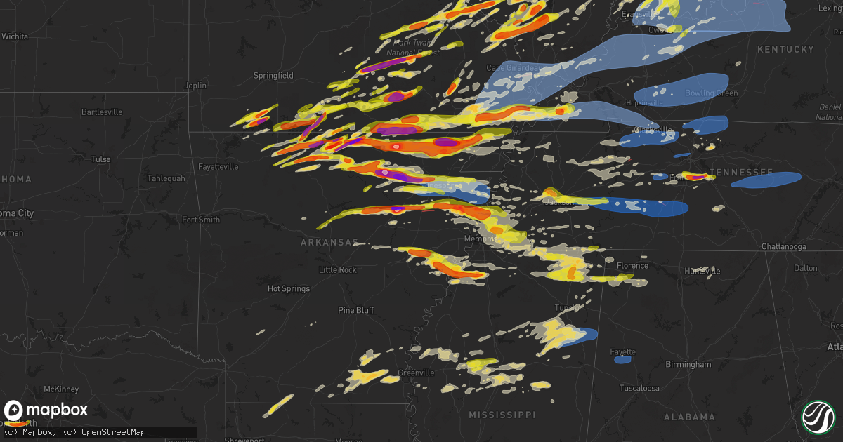
Hail Map on March 30, 2025
Get this storm
March 30 map
$229
one time, instant access
Download today. No call, no setup
Keep the $229
Bought the map and want the full workflow? Apply the entire $229 to a subscription within 7 days. None of it is wasted.
Every map, not just this one
This buys you this map. Subscription and you get every map we run, in the markets you choose from a few cities to whole states to nationwide. Plus real-time alerts the moment a storm fires.
Contact data
Name, contact info, occupancy, even credit band for addresses in the footprint. You go from where it hit to who to call.
Become the source they trust
Unlimited branding weather history reports on demand. You already have the documented answer ready for the property owner, and you are the one who showed up with it.
Property data and RoofTrace estimates
Pull up any address you have got, its value and the exact code rules for that jurisdiction, straight from One Click Code. Then RoofTrace estimates the squares, pitch, and roof value, priced the way you price.
States Impacted by Hail Map on March 30, 2025
Storm reports
Tennessee
| Date | Description |
|---|---|
| 03/30/20251:08 AM CDT | A local report indicates 1.00 inch wind near Pickwick Dam |
| 03/30/20251:05 AM CDT | Tspotter report of 3 large trees down and shingle damage to a home near locks creek/county lane east of readyville. Time is radar estimated. |
| 03/30/202512:12 AM CDT | Trees and powerlines down on highway 64 along the hardin county line. Time estimated via radar. |
| 03/30/202512:08 AM CDT | Cross bridges road unpassable due to damage in the area. Other reports of electrical poles down... Damage to structures and multiple trees down in maury county. Time is |
| 03/30/202512:05 AM CDT | Trees down at the crossroad of hampshire pike and old state road near columbia. Time is radar estimated. |
| 03/30/202512:05 AM CDT | At least one home destroyed... Multiple homes damaged... And multiple power outages in the hampshire area. Time is radar estimated. |
| 03/30/202512:05 AM CDT | Tspotter photo received of 2 inch size hail between nolensville and smyrna. Time is radar estimated. |
| 03/30/202512:05 AM CDT | Tspotter photos received of minor damage to roof of a home on fairview blvd |
| 03/30/202512:00 AM CDT | Tspotter photo received of 2 inch size hail southwest of nolensville. |
| 03/29/202511:43 PM CDT | Photo received of ping pong size hail on lena lane in franklin. |
| 03/29/202511:41 PM CDT | Quarter size hail near interstate 65 and highway 96 in franklin. |
| 03/29/202511:41 PM CDT | Tspotter report of quarter size hail at mckays mill in franklin. |
| 03/29/202511:40 PM CDT | Report from mping: ping pong ball |
| 03/29/202511:30 PM CDT | Report from mping: half dollar |
| 03/29/202511:20 PM CDT | A couple of trees down in linden. Times estimated via radar. |
| 03/29/202511:12 PM CDT | Tspotter report of groups of trees down and damage in the area of highway 100/840/pinewood road/liberty road. Time is radar estimated. |
| 03/29/202511:06 PM CDT | Fire at a substation near highway 100/pinewood. 776 power outages in the area. Time estimated on radar. |
| 03/29/202511:06 PM CDT | Multiple trees down on highway 100 east near the williamson county line. Time estimated on radar. |
| 03/29/202510:54 PM CDT | A local report indicates 1.00 inch wind near Somerville |
| 03/29/202510:37 PM CDT | Tree down on home on shady hill rd. |
| 03/29/202510:28 PM CDT | Report of tree on home on circle drive. Time estimated on radar. |
| 03/29/202510:20 PM CDT | Several reports coming in of quarter to half dollar sized hail in the bartlett/lakeland/arlington area. |
| 03/29/202510:19 PM CDT | Several reports of quarter to half dollar sized hail coming in from the bartlett/arlington area. |
| 03/29/202510:18 PM CDT | A local report indicates 1.00 inch wind near 3 S Blue Goose |
| 03/29/202510:10 PM CDT | A local report indicates 1.50 inch wind near Ellendale |
| 03/29/202510:10 PM CDT | Report of roof gone on a house. Time estimated by tornado debris signature on radar. |
| 03/29/202510:03 PM CDT | Report from mping: quarter |
| 03/29/202510:03 PM CDT | Just larger than quarter sized hail in jackson. |
| 03/29/20259:55 PM CDT | A local report indicates 1.00 inch wind near 2 ENE Dixonville |
| 03/29/20259:54 PM CDT | A local report indicates 1.25 inch wind near 3 NNE Jackson |
| 03/29/20259:36 PM CDT | Ems director reported just below golf ball size hail east of gadsden tn within crockett county. |
| 03/29/20259:12 PM CDT | Report of two trees down in the bumpus mills area. Time estimated from radar. |
| 03/29/20259:04 PM CDT | A local report indicates 1.00 inch wind near 2 W Burlison |
Arkansas
| Date | Description |
|---|---|
| 03/30/20256:58 PM CDT | Report of quarter size hail 2 miles east of egypt. |
| 03/30/20256:58 PM CDT | A local report indicates 3.00 inch wind near Olyphant |
| 03/30/20256:43 PM CDT | Report of golf ball to egg size hail. |
| 03/30/20256:32 PM CDT | Golf ball size hail in piggott... Ar. |
| 03/30/20256:25 PM CDT | A local report indicates 1.75 inch wind near Strawberry |
| 03/30/20256:10 PM CDT | A local report indicates 3.00 inch wind near Cave City |
| 03/30/20256:07 PM CDT | Social media report of golf ball size hail between mcdougal and boydsville. |
| 03/30/20256:05 PM CDT | A local report indicates 1.75 inch wind near Cave City |
| 03/30/20256:03 PM CDT | Report of half dollar size hail. |
| 03/30/20256:00 PM CDT | This was from a second storm that occurred an hour later that produced severe hail at the same location. |
| 03/30/20256:00 PM CDT | Report of golf ball size hail south of highway 90 along highway 141 east of knobel. |
| 03/30/20255:59 PM CDT | A local report indicates 1.25 inch wind near Mount Pleasant |
| 03/30/20255:55 PM CDT | A local report indicates 1.00 inch wind near 3 E Knobel |
| 03/30/20255:35 PM CDT | Report from mping: ping pong ball |
| 03/30/20255:02 PM CDT | A local report indicates 1.75 inch wind near Ralph |
| 03/30/20255:00 PM CDT | A local report indicates 3.00 inch wind near 1 NW Ozark Acres |
| 03/30/20254:52 PM CDT | A local report indicates 1.00 inch wind near Cherokee Village |
| 03/30/20254:51 PM CDT | A local report indicates 1.75 inch wind near Gamaliel |
| 03/30/20254:42 PM CDT | A local report indicates 1.00 inch wind near 1 E Whiteville |
| 03/30/20254:29 PM CDT | **delayed report** public report relayed from local media. |
| 03/30/20254:02 PM CDT | A local report indicates 1.75 inch wind near Viola |
| 03/30/20253:56 PM CDT | Report from mping: baseball |
| 03/30/20253:56 PM CDT | A local report indicates 1.75 inch wind near 1 WNW Heritage Estates |
| 03/30/20253:41 PM CDT | A local report indicates 1.25 inch wind near Gamaliel Landing |
| 03/30/20253:21 PM CDT | A local report indicates 1.50 inch wind near 2 NE Lakeview |
| 03/30/20253:21 PM CDT | A local report indicates 1.50 inch wind near 2 NE Lakeview |
| 03/30/20253:03 PM CDT | A local report indicates 1.00 inch wind near 2 W Briarcliff |
| 03/30/20253:00 PM CDT | A local report indicates 1.50 inch wind near Clarkridge |
| 03/30/20252:56 PM CDT | A local report indicates 1.25 inch wind near Dodd City |
| 03/30/20252:36 PM CDT | Report from mping: quarter |
| 03/29/202510:30 PM CDT | A local report indicates 1.50 inch wind near Marianna |
| 03/29/20259:40 PM CDT | Quarter to half-dollar sized hail. |
| 03/29/20258:53 PM CDT | A local report indicates 1.75 inch wind near 1 E Bassett |
| 03/29/20258:32 PM CDT | A local report indicates 1.00 inch wind near 1 ENE Tyronza |
| 03/29/20258:25 PM CDT | A local report indicates 1.75 inch wind near 3 W Tyronza |
| 03/29/20258:25 PM CDT | Several reports of golf ball sized hail in marked tree. |
| 03/29/20258:25 PM CDT | Photo of very large hail from marked tree. Time is radar estimated. |
| 03/29/20258:10 PM CDT | Quarter sized hail in payneway. Time is radar estimated. |
| 03/29/20257:58 PM CDT | Delayed report of hail in manila. Time is radar estimated. |
| 03/29/20257:55 PM CDT | A local report indicates 1.00 inch wind near Harrisburg |
| 03/29/20257:41 PM CDT | Trees and power lines down on bornhoft road and highway 214 e. Possible tornado. |
| 03/29/20257:15 PM CDT | Nickel to quarter size hail in bono. |
| 03/29/20257:10 PM CDT | Siding ripped off of two homes. |
| 03/29/20257:09 PM CDT | Quarter size hail reported on social media. 2 miles north of rector. |
Michigan
| Date | Description |
|---|---|
| 03/30/20256:52 PM CDT | Dispatch reports trees down |
| 03/30/20256:49 PM CDT | Tree fell on mobile home. |
| 03/30/20256:47 PM CDT | Power lines down and roof blown off. |
| 03/30/20256:38 PM CDT | Dispatch reports trees down near jewell and 27 mile road |
| 03/30/20256:33 PM CDT | Dispatch reports trees and wires down throughout area |
| 03/30/20256:30 PM CDT | Tree down on wires near livernois and wendelton roads |
| 03/30/20256:18 PM CDT | Dispatch reports multiple trees down on houses in the southern part of the county. |
| 03/30/20256:17 PM CDT | A local report indicates 63 MPH wind near Detroit Metro Intl Airp |
| 03/30/20256:12 PM CDT | Report of numerous 8 to 10 inch diameter tree limbs down across grand blanc... Downed power lines... And a few flooded roads. A few smaller trees were also uprooted. Es |
| 03/30/20256:12 PM CDT | Also reported quarter sized hail |
| 03/30/20256:11 PM CDT | Pictures of damaged fencing... Shredded netting... And snapped poles at powers catholic high school baseball fields |
| 03/30/20256:10 PM CDT | Measured on private weather station |
| 03/30/20256:09 PM CDT | A local report indicates 61 MPH wind near Flint Bishop Intl Airpo |
| 03/30/20256:07 PM CDT | Spotter reported trees uprooted near the intersection of morrish adn lennon roads and on van vleet road. |
| 03/30/20256:07 PM CDT | Emergency management reports mobile homes damaged in the holiday estates mobile home park. |
| 03/30/20256:07 PM CDT | Delayed report. Numerous large trees uprooted... All were blown down in the same direction. One tree fell on a home and caused significant damage. A nearby large shed o |
| 03/30/20256:07 PM CDT | A local report indicates 63 MPH wind near Willow Run Airport |
| 03/30/20256:05 PM CDT | Video of large tree uprooted |
| 03/30/20256:05 PM CDT | Large pine snapped and partially uprooted |
| 03/30/20255:59 PM CDT | Large pine uprooted and down on a garage |
| 03/30/20255:57 PM CDT | Trees down including one partially uprooted taking the sidewalk with it on broadway av. |
| 03/30/20255:57 PM CDT | Tree uprooted and street sign bent |
| 03/30/20255:54 PM CDT | Estimated wind gusts with pea to half inch sized hail |
| 03/30/20255:53 PM CDT | A local report indicates 75 MPH wind near 1 NE Howell |
| 03/30/20255:51 PM CDT | 2 foot diameter tree down near liberty and dornoch rds. |
| 03/30/20255:40 PM CDT | An ef1 tornado caused damage to multiple houses including a two story home that lost its roof. Several other homes had roof and siding damage. There was also damage to |
| 03/30/20255:37 PM CDT | Roof blown off an assisted living center. All 7 residents safe. |
| 03/30/20255:32 PM CDT | Asos station klan lansing. |
| 03/30/20255:30 PM CDT | Report from mping: quarter |
| 03/30/20255:30 PM CDT | Report from mping: quarter time estimated via radar. |
| 03/30/20255:28 PM CDT | Delayed report. Time estimated via radar. Barn with roof partially removed. |
| 03/30/20255:28 PM CDT | Delayed report. Time estimated via radar. Large tree down over dexter trail. |
| 03/30/20255:24 PM CDT | Delayed report. Time estimated via radar. Several photos of social media on downed trees. |
| 03/30/20255:22 PM CDT | Delayed report. Time estimated via radar. Several downed trees and large limbs in grand ledge area. |
| 03/30/20255:20 PM CDT | Delayed report. Time estimated via radar. Wire down on grand ledge hwy. |
| 03/30/20255:20 PM CDT | Ef0 began at olds road south of leslie... Mi. Caused tree damage along the path as well as minor damage to homes and resulted in the loss of several outbuildings. Total |
| 03/30/20255:17 PM CDT | Delayed report. Time estimated via radar and asos observation. Numerous large trees and branches down in the jackson area. |
| 03/30/20255:17 PM CDT | Asos station kjxn jackson county-reynolds field airport. |
| 03/30/20255:13 PM CDT | Pictures of large tree limbs down and multiple trees down on roads or partially uprooted. |
| 03/30/20255:11 PM CDT | Report of 62 mph winds via trained spotter. Numerous trees down. |
| 03/30/20255:10 PM CDT | Mesonet station mc151 us-131 mile marker 104.7. |
| 03/30/20255:05 PM CDT | Multiple public reports of a tornado on the ground... Observed at oak and 104th. Time 605 pm estimated via radar. |
| 03/30/20255:04 PM CDT | Partial barn collapse. Barn looks old and dilapidated. |
| 03/30/20255:02 PM CDT | Delayed report. Time estimated via radar. Garage doors blown out at ionia co road dept. Building. |
| 03/30/20255:00 PM CDT | Corrects previous non-tstm wnd gst report from 2 nw sparta. Mesonet station mispn 2.0 nw sparta |
| 03/30/20255:00 PM CDT | Trees and power lines down throughout the county. |
| 03/30/20255:00 PM CDT | Trees down. |
| 03/30/20255:00 PM CDT | Delayed report. Time estimated via radar. One electric transmission tower downed and another bent. Possible tornado. |
| 03/30/20254:55 PM CDT | 72 mph gust reported by trainer spotter. Time estimated via radar. Delayed report. |
| 03/30/20254:50 PM CDT | Roof blown off a barn. Also a tree on a house. |
| 03/30/20254:50 PM CDT | Asos station kgrr gerald r ford intl. |
| 03/30/20254:50 PM CDT | Delayed report. Time estimated via radar and asos observation. Numerous trees downed. |
| 03/30/20254:49 PM CDT | Delayed report. Time estimated via radar. Several reports of trees and wires down. |
| 03/30/20254:47 PM CDT | Asos station kbtl battle creek executive airport. |
| 03/30/20254:45 PM CDT | Trained spotter reports significant tree damage... A flattened barn... And debris spread. Delayed report. |
| 03/30/20254:44 PM CDT | Delayed report. Time estimated via radar. Photos on social media show bricks blown off of a roof parapet wall... Two barns damaged... And several trees down. |
| 03/30/20254:42 PM CDT | Ef0 with winds up to 80 mph. Tornado path was 4.2 miles and ended at lat/lon 42.814/-85.575. |
| 03/30/20254:42 PM CDT | Delayed report. Time estimated via radar. Numerous large trees down. Steeple removed from church building. |
| 03/30/20254:40 PM CDT | Awos station koeb coldwater. |
| 03/30/20254:32 PM CDT | Minor roof damage as storms went through. |
| 03/30/20254:31 PM CDT | Asos station kazo kalamazoo/bc intl airport. |
| 03/30/20254:30 PM CDT | Delayed report. Time estimated via radar. Numerous reports of downed trees across portage and kalamazoo. |
| 03/30/20254:30 PM CDT | Tree branches down... Barn is leaning. 72 mph wind gust from public report... Time estimated via radar. |
| 03/30/20254:29 PM CDT | Delayed report. Time estimated by radar. School district reports gymnasium roof blown off. |
| 03/30/20254:29 PM CDT | Delayed report... Photos of gas station canopy blown over. |
| 03/30/20254:25 PM CDT | Corrects previous non-tstm wnd gst report from 1 e lawton. Mesonet station ew6899 lawton. |
| 03/30/20254:25 PM CDT | Huge tree down on powerlines. Via nwschat. Time estimated by radar. |
| 03/30/20254:23 PM CDT | Measured at holland asos |
| 03/30/20254:22 PM CDT | Report of thunderstorm damage in the vicinity of 5th and pq ave. Time estimated via radar. Delayed report. |
| 03/30/20254:22 PM CDT | Corrects previous non-tstm wnd gst report from 1 w sturgis. Awos station kirs sturgis kirsch. |
| 03/30/20254:20 PM CDT | Photos of numerous... Large glass panes blown out of a tire shop. Seme trailer blown over in parking lot. Some roof damage is possible. |
| 03/30/20254:20 PM CDT | Numerous reports of trees and branches down at various locations around sturgis. |
| 03/30/20254:20 PM CDT | Corrects previous tstm wnd dmg report from 2 ene three rivers. No power at three rivers airport. Multiple trees down in the area including near andrews elementary. |
| 03/30/20254:20 PM CDT | No power at three rivers airport. Multiple trees down in the area. |
| 03/30/20254:17 PM CDT | Delayed report. Time estimated via radar. Several photos of downed trees across lawton. |
| 03/30/20254:15 PM CDT | Trained spotter reports numerous trees or limbs down around the areas of us 131 and sr 216. |
| 03/30/20254:14 PM CDT | Backyard weather station reported peak wind gust of 68 mph at 514 pm. |
| 03/30/20254:11 PM CDT | Pictures shared on twitter of a barn suffering damage at bradt rd and w main st |
| 03/30/20254:00 PM CDT | A local report indicates 64 MPH wind near South Haven |
| 03/30/20253:56 PM CDT | Facebook picture of roof damage to a barn on m 62... South of monette st. |
| 03/30/20253:56 PM CDT | Picture posted on facebook of a barn with some roof damage. |
| 03/30/20253:54 PM CDT | Tree down on house. |
| 03/30/20253:54 PM CDT | Roof blown off building. |
| 03/30/20253:54 PM CDT | Corrects previous non-tstm wnd gst report from 1 n benton heights. Asos station kbeh benton harbor. |
| 03/30/20253:52 PM CDT | Nws survey confirms an ef-1 tornado developed just southwest of edwardsburg. The tornado tracked 2.1 miles northeast along the east side of edwardsburg before dissipati |
| 03/30/20253:51 PM CDT | Grain bin damaged... Possibly completely down in edwardsburg. Additional information not available. Time estimated by radar. |
| 03/30/20253:51 PM CDT | Power poles snapped and laying across the road near the intersection of may street and conrad rd. Some poles were snapped at the base... Others about 3-4 feet off the g |
| 03/30/20253:51 PM CDT | Downed power poles across the road near the intersection of may st. And conrad rd. Some of the poles were snapped at the base... And others were snapped about 3 to 4 ft |
| 03/30/20253:50 PM CDT | Barn roof ripped off. Multiple trees uprooted. Tree tops broken. |
| 03/30/20253:50 PM CDT | Two big oak trees down... Trampoline thrown at least 50 feet into 2 houses... And roof damage to some buildings. |
| 03/30/20253:50 PM CDT | Tree down on garage and tree down over the road on elkhart rd just east of m62. Power lines down at redfield st and conrad rd intersection. Agriculture irrigation flipp |
| 03/30/20253:43 PM CDT | Several large trees down in and around buchanan. Power is out. |
| 03/30/20253:40 PM CDT | Large pine tree fell on a garage and crushed it. The garage at the house was moved off its foundation. There were shepherds hooks in the hard bent over. There is siding |
| 03/30/20253:37 PM CDT | Several large trees down in and around new troy. Power is out. |
| 03/29/20257:15 PM CDT | 2 foot diameter tree down on griswold and oak roads. |
Texas
| Date | Description |
|---|---|
| 03/30/20254:16 PM CDT | Corrects previous hail report from 3 nne pantego. Ping pong ball size hail reported on meadowbrook dr near i-30 and cooks. |
| 03/30/20254:16 PM CDT | Ping pong ball size hail reported near i-30 and fielder. |
| 03/30/20254:09 PM CDT | Corrects previous hail report from 4 nw pantego. Golf ball size hail reported near lancaster and east loop 820. |
| 03/30/20254:09 PM CDT | Golf ball size hail reported near i-30 and east loop 820. |
| 03/30/20254:09 PM CDT | Corrects previous hail report from 4 nw pantego. Golf ball size hail reported near lancaster and east loop 820. |
| 03/30/20254:05 PM CDT | Golf ball size hail reported at e loop 820 and lancaster. |
| 03/30/20253:49 PM CDT | Report from mping: half dollar |
| 03/30/20253:48 PM CDT | Report from mping: half dollar |
| 03/30/20253:45 PM CDT | Report from mping: half dollar |
| 03/30/202512:18 PM CDT | Report from mping. |
| 03/30/202510:30 AM CDT | Time estimated off radar. |
| 03/29/202510:36 PM CDT | Quarter sized hail reported between garrison and timpson. |
| 03/29/202510:19 PM CDT | Hail reported at a convenience store in tenaha... Texas. |
| 03/29/202510:04 PM CDT | Quarter size hail reported between garrison and cushing. |
| 03/29/20259:57 PM CDT | Report of a few hailstones up to the size of a quarter near the central heights community. Time estimated by radar. |
| 03/29/20259:50 PM CDT | Hail up to golf ball size reported in the town of timpson. |
| 03/29/20258:50 PM CDT | Quarter sized hail in mt. Enterprise. |
| 03/29/20258:40 PM CDT | Reported just ne of mount enterprise along highway 315. Time estimated by radar. |
| 03/29/20258:30 PM CDT | Reported west of mount enterprise along cr 3206. Time estimated by radar. |
| 03/29/20258:05 PM CDT | Reported at the new salem vfd... Just east of lake striker. Time estimated by radar. |
| 03/29/20258:05 PM CDT | Approximately 3 miles west of lake striker. Time estimated by radar. |
| 03/29/20258:00 PM CDT | Local media relaying public report of golf ball size hail in the ponta community. |
| 03/29/20258:00 PM CDT | Social media report of at least 2 inch size hail just south of lake striker. |
| 03/29/20257:55 PM CDT | Report from mping: tennis ball |
| 03/29/20257:25 PM CDT | Reports of hail up to golf ball size falling in the city of jacksonville. |
Mississippi
| Date | Description |
|---|---|
| 03/30/20251:37 PM CDT | Em reports mobile home damaged on school land rd south of jim ramsay rd. Likely tornado. |
| 03/30/20256:44 AM CDT | Trees down and possible structures damaged in the area of johnson rd... Vernon gipson ln... And mcgraw rd. Tds observed from both dgx and hdc at the time. |
| 03/30/20256:30 AM CDT | A tornado touched down near jefftown road and hwy 13 in marion county. The tornado started of small causing some minor tree damage near the starting point. The tornado |
| 03/30/20256:17 AM CDT | Tree down along hwy 25. |
| 03/30/20256:13 AM CDT | Tree downed on odom rd. |
| 03/30/20255:45 AM CDT | Cedar tree snapped along old fannin rd. Additional large limbs down in the area. |
| 03/30/20255:45 AM CDT | Trees down on 9th ave north in amory. |
| 03/30/20255:41 AM CDT | A tree was blown down near the intersection of hwy 51 and the natchez trace parkway. |
| 03/30/20255:41 AM CDT | Estimated by nws employees. Asos wind sensor failed during highest wind. |
| 03/30/20254:39 AM CDT | Large tree snapped and down on home off caldwell ave. |
| 03/30/20253:48 AM CDT | Occurred along whaley rd near money. Strong wind also reported. |
| 03/30/20253:33 AM CDT | Two trees down and covering money road. Reported by ema. |
| 03/30/20253:10 AM CDT | Tree fell on powerline on w floyce. Reported by city hall. |
| 03/30/20252:01 AM CDT | A local report indicates 1.00 inch wind near Booneville |
| 03/30/20251:58 AM CDT | Quarter sized hail in the blackland area. |
| 03/30/20251:47 AM CDT | A local report indicates 1.00 inch wind near 1 SE Burnsville |
| 03/30/20251:45 AM CDT | Ping pong ball sized hail just off highway 45 near rienzi. |
| 03/30/202512:14 AM CDT | A local report indicates 1.00 inch wind near 3 NNE Falkner |
| 03/29/202511:43 PM CDT | A local report indicates 1.75 inch wind near Arkabutla |
| 03/29/202511:22 PM CDT | A local report indicates 1.75 inch wind near North Tunica |
| 03/29/202511:01 PM CDT | A few power poles down on old hwy 61 near bowdre. |
Louisiana
| Date | Description |
|---|---|
| 03/30/20256:44 AM CDT | Large tree down blocking simmons rd. |
| 03/30/20256:40 AM CDT | Corrects previous tstm wnd dmg report from montpelier. Sheriffs office reports trees down across the parish... Especially on 3rd street near montpelier and near myrtle |
| 03/30/20256:36 AM CDT | Corrects previous tstm wnd dmg report from kentwood. Sheriffs office reports trees down across the parish... Especially in kentwood... La. |
| 03/30/20256:35 AM CDT | Tree down on bridgemore rd sw of kentwood. |
| 03/30/20256:34 AM CDT | Tree down at hwy 1053 and sanders rd. |
| 03/30/20256:34 AM CDT | Tree down on hookfin rd sw of kentwood. |
| 03/30/20256:20 AM CDT | Picture shared on social media. |
| 03/30/20256:20 AM CDT | A local report indicates 1.75 inch wind near 3 NW Prairieville |
| 03/30/20256:20 AM CDT | Ping pong ball size hail near country club of louisiana. |
| 03/30/20256:12 AM CDT | Sheriffs office reports a tree down near bayou nw road and oneil road in ascension parish. |
| 03/30/20256:05 AM CDT | Corrects previous tstm wnd dmg report from 4 n slaughter. East feliciana em reports trees down across the parish... Near hwy 19... 955 and near 952. |
| 03/30/20256:00 AM CDT | Corrects previous tstm wnd dmg report from 1 s zachary. Sheriffs office reported trees down near zachary and pride in east baton rouge... La. |
| 03/30/20255:44 AM CDT | Trees down on la 966. |
| 03/30/20255:40 AM CDT | Trees down on folkes rd. |
| 03/30/20255:40 AM CDT | Sheriffs office reports trees down across the parish... Especially on 3rd street near montpelier and near myrtle st. |
| 03/30/20255:36 AM CDT | Sheriffs office reports trees down across the parish... Especially in kentwood... La. |
| 03/30/20255:35 AM CDT | Trees down on bains rd. |
| 03/30/20255:20 AM CDT | Tree down on hwy 1 n of morganza. |
| 03/30/20255:14 AM CDT | Tree down on power lines fordoche bayou rd. |
| 03/30/20255:05 AM CDT | East feliciana em reports trees down across the parish... Near hwy 19... 955 and near 952. |
| 03/30/20255:00 AM CDT | Sheriffs office reported trees down near zachary and pride in east baton rouge... La. |
| 03/30/20254:39 AM CDT | A nws survey has concluded the damage around the lebeau area is from straight line winds estimated between 60 and 70 mph. Tree damage and damage to awnings was noted. |
| 03/30/20253:00 AM CDT | Half dollar sized hail in pollock... Louisiana. |
| 03/30/20252:55 AM CDT | Reports of quarter size hail in the community of bentley la. |
| 03/30/20252:40 AM CDT | Report of golf ball sized hail in many... La. |
| 03/30/20252:19 AM CDT | Report of golf ball size hail in the colgrade community east of winnfield. |
| 03/30/20252:12 AM CDT | Quarter size hail reported in many... Louisiana. |
| 03/30/20251:20 AM CDT | Golfball sized hail reported in the campti community. |
| 03/30/20251:15 AM CDT | 2 inch hail reported in powhatan... La. |
West Virginia
| Date | Description |
|---|---|
| 03/30/20253:40 AM CDT | One tree down between gap mills and union along highway 3. |
| 03/30/20253:17 AM CDT | 4 trees down at camp summers on 4-h camp road near forest hill. |
| 03/30/20253:02 AM CDT | 2 reports of trees into power lines along old crow rd. |
| 03/30/20253:01 AM CDT | One tree down along maple acres road. |
| 03/30/20252:55 AM CDT | Tree down in the 100 block of basham st... Time estimated from radar. |
| 03/30/20252:45 AM CDT | Tree down between hayes saw mill road and greens run road closing the road in both directions. |
| 03/30/20252:35 AM CDT | Trees into lines along rt 16 near big branch rd. |
| 03/30/20252:23 AM CDT | Tree down. Time estimated from radar. |
| 03/30/20252:20 AM CDT | Electric wire down from roadway pole to house. |
| 03/30/20252:16 AM CDT | Tree down in branton. Time estimated from radar. |
| 03/30/20252:07 AM CDT | Tree on power line. |
| 03/30/20251:58 AM CDT | Tree on power line. |
| 03/30/20251:17 AM CDT | Tree down on taylor drain road. |
| 03/30/202512:58 AM CDT | Power lines down across driveway on lost run rd. Time estimated from radar. |
| 03/30/202512:51 AM CDT | Tree down on charleston road. |
| 03/30/202512:50 AM CDT | Tree down in the roadway and possible phone lines involved on mclane pike... Liberty. Time estimated from radar. |
| 03/30/202512:29 AM CDT | Tree on power line. |
| 03/30/202512:19 AM CDT | Tree on power line. |
| 03/30/202512:18 AM CDT | Small tree down that bus cannot get past on toms creek rd. Near shrewsbury rd.... Garretts creek rd. And whites creek rd. Time estimated from radar. |
Pennsylvania
| Date | Description |
|---|---|
| 03/29/202511:58 PM CDT | Tree down across sandy hill road at i-80 on ramp. |
| 03/29/202511:37 PM CDT | Less than 200f roof blown off a house and a tow behind trailer moved 30 feet. Several down trees and large branches as well. |
| 03/29/202511:36 PM CDT | Damage to part of a fence... Tree branches down... And a destroyed metal shed. Time estimated via radar. |
| 03/29/202511:35 PM CDT | Numerous reports of tree damage on the south side of hermitage including a tree through a house window and trees into powerlines. |
| 03/29/202511:35 PM CDT | Trees uprooted... House window blown in... And a garage door blown out. Time estimated via radar. |
Ohio
| Date | Description |
|---|---|
| 03/30/20256:08 PM CDT | Power lines downed near whitmer high school. |
| 03/30/20256:08 PM CDT | Multiple trees and power lines down near the intersection of laskey and secor roads. |
| 03/30/20255:01 PM CDT | Outbuilding lost its roof. Roof was toppled into the adjacent field. |
| 03/29/202511:59 PM CDT | Tree blocking co road 15. |
| 03/29/202511:35 PM CDT | Power lines down in the roadway along county rd 53. Time estimated from radar. |
| 03/29/202510:30 PM CDT | Large tree down in a backyard. Time estimated via radar. |
| 03/29/202510:15 PM CDT | Tree and large limbs down. |
| 03/29/202510:11 PM CDT | Tree reported down across logan street. |
| 03/29/202510:00 PM CDT | Multiple trees down. Time estimated from radar. |
| 03/29/20259:58 PM CDT | Multiple trees along with a couple of power lines on flagdale rd. Time estimated from radar. |
| 03/29/20259:53 PM CDT | Asos station kosu columbus ohio state university airport. |
| 03/29/20259:43 PM CDT | A couple of trees down in utica. Time estimated from radar. |
| 03/29/20259:41 PM CDT | Multiple trees downed in utica. Time estimated by radar. |
| 03/29/20259:35 PM CDT | One tree down. Time estimated from radar. |
| 03/29/20259:29 PM CDT | Power poles down... Large tree downed across tollgate road south of 204. Large limbs downed. |
| 03/29/20259:17 PM CDT | Numerous trees downed near east mound st and striebel. Time estimated by radar. |
| 03/29/20259:16 PM CDT | Many trees uprooted... Snapped at trunks... Large branches broken off... Shingles lifted from homes... Siding lifted from homes... Gutters torn down. |
| 03/29/20259:15 PM CDT | Tree reported down on a home. Power lines down in the area. Time estimated from radar. |
| 03/29/20259:12 PM CDT | Several trees downed |
| 03/29/20259:11 PM CDT | Damaged siding... Roof damage... Carports damaged. Manufactured homes damaged. |
| 03/29/20259:07 PM CDT | A local report indicates 1.00 inch wind near 3 W Riverlea |
| 03/29/20259:00 PM CDT | Barn destroyed. Time estimated from radar. |
| 03/29/20258:55 PM CDT | Power poles down on 62. Time estimated from radar. |
| 03/29/20258:55 PM CDT | Power pole down. Time estimated from radar. |
| 03/29/20258:54 PM CDT | Asos station kiln wilmington air park. |
| 03/29/20258:42 PM CDT | Multiple trees down in london. Time estimated from radar. |
| 03/29/20258:38 PM CDT | Power poles down on 71. Time estimated from radar. |
| 03/29/20258:38 PM CDT | Large softwood trees snapped at base and large branches broken off. |
| 03/29/20258:37 PM CDT | Trees down on houses. Time estimated from radar. |
| 03/29/20258:36 PM CDT | Large barn collapsed/destroyed. |
| 03/29/20258:35 PM CDT | Several trees downed... With some outbuilding damage in the 5000 block on antioch road near 729. Time estimated by radar. |
| 03/29/20258:35 PM CDT | Tree uprooted and on road. Time estimated from radar. |
| 03/29/20258:32 PM CDT | Trees split... Outdoor above ground pool smashed in. |
| 03/29/20258:29 PM CDT | Kiln asos. |
| 03/29/20258:28 PM CDT | Large softwood trees snapped at bases. |
| 03/29/20258:27 PM CDT | Partial collapse of an outbuilding. Time estimated by radar. |
| 03/29/20258:27 PM CDT | Power pole down. Time estimated from radar. |
| 03/29/20258:18 PM CDT | Roof blown off on barn. Time estimated by radar. |
| 03/29/20258:16 PM CDT | Trees split... Outdoor above ground pool smashed in. |
| 03/29/20258:16 PM CDT | Corrects previous tstm wnd dmg report from 5 ese harveysburg. Tore roof completely off of a barn. |
| 03/29/20258:16 PM CDT | Trees and power poles down. Time estimated from radar. |
| 03/29/20258:13 PM CDT | Numerous trees downed in caesar creek state park. Time estimated by radar. |
| 03/29/20258:13 PM CDT | Large trees down on 73 east of harveysburg. Road closed. Time estimated by radar. |
| 03/29/20258:12 PM CDT | Large softwood trees snapped aloft. |
| 03/29/20258:11 PM CDT | Asos station kday dayton international airport. |
| 03/29/20258:10 PM CDT | Pole down on 132 and kunker. |
| 03/29/20258:10 PM CDT | Power poles downed. |
| 03/29/20258:09 PM CDT | Damage to homes. |
| 03/29/20258:09 PM CDT | Large barn collapsed. |
| 03/29/20258:07 PM CDT | Trees down on social row and wilmington dayton road. |
| 03/29/20258:05 PM CDT | Multiple trees down between milford and miami township. Time estimated from radar. |
| 03/29/20258:05 PM CDT | Large amounts of siding ripped off well built home. |
| 03/29/20258:05 PM CDT | Hardwood trees downed at multiple homes. Shutter ripped off home. |
| 03/29/20258:04 PM CDT | Tree downed near appaloosa circle and us 22. Time estimated by radar. |
| 03/29/20258:04 PM CDT | Three trees uprooted. |
| 03/29/20258:01 PM CDT | Shingles down from one home... Roof destroyed on another home on vandergrift drive. Time estimated from radar. |
| 03/29/20258:00 PM CDT | Measured with davis. |
| 03/29/20258:00 PM CDT | Tree downed with powerlines down along hart rd west of fairgrounds. Time estimated by radar. |
| 03/29/20257:59 PM CDT | Barn and house roof torn off. |
| 03/29/20257:59 PM CDT | Multiple trees were downed. |
| 03/29/20257:59 PM CDT | Large pine snapped at trunk. |
| 03/29/20257:59 PM CDT | Trailers overturned. Time estimated from radar. |
| 03/29/20257:59 PM CDT | Trees down on the news. Time estimated from radar. |
| 03/29/20257:55 PM CDT | Multiple trees with large branches broken off... Shingle damage to home. |
| 03/29/20257:52 PM CDT | An ef-0 tornado developed in west chester and traveled east into warren county... Through mason and kings mills before ending about 2 miles west of morrow at 906 pm. Nu |
| 03/29/20257:51 PM CDT | Poles ripped apart... Fence down... Yard furniture everywhere. Time estimated from radar. |
| 03/29/20257:49 PM CDT | A local report indicates 1.00 inch wind near 1 SW Covedale |
| 03/29/20257:48 PM CDT | Roof shingles taken off portable shelters. |
| 03/29/20257:40 PM CDT | An ef-0 tornado with estimated peak winds of about 80 mph and a path width of about 150 yards touched down just north of new miami near hamilton eaton road and traveled |
| 03/29/20257:40 PM CDT | Multiple trailers off foundation in trailer park on hamilton trenton road. Time estimated from radar. |
Oregon
| Date | Description |
|---|---|
| 03/29/20257:39 PM CDT | Several reports of downed trees... Of medium-to-large in size... At the sunnyside county park. These trees generally fell in the same direction... Suggesting strong str |
Indiana
| Date | Description |
|---|---|
| 03/30/20256:55 PM CDT | Tree down across the road on horners chapel rd at palmyra rd in organ springs. |
| 03/30/20256:42 PM CDT | Very rough location. Time is estimated from radar. Location was given as southern parts of the county. Many trees and power lines down across the area from thunderstorm |
| 03/30/20256:40 PM CDT | Very rough location. Location given as east side of rush county. Reports of limbs down and a basketball goal blown over. |
| 03/30/20256:40 PM CDT | A local report indicates 1.00 inch wind near Seymour |
| 03/30/20256:34 PM CDT | A local report indicates 1.50 inch wind near 3 NE Maltersville |
| 03/30/20256:25 PM CDT | Downed trees. Tree bark gone off trees. |
| 03/30/20256:24 PM CDT | A local report indicates 1.00 inch wind near 4 WSW Columbus |
| 03/30/20256:20 PM CDT | A local report indicates 60 MPH wind near 1 NW Taylorsville |
| 03/30/20256:13 PM CDT | A local report indicates 60 MPH wind near 1 SSW Indianapolis Int' |
| 03/30/20256:05 PM CDT | West gate of the brown county state park......brown county....numerous tree tops taken out and trees toppled...unknown number at this time. |
| 03/30/20256:04 PM CDT | Mcsd reports power line and tree down...blocking west river rd in shoals. |
| 03/30/20256:00 PM CDT | Tree branches snapped. Trampoline thrown 100 yards. Time estimated from radar. |
| 03/30/20255:57 PM CDT | Pea to quarter size hail reported 2 miles northeast of the airport. |
| 03/30/20255:53 PM CDT | A local report indicates 1.00 inch wind near 4 SE Bedford |
| 03/30/20255:50 PM CDT | *** 1 inj *** a tree was blown onto a mobile home... Causing brief entrapment and a minor injury to an individual. |
| 03/30/20255:45 PM CDT | Large tree branches down onto a house at 206 w 10th st. |
| 03/30/20255:40 PM CDT | Delayed report...damage near lake monroe on in-446. A large tree over the roadway. Farm in the area was reported to have roof damage to a barn. Time estimated from rada |
| 03/30/20255:35 PM CDT | A local report indicates 1.00 inch wind near Spencer |
| 03/30/20255:26 PM CDT | A local report indicates 1.75 inch wind near Lyons |
| 03/30/20255:24 PM CDT | Delayed report. |
| 03/30/20255:18 PM CDT | Corrects previous tstm wnd dmg report from bicknell. Tree down onto a car from thunderstorm winds. |
| 03/30/20255:18 PM CDT | Tree down onto a car from thunderstorm winds. |
| 03/30/20255:18 PM CDT | Tree blown down by thunderstorm winds. |
| 03/30/20255:07 PM CDT | A local report indicates 70 MPH wind near Bicknell |
| 03/30/20255:04 PM CDT | Tree down at camp arthur rd and sr 550 north of bruceville reported to 911 center. |
| 03/30/20255:00 PM CDT | A local report indicates 1.00 inch wind near Sullivan |
| 03/30/20255:00 PM CDT | A local report indicates 1.00 inch wind near Carlisle |
| 03/30/20254:45 PM CDT | Approximate location. |
| 03/30/20254:45 PM CDT | A local report indicates 1.00 inch wind near Fillmore |
| 03/30/20254:39 PM CDT | Corrects previous hail report from 2 e terre haute. Approximate location. |
| 03/30/20254:37 PM CDT | Corrects previous tstm wnd dmg report from angola. 2 to 3 ft diameter healthy pine tree down. Power poles damaged at trine university. |
| 03/30/20254:37 PM CDT | Large tree uprooted across e washington center rd. |
| 03/30/20254:36 PM CDT | Measured wind gust via handheld anemometer. |
| 03/30/20254:35 PM CDT | Damage to billboard near i69. |
| 03/30/20254:35 PM CDT | Tree down onto a house. |
| 03/30/20254:30 PM CDT | Large tree uprooted. Shingles off house and in trees. Steel off barn roof. Wood impaled into the ground from another property. |
| 03/30/20254:25 PM CDT | Delayed report of damage to a house as well as damage to 3 sheds and a fence. Time estimated by radar. |
| 03/30/20254:25 PM CDT | Power poles and trees down. |
| 03/30/20254:19 PM CDT | Delayed report. A large limb fell down out of a tree. Time estimated by radar. |
| 03/30/20254:17 PM CDT | Near intersection of poplar and highway 46. |
| 03/30/20254:14 PM CDT | Report from mping: quarter |
| 03/30/20254:13 PM CDT | Several large trees uprooted. Moderate shingle damage. |
| 03/30/20254:11 PM CDT | Several trees down on s. Walnut st. Between garden st. And east weninger. The alleyway heading west of there has trees damaged as well. Powerlines and pine tree downed |
| 03/30/20254:11 PM CDT | Lost the roof on two barns. Winds destroyed an out building... Blew fuel tanks a long distance... Broke telephone poles in half. |
| 03/30/20254:11 PM CDT | *** 1 inj *** trailer home removed from its foundation |
| 03/30/20254:10 PM CDT | Nickle to quarter sized hail for about 4 minutes with 40-50 mph wind gusts |
| 03/30/20254:09 PM CDT | Report relayed from wane 15. There was siding and roof damage at the noble county highway dept. Time estimated by radar. |
| 03/30/20254:09 PM CDT | A local report indicates 1.00 inch wind near 2 E Terre Haute |
| 03/30/20254:05 PM CDT | Pea to quarter size hail at my location along us 41 near walmart in terre haute....40 mph wind... Torrential rain. |
| 03/30/20254:04 PM CDT | *** 2 fatal *** there were two fatalities when thunderstorm winds blew over an amish buggy at the intersection of sr-13 and cr 43. Time estimated by radar. |
| 03/30/20254:04 PM CDT | Truck and trailer overturned. |
| 03/30/20254:04 PM CDT | *** 1 fatal *** corrects previous tstm wnd dmg report from 4 n millersburg. There was one confirmed fatality when thunderstorm winds blew over an amish buggy at the int |
| 03/30/20254:04 PM CDT | Numerous reports of trees and power lines down across whitley county. |
| 03/30/20254:04 PM CDT | Photo received of tree down and some siding removed from a house. |
| 03/30/20254:00 PM CDT | Barn blown over. |
| 03/30/20253:58 PM CDT | Several shingles blown off a roof. |
| 03/30/20253:58 PM CDT | Tree down in south whitley and 1/4 inch hail. |
| 03/30/20253:57 PM CDT | Barn blow over into the road near the intersection of cr 33 and cr 34. Time estimated from radar. |
| 03/30/20253:57 PM CDT | Large rotten based tree snapped at base at cr 750 n and n cr 300 e. |
| 03/30/20253:57 PM CDT | Ham trained spotter reports 24-inch dia. Tree down just east of in26 and 350 w on the south side of the road. |
| 03/30/20253:56 PM CDT | Significant structural damage to a building on sterling avenue between bar and ren streets. Reported via wbnd. |
| 03/30/20253:56 PM CDT | Various large branches down... One tree uprooted on the se side of elkhart. |
| 03/30/20253:56 PM CDT | Tree down on parked vehicle. Lines down near epworth forest. |
| 03/30/20253:55 PM CDT | Multiple irrigation systems rolled and mangled in fields. Systems were still in one piece but rolled over. |
| 03/30/20253:55 PM CDT | Estimated winds up to 70 mph at the corner of wolf street and frances avenue. Uprooted trees and broken tree branches in the area. |
| 03/30/20253:54 PM CDT | There were 30 homes with trees on them around the city of elkhart. |
| 03/30/20253:54 PM CDT | Corrects previous non-tstm wnd gst report from 3 nw elkhart. Awos station kekm elkhart municipa. |
| 03/30/20253:50 PM CDT | Ema trained spotter reports 16-inch measured diameter tree down 100yds west of 950 w 150 s in howard county. |
| 03/30/20253:48 PM CDT | Trees downed with debris in roadway around granger. One location was brick and waylan st... Another at brick and current st. |
| 03/30/20253:48 PM CDT | Numerous reports of trees down and branches down from mishawka high school to granger. Some instances of property damage such as shingles blown off of a church. |
| 03/30/20253:48 PM CDT | Numerous tree damage reports from the mishawaka area. There is roof damage and significant shingle loss from a building at smith and 8th... There are trees down blockin |
| 03/30/20253:47 PM CDT | Semi trailers blown over at state road 13 at 500 south. No known injuries. |
| 03/30/20253:46 PM CDT | Drone footage of 8 power poles snapped or bent at the base on harrison rd between beacon dr and cedar wood ln. |
| 03/30/20253:45 PM CDT | Trees blown down by thunderstorm winds. |
| 03/30/20253:45 PM CDT | Large pine tree uprooted and down onto a small residential structure. |
| 03/30/20253:45 PM CDT | Metal hog barn roof torn off and thrown throughout two fields. |
| 03/30/20253:45 PM CDT | Multiple large trees down. |
| 03/30/20253:45 PM CDT | Power pole snapped. |
| 03/30/20253:45 PM CDT | Trees down... Large limbs and branches down... Had smaller hail... Lost power. |
| 03/30/20253:44 PM CDT | Approx 6 in limb down. Clipped a house. Along with a partial fence blown over. Time estimated by radar. |
| 03/30/20253:44 PM CDT | Numerous reports of limbs... Trees... And powerlines downed around kosciusko county. There was a tree down on a vehicle near epworth forest |
| 03/30/20253:44 PM CDT | Corrects previous non-tstm wnd gst report from 3 wnw south bend. Asos station ksbn south bend international ap. |
| 03/30/20253:42 PM CDT | From a private weather station near the st. Joe county fair grounds. |
| 03/30/20253:42 PM CDT | Reported from facebook. Small tree limbs down. |
| 03/30/20253:40 PM CDT | Trees down and large branches down near us 31 and new rd. |
| 03/30/20253:36 PM CDT | Power pole snapped. |
| 03/30/20253:35 PM CDT | Spotter reported major tree damage and some structural damage on s. Beech rd between sr-10 and 14b road. Siding is in the trees and on the road. There is a narrow path |
| 03/30/20253:32 PM CDT | Corrects previous non-tstm wnd gst report from 2 s grissom afb. Awos station kgus grissom afb peru. |
| 03/30/20253:31 PM CDT | Large tree limbs of varying health down... Some onto roadway and at least one onto the home. |
| 03/30/20253:30 PM CDT | Numerous reports of tree damage around the county. Tree was reported downed on a home in plymouth at pretty view condos. Time for marshall county damage was likely betw |
| 03/30/20253:30 PM CDT | 25 foot tall tree downed across a driveway. There was also a stacked stone wall failure. Time estimated by radar. |
| 03/30/20253:30 PM CDT | Trees down over the road. |
| 03/30/20253:30 PM CDT | Semi blown over on us 31 north of peru... In. Specific location not known. Unknown if driver was injured. |
| 03/30/20253:29 PM CDT | *** 1 inj *** mobile home demolished. Location approximate. |
| 03/30/20253:29 PM CDT | 5 foot radio tower blown down at fulton co. Indiana ema building about 10 minutes ago due to high winds. Location just east of the junction of state rd 25 and state rd |
| 03/30/20253:29 PM CDT | Large portion of a metal outbuilding roof and wall toppled into the street. |
| 03/30/20253:28 PM CDT | Trees down and a 58 mph gust was also measured in an anemometer. Time estimated by radar. |
| 03/30/20253:27 PM CDT | Two poles down and in road near intersection of sr 10 and sr 17. |
| 03/30/20253:25 PM CDT | Numerous reports of trees and powerlines down across the county |
| 03/30/20253:25 PM CDT | Numerous trees and powerlines downed across the area of fish lake. Debris on the roads... Some trees in houses. There are several large uprooted trees. There are severa |
| 03/30/20253:22 PM CDT | Nws survey confirms an ef-1 tornado developed 2 miles sw of ancilla college. The tornado tracked 3.3 miles northeast before dissipating and was 750 yards wide. Estimate |
| 03/30/20253:22 PM CDT | Barn roof blew off and was temporarily blocking road at e state rd 4 and sr 104. Time estimated by radar. |
| 03/30/20253:20 PM CDT | Trees downed in michigan city with estimated wind gust of 60 mph. There are power outages. A large branch was reported downed on maple street. |
| 03/30/20253:19 PM CDT | Numerous reports of damage... Including trees downed and roof blow off. Metal siding is hanging from power lines in one video... Damage to silo. Power is out. |
| 03/30/20253:17 PM CDT | Several trees reported down in la porte. |
| 03/30/20253:15 PM CDT | 400 block of laurel drive has trees on top of houses |
| 03/30/20253:15 PM CDT | Trees down on us 24 near georgetown. |
| 03/30/20253:15 PM CDT | Several big tree branches are down and this one fell on a house on avondale ave in trail creek. |
| 03/30/20253:15 PM CDT | Tree downed across the road... Large limbs downed. |
| 03/30/20253:15 PM CDT | There are numerous reports of tree damage and several reports of structural damage around cass county... In. Structural damage includes fencing downed and siding blown |
| 03/30/20253:14 PM CDT | Tree into a house on ridgeview way. No information on the tree size/health. |
| 03/30/20253:14 PM CDT | Trees downed on holland street and water st. |
| 03/30/20253:14 PM CDT | Downed power lines. |
| 03/30/20253:14 PM CDT | Trees downed on holland street and water st. Wn from mishawka high school to granger. Some instances of property damage such as shingles blow |
| 03/30/20253:14 PM CDT | Multiple trees down on us 35. |
| 03/30/20253:14 PM CDT | Structural damage to a barn at 2450 e 475 s. Roof and siding blown off and strewn across road/field. Large limbs also downed. Time estimated based on radar. |
| 03/30/20253:13 PM CDT | Delayed report...top edge of brick facade on front of a building extending above the roof line was damaged. |
| 03/30/20253:11 PM CDT | Large sections of roofing material blown off st peter lutheran church. |
| 03/30/20253:10 PM CDT | Power lines down across 421. |
| 03/30/20253:10 PM CDT | A local report indicates 60 MPH wind near 4 SW Seelyville |
| 03/30/20253:07 PM CDT | Lines down across highway 421. |
| 03/30/20253:04 PM CDT | Private weather station kinkouts6 reported 70 mph gust north of kouts. |
| 03/30/20253:04 PM CDT | Trained spotter reported multiple 6 inch diameter branches broken along us-6 between porter and valparaiso. Time estimated by radar... Location approximate. |
| 03/30/20253:02 PM CDT | Private weather station reported 64 mph gust southeast of kouts. |
| 03/30/20253:01 PM CDT | Public report of broken tree branches in northern valparaiso. Time estimated by radar. |
| 03/30/20253:01 PM CDT | A local report indicates 64 MPH wind near 4 S Delphi |
| 03/30/20253:00 PM CDT | Trained spotter reported 80 mph gust in valparaiso. |
| 03/30/20253:00 PM CDT | Large tree snape in half 10 feet up. Also 3 12 foot diameter trees snapped at base. |
| 03/30/20253:00 PM CDT | *** 1 fatal *** a semi truck rolled onto a person... Leading to a fatality. |
| 03/30/20253:00 PM CDT | Valparaiso porter county airport vpz awos reported 81 mph gust prior to data outage. |
| 03/30/20253:00 PM CDT | Three trees blown down by thunderstorm winds measured at 70 mph by an anemometer at the site. |
| 03/30/20253:00 PM CDT | Three trees blown down by thunderstorm winds measured at 70 mph by an anemometer at the site. |
| 03/30/20253:00 PM CDT | Trained weather spotter reported 63 mph gust on handheld anemometer on county 1200s southeast of kouts. Time estimated by radar. |
| 03/30/20252:59 PM CDT | Siding damaged by thunderstorm wind gusts. |
| 03/30/20252:56 PM CDT | Private weather station reported 75 mph gust northeast of winfield. |
| 03/30/20252:56 PM CDT | Photo shows metal roof panels peeled from farm outbuilding along county 75e road south of valparaiso. Time estimated by radar. |
| 03/30/20252:55 PM CDT | Gary airport gyy reported 74 mph gust. Winds sustained at 48 mph for 10 minutes. |
| 03/30/20252:55 PM CDT | Lake county ema reports power poles snapped in gary. Time estimated by radar... Location approximate. |
| 03/30/20252:55 PM CDT | Corrects previous report from 2 wnw rensselaer. Rensselaer jasper county airport rzl awos reported 59 mph gust. |
| 03/30/20252:55 PM CDT | Rensselaer jasper county airport rzl awos reported 59 mph gust. |
| 03/30/20252:55 PM CDT | Power lines downed in kouts. Time estimated by radar... Location approximate. |
| 03/30/20252:53 PM CDT | Tree down. |
| 03/30/20252:53 PM CDT | Trained spotter reports large branches broken near county 300s road and county 500w road southwest of valparaiso. Time estimated by radar. |
| 03/30/20252:53 PM CDT | Public report of shingle damage near lake of the four seasons. Time estimated by radar. |
| 03/30/20252:53 PM CDT | Lake county ema reports power poles snapped in east chicago. Time estimated by radar... Location approximate. |
| 03/30/20252:53 PM CDT | Trained spotter reports 4 power poles snapped and downed power lines near boone grove high school southwest of valparaiso. Time estimated by radar. |
| 03/30/20252:53 PM CDT | Wxflow station cline avenue bridge. |
| 03/30/20252:52 PM CDT | Tree branches broken and barn damaged near in-2 and county 350s road. Time estimated by radar. |
| 03/30/20252:51 PM CDT | Photo shows shingle damage to house in latitude subdivision west of lake of the four seasons in winfield. Time estimated by radar. |
| 03/30/20252:51 PM CDT | Davis station. |
| 03/30/20252:51 PM CDT | Trees down. |
| 03/30/20252:51 PM CDT | Private weather station reported 60 mph gust in munster. |
| 03/30/20252:50 PM CDT | Considerable siding off a home. Time estimated from radar. |
| 03/30/20252:50 PM CDT | Private weather station reported 71 mph gust between goodland and remington. |
| 03/30/20252:50 PM CDT | Lake county ema reports power poles snapped in hammond. Time estimated by radar... Location approximate. |
| 03/30/20252:50 PM CDT | Report of several trees down some over 2 inches in diameter. Time estimated from radar. |
| 03/30/20252:50 PM CDT | Lake county ema reports tree or large branch on house in highland. Time estimated by radar... Location approximate. |
| 03/30/20252:48 PM CDT | Lake county ema reports power poles snapped in dyer. Time estimated by radar... Location approximate. |
| 03/30/20252:48 PM CDT | Davis station measurement. |
| 03/30/20252:46 PM CDT | Measured at davis station wwtp. |
| 03/30/20252:45 PM CDT | Photo shows construction trailer overturned and broken into pieces along in-2 near clay street east of lowell. Time estimated by radar. |
| 03/30/20252:45 PM CDT | Time estimated from radar. Southwest corner of purdue university there are branches up to inch in diameter blown down by thunderstorm winds. |
| 03/30/20252:40 PM CDT | Large tree branches down onto house...no apparent damage. Damage to barn doors. Time estimated from radar. |
| 03/30/20252:39 PM CDT | Lake county ema reports power poles snapped in lowell. Time estimated by radar... Location approximate. |
| 03/30/20252:39 PM CDT | Private weather station reported 62 mph gust in remington. Multiple other private weather stations reported gusts 55-60 mph in vicinity. |
| 03/30/20252:38 PM CDT | Trained spotter reports bent power poles in roselawn along in-10 3 miles east of in-55. Time estimated by radar... Location approximate. |
| 03/30/20252:38 PM CDT | Private weather station reported 63 mph gust north of remington. |
| 03/30/20252:37 PM CDT | Trained spotter reports 12 inch diameter tree downed near county 400 e and county 1200 n. Time estimated by radar. |
| 03/30/20252:36 PM CDT | Trained spotter reports numerous trees uprooted and branches broken along in-55 north of in-10. Time estimated by radar... Location approximate. |
| 03/30/20252:35 PM CDT | Private weather station reported 62 mph gust east of fowler. |
| 03/30/20252:30 PM CDT | Corrects previous report from 2 n fowler. Benton county ema reports semi tipped over on in-55 north of fowler near 600n road. Time estimated by radar... Location approx |
| 03/30/20252:30 PM CDT | Benton county ema reports semi tipped over on in-55 north of fowler. Time estimated by radar... Location approximate. |
| 03/30/20252:30 PM CDT | Utility lines were blown down. Time estimated from radar. |
| 03/30/20252:29 PM CDT | Private weather station reported 59 mph gust near brook. |
| 03/30/20252:28 PM CDT | A national weather service storm survey determined an ef-0 tornado with peak winds near 75 mph developed near w 600 n about 2 miles west of us route 41 where it uproote |
| 03/30/20252:27 PM CDT | Private weather station reported 59 mph gust between boswell and oxford. |
| 03/30/20252:26 PM CDT | Trees down. |
| 03/30/20252:26 PM CDT | Photo shows metal roof panels peeled from farm outbuilding at benton county fairgrounds. Time estimated by radar. |
| 03/30/20252:26 PM CDT | Davis weather station. |
| 03/30/20252:10 PM CDT | A few structures sustained minor damage across the county. |
| 03/30/20251:30 PM CDT | Barn and tree damage across the county. |
| 03/29/20259:15 PM CDT | Report of flooding. |
| 03/29/20257:22 PM CDT | Complete collapse of barn roof... Shingles ripped from home roof... Trees downed. |
| 03/29/20257:21 PM CDT | Barn doors caved... Shingles ripped from home roof... Trees downed. |
| 03/29/20257:20 PM CDT | Tree down in the 900 block of leon prall road in otisco... In. |
| 03/29/20257:18 PM CDT | Delayed report...tree down blocking old 41 south of oaktown. |
| 03/29/20257:17 PM CDT | Report from mping: quarter |
| 03/29/20257:15 PM CDT | Multiple trees down in canaan. Halls ridge rd & lower dry fork rd. Reported by canaan firefighters. |
| 03/29/20257:11 PM CDT | Trees and power lines down between napoleon and delaware. Time estimated from radar. |
| 03/29/20257:11 PM CDT | Several trees downed in 8000 block of n spades rd. Time estimated by radar. |
| 03/29/20257:07 PM CDT | Numerous trees downed... Along with some property damage near county road 800 n and old michigan rd. Time estimated by radar. |
| 03/29/20257:02 PM CDT | A local report indicates 1.00 inch wind near Boonville |
Alabama
| Date | Description |
|---|---|
| 03/30/20256:56 AM CDT | Tree down on yuma dr. |
| 03/30/20256:49 AM CDT | Trees down on walnut ln rd. |
| 03/30/20256:45 AM CDT | Trees down on cr 1. |
| 03/30/20256:41 AM CDT | Trees down on cr 2 and ashcroft corner rd. |
| 03/30/20256:35 AM CDT | Tree down and lightning struck a house. |
| 03/30/20256:28 AM CDT | Trees down along fernbank road/cr 12. Time estimated. |
Missouri
| Date | Description |
|---|---|
| 03/30/20256:57 PM CDT | Report from mping: half dollar |
| 03/30/20256:19 PM CDT | Report of hail the size of quarters near malden. |
| 03/30/20256:03 PM CDT | Report from mping: ping pong ball |
| 03/30/20256:03 PM CDT | Report from mping: ping pong ball |
| 03/30/20256:01 PM CDT | Cgi airport gusted to 50 kt. |
| 03/30/20255:58 PM CDT | Report from mping: ping pong ball |
| 03/30/20255:51 PM CDT | A local report indicates 1.00 inch wind near Dexter |
| 03/30/20255:48 PM CDT | Quarter size hail between birch tree and thomasville. |
| 03/30/20255:48 PM CDT | Small branches broken. |
| 03/30/20255:35 PM CDT | Quarter size hail in peace valley area. |
| 03/30/20255:33 PM CDT | A local report indicates 1.00 inch wind near Qulin |
| 03/30/20255:06 PM CDT | Hail up to half dollar size just north of dora. |
| 03/30/20255:01 PM CDT | A local report indicates a tornado near 1 WNW Naylor |
| 03/30/20254:52 PM CDT | A local report indicates 1.00 inch wind near Greenville |
| 03/30/20254:52 PM CDT | A local report indicates 1.75 inch wind near Greenville |
| 03/30/20254:49 PM CDT | A local report indicates 1.00 inch wind near Longtown |
| 03/30/20254:45 PM CDT | A local report indicates 1.50 inch wind near Farrar |
| 03/30/20254:44 PM CDT | A local report indicates 1.75 inch wind near Longtown |
| 03/30/20254:42 PM CDT | Hail in between quarter and ping pong ball size fell on county road 851. Time estimated via radar. |
| 03/30/20254:29 PM CDT | Approximate golf ball size hail in myrtle area. |
| 03/30/20254:28 PM CDT | A local report indicates 1.75 inch wind near Williamsville |
| 03/30/20254:25 PM CDT | Report from mping half dollar 1.25 in. |
| 03/30/20254:23 PM CDT | Quarter size hail 5 n ava. |
| 03/30/20254:23 PM CDT | Reported on m hwy... 4 miles north of van buren. |
| 03/30/20254:15 PM CDT | Slightly larger than golf ball size hail. |
| 03/30/20254:10 PM CDT | Quarter size hail 2 miles west cabool. |
| 03/30/20254:05 PM CDT | Reported in thayer. |
| 03/30/20254:05 PM CDT | A local report indicates 1.00 inch wind near 2 S Mountain Grove |
| 03/30/20254:02 PM CDT | Golf ball size hail in kimberling city. |
| 03/30/20253:58 PM CDT | Approximately 2 inch hail winona area. |
| 03/30/20253:58 PM CDT | Golf ball to tennis ball size hail... 2.5 inch... Hail in kimberling city area. |
| 03/30/20253:50 PM CDT | Golf ball size hail hwy yy and county line road. |
| 03/30/20253:40 PM CDT | Quarter size hail northeast of theodosia. |
| 03/30/20253:34 PM CDT | Approximate 1 inch hail in theodosia area. |
| 03/30/20253:30 PM CDT | A local report indicates 1.00 inch wind near Theodosia |
| 03/30/20252:58 PM CDT | Quarter sized hail in bismarck. |
| 03/30/20252:56 PM CDT | A local report indicates 2.50 inch wind near Bunker |
| 03/30/20252:53 PM CDT | A local report indicates 1.75 inch wind near 1 W Bloomsdale |
| 03/30/20252:50 PM CDT | Quarter or slightly larger sized hail in caledonia. |
| 03/30/20252:45 PM CDT | A local report indicates 2.50 inch wind near Timber |
| 03/30/20252:42 PM CDT | A local report indicates 1.00 inch wind near 1 S Salem |
| 03/30/20252:42 PM CDT | 5 minutes of quarter sized hail falling in french village. |
| 03/30/20252:37 PM CDT | Relayed from pah: picture of estimated golf ball sized hail. |
| 03/30/20252:29 PM CDT | Quarter sized hail in bonne terre. |
| 03/30/20252:27 PM CDT | A local report indicates 1.75 inch wind near Bonne Terre |
| 03/30/20252:22 PM CDT | Pea to quarter size hail. Picture on social media. |
| 03/30/20252:15 PM CDT | A local report indicates 2.25 inch wind near Yukon |
| 03/30/20252:04 PM CDT | Quarter to half dollar sized hail reported - lsring quarters based on radar trends. |
| 03/30/20252:02 PM CDT | Houston fire reported quarter size hail. |
| 03/30/20252:00 PM CDT | A local report indicates 1.25 inch wind near Pomona |
| 03/30/20251:40 PM CDT | A local report indicates 1.00 inch wind near 3 ESE Davisville |
| 03/30/20251:34 PM CDT | Quarter size hail in dora area. |
| 03/30/20251:20 PM CDT | Northeast of salem. |
| 03/30/202512:12 PM CDT | Mostly penny size with a few quarter size hail stones near roby. |
| 03/29/20257:43 PM CDT | Report from mping: quarter |
| 03/29/20257:15 PM CDT | A local report indicates 58 MPH wind near 5 S Wolf Island |
Illinois
| Date | Description |
|---|---|
| 03/30/20256:30 PM CDT | Power poles snapped. |
| 03/30/20256:30 PM CDT | Damage to high school roof. |
| 03/30/20256:05 PM CDT | Ef-1 tornado. 105 mph. 18.2 mile track. Numerous trees snapped... Roof damage to homes and barns. Shrouded in 70-90 mph straight line winds to the south that eventually |
| 03/30/20255:38 PM CDT | A local report indicates 1.50 inch wind near Hurst |
| 03/30/20255:11 PM CDT | A local report indicates 1.50 inch wind near 2 SSW Christopher |
| 03/30/20254:51 PM CDT | Asos station klwv lawrenceville ap station elevation: 430 ft. |
| 03/30/20254:50 PM CDT | Time estimated from radar. |
| 03/30/20254:27 PM CDT | Report from mping: half dollar |
| 03/30/20254:20 PM CDT | A local report indicates 1.25 inch wind near 1 NNW Du Quoin |
| 03/30/20254:20 PM CDT | A few powerlines blown down in robinson along with pea size hail. |
| 03/30/20254:09 PM CDT | A local report indicates 1.00 inch wind near 2 N Vergennes |
| 03/30/20254:08 PM CDT | Hail fell for about 5 minutes and nearly covered the ground. |
| 03/30/20254:05 PM CDT | A local report indicates 1.00 inch wind near 3 E Dundas |
| 03/30/20254:03 PM CDT | Ping pong size hail south of flora with photos. |
| 03/30/20254:00 PM CDT | A local report indicates 1.50 inch wind near 1 WSW Sesser |
| 03/30/20254:00 PM CDT | Golf ball size hail lasted 8 minutes. |
| 03/30/20253:55 PM CDT | Tree blown down along with pea size hail. |
| 03/30/20253:49 PM CDT | A local report indicates 1.75 inch wind near 6 NW Pinckneyville |
| 03/30/20253:47 PM CDT | A local report indicates 1.00 inch wind near 6 SW Campbell Hill |
| 03/30/20253:45 PM CDT | A local report indicates 1.00 inch wind near Clay City |
| 03/30/20253:36 PM CDT | Via slack with picture of stones next to ruler - measured half dollar sized hail. |
| 03/30/20253:35 PM CDT | Photo from facebook of large hail in flora. |
| 03/30/20253:34 PM CDT | Via twitter. |
| 03/30/20253:31 PM CDT | Quarter to golf ball sized hail south and east of salem il. |
| 03/30/20253:19 PM CDT | A local report indicates 1.00 inch wind near 1 SE Wamac |
| 03/30/20253:19 PM CDT | Report from social media. |
| 03/30/20253:17 PM CDT | Large tree limb down. Time estimated from radar. |
| 03/30/20253:14 PM CDT | Report of golf balls falling in evansville. |
| 03/30/20253:14 PM CDT | Report of golf balls falling in evansville. |
| 03/30/20253:00 PM CDT | Broke siding. |
| 03/30/20252:53 PM CDT | Photos of hailstones compared to a quarter as well as wind driven hail damage to siding of a buiding. Siding has multiple quarter sized holes. |
| 03/30/20252:53 PM CDT | A local report indicates 1.00 inch wind near Addieville |
| 03/30/20252:53 PM CDT | Picture of estimated golf ball sized hail east of salem. |
| 03/30/20252:45 PM CDT | Private weather station reported reported 74 mph gust near ford heights. |
| 03/30/20252:45 PM CDT | 9 power poles broken and blown down. |
| 03/30/20252:44 PM CDT | A few scattered reports of tree branches downed in the east side... Calumet heights... Roseland... Burnside... Pullman... South deering... And riverdale community areas |
| 03/30/20252:40 PM CDT | Public report of small tree branches downed near 12th place and parnell avenue in west pullman community area of chicago. Time estimated by radar. |
| 03/30/20252:40 PM CDT | Public report of small tree branches downed near 12th place and parnell avenue in west pullman community area |
| 03/30/20252:39 PM CDT | Roof blown off building near sauk trail and holeman avenue in steger. Time estimated by radar. |
| 03/30/20252:34 PM CDT | Report east of new athens. |
| 03/30/20252:31 PM CDT | 1.5 inch diameter tree branch broken near chadbourn drive and 88th avenue in orland hills. Time estimated by radar. |
| 03/30/20252:31 PM CDT | Slack post of ping pong ball sized hail. |
| 03/30/20252:24 PM CDT | Private weather station reported 62 mph gust southeast of momence. |
| 03/30/20252:22 PM CDT | Report from mping: quarter |
| 03/30/20252:17 PM CDT | Private weather station reported 60 mph gust southeast of beaverville. |
| 03/30/20252:15 PM CDT | Indiana sign along route 9 near the indiana border damaged along with a farm shed. |
| 03/30/20252:10 PM CDT | Damge to out building 0.5 mile ne of vermilion regional airport at 2400 north rd and 1950 east rd. Photo provided. |
| 03/30/20252:10 PM CDT | Garage destroyed in danville near fairchild and griffin streets. |
| 03/30/20252:10 PM CDT | Trees and powerlines blown down. |
| 03/30/20252:09 PM CDT | 70 mph winds at route 1 near the iroquois and vermilion county border with nickel hail. |
| 03/30/20252:08 PM CDT | Damage shed from strong winds in bismarck. Facebook report. |
| 03/30/20252:07 PM CDT | Video showing half of large tree blowing down in backyard. |
| 03/30/20252:07 PM CDT | Video on facebook showing tree falling down on a house in hoopeston from strong winds. |
| 03/30/20252:07 PM CDT | A local report indicates 70 MPH wind near Rossville |
| 03/30/20252:07 PM CDT | Wind gust of 62 mph with damage to chicken coop fence. Wind snapped old cedar posts off. |
| 03/30/20252:07 PM CDT | Tree branches blown down on power lines. About 25 percent of hoopeston without power. |
| 03/30/20252:05 PM CDT | Measured wind gusts from 70 to 85 mph. Unofficial nearby report of 105 mph wind gust. |
| 03/30/20252:05 PM CDT | Tree blown down on a house near denmark rd and west newell rd. |
| 03/30/20252:00 PM CDT | House roof damage from strong winds on e 2430 north road. |
| 03/30/20251:58 PM CDT | Private weather station kilgilma8 reported 66 mph gust southwest of crescent city. |
| 03/30/20251:52 PM CDT | Report of downed power lines that caused a fire. The cause of the downed power lines was reported to be the thunderstorm. Time and location estimated by radar. |
| 03/30/20251:50 PM CDT | A local report indicates 62 MPH wind near Ogden |
| 03/30/20251:50 PM CDT | Power outages in homer from high winds. |
| 03/30/20251:49 PM CDT | Hail ranging in size from dimes to quarters fell for nearly 6 mins. |
| 03/30/20251:46 PM CDT | Kane county ema reports broken tree branch on power lines near fremont street and hill avenue in elgin. Time estimated by radar. |
| 03/30/20251:46 PM CDT | Kane county ema reports power lines downed along arrow street and austin avenue in carpentersville. Time estimated by radar. |
| 03/30/20251:45 PM CDT | Semi truck on west bound i-74 blown over near st joseph by high winds. |
| 03/30/20251:45 PM CDT | At least 8-9 power poles blown down near royal. |
| 03/30/20251:45 PM CDT | Some structural damage from high winds along with power outages. |
| 03/30/20251:45 PM CDT | Photo sent with 1 inch hail next to a quarter. Hail lasted for about 15 minutes and ponding of water. |
| 03/30/20251:45 PM CDT | Power outages from high thunderstorm wind gusts. |
| 03/30/20251:45 PM CDT | Morton building damaged by high winds. |
| 03/30/20251:43 PM CDT | Photo shows evergreen tree uprooted near sleepy hollow. Relayed by broadcast media... Time estimated by radar. |
| 03/30/20251:42 PM CDT | Report from mping: quarter |
| 03/30/20251:40 PM CDT | Several trees blown down on the south side of windsor road... Between meadow brook park and philo rd. Time estimated from radar. |
| 03/30/20251:40 PM CDT | A local report indicates 1.00 inch wind near Effingham |
| 03/30/20251:40 PM CDT | Mesonet station fw0668 urbana station elevation: 748 ft. |
| 03/30/20251:39 PM CDT | Public report 1.5 ne of columbia proper. |
| 03/30/20251:37 PM CDT | Kane county ema reports tree blocking eastbound lanes of highland avenue at coombs road west of elgin. Time estimated by radar. |
| 03/30/20251:36 PM CDT | Quarter sized hail in columbia. |
| 03/30/20251:35 PM CDT | Several power poles and lines blown down west of 2.5 miles west of charleston. |
| 03/30/20251:35 PM CDT | Largest hail between 1 and 1.5 inches in diameter. |
| 03/30/20251:35 PM CDT | Asos station kcmi willard arpt station elevation: 742 ft. |
| 03/30/20251:35 PM CDT | Pine tree broke off from high winds and landed on a car. |
| 03/30/20251:35 PM CDT | 3 car crashes on southbound i-57 at mile marker 229 from high winds. |
| 03/30/20251:33 PM CDT | Kane county ema reports fence damage along muirhead road west of elgin. Time estimated by radar. |
| 03/30/20251:33 PM CDT | Kane county ema reports fence damage along muirhead road west of elgin. Time estimated by radar. Of chicago. Time estimated by ra |
| 03/30/20251:30 PM CDT | Morton building collapsed at 1083 caty road 900 n 1.5 miles nne of tolono. Photos sent. |
| 03/30/20251:30 PM CDT | Building collapsed from high winds. |
| 03/30/20251:30 PM CDT | Storage unit damaged on county road 900 just east of highway 45 1.5 miles nne of tolono. |
| 03/30/20251:22 PM CDT | The tornado moved from the sw corner of champaign county to just north of tolono. It covered 12 miles in 12 minutes doing ef1 damage to outbuildings and trees. It was 2 |
| 03/30/20251:17 PM CDT | Photos of power poles down northwest of mattoon on near highway 33. |
| 03/30/20251:07 PM CDT | Downs trees and power lines and poles in sullivan via facebook post. |
| 03/30/202512:16 PM CDT | Doors of a farm outbuilding blown in and camper blown on its side. Pictures from slack. |
Virginia
| Date | Description |
|---|---|
| 03/30/20252:12 AM CDT | Tree on power line. |
| 03/30/20251:58 AM CDT | Tree on power line. |
| 03/30/20251:05 AM CDT | Tree on power line. |
Kentucky
| Date | Description |
|---|---|
| 03/30/20256:15 PM CDT | A local report indicates 62 MPH wind near 3 NNE Bandana |
| 03/30/20251:19 AM CDT | Powerlines were reported to have been blown down at the mouth of long fork. The event time is radar estimated. |
| 03/30/20251:17 AM CDT | A roof was blown off a structure with additional damage to that structures second story with debris reported to be blocking all lanes of us 23. Powerlines were also blo |
| 03/30/20251:16 AM CDT | Considerable damage off of us-23 in broad bottom. Time estimated by radar. |
| 03/30/20251:14 AM CDT | Trees and powerlines were reported to have been blown down in the beaver community near ky 979. The event time is radar estimated. |
| 03/30/20251:07 AM CDT | Trees and powerlines were reported to have been blown down in the printer community. The event time is radar estimated. |
| 03/30/20251:04 AM CDT | Social media report said trees and powerlines were down on the 120 block of turner branch road in eastern. |
| 03/30/20251:03 AM CDT | Damage observed from photos near the town of langley... In floyd county. Time estimated from radar. |
| 03/30/202512:58 AM CDT | Public report relayed by broadcast from valley road of several trees that have blown down and blocked the road. |
| 03/30/202512:51 AM CDT | Perry county 911 center reported a tree down on ky-451 before messer branch road. Time estimated from radar. |
| 03/30/202512:41 AM CDT | Perry county 911 center reported utility lines down near the 2700 block of ky-28 near the grapevine area. Time estimated from radar. |
| 03/30/202512:20 AM CDT | A tree was reported to have been blown down near the intersection of charlie sizemore road and us 421. The event time is radar estimated. |
| 03/30/202512:13 AM CDT | Report including video via social media. |
| 03/29/202511:58 PM CDT | Pulaski county 911 center reported a tree down near the intersection ky 192 and providence road. Time estimated from radar. |
| 03/29/202511:53 PM CDT | Pulaski county 911 center reported a tree down near the 10000 block of ky 192. Time estimated from radar. |
| 03/29/202511:53 PM CDT | Pulaski county 911 center reported several trees down at the intersection of malvin hill church road and jessie sears road. Time estimated from radar. |
| 03/29/202511:51 PM CDT | Trees down on grandview drive. |
| 03/29/202511:48 PM CDT | Pulaski county dispatch reported a downed tree on a powerline on the 450 block of sierra dr near burnside. Time is based off of time of 911 call. |
| 03/29/202511:36 PM CDT | Tree on power line. |
| 03/29/202511:20 PM CDT | Powerlines were reported to have been blown down at 2966 dry creek road clearfield. Time is estimated from radar. |
| 03/29/202511:16 PM CDT | Powerlines were reported to have been blown down at 650 dry creek road clearfield. Time is estimated from radar. |
| 03/29/202510:30 PM CDT | Image posted in nws chat o |
| 03/29/202510:30 PM CDT | Image posted in nws chat of tree debris across a road in buckeye. |
| 03/29/202510:07 PM CDT | Many trees uprooted and snapped across two farms. |
| 03/29/20259:57 PM CDT | Social media image shows damage to the front of the faith baptist church. |
| 03/29/20259:39 PM CDT | A local report indicates 65 MPH wind near Clifty |
| 03/29/20259:29 PM CDT | One tree down near gratz. Time estimated from radar. |
| 03/29/20259:22 PM CDT | 1 inch hail reported nnw of allegre... Near the christian and todd county line. |
| 03/29/20259:15 PM CDT | Awos station kbry bardstown. |
| 03/29/20259:08 PM CDT | 1 inch hail reported south of gracey. |
| 03/29/20258:58 PM CDT | Power lines down at oak street and s preston hwy... Lebanon junction. |
| 03/29/20258:56 PM CDT | Asos station ksdf louisville intl airport. |
| 03/29/20258:55 PM CDT | Barn destroyed...trees and power lines down. |
| 03/29/20258:54 PM CDT | Tree down along with powerlines. |
| 03/29/20258:53 PM CDT | Tree across blankenbaker blocking rd. |
| 03/29/20258:52 PM CDT | Tree down on home... Front of home partially collapsed. |
| 03/29/20258:51 PM CDT | Wires down around 11210 blue lick rd. |
| 03/29/20258:51 PM CDT | Report of tree down on house. |
| 03/29/20258:48 PM CDT | Road impassable due to debris. |
| 03/29/20258:48 PM CDT | *** 1 inj *** nws survey determined an ef1 tornado with max estimated winds of 100 mph occurred in south louisville |
| 03/29/20258:48 PM CDT | Tree on house with damage. |
| 03/29/20258:48 PM CDT | Tree down on vehicle and blocking rd. |
| 03/29/20258:47 PM CDT | Wires down blocking road on new cut rd near southern pkwy. |
| 03/29/20258:45 PM CDT | Barn damage...grain auger flipped over...two hay wagons flipped upside down...silo blown down. |
| 03/29/20258:42 PM CDT | Report of tree down in the middle of the road on powerlines. |
| 03/29/20258:42 PM CDT | Tree down. |
| 03/29/20258:41 PM CDT | Dixie hwy and stites station rd. Report of trees down. |
| 03/29/20258:41 PM CDT | Via social media... Local media... Wdrb... Showed photos of trees down in prairie village. |
| 03/29/20258:40 PM CDT | Mesonet station cw9792 flaherty. |
| 03/29/20258:30 PM CDT | Ky mesonet station in meade county. |
| 03/29/20258:30 PM CDT | Trees down...roof off garage...trees snapped...windows blown out of house. |
| 03/29/20258:29 PM CDT | Multiple trees down...roof and siding material removed form structures...debris blown into trees. |
| 03/29/20258:29 PM CDT | Many trees down on doe valley golf course. Witness said it was the most damage he had seen there in 30 years. |
| 03/29/20258:28 PM CDT | Via social media... Report of heavy damage to homes and trees. |
| 03/29/20258:28 PM CDT | Report of camper flipped. |
| 03/29/20258:28 PM CDT | Barn destroyed...debris blown into trees...damage to house...several trees snapped. |
| 03/29/20258:13 PM CDT | A local report indicates 1.00 inch wind near Mayfield |
| 03/29/20258:10 PM CDT | Power pole down. Time estimated from radar. |
| 03/29/20258:00 PM CDT | Tree down in road way on lambert schoolhouse rd and scifres ridge rd. |
| 03/29/20257:56 PM CDT | Corrects previous hail report from 2 ssw fancy farm. |
| 03/29/20257:56 PM CDT | A local report indicates 1.00 inch wind near 3 N Fancy Farm |
| 03/29/20257:55 PM CDT | Report from mping: quarter |
| 03/29/20257:30 PM CDT | Anywhere from pea to quarter size hail reported. |
| 03/29/20257:30 PM CDT | A local report indicates 62 MPH wind near 4 NE Marion |
| 03/29/20257:13 PM CDT | Measured at henshaw fire dept. |
Cities Impacted by Hail Map on March 30, 2025
- Coolidge, TX
- Dawson, TX
- Valley Mills, TX
- Clifton, TX
- Mexia, TX
- Wortham, TX
- Comanche, TX
- Streetman, TX
- Fairfield, TX
- San Saba, TX
- Lampasas, TX
- Foley, AL
- Kempner, TX
- Burnet, TX
- Florence, TX
- Bertram, TX
- Briggs, TX
- Copperas Cove, TX
- Jarrell, TX
- Georgetown, TX
- Bartlett, TX
- Liberty Hill, TX
- Granger, TX
- Vancleave, MS
- Moss Point, MS
- Holland, TX
- Buckholts, TX
- Thorndale, TX
- Breese, IL
- Germantown, IL
- Aviston, IL
- Albers, IL
- Cameron, TX
- Sainte Genevieve, MO
- Saint Mary, MO
- Bartelso, IL
- Chester, IL
- Ellis Grove, IL
- Walsh, IL
- Wasola, MO
- Brixey, MO
- Altamont, IL
- Windsor, IL
- Findlay, IL
- Salem, MO
- Thornfield, MO
- Sullivan, IL
- Dora, MO
- Drury, MO
- Gainesville, MO
- Cherryville, MO
- Festus, MO
- Mason, IL
- Mattoon, IL
- Beecher City, IL
- Valmeyer, IL
- Columbia, IL
- Millstadt, IL
- Davisville, MO
- Steelville, MO
- Viburnum, MO
- Potosi, MO
- Tuscola, IL
- Atwood, IL
- Hammond, IL
- Lovington, IL
- Ivesdale, IL
- Charleston, IL
- Greenup, IL
- Lerna, IL
- Toledo, IL
- Washington, MO
- Watson, IL
- Effingham, IL
- Teutopolis, IL
- Philo, IL
- Tolono, IL
- Urbana, IL
- Arcola, IL
- Humboldt, IL
- Bement, IL
- Sadorus, IL
- Pesotum, IL
- Champaign, IL
- Villa Grove, IL
- Savoy, IL
- Sidney, IL
- Saint Joseph, IL
- Ogden, IL
- Fithian, IL
- Homer, IL
- Royal, IL
- Armstrong, IL
- Belleville, IL
- Fisher, IL
- Foosland, IL
- Mahomet, IL
- Dewey, IL
- Rantoul, IL
- Ludlow, IL
- Paxton, IL
- Gibson City, IL
- Loda, IL
- Buckley, IL
- Melvin, IL
- Rankin, IL
- Cissna Park, IL
- Onarga, IL
- Gilman, IL
- Collison, IL
- Muncie, IL
- Penfield, IL
- Potomac, IL
- Danville, IL
- Rossville, IL
- Hoopeston, IL
- Oakwood, IL
- O'Fallon, IL
- Fairview Heights, IL
- Fults, IL
- Smithton, IL
- New Athens, IL
- Westfield, IL
- Ashmore, IL
- Cabool, MO
- Waterloo, IL
- Pinckneyville, IL
- Coulterville, IL
- Freeburg, IL
- Kansas, IL
- Sigel, IL
- Belgrade, MO
- Mineral Point, MO
- Houston, MO
- Watseka, IL
- Crescent City, IL
- Milford, IL
- Ashkum, IL
- Clifton, IL
- Martinton, IL
- Saint Anne, IL
- Papineau, IL
- Beaverville, IL
- Alvin, IL
- Henning, IL
- Wellington, IL
- Sheldon, IL
- Gifford, IL
- Thomasboro, IL
- Williamsport, IN
- Stockland, IL
- Ambia, IN
- West Lebanon, IN
- Bismarck, IL
- Defiance, MO
- Boss, MO
- Red Bud, IL
- Valles Mines, MO
- Bonne Terre, MO
- Nashville, IL
- Oakdale, IL
- Augusta, MO
- Saint Charles, MO
- Brooksville, FL
- De Soto, MO
- Cadet, MO
- Elk Creek, MO
- Eunice, MO
- Raymondville, MO
- Yukon, MO
- Solo, MO
- Stewardson, IL
- Shumway, IL
- Montrose, IL
- Edgewood, IL
- Tamaroa, IL
- Ashley, IL
- French Village, MO
- Bloomsdale, MO
- Harrison, AR
- Licking, MO
- Key Biscayne, FL
- Summersville, MO
- O'Fallon, MO
- Saint Peters, MO
- Blackwell, MO
- Alpena, AR
- Bixby, MO
- Cayuga, IN
- Perrysville, IN
- Frankfort, IL
- Mokena, IL
- New Lenox, IL
- Tinley Park, IL
- Orland Park, IL
- Oak Forest, IL
- Crestwood, IL
- Midlothian, IL
- Chicago, IL
- Alsip, IL
- Robbins, IL
- Palos Heights, IL
- Oak Lawn, IL
- Chicago Ridge, IL
- Burbank, IL
- Worth, IL
- Hazel Crest, IL
- Homewood, IL
- Country Club Hills, IL
- Hometown, IL
- Markham, IL
- Blue Island, IL
- Evergreen Park, IL
- Posen, IL
- Harvey, IL
- Riverdale, IL
- South Holland, IL
- Dolton, IL
- Lowell, IN
- Cedar Lake, IN
- Pembroke Township, IL
- Grant Park, IL
- Beecher, IL
- Momence, IL
- Lake Village, IN
- Schneider, IN
- Shelby, IN
- Demotte, IN
- Thayer, IN
- Hebron, IN
- Crown Point, IN
- Morocco, IN
- Donovan, IL
- Goodland, IN
- Kentland, IN
- Fowler, IN
- Boswell, IN
- Brook, IN
- Earl Park, IN
- Oxford, IN
- Pine Village, IN
- Remington, IN
- Rensselaer, IN
- Templeton, IN
- West Lafayette, IN
- Wolcott, IN
- Attica, IN
- Westpoint, IN
- Brookston, IN
- Chalmers, IN
- Lafayette, IN
- Otterbein, IN
- Lenzburg, IL
- Mascoutah, IL
- Calumet City, IL
- Hammond, IN
- Marissa, IL
- Addieville, IL
- Saint Libory, IL
- Chicago Heights, IL
- Steger, IL
- Crete, IL
- Schererville, IN
- Highland, IN
- Dyer, IN
- Munster, IN
- Lansing, IL
- Glenwood, IL
- Roby, MO
- Woodlawn, IL
- New Baden, IL
- Hartshorn, MO
- Eminence, MO
- Walnut Hill, IL
- Centralia, IL
- Yellville, AR
- Lead Hill, AR
- Park Hills, MO
- Plato, MO
- Miami, FL
- Miami Beach, FL
- Green Forest, AR
- Covington, IN
- Belleview, MO
- Caledonia, MO
- Casey, IL
- Kouts, IN
- Wheatfield, IN
- Monon, IN
- Reynolds, IN
- Francesville, IN
- Okawville, IL
- Monticello, IN
- Delphi, IN
- Battle Ground, IN
- Rockville, IN
- Bloomingdale, IN
- Marshall, IN
- Carbon, IN
- Waveland, IN
- Mecca, IN
- Hillsdale, IN
- Montezuma, IN
- Clinton, IN
- Dana, IN
- Crawfordsville, IN
- Greencastle, IN
- New Market, IN
- Roachdale, IN
- Ladoga, IN
- Russellville, IN
- Dix, IL
- Irondale, MO
- Salem, IL
- Kell, IL
- Iuka, IL
- Hoyleton, IL
- Prairie Du Rocher, IL
- Alhambra, IL
- Pocahontas, IL
- Highland, IL
- New Douglas, IL
- Mountain Home, AR
- Mount Vernon, IL
- Cantonment, FL
- Saint Louis, MO
- Pontiac, MO
- Farmington, MO
- Molino, FL
- Texico, IL
- Marine, IL
- Bismarck, MO
- Sparta, IL
- Baldwin, IL
- Bull Shoals, AR
- Flippin, AR
- Clarkridge, AR
- East Chicago, IN
- Griffith, IN
- Gary, IN
- Whiting, IN
- Boone Grove, IN
- Lake Station, IN
- Portage, IN
- Hobart, IN
- Valparaiso, IN
- Merrillville, IN
- La Crosse, IN
- Wanatah, IN
- Knox, IN
- Hanna, IN
- Modoc, IL
- Evansville, IL
- Tilden, IL
- Star City, IN
- North Judson, IN
- Buffalo, IN
- Yeoman, IN
- Medaryville, IN
- Winamac, IN
- San Pierre, IN
- Elizabeth, AR
- Kewanna, IN
- Monterey, IN
- Burnettsville, IN
- Ora, IN
- Rochester, IN
- Lucerne, IN
- Royal Center, IN
- Idaville, IN
- Logansport, IN
- Galveston, IN
- Twelve Mile, IN
- Walton, IN
- Flora, IN
- Camden, IN
- New Richmond, IN
- Peel, AR
- Marble Falls, AR
- Linden, IN
- Romney, IN
- Bunker, MO
- Centerville, MO
- Newton, IL
- Patoka, IL
- Oakland, AR
- Richview, IL
- Lesterville, MO
- Xenia, IL
- Seligman, MO
- Washburn, MO
- Kinmundy, IL
- Gassville, AR
- Cotter, AR
- Carlyle, IL
- Paris, IL
- Vernon, IL
- Henderson, AR
- Bainbridge, IN
- Colfax, IN
- Darlington, IN
- New Ross, IN
- Frankfort, IN
- Thorntown, IN
- Clarks Hill, IN
- Jamestown, IN
- Advance, IN
- Lebanon, IN
- North Salem, IN
- Johnsonville, IL
- Rinard, IL
- Odin, IL
- Black, MO
- Michigan City, IN
- Kingsford Heights, IN
- Hamlet, IN
- Beverly Shores, IN
- Westville, IN
- La Porte, IN
- Chesterton, IN
- Union Mills, IN
- New Buffalo, MI
- Rolling Prairie, IN
- Grovertown, IN
- Culver, IN
- Plymouth, IN
- Walkerton, IN
- North Liberty, IN
- Mill Creek, IN
- Argos, IN
- Tippecanoe, IN
- Macy, IN
- Peru, IN
- Grissom Arb, IN
- New Waverly, IN
- Denver, IN
- Bunker Hill, IN
- Onward, IN
- Akron, IN
- Mexico, IN
- Kirklin, IN
- Russiaville, IN
- Michigantown, IN
- Forest, IN
- Annapolis, IL
- Oblong, IL
- Martinsville, IL
- Yale, IL
- Everton, AR
- Willow Hill, IL
- Marshall, IL
- Dennison, IL
- Du Bois, IL
- Protem, MO
- Theodosia, MO
- Udall, MO
- Bakersfield, MO
- Sorento, IL
- Cassville, MO
- Aurora, MO
- Cape Fair, MO
- Shell Knob, MO
- Viola, AR
- Ellington, MO
- Galena, MO
- Moody, MO
- Louisville, IL
- Flora, IL
- Omaha, AR
- Caulfield, MO
- Midway, AR
- Mountain View, MO
- Lakeview, AR
- Isabella, MO
- West York, IL
- Clay City, IL
- Fort Worth, TX
- Naval Air Station Jrb, TX
- West Plains, MO
- Ironton, MO
- Fredericktown, MO
- Bourbon, IN
- Eagle Rock, MO
- Mammoth Spring, AR
- Salem, AR
- Arcadia, MO
- Lakeville, IN
- South Bend, IN
- Donnellson, IL
- Hillsboro, IL
- Gamaliel, AR
- Ingraham, IL
- Reeds Spring, MO
- Birch Tree, MO
- Saint Peter, IL
- Vandalia, IL
- Dieterich, IL
- Campbell Hill, IL
- Coffeen, IL
- Sturkie, AR
- Rockwood, IL
- Cutler, IL
- Gepp, AR
- Greenville, IL
- Ava, IL
- Du Quoin, IL
- Bridgman, MI
- Lakeside, MI
- New Carlisle, IN
- Saint Joseph, MI
- Baroda, MI
- Union Pier, MI
- Stevensville, MI
- Harbert, MI
- Three Oaks, MI
- Galien, MI
- Buchanan, MI
- Bremen, IN
- Sawyer, MI
- New Troy, MI
- Cassopolis, MI
- Sodus, MI
- Granger, IN
- Eau Claire, MI
- Wakarusa, IN
- Berrien Center, MI
- Berrien Springs, MI
- Niles, MI
- Mishawaka, IN
- Elkhart, IN
- Osceola, IN
- Dowagiac, MI
- Edwardsburg, MI
- Notre Dame, IN
- New Paris, IN
- Goshen, IN
- Bristol, IN
- Milford, IN
- Middlebury, IN
- Etna Green, IN
- Nappanee, IN
- Roann, IN
- Atwood, IN
- Leesburg, IN
- Claypool, IN
- Burket, IN
- Mentone, IN
- Syracuse, IN
- Winona Lake, IN
- North Webster, IN
- Pierceton, IN
- North Manchester, IN
- Millersburg, IN
- Warsaw, IN
- Silver Lake, IN
- Cromwell, IN
- Columbia City, IN
- South Whitley, IN
- Larwill, IN
- Laketon, IN
- Liberty Mills, IN
- Huntington, IN
- Wabash, IN
- Servia, IN
- Urbana, IN
- Lagro, IN
- Kempton, IN
- Sharpsville, IN
- Tipton, IN
- Kokomo, IN
- Vergennes, IL
- West Union, IL
- Spokane, MO
- Chestnutridge, MO
- Walnut Shade, MO
- Elkville, IL
- Dowell, IL
- Koshkonong, MO
- Thayer, MO
- Noble, IL
- Dundas, IL
- Golden, MO
- Shubuta, MS
- Farina, IL
- Terre Haute, IN
- Pyatt, AR
- West Terre Haute, IN
- Olney, IL
- West Liberty, IL
- Sesser, IL
- Scheller, IL
- Mulkeytown, IL
- Waltonville, IL
- Bonnie, IL
- Arlington, TX
- Opdyke, IL
- Belle Rive, IL
- Bluford, IL
- Keenes, IL
- Kimberling City, MO
- Berryville, AR
- Lampe, MO
- Norwood, MO
- Couch, MO
- Wiggins, MS
- Vanzant, MO
- Mountain Grove, MO
- Hartford, MI
- Squires, MO
- Fremont, MO
- Winona, MO
- Alton, MO
- Eureka Springs, AR
- Steeleville, IL
- Percy, IL
- Pensacola, FL
- Kimmell, IN
- Churubusco, IN
- Laotto, IN
- Avilla, IN
- Albion, IN
- Wawaka, IN
- Ligonier, IN
- Kendallville, IN
- Howe, IN
- Wolcottville, IN
- Topeka, IN
- Lagrange, IN
- Shipshewana, IN
- South Milford, IN
- Rome City, IN
- Constantine, MI
- Burr Oak, MI
- White Pigeon, MI
- Jones, MI
- Sturgis, MI
- Union, MI
- Benton Harbor, MI
- Lawton, MI
- Three Rivers, MI
- Decatur, MI
- Marcellus, MI
- Centreville, MI
- Mendon, MI
- Vandalia, MI
- Schoolcraft, MI
- Vicksburg, MI
- Kalamazoo, MI
- Watervliet, MI
- South Haven, MI
- Mattawan, MI
- Gobles, MI
- Douglas, MI
- Coloma, MI
- Grand Junction, MI
- Bloomingdale, MI
- Covert, MI
- Fennville, MI
- Lawrence, MI
- Pullman, MI
- Allegan, MI
- Saugatuck, MI
- Bangor, MI
- Portage, MI
- Paw Paw, MI
- Holland, MI
- Hamilton, MI
- Macatawa, MI
- Grand Haven, MI
- West Olive, MI
- Otsego, MI
- Wayne City, IL
- Robinson, IL
- Sumner, IL
- Palestine, IL
- Stoy, IL
- Branson, MO
- Brazil, IN
- Cory, IN
- Ravenden, AR
- Williamsville, MO
- Rosedale, IN
- Doniphan, MO
- Gatewood, MO
- Myrtle, MO
- Van Buren, MO
- Blue Eye, MO
- Quitman, MS
- Ava, MO
- Kirbyville, MO
- Hollister, MO
- Ridgedale, MO
- Hutsonville, IL
- Oak Grove, AR
- Staunton, IN
- Dorr, MI
- Allendale, MI
- Zeeland, MI
- Hudsonville, MI
- Hopkins, MI
- Coopersville, MI
- Byron Center, MI
- Jenison, MI
- Martin, MI
- Plainwell, MI
- Grandville, MI
- Wayland, MI
- Shelbyville, MI
- Leonidas, MI
- Scotts, MI
- Colon, MI
- Climax, MI
- Fulton, MI
- Athens, MI
- Galesburg, MI
- Sherwood, MI
- East Leroy, MI
- Battle Creek, MI
- Richland, MI
- Augusta, MI
- Hudson, IN
- Corunna, IN
- Butler, IN
- Auburn, IN
- Pleasant Lake, IN
- Waterloo, IN
- Garrett, IN
- Angola, IN
- Ashley, IN
- Pomona, MO
- Murphysboro, IL
- Fremont, IN
- Bronson, MI
- Hamilton, IN
- Orland, IN
- Montgomery, MI
- Coldwater, MI
- Union City, MI
- Perryville, MO
- Sullivan, IN
- Merom, IN
- Claremont, IL
- Bridgeport, IL
- Flat Rock, IL
- Reelsville, IN
- Greenville, MO
- Pocahontas, AR
- Grandin, MO
- Bradleyville, MO
- Cedarcreek, MO
- Milton, FL
- Poplar Bluff, MO
- Ellsinore, MO
- Mill Spring, MO
- Centerpoint, IN
- Farmersburg, IN
- Kissimmee, FL
- Camp, AR
- Glencoe, AR
- Shelburn, IN
- Fairbanks, IN
- Frohna, MO
- Wyoming, MI
- Caledonia, MI
- Marne, MI
- Grand Rapids, MI
- Comstock Park, MI
- Hickory Corners, MI
- Delton, MI
- Middleville, MI
- Alto, MI
- Ada, MI
- Hastings, MI
- Freeport, MI
- Dowling, MI
- Ceresco, MI
- Nashville, MI
- Bellevue, MI
- Homer, MI
- Marshall, MI
- Tekonsha, MI
- Reading, MI
- Quincy, MI
- Burlington, MI
- Allen, MI
- Camden, MI
- Hillsdale, MI
- Litchfield, MI
- Montpelier, OH
- Edon, OH
- Jonesville, MI
- Waldron, MI
- Pioneer, OH
- Osseo, MI
- Edgerton, OH
- Alvordton, OH
- Bryan, OH
- Lewis, IN
- Hymera, IN
- Jasonville, IN
- Coalmont, IN
- Saint Francisville, IL
- Lawrenceville, IL
- Vincennes, IN
- Oaktown, IN
- Silva, MO
- Carlisle, IN
- Hardy, AR
- Saint Joe, AR
- Western Grove, AR
- Valley Springs, AR
- Redford, MO
- Patton, MO
- Sedgewickville, MO
- Farrar, MO
- Cherokee Village, AR
- Rueter, MO
- Gulf Breeze, FL
- Poland, IN
- Noble, MO
- Kissee Mills, MO
- Jacob, IL
- Newaygo, MI
- Conklin, MI
- Ravenna, MI
- Grant, MI
- Nunica, MI
- Casnovia, MI
- Bailey, MI
- Spring Lake, MI
- Sparta, MI
- Cedar Springs, MI
- Sand Lake, MI
- Belmont, MI
- Kent City, MI
- Rockford, MI
- Howard City, MI
- Greenville, MI
- Belding, MI
- Lowell, MI
- Lake Odessa, MI
- Saranac, MI
- Clarksville, MI
- Woodland, MI
- Charlotte, MI
- Vermontville, MI
- Olivet, MI
- Eaton Rapids, MI
- Springport, MI
- Hanover, MI
- Horton, MI
- Albion, MI
- Spring Arbor, MI
- Concord, MI
- Parma, MI
- Edwardsport, IN
- Freelandville, IN
- Sandborn, IN
- Jerome, MI
- North Adams, MI
- Pittsford, MI
- Hudson, MI
- West Unity, OH
- Stryker, OH
- Gorham, IL
- Royalton, IL
- Warm Springs, AR
- Bruceville, IN
- Wheatland, IN
- Bicknell, IN
- Monroe City, IN
- Ragsdale, IN
- Fairdealing, MO
- Zeigler, IL
- Ash Flat, AR
- Westphalia, IN
- Williford, AR
- Friedheim, MO
- Oxly, MO
- Naylor, MO
- Clubb, MO
- Ravenden Springs, AR
- Neelyville, MO
- Harviell, MO
- Zalma, MO
- McGee, MO
- Glenallen, MO
- Marquand, MO
- Russellville, AR
- Wappapello, MO
- Linton, IN
- Clay City, IN
- Uniontown, MO
- Washington, IN
- Gowen, MI
- Morley, MI
- Stanton, MI
- Coral, MI
- Trufant, MI
- Pierson, MI
- Lakeview, MI
- Sidney, MI
- Crystal, MI
- Sheridan, MI
- Ionia, MI
- Fenwick, MI
- Orleans, MI
- Six Lakes, MI
- Carson City, MI
- Sunfield, MI
- Fowler, MI
- Pewamo, MI
- Lyons, MI
- Portland, MI
- Hubbardston, MI
- Westphalia, MI
- Muir, MI
- De Soto, IL
- Eagle, MI
- Potterville, MI
- Mulliken, MI
- Grand Ledge, MI
- Dimondale, MI
- Benton, IL
- Lansing, MI
- Mason, MI
- Pleasant Lake, MI
- Stockbridge, MI
- Holt, MI
- Jackson, MI
- Leslie, MI
- Rives Junction, MI
- Onondaga, MI
- Cement City, MI
- Brooklyn, MI
- Somerset Center, MI
- Napoleon, MI
- Adrian, MI
- Onsted, MI
- Michigan Center, MI
- Manitou Beach, MI
- Clarklake, MI
- Munith, MI
- Grass Lake, MI
- Clayton, MI
- Morenci, MI
- Fayette, OH
- Addison, MI
- Archbold, OH
- Powersite, MO
- Lyons, IN
- Elnora, IN
- Newberry, IN
- Bloomfield, IN
- Switz City, IN
- Plainville, IN
- Montgomery, IN
- Carbondale, IL
- Carterville, IL
- Hurst, IL
- Damascus, AR
- Springfield, AR
- Moore Haven, FL
- Okeechobee, FL
- West Frankfort, IL
- Norfork, AR
- Dugger, IN
- Qulin, MO
- Worthington, IN
- Broseley, MO
- Willow Springs, MO
- Calico Rock, AR
- Jerusalem, AR
- Hattieville, AR
- Imboden, AR
- Tecumseh, MO
- Zanoni, MO
- Bexar, AR
- Bowling Green, IN
- Coal City, IN
- Shoals, IN
- Mitchell, IN
- Maynard, AR
- Princeton, IN
- Francisco, IN
- Manchester, MI
- Tecumseh, MI
- Chelsea, MI
- Tipton, MI
- Britton, MI
- Clinton, MI
- Norvell, MI
- East Lansing, MI
- Williamston, MI
- Webberville, MI
- Gregory, MI
- Saline, MI
- Dansville, MI
- Okemos, MI
- Dexter, MI
- Howell, MI
- Pinckney, MI
- Ann Arbor, MI
- Dewitt, MI
- Bath, MI
- Perry, MI
- Haslett, MI
- Fowlerville, MI
- Saint Johns, MI
- Herrin, IL
- Owosso, MI
- Ovid, MI
- Perrinton, MI
- Maple Rapids, MI
- Laingsburg, MI
- Middleton, MI
- Riverdale, MI
- Alma, MI
- Elsie, MI
- Vestaburg, MI
- Ashley, MI
- Ithaca, MI
- Bannister, MI
- Pompeii, MI
- Blanchard, MI
- Edmore, MI
- Elwell, MI
- Sumner, MI
- North Star, MI
- Biggers, AR
- Corning, AR
- Datto, AR
- Bernie, MO
- Campbell, MO
- Fisk, MO
- Malden, MO
- Dexter, MO
- West Baden Springs, IN
- Quincy, IN
- Altenburg, MO
- Old Appleton, MO
- Oak Ridge, MO
- Melbourne, AR
- Pindall, AR
- Brownwood, MO
- Oran, MO
- Sturdivant, MO
- Advance, MO
- Pineville, AR
- Peace Valley, MO
- Saint Cloud, FL
- Gosport, IN
- Solsberry, IN
- Freedom, IN
- Spencer, IN
- Bee Branch, AR
- Buckner, IL
- Puxico, MO
- Dudley, MO
- Brockwell, AR
- Odon, IN
- Bell City, MO
- Orient, IL
- Christopher, IL
- Martinsville, IN
- Morgantown, IN
- Heltonville, IN
- Bedford, IN
- Norman, IN
- Nashville, IN
- Saint Louis, MI
- Shepherd, MI
- Midland, MI
- Mount Pleasant, MI
- Knobel, AR
- Saint Charles, MI
- Henderson, MI
- Wheeler, MI
- Oakley, MI
- Chesaning, MI
- Merrill, MI
- Breckenridge, MI
- Brant, MI
- Hemlock, MI
- Evansville, IN
- Chandler, IN
- Fenton, MI
- Corunna, MI
- Morrice, MI
- Lennon, MI
- Swartz Creek, MI
- Durand, MI
- Bancroft, MI
- Linden, MI
- Gaines, MI
- Byron, MI
- Vernon, MI
- Hartland, MI
- Holly, MI
- Highland, MI
- Brighton, MI
- Milford, MI
- South Lyon, MI
- Wixom, MI
- Northville, MI
- Plymouth, MI
- New Hudson, MI
- Milan, MI
- Whitmore Lake, MI
- Hamburg, MI
- Elberfeld, IN
- Willis, MI
- Canton, MI
- Maybee, MI
- Carleton, MI
- Ypsilanti, MI
- Belleville, MI
- New Boston, MI
- Logan, IL
- Thompsonville, IL
- Bloomington, IN
- Wadesville, IN
- Poseyville, IN
- New Harmony, IN
- Quitman, AR
- Lynnville, IN
- Clinton, AR
- Jackson, MO
- Cape Girardeau, MO
- Chaffee, MO
- Peach Orchard, AR
- Horseshoe Bend, AR
- Bloomfield, MO
- Sage, AR
- Mount Pleasant, AR
- Jasper, AR
- Guion, AR
- Franklin, AR
- Violet Hill, AR
- Freeman Spur, IL
- Tennyson, IN
- Essex, MO
- Broughton, IL
- McLeansboro, IL
- Rector, AR
- Piggott, AR
- Medora, IN
- Romulus, MI
- Westland, MI
- Wayne, MI
- Detroit, MI
- Novi, MI
- Garden City, MI
- Commerce Township, MI
- Walled Lake, MI
- Inkster, MI
- Livonia, MI
- Farmington, MI
- Oakland City, IN
- White Lake, MI
- Taylor, MI
- Waterford, MI
- West Bloomfield, MI
- Clarkston, MI
- Davisburg, MI
- Flushing, MI
- Grand Blanc, MI
- New Lothrop, MI
- Flint, MI
- Davison, MI
- Goodrich, MI
- Ortonville, MI
- Burton, MI
- Montrose, MI
- Burt, MI
- Clio, MI
- Freeland, MI
- Saginaw, MI
- Birch Run, MI
- Mount Morris, MI
- Columbus, IN
- Auburn, MI
- Bridgeport, MI
- Compton, AR
- Mountain View, AR
- Evening Shade, AR
- Sidney, AR
- Stendal, IN
- Heber Springs, AR
- Wilburn, AR
- Cave City, AR
- Wolf Lake, IL
- Cynthiana, IN
- Fort Branch, IN
- Haubstadt, IN
- Benton, MO
- Scott City, MO
- Velpen, IN
- Winslow, IN
- Parma, MO
- Batesville, AR
- Enfield, IL
- Poughkeepsie, AR
- Sikeston, MO
- Marion, IL
- Makanda, IL
- Alto Pass, IL
- Trafalgar, IN
- Mount Vernon, IN
- Thebes, IL
- Vanduser, MO
- Macedonia, IL
- Smithville, AR
- Sulphur Rock, AR
- Strawberry, AR
- Tamms, IL
- Cord, AR
- Alicia, AR
- Lynn, AR
- Saffell, AR
- Pollard, AR
- Greenway, AR
- Whitewater, MO
- Marble Hill, MO
- Canalou, MO
- Catron, MO
- Matthews, MO
- New Madrid, MO
- Cairo, IL
- Miller City, IL
- Charleston, MO
- Bertrand, MO
- Jonesboro, IL
- Ullin, IL
- McClure, IL
- Olive Branch, IL
- Dongola, IL
- Bringhurst, IN
- Buck Creek, IN
- Locust Grove, AR
- Marcella, AR
- Jasper, IN
- Holland, IN
- Huntingburg, IN
- Bay City, MI
- Carrollton, MI
- Munger, MI
- Pinconning, MI
- Kawkawlin, MI
- Millington, MI
- Essexville, MI
- University Center, MI
- Linwood, MI
- Frankenmuth, MI
- Reese, MI
- Vassar, MI
- Genesee, MI
- Metamora, MI
- Troy, MI
- Redford, MI
- Rochester, MI
- Berkley, MI
- Birmingham, MI
- Huntington Woods, MI
- Atlas, MI
- Columbiaville, MI
- Keego Harbor, MI
- Royal Oak, MI
- Otter Lake, MI
- Dearborn Heights, MI
- Lake Orion, MI
- Oak Park, MI
- Franklin, MI
- Utica, MI
- Southfield, MI
- Hadley, MI
- Leonard, MI
- Oakland, MI
- Clawson, MI
- Pontiac, MI
- Auburn Hills, MI
- Dryden, MI
- Bloomfield Hills, MI
- Lapeer, MI
- Oxford, MI
- Dearborn, MI
- Fostoria, MI
- Otisville, MI
- Riverview, MI
- Hazel Park, MI
- Hamtramck, MI
- Wyandotte, MI
- Warren, MI
- Ferndale, MI
- Allen Park, MI
- Ecorse, MI
- Southgate, MI
- Pleasant Ridge, MI
- Madison Heights, MI
- Lincoln Park, MI
- Trenton, MI
- Highland Park, MI
- Melvindale, MI
- Sterling Heights, MI
- River Rouge, MI
- Villa Ridge, IL
- Eldorado, IL
- Galatia, IL
- Raleigh, IL
- Dale, IL
- Pangburn, AR
- Judsonia, AR
- Floral, AR
- Pulaski, IL
- Nineveh, IN
- Taylorsville, IN
- Edinburgh, IN
- Drasco, AR
- Goreville, IL
- Palestine, TX
- Pittsburg, IL
- Mounds, IL
- La Center, KY
- Belknap, IL
- Barlow, KY
- Olmsted, IL
- Grand Chain, IL
- Karnak, IL
- Metropolis, IL
- Kevil, KY
- East Prairie, MO
- Cypress, IL
- Mound City, IL
- Saint Anthony, IN
- Dubois, IN
- Birdseye, IN
- Bardwell, KY
- Wickliffe, KY
- Anniston, MO
- Celestine, IN
- Holcomb, MO
- Saint Francis, AR
- Loogootee, IN
- Seymour, IN
- Owensburg, IN
- Springville, IN
- Avoca, IN
- Crane, IN
- Freetown, IN
- Williams, IN
- Oolitic, IN
- Scotland, IN
- Unionville, IN
- Franklin, IN
- Swifton, AR
- Eastpointe, MI
- Fraser, MI
- Grosse Pointe, MI
- Center Line, MI
- Clinton Township, MI
- Harper Woods, MI
- Saint Clair Shores, MI
- Roseville, MI
- Frankston, TX
- Capac, MI
- Mayville, MI
- Silverwood, MI
- Armada, MI
- Macomb, MI
- Attica, MI
- Imlay City, MI
- Allenton, MI
- Brown City, MI
- Kingston, MI
- Almont, MI
- North Branch, MI
- Caro, MI
- Washington, MI
- Clifford, MI
- Romeo, MI
- Ray, MI
- Fairgrove, MI
- Akron, MI
- Elizabethtown, IN
- Jonesville, IN
- Scipio, IN
- Saint Paul, IN
- Flat Rock, IN
- Manilla, IN
- Hope, IN
- Greensburg, IN
- Hartsville, IN
- Shelbyville, IN
- Clifford, IN
- Waldron, IN
- Rushville, IN
- Homer, IN
- Milroy, IN
- French Lick, IN
- Eckerty, IN
- Grantsburg, IL
- Golconda, IL
- Vienna, IL
- West Paducah, KY
- Owensville, IN
- Bradford, AR
- Brownstown, IN
- Hoxie, AR
- Powhatan, AR
- Ozark, IL
- Bald Knob, AR
- Tumbling Shoals, AR
- Delaplaine, AR
- Creal Springs, IL
- Walnut Ridge, AR
- Portia, AR
- Pleasant Plains, AR
- Thida, AR
- Oil Trough, AR
- Cash, AR
- Richmond, MI
- New Baltimore, MI
- New Haven, MI
- Memphis, MI
- Harrison Township, MI
- Mount Clemens, MI
- Emmett, MI
- Melvin, MI
- Marlette, MI
- Yale, MI
- Unionville, MI
- Cass City, MI
- Deford, MI
- Sebewaing, MI
- Gagetown, MI
- Gibson, MO
- Clarkton, MO
- Gideon, MO
- Laurel, IN
- Grammer, IN
- Glenwood, IN
- Westport, IN
- Connersville, IN
- Metamora, IN
- Batesville, IN
- Oldenburg, IN
- Osgood, IN
- Boonville, IN
- Bono, AR
- Smithland, KY
- Hampton, KY
- Paducah, KY
- Brookport, IL
- Tuckerman, AR
- Jacksonville, TX
- Branchville, IN
- Beech Grove, AR
- Fredericksburg, IN
- Hardinsburg, IN
- Milltown, IN
- Depauw, IN
- Paragould, AR
- Newark, AR
- Dale, IN
- Cannelburg, IN
- Newburgh, IN
- Bristow, IN
- Saint Meinrad, IN
- Newport, AR
- Rusk, TX
- Marengo, IN
- Lilbourn, MO
- Jonesboro, AR
- Portageville, MO
- Ubly, MI
- Elkton, MI
- Sandusky, MI
- Pigeon, MI
- Owendale, MI
- Peck, MI
- Snover, MI
- Decker, MI
- Bad Axe, MI
- Carsonville, MI
- Avoca, MI
- Applegate, MI
- Goodells, MI
- Croswell, MI
- North Street, MI
- Smiths Creek, MI
- East China, MI
- Saint Clair, MI
- Fair Haven, MI
- Columbus, MI
- Jeddo, MI
- Casco, MI
- Brookville, IN
- Sunman, IN
- Algonac, MI
- Harsens Island, MI
- Marine City, MI
- Liberty, IN
- Brownsville, IN
- Marion, KY
- Burna, KY
- Salem, KY
- Amagon, AR
- Gentryville, IN
- Ferdinand, IN
- Salem, IN
- English, IN
- Dupont, IN
- Butlerville, IN
- Lafe, AR
- Marmaduke, AR
- Pekin, IN
- Hanson, KY
- Deckerville, MI
- Minden City, MI
- Palms, MI
- Ruth, MI
- Forestville, MI
- Fort Gratiot, MI
- Port Sanilac, MI
- Lexington, MI
- Port Huron, MI
- Marysville, MI
- Brookland, AR
- Bath, IN
- Eaton, OH
- Cedar Grove, IN
- Camden, OH
- College Corner, OH
- New Trenton, IN
- West Harrison, IN
- West College Corner, IN
- Oxford, OH
- Weiner, AR
- Fisher, AR
- Sturgis, KY
- Rosiclare, IL
- Cave In Rock, IL
- Elizabethtown, IL
- Morganfield, KY
- Harrisburg, AR
- State University, AR
- Lake City, AR
- Bay, AR
- Henderson, KY
- Clinton, KY
- Philpot, KY
- Utica, KY
- Lincoln City, IN
- Columbus, KY
- Manitou, KY
- Madisonville, KY
- Arlington, KY
- Kennett, MO
- Somerville, OH
- West Alexandria, OH
- Lewisburg, OH
- Okeana, OH
- Hamilton, OH
- Middletown, OH
- New Lebanon, OH
- Brookville, OH
- Farmersville, OH
- Harrison, OH
- Clay, KY
- Trumann, AR
- Black Oak, AR
- Reed, KY
- Spottsville, KY
- Monette, AR
- Leachville, AR
- Manila, AR
- Owensboro, KY
- Rockport, IN
- Grandview, IN
- Santa Claus, IN
- Chrisney, IN
- Richland, IN
- Rumsey, KY
- Vero Beach, FL
- Beebe, AR
- Whitesville, KY
- Austin, AR
- Saint Croix, IN
- Bragg City, MO
- Hawesville, KY
- Reynolds Station, KY
- Caraway, AR
- Maceo, KY
- Lewisport, KY
- Fancy Farm, KY
- Mayfield, KY
- Wingo, KY
- Princeton, KY
- Providence, KY
- Nebo, KY
- Dixon, KY
- Corydon, KY
- Robards, KY
- Calhoun, KY
- Sebree, KY
- Slaughters, KY
- Waverly, KY
- Island, KY
- Bremen, KY
- Central City, KY
- Livermore, KY
- Sacramento, KY
- Centertown, KY
- Hebron, KY
- Addyston, OH
- Cincinnati, OH
- North Bend, OH
- Lamar, IN
- Evanston, IN
- Tell City, IN
- Troy, IN
- Cannelton, IN
- Hartford, KY
- Reklaw, TX
- Henderson, TX
- Laneville, TX
- Hickory, KY
- Seven Mile, OH
- Trenton, OH
- Melber, KY
- Boaz, KY
- Centerville, TX
- Schnellville, IN
- Marston, MO
- Hayti, MO
- McRae, AR
- Dell, AR
- Lepanto, AR
- Dyess, AR
- Etowah, AR
- Osceola, AR
- Marked Tree, AR
- Monroe, OH
- Mason, OH
- South Lebanon, OH
- Morrow, OH
- Kings Mills, OH
- Blanchester, OH
- West Chester, OH
- Lebanon, OH
- Maineville, OH
- Fairfield, OH
- Franklin, OH
- Oregonia, OH
- Clarksville, OH
- Springboro, OH
- Waynesville, OH
- Harveysburg, OH
- Wilmington, OH
- Midland, OH
- Pleasant Plain, OH
- Cushing, TX
- Cloverport, KY
- Union Star, KY
- Derby, IN
- Hardinsburg, KY
- Leopold, IN
- Stephensport, KY
- Battletown, KY
- Rhodelia, KY
- Payneville, KY
- Rome, IN
- Leavenworth, IN
- Fordsville, KY
- Falls Of Rough, KY
- Dundee, KY
- Webster, KY
- Augusta, AR
- Ridgely, TN
- Tiptonville, TN
- Cunningham, KY
- Symsonia, KY
- Dayton, OH
- Blytheville, AR
- Keiser, AR
- Des Arc, AR
- Luxora, AR
- Ripley, TN
- Wilson, AR
- Carthage, AR
- Tyronza, AR
- Mount Enterprise, TX
- Miamisburg, OH
- Bellbrook, OH
- Spring Valley, OH
- West Milton, OH
- Vandalia, OH
- Englewood, OH
- Clayton, OH
- Tipp City, OH
- Germantown, OH
- New Carlisle, OH
- Xenia, OH
- Medway, OH
- Troy, OH
- Springfield, OH
- North Hampton, OH
- Donnelsville, OH
- Alpha, OH
- Yellow Springs, OH
- Enon, OH
- Fairborn, OH
- Cedarville, OH
- Wilberforce, OH
- Joiner, AR
- South Charleston, OH
- Jamestown, OH
- Martinsville, OH
- Port William, OH
- New Vienna, OH
- Sabina, OH
- Obion, TN
- Hornbeak, TN
- Blevins, AR
- Ward, AR
- Griffithville, AR
- Guston, KY
- Laconia, IN
- Elizabeth, IN
- Mauckport, IN
- Central, IN
- Corydon, IN
- Brandenburg, KY
- Irvington, KY
- Harned, KY
- McDaniels, KY
- Elizabethtown, KY
- Rineyville, KY
- Cecilia, KY
- Hudson, KY
- Garfield, KY
- Leitchfield, KY
- Westview, KY
- Custer, KY
- West Point, KY
- Radcliff, KY
- Vine Grove, KY
- Fort Knox, KY
- Muldraugh, KY
- Ekron, KY
- Benton, KY
- Murray, KY
- Hardin, KY
- Dexter, KY
- Kirksey, KY
- Almo, KY
- Farmington, KY
- Hornersville, MO
- Long Branch, TX
- Rives, TN
- Troy, TN
- McCrory, AR
- Union City, TN
- Dyersburg, TN
- Newbern, TN
- Gilmore, AR
- Frenchmans Bayou, AR
- Bassett, AR
- Turrell, AR
- Fairdale, KY
- Cotton Plant, AR
- Louisville, KY
- Drummonds, TN
- Millington, TN
- Munford, TN
- Greenfield, OH
- Leesburg, OH
- Jeffersonville, OH
- Washington Court House, OH
- Hillsboro, OH
- South Solon, OH
- London, OH
- Mount Sterling, OH
- Bloomingburg, OH
- New Holland, OH
- South Vienna, OH
- West Jefferson, OH
- Mechanicsburg, OH
- Cadiz, KY
- Dover, TN
- Henning, TN
- Dyer, TN
- Kenton, TN
- Rutherford, TN
- Troup, TX
- Nacogdoches, TX
- Springville, TN
- Buchanan, TN
- Garrison, TX
- Timpson, TX
- Grove City, OH
- Orient, OH
- Ashville, OH
- Lockbourne, OH
- Commercial Point, OH
- Frankfort, OH
- Clarksburg, OH
- Harrisburg, OH
- Williamsport, OH
- Galloway, OH
- Columbus, OH
- Circleville, OH
- Mount Washington, KY
- Lebanon Junction, KY
- Shepherdsville, KY
- Brooks, KY
- Taylorsville, KY
- Boston, KY
- Bardstown, KY
- Coxs Creek, KY
- Clermont, KY
- Bumpus Mills, TN
- Herndon, KY
- La Fayette, KY
- Big Rock, TN
- Fort Campbell, KY
- Covington, TN
- Greenfield, TN
- Bradford, TN
- Brinkley, AR
- Mansfield, TN
- Bruceton, TN
- Hollow Rock, TN
- Earle, AR
- Gates, TN
- Burlison, TN
- Alto, TX
- Crockett, TX
- Wheatley, AR
- Big Sandy, TN
- Brighton, TN
- Atoka, TN
- Groveport, OH
- Canal Winchester, OH
- Goodwin, AR
- Palestine, AR
- Bloomfield, KY
- Fairfield, KY
- Willisburg, KY
- Springfield, KY
- Finchville, KY
- Fisherville, KY
- Shelbyville, KY
- Simpsonville, KY
- Mount Eden, KY
- Indian Mound, TN
- Woodlawn, TN
- Camden, TN
- Cub Run, KY
- Munfordville, KY
- Stewart, TN
- Bells, TN
- Oak Grove, KY
- McKenzie, TN
- Huntingdon, TN
- Brownsville, TN
- Forrest City, AR
- Gary, TX
- Marianna, AR
- Haynes, AR
- Dublin, OH
- Hilliard, OH
- Powell, OH
- Westerville, OH
- Elkton, KY
- Jackson, TN
- Crawfordsville, AR
- Prescott, AR
- Gadsden, TN
- Humboldt, TN
- Douglass, TX
- Eva, TN
- Cumberland City, TN
- Tennessee Ridge, TN
- Big Flat, AR
- Galena, OH
- Erin, TN
- Palmyra, TN
- Cumberland Furnace, TN
- Oakfield, TN
- Clarksville, TN
- Cunningham, TN
- Southside, TN
- Charlotte, TN
- Waverly, TN
- Denmark, TN
- Moro, AR
- Alamo, TN
- Sparkman, AR
- Buena Vista, TN
- Mason, TN
- Memphis, TN
- Arlington, TN
- Beech Bluff, TN
- McEwen, TN
- Cordova, TN
- Chapmansboro, TN
- Pleasant View, TN
- Ashland City, TN
- Adams, TN
- Springfield, TN
- Cedar Hill, TN
- Marion, AR
- Westport, TN
- Holladay, TN
- Tenaha, TX
- Stanton, TN
- Eads, TN
- Collierville, TN
- Luray, TN
- Lexington, TN
- Huron, TN
- Brickeys, AR
- Oakland, TN
- Somerville, TN
- Rossville, TN
- Lewisburg, KY
- Hurricane Mills, TN
- Crofton, KY
- Hopkinsville, KY
- Lobelville, TN
- Sugar Tree, TN
- Greenville, KY
- Hughes, AR
- Joaquin, TX
- Orlinda, TN
- Portland, TN
- Franklin, KY
- Cross Plains, TN
- Cottontown, TN
- Altheimer, AR
- Casscoe, AR
- Marvell, AR
- Humphrey, AR
- Lexa, AR
- Stuttgart, AR
- Almyra, AR
- Holly Grove, AR
- Aubrey, AR
- Germantown, TN
- Lake Cormorant, MS
- Southaven, MS
- Pine Bluff, AR
- Horn Lake, MS
- Walls, MS
- Grapevine, AR
- Scotts Hill, TN
- Williston, TN
- Darden, TN
- Parsons, TN
- Decaturville, TN
- White House, TN
- Moscow, TN
- Gallatin, TN
- Greenbrier, TN
- Dawson Springs, KY
- Medon, TN
- Pinson, TN
- Center, TX
- New Johnsonville, TN
- Tunica, MS
- Robinsonville, MS
- Linden, TN
- Trimble, TN
- Dickson, TN
- Whiteville, TN
- Bolivar, TN
- Henderson, TN
- Only, TN
- Nunnelly, TN
- Lyles, TN
- Bon Aqua, TN
- Fairview, TN
- Primm Springs, TN
- Adolphus, KY
- Scottsville, KY
- Westmoreland, TN
- Bethpage, TN
- Logansport, LA
- Reagan, TN
- Hornsby, TN
- Toone, TN
- Burns, TN
- Pegram, TN
- Nashville, TN
- Converse, LA
- Centerville, TN
- Hickory Valley, TN
- Bethel Springs, TN
- Finger, TN
- Grand Junction, TN
- Saulsbury, TN
- Franklin, TN
- Byhalia, MS
- Holly Springs, MS
- Coldwater, MS
- Center Ridge, AR
- Sarah, MS
- Michigan City, MS
- Lamar, MS
- Middleton, TN
- Hernando, MS
- Brentwood, TN
- Dundee, MS
- La Grange, TN
- Senatobia, MS
- Hohenwald, TN
- Pocahontas, TN
- Selmer, TN
- Walnut, MS
- Ashland, MS
- Mansfield, LA
- Nolensville, TN
- Arrington, TN
- College Grove, TN
- Smyrna, TN
- La Vergne, TN
- Annville, KY
- Falkner, MS
- Antioch, TN
- Mount Pleasant, TN
- Columbia, TN
- Shelbyville, TX
- Tiplersville, MS
- Thompsons Station, TN
- Manchester, KY
- Murfreesboro, TN
- Cotton Valley, LA
- Sarepta, LA
- Minden, LA
- Grapeland, TX
- Eagleville, TN
- Corinth, MS
- Sandoval, IL
- Ramer, TN
- O'Kean, AR
- Shongaloo, LA
- Pleasant Hill, LA
- Haynesville, LA
- Strong, AR
- Guys, TN
- Michie, TN
- Lebanon, TN
- Mount Juliet, TN
- Milton, TN
- Readyville, TN
- Woodbury, TN
- Lascassas, TN
- Liberty, TN
- Smithville, TN
- Dowelltown, TN
- Mcminnville, TN
- Emerson, AR
- Coushatta, LA
- Marthaville, LA
- Robeline, LA
- Pelican, LA
- Rockvale, TN
- Ripley, MS
- Gunlock, KY
- Hueysville, KY
- Prestonsburg, KY
- Langley, KY
- Garrett, KY
- Drift, KY
- Eastern, KY
- Printer, KY
- Banner, KY
- Dana, KY
- Martin, KY
- Harold, KY
- Natchitoches, LA
- Crossett, AR
- Shelbyville, TN
- El Dorado, AR
- Hickory Flat, MS
- Blue Mountain, MS
- Bell Buckle, TN
- Jersey, AR
- Burnsville, MS
- Counce, TN
- Hermitage, AR
- Campti, LA
- Walling, TN
- Rock Island, TN
- Pikeville, KY
- Kimper, KY
- Ivel, KY
- Grethel, KY
- Stanville, KY
- Betsy Layne, KY
- Sidney, KY
- Raccoon, KY
- Winnfield, LA
- Wartrace, TN
- Dumas, MS
- Wilmar, AR
- Fountain Hill, AR
- Kennard, TX
- Hamburg, AR
- Rienzi, MS
- Phyllis, KY
- Adamsville, TN
- Shiloh, TN
- Morris Chapel, TN
- Iuka, MS
- Saline, LA
- Goldonna, LA
- Booneville, MS
- Tillar, AR
- Monticello, AR
- Montgomery, LA
- Atlanta, LA
- Waterloo, AL
- Glen, MS
- Baldwyn, MS
- Cherokee, AL
- Savannah, TN
- Sparta, TN
- Quebeck, TN
- Doyle, TN
- Crossville, TN
- Natchez, LA
- Cloutierville, LA
- Dry Prong, LA
- Georgetown, LA
- Bon Wier, TX
- Many, LA
- Montrose, AR
- Zwolle, LA
- Noble, LA
- Dermott, AR
- Dodson, LA
- Colfax, LA
- McGehee, AR
- Tullos, LA
- Fisher, LA
- Florien, LA
- Sikes, LA
- Benoit, MS
- Olla, LA
- Merryville, LA
- Burkeville, TX
- Newton, TX
- Beulah, MS
- Apple Springs, TX
- Dry Creek, LA
- Lena, LA
- Shaw, MS
- Cleveland, MS
- Boyle, MS
- Pitkin, LA
- Mittie, LA
- Oakdale, LA
- Ragley, LA
- Reeves, LA
- Tishomingo, MS
- Grayson, LA
- Killen, AL
- Deridder, LA
- New Site, MS
- Marietta, MS
- Bentley, LA
- Dennis, MS
- Kelly, LA
- Kinder, LA
- Provencal, LA
- Pollock, LA
- Glenmora, LA
- Elmer, LA
- Belmont, MS
- Russellville, AL
- Oberlin, LA
- Melrose, LA
- Doddsville, MS
- Indianola, MS
- Lufkin, TX
- Pineville, LA
- Ball, LA
- Portland, AR
- Lake Village, AR
- Ruleville, MS
- Forest Hill, LA
- Buna, TX
- Groveton, TX
- Winnsboro, LA
- Columbia, LA
- Jena, LA
- Trout, LA
- Harrisonburg, LA
- Alexandria, LA
- Lecompte, LA
- Sunflower, MS
- Ville Platte, LA
- Gilbert, LA
- Schlater, MS
- Fort Necessity, LA
- Enterprise, LA
- Deville, LA
- Tuscumbia, AL
- Charleston, MS
- Philipp, MS
- Itta Bena, MS
- Moorhead, MS
- Hollandale, MS
- Jonesville, LA
- Boyce, LA
- Saint Joseph, LA
- Wisner, LA
- Greenwood, MS
- Greenville, MS
- Holcomb, MS
- Cascilla, MS
- Sugartown, LA
- Coffeeville, MS
- Mamou, LA
- Carrollton, MS
- Newellton, LA
- Hineston, LA
- Sicily Island, LA
- Grenada, MS
- Scobey, MS
- Belmont, LA
- Tillatoba, MS
- Singer, LA
- Dequincy, LA
- Westlake, LA
- Bruce, MS
- Isola, MS
- Belzoni, MS
- Sidon, MS
- Sulphur, LA
- Monterey, LA
- Longville, LA
- Hornbeck, LA
- Cameron, LA
- Red Bay, AL
- Opelousas, LA
- Woodworth, LA
- Washington, LA
- Lake Charles, LA
- Eunice, LA
- Basile, LA
- Coila, MS
- Water Valley, MS
- McCarley, MS
- Iowa, LA
- Bunkie, LA
- Tchula, MS
- Winona, MS
- Olive Branch, MS
- Church Point, LA
- Port Gibson, MS
- Hermanville, MS
- North Carrollton, MS
- Lexington, MS
- Plantersville, MS
- Tupelo, MS
- Pattison, MS
- Pittsboro, MS
- Calhoun City, MS
- Big Creek, MS
- Grand Chenier, LA
- Creole, LA
- Starks, LA
- Saltillo, MS
- Guntown, MS
- Mantachie, MS
- Leighton, AL
- Spencer, TN
- Plaucheville, LA
- Palmetto, LA
- Kilmichael, MS
- Vaiden, MS
- West, MS
- Vardaman, MS
- Houlka, MS
- Mooreville, MS
- Port Barre, LA
- Fulton, MS
- Mount Hope, AL
- Town Creek, AL
- Pleasant Hill, TN
- Mantee, MS
- Woodland, MS
- Eupora, MS
- Stewart, MS
- Maben, MS
- Mathiston, MS
- Okolona, MS
- Houston, MS
- Jennings, LA
- Durant, MS
- French Camp, MS
- Morganza, LA
- Melville, LA
- Fordoche, LA
- Como, MS
- Duck Hill, MS
- Canada, KY
- McAndrews, KY
- Ethel, MS
- Wesson, MS
- Hazlehurst, MS
- Egan, LA
- Evangeline, LA
- Iota, LA
- Pontotoc, MS
- West Point, MS
- Cedarbluff, MS
- Prairie, MS
- Shannon, MS
- Verona, MS
- Gueydan, LA
- Lake Arthur, LA
- Woodville, MS
- Kaplan, LA
- Jackson, MS
- Flowood, MS
- Richland, MS
- Pearl, MS
- Ecru, MS
- Belden, MS
- Blue Springs, MS
- Golden, MS
- Vina, AL
- Tremont, MS
- Nettleton, MS
- Aberdeen, MS
- Amory, MS
- Pheba, MS
- Abbeville, LA
- Tutwiler, MS
- Duson, LA
- Scott, LA
- Weir, MS
- Lacassine, LA
- Crowley, LA
- Ackerman, MS
- Louisville, MS
- McCool, MS
- Georgetown, MS
- Crystal Springs, MS
- Harrisville, MS
- Pinola, MS
- Hamilton, MS
- Braxton, MS
- Morse, LA
- Monticello, MS
- Jayess, MS
- Sturgis, MS
- Lafayette, LA
- Kosciusko, MS
- New Roads, LA
- Oscar, LA
- Jarreau, LA
- Ventress, LA
- Livonia, LA
- Carencro, LA
- Arnaudville, LA
- Lowndes, MO
- White Castle, LA
- Rayne, LA
- Branch, LA
- Plaquemine, LA
- Carville, LA
- Saint Gabriel, LA
- Baton Rouge, LA
- Prairieville, LA
- Caledonia, MS
- Greenwood Springs, MS
- Gattman, MS
- Sulligent, AL
- Youngsville, LA
- Maurice, LA
- Oak Vale, MS
- Glynn, LA
- Lakeland, LA
- Rougon, LA
- Erwinville, LA
- Zachary, LA
- Breaux Bridge, LA
- Silver Creek, MS
- Liberty, MS
- Greensburg, LA
- Osyka, MS
- Kentwood, LA
- Amite, LA
- Columbia, MS
- Clinton, LA
- Slaughter, LA
- Pride, LA
- Saint Martinville, LA
- Baker, LA
- Port Allen, LA
- Denham Springs, LA
- Madison, AL
- Kennedy, AL
- Huntsville, AL
- Broussard, LA
- Fayette, AL
- Greenwell Springs, LA
- Fluker, LA
- Roseland, LA
- Bankston, AL
- Berry, AL
- Owens Cross Roads, AL
- Walker, LA
- Pine Grove, LA
- Holden, LA
- New Iberia, LA
- Erath, LA
- Gurley, AL
- Brownsboro, AL
- Sunshine, LA
- Castalian Springs, TN
- Hendersonville, TN
- Old Hickory, TN
- Madison, TN
- Goodlettsville, TN
- Summertown, TN
- Hampshire, TN
- Culleoka, TN
- Lynnville, TN
- Lewisburg, TN
- Clifton, TN
- Waynesboro, TN
- Bath Springs, TN
- Cynthiana, KY
- Paris, KY
- Jeffersonville, IN
- Clarksville, IN
- New Middletown, IN
- Lanesville, IN
- New Albany, IN
- Masonic Home, KY
- Cerulean, KY
- Gracey, KY
- Belton, KY
- Dunmor, KY
- Morgantown, KY
- Sharon Grove, KY
- Pembroke, KY
- Trenton, KY
- Russellville, KY
- Auburn, KY
- Bowling Green, KY
- Rockfield, KY
- Jetson, KY
- Roundhill, KY
- Brownsville, KY
- Oakland, KY
- Smiths Grove, KY
- Alvaton, KY
- Woodburn, KY
- Urbana, OH
- Plain City, OH
- Catawba, OH
- Amlin, OH
- Reynoldsburg, OH
- Blacklick, OH