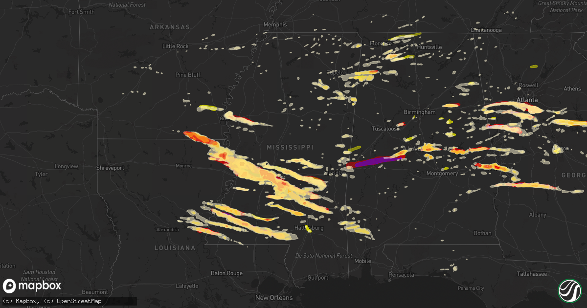
Hail Map in Mississippi on March 18, 2013
Get this storm
March 18 map
$229
one time, instant access
Download today. No call, no setup
Keep the $229
Bought the map and want the full workflow? Apply the entire $229 to a subscription within 7 days. None of it is wasted.
Every map, not just this one
This buys you this map. Subscription and you get every map we run, in the markets you choose from a few cities to whole states to nationwide. Plus real-time alerts the moment a storm fires.
Contact data
Name, contact info, occupancy, even credit band for addresses in the footprint. You go from where it hit to who to call.
Become the source they trust
Unlimited branding weather history reports on demand. You already have the documented answer ready for the property owner, and you are the one who showed up with it.
Property data and RoofTrace estimates
Pull up any address you have got, its value and the exact code rules for that jurisdiction, straight from One Click Code. Then RoofTrace estimates the squares, pitch, and roof value, priced the way you price.
Storm reports in Mississippi
Mississippi
| Date | Description |
|---|---|
| 03/18/20136:55 PM CDT | Occurred in the oldenburg community |
| 03/18/20136:40 PM CDT | In the myrick community |
| 03/18/20136:33 PM CDT | A local report indicates 1.75 inch wind near 4 NNE TUCKERS CROSSING |
| 03/18/20136:30 PM CDT | A local report indicates 1.75 inch wind near 7 W FAYETTE |
| 03/18/20136:30 PM CDT | Golf ball sized hail north side of laurel |
| 03/18/20136:10 PM CDT | A local report indicates 1.75 inch wind near 5 WNW SOSO |
| 03/18/20136:10 PM CDT | A local report indicates 1.75 inch wind near 2 N HEBRON |
| 03/18/20135:55 PM CDT | A local report indicates 1.75 inch wind near 4 NW CARPENTER |
| 03/18/20135:47 PM CDT | A local report indicates 1.75 inch wind near ROCKY SPRINGS |
| 03/18/20135:45 PM CDT | 18 wheeler turned over with broken windows on hwy 35 |
| 03/18/20135:40 PM CDT | A local report indicates 1.00 inch wind near MIZE |
| 03/18/20135:40 PM CDT | A local report indicates 1.00 inch wind near MAGEE |
| 03/18/20135:35 PM CDT | A local report indicates 1.75 inch wind near 2 NE STRINGER |
| 03/18/20135:35 PM CDT | A local report indicates 1.00 inch wind near BAY SPRINGS |
| 03/18/20135:25 PM CDT | Near the intersection of hwy 469 and hwy 28. |
| 03/18/20135:20 PM CDT | A local report indicates 2.00 inch wind near 2 SW D'LO |
| 03/18/20135:17 PM CDT | A local report indicates 1.75 inch wind near 6 SE RALEIGH |
| 03/18/20135:05 PM CDT | Hail over golfball sized covering the ground in northeastern jasper county |
| 03/18/20135:05 PM CDT | And in whynot. Reported via facebook. |
| 03/18/20135:05 PM CDT | A local report indicates 1.50 inch wind near 2 W BRAXTON |
| 03/18/20134:45 PM CDT | Roofs damaged in the area |
| 03/18/20134:40 PM CDT | In the city of byram |
| 03/18/20134:40 PM CDT | In the brookhollow community |
| 03/18/20134:40 PM CDT | A local report indicates 2.00 inch wind near CATO |
| 03/18/20134:35 PM CDT | A local report indicates 2.75 inch wind near 2 NW JOHNS |
| 03/18/20134:32 PM CDT | A local report indicates 1.00 inch wind near HOMEWOOD |
| 03/18/20134:31 PM CDT | A local report indicates 1.75 inch wind near 1 N HOMEWOOD |
| 03/18/20134:30 PM CDT | A local report indicates 2.75 inch wind near 8 NE STAR |
| 03/18/20134:30 PM CDT | A local report indicates 2.00 inch wind near RAYMOND |
| 03/18/20134:30 PM CDT | A local report indicates 1.75 inch wind near 6 E FLORENCE |
| 03/18/20134:27 PM CDT | A local report indicates 1.75 inch wind near RAYMOND |
| 03/18/20134:25 PM CDT | Numerous vehicle windows blown out. |
| 03/18/20134:25 PM CDT | A local report indicates 2.00 inch wind near 8 SW BRANDON |
| 03/18/20134:25 PM CDT | In the robinhood community |
| 03/18/20134:20 PM CDT | A local report indicates 2.00 inch wind near 8 SW BRANDON |
| 03/18/20134:20 PM CDT | Near i-20 and crossgates. Vehicles damaged. |
| 03/18/20134:20 PM CDT | A local report indicates 1.75 inch wind near BRANDON |
| 03/18/20134:19 PM CDT | A local report indicates 1.00 inch wind near MERIDIAN STATION |
| 03/18/20134:18 PM CDT | At the i-20 exit with hwy 481 |
| 03/18/20134:15 PM CDT | Whitfield area |
| 03/18/20134:15 PM CDT | Whitfield area |
| 03/18/20134:15 PM CDT | Hail up to golfball sized nearly covering the ground |
| 03/18/20134:15 PM CDT | At whitfield state hospital...roof damaged. Windows were broken and left glass in patients beds. |
| 03/18/20134:15 PM CDT | Hail up to golfball sized nearly covering the ground |
| 03/18/20134:15 PM CDT | A local report indicates 1.75 inch wind near 6 SSE PEARL |
| 03/18/20134:15 PM CDT | A local report indicates 2.00 inch wind near 2 S EDWARDS |
| 03/18/20134:15 PM CDT | At whitfield state hospital...roof damaged. Windows were broken and left glass in patients beds. |
| 03/18/20134:13 PM CDT | Golf ball to baseball sized hail at state eoc |
| 03/18/20134:12 PM CDT | Numerous vehicle windows blown out. |
| 03/18/20134:11 PM CDT | Golf ball to baseball sized hail at state eoc |
| 03/18/20134:10 PM CDT | A local report indicates 1.75 inch wind near MORTON |
| 03/18/20134:05 PM CDT | Golfball sized hail in north jackson near interstate 55. |
| 03/18/20134:05 PM CDT | At baptist hospital...skylight broken. Cameras on roof damaged and multiple canopies damaged as well as vehicles. |
| 03/18/20134:05 PM CDT | At baptist hospital...skylight broken. Cameras on roof damaged and multiple canopies damaged as well as vehicles. |
| 03/18/20134:05 PM CDT | At eoc in downtown jackson |
| 03/18/20134:05 PM CDT | Reported along mcclure road |
| 03/18/20134:03 PM CDT | A local report indicates 1.25 inch wind near PORTERVILLE |
| 03/18/20134:02 PM CDT | Baseball sized hail reported at the salvation army disaster center at hawkins field. Roof was damaged. |
| 03/18/20134:02 PM CDT | Baseball sized hail reported at the salvation army disaster center at hawking field. Roof was damaged. |
| 03/18/20134:00 PM CDT | Along barefoot trail north of pelahatchie |
| 03/18/20133:59 PM CDT | A local report indicates 2.50 inch wind near 2 S LEESBURG |
| 03/18/20133:59 PM CDT | Hail at an apartment with windows damaged. |
| 03/18/20133:56 PM CDT | A local report indicates 2.75 inch wind near 4 E CLINTON |
| 03/18/20133:55 PM CDT | Lasted for 12 minutes |
| 03/18/20133:55 PM CDT | A local report indicates 1.75 inch wind near WHITE OAK |
| 03/18/20133:55 PM CDT | In the presidential hills neighborhood |
| 03/18/20133:55 PM CDT | Baseball sized hail at clinton central fire station |
| 03/18/20133:55 PM CDT | A local report indicates 2.50 inch wind near BOVINA |
| 03/18/20133:51 PM CDT | Lasted for 12 minutes |
| 03/18/20133:50 PM CDT | Off duty nws employee has measured hail stone of approximately softball sized |
| 03/18/20133:47 PM CDT | *** 1 inj *** near pinehaven drive...person injured by hail |
| 03/18/20133:47 PM CDT | *** 1 inj *** near pinehaven drive...person injured by hail |
| 03/18/20133:45 PM CDT | A local report indicates 1.50 inch wind near 7 NNE VICKSBURG |
| 03/18/20133:45 PM CDT | A local report indicates 1.00 inch wind near BOLTON |
| 03/18/20133:40 PM CDT | At the port of vicksburg |
| 03/18/20133:40 PM CDT | A local report indicates 1.75 inch wind near WALNUT GROVE |
| 03/18/20133:30 PM CDT | A local report indicates 1.75 inch wind near 10 NW BOLTON |
| 03/18/20133:29 PM CDT | On main street in madison. Been falling for 7 minutes. |
| 03/18/20133:25 PM CDT | A local report indicates 1.75 inch wind near EAGLE BEND |
| 03/18/20133:25 PM CDT | A local report indicates 1.75 inch wind near LENA |
| 03/18/20133:15 PM CDT | *** 1 inj *** a tree on a house on gowall rd. One minor injury. |
| 03/18/20133:15 PM CDT | A tree on a house on gowall rd. |
| 03/18/20133:15 PM CDT | A local report indicates 1.00 inch wind near MADISON |
| 03/18/20133:15 PM CDT | On cedar hill rd |
| 03/18/20133:15 PM CDT | Grapefruit size hail reported. Ema reports numerous vehicle windows being broken by large hail as well as windows in one home. |
| 03/18/20133:10 PM CDT | Half dollar to golf ball sized hail in hwy 465 and hwy 3 areas of northern warren county |
| 03/18/20133:00 PM CDT | A local report indicates 1.00 inch wind near VALLEY PARK |
| 03/18/20132:59 PM CDT | Fifteen trees were blown down with power outages across the north half of the county. |
| 03/18/20132:59 PM CDT | Hail at an apartment with windows damaged. |
| 03/18/20132:58 PM CDT | Occurred on brown rd |
| 03/18/20132:41 PM CDT | A local report indicates 60 MPH wind near 8 SW COLUMBUS |
| 03/18/20132:36 PM CDT | A local report indicates 1.00 inch wind near 2 SSW CARY |
| 03/18/20132:30 PM CDT | Fifteen trees were blown down with power outages across the north half of the county. |
| 03/18/20132:11 PM CDT | Nickel to quarter sized hail reported across town |
| 03/18/20132:10 PM CDT | A local report indicates 1.50 inch wind near 7 ENE NEW HAMILTON |
| 03/18/20132:10 PM CDT | Msu chase team |
| 03/18/20132:05 PM CDT | Roof damage reported by public near kroger in west point |
| 03/18/20132:05 PM CDT | A local report indicates 1.75 inch wind near GREENVILLE |
| 03/18/20132:03 PM CDT | *** 1 inj *** part of roof blown off justice coure building. Numerous trees down around county. Woman knocked over from wind and was transported to a hospital. |
| 03/18/20132:02 PM CDT | A local report indicates 1.00 inch wind near ACKERMAN |
| 03/18/20132:00 PM CDT | 20 foot section of roof off justice course building...roof damage to home on torbert drive...tree crushed truck on mapleview drive...numerous reports of trees and power |
| 03/18/20132:00 PM CDT | Several houses with shingle damage and two large sections of fencing blown down in diamond cove subdivision. Reported by msu meteorology professor. |
| 03/18/20132:00 PM CDT | Large trees down at intersection of hwy 8 and old columbus road in aberdeen |
| 03/18/20131:59 PM CDT | Fifteen trees were blown down with power outages across the north half of the county. |
| 03/18/20131:59 PM CDT | Large trees down along hwy 45 alt |
| 03/18/20131:59 PM CDT | Large trees down in the greenwood springs area |
| 03/18/20131:59 PM CDT | Large trees down in city of amory |
| 03/18/20131:54 PM CDT | A local report indicates 1.00 inch wind near ABERDEEN |
| 03/18/20131:50 PM CDT | A local report indicates 1.75 inch wind near 2 S INVERNESS |
| 03/18/20131:42 PM CDT | Trees down along highway 365 near holts spur. |
| 03/18/20131:41 PM CDT | A local report indicates 60 MPH wind near HOUSTON |
| 03/18/20131:38 PM CDT | Part of roof off of a building |
| 03/18/20131:37 PM CDT | Reported in stoneville and 2 miles east of leland |
| 03/18/20131:35 PM CDT | A local report indicates 1.75 inch wind near 3 WSW GREENVILLE |
| 03/18/20131:33 PM CDT | Multiple structure damaged. 18 wheelers blown from highway. |
| 03/18/20131:29 PM CDT | Trees and powerlines down across webster county |
| 03/18/20131:20 PM CDT | A local report indicates 1.25 inch wind near 7 N HOUSTON |
| 03/18/20131:20 PM CDT | Nickel to quarter sized |
| 03/18/20131:20 PM CDT | Trees down |
| 03/18/20131:18 PM CDT | Out building blown over at home depot in tupelo. Estimated 50-60 mph gusts. |
| 03/18/20131:05 PM CDT | Roof off of a outbuilding |
| 03/18/20131:05 PM CDT | Quarter sized hail reported in duck hill. |
| 03/18/20131:03 PM CDT | Estimated 65 mph wind gust |
| 03/18/201312:57 PM CDT | Trees down in north union county near county road 75 along with powerlines and possibly structure damage. |
| 03/18/201312:57 PM CDT | Damage to church in ingomar. Trees also blocking county road 86 near ingomar. |
| 03/18/201312:55 PM CDT | Trees damaged in myrtle area. |
| 03/18/201312:53 PM CDT | Some damage with wind gusts in west union county. |
| 03/18/201312:47 PM CDT | Reported by weather station |
| 03/18/201312:45 PM CDT | Multiple reports of trees down across grenada county beginning at 1245 pm. Also roof blown off a shop building in northern part of county. |
| 03/18/201312:20 PM CDT | A local report indicates 1.00 inch wind near AMORY |
| 03/18/201312:20 PM CDT | Trees down or uprooted |
| 03/17/20139:53 PM CDT | On edwards street |
| 03/17/20139:48 PM CDT | A local report indicates 1.00 inch wind near 2 ENE HATTIESBURG |
| 03/17/20139:47 PM CDT | On edwards street |
| 03/17/20139:43 PM CDT | A local report indicates 1.00 inch wind near PINEBUR |
| 03/17/20139:25 PM CDT | Nickel to quarter sized hail at fortification street. Reported via twitter. |
| 03/17/20139:20 PM CDT | Pea to quarter size hail near foxworth off of stringer-bullock rd |
| 03/17/20139:20 PM CDT | Reported via facebook |
| 03/17/20139:00 PM CDT | A local report indicates 2.00 inch wind near 7 NW SALEM |
| 03/17/20138:45 PM CDT | A local report indicates 1.00 inch wind near 1 N SIBLEY |
| 03/17/20138:33 PM CDT | A local report indicates 2.75 inch wind near 8 SSW MONTICELLO |
| 03/17/20138:30 PM CDT | A local report indicates 1.75 inch wind near MCCOMB |
| 03/17/20138:20 PM CDT | A local report indicates 1.00 inch wind near 3 SE LOUIN |
| 03/17/20138:15 PM CDT | A local report indicates 2.50 inch wind near SEMINARY |
| 03/17/20138:15 PM CDT | Near kyzar loop |
| 03/17/20138:15 PM CDT | Sheriffs deputy near franklin county line and highway 567 reported golfball size hail. |
| 03/17/20138:12 PM CDT | A local report indicates 1.75 inch wind near SEMINARY |
| 03/17/20138:10 PM CDT | A local report indicates 1.75 inch wind near GARDEN CITY |
| 03/17/20138:10 PM CDT | Occurred near smithdale in se franklin county. Hail sizes ranging from nickel to baseball. |
| 03/17/20137:54 PM CDT | A local report indicates 1.00 inch wind near 4 SW BROOKHAVEN |
| 03/17/20137:52 PM CDT | A local report indicates 1.75 inch wind near BUDE |
| 03/17/20137:50 PM CDT | In south jackson |
| 03/17/20137:48 PM CDT | A local report indicates 1.75 inch wind near MEADVILLE |
| 03/17/20137:47 PM CDT | A local report indicates 2.00 inch wind near MEADVILLE |
| 03/17/20137:38 PM CDT | Occurred on walker ln. |
| 03/17/20137:38 PM CDT | Reported on white rogers rd and clem rd. |
| 03/17/20137:30 PM CDT | A local report indicates 1.75 inch wind near ROXIE |
| 03/17/20137:01 PM CDT | Ping pong to golf ball sized hail in washington area |
All States Impacted by Hail Map on March 18, 2013
Cities Impacted by Hail Map on March 18, 2013
- Russellville, AL
- Moulton, AL
- Courtland, AL
- Town Creek, AL
- Mount Hope, AL
- Piedmont, AL
- Jacksonville, AL
- Clanton, AL
- Verbena, AL
- Aberdeen, MS
- Raleigh, MS
- Flora, MS
- Okatie, SC
- Ridgeland, SC
- Montgomery, AL
- Millbrook, AL
- Calera, AL
- Clayton, LA
- Ferriday, LA
- Bogue Chitto, MS
- Ruth, MS
- Smithdale, MS
- Summit, MS
- Natchez, MS
- Sicily Island, LA
- Lumberton, MS
- Bude, MS
- McCall Creek, MS
- Foxworth, MS
- Meadville, MS
- Kokomo, MS
- Columbia, MS
- Mccomb, MS
- Liberty, MS
- Roxie, MS
- Tylertown, MS
- Jayess, MS
- Sandy Hook, MS
- Starkville, MS
- Fayette, MS
- Carrollton, GA
- Carlisle, AR
- Senoia, GA
- Fayetteville, GA
- Richland, MS
- Transylvania, LA
- Lake Providence, LA
- Harvest, AL
- Corinth, MS
- Redwood, MS
- De Kalb, MS
- Daleville, MS
- Rome, GA
- Cedar Bluff, AL
- Newington, GA
- Goodwater, AL
- Prentiss, MS
- Newhebron, MS
- Rocky Face, GA
- Waynesboro, MS
- Swainsboro, GA
- Dublin, GA
- Wrightsville, GA
- Kite, GA
- Tennille, GA
- Adrian, GA
- Toomsboro, GA
- East Dublin, GA
- Irwinton, GA
- Collinsville, MS
- Meridian, MS
- Strong, AR
- Muscle Shoals, AL
- Varnville, SC
- Opelika, AL
- Holly Springs, MS
- Marion, MS
- Laurel, MS
- Bay Springs, MS
- Stringer, MS
- Waynesboro, GA
- State Line, MS
- Prattville, AL
- Marbury, AL
- Monterey, LA
- Rainsville, AL
- Fyffe, AL
- Belzoni, MS
- Athens, AL
- Toney, AL
- Hogansville, GA
- Collins, MS
- Mount Olive, MS
- Seminary, MS
- Monticello, MS
- Pinola, MS
- Ranburne, AL
- Bowdon, GA
- Luthersville, GA
- Greenville, MS
- Kentwood, LA
- Tallapoosa, GA
- Bremen, GA
- Lagrange, GA
- Greenville, GA
- Olive Branch, MS
- Byhalia, MS
- Wilmot, AR
- Jones, LA
- Hamburg, AR
- Newton, MS
- Rose Hill, MS
- Louin, MS
- Pearl, MS
- Jackson, MS
- Flowood, MS
- Cornersville, TN
- Petersburg, TN
- Moreland, GA
- Newnan, GA
- Sharpsburg, GA
- McIntosh, AL
- Harrisville, MS
- Porterville, MS
- Scooba, MS
- Beaufort, SC
- Pell City, AL
- Anniston, AL
- Lincoln, AL
- Riverside, AL
- Eastaboga, AL
- Ragland, AL
- Greensboro, AL
- Newbern, AL
- Marion, AL
- Centreville, AL
- Lawley, AL
- Temple, GA
- Villa Rica, GA
- Waco, GA
- Winston, GA
- Raymond, MS
- Terry, MS
- Byram, MS
- Grantville, GA
- Pisgah, AL
- Henagar, AL
- Deatsville, AL
- Billingsley, AL
- Fort Valley, GA
- Mendenhall, MS
- Braxton, MS
- Clinton, MS
- Hazlehurst, MS
- Georgetown, MS
- Tunica, MS
- Buckatunna, MS
- Silas, AL
- Frankville, AL
- Millry, AL
- Forest, MS
- Decatur, MS
- Walnut Grove, MS
- Union, MS
- Carthage, MS
- Sebastopol, MS
- Philadelphia, MS
- Lena, MS
- Conehatta, MS
- Gay, GA
- Paulding, MS
- Hickory, MS
- Morton, MS
- Pachuta, MS
- Madison, MS
- Lake, MS
- Lawrence, MS
- Canton, MS
- Pulaski, MS
- Brandon, MS
- Ridgeland, MS
- Pelahatchie, MS
- Richland, GA
- Buena Vista, GA
- Cusseta, GA
- Americus, GA
- Plains, GA
- Bartow, GA
- Oak Grove, LA
- Soso, MS
- Douglasville, GA
- Hampton, GA
- Valley Park, MS
- Tyrone, GA
- Jonesboro, GA
- Peachtree City, GA
- Metter, GA
- Greensburg, LA
- Covington, GA
- Mansfield, GA
- Deer Park, AL
- Fruitdale, AL
- Vinegar Bend, AL
- Tibbie, AL
- Walnut, MS
- Houlka, MS
- Vardaman, MS
- Alpine, AL
- Pioneer, LA
- Vidalia, LA
- Jonesville, LA
- Amory, MS
- Fulton, MS
- Trinity, AL
- Abbeville, MS
- Brookhaven, MS
- Alexander City, AL
- Dadeville, AL
- Epps, LA
- Davisboro, GA
- Louisville, GA
- Edwards, MS
- Acme, LA
- Woodville, MS
- Inverness, MS
- Indianola, MS
- Vicksburg, MS
- Magee, MS
- Florence, MS
- Bolton, MS
- Heidelberg, MS
- Woodland, MS
- Stockbridge, GA
- Rex, GA
- Columbus, GA
- Garnett, SC
- Pineland, SC
- Sardis, GA
- Millen, GA
- Sylvania, GA
- Statesboro, GA
- Yemassee, SC
- Wadley, GA
- Midville, GA
- Early Branch, SC
- Garfield, GA
- Twin City, GA
- Clyo, GA
- Tillman, SC
- Estill, SC
- Guyton, GA
- Springfield, GA
- Rocky Ford, GA
- Hardeeville, SC
- Greenwood Springs, MS
- Crosby, MS
- Des Arc, AR
- Weir, MS
- McCool, MS
- Satartia, MS
- Lisman, AL
- Wesson, MS
- Leland, MS
- Isola, MS
- Hollandale, MS
- Hillsboro, AL
- Talladega, AL
- Auburn, AL
- Phenix City, AL
- Fort Benning, GA
- Salem, AL
- Smiths Station, AL
- Tremont, MS
- Hamilton, AL
- Wellington, AL
- Hamilton, GA
- Lester, AL
- Elkmont, AL
- Eatonton, GA
- Randolph, AL
- Mcdonough, GA
- Ellenwood, GA
- Morrow, GA
- Forest Park, GA
- Warthen, GA
- Gibson, GA
- Mitchell, GA
- Avera, GA
- Stapleton, GA
- Wrens, GA
- Brooks, GA
- Malvern, AR
- Silver Creek, MS
- Union Church, MS
- Oak Vale, MS
- Waterproof, LA
- McGehee, AR
- Rohwer, AR
- Monticello, AR
- Dermott, AR
- Arkansas City, AR
- Palmetto, GA
- Whitesburg, GA
- Locust Grove, GA
- Griffin, GA
- Rhine, GA
- Eastman, GA
- Abbeville, GA
- Pitts, GA
- Rochelle, GA
- Cedartown, GA
- Macon, GA
- Sawyerville, AL
- Vienna, GA
- Lauderdale, MS
- Plantersville, AL
- Jones, AL
- Toomsuba, MS
- York, AL
- Cuba, AL
- Detroit, AL
- Marianna, AR
- Gloster, MS
- Georgetown, TN
- Riceville, TN
- Caledonia, MS
- Houston, MS
- Mount Vernon, AL
- Eufaula, AL
- Pittsview, AL
- Omaha, GA
- Falkville, AL
- Somerville, AL
- Hartselle, AL
- Whiteside, TN
- Chattanooga, TN
- Cottondale, AL
- Brookwood, AL
- Vance, AL
- Port Gibson, MS
- Livingston, AL
- Sparta, GA
- Monticello, GA
- Holladay, TN
- Holcomb, MS
- Grenada, MS
- Rogersville, AL
- Anderson, AL
- Thorsby, AL
- Centreville, MS
- Valley, AL
- West Point, GA
- Rison, AR
- Red Bay, AL
- Dutton, AL
- Scottsboro, AL
- Bryant, AL
- Okolona, MS
- Hillsboro, GA
- Franklin, GA
- Roanoke, AL
- Lineville, AL
- Potts Camp, MS
- Lake Village, AR
- Williamson, GA
- Shady Dale, GA
- Jackson, GA
- Flovilla, GA
- Lake Cormorant, MS
- Nesbit, MS
- Aliceville, AL
- Macon, MS
- Daviston, AL
- Hughes, AR
- Hazen, AR
- Smithville, MS
- Baldwyn, MS
- Booneville, MS
- Shannon, MS
- Wadley, AL
- Cragford, AL
- Mayersville, MS
- Brooklet, GA
- Guin, AL
- Rockmart, GA
- Eclectic, AL
- Mize, MS
- Bentonia, MS
- Prairie, MS
- Hackleburg, AL
- Hodges, AL
- Vina, AL
- Phil Campbell, AL
- Madison, AL
- Huntsville, AL
- Port Royal, SC
- Duck Hill, MS
- Ovett, MS
- Marks, MS
- Pickens, AR
- Dumas, AR
- Concord, GA
- Red Banks, MS
- Haleyville, AL
- Waverly, AL
- Lafayette, AL
- Equality, AL
- Camp Hill, AL
- Hamilton, MS
- Sulligent, AL
- Sylacauga, AL
- Guild, TN
- Jasper, TN
- Woodville, AL
- New Hope, AL
- Red Oak, GA
- Union City, GA
- Fairburn, GA
- Conley, GA
- Atlanta, GA
- Barnesville, GA
- Forsyth, GA
- Flat Rock, AL
- Crossett, AR
- Bonita, LA
- Calhoun, TN
- Delano, TN
- Rienzi, MS
- Milner, GA
- Maplesville, AL
- Union Springs, AL
- Banks, AL
- Shorter, AL
- Hardaway, AL
- Sturgis, MS
- Vernon, AL
- Taylorsville, MS
- Lizella, GA
- Preston, GA
- Andersonville, GA
- Ellaville, GA
- Byromville, GA
- Gurley, AL
- Chatom, AL
- Pontotoc, MS
- Tallassee, AL
- Steele, AL
- Shuqualak, MS
- Middleton, TN
- Ohatchee, AL
- Freeport, FL
- Sondheimer, LA
- West Blocton, AL
- Rockford, AL
- Jemison, AL
- Cherokee, AL
- Tuscumbia, AL
- Midway, AL
- Falkner, MS
- Tiplersville, MS
- Rolling Fork, MS
- Rutledge, GA
- Riverdale, GA
- Cullman, AL
- Holly Pond, AL
- Gadsden, AL
- Centre, AL
- Hatchechubbee, AL
- Seale, AL
- Florala, AL
- Crossville, AL
- Boaz, AL
- Albertville, AL
- Camden, AL
- Hernando, MS
- Robinsonville, MS
- Utica, MS
- Pine Hill, AL
- Cedarbluff, MS
- Ellisville, MS
- Dallas, GA
- Athens, TN
- Woodland, GA
- Newborn, GA
- Coy, AL
- Sandersville, GA
- Keysville, GA
- Delta, AL
- Woodland, AL
- Wedowee, AL
- Hattiesburg, MS
- Hermanville, MS
- Chickamauga, GA
- Minter, AL
- Tuskegee, AL
- Five Points, AL
- Lanett, AL
- Cusseta, AL
- Stewart, MS
- French Camp, MS
- Warren, AR
- Wilmar, AR
- New Edinburg, AR
- Acworth, GA
- Ripley, MS
- McCalla, AL
- Bastrop, LA
- Crystal Springs, MS
- Spruce Pine, AL
- Ponce De Leon, FL
- Winona, MS
- De Valls Bluff, AR
- Clarendon, AR
- Randolph, MS
- Valhermoso Springs, AL
- Little Rock, MS
- Munford, AL
- Wetumpka, AL
- Heflin, AL
- Carrollton, MS
- McCarley, MS
- Leighton, AL
- Stockton, AL
- Wagarville, AL
- Jackson, AL
- Claxton, GA
- Register, GA
- Cobbtown, GA
- Dumas, MS
- Menlo, GA
- Valley Head, AL
- Rising Fawn, GA
- Meridianville, AL
- Selma, AL
- Whitwell, TN
- Talbotton, GA
- Lookout Mountain, GA
- Trenton, GA
- Wildwood, GA
- Troy, AL
- Glenwood, AL
- Ashland, MS
- Tuscaloosa, AL
- Tishomingo, MS
- Iuka, MS
- Florence, AL
- Guntown, MS
- Blue Springs, MS
- Saltillo, MS
- Little Rock, AR
- Darden, TN
- Lexington, TN
- Scott, AR
- Richton, MS
- Emelle, AL
- Weogufka, AL
- Water Valley, MS
- Santa Rosa Beach, FL
- Bessemer, AL
- Birmingham, AL
- Jenkinsburg, GA
- Columbus, MS
- Burnsville, MS
- Bismarck, AR
- Beaverton, AL
- Nettleton, MS
- Bear Creek, AL
- Myrtle, MS
- Gordon, GA
- Jeffersonville, GA
- Notasulga, AL
- Houston, AL
- Double Springs, AL
- Kennesaw, GA
- Zebulon, GA
- Hanceville, AL
- Bremen, AL
- Hayden, AL
- Belden, MS
- Tupelo, MS
- Laceys Spring, AL
- Decatur, AL
- Louisville, MS
- Milledgeville, GA
- Dry Branch, GA
- Gilbertown, AL
- Itta Bena, MS
- Marksville, LA
- Effie, LA
- Chunky, MS
- West Point, MS
- Steens, MS
- Whiteville, TN
- Ackerman, MS
- Aubrey, AR
- Moro, AR
- Pulaski, TN
- Langston, AL
- Jena, LA
- Green Pond, SC
- Mantachie, MS
- Madison, GA
- Milan, GA
- Cruger, MS
- Coahoma, MS
- Graham, AL
- Lawrenceburg, TN
- Titus, AL
- Grand Junction, TN
- Saulsbury, TN
- Ethel, MS
- Plantersville, MS
- Lumpkin, GA
- Donaldson, AR
- Culloden, GA
- Eupora, MS
- Pine Mountain, GA
- Shiloh, GA
- Pine Mountain Valley, GA
- Conyers, GA
- Matthews, GA
- Marietta, GA
- Golden, MS
- Waynesboro, TN
- Waverly Hall, GA
- Cataula, GA
- Jacksons Gap, AL
- Kellyton, AL
- Altoona, AL
- Tanner, AL
- Boligee, AL
- Bonifay, FL
- Caryville, FL
- Defuniak Springs, FL
- Summerville, GA
- Owens Cross Roads, AL
- Senatobia, MS
- Shelby, AL
- Enterprise, MS
- Vossburg, MS
- Shubuta, MS
- Tallulah, LA
- Tougaloo, MS
- Leola, AR
- Deville, LA
- Hickory Flat, MS
- Castleberry, AL
- Evergreen, AL
- Ashland, AL
- Dundee, MS
- Northport, AL
- Roberta, GA
- Knoxville, GA
- Musella, GA
- West, MS
- Faunsdale, AL
- Moselle, MS
- Westville, FL
- Roopville, GA
- Frankewing, TN
- Allendale, SC
- Fairfax, SC
- Pembroke, GA
- Collinwood, TN
- Cordele, GA
- Gurdon, AR
- Trussville, AL
- Box Springs, GA
- Saint Stephens, AL
- Thomasville, AL
- Glen, MS
- Sardis, AL
- Brent, AL
- Ward, AL
- Prospect, TN
- Goodspring, TN
- Leoma, TN
- Epes, AL
- Brierfield, AL
- Montevallo, AL
- Quitman, MS
- Niceville, FL
- Gallion, AL
- Reynolds, GA
- Muscadine, AL
- Lexington, AL
- Killen, AL
- Little River, AL
- Blythe, GA
- Brooksville, MS
- Lynn, AL
- Prescott, AR
- Yatesville, GA
- Ardmore, AL
- Tillar, AR
- Forkland, AL
- Demopolis, AL
- Dawsonville, GA
- Ball Ground, GA
- Gainesville, AL


