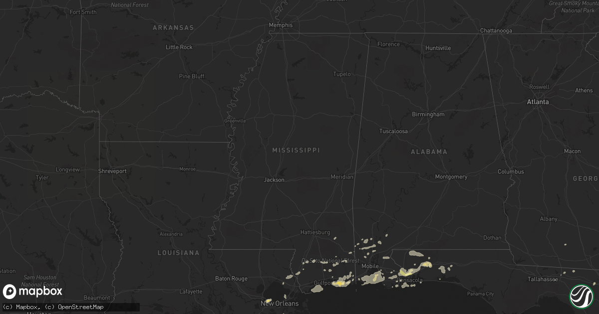
Hail Map in Mississippi on March 9, 2011
Get this storm
March 9 map
$229
one time, instant access
Download today. No call, no setup
Keep the $229
Bought the map and want the full workflow? Apply the entire $229 to a subscription within 7 days. None of it is wasted.
Every map, not just this one
This buys you this map. Subscription and you get every map we run, in the markets you choose from a few cities to whole states to nationwide. Plus real-time alerts the moment a storm fires.
Contact data
Name, contact info, occupancy, even credit band for addresses in the footprint. You go from where it hit to who to call.
Become the source they trust
Unlimited branding weather history reports on demand. You already have the documented answer ready for the property owner, and you are the one who showed up with it.
Property data and RoofTrace estimates
Pull up any address you have got, its value and the exact code rules for that jurisdiction, straight from One Click Code. Then RoofTrace estimates the squares, pitch, and roof value, priced the way you price.
Storm reports in Mississippi
Mississippi
| Date | Description |
|---|---|
| 03/09/20118:00 AM CST | Aws site at coast community college measured 60 mph. Relayed by wlox-13 tv meteorologist. Delayed report. Time estimated. |
| 03/09/20118:00 AM CST | Trees down on polktown road and also at hwy 613 in northern jackson county |
| 03/09/20117:50 AM CST | Damage in landon lakes subdivision north of long beach. Possible tornado... Roof of shed and trees down. |
| 03/09/20117:47 AM CST | Along cedar lake road and popps ferry road in biloxi 22 trailers with wind damage and one trailer destroyed...possible tornado. |
| 03/09/20117:47 AM CST | Trees blown down on oaklawn road northwest of biloxi |
| 03/09/20117:47 AM CST | Trees down on lickskillet road north of diberville. |
| 03/09/20117:47 AM CST | Tornado touched donw near cedar lake road and popps ferry road damaging several mobile homes. One mobile home was rolled and destroyed with minor to moderate damage to |
| 03/09/20117:45 AM CST | Sign of captain alis restaurant blown down and power pole blown down along state route 605 and dedeaux road. |
| 03/09/20117:43 AM CST | Tree on roof of car along south swan rd. |
| 03/09/20117:43 AM CST | 3 homes with roof damage...16 homes with minor wind damage in turn berry subdivision...possible tornado. |
| 03/09/20117:40 AM CST | ... |
| 03/09/20117:38 AM CST | Thunderstorm wind gusts damaged several houses in turnberry subdivision. 3 homes with roof damage...16 homes with minor wind damage in turn berry subdivision. Siding pu |
| 03/09/20117:38 AM CST | Work trailer flipped over on landon road...possible tornado. |
| 03/09/20117:34 AM CST | Tornado touched down along landon road. One house had portion of roof removed...storage building and awning destroyed. Several trees blown down and large branches snapp |
| 03/09/20117:34 AM CST | Wind damage to residences in landon lakes estates off of landon road. One shed lost roof. |
| 03/09/20117:34 AM CST | Roof damage...tree on roof...and structure damage along allen road in west gulfport |
| 03/09/20117:30 AM CST | Thunderstorm wind gusts damaged several houses in turnberry subdivision.3 homes with roof damage...16 homes with minor wind damage in turn berry subdivision. Siding pul |
| 03/09/20117:30 AM CST | Tornado touched donw in near cedar lake road damaging several mobile homes. One mobile home was rolled and destroyed with minor to modeate to several other mobile homes |
| 03/09/20117:25 AM CST | Tornado touched down along landon road. One house had portion of roof removed...storage building and awning destroyed. Several trees blown down and large branches snapp |
| 03/09/20117:25 AM CST | Roof blown off house at hwy 63 and beecher rd. Southern greene county. |
| 03/09/20117:20 AM CST | Small trees blown down...soffiting ripped off of a bank drive thru...metal roof pulled off of house. Attributed to straight line winds. |
| 03/09/20117:15 AM CST | 4 houses damaged in wiggins. No injuries. |
| 03/09/20117:15 AM CST | Part of tin roof ripped off. Location and time estimated. |
| 03/09/20116:56 AM CST | Several trees and power lines down in wiggins. A tree also down on a house on college ave. |
| 03/09/20116:53 AM CST | Tree limbs down on roads in area. |
| 03/09/20116:45 AM CST | Report of a tree down in the northeast portion of the county. |
| 03/09/20116:32 AM CST | Straight line wind damage was first noted off of highway 26 just west of u.s. Highway 49. Sporadic damage continued to the northeast to just north of college avenue. Al |
| 03/09/20116:20 AM CST | Numerous large tree branches down. |
| 03/09/20116:05 AM CST | A local report indicates 1.00 inch wind near 1 W BEAUMONT |
Cities Impacted by Hail Map on March 9, 2011
- Lillian, AL
- Pensacola, FL
- Ocean Springs, MS
- Gulf Breeze, FL
- Moultrie, GA
- Greenville, FL
- Summerdale, AL
- Elberta, AL
- Robertsdale, AL
- Foley, AL
- Holt, FL
- Milton, FL
- Grand Bay, AL
- Fairhope, AL
- Irvington, AL
- Coden, AL
- Bayou La Batre, AL
- Theodore, AL
- Daphne, AL
- Lucedale, MS
- Lebanon, TN
- Mount Juliet, TN
- Cantonment, FL
- Jay, FL
- Axis, AL
- Little River, AL
- Orange Beach, AL
- Beaumont, MS
- Eglin Afb, FL
- Perkinston, MS
- Braithwaite, LA
- Monticello, FL
- Defuniak Springs, FL
- Port Sulphur, LA
- Moss Point, MS
- Vancleave, MS
- Pascagoula, MS
- Chunchula, AL
- Citronelle, AL
- Gautier, MS
- Pass Christian, MS
- Bay Minette, AL
- Poplarville, MS
- Biloxi, MS
- Diberville, MS
- Niceville, FL
- Eight Mile, AL
- Saraland, AL
- Carriere, MS
- Picayune, MS
- Baker, FL
- Saint Rose, LA
- Saucier, MS
- Bagdad, FL
- Seminole, AL
- Pearl River, LA
- Lacombe, LA
- Lafitte, LA
- McIntosh, AL
- Deer Park, AL
- New Orleans, LA
- Live Oak, FL
- Kenner, LA
- Barataria, LA
- Shalimar, FL
- Mount Vernon, AL
- Silverhill, AL
- Eustis, FL
- Stockton, AL


