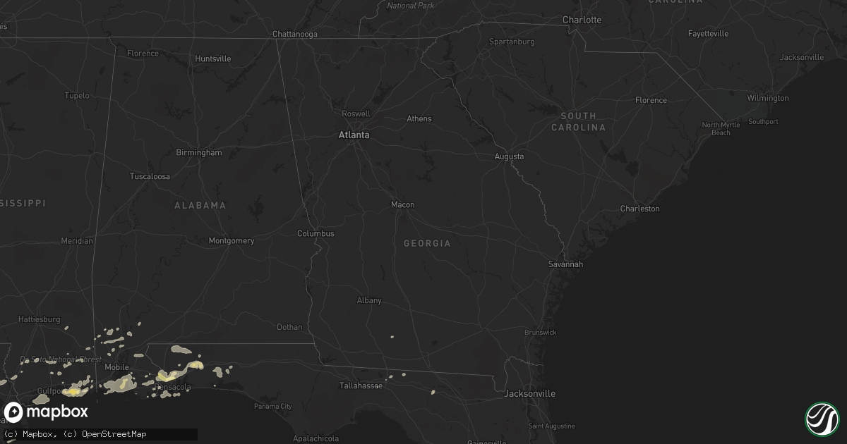
Hail Map in Georgia on March 9, 2011
Get this storm
March 9 map
$229
one time, instant access
Download today. No call, no setup
Keep the $229
Bought the map and want the full workflow? Apply the entire $229 to a subscription within 7 days. None of it is wasted.
Every map, not just this one
This buys you this map. Subscription and you get every map we run, in the markets you choose from a few cities to whole states to nationwide. Plus real-time alerts the moment a storm fires.
Contact data
Name, contact info, occupancy, even credit band for addresses in the footprint. You go from where it hit to who to call.
Become the source they trust
Unlimited branding weather history reports on demand. You already have the documented answer ready for the property owner, and you are the one who showed up with it.
Property data and RoofTrace estimates
Pull up any address you have got, its value and the exact code rules for that jurisdiction, straight from One Click Code. Then RoofTrace estimates the squares, pitch, and roof value, priced the way you price.
Storm reports in Georgia
Georgia
| Date | Description |
|---|---|
| 03/09/20114:45 PM CST | Emergency manager reported tree limb down on state road 121 in hoboken. Time estimate based on radar imagery. |
| 03/09/20114:00 PM CST | Emergency manager reported that truck was overturned due to wind along u.s. Highway 341 west of odum. No injuries were reported. Time was based on report from emergency |
| 03/09/20113:29 PM CST | Tree down at the intersection of hendrix bridge rd and highway 169 |
| 03/09/20113:22 PM CST | The sheriffs office reported a large tree down blocking cricket river road. |
| 03/09/20113:15 PM CST | The sheriffs office received reports of trees and powerlines down in an area between baxley and plant hatch. |
| 03/09/20112:55 PM CST | Toombs county 911 relayed a report of a downed tree across rackettown road in lyons. |
| 03/09/20112:53 PM CST | The sheriffs office reported a large tree down blocking albany and old dixie school roads. |
| 03/09/20112:47 PM CST | Public report of grill blown into yard and large treebranches broken. |
| 03/09/20112:36 PM CST | Emanuel county 911 relayed a report of a downed tree on canoochee road south of swainsboro. |
| 03/09/20112:35 PM CST | The sheriffs office received reports of trees and powerlines down. |
| 03/09/20112:27 PM CST | Treutlen county emergency management reports straight line wind damage to a house between soperton and mount vernon in treutlen county. |
| 03/09/20112:15 PM CST | Telfair county 911 realyed reports of 8 downed trees in mcrae along sugar creek and rebecca church roads. |
| 03/09/20112:15 PM CST | Telfair-wheeler 911 reported 1 downed trees in wheeler county. |
| 03/09/20112:10 PM CST | 4 trees down across the southern portion of the county between scott and adrian. |
| 03/09/20112:10 PM CST | Telfair-wheeler 911 reported 1 down tree in telfair county. |
| 03/09/20112:00 PM CST | Treutlen county 911 relayed reports of 3 downed trees in lothair. |
| 03/09/20112:00 PM CST | Telfair county 911 relayed reports of 3 downed trees in the milan area. |
| 03/09/20111:58 PM CST | Tree fell on a mobile home and the limb of the tree poked through the roof. Occurred near new buckeye road and calvary church road. |
| 03/09/20111:42 PM CST | Trees down in fitzgerald. |
| 03/09/20111:35 PM CST | Laurens county 911 relayed reports of 3 downed trees near mile marker 42 of eastbound interstate 16. |
| 03/09/20111:29 PM CST | Laurens county 911 relayed reports of 6-12 downed trees in the western end of the county along with 4-5 power lines downed in dexter. |
| 03/09/20111:29 PM CST | Laurens county 911 relayed reports of 6-12 downed trees in the western end of the county along with 4-5 power lines downed in dexter. |
| 03/09/20111:23 PM CST | Wilcox county sheriffs office relayed reports of 2 downed trees in rochelle. |
| 03/09/20111:23 PM CST | Dodge county 911 relayed a report of a downed line on the empire-chester hwy in northern dodge county. It is thought the line may be a telephone line. Reports of 7 down |
| 03/09/20111:20 PM CST | Several boards blown off a wooden fence. |
| 03/09/20111:20 PM CST | Trees down and debris on ground on evergreen road. |
| 03/09/20111:10 PM CST | Emergency manager relayed report from law enforcement of tornado on ground near worth-colquitt county line. |
| 03/09/20111:08 PM CST | Bleckly county 911 relayed reports of over a dozen downed trees along highway 112 southwest of cary. |
| 03/09/201112:30 PM CST | Trees down along highway 195. |
| 03/09/201112:30 PM CST | Trees down on stuart avenue. |
| 03/09/201112:30 PM CST | Trees down on aristedes road. |
| 03/09/201112:25 PM CST | 2 roofs damaged at the same building complex. |
| 03/09/201112:25 PM CST | Trees down on oakland road. |
| 03/09/201111:50 AM CST | Trees down in edison. |
| 03/09/201111:15 AM CST | Tree on house in fort gaines. Reports of trees down throughout county. |
Cities Impacted by Hail Map on March 9, 2011
- Lillian, AL
- Pensacola, FL
- Ocean Springs, MS
- Gulf Breeze, FL
- Moultrie, GA
- Greenville, FL
- Summerdale, AL
- Elberta, AL
- Robertsdale, AL
- Foley, AL
- Holt, FL
- Milton, FL
- Grand Bay, AL
- Fairhope, AL
- Irvington, AL
- Coden, AL
- Bayou La Batre, AL
- Theodore, AL
- Daphne, AL
- Lucedale, MS
- Lebanon, TN
- Mount Juliet, TN
- Cantonment, FL
- Jay, FL
- Axis, AL
- Little River, AL
- Orange Beach, AL
- Beaumont, MS
- Eglin Afb, FL
- Perkinston, MS
- Braithwaite, LA
- Monticello, FL
- Defuniak Springs, FL
- Port Sulphur, LA
- Moss Point, MS
- Vancleave, MS
- Pascagoula, MS
- Chunchula, AL
- Citronelle, AL
- Gautier, MS
- Pass Christian, MS
- Bay Minette, AL
- Poplarville, MS
- Biloxi, MS
- Diberville, MS
- Niceville, FL
- Eight Mile, AL
- Saraland, AL
- Carriere, MS
- Picayune, MS
- Baker, FL
- Saint Rose, LA
- Saucier, MS
- Bagdad, FL
- Seminole, AL
- Pearl River, LA
- Lacombe, LA
- Lafitte, LA
- McIntosh, AL
- Deer Park, AL
- New Orleans, LA
- Live Oak, FL
- Kenner, LA
- Barataria, LA
- Shalimar, FL
- Mount Vernon, AL
- Silverhill, AL
- Eustis, FL
- Stockton, AL


