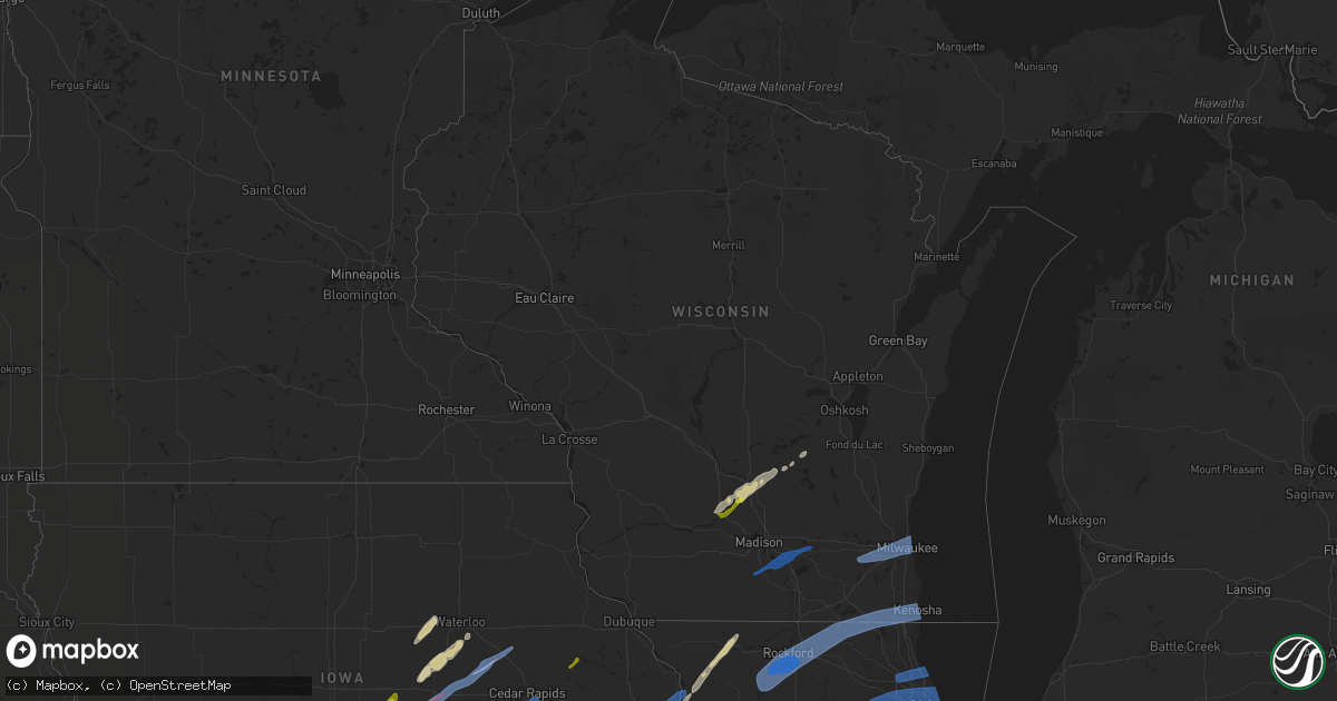
Hail Map in Wisconsin on March 5, 2022
Get this storm
March 5 map
$229
one time, instant access
Download today. No call, no setup
Keep the $229
Bought the map and want the full workflow? Apply the entire $229 to a subscription within 7 days. None of it is wasted.
Every map, not just this one
This buys you this map. Subscription and you get every map we run, in the markets you choose from a few cities to whole states to nationwide. Plus real-time alerts the moment a storm fires.
Contact data
Name, contact info, occupancy, even credit band for addresses in the footprint. You go from where it hit to who to call.
Become the source they trust
Unlimited branding weather history reports on demand. You already have the documented answer ready for the property owner, and you are the one who showed up with it.
Property data and RoofTrace estimates
Pull up any address you have got, its value and the exact code rules for that jurisdiction, straight from One Click Code. Then RoofTrace estimates the squares, pitch, and roof value, priced the way you price.
Storm reports in Wisconsin
Wisconsin
| Date | Description |
|---|---|
| 03/05/20225:01 PM CST | A local report indicates 1.00 inch wind near PRAIRIE DU SAC |
| 03/05/20224:45 AM CST | At 1044 PM CST, severe thunderstorms were located along a line extending from near Hebron to near Gilberts to near Sandwich, moving northeast at 60 mph. HAZARD...70 mph wind gusts. SOURCE...Radar indicated. IMPACT...Expect considerable tree damage. Damage is likely to mobile homes, roofs, and outbuildings. Severe thunderstorms will be near... Elgin, Hoffman Estates, Carpentersville, Barrington Hills and East Dundee around 1050 PM CST. Wauconda, Barrington, Island Lake, Inverness, Lake Barrington, Fox River Grove, Port Barrington and Tower Lakes around 1055 PM CST. Aurora, Naperville, Palatine, Lake Zurich, Montgomery, Boulder Hill, Hawthorn Woods, Kildeer, Channel Lake and Forest Lake around 1100 PM CST. |
| 03/05/20224:18 AM CST | At 1017 PM CST, a severe thunderstorm was located over Jefferson, moving east at 40 mph. HAZARD...60 mph wind gusts. SOURCE...Radar indicated. IMPACT...Expect damage to roofs, siding, and trees. Locations impacted include... Waukesha, Watertown, Pewaukee, Hartland, Jefferson, Delafield, Wales, Okauchee Lake, Oconomowoc, Ottawa, Merton, Johnson Creek, Dousman, Lac La Belle, Ixonia, Rome, Ashippun, Nashotah, Waterville and Sullivan. |
| 03/05/20224:11 AM CST | At 1010 PM CST, severe thunderstorms were located along a line extending from 6 miles west of Rockton to Cherry Valley to 6 miles southwest of Kirkland to 6 miles west of Paw Paw, moving northeast at 65 mph. HAZARD...70 mph wind gusts. SOURCE...Radar indicated. IMPACT...Expect considerable tree damage. Damage is likely to mobile homes, roofs, and outbuildings. Severe thunderstorms will be near... Belvidere, Loves Park, Cherry Valley and Kirkland around 1015 PM CST. Poplar Grove, Candlewick Lake, Kingston and Timberlane around 1020 PM CST. Genoa, Shabbona, Waterman and Capron around 1025 PM CST. Malta around 1030 PM CST. DeKalb, Harvard, Marengo and Cortland around 1035 PM CST. Crystal Lake, Sycamore, Lakewood, Maple Park and Hebron around 1040 PM CST. Woodstock, Campton Hills, Wonder Lake, Bull Valley and Lily Lake around 1045 PM CST. McHenry, Huntley, Pingree Grove, Hampshire, Spring Grove and McCullom Lake around 1050 PM CST.Including the following interstates... I-88 between mile markers 83 and 110. I-90 between mile markers 19 and 56. |
| 03/05/20223:24 AM CST | At 923 PM CST, severe thunderstorms were located along a line extending from near Mount Carroll to near Emerson to near Hooppole, moving northeast at 65 mph. HAZARD...60 mph wind gusts. SOURCE...Radar indicated. IMPACT...Expect damage to roofs, siding, and trees. Severe thunderstorms will be near... Polo around 940 PM CST. Dixon around 945 PM CST. Franklin Grove and Lost Nation around 950 PM CST. Oregon, Amboy, Pecatonica, Ashton and Woodhaven Lakes around 955 PM CST. Winnebago, Lake Summerset, Durand, Stillman Valley and Sublette around 1000 PM CST. Rochelle and Hillcrest around 1005 PM CST. Paw Paw around 1010 PM CST. Beloit, Loves Park, Machesney Park, Roscoe, South Beloit and Rockton around 1015 PM CST.Including the following interstates... I-39 between mile markers 78 and 123. I-88 between mile markers 45 and 82. I-90 between mile markers 0 and 18. |
| 03/05/20221:59 AM CST | At 759 PM CST, severe thunderstorms were located along a line extending from Farley to near Morley, moving east at 55 mph. HAZARD...60 mph wind gusts and quarter size hail. SOURCE...Trained weather spotters. IMPACT...Hail damage to vehicles is expected. Expect wind damage to roofs, siding, and trees. Severe thunderstorms will be near... Epworth, Farley and Bankston around 805 PM CST. Dubuque, Peosta and Centralia around 810 PM CST. Asbury, Wyoming and Durango around 815 PM CST.Other locations in the path of these severe thunderstorms includeEast Dubuque, Monmouth, Sageville, Menominee, Hurstville and Fulton. |
| 03/05/202212:38 AM CST | At 638 PM CST, a severe thunderstorm was located over Dakota, or 7 miles northeast of Freeport, moving northeast at 85 mph. HAZARD...60 mph wind gusts and quarter size hail. SOURCE...Radar indicated. IMPACT...Hail damage to vehicles is expected. Expect wind damage to roofs, siding, and trees. Locations impacted include... Janesville, Milton, Edgerton, Evansville, Brodhead, Orfordville, Albany, Footville, Fulton, Newark, Magnolia, Hanover, Cooksville, Juda, Avon, Indianford, Leyden and Lima Center. |
| 03/04/202211:33 PM CST | At 532 PM CST, a severe thunderstorm was located near Pardeeville, or 13 miles east of Portage, moving northeast at 60 mph. HAZARD...60 mph wind gusts and quarter size hail. SOURCE...Radar indicated. IMPACT...Hail damage to vehicles is expected. Expect wind damage to roofs, siding, and trees. Locations impacted include... Fond Du Lac, Ripon, North Fond Du Lac, Randolph, Markesan, Rosendale, Rio, Green Lake, Brandon, Cambria, Southern Lake Winnebago, Eldorado, Alto, Manchester, Fairwater, Friesland, Kingston, Van Dyne, Marquette and Lagoda. |
| 03/04/202211:08 PM CST | Measured at kenosha regional airport. |
| 03/04/202211:06 PM CST | At 506 PM CST, a severe thunderstorm was located near Lake Wisconsin, moving northeast at 55 mph. HAZARD...Quarter size hail. SOURCE...Trained weather spotters. IMPACT...Damage to vehicles is expected. Locations impacted include... Portage, Prairie Du Sac, Sauk City, Lake Wisconsin, Lodi, Poynette, Pardeeville, Randolph, Rio, Cambria, Wyocena, Merrimac, Friesland, Kingston, Harmony Grove, Dalton, Interstate 90/94 Interchange and Okee. |
| 03/04/202210:16 PM CST | Estimated gust of 60 mph winds as storms moved through near hwy26 & hwy16. |
| 03/04/20229:53 PM CST | National weather service storm survey confirms a tornado rated ef-1 with a max wind speed of around 95mph and a max width of around 50 yards. The path of the tornado be |
| 03/04/20229:50 PM CST | Multiple reports of trees and power lines down in the stoughton area. |
| 03/04/20229:50 PM CST | Nws storm survey concludes that damage in the stoughton area was due to downburst/straight line winds between 70 and 80 mph. Trees... Limbs and power lines were downed |
Cities Impacted by Hail Map on March 5, 2022
- Bondurant, IA
- Prole, IA
- Baxter, IA
- Mitchellville, IA
- Ira, IA
- Van Meter, IA
- Fontanelle, IA
- Norwalk, IA
- Winterset, IA
- Newton, IA
- Berwick, IA
- Carlisle, IA
- Windsor Heights, IA
- Waukee, IA
- Runnells, IA
- Cumming, IA
- Maxwell, IA
- Earlham, IA
- Prescott, IA
- Orient, IA
- Dexter, IA
- Creston, IA
- Altoona, IA
- Des Moines, IA
- Ankeny, IA
- Corning, IA
- Colfax, IA
- Pleasant Hill, IA
- Mingo, IA
- West Des Moines, IA
- Greenfield, IA
- Garwin, IA
- Gladbrook, IA
- Traer, IA
- Toledo, IA
- Seneca, KS
- Centralia, KS
- Villisca, IA
- Stanton, IA
- Clarinda, IA
- Essex, IA
- Red Oak, IA
- Nodaway, IA
- Laurel, IA
- Gilman, IA
- Kellogg, IA
- Butler, MO
- Bridgewater, IA
- Onaga, KS
- Vermillion, KS
- Frankfort, KS
- Bolckow, MO
- Gentry, MO
- Guilford, MO
- Stanberry, MO
- Conception, MO
- Appleton City, MO
- Promise City, IA
- Plano, IA
- Lenox, IA
- Eagleville, MO
- Ridgeway, MO
- Blythedale, MO
- Leon, IA
- Merrimac, WI
- Lodi, WI
- Decatur, IA
- Amsterdam, MO
- Amoret, MO
- Adrian, MO
- Rich Hill, MO
- Greenwood, MO
- Lees Summit, MO
- Shannon, IL
- Freeport, IL
- Lanark, IL
- Pearl City, IL
- Malvern, IA
- Emerson, IA
- Hastings, IA
- Montrose, MO
- Clinton, MO
- Corydon, IA
- Riverton, IA
- Imogene, IA
- Sidney, IA
- Farragut, IA
- Muscatine, IA
- King City, MO
- Cainsville, MO
- Davis City, IA
- Lineville, IA
- Fulton, IL
- Thomson, IL
- Excelsior Springs, MO
- Urich, MO
- Creighton, MO
- Ottumwa, IA
- Waterloo, IA
- La Porte City, IA
- Allerton, IA
- Bethany, MO
- Mount Ayr, IA
- Hatfield, MO
- Lamoni, IA
- Grand River, IA
- Grant City, MO
- Kellerton, IA
- Denver, MO
- Colo, IA
- Oakland, IL
- Newman, IL
- Camargo, IL
- Arcola, IL
- Tuscola, IL
- Hindsboro, IL
- Trenton, MO
- Melrose, IA
- Marshall, IN
- Marne, IA
- Walnut, IA
- Hancock, IA
- Pardeeville, WI
- Reinbeck, IA
- Buckingham, IA
- Hudson, IA
- Cambria, WI
- Portage, WI
- Poynette, WI
- Baraboo, WI
- Prairie Du Sac, WI
- Wyocena, WI
- Savanna, IL
- Dakota, IL
- Cedarville, IL
- Chadwick, IL
- Mount Carroll, IL
- Patterson, IA
- Melbourne, IA
- Rhodes, IA
- Clive, IA
- Macksburg, IA
- Urbandale, IA
- Prairie City, IA
- Stuart, IA
- Bonnots Mill, MO
- Chamois, MO
- Darlington, MO
- Albany, MO
- Franklin, MO
- Jamesport, MO
- Raymore, MO
- Weldon, IA
- Garden Grove, IA
- Humeston, IA
- Markesan, WI
- Van Wert, IA
- Worth, MO
- Kearney, MO
- Elk Horn, IA
- Humboldt, IL
- Chrisman, IL
- Hume, IL
- Metcalf, IL
- Brocton, IL
- Albia, IA
- Moravia, IA
- Galt, MO
- Humphreys, MO
- Milan, MO
- Dike, IA
- Cedar Falls, IA
- Grundy Center, IA
- Haverhill, IA
- Booneville, IA
- Pollock, MO
- Audubon, IA
- Kimballton, IA
- Russell, IA
- Randolph, WI
- Archie, MO
- Dysart, IA
- Sheridan, MO
- Chillicothe, IA
- Eddyville, IA
- Dana, IN
- Westmoreland, KS
- Massena, IA
- Blakesburg, IA
- Seymour, IA
- Mystic, IA
- Olsburg, KS
- Chariton, IA
- Blairstown, MO
- Richards, MO
- Chilhowee, MO
- Coin, IA
- Blanchard, IA
- Waveland, IN
- Hamilton, MO
- Kidder, MO
- Kingston, MO
- Oakland, IA
- Exira, IA
- Redding, IA
- Derby, IA
- Woodburn, IA
- Avoca, IA
- Lawson, MO
- Afton, IA
- New Hampton, MO
- Martinsville, MO
- Bloomingdale, IN
- Crawfordsville, IN
- Grinnell, IA
- Garrison, IA
- Mount Auburn, IA
- Clutier, IA
- Tama, IA
- Vining, IA
- Center Point, IA
- Elberon, IA
- Keystone, IA
- Chelsea, IA
- Walker, IA
- Vinton, IA
- Urbana, IA
- Van Horne, IA
- Indianola, IA
- Clio, IA
- Mercer, MO
- Cedar Rapids, IA
- Williamsburg, IA
- Amana, IA
- Marengo, IA
- Middle Amana, IA
- Fairfax, IA
- South Amana, IA
- Homestead, IA
- Ely, IA
- Conroy, IA
- Swisher, IA
- Fairfield, IA
- Libertyville, IA
- Batavia, IA
- Walcott, IA
- Davenport, IA
- Blue Grass, IA
- Camanche, IA
- Stockton, IA
- Princeton, IA
- Morrison, IL
- Albany, IL
- Letts, IA
- Erie, IL
- Long Grove, IA
- Le Claire, IA
- Fenton, IL
- Fruitland, IA
- Cordova, IL
- Eldridge, IA
- Wilton, IA
- Atalissa, IA
- Nichols, IA
- Moscow, IA
- West Liberty, IA
- Durant, IA
- De Witt, IA
- Clinton, IA
- Lincoln, MO
- Warsaw, MO
- Cole Camp, MO
- Versailles, MO
- Stover, MO
- Antwerp, OH
- Monroeville, IN
- Paulding, OH
- Hoagland, IN
- Fort Wayne, IN
- Lagro, IN
- Woodburn, IN
- New Haven, IN
- Ossian, IN
- Yoder, IN
- Markle, IN
- Payne, OH
- Huntington, IN
- Roanoke, IN
- Wabash, IN
- Zanesville, IN
- Andrews, IN
- Ingalls, IN
- Indianapolis, IN
- Fishers, IN
- Mccordsville, IN
- Fortville, IN
- Frankfort, IN
- Michigantown, IN
- Versailles, OH
- Marshalltown, IA
- Monticello, IA
- Sauk City, WI
- Cameron, MO
- Rayville, MO
- Chillicothe, MO
- Grain Valley, MO
- Moundville, MO
- Nevada, MO
- Deerfield, MO
- Blue Springs, MO
- Prophetstown, IL
- Rock Island, IL
- Silvis, IL
- Coal Valley, IL
- Moline, IL
- Milan, IL
- Geneseo, IL
- Carbon Cliff, IL
- East Moline, IL
- Colona, IL
- Rock Falls, IL
- Lyndon, IL
- Dixon, IL
- Franklin Grove, IL
- Ashton, IL
- Tampico, IL
- Harmon, IL
- Sterling, IL
- Genoa City, WI
- Loves Park, IL
- Mount Morris, IL
- Byron, IL
- Capron, IL
- Zion, IL
- Twin Lakes, WI
- Kenosha, WI
- Belvidere, IL
- Poplar Grove, IL
- Monroe Center, IL
- Hebron, IL
- Wilmot, WI
- Ringwood, IL
- Rockford, IL
- Stillman Valley, IL
- Spring Grove, IL
- Burlington, WI
- Caledonia, IL
- Silver Lake, WI
- Salem, WI
- Pleasant Prairie, WI
- Leaf River, IL
- Oregon, IL
- Wonder Lake, IL
- Cherry Valley, IL
- Marengo, IL
- Chana, IL
- Garden Prairie, IL
- Woodstock, IL
- Lake Geneva, WI
- Bristol, WI
- Richmond, IL
- Antioch, IL
- Harvard, IL
- Walworth, WI
- Trevor, WI
- Winnebago, IL
- Davis Junction, IL
- Lake Mills, WI
- Edgerton, WI
- Oregon, WI
- Brooklyn, WI
- Cambridge, WI
- Fort Atkinson, WI
- Stoughton, WI
- Jefferson, WI
- Milwaukee, WI
- Brookfield, WI
- Mukwonago, WI
- North Prairie, WI
- New Berlin, WI
- Waukesha, WI
- Elm Grove, WI
- Dalzell, IL
- Granville, IL
- Oglesby, IL
- Princeton, IL
- Peru, IL
- Hennepin, IL
- Depue, IL
- Spring Valley, IL
- Utica, IL
- Bureau, IL
- La Salle, IL
- Tiskilwa, IL
- Mark, IL
- Sherman, IL
- Buffalo, IL
- Springfield, IL
- Pleasant Plains, IL
- Riverton, IL
- Elkhart, IL
- Williamsville, IL
- New Berlin, IL
- Sugar Grove, IL
- Berkeley, IL
- Melrose Park, IL
- Woodridge, IL
- Lombard, IL
- Cicero, IL
- Itasca, IL
- Glen Ellyn, IL
- Hines, IL
- Montgomery, IL
- Hinckley, IL
- Saint Charles, IL
- Maywood, IL
- Berwyn, IL
- Willowbrook, IL
- Warrenville, IL
- Roselle, IL
- Westchester, IL
- Hanover Park, IL
- Brookfield, IL
- Winfield, IL
- Summit Argo, IL
- Bensenville, IL
- Sandwich, IL
- Big Rock, IL
- Chicago, IL
- Yorkville, IL
- Medinah, IL
- Waterman, IL
- Downers Grove, IL
- Clarendon Hills, IL
- Darien, IL
- Naperville, IL
- Lyons, IL
- Wood Dale, IL
- Bloomingdale, IL
- Mooseheart, IL
- Park Ridge, IL
- Batavia, IL
- Lisle, IL
- Geneva, IL
- Bellwood, IL
- Elmwood Park, IL
- Elmhurst, IL
- Aurora, IL
- North Aurora, IL
- Stone Park, IL
- Oak Brook, IL
- Glendale Heights, IL
- Lincolnwood, IL
- Leland, IL
- Addison, IL
- Skokie, IL
- Hinsdale, IL
- Schiller Park, IL
- River Forest, IL
- Wayne, IL
- Carol Stream, IL
- Elk Grove Village, IL
- Burbank, IL
- Des Plaines, IL
- Riverside, IL
- Wheaton, IL
- Oswego, IL
- Western Springs, IL
- Willow Springs, IL
- Bristol, IL
- Forest Park, IL
- Plano, IL
- Westmont, IL
- La Grange Park, IL
- River Grove, IL
- Oak Park, IL
- Broadview, IL
- Somonauk, IL
- La Grange, IL
- Bartlett, IL
- Bolingbrook, IL
- Franklin Park, IL
- West Chicago, IL
- Villa Park, IL
- Justice, IL
- Bridgeview, IL
- Niles, IL
- Harwood Heights, IL
- Elburn, IL
- Hillside, IL
- Kenilworth, IL
- Palatine, IL
- Rolling Meadows, IL
- Glenview, IL
- Wilmette, IL
- Glencoe, IL
- Mount Prospect, IL
- Arlington Heights, IL
- Northbrook, IL
- Prospect Heights, IL
- Winnetka, IL
- Wheeling, IL
- Highland Park, IL
- Morrisonville, IL
- Carlinville, IL
- Farmersville, IL
- Waggoner, IL
- Palmer, IL
- Girard, IL
- Taylorville, IL
- Harvel, IL
- Decatur, IL
- Bement, IL
- Cerro Gordo, IL
- Argenta, IL
- Milmine, IL
- Fithian, IL
- Oakwood, IL
- Attica, IN
- West Lebanon, IN
- Danville, IL
- Williamsport, IN
- Bismarck, IL


