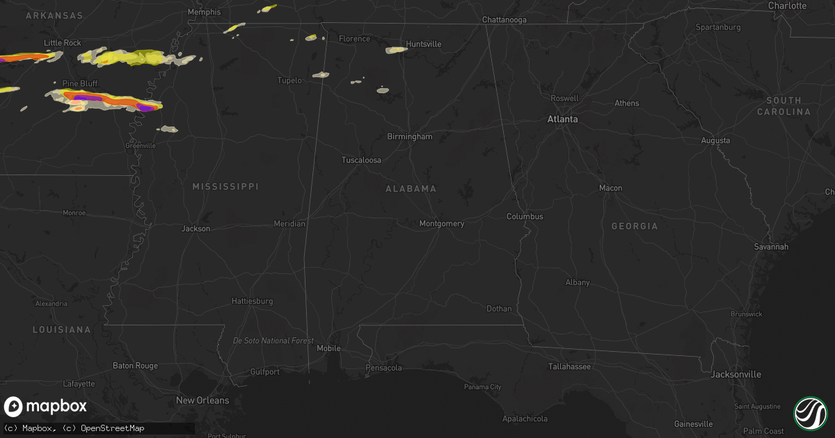
Hail Map in Alabama on March 1, 2023
Get this storm
March 1 map
$229
one time, instant access
Download today. No call, no setup
Keep the $229
Bought the map and want the full workflow? Apply the entire $229 to a subscription within 7 days. None of it is wasted.
Every map, not just this one
This buys you this map. Subscription and you get every map we run, in the markets you choose from a few cities to whole states to nationwide. Plus real-time alerts the moment a storm fires.
Contact data
Name, contact info, occupancy, even credit band for addresses in the footprint. You go from where it hit to who to call.
Become the source they trust
Unlimited branding weather history reports on demand. You already have the documented answer ready for the property owner, and you are the one who showed up with it.
Property data and RoofTrace estimates
Pull up any address you have got, its value and the exact code rules for that jurisdiction, straight from One Click Code. Then RoofTrace estimates the squares, pitch, and roof value, priced the way you price.
Storm reports in Alabama
Alabama
| Date | Description |
|---|---|
| 03/01/20239:54 AM CST | Trees blocking cr 56 near shottsville community church. Possible tornado. |
| 02/28/202311:15 PM CST | Tree down blocking roadway along county road 107 in skyline. Time estimated by radar. |
| 02/28/202310:38 PM CST | Bristol ridge subdivision in new market has roofs... Front porches... And a truck was thrown. Time estimated by radar. |
| 02/28/202310:33 PM CST | Power poles snapped near hwy 231 and walker ln - possibly due to a circulation. Time estimated by radar. |
| 02/28/202310:32 PM CST | While this tornado was very narrow and very short-lived... It did manage to cause a significant amount of damage to structures along short track dr. In new market. The |
| 02/28/202310:11 PM CST | Multiple trees down on hwy 187 near mile marker 7. Possible tornado. |
| 02/28/20239:56 PM CST | Several trees and power lines down east of shotsville. A few roadways are impassable due to downed trees. Radar depicted a tds. |
| 02/28/20239:55 PM CST | Signs blown down along with other debris in the area. Corresponds to the intense circulation. |
| 02/28/20239:54 PM CST | Corrects previous tstm wnd dmg report from shottsville. Trees blocking cr 56 near shottsville community church. Possible tornado. |
| 02/28/20239:53 PM CST | A local report indicates 59 MPH wind near DCU PRYOR FIELD |
| 02/28/20239:53 PM CST | Measured at pryor field. |
All States Impacted by Hail Map on March 1, 2023
Cities Impacted by Hail Map on March 1, 2023
- Granbury, TX
- Tolar, TX
- Bluff Dale, TX
- Cresson, TX
- Godley, TX
- Joshua, TX
- Crowley, TX
- Burleson, TX
- Fort Worth, TX
- Lancaster, TX
- Dallas, TX
- Mansfield, TX
- Arlington, TX
- Grand Prairie, TX
- Cedar Hill, TX
- Duncanville, TX
- Desoto, TX
- Hutchins, TX
- Balch Springs, TX
- Mesquite, TX
- Seagoville, TX
- Forney, TX
- Terrell, TX
- Lipan, TX
- Stephenville, TX
- Weatherford, TX
- Sunnyvale, TX
- Midlothian, TX
- Kennedale, TX
- Venus, TX
- Robards, KY
- Owensboro, KY
- Henderson, KY
- Slaughters, KY
- Sebree, KY
- Calhoun, KY
- Rockport, IN
- Leopold, IN
- Branchville, IN
- Leavenworth, IN
- English, IN
- Battletown, KY
- Sulphur, IN
- Milltown, IN
- Norman, AR
- Mount Ida, AR
- Story, AR
- New Salisbury, IN
- Palmyra, IN
- Greenville, IN
- Pekin, IN
- Borden, IN
- Floyds Knobs, IN
- Memphis, IN
- Sellersburg, IN
- Charlestown, IN
- Royal, AR
- Hot Springs National Park, AR
- Hickory Valley, TN
- Bolivar, TN
- Byhalia, MS
- Red Banks, MS
- Holly Springs, MS
- Mountain Pine, AR
- Saulsbury, TN
- Hot Springs Village, AR
- Murfreesboro, AR
- Nashville, AR
- Delight, AR
- Lonsdale, AR
- Benton, AR
- Okolona, AR
- Arkadelphia, AR
- Bryant, AR
- Bauxite, AR
- Alexander, AR
- Vevay, IN
- Ghent, KY
- Warsaw, KY
- Sanders, KY
- Sparta, KY
- Glencoe, KY
- England, AR
- Humnoke, AR
- Stuttgart, AR
- Carlisle, AR
- Ulm, AR
- Humphrey, AR
- Wabbaseka, AR
- Roe, AR
- De Valls Bluff, AR
- Grapevine, AR
- Pine Bluff, AR
- Rison, AR
- Holly Grove, AR
- Clarendon, AR
- Casscoe, AR
- Glen, MS
- Burnsville, MS
- Iuka, MS
- Star City, AR
- Yorktown, AR
- Marvell, AR
- Aubrey, AR
- Poplar Grove, AR
- Lexa, AR
- Marianna, AR
- Grady, AR
- Gould, AR
- Dumas, AR
- Gillett, AR
- Helena, AR
- West Helena, AR
- Watson, AR
- Burlington, KY
- Depauw, IN
- Corydon, IN
- Cannelton, IN
- Hazen, AR
- Jeffersonville, IN
- Prospect, KY
- Goshen, KY
- Gurdon, AR
- Sparkman, AR
- Lamar, MS
- Olive Branch, MS
- Moscow, TN
- Madison, IN
- Dupont, IN
- Commiskey, IN
- Rienzi, MS
- Dundee, MS
- Marysville, IN
- Nabb, IN
- Milton, KY
- Lexington, IN
- Bedford, KY
- Underwood, IN
- Hanover, IN
- Bennington, IN
- Florence, IN
- Patriot, IN
- Philpot, KY
- Maceo, KY
- Lewisport, KY
- Dixon, KY
- Hawesville, KY
- Tell City, IN
- Derby, IN
- Otisco, IN
- Georgetown, IN
- Ramsey, IN
- Henryville, IN
- New Washington, IN
- Scott, AR
- Lonoke, AR
- Keo, AR
- Crandall, IN
- Mena, AR
- Little Rock, AR
- Mabelvale, AR
- Traskwood, AR
- Caddo Gap, AR
- Carthage, AR
- Haworth, OK
- Winthrop, AR
- Foreman, AR
- Donaldson, AR
- Sheridan, AR
- Malvern, AR
- Sledge, MS
- Avery, TX
- Tunica, MS
- Cincinnati, OH
- Tichnor, AR
- Snow Lake, AR
- Rosedale, MS
- Gunnison, MS
- Shelby, MS
- Mound Bayou, MS
- Crystal City, TX
- Batesville, TX
- Big Wells, TX
- Dilley, TX
- Pearsall, TX
- Carrizo Springs, TX
- Charlotte, TX
- Jourdanton, TX
- Pleasanton, TX
- Christine, TX
- Campbellton, TX
- Falls City, TX
- Three Rivers, TX
- Karnes City, TX
- Kenedy, TX
- Runge, TX
- Nordheim, TX
- Yorktown, TX
- Cuero, TX
- Yoakum, TX
- Moore, TX
- Vina, AL
- Golden, MS
- Red Bay, AL
- Fulton, MS
- Tremont, MS
- Sarah, MS
- Como, MS
- Crenshaw, MS
- Double Springs, AL
- Grand Junction, TN
- Haleyville, AL
- Tanner, AL
- Coahoma, MS
- Crocketts Bluff, AR
- Decatur, AL
- Trinity, AL
- Hillsboro, AL
- Madison, AL
- Athens, AL
- Bear Creek, AL
- Hensley, AR
- Kingsland, AR
- New Market, AL
- Helotes, TX
- Pipe Creek, TX
- Mico, TX
- San Antonio, TX
- Boerne, TX
- Bulverde, TX
- New Braunfels, TX
- Spring Branch, TX
- Canyon Lake, TX
- San Marcos, TX
- Martindale, TX
- Maxwell, TX
- Lockhart, TX
- Dale, TX
- Kerrville, TX
- Fredericksburg, TX
- Johnson City, TX
- Round Mountain, TX
- Westhoff, TX
- Hobson, TX
- Carrollton, KY
- Addison, AL
- Bandera, TX
- Ecleto, TX
- Floresville, TX
- Poth, TX
- Gillett, TX
- Houston, AL
- Arley, AL
- Hunt, TX
- Ingram, TX
- Spicewood, TX
- Marble Falls, TX
- Willow City, TX
- Llano, TX
- Horseshoe Bay, TX
- Indianola, MS
- Shaw, MS
- Doddsville, MS
- Sunflower, MS
- Kyle, TX
- Wimberley, TX
- Red Rock, TX
- Leander, TX
- Seguin, TX
- Kingsbury, TX
- Comfort, TX
- Mountain Home, TX
- Harper, TX
- Eddyville, KY
- Fredonia, KY
- Troy, IN
- Evanston, IN


