Hail Map in Hopkinsville, KY on February 29, 2012
The weather event in Hopkinsville, KY on February 29, 2012 includes Hail map. 13 states and 318 cities were impacted and suffered possible damage. The total estimated number of properties impacted is 0.
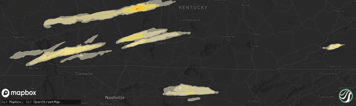
Hail
0
Estimated number of impacted properties by a 1.00" hail or larger0
Estimated number of impacted properties by a 1.75" hail or larger0
Estimated number of impacted properties by a 2.50" hail or largerStorm reports in Hopkinsville, KY
Hopkinsville, KY
| Date | Description |
|---|---|
| 02/29/201210:40 AM CST | A local report indicates 1.50 inch wind near 6 NE HOPKINSVILLE |
| 02/29/201210:30 AM CST | Large barn on the ground with tin rolled up on adjacent roof. Appears to be straight line winds. |
| 02/29/201210:28 AM CST | A local report indicates 1.00 inch wind near HOPKINSVILLE |
| 02/29/201210:05 AM CST | Also...dime size hail reported |
| 02/29/20129:58 AM CST | Unconfirmed report of a tornado on the ground in a field by north sinking fork road. |
| 02/29/20129:51 AM CST | A local report indicates 70 MPH wind near GRACEY |
| 02/29/20129:48 AM CST | A local report indicates 1.50 inch wind near GRACEY |
All States Impacted by Hail Map on February 29, 2012
All Cities Impacted by Hail Map on February 29, 2012
- Eastview, KY
- Cerulean, KY
- Crofton, KY
- Flatgap, KY
- Stambaugh, KY
- Lowmansville, KY
- Blaine, KY
- Sitka, KY
- Ulysses, KY
- Louisa, KY
- Trenton, KY
- Pocahontas, AR
- Walnut Ridge, AR
- West Liberty, KY
- Elkfork, KY
- Burghill, OH
- Greenway, AR
- Knobel, AR
- Delaplaine, AR
- Holcomb, MO
- Marmaduke, AR
- Kennett, MO
- Paragould, AR
- Lafe, AR
- Rector, AR
- Piggott, AR
- Tiptonville, TN
- Troy, TN
- Hornbeak, TN
- Union City, TN
- Tallassee, TN
- Walland, TN
- Townsend, TN
- Maryville, TN
- Park City, KY
- Horse Cave, KY
- Cave City, KY
- Smiths Grove, KY
- Center, KY
- Edmonton, KY
- Knob Lick, KY
- Glasgow, KY
- Winchester, KY
- Richmond, KY
- Franklin, PA
- Wise, VA
- Pound, VA
- Fayetteville, TN
- Monterey, TN
- Crawford, TN
- Greenwood Springs, MS
- Sulligent, AL
- Leitchfield, KY
- Rockholds, KY
- Stearns, KY
- Whitley City, KY
- Pine Knot, KY
- Williamsburg, KY
- Duffield, VA
- Blackwater, VA
- Cookeville, TN
- Salem, KY
- Marion, KY
- Sevierville, TN
- Spearsville, LA
- Greensburg, KY
- Millwood, KY
- Clarkson, KY
- Caneyville, KY
- Hardin, KY
- Almo, KY
- Dexter, KY
- Irvine, KY
- Waco, KY
- Fort Gay, WV
- Martha, KY
- Wellington, KY
- Denniston, KY
- Jeffersonville, KY
- Lexington, KY
- Stanton, KY
- Keaton, KY
- Frenchburg, KY
- Ezel, KY
- Clay City, KY
- Pall Mall, TN
- Allons, TN
- Monticello, KY
- Byrdstown, TN
- Monroe, TN
- Albany, KY
- Dawson Springs, KY
- Nebo, KY
- Providence, KY
- Madisonville, KY
- Hanson, KY
- Manitou, KY
- Princeton, KY
- Batesville, AR
- Saffell, AR
- Lynn, AR
- Sulphur Rock, AR
- Cave City, AR
- Strawberry, AR
- Alicia, AR
- Mayfield, KY
- Hamburg, AR
- Crossett, AR
- Barbourville, KY
- Elkton, KY
- Hopkinsville, KY
- Cadiz, KY
- Gracey, KY
- Murray, KY
- Benton, KY
- Frankewing, TN
- Dellrose, TN
- Pulaski, TN
- Jamestown, TN
- Eubank, KY
- Hardyville, KY
- Russellville, KY
- Brownsville, KY
- Mammoth Cave, KY
- Bowling Green, KY
- Rockfield, KY
- Rocky Hill, KY
- Oakland, KY
- Auburn, KY
- Morgantown, KY
- Cord, AR
- Crab Orchard, KY
- Huttig, AR
- Strong, AR
- Sharon Grove, KY
- Pembroke, KY
- Olmstead, KY
- Allensville, KY
- Jamestown, KY
- Russell Springs, KY
- Science Hill, KY
- Somerset, KY
- Jonesville, VA
- Pennington Gap, VA
- Gatlinburg, TN
- Greenback, TN
- Big Stone Gap, VA
- Norton, VA
- Coeburn, VA
- Fourmile, KY
- Flat Lick, KY
- Pineville, KY
- Eldridge, AL
- Greenville, KY
- Glens Fork, KY
- Columbia, KY
- Liberty, TN
- Dowelltown, TN
- Clearfield, KY
- Morehead, KY
- Mulberry, TN
- Deer Lodge, TN
- Wilder, TN
- Gainesboro, TN
- Grimsley, TN
- Rickman, TN
- Bloomington Springs, TN
- Alpine, TN
- Hilham, TN
- Clarkrange, TN
- Livingston, TN
- Centertown, KY
- Lenoir City, TN
- Liberty, KY
- Waynesburg, KY
- Kings Mountain, KY
- Stanford, KY
- Hustonville, KY
- Middleburg, KY
- Granville, TN
- Baxter, TN
- Buffalo Valley, TN
- Chestnut Mound, TN
- Allred, TN
- Guthrie, KY
- Herndon, KY
- Lewisburg, KY
- Hardinsburg, KY
- McDaniels, KY
- Falls Of Rough, KY
- Gate City, VA
- Clinton, TN
- Dunlow, WV
- Big Clifty, KY
- Cromwell, KY
- Fredonia, KY
- Beaver Dam, KY
- Cecilia, KY
- Rosine, KY
- Hudson, KY
- Island, KY
- Sacramento, KY
- McHenry, KY
- White Mills, KY
- Glendale, KY
- Horse Branch, KY
- Hartford, KY
- Olaton, KY
- Sonora, KY
- Bremen, KY
- Central City, KY
- Elmwood, TN
- Raven, VA
- Rowe, VA
- Vansant, VA
- Oakwood, VA
- Means, KY
- Wadley, AL
- Cragford, AL
- Ashland, AL
- Salyersville, KY
- Nicholasville, KY
- Appalachia, VA
- Pelham, TN
- Hillsboro, TN
- Jacksboro, TN
- Saint Paul, VA
- Andersonville, TN
- Elizabethtown, KY
- Friendsville, TN
- Windsor, KY
- Bethelridge, KY
- Dunnville, KY
- Nancy, KY
- Bristol, TN
- Coalton, WV
- Williamsfield, OH
- Artemus, KY
- Walker, KY
- Trosper, KY
- Stoney Fork, KY
- Kettle Island, KY
- Arjay, KY
- La Follette, TN
- Rocky Top, TN
- Eolia, KY
- Bryants Store, KY
- Amory, MS
- Hickory, KY
- Caryville, TN
- Maynardville, TN
- New Haven, KY
- Loretto, KY
- New Hope, KY
- Smithville, TN
- Lancaster, TN
- Auburntown, TN
- Watertown, TN
- Alexandria, TN
- Portageville, MO
- Wardell, MO
- O'Kean, AR
- Hodgenville, KY
- Detroit, AL
- Caledonia, MS
- Gattman, MS
- Moody, AL
- Odenville, AL
- Eddyville, KY
- Symsonia, KY
- Farmington, KY
- Kirksey, KY
- Tiline, KY
- Grand Rivers, KY
- Ledbetter, KY
- Brookport, IL
- Paducah, KY
- Smithland, KY
- Campton, KY
- Graham, KY
- Harrodsburg, KY
- Wilmore, KY
- Lancaster, KY
- Pigeon Forge, TN
- Eudora, AR
- Lynchburg, TN
- Blountville, TN
- Drakesboro, KY
- Lascassas, TN
- Lebanon, TN
- Parkers Lake, KY
- Corbin, KY
- Revelo, KY
- Norris, TN
- Birdseye, IN
- Ferdinand, IN
- Black Rock, AR
- Tullahoma, TN
- Estill Springs, TN
- Coldiron, KY
- Hulen, KY
- Aberdeen, MS
- Campbellsville, KY
- Rose Hill, VA
- Henderson, KY
- Cleveland, OH
- Thelma, KY
- Tutor Key, KY
- Paintsville, KY
- Boons Camp, KY
- Staffordsville, KY
- Meally, KY
- Hagerhill, KY
- Williamsport, KY
- Winfield, AL
- Guin, AL
- Beaverton, AL
- Parkdale, AR


