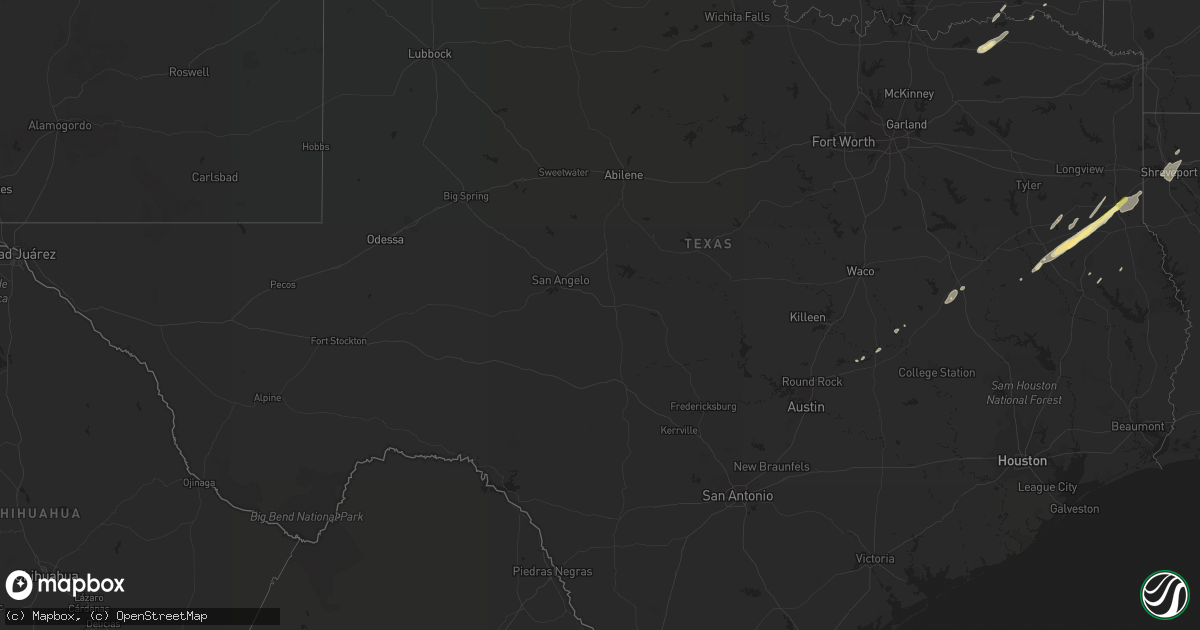
Hail Map in Texas on January 2, 2023
Get this storm
January 2 map
$229
one time, instant access
Download today. No call, no setup
Keep the $229
Bought the map and want the full workflow? Apply the entire $229 to a subscription within 7 days. None of it is wasted.
Every map, not just this one
This buys you this map. Subscription and you get every map we run, in the markets you choose from a few cities to whole states to nationwide. Plus real-time alerts the moment a storm fires.
Contact data
Name, contact info, occupancy, even credit band for addresses in the footprint. You go from where it hit to who to call.
Become the source they trust
Unlimited branding weather history reports on demand. You already have the documented answer ready for the property owner, and you are the one who showed up with it.
Property data and RoofTrace estimates
Pull up any address you have got, its value and the exact code rules for that jurisdiction, straight from One Click Code. Then RoofTrace estimates the squares, pitch, and roof value, priced the way you price.
Storm reports in Texas
Texas
| Date | Description |
|---|---|
| 01/02/20233:10 AM CST | Quarter size hail reported in carthage. |
| 01/02/20232:15 AM CST | Ping pong ball size hail reported just south of cushing near the intersection of fm 225 and fm 343. |
| 01/01/20238:07 PM CST | At 206 PM CST, a severe thunderstorm was located over Ebenezer, moving north at 35 mph. HAZARD...60 mph wind gusts. SOURCE...Radar indicated. IMPACT...Expect damage to roofs, siding, and trees. Locations impacted include... Pineland, Bronson and Chinaquapin. |
| 01/01/20237:00 PM CST | At 1259 PM CST, a severe thunderstorm was located 10 miles east of Raymond Gary State Park, or 24 miles east of Hugo, moving northeast at 50 mph. HAZARD...60 mph wind gusts and quarter size hail. SOURCE...Radar indicated. IMPACT...Hail damage to vehicles is expected. Expect wind damage to roofs, siding, and trees. Locations impacted include... Wright City, Valliant, Millerton, Redland, Farmers Hill, Glover, Slim, Bethel, Battiest, Mount Herman, Sherwood and Golden. |
All States Impacted by Hail Map on January 2, 2023
Cities Impacted by Hail Map on January 2, 2023
- Council Hill, OK
- Checotah, OK
- Henderson, TX
- Wright City, OK
- Des Arc, AR
- Hazen, AR
- Bon Aqua, TN
- Dickson, TN
- Lyles, TN
- Indianola, OK
- Hanna, OK
- Jonesboro, LA
- Fairview, TN
- Burns, TN
- White Bluff, TN
- Kingston Springs, TN
- Calvert, TX
- Cameron, TX
- Jewett, TX
- Buffalo, TX
- Marquez, TX
- Mount Enterprise, TX
- Carthage, TX
- Timpson, TX
- Alto, TX
- Long Branch, TX
- Douglass, TX
- Garrison, TX
- Nacogdoches, TX
- Cushing, TX
- Gary, TX
- Chouteau, OK
- Wagoner, OK
- Muskogee, OK
- Porter, OK
- Montrose, AR
- Downsville, LA
- West Monroe, LA
- Sterlington, LA
- Calhoun, LA
- Choudrant, LA
- Farmerville, LA
- De Witt, AR
- Gillett, AR
- Snow Lake, AR
- Monticello, AR
- Tillar, AR
- McGehee, AR
- Dermott, AR
- Watson, AR
- Eros, LA
- Brookston, TX
- Pryor, OK
- Mcalester, OK
- Hulbert, OK
- Humnoke, AR
- Tucker, AR
- England, AR
- Altheimer, AR
- Wilmar, AR
- Goldonna, LA
- Beckville, TX
- Thorndale, TX
- Jacksonville, TX
- Nashville, TN
- Petty, TX
- Roxton, TX
- Detroit, TX
- Only, TN
- McEwen, TN
- Hurricane Mills, TN
- Nunnelly, TN
- Warner, OK
- Eufaula, OK
- Vian, OK
- Gore, OK
- Porum, OK
- Stigler, OK
- Whitefield, OK
- Webbers Falls, OK
- Quinton, OK
- Adair, OK
- Big Cabin, OK
- Vinita, OK
- Braggs, OK
- Grapeland, TX
- Claremore, OK
- Bossier City, LA
- Shreveport, LA
- Haughton, LA
- Barksdale Afb, LA
- Chatham, LA
- Honey Grove, TX
- Collinston, LA
- Monroe, LA
- Bastrop, LA
- Mer Rouge, LA
- Oak Grove, LA
- Jones, LA
- Oak Ridge, LA
- Dodson, LA
- Winnfield, LA
- Madison, TN
- Old Hickory, TN
- Hendersonville, TN
- Carlisle, AR
- Fort Gibson, OK
- San Augustine, TX
- Rockdale, TX
- Valliant, OK
- Powderly, TX
- Sumner, TX
- Paris, TX
- Benton, LA
- Tahlequah, OK
- Fountain Hill, AR
- New Concord, KY
- Elkton, KY
- Arthur City, TX
- Laneville, TX
- Canadian, OK
- Pomona, KS
- Ottawa, KS
- Williamsburg, KS
- Paris, AR
- Stuart, OK
- Oktaha, OK
- Hugo, OK
- Pegram, TN
- Waverly, TN
- Centerville, TN
- Lobelville, TN
- Chireno, TX
- De Berry, TX
- Rusk, TX
- Saline, LA
- Arkansas City, AR
- Rohwer, AR
- Lake Village, AR
- Portland, AR
- Pleasant Hill, LA
- Coushatta, LA
- Quitman, LA
- Russellville, KY
- Brownsville, TN
- Jessieville, AR
- Homer, LA
- Haynesville, LA


