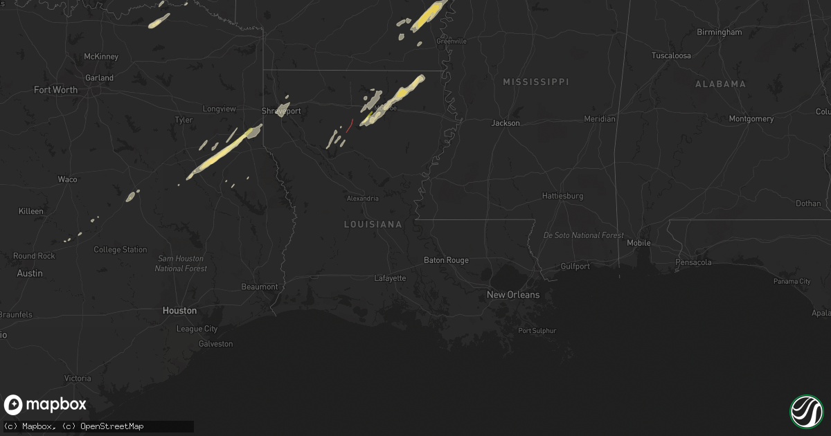
Hail Map in Louisiana on January 2, 2023
Get this storm
January 2 map
$229
one time, instant access
Download today. No call, no setup
Keep the $229
Bought the map and want the full workflow? Apply the entire $229 to a subscription within 7 days. None of it is wasted.
Every map, not just this one
This buys you this map. Subscription and you get every map we run, in the markets you choose from a few cities to whole states to nationwide. Plus real-time alerts the moment a storm fires.
Contact data
Name, contact info, occupancy, even credit band for addresses in the footprint. You go from where it hit to who to call.
Become the source they trust
Unlimited branding weather history reports on demand. You already have the documented answer ready for the property owner, and you are the one who showed up with it.
Property data and RoofTrace estimates
Pull up any address you have got, its value and the exact code rules for that jurisdiction, straight from One Click Code. Then RoofTrace estimates the squares, pitch, and roof value, priced the way you price.
Storm reports in Louisiana
Louisiana
| Date | Description |
|---|---|
| 01/02/20235:50 PM CST | One tree reported down along pine grove drive and another nearby along highway 80. |
| 01/02/20234:56 PM CST | Trees down reported along strain allen road. Coincident with radar tornadic debris signature. Likely tornado. |
| 01/02/20234:54 PM CST | Numerous trees down... Including large ones. Likely tornado damage based on tds. |
| 01/02/20234:11 AM CST | Large tree down on the 500 block of college street. Multiple power lines down as well. |
| 01/02/20232:27 AM CST | At 827 PM CST, a severe thunderstorm was located near Galion, or 13 miles east of Bastrop, moving northeast at 30 mph. HAZARD...60 mph wind gusts and quarter size hail. SOURCE...Radar indicated. IMPACT...Hail damage to vehicles is expected. Expect wind damage to roofs, siding, and trees. This severe thunderstorm will be near... Jones around 845 PM CST. Wilmot around 900 PM CST.Other locations impacted by this severe thunderstorm include MerRouge and Bonita. |
| 01/02/20232:27 AM CST | At 827 PM CST, severe thunderstorms were located along a line extending from near Junction City to 10 miles northwest of Cooley to 9 miles west of Bernice to 10 miles southeast of Homer to near Gibsland to near Dubberly, moving east at 50 mph. HAZARD...60 mph wind gusts and penny size hail. SOURCE...Radar indicated. IMPACT...Expect damage to roofs, siding, and trees. Locations impacted include... Junction City, Bernice, Urbana, Lawson, Cooley, Dubach, Lisbon, Spearsville, Lillie, Antioch, Aurelle, Mount Zion, Taylorville, Summerfield, Hillsboro, Corney Lake, Lockhart, Corinth, Shiloh and Unionville. |
| 01/02/20231:56 AM CST | At 756 PM CST, severe thunderstorms were located along a line extending from near Dixie Inn to near Sibley to 8 miles south of Doyline to 13 miles west of Ringgold to 11 miles northeast of Mansfield, moving northeast at 60 mph. HAZARD...60 mph wind gusts and penny size hail. SOURCE...Radar indicated. IMPACT...Expect damage to roofs, siding, and trees. Locations impacted include... Minden, Homer, Haughton, Arcadia, Ringgold, Sibley, Gibsland, Doyline, Dubberly, Dixie Inn, Heflin, Castor, Athens, Bienville, Lisbon, Jamestown, Bryceland, Mount Lebanon, Curtis and Plum Orchard Landing. |
| 01/02/20231:45 AM CST | At 745 PM CST, a severe thunderstorm was located over Richwood, or near Brownsville-Bawcomville, moving northeast at 40 mph. HAZARD...60 mph wind gusts and quarter size hail. SOURCE...Radar indicated. IMPACT...Hail damage to vehicles is expected. Expect wind damage to roofs, siding, and trees. Locations impacted include... Monroe, West Monroe, Brownsville-Bawcomville, Swartz, Brownsville-Bawcom, Richwood, Fondale, Fairbanks, Pine Grove and Millhaven. |
| 01/02/202312:11 AM CST | At 611 PM CST, a severe thunderstorm was located 8 miles northwest of Sterlington, or 15 miles west of Bastrop, moving northeast at 40 mph. HAZARD...60 mph wind gusts. SOURCE...Radar indicated. IMPACT...Expect damage to roofs, siding, and trees. This severe thunderstorm will be near... Beekman around 640 PM CST. Crossett around 650 PM CST. North Crossett around 655 PM CST. Berlin around 700 PM CST.Other locations impacted by this severe thunderstorm include MerRouge, Bonita and Blanchton. |
| 01/01/20239:57 PM CST | At 357 PM CST, a severe thunderstorm was located 8 miles east of Converse, or 16 miles southeast of Mansfield, moving northeast at 30 mph. HAZARD...60 mph wind gusts and nickel size hail. SOURCE...Radar indicated. IMPACT...Expect damage to roofs, siding, and trees. Locations impacted include... Coushatta, Zwolle, Converse, Oak Grove, Pleasant Hill, Martin, Ashland, Noble, Edgefield, Carmel, Lake End, Evelyn, Grand Bayou, Belmont, Hanna, Loggy Bayou, Pelican, Crichton, Rambin and Armistead. |
| 01/01/20239:43 PM CST | At 343 PM CST, a severe thunderstorm was located near Natchitoches, moving northeast at 50 mph. HAZARD...60 mph wind gusts and quarter size hail. SOURCE...Radar indicated. IMPACT...Hail damage to vehicles is expected. Expect wind damage to roofs, siding, and trees. Locations impacted include... Natchitoches, Campti, Provencal, Clarence, Goldonna, Saline, Lucky, Ashland, Robeline, Powhatan, Grand Ecore, Friendship, Black Lake, Chestnut, Clear Lake, Creston and Hagewood. |
| 01/01/20238:30 PM CST | Power line down near e 4th street. |
| 01/01/20238:30 PM CST | Pictures were sent in from em showing down trees and also a shed destroyed. |
| 01/01/20238:15 PM CST | Tree down on pinehill spur near hwy 79. |
| 01/01/20238:05 PM CST | Tree down near heflin and bienville parish line. |
| 01/01/20237:57 PM CST | Tree on power line. |
| 01/01/20237:55 PM CST | Trees down on sligo road. |
| 01/01/20237:55 PM CST | Trees down |
| 01/01/20237:55 PM CST | Pergola lifted and relocated 50 feet from original location. |
| 01/01/20237:32 PM CST | Few buildings with wind damage and trees were reported down. |
| 01/01/20237:00 PM CST | Large hail reported west of monroe. |
| 01/01/20236:45 PM CST | Trees down along lousiana hwy 590 northeast of beekman. |
| 01/01/20236:24 PM CST | Tree down on alabama-landing rd. |
| 01/01/20236:22 PM CST | Transmission towers damaged in the haile community. |
All States Impacted by Hail Map on January 2, 2023
Cities Impacted by Hail Map on January 2, 2023
- Council Hill, OK
- Checotah, OK
- Henderson, TX
- Wright City, OK
- Des Arc, AR
- Hazen, AR
- Bon Aqua, TN
- Dickson, TN
- Lyles, TN
- Indianola, OK
- Hanna, OK
- Jonesboro, LA
- Fairview, TN
- Burns, TN
- White Bluff, TN
- Kingston Springs, TN
- Calvert, TX
- Cameron, TX
- Jewett, TX
- Buffalo, TX
- Marquez, TX
- Mount Enterprise, TX
- Carthage, TX
- Timpson, TX
- Alto, TX
- Long Branch, TX
- Douglass, TX
- Garrison, TX
- Nacogdoches, TX
- Cushing, TX
- Gary, TX
- Chouteau, OK
- Wagoner, OK
- Muskogee, OK
- Porter, OK
- Montrose, AR
- Downsville, LA
- West Monroe, LA
- Sterlington, LA
- Calhoun, LA
- Choudrant, LA
- Farmerville, LA
- De Witt, AR
- Gillett, AR
- Snow Lake, AR
- Monticello, AR
- Tillar, AR
- McGehee, AR
- Dermott, AR
- Watson, AR
- Eros, LA
- Brookston, TX
- Pryor, OK
- Mcalester, OK
- Hulbert, OK
- Humnoke, AR
- Tucker, AR
- England, AR
- Altheimer, AR
- Wilmar, AR
- Goldonna, LA
- Beckville, TX
- Thorndale, TX
- Jacksonville, TX
- Nashville, TN
- Petty, TX
- Roxton, TX
- Detroit, TX
- Only, TN
- McEwen, TN
- Hurricane Mills, TN
- Nunnelly, TN
- Warner, OK
- Eufaula, OK
- Vian, OK
- Gore, OK
- Porum, OK
- Stigler, OK
- Whitefield, OK
- Webbers Falls, OK
- Quinton, OK
- Adair, OK
- Big Cabin, OK
- Vinita, OK
- Braggs, OK
- Grapeland, TX
- Claremore, OK
- Bossier City, LA
- Shreveport, LA
- Haughton, LA
- Barksdale Afb, LA
- Chatham, LA
- Honey Grove, TX
- Collinston, LA
- Monroe, LA
- Bastrop, LA
- Mer Rouge, LA
- Oak Grove, LA
- Jones, LA
- Oak Ridge, LA
- Dodson, LA
- Winnfield, LA
- Madison, TN
- Old Hickory, TN
- Hendersonville, TN
- Carlisle, AR
- Fort Gibson, OK
- San Augustine, TX
- Rockdale, TX
- Valliant, OK
- Powderly, TX
- Sumner, TX
- Paris, TX
- Benton, LA
- Tahlequah, OK
- Fountain Hill, AR
- New Concord, KY
- Elkton, KY
- Arthur City, TX
- Laneville, TX
- Canadian, OK
- Pomona, KS
- Ottawa, KS
- Williamsburg, KS
- Paris, AR
- Stuart, OK
- Oktaha, OK
- Hugo, OK
- Pegram, TN
- Waverly, TN
- Centerville, TN
- Lobelville, TN
- Chireno, TX
- De Berry, TX
- Rusk, TX
- Saline, LA
- Arkansas City, AR
- Rohwer, AR
- Lake Village, AR
- Portland, AR
- Pleasant Hill, LA
- Coushatta, LA
- Quitman, LA
- Russellville, KY
- Brownsville, TN
- Jessieville, AR
- Homer, LA
- Haynesville, LA


