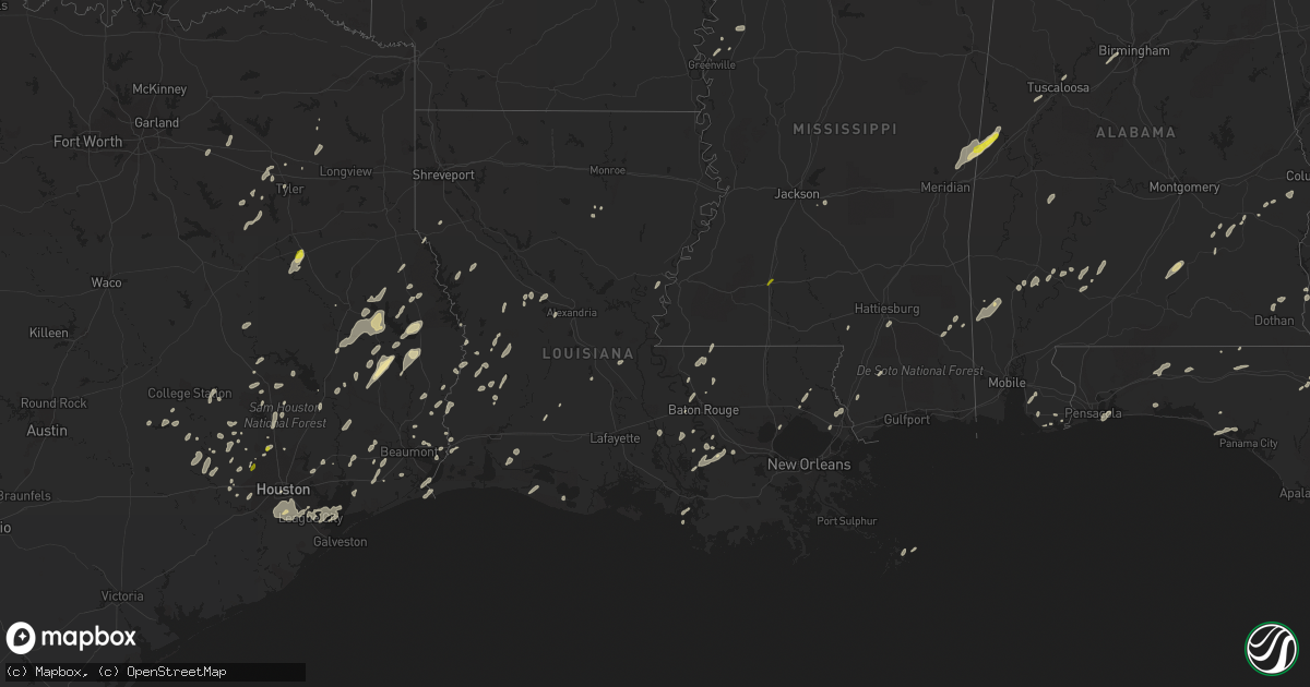
Hail Map in Louisiana on January 2, 2017
Get this storm
January 2 map
$229
one time, instant access
Download today. No call, no setup
Keep the $229
Bought the map and want the full workflow? Apply the entire $229 to a subscription within 7 days. None of it is wasted.
Every map, not just this one
This buys you this map. Subscription and you get every map we run, in the markets you choose from a few cities to whole states to nationwide. Plus real-time alerts the moment a storm fires.
Contact data
Name, contact info, occupancy, even credit band for addresses in the footprint. You go from where it hit to who to call.
Become the source they trust
Unlimited branding weather history reports on demand. You already have the documented answer ready for the property owner, and you are the one who showed up with it.
Property data and RoofTrace estimates
Pull up any address you have got, its value and the exact code rules for that jurisdiction, straight from One Click Code. Then RoofTrace estimates the squares, pitch, and roof value, priced the way you price.
Storm reports in Louisiana
Louisiana
| Date | Description |
|---|---|
| 01/02/20172:44 PM CST | A weak tornado...ef0..snapped or toppled several small trees on hands drive.path length 30 yards. Path width 5 yards. Estimated maximum wind 65 mph. |
| 01/02/20172:43 PM CST | Trees and powerlines downed in bush reported by emergency management. |
| 01/02/20172:15 PM CST | 100 to 200 trees downed in kentwood and northeast of kentwood. Several powerlines downed. Roof damage to kentwood hardware store. Possible tornado touchdown reported by |
| 01/02/20172:06 PM CST | Along highway 438... Wind damage occurred to the roof of 5 buildings... Power lines were knocked down... And a large pine tree was blown down. Time was estimated by rad |
| 01/02/20171:45 PM CST | A weak tornado...ef1.. T0uched down briefly along west lewiston road with several large pine trees uprooted and a few snapped along a narrow path. Path length 0.5 miles |
| 01/02/201712:54 PM CST | Large tree snapped reported on social media. |
| 01/02/201712:41 PM CST | Several trees and poles were blown down and damage to a large transmission line causing power outages to 1500 homes and businesses. Most of the damage was in bains. Eme |
| 01/02/201712:40 PM CST | Several trees were blown down and metal roofs were damaged on several buildings. |
| 01/02/201712:30 PM CST | Numerous trees and power lines down |
| 01/02/201712:30 PM CST | Roof damage home and shed reported on social media. |
| 01/02/201712:00 PM CST | Several powerlines and trees down... Door ripped off of fire station... Missing hunter |
| 01/02/201711:55 AM CST | Trees and power lines down |
| 01/02/201711:53 AM CST | Semi truck trailer blown on side. Considerable damage at walmart per social media. Time estimated by radar. |
| 01/02/201711:51 AM CST | Tree down across charlene hwy. |
| 01/02/201711:51 AM CST | A tornado touched down near the airport where one hangar and two planes were damaged. A wal-mart store had some skylights shattered and parts of the roof was damaged. N |
| 01/02/201711:50 AM CST | Social media pictures show trees and power lines down at hwy 361 and 29. Time estimated by radar. |
| 01/02/201711:50 AM CST | Several sheds and out buildings received damage with multiple limbs and trees falling on powerlines. |
| 01/02/201711:48 AM CST | Semi truck blown over. Numerous trees and power lines down via social media. Time estimated by radar. |
| 01/02/201711:47 AM CST | Widespread trees were snapped or uprooted across the hessmer community. At least 30 buildings were dmaged or destroyed. Numerous power lines and poles were blown down a |
| 01/02/201711:45 AM CST | Roof damage to and large branches down. |
| 01/02/201711:45 AM CST | Em reports numerous trees and powerpoles down. One house physically moved. |
| 01/02/201711:44 AM CST | A tornado formed over bunkie and produced widespread tree damage...especially on the western side of town. Two homes were destroyed when trees fell on them. At least 70 |
| 01/02/201711:31 AM CST | A tornado touched down along lloyds bridge road...damaging several homes and large barns. Debris was strewn across adjacent fields. Path length was 1.4 miles. Path widt |
| 01/02/201711:30 AM CST | Em reports rooofs blown off 3 houses on l d verrette ln. |
| 01/02/201711:30 AM CST | E 911 several homes damaged in lecompte. Possible tornado. |
| 01/02/201711:30 AM CST | A tornado briefly touched down on l d verrette lane...damaging three homes.all three had roof damage...with partial metal roofing material removed. Path length was 0.5 |
| 01/02/201711:15 AM CST | Local television station reports tree down across hwy 26. |
| 01/02/201711:04 AM CST | 911 cener reports roof removed from trailer...powerpoles and lines down on boogaerts rd. |
| 01/02/201711:00 AM CST | Picture of barn with roof blown off on socaial media. Time based on radar. |
| 01/02/201710:54 AM CST | Trees down on hwy 8. |
| 01/02/201710:44 AM CST | Numerous trees down and building damage across town. |
| 01/02/201710:42 AM CST | Large tree down across highway 1 just north of cypress |
| 01/02/201710:40 AM CST | Tree down on hwy 485 just south of compactor station |
| 01/02/201710:35 AM CST | Local television station displayed several power poles down and shed destroyed on hwy 171. |
| 01/02/201710:30 AM CST | A tornado touched down south of ragley...damaging 10 to 25 homes. Most of the damage was to roofing material...although some homes had trees land on them. Several garag |
| 01/02/201710:26 AM CST | Pine tree snapped near intersection highway 41 and highway 36 reported ham operator. |
| 01/02/201710:10 AM CST | Sheriffs dept reports trees down on hwy 27 northwest of oretta. |
| 01/02/201710:06 AM CST | A tornado touched down at the mystic baptist church. Part of the metal roof was peeled off and several trees were snapped. Path length was 0.3 miles. Path width was 20 |
| 01/02/201710:00 AM CST | . |
All States Impacted by Hail Map on January 2, 2017
Cities Impacted by Hail Map on January 2, 2017
- Corrigan, TX
- Sylvania, GA
- Jasper, TX
- Tuckerman, AR
- Newport, AR
- Swifton, AR
- Woodville, TX
- Colmesneil, TX
- Epes, AL
- Gainesville, AL
- Emelle, AL
- Porterville, MS
- Lauderdale, MS
- Houston, TX
- Deridder, LA
- Chandler, TX
- Terrell, TX
- Kaufman, TX
- Wills Point, TX
- Cotton Plant, AR
- McCrory, AR
- Leesville, LA
- Augusta, GA
- Vinton, LA
- Ville Platte, LA
- Hurtsboro, AL
- Deer Park, AL
- Dayton, TX
- Cypress, TX
- Poplarville, MS
- Perkinston, MS
- Columbia, MS
- De Witt, AR
- Livingston, TX
- Conroe, TX
- Tomball, TX
- Magnolia, TX
- Center, TX
- Katy, TX
- Hockley, TX
- Columbia, LA
- Call, TX
- Franklin, AL
- Brenham, TX
- Stuttgart, AR
- Athens, TX
- Des Arc, AR
- Augusta, AR
- Griffithville, AR
- Joaquin, TX
- Port Arthur, TX
- Huntsville, TX
- New Waverly, TX
- Pearl River, LA
- Rocky Ford, GA
- Millen, GA
- Gillett, AR
- Livingston, AL
- Morrow, LA
- Plaucheville, LA
- Monroeville, AL
- Belle Rose, LA
- Donaldsonville, LA
- Baker, LA
- Brookshire, TX
- Flatwoods, LA
- Lena, LA
- Cuthbert, GA
- Lumpkin, GA
- Richland, GA
- Jackson, SC
- Anderson, TX
- Port Allen, LA
- Seale, AL
- Hatchechubbee, AL
- Spring, TX
- Fisher, AR
- Weiner, AR
- Jonesboro, AR
- Wynne, AR
- Hickory Ridge, AR
- Bronson, TX
- Kirbyville, TX
- Singer, LA
- Waller, TX
- Navasota, TX
- Hempstead, TX
- Ponchatoula, LA
- San Augustine, TX
- Beaumont, TX
- Devers, TX
- Tyler, TX
- Basile, LA
- Eunice, LA
- Seabrook, TX
- Dickinson, TX
- Webster, TX
- Bacliff, TX
- Kemah, TX
- League City, TX
- Shepherd, TX
- McIntosh, AL
- Fruitdale, AL
- Vinegar Bend, AL
- Tibbie, AL
- Wagarville, AL
- Vidor, TX
- Grove Hill, AL
- Jackson, AL
- Pittsburg, TX
- Gilmer, TX
- Bush, LA
- Whatley, AL
- Jennings, LA
- Plantersville, TX
- Baton Rouge, LA
- Orange, TX
- Grosse Tete, LA
- Brookeland, TX
- Pineland, TX
- Broaddus, TX
- Moscow, TX
- Grand Cane, LA
- Willis, TX
- Rusk, TX
- Covington, LA
- Huntington, TX
- Lufkin, TX
- Zavalla, TX
- Etoile, TX
- Diboll, TX
- Chappell Hill, TX
- Buna, TX
- Shorterville, AL
- Richmond, TX
- Bonifay, FL
- Provencal, LA
- Headland, AL
- Newville, AL
- Pearland, TX
- Manvel, TX
- Tuscaloosa, AL
- Peterman, AL
- Blakely, GA
- Fort Polk, LA
- Grayson, LA
- Ragley, LA
- Longville, LA
- Ridgeland, SC
- Brandon, MS
- Westville, FL
- Liberty, TX
- Cleveland, TX
- Grand Chenier, LA
- Winona, TX
- Greenville, MS
- Foley, AL
- Magnolia Springs, AL
- Hattiesburg, MS
- Chester, TX
- Leakesville, MS
- Alvin, TX
- Friendswood, TX
- Fresno, TX
- Rosharon, TX
- Brantley, AL
- Rutledge, AL
- Luverne, AL
- Dolomite, AL
- Bessemer, AL
- Pleasant Grove, AL
- Jackson, LA
- Ethel, LA
- Wilson, LA
- Picayune, MS
- Lindale, TX
- Loxley, AL
- Daphne, AL
- Thomaston, AL
- Union Springs, AL
- Logansport, LA
- Swainsboro, GA
- Centerville, TX
- Crockett, TX
- Somerville, TX
- Winnie, TX
- Newton, TX
- Elberta, AL
- Defuniak Springs, FL
- Grand Ridge, FL
- Marianna, FL
- Fairhope, AL
- Troy, AL
- Plaquemine, LA
- Paulina, LA
- Convent, LA
- Boyle, MS
- Cleveland, MS
- Mora, LA
- Lacassine, LA
- Bell City, LA
- Crosby, TX
- Kaplan, LA
- White Castle, LA
- Slidell, LA
- Meridian, MS
- Boligee, AL
- Scooba, MS
- Aliceville, AL
- Amagon, AR
- Gulf Shores, AL
- Lexa, AR
- Vidalia, LA
- Sour Lake, TX
- Palestine, TX
- Larue, TX
- Elmer, LA
- Boyce, LA
- Many, LA
- Pierre Part, LA
- Morgan City, LA
- Zwolle, LA
- Evergreen, AL
- Brownsboro, TX
- Murchison, TX
- Patterson, LA
- Anahuac, TX
- Bon Wier, TX
- Merryville, LA
- Starks, LA
- Monticello, FL
- Geismar, LA
- Bellville, TX
- Sabine Pass, TX
- Cameron, LA
- Bridge City, TX
- Pointblank, TX
- Shaw, MS
- Leland, MS
- Gulf Breeze, FL
- Ben Wheeler, TX
- Ebro, FL
- Morris, GA
- Norwood, LA
- Sealy, TX
- Saint Stephens, AL
- Leroy, AL
- Pitkin, LA
- Evans, LA
- Buhl, AL
- Ralph, AL
- Midway, AL
- Saint James, LA
- Plattenville, LA
- Napoleonville, LA
- Big Sandy, TX
- Goodrich, TX
- Chireno, TX
- Panama City Beach, FL
- Burton, TX
- Fort Walton Beach, FL
- Shalimar, FL
- Eglin Afb, FL
- Lone Star, TX
- Dothan, AL
- Benoit, MS
- Burkeville, TX
- Pride, LA
- Zachary, LA
- Slaughter, LA
- Crestview, FL
- Warren, TX
- Point, TX
- Edgewood, TX
- Brookhaven, MS
- Bogue Chitto, MS
- Sonora, TX
- Eldorado, TX


