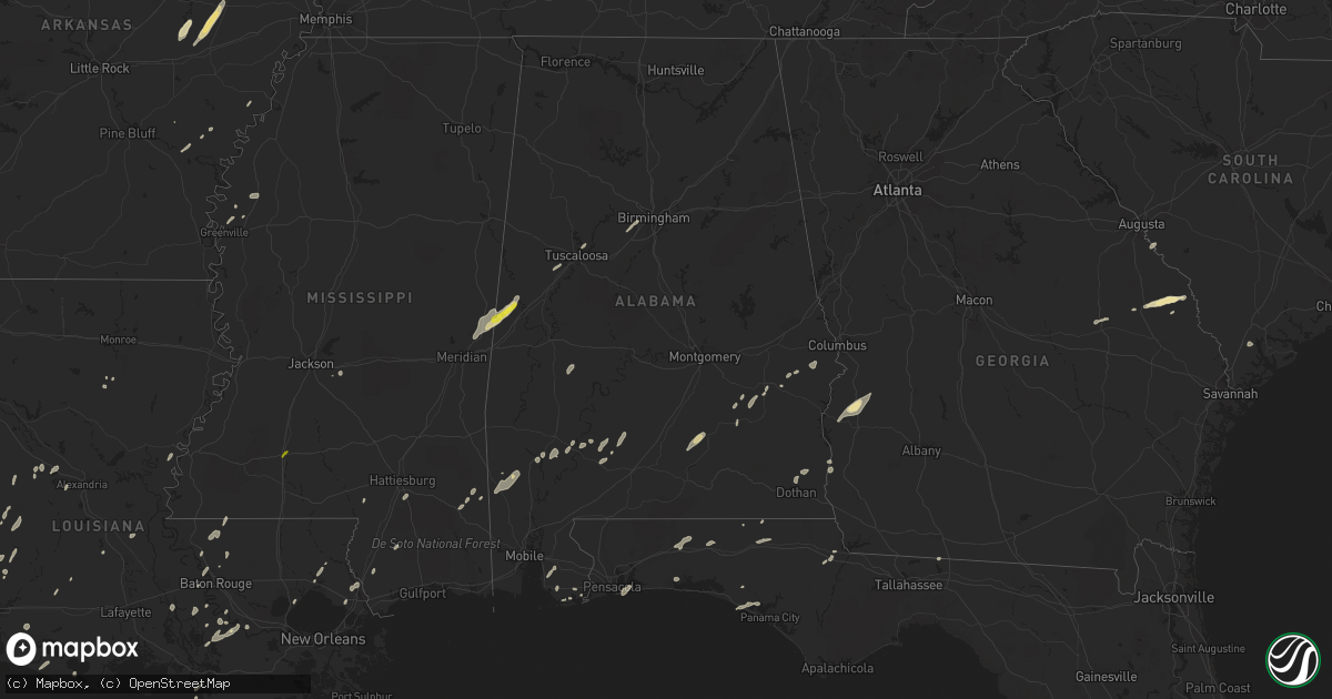
Hail Map in Alabama on January 2, 2017
Get this storm
January 2 map
$229
one time, instant access
Download today. No call, no setup
Keep the $229
Bought the map and want the full workflow? Apply the entire $229 to a subscription within 7 days. None of it is wasted.
Every map, not just this one
This buys you this map. Subscription and you get every map we run, in the markets you choose from a few cities to whole states to nationwide. Plus real-time alerts the moment a storm fires.
Contact data
Name, contact info, occupancy, even credit band for addresses in the footprint. You go from where it hit to who to call.
Become the source they trust
Unlimited branding weather history reports on demand. You already have the documented answer ready for the property owner, and you are the one who showed up with it.
Property data and RoofTrace estimates
Pull up any address you have got, its value and the exact code rules for that jurisdiction, straight from One Click Code. Then RoofTrace estimates the squares, pitch, and roof value, priced the way you price.
Storm reports in Alabama
Alabama
| Date | Description |
|---|---|
| 01/02/20175:21 PM CST | County em reports trees and powerlines down near corner fork rd and highway 42 in monroe county. Time estimated via radar. |
| 01/02/20174:42 PM CST | Numerous reports of trees and limbs down across west mobile with thuderstorm passage. Time estimated via radar. |
| 01/02/20174:26 PM CST | Trees and power lines downed along bullock county road 14. |
| 01/02/20174:24 PM CST | The tornado touched down along cr 13 and traveled ne crossing cr 14 & cr 15 before dissipating just n of east creek. Damaged consisted of numerous trees snapped/uproote |
| 01/02/20172:47 PM CST | A severe thunderstorm moved across gulf shores and produced a corridor of significant wind damage from near the intersection of highway 59 and highway 182 north and eas |
| 01/02/20172:46 PM CST | Numerous reports of wind damage in and around gulf shores and the little lagoon pass areas. |
| 01/02/20171:15 PM CST | Multiple mobile homes damaged in the perry chapel community off of bryan johnson rd. Time estimated via radar. |
| 01/02/201712:15 PM CST | Multiple mobile homes damaged in the perry chapel community off of bryan johnson rd. Time estimated via radar. |
| 01/02/201712:00 PM CST | Tree on a home on belview circle near jackson. Several other trees down across the area. Time estimated based on radar. |
| 01/02/201712:00 PM CST | Windows blown out of the subway in jackson. Some injuries reported. |
| 01/02/20177:05 AM CST | . |
| 01/02/20176:56 AM CST | Small hail covering the ground... Some of the pieces were quarter size. |
| 01/01/20177:47 PM CST | Downed trees reported near the mccallister and beverlye road area. Tds observed on radar in this area |
| 01/01/20177:46 PM CST | Tornado touched down along e. Cottonwood road se of dothan al. The tornado traveled east for approximately 2.6 miles along mccallister road before lifting near rosewood |
| 01/01/20177:40 PM CST | *** 4 fatal *** significant damage in the rehobeth area. Governor tweeted 4 fatalities |
| 01/01/20177:40 PM CST | *** 4 fatal *** nws survey team determined that the damage at leonard drive in the rehobeth areas was caused by strong straight line winds on the southern flank of a to |
| 01/01/20177:35 PM CST | Back porch awning of a house damaged in malvern |
| 01/01/20177:35 PM CST | Tornado touched down in geneva county near houston county border along rehobeth road before lifting after crossing us 231 east of the national peanut festival grounds. |
| 01/01/20177:30 PM CST | Trees down in the slocomb area |
| 01/01/20177:17 PM CST | Trees down in the black area |
| 01/01/20177:13 PM CST | Trees down in the coffee springs area |
| 01/01/20177:10 PM CST | Trees down in the geneva area |
| 01/01/20177:02 PM CST | Trees down in the samson area |
| 01/01/20176:57 PM CST | Power line down in the western part of geneva county |
All States Impacted by Hail Map on January 2, 2017
Cities Impacted by Hail Map on January 2, 2017
- Corrigan, TX
- Sylvania, GA
- Jasper, TX
- Tuckerman, AR
- Newport, AR
- Swifton, AR
- Woodville, TX
- Colmesneil, TX
- Epes, AL
- Gainesville, AL
- Emelle, AL
- Porterville, MS
- Lauderdale, MS
- Houston, TX
- Deridder, LA
- Chandler, TX
- Terrell, TX
- Kaufman, TX
- Wills Point, TX
- Cotton Plant, AR
- McCrory, AR
- Leesville, LA
- Augusta, GA
- Vinton, LA
- Ville Platte, LA
- Hurtsboro, AL
- Deer Park, AL
- Dayton, TX
- Cypress, TX
- Poplarville, MS
- Perkinston, MS
- Columbia, MS
- De Witt, AR
- Livingston, TX
- Conroe, TX
- Tomball, TX
- Magnolia, TX
- Center, TX
- Katy, TX
- Hockley, TX
- Columbia, LA
- Call, TX
- Franklin, AL
- Brenham, TX
- Stuttgart, AR
- Athens, TX
- Des Arc, AR
- Augusta, AR
- Griffithville, AR
- Joaquin, TX
- Port Arthur, TX
- Huntsville, TX
- New Waverly, TX
- Pearl River, LA
- Rocky Ford, GA
- Millen, GA
- Gillett, AR
- Livingston, AL
- Morrow, LA
- Plaucheville, LA
- Monroeville, AL
- Belle Rose, LA
- Donaldsonville, LA
- Baker, LA
- Brookshire, TX
- Flatwoods, LA
- Lena, LA
- Cuthbert, GA
- Lumpkin, GA
- Richland, GA
- Jackson, SC
- Anderson, TX
- Port Allen, LA
- Seale, AL
- Hatchechubbee, AL
- Spring, TX
- Fisher, AR
- Weiner, AR
- Jonesboro, AR
- Wynne, AR
- Hickory Ridge, AR
- Bronson, TX
- Kirbyville, TX
- Singer, LA
- Waller, TX
- Navasota, TX
- Hempstead, TX
- Ponchatoula, LA
- San Augustine, TX
- Beaumont, TX
- Devers, TX
- Tyler, TX
- Basile, LA
- Eunice, LA
- Seabrook, TX
- Dickinson, TX
- Webster, TX
- Bacliff, TX
- Kemah, TX
- League City, TX
- Shepherd, TX
- McIntosh, AL
- Fruitdale, AL
- Vinegar Bend, AL
- Tibbie, AL
- Wagarville, AL
- Vidor, TX
- Grove Hill, AL
- Jackson, AL
- Pittsburg, TX
- Gilmer, TX
- Bush, LA
- Whatley, AL
- Jennings, LA
- Plantersville, TX
- Baton Rouge, LA
- Orange, TX
- Grosse Tete, LA
- Brookeland, TX
- Pineland, TX
- Broaddus, TX
- Moscow, TX
- Grand Cane, LA
- Willis, TX
- Rusk, TX
- Covington, LA
- Huntington, TX
- Lufkin, TX
- Zavalla, TX
- Etoile, TX
- Diboll, TX
- Chappell Hill, TX
- Buna, TX
- Shorterville, AL
- Richmond, TX
- Bonifay, FL
- Provencal, LA
- Headland, AL
- Newville, AL
- Pearland, TX
- Manvel, TX
- Tuscaloosa, AL
- Peterman, AL
- Blakely, GA
- Fort Polk, LA
- Grayson, LA
- Ragley, LA
- Longville, LA
- Ridgeland, SC
- Brandon, MS
- Westville, FL
- Liberty, TX
- Cleveland, TX
- Grand Chenier, LA
- Winona, TX
- Greenville, MS
- Foley, AL
- Magnolia Springs, AL
- Hattiesburg, MS
- Chester, TX
- Leakesville, MS
- Alvin, TX
- Friendswood, TX
- Fresno, TX
- Rosharon, TX
- Brantley, AL
- Rutledge, AL
- Luverne, AL
- Dolomite, AL
- Bessemer, AL
- Pleasant Grove, AL
- Jackson, LA
- Ethel, LA
- Wilson, LA
- Picayune, MS
- Lindale, TX
- Loxley, AL
- Daphne, AL
- Thomaston, AL
- Union Springs, AL
- Logansport, LA
- Swainsboro, GA
- Centerville, TX
- Crockett, TX
- Somerville, TX
- Winnie, TX
- Newton, TX
- Elberta, AL
- Defuniak Springs, FL
- Grand Ridge, FL
- Marianna, FL
- Fairhope, AL
- Troy, AL
- Plaquemine, LA
- Paulina, LA
- Convent, LA
- Boyle, MS
- Cleveland, MS
- Mora, LA
- Lacassine, LA
- Bell City, LA
- Crosby, TX
- Kaplan, LA
- White Castle, LA
- Slidell, LA
- Meridian, MS
- Boligee, AL
- Scooba, MS
- Aliceville, AL
- Amagon, AR
- Gulf Shores, AL
- Lexa, AR
- Vidalia, LA
- Sour Lake, TX
- Palestine, TX
- Larue, TX
- Elmer, LA
- Boyce, LA
- Many, LA
- Pierre Part, LA
- Morgan City, LA
- Zwolle, LA
- Evergreen, AL
- Brownsboro, TX
- Murchison, TX
- Patterson, LA
- Anahuac, TX
- Bon Wier, TX
- Merryville, LA
- Starks, LA
- Monticello, FL
- Geismar, LA
- Bellville, TX
- Sabine Pass, TX
- Cameron, LA
- Bridge City, TX
- Pointblank, TX
- Shaw, MS
- Leland, MS
- Gulf Breeze, FL
- Ben Wheeler, TX
- Ebro, FL
- Morris, GA
- Norwood, LA
- Sealy, TX
- Saint Stephens, AL
- Leroy, AL
- Pitkin, LA
- Evans, LA
- Buhl, AL
- Ralph, AL
- Midway, AL
- Saint James, LA
- Plattenville, LA
- Napoleonville, LA
- Big Sandy, TX
- Goodrich, TX
- Chireno, TX
- Panama City Beach, FL
- Burton, TX
- Fort Walton Beach, FL
- Shalimar, FL
- Eglin Afb, FL
- Lone Star, TX
- Dothan, AL
- Benoit, MS
- Burkeville, TX
- Pride, LA
- Zachary, LA
- Slaughter, LA
- Crestview, FL
- Warren, TX
- Point, TX
- Edgewood, TX
- Brookhaven, MS
- Bogue Chitto, MS
- Sonora, TX
- Eldorado, TX


