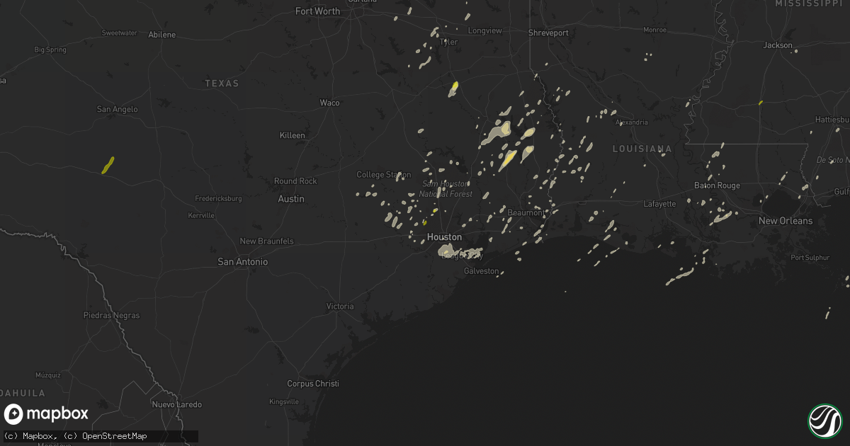
Hail Map on January 2, 2017
Get this storm
January 2 map
$229
one time, instant access
Download today. No call, no setup
Keep the $229
Bought the map and want the full workflow? Apply the entire $229 to a subscription within 7 days. None of it is wasted.
Every map, not just this one
This buys you this map. Subscription and you get every map we run, in the markets you choose from a few cities to whole states to nationwide. Plus real-time alerts the moment a storm fires.
Contact data
Name, contact info, occupancy, even credit band for addresses in the footprint. You go from where it hit to who to call.
Become the source they trust
Unlimited branding weather history reports on demand. You already have the documented answer ready for the property owner, and you are the one who showed up with it.
Property data and RoofTrace estimates
Pull up any address you have got, its value and the exact code rules for that jurisdiction, straight from One Click Code. Then RoofTrace estimates the squares, pitch, and roof value, priced the way you price.
States Impacted by Hail Map on January 2, 2017
Storm reports
Texas
| Date | Description |
|---|---|
| 01/02/201710:05 AM CST | Trees down. |
| 01/02/20179:30 AM CST | Large limbs / branches down less than 2... Chicken house roof damaged in patroon tx... Wind est 55 mph |
| 01/02/20179:10 AM CST | Houston fd reports light wire down on century dr in houston via social media |
| 01/02/20179:08 AM CST | Several large trees down in the rayburn browndell area. |
| 01/02/20179:06 AM CST | Tree down on 1751 south of 103 |
| 01/02/20178:47 AM CST | Houston fd reports light wire down at e echo glen dr and werner st relayed via social media |
| 01/02/20178:38 AM CST | Public reports trees/wires down near kashmere gardens relayed by houston oem social media |
| 01/02/20178:38 AM CST | Public reports wire down on the 1700 block of maryland st in river oaks area relayed by houston oem social media |
| 01/02/20178:35 AM CST | Public reports a downed tree at 12th street and n durham in the houston heights relayed by houston oem social media |
| 01/02/20178:35 AM CST | Public report of a tree down near briar forest and gessner in w houson relayed by houston oem social media |
| 01/02/20178:30 AM CST | Tree down across road near chester. |
| 01/02/20178:15 AM CST | Public reports tree down in spring via social media |
| 01/02/20178:10 AM CST | Tree down across fm 840 in se rusk near brachfield |
| 01/02/20178:10 AM CST | Several trees down. |
| 01/02/20177:25 AM CST | Public post picture of quarter size hail via kltv facebook page. |
| 01/02/20177:11 AM CST | Houston co sheriffs office reports a tree down on hwy 19 s just north of lovelady |
| 01/02/20177:05 AM CST | Numerous trees down across fm 14. |
| 01/02/20176:50 AM CST | Numerous trees and power lines down. |
| 01/02/20176:47 AM CST | Houston co sheriffs office reports a tree down on fm 227 near hwy 21 e |
| 01/02/20176:45 AM CST | Houston co sheriffs office reports power lines down in crockett |
| 01/02/20176:40 AM CST | Trees of various sizes down |
| 01/02/20176:35 AM CST | Brazos co sheriffs office reports tree down near clay hill rd at ferrill creek rd in wixon valley |
| 01/02/20176:30 AM CST | Large tree down |
| 01/02/20176:04 AM CST | 2 to 4 inch tree limbs down in marquez |
| 01/02/20176:02 AM CST | Delayed report - collapse of an attached carport 4 miles nne of maypearl due to high wind. 2 vehicles in the carport were also damaged. |
| 01/02/20176:00 AM CST | Law enforcement reports a tree down on county rd 331 near the south cleveland water tower |
| 01/02/20176:00 AM CST | Wind gusts estimated to 60 mph along with pea size hail and nearly continuous lightning |
Arkansas
| Date | Description |
|---|---|
| 01/02/20179:05 AM CST | A local report indicates 1.00 inch wind near SWIFTON |
Georgia
| Date | Description |
|---|---|
| 01/02/20175:30 PM CST | Tree down at fort benning access point 2... Blocking 1 lane of traffic |
| 01/02/20175:25 PM CST | Reports of a downed tree blocking the roadway on vibbert ave by olsen hall |
| 01/02/20175:20 PM CST | 911 call center received report of trees down at the intersection of hwy 41 and centerpoint rd... In between weston and preston |
| 01/02/20175:20 PM CST | Emergency manager reports trees down on wilson pond rd about 3 miles nw of downtown preston along with structural damage to metal buildings... And shingles blown off of |
| 01/02/20174:47 PM CST | Emergency manager received reports of several destroyed chicken coops... Several chicken coops with major damage... And several trees down on freeman road in troutman. |
| 01/02/20174:33 PM CST | A large tree crushed a mobile home in the boscom community. Social media images show extensive damage to the home. Time estimated based on radar. Reported relayed by lo |
| 01/02/20174:26 PM CST | Screven county 911 reported trees down at intersection of winchester rd and sunnyside rd. Separate report received of hail damage to a passing vehicle but hail size was |
| 01/01/201711:55 PM CST | 4 trees reported down along old louisville rd. Near montgomery county border. Time of event estimated from radar |
| 01/01/201711:50 PM CST | 4 trees down around paradice circle... Time of event estimated from radar |
| 01/01/201711:48 PM CST | Candler county warning point reported tree across roadway at 121 forehand lane. |
| 01/01/201711:36 PM CST | Tree down near intersection of hwy 199 and hwy 221... Time of event estimated from radar data. |
| 01/01/201711:36 PM CST | Several reports of trees down on the west side and north side of the county. Details still coming in |
| 01/01/201711:21 PM CST | Trees down in cedar grove area... Time of event estimated from radar. |
| 01/01/201710:40 PM CST | In the south corner of whatley vineyard... 20 to 25 trees were uprooted and a few were snapped. |
| 01/01/201710:35 PM CST | At the intersection of el bethel church road and highway 280... A house was reported with roof shingles blown off. There was also a farm shed that collapsed in the stor |
| 01/01/201710:30 PM CST | Several trees down across hwy 129... South of abbeville. Location and time estimated from radar. |
| 01/01/201710:23 PM CST | Tree down on a home at 32 reeves street in rhine |
| 01/01/201710:20 PM CST | Report of trees down along livingston road |
| 01/01/201710:15 PM CST | Emergency manager reported numerous trees down along hwy 233 south of rochelle. Also...one power pole was snapped and several were leaning. Time estimated from radar. |
| 01/01/201710:15 PM CST | Emergency manager reported numerous trees down along hwy 233 south of rochelle. Also...one power pole was snapped and several were leaning. Time estimated from radar. |
| 01/01/201710:13 PM CST | 1 tree reported down in ben hill county |
| 01/01/201710:05 PM CST | Trees down on shady lane |
| 01/01/201710:04 PM CST | Trees down on scott road |
| 01/01/201710:03 PM CST | Trees down on the north end of freeman road |
| 01/01/201710:00 PM CST | Tree down into a house |
| 01/01/201710:00 PM CST | Trees down on amboy farms road |
| 01/01/201710:00 PM CST | Trees down on john pate road |
| 01/01/20179:56 PM CST | Trees down on hopewell road |
| 01/01/20179:56 PM CST | Trees down on highway 159 |
| 01/01/20179:56 PM CST | Trees down on kendrick road |
| 01/01/20179:56 PM CST | Trees down on ireland road |
| 01/01/20179:55 PM CST | Preliminary from crisp county. 1 vehicle totaled...2 damaged from falling trees. One home has moderate damage. One home has minimal. Several barns and storage buidlings |
| 01/01/20179:55 PM CST | Preliminary from crisp county. 1 vehicle totaled...2 damaged from falling trees. One home has moderate damage. One home has minimal. Several barns and storage buidlings |
| 01/01/20179:55 PM CST | Numerous trees and power lines down in turner county |
| 01/01/20179:54 PM CST | Trees down on alberson road |
| 01/01/20179:52 PM CST | Trees down on warwick highway |
| 01/01/20179:52 PM CST | *** 1 fatal *** straight line winds destroyed a small unsecured building killing the occupant. Winds estimated around 80 mph. |
| 01/01/20179:50 PM CST | Roof to a screened in porch ripped off along highway 313 north |
| 01/01/20179:49 PM CST | Tree on a power line on highway 33 south of gleaton road |
| 01/01/20179:46 PM CST | Numerous trees and power lines down across colquitt county |
| 01/01/20179:46 PM CST | Trees down on highway 32 |
| 01/01/20179:45 PM CST | Tree across home with power lines down on walter murphy road |
| 01/01/20179:45 PM CST | Roof damage...pool damage...outbuilding damage...and vehicle damage on highway 32 east |
| 01/01/20179:45 PM CST | Trees down on abrams road |
| 01/01/20179:45 PM CST | Trees down on eric alred road |
| 01/01/20179:45 PM CST | Windows blown out of barn and roof off an outbuilding on highway 32 east. |
| 01/01/20179:45 PM CST | Trees down on jodie hobby road |
| 01/01/20179:45 PM CST | Roof damage to several large commercial chicken houses and large barns |
| 01/01/20179:44 PM CST | Trees down and roof damage on howard drive |
| 01/01/20179:43 PM CST | Trees down on red oak road |
| 01/01/20179:43 PM CST | Numerous trees down on highway 313 |
| 01/01/20179:43 PM CST | Roof damage along highway 313 north |
| 01/01/20179:39 PM CST | Damage to a shop along highway 313 north |
| 01/01/20179:38 PM CST | Trees down on crowe lane |
| 01/01/20179:37 PM CST | Structural damage reported at the charity grove baptist church |
| 01/01/20179:37 PM CST | Trees and power lines down on blue springs road from church to jewel crowe road |
| 01/01/20179:37 PM CST | Trees down on harris road |
| 01/01/20179:37 PM CST | Trees down on fowler road |
| 01/01/20179:37 PM CST | Trees and power lines down on ausby road |
| 01/01/20179:37 PM CST | Roof off a farm house along cleo boyd road |
| 01/01/20179:35 PM CST | Numerous trees and power lines down in worth county |
| 01/01/20179:35 PM CST | Trees down and barn damaged along massey airport road |
| 01/01/20179:35 PM CST | Trees down on hollhouse road |
| 01/01/20179:35 PM CST | Trees on a house on boyd road |
| 01/01/20179:35 PM CST | Power pole snapped near 200 strangward road |
| 01/01/20179:35 PM CST | Two trees down on a house on steve lane |
| 01/01/20179:35 PM CST | Power line down on highway 256 just east of cotton road |
| 01/01/20179:34 PM CST | Tree hit the side of a home on lakeside drive |
| 01/01/20179:34 PM CST | Trees down near worthy and rich roads |
| 01/01/20179:34 PM CST | Trees and power lines down in the area along with dual-pol tds signature from jgx radar along the dougherty...worth...lee county line. |
| 01/01/20179:33 PM CST | Trees down on pearson road at woodcrest road |
| 01/01/20179:32 PM CST | Under skirting of a home pushed under a home on ramblewood drive |
| 01/01/20179:32 PM CST | Ef-1 tornado touched down just inside dougherty co. Line along cordele rd before moving northeast into worth county. The tornado lifted just east of highway 313 after t |
| 01/01/20179:30 PM CST | Several power poles down on springs flat road |
| 01/01/20179:30 PM CST | Scattered trees down in lee county |
| 01/01/20179:30 PM CST | Trees down near 200 henry road |
| 01/01/20179:28 PM CST | Power lines down in the meigs area |
| 01/01/20179:27 PM CST | Trees and power lines down along bridgeboro anderson road |
| 01/01/20179:20 PM CST | Three trees down on house in sylvester. |
| 01/01/20179:19 PM CST | Weatherbug station at darton state college reported 68 mph gust at 1019 pm et. |
| 01/01/20179:17 PM CST | Lots of storm damage being reported in the albany area. Numerous trees down...some on houses and cars. Possible tornado. |
| 01/01/20179:14 PM CST | Trees and power lines down in the macedonia church area |
| 01/01/20179:14 PM CST | Severe thunderstorms produced a 3 to 4 mile swath of 80 to 85 winds across the northern half of albany causing widespread damage across the city. The storm snapped or u |
| 01/01/20179:12 PM CST | Multiple homes damaged. Possible tornado. |
| 01/01/20179:10 PM CST | Several power lines down north of cairo |
| 01/01/20179:10 PM CST | Multiple homes damaged. Possible tornado. |
| 01/01/20179:08 PM CST | Nws ground survey indicates ef1 tornado touched down near flint river just west of us 19. Numerous pecan trees uprooted and pine trees snapped. Roof damage to several m |
| 01/01/20179:05 PM CST | 60 mph gust measured by the georgia automated environmental monitoring network site at ducker |
| 01/01/20179:00 PM CST | Tree down along highway 82 |
| 01/01/20178:54 PM CST | Significant damage to trees and a few structures in the town of newton. Survey team determined that the damage was consistent with straight line winds of approximately |
| 01/01/20178:50 PM CST | Damage reported in the leary area. Probable tornado |
| 01/01/20178:47 PM CST | Numerous trees down and 2 homes possibly damaged along julienne sheo road. Likely tornado damage with tds signature noted on dual pol radar |
| 01/01/20178:41 PM CST | Ef-1 tornado touched down near albany hwy and kimbrel rd in eastern miller county. The tornado traveled northeast 10 miles...doing heavy damage to trees along the path. |
| 01/01/20178:40 PM CST | Power lines down in southwest decatur county |
| 01/01/20178:38 PM CST | A few trees were blown down in southwest randolph county |
| 01/01/20178:37 PM CST | Report of tornado in west bainbridge. Propery damage and trees down dothan rd at jimmys and john deere...donald dr...hawk st...dennard st...miller ave...bethel rd...new |
| 01/01/20178:37 PM CST | Damage to farm equipment dealer and autmobile dealer reported by decatur county ema. The damage was concentrated along a small stretch of dothan road in western bainbri |
| 01/01/20178:35 PM CST | Trees down in early county with dual-pol tds at this location |
| 01/01/20178:34 PM CST | Ef-2 tornado touched down just west of highway 45 north of billy newberry road. The tornado liftted just north of newton rd after a path of 4.6 miles. There was signifi |
| 01/01/20178:25 PM CST | Survey team found small area of damage to trees and outbuildings consistent with straight line winds of around 80 mph. |
| 01/01/20178:20 PM CST | Trees down in early county with dual pol tds at this location |
| 01/01/20178:18 PM CST | Ef-2 tornado touched down on early co. Side of early-miller line near three notch road. The tornado moved ne towards us-27 near bates rd. A mobile home suffered roof da |
| 01/01/20178:14 PM CST | Ef-1 tornado touched down on grant graham rd causing damage to pecan groves...two mobile homes...and one single family home. The tornado tracked northeast for approx. 3 |
| 01/01/20178:14 PM CST | Trees down in early county with dual-pol tds at this location |
| 01/01/20178:12 PM CST | Tornado touched down on damascus-hilton rd just east of zion road and moved ne toward cedar springs rd. At the intersection of cedar springs rd and hightower rd... Two |
| 01/01/20177:30 PM CST | A tree fell in the road at the intersection of barrow road and mangham road. The time was estimatd on radar. |
| 01/01/20177:00 PM CST | A large tree fell on a power line and took out the main breaker at the intersection of tax road and pleasant valley road. Which shut off the power for many residents in |
| 01/01/20176:43 PM CST | 911 call center received reports of a washed out road at the intersection of marvin murphy and ebenezer rd |
Louisiana
| Date | Description |
|---|---|
| 01/02/20172:44 PM CST | A weak tornado...ef0..snapped or toppled several small trees on hands drive.path length 30 yards. Path width 5 yards. Estimated maximum wind 65 mph. |
| 01/02/20172:43 PM CST | Trees and powerlines downed in bush reported by emergency management. |
| 01/02/20172:15 PM CST | 100 to 200 trees downed in kentwood and northeast of kentwood. Several powerlines downed. Roof damage to kentwood hardware store. Possible tornado touchdown reported by |
| 01/02/20172:06 PM CST | Along highway 438... Wind damage occurred to the roof of 5 buildings... Power lines were knocked down... And a large pine tree was blown down. Time was estimated by rad |
| 01/02/20171:45 PM CST | A weak tornado...ef1.. T0uched down briefly along west lewiston road with several large pine trees uprooted and a few snapped along a narrow path. Path length 0.5 miles |
| 01/02/201712:54 PM CST | Large tree snapped reported on social media. |
| 01/02/201712:41 PM CST | Several trees and poles were blown down and damage to a large transmission line causing power outages to 1500 homes and businesses. Most of the damage was in bains. Eme |
| 01/02/201712:40 PM CST | Several trees were blown down and metal roofs were damaged on several buildings. |
| 01/02/201712:30 PM CST | Numerous trees and power lines down |
| 01/02/201712:30 PM CST | Roof damage home and shed reported on social media. |
| 01/02/201712:00 PM CST | Several powerlines and trees down... Door ripped off of fire station... Missing hunter |
| 01/02/201711:55 AM CST | Trees and power lines down |
| 01/02/201711:53 AM CST | Semi truck trailer blown on side. Considerable damage at walmart per social media. Time estimated by radar. |
| 01/02/201711:51 AM CST | A tornado touched down near the airport where one hangar and two planes were damaged. A wal-mart store had some skylights shattered and parts of the roof was damaged. N |
| 01/02/201711:51 AM CST | Tree down across charlene hwy. |
| 01/02/201711:50 AM CST | Social media pictures show trees and power lines down at hwy 361 and 29. Time estimated by radar. |
| 01/02/201711:50 AM CST | Several sheds and out buildings received damage with multiple limbs and trees falling on powerlines. |
| 01/02/201711:48 AM CST | Semi truck blown over. Numerous trees and power lines down via social media. Time estimated by radar. |
| 01/02/201711:47 AM CST | Widespread trees were snapped or uprooted across the hessmer community. At least 30 buildings were dmaged or destroyed. Numerous power lines and poles were blown down a |
| 01/02/201711:45 AM CST | Em reports numerous trees and powerpoles down. One house physically moved. |
| 01/02/201711:45 AM CST | Roof damage to and large branches down. |
| 01/02/201711:44 AM CST | A tornado formed over bunkie and produced widespread tree damage...especially on the western side of town. Two homes were destroyed when trees fell on them. At least 70 |
| 01/02/201711:31 AM CST | A tornado touched down along lloyds bridge road...damaging several homes and large barns. Debris was strewn across adjacent fields. Path length was 1.4 miles. Path widt |
| 01/02/201711:30 AM CST | A tornado briefly touched down on l d verrette lane...damaging three homes.all three had roof damage...with partial metal roofing material removed. Path length was 0.5 |
| 01/02/201711:30 AM CST | Em reports rooofs blown off 3 houses on l d verrette ln. |
| 01/02/201711:30 AM CST | E 911 several homes damaged in lecompte. Possible tornado. |
| 01/02/201711:15 AM CST | Local television station reports tree down across hwy 26. |
| 01/02/201711:04 AM CST | 911 cener reports roof removed from trailer...powerpoles and lines down on boogaerts rd. |
| 01/02/201711:00 AM CST | Picture of barn with roof blown off on socaial media. Time based on radar. |
| 01/02/201710:54 AM CST | Trees down on hwy 8. |
| 01/02/201710:44 AM CST | Numerous trees down and building damage across town. |
| 01/02/201710:42 AM CST | Large tree down across highway 1 just north of cypress |
| 01/02/201710:40 AM CST | Tree down on hwy 485 just south of compactor station |
| 01/02/201710:35 AM CST | Local television station displayed several power poles down and shed destroyed on hwy 171. |
| 01/02/201710:30 AM CST | A tornado touched down south of ragley...damaging 10 to 25 homes. Most of the damage was to roofing material...although some homes had trees land on them. Several garag |
| 01/02/201710:26 AM CST | Pine tree snapped near intersection highway 41 and highway 36 reported ham operator. |
| 01/02/201710:10 AM CST | Sheriffs dept reports trees down on hwy 27 northwest of oretta. |
| 01/02/201710:06 AM CST | A tornado touched down at the mystic baptist church. Part of the metal roof was peeled off and several trees were snapped. Path length was 0.3 miles. Path width was 20 |
| 01/02/201710:00 AM CST | . |
Florida
| Date | Description |
|---|---|
| 01/02/20175:56 PM CST | Awning blown off of area restaurant. Time estimated from radar. |
| 01/02/20173:30 PM CST | Local media reports tree fell on a vehicle in gonzalez. |
| 01/01/20177:58 PM CST | Trees down in the greenwood area |
| 01/01/20177:56 PM CST | 52 knot or 60 mph gust measured at kmai |
| 01/01/20177:49 PM CST | Trees down in the cottondale area |
| 01/01/20177:30 PM CST | Multiple trees and power lines down across holmes county |
| 01/01/20177:30 PM CST | Trees down in the graceville area |
| 01/01/20176:47 PM CST | Report of trees and power lines down near highway 331 and highway 2a |
Alabama
| Date | Description |
|---|---|
| 01/02/20175:21 PM CST | County em reports trees and powerlines down near corner fork rd and highway 42 in monroe county. Time estimated via radar. |
| 01/02/20174:42 PM CST | Numerous reports of trees and limbs down across west mobile with thuderstorm passage. Time estimated via radar. |
| 01/02/20174:26 PM CST | Trees and power lines downed along bullock county road 14. |
| 01/02/20174:24 PM CST | The tornado touched down along cr 13 and traveled ne crossing cr 14 & cr 15 before dissipating just n of east creek. Damaged consisted of numerous trees snapped/uproote |
| 01/02/20172:47 PM CST | A severe thunderstorm moved across gulf shores and produced a corridor of significant wind damage from near the intersection of highway 59 and highway 182 north and eas |
| 01/02/20172:46 PM CST | Numerous reports of wind damage in and around gulf shores and the little lagoon pass areas. |
| 01/02/20171:15 PM CST | Multiple mobile homes damaged in the perry chapel community off of bryan johnson rd. Time estimated via radar. |
| 01/02/201712:15 PM CST | Multiple mobile homes damaged in the perry chapel community off of bryan johnson rd. Time estimated via radar. |
| 01/02/201712:00 PM CST | Tree on a home on belview circle near jackson. Several other trees down across the area. Time estimated based on radar. |
| 01/02/201712:00 PM CST | Windows blown out of the subway in jackson. Some injuries reported. |
| 01/02/20177:05 AM CST | . |
| 01/02/20176:56 AM CST | Small hail covering the ground... Some of the pieces were quarter size. |
| 01/01/20177:47 PM CST | Downed trees reported near the mccallister and beverlye road area. Tds observed on radar in this area |
| 01/01/20177:46 PM CST | Tornado touched down along e. Cottonwood road se of dothan al. The tornado traveled east for approximately 2.6 miles along mccallister road before lifting near rosewood |
| 01/01/20177:40 PM CST | *** 4 fatal *** significant damage in the rehobeth area. Governor tweeted 4 fatalities |
| 01/01/20177:40 PM CST | *** 4 fatal *** nws survey team determined that the damage at leonard drive in the rehobeth areas was caused by strong straight line winds on the southern flank of a to |
| 01/01/20177:35 PM CST | Tornado touched down in geneva county near houston county border along rehobeth road before lifting after crossing us 231 east of the national peanut festival grounds. |
| 01/01/20177:35 PM CST | Back porch awning of a house damaged in malvern |
| 01/01/20177:30 PM CST | Trees down in the slocomb area |
| 01/01/20177:17 PM CST | Trees down in the black area |
| 01/01/20177:13 PM CST | Trees down in the coffee springs area |
| 01/01/20177:10 PM CST | Trees down in the geneva area |
| 01/01/20177:02 PM CST | Trees down in the samson area |
| 01/01/20176:57 PM CST | Power line down in the western part of geneva county |
Mississippi
| Date | Description |
|---|---|
| 01/02/20173:45 PM CST | Tree across road on hwy 39 |
| 01/02/20173:33 PM CST | Tree on a home in meridian |
| 01/02/20173:30 PM CST | County em reports many trees and powerlines down across wayne county. Time estimated via radar |
| 01/02/20173:30 PM CST | Tree on a house |
| 01/02/20173:28 PM CST | Nws storm survey found an ef0 tornado with max winds of 75mph. Max width of 75 yards. Path length of 1.5 miles. This brief tornado touched down along meehan-savoy road |
| 01/02/20173:26 PM CST | Trees and power lines down on memorial church rd. Time estimated via radar. |
| 01/02/20173:22 PM CST | Trees and lines down at us 45 and ms 145 |
| 01/02/20173:21 PM CST | Tree on a vehicle along cr 1681 |
| 01/02/20173:21 PM CST | Trees down on i-59...possible tornado. |
| 01/02/20173:15 PM CST | Trees down on hwy 513...possible tornado |
| 01/02/20173:12 PM CST | Tree down across old river rd and kennedy rd |
| 01/02/20173:10 PM CST | Trees down on line rd |
| 01/02/20173:10 PM CST | Several limbs were down |
| 01/02/20173:07 PM CST | Tree down across us 49 at dewitt carter rd |
| 01/02/20173:06 PM CST | Several homes damaged |
| 01/02/20173:05 PM CST | Several trees down on shady grove moss rd |
| 01/02/20173:03 PM CST | Numerous trees and powerlines down |
| 01/02/20173:00 PM CST | Tree down across pig town rd |
| 01/02/20173:00 PM CST | Trees down on lake como road |
| 01/02/20173:00 PM CST | A large tree was snapped on pine grove road. |
| 01/02/20172:59 PM CST | Numerous trees and powerlines down down on app slade rd. Several homes were damaged. |
| 01/02/20172:59 PM CST | Several trees downed along baker rd |
| 01/02/20172:59 PM CST | Several trees down across parts of interstate 59. Tree damage about a quarter mile along interstate 59 reported by storm chaser. |
| 01/02/20172:56 PM CST | Trees down on i-59 near mile marker 50 |
| 01/02/20172:55 PM CST | Trees downed across old highway 11 |
| 01/02/20172:53 PM CST | Traveled east and caused damage to trees and structures. Path length 5.61 miles. Max width 150 yards. Peak wind 107 mph. |
| 01/02/20172:53 PM CST | Trees down along max white rd |
| 01/02/20172:52 PM CST | Nws survey found an ef1 tornado with max winds of 105mph. Max width of 225 yards. Path length of 8.4 miles. This tornado touched down near corinth cutoff road and conti |
| 01/02/20172:50 PM CST | Numerous trees and powerlines down. Tree on home at 1024 county rd 17. |
| 01/02/20172:50 PM CST | Numerous trees down on max white road |
| 01/02/20172:50 PM CST | Mutiple trees down on columbia purvis rd. Tree on home at 1933 columbia purvis rd. |
| 01/02/20172:48 PM CST | Numerous trees and powerlines down. Tree on home at 21 north 1st street in bay springs. |
| 01/02/20172:43 PM CST | Nws survey found an ef1 tornado with max winds of 105mph. Max width of 275 yards. Path length of 3.9 miles. This tornado touched down near county road 33b and continued |
| 01/02/20172:42 PM CST | Minor damage to a school along ms hwy 13 |
| 01/02/20172:31 PM CST | Trees downed blocking us 49 south of collins |
| 01/02/20172:30 PM CST | Multiple trees downed along a mile long stretch of highway 37 in far northeast covington county. Damage indicators and radar suggest straight line winds. |
| 01/02/20172:28 PM CST | Power lines and power poles downed along ms hwy 13 at old river rd |
| 01/02/20172:25 PM CST | Trees down on 10 mile creek road including one on a home. Power line down as well. |
| 01/02/20172:24 PM CST | Multiple trees down along ms hwy 532 |
| 01/02/20172:21 PM CST | Traveled northeast and caused damage to structures and trees. Path length 4.23 miles. Max width 300 yards. Peak wind 113 mph. |
| 01/02/20172:21 PM CST | A bunch of large metal chicken houses were destroyed. Debris lofted into trees. Several trees and power lines down. |
| 01/02/20172:20 PM CST | Several trees were blown down and there was damage to a building along highway 48. |
| 01/02/20172:18 PM CST | Tree down at ms 35 south of mount olive |
| 01/02/20172:10 PM CST | Large tree downed on mcdowell rd in jackson |
| 01/02/20172:08 PM CST | Homes and chicken houses damaged... Trees blocking merritt welch road... Highway13 and highway 43 |
| 01/02/20172:08 PM CST | Trees down across hwy 469 near foster rd. |
| 01/02/20172:06 PM CST | Several trees downed...roof damage to home...mobile flipped on side and firework stand blown over reported by storm spotter. |
| 01/02/20172:04 PM CST | Trees and power lines down |
| 01/02/20172:02 PM CST | Trees and power lines down |
| 01/02/20172:02 PM CST | Traveled northeast causing damage to trees and structures including a chicken farm. Path length 9.47 miles. Max width 400 yards. Peak wind 110 mph. |
| 01/02/20172:00 PM CST | A weak tornado...ef1...touched down along and just north of highway 48 west of tylertown. Some large trees were uprooted and snapped. Power lines were damaged by the fa |
| 01/02/20171:55 PM CST | A weak tornado...ef1...touched down along an intermittent path in southeast pike county from around emerald road south of highway 48 to love creek road just north of hi |
| 01/02/20171:55 PM CST | Trees and power lines down across the south portion of the county. |
| 01/02/20171:46 PM CST | Trees and power lines down across the west part of the county. |
| 01/02/20171:45 PM CST | A tree down on hwy 467 |
| 01/02/20171:45 PM CST | Ham operator reported numerous trees down and roof blown off structure along lang rd. |
| 01/02/20171:43 PM CST | Ham operator reported a tree down across highway 51 in chatawa. |
| 01/02/20171:42 PM CST | Tree down on interstate 55 reported by media. |
| 01/02/20171:42 PM CST | Tree uprooted |
| 01/02/20171:42 PM CST | Trees and lines down along hwy 61 north |
| 01/02/20171:32 PM CST | A tree was snapped |
| 01/02/20171:30 PM CST | A local report indicates 1.00 inch wind near 1 W BROOKHAVEN |
| 01/02/20171:30 PM CST | Shed and two barns destroyed on monticello rd |
| 01/02/20171:30 PM CST | Tree split a mobile home |
| 01/02/20171:30 PM CST | Numerous trees down with power outages |
| 01/02/20171:30 PM CST | Tree on house near chippewa and cleveland |
| 01/02/20171:29 PM CST | Several homes damaged in thompson community. Possible tornado touch down reported by emergency management. |
| 01/02/20171:26 PM CST | Top blown off mobile home trees and powerlines down... Chicken house damaged |
| 01/02/20171:25 PM CST | Sweetwater united methodist church was pushed off of the foundation and the backwall was blown out. |
| 01/02/20171:25 PM CST | Top blown off mobile home trees and powerlines down... Chicken house damaged |
| 01/02/20171:25 PM CST | Barn destroyed on hunsucker lane |
| 01/02/20171:24 PM CST | Trees down and damage to homes along watson rd |
| 01/02/20171:23 PM CST | Sweetwater united methodist church was pushed off of the foundation and the backwall was blown out. |
| 01/02/20171:21 PM CST | Traveled northeast into copiah county causing damage to trees and structures. Path length 6.81 miles. Max width 300 yards. Peak wind 110 mph. |
| 01/02/20171:18 PM CST | Trees down across the trace |
| 01/02/20171:18 PM CST | Trees and lines down along hwy 61 south. |
| 01/02/20171:14 PM CST | Several trees downed along ms hwy 547 at white hall rd. Possible tornado. |
| 01/02/20171:14 PM CST | Traveled northeast and crossed ms highway 547. Path length 5.62 miles. Max width 200 yards. Peak wind 95 mph. |
| 01/02/20171:14 PM CST | A few trees down along with a power line and power pole. |
| 01/02/20171:06 PM CST | A couple trees down in bude and meadville |
| 01/02/20171:02 PM CST | Moved northeast and crossed ms highway 28. Damaged only trees. Path length 3.95 miles. Max width 250 yards. |
| 01/02/201712:53 PM CST | A large tree was uprooted |
| 01/02/201712:45 PM CST | Numerous trees down across the county |
| 01/02/201712:25 PM CST | Trees were down across liberty and ellislie plantation roads. |
| 01/02/201712:25 PM CST | A tree was down blocking both southbound lanes of highway 61. |
| 01/02/201710:47 AM CST | Tree fell on a truck near the prison in greene county. Time estimated via radar. |
| 01/01/20176:00 PM CST | Trees down and power lines down on marvin williams road |
South Carolina
| Date | Description |
|---|---|
| 01/02/20171:04 AM CST | Trees down near the intersection of trask parkway and jasmine hall road. Time estimated based on radar. |
Cities Impacted by Hail Map on January 2, 2017
- Corrigan, TX
- Sylvania, GA
- Jasper, TX
- Tuckerman, AR
- Newport, AR
- Swifton, AR
- Woodville, TX
- Colmesneil, TX
- Epes, AL
- Gainesville, AL
- Emelle, AL
- Porterville, MS
- Lauderdale, MS
- Houston, TX
- Deridder, LA
- Chandler, TX
- Terrell, TX
- Kaufman, TX
- Wills Point, TX
- Cotton Plant, AR
- McCrory, AR
- Leesville, LA
- Augusta, GA
- Vinton, LA
- Ville Platte, LA
- Hurtsboro, AL
- Deer Park, AL
- Dayton, TX
- Cypress, TX
- Poplarville, MS
- Perkinston, MS
- Columbia, MS
- De Witt, AR
- Livingston, TX
- Conroe, TX
- Tomball, TX
- Magnolia, TX
- Center, TX
- Katy, TX
- Hockley, TX
- Columbia, LA
- Call, TX
- Franklin, AL
- Brenham, TX
- Stuttgart, AR
- Athens, TX
- Des Arc, AR
- Augusta, AR
- Griffithville, AR
- Joaquin, TX
- Port Arthur, TX
- Huntsville, TX
- New Waverly, TX
- Pearl River, LA
- Rocky Ford, GA
- Millen, GA
- Gillett, AR
- Livingston, AL
- Morrow, LA
- Plaucheville, LA
- Monroeville, AL
- Belle Rose, LA
- Donaldsonville, LA
- Baker, LA
- Brookshire, TX
- Flatwoods, LA
- Lena, LA
- Cuthbert, GA
- Lumpkin, GA
- Richland, GA
- Jackson, SC
- Anderson, TX
- Port Allen, LA
- Seale, AL
- Hatchechubbee, AL
- Spring, TX
- Fisher, AR
- Weiner, AR
- Jonesboro, AR
- Wynne, AR
- Hickory Ridge, AR
- Bronson, TX
- Kirbyville, TX
- Singer, LA
- Waller, TX
- Navasota, TX
- Hempstead, TX
- Ponchatoula, LA
- San Augustine, TX
- Beaumont, TX
- Devers, TX
- Tyler, TX
- Basile, LA
- Eunice, LA
- Seabrook, TX
- Dickinson, TX
- Webster, TX
- Bacliff, TX
- Kemah, TX
- League City, TX
- Shepherd, TX
- McIntosh, AL
- Fruitdale, AL
- Vinegar Bend, AL
- Tibbie, AL
- Wagarville, AL
- Vidor, TX
- Grove Hill, AL
- Jackson, AL
- Pittsburg, TX
- Gilmer, TX
- Bush, LA
- Whatley, AL
- Jennings, LA
- Plantersville, TX
- Baton Rouge, LA
- Orange, TX
- Grosse Tete, LA
- Brookeland, TX
- Pineland, TX
- Broaddus, TX
- Moscow, TX
- Grand Cane, LA
- Willis, TX
- Rusk, TX
- Covington, LA
- Huntington, TX
- Lufkin, TX
- Zavalla, TX
- Etoile, TX
- Diboll, TX
- Chappell Hill, TX
- Buna, TX
- Shorterville, AL
- Richmond, TX
- Bonifay, FL
- Provencal, LA
- Headland, AL
- Newville, AL
- Pearland, TX
- Manvel, TX
- Tuscaloosa, AL
- Peterman, AL
- Blakely, GA
- Fort Polk, LA
- Grayson, LA
- Ragley, LA
- Longville, LA
- Ridgeland, SC
- Brandon, MS
- Westville, FL
- Liberty, TX
- Cleveland, TX
- Grand Chenier, LA
- Winona, TX
- Greenville, MS
- Foley, AL
- Magnolia Springs, AL
- Hattiesburg, MS
- Chester, TX
- Leakesville, MS
- Alvin, TX
- Friendswood, TX
- Fresno, TX
- Rosharon, TX
- Brantley, AL
- Rutledge, AL
- Luverne, AL
- Dolomite, AL
- Bessemer, AL
- Pleasant Grove, AL
- Jackson, LA
- Ethel, LA
- Wilson, LA
- Picayune, MS
- Lindale, TX
- Loxley, AL
- Daphne, AL
- Thomaston, AL
- Union Springs, AL
- Logansport, LA
- Swainsboro, GA
- Centerville, TX
- Crockett, TX
- Somerville, TX
- Winnie, TX
- Newton, TX
- Elberta, AL
- Defuniak Springs, FL
- Grand Ridge, FL
- Marianna, FL
- Fairhope, AL
- Troy, AL
- Plaquemine, LA
- Paulina, LA
- Convent, LA
- Boyle, MS
- Cleveland, MS
- Mora, LA
- Lacassine, LA
- Bell City, LA
- Crosby, TX
- Kaplan, LA
- White Castle, LA
- Slidell, LA
- Meridian, MS
- Boligee, AL
- Scooba, MS
- Aliceville, AL
- Amagon, AR
- Gulf Shores, AL
- Lexa, AR
- Vidalia, LA
- Sour Lake, TX
- Palestine, TX
- Larue, TX
- Elmer, LA
- Boyce, LA
- Many, LA
- Pierre Part, LA
- Morgan City, LA
- Zwolle, LA
- Evergreen, AL
- Brownsboro, TX
- Murchison, TX
- Patterson, LA
- Anahuac, TX
- Bon Wier, TX
- Merryville, LA
- Starks, LA
- Monticello, FL
- Geismar, LA
- Bellville, TX
- Sabine Pass, TX
- Cameron, LA
- Bridge City, TX
- Pointblank, TX
- Shaw, MS
- Leland, MS
- Gulf Breeze, FL
- Ben Wheeler, TX
- Ebro, FL
- Morris, GA
- Norwood, LA
- Sealy, TX
- Saint Stephens, AL
- Leroy, AL
- Pitkin, LA
- Evans, LA
- Buhl, AL
- Ralph, AL
- Midway, AL
- Saint James, LA
- Plattenville, LA
- Napoleonville, LA
- Big Sandy, TX
- Goodrich, TX
- Chireno, TX
- Panama City Beach, FL
- Burton, TX
- Fort Walton Beach, FL
- Shalimar, FL
- Eglin Afb, FL
- Lone Star, TX
- Dothan, AL
- Benoit, MS
- Burkeville, TX
- Pride, LA
- Zachary, LA
- Slaughter, LA
- Crestview, FL
- Warren, TX
- Point, TX
- Edgewood, TX
- Brookhaven, MS
- Bogue Chitto, MS
- Sonora, TX
- Eldorado, TX