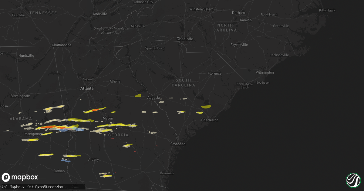
Hail Map in South Carolina on December 30, 2021
Get this storm
December 30 map
$229
one time, instant access
Download today. No call, no setup
Keep the $229
Bought the map and want the full workflow? Apply the entire $229 to a subscription within 7 days. None of it is wasted.
Every map, not just this one
This buys you this map. Subscription and you get every map we run, in the markets you choose from a few cities to whole states to nationwide. Plus real-time alerts the moment a storm fires.
Contact data
Name, contact info, occupancy, even credit band for addresses in the footprint. You go from where it hit to who to call.
Become the source they trust
Unlimited branding weather history reports on demand. You already have the documented answer ready for the property owner, and you are the one who showed up with it.
Property data and RoofTrace estimates
Pull up any address you have got, its value and the exact code rules for that jurisdiction, straight from One Click Code. Then RoofTrace estimates the squares, pitch, and roof value, priced the way you price.
Storm reports in South Carolina
South Carolina
| Date | Description |
|---|---|
| 12/30/20214:10 PM CST | A spotter reported quarter size hail near the intersection of boone hill and old orangeburg rd. |
| 12/30/20213:50 PM CST | A local report indicates 1.00 inch wind near MONCKS CORNER |
| 12/30/20213:45 PM CST | A local report indicates 1.00 inch wind near MONCKS CORNER |
| 12/29/202110:55 PM CST | At 454 PM EST, a severe thunderstorm was located over Givhans Ferry State Park, moving east at 50 mph. HAZARD...60 mph wind gusts and quarter size hail. SOURCE...Radar indicated. IMPACT...Minor hail damage to vehicles is possible. Expect wind damage to trees and powerlines. Locations impacted include: North Charleston, Summerville, Goose Creek, Ladson, Givhans Ferry State Park, Ridgeville, Givhans, Sangaree, Crowfield Plantation, Jedburg, Knightsville and College Park.This warning includes I-26 between mile markers 192 and 205. |
| 12/29/202110:11 PM CST | At 410 PM EST, a severe thunderstorm was located over Ashton, moving east at 20 mph. HAZARD...60 mph wind gusts and quarter size hail. SOURCE...Radar indicated. IMPACT...Minor hail damage to vehicles is possible. Expect wind damage to trees and powerlines. Locations impacted include: Walterboro, Colleton, Smoaks, Lodge, Williams, Islandton, Ruffin, Padgetts, Ashton and Canadys.This warning includes I-95 in South Carolina between mile markers 55and 69. |
| 12/29/20217:12 PM CST | At 110 PM EST, a severe thunderstorm was located near Wrightsboro, or near Thomson, moving east at 45 mph. HAZARD...60 mph wind gusts and nickel size hail. SOURCE...Radar indicated. IMPACT...Expect damage to roofs, siding, and trees. Locations impacted include... North Augusta, Grovetown, Evans, Thomson, Martinez, Augusta, Clearwater, Belvedere, Edgefield, Harlem, Appling, Clarks Hill Recreation Area, Midtown, Riverwood, Mistletoe State Park, Summerville, Wrightsboro, Augusta Mall, Daniel Field and Village Plaza Shopping Center. |
All States Impacted by Hail Map on December 30, 2021
Cities Impacted by Hail Map on December 30, 2021
- Letohatchee, AL
- Hope Hull, AL
- Ramer, AL
- Hayneville, AL
- Montgomery, AL
- Byron, GA
- Greensboro, AL
- Boligee, AL
- Gallion, AL
- Forkland, AL
- Sawyerville, AL
- Livingston, AL
- Faunsdale, AL
- Wadley, AL
- Daviston, AL
- Cragford, AL
- Alexander City, AL
- Ashland, AL
- Smiths Station, AL
- Gray, GA
- Macon, GA
- Haddock, GA
- Prattville, AL
- Troy, AL
- Goshen, AL
- Brundidge, AL
- Clio, AL
- Ariton, AL
- Shorter, AL
- Hardaway, AL
- Tuskegee, AL
- Adrian, GA
- Wrightsville, GA
- East Dublin, GA
- Meansville, GA
- Danville, GA
- Dublin, GA
- Montrose, GA
- Jeffersonville, GA
- Irwinton, GA
- Dry Branch, GA
- Salem, AL
- Opelika, AL
- Fortson, GA
- Phenix City, AL
- Columbus, GA
- Auburn, AL
- Midland, GA
- Louisville, GA
- Camp Hill, AL
- Waverly, AL
- Dadeville, AL
- Deatsville, AL
- Marbury, AL
- Goodwater, AL
- Roanoke, AL
- Franklin, GA
- Woodland, GA
- Forsyth, GA
- The Rock, GA
- Barnesville, GA
- Molena, GA
- Zebulon, GA
- Milner, GA
- Moultrie, GA
- Pavo, GA
- Coolidge, GA
- Berlin, GA
- Barney, GA
- Adel, GA
- Perry, GA
- Warner Robins, GA
- Summerville, SC
- Wetumpka, AL
- Fort Gaines, GA
- Cuthbert, GA
- Coleman, GA
- Abbeville, AL
- Juliette, GA
- Concord, GA
- Thomaston, GA
- Jemison, AL
- Montevallo, AL
- Randolph, AL
- Eclectic, AL
- Shorterville, AL
- Tallassee, AL
- Reynolds, GA
- Rupert, GA
- Lodge, SC
- Islandton, SC
- McRae Helena, GA
- Milan, GA
- Notasulga, AL
- Auburn University, AL
- Cataula, GA
- Williston, SC
- Blackville, SC
- Coker, AL
- Marshallville, GA
- Hartsfield, GA
- Meigs, GA
- Metter, GA
- Lafayette, AL
- Fort Valley, GA
- Valley, AL
- Cusseta, AL
- Pike Road, AL
- Hamilton, GA
- Montezuma, GA
- Ideal, GA
- Kathleen, GA
- Cochran, GA
- Elko, GA
- Oglethorpe, GA
- Bonaire, GA
- Shiloh, GA
- Pine Mountain Valley, GA
- Pine Mountain, GA
- Twin City, GA
- Cecil, AL
- Tuskegee Institute, AL
- Morris, GA
- Eufaula, AL
- Waynesboro, GA
- Peachtree City, GA
- Sharpsburg, GA
- Box Springs, GA
- Sardis, GA
- Ehrhardt, SC
- Brunson, SC
- Hampton, SC
- Titus, AL
- Fairfax, SC
- Millbrook, AL
- Booth, AL
- Elmore, AL
- Autaugaville, AL
- Mauk, GA
- Junction City, GA
- Lizella, GA
- Centerville, GA
- Weogufka, AL
- Sylacauga, AL
- Ridgeville, SC
- Thomasville, AL
- Musella, GA
- Roberta, GA
- Jackson, SC
- Fort Benning, GA
- Orangeburg, SC
- Rowesville, SC
- Cordova, SC
- Norman Park, GA
- Louisville, AL
- Statesboro, GA
- Pulaski, GA
- Register, GA
- West Point, GA
- Talbotton, GA
- Waverly Hall, GA
- Marion Junction, AL
- Billingsley, AL
- Verbena, AL
- Jones, AL
- Butler, GA
- Minter, AL
- New Ellenton, SC
- Aiken, SC
- Cope, SC
- Equality, AL
- Northport, AL
- Kellyton, AL
- Union Springs, AL
- Newbern, AL
- Ellerslie, GA
- Upatoi, GA
- Newville, AL
- Williams, SC
- Ruffin, SC
- Pinopolis, SC
- Moncks Corner, SC
- Hazlehurst, GA
- Glennville, GA
- Hawkinsville, GA
- Brooklet, GA
- Sparks, GA
- Idaho Springs, CO
- Strasburg, CO
- Cripple Creek, CO
- Niwot, CO
- Calhan, CO
- Loveland, CO
- Louviers, CO
- Monument, CO
- Pine, CO
- Wheatland, WY
- Boulder, CO
- Golden, CO
- Glendo, WY
- Medicine Bow, WY
- Empire, CO
- Deer Trail, CO
- Estes Park, CO
- Berthoud, CO
- Parshall, CO
- Canon City, CO
- Evansville, WY
- Buffalo Creek, CO
- Johnstown, CO
- Lusk, WY
- Louisville, CO
- Drake, CO
- Glen Haven, CO
- Windsor, CO
- Usaf Academy, CO
- Bosler, WY
- Lafayette, CO
- Hartville, WY
- Dumont, CO
- Florissant, CO
- Douglas, WY
- Bairoil, WY
- Fountain, CO
- Livermore, CO
- Black Hawk, CO
- Woodland Park, CO
- Franktown, CO
- Silver Plume, CO
- Hanna, WY
- Cascade, CO
- Gillette, WY
- Castle Rock, CO
- Lingle, WY
- Tie Siding, WY
- Jay Em, WY
- Rock River, WY
- Alcova, WY
- Agate, CO
- Bailey, CO
- Divide, CO
- Buford, WY
- Indian Hills, CO
- Natrona, WY
- Rollinsville, CO
- Colorado Springs, CO
- Idledale, CO
- Casper, WY
- Granby, CO
- Elbert, CO
- Kiowa, CO
- Bellvue, CO
- Ward, CO
- Fraser, CO
- Longmont, CO
- Sedalia, CO
- Eldorado Springs, CO
- Wellington, CO
- Carr, CO
- Victor, CO
- Brighton, CO
- Guernsey, WY
- Lone Tree, CO
- Westminster, CO
- Larkspur, CO
- Shawnee, WY
- Nunn, CO
- Byers, CO
- Shoshoni, WY
- Centennial, WY
- Manitou Springs, CO
- Jeffrey City, WY
- Veteran, WY
- Georgetown, CO
- Littleton, CO
- Ramah, CO
- Ault, CO
- Grover, CO
- Aurora, CO
- Chugwater, WY
- Penrose, CO
- Greeley, CO
- Laporte, CO
- Parker, CO
- Fort Laramie, WY
- Palmer Lake, CO
- Fort Collins, CO
- Garrett, WY
- Arvada, CO
- Rawlins, WY
- Denver, CO
- Lyons, CO
- Glenrock, WY
- Erie, CO
- Red Feather Lakes, CO
- Walden, CO
- Allenspark, CO
- Manville, WY
- Lost Springs, WY
- Wheat Ridge, CO
- Laramie, WY
- Grand Lake, CO
- Nederland, CO
- Mills, WY
- Central City, CO
- Kittredge, CO
- Bennett, CO
- Evergreen, CO
- Lance Creek, WY
- Conifer, CO
- Winter Park, CO
- Granite Canon, WY
- Elk Mountain, WY
- Jamestown, CO
- Broomfield, CO
- Morrison, CO
- Dillon, CO
- Jelm, WY
- Peyton, CO
- Cheyenne, WY
- Yoder, WY
- Elizabeth, CO
- Green Mountain Falls, CO
- Wamsutter, WY
- Norwood, GA
- Thomson, GA
- Camak, GA
- Warrenton, GA
- Alamo, GA
- Monticello, GA
- Milledgeville, GA
- Culloden, GA
- Shellman, GA
- Kite, GA


