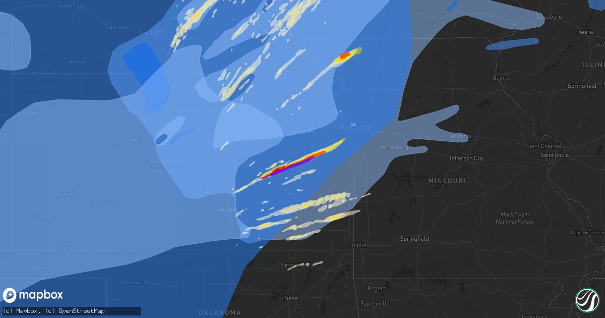
Hail Map on December 15, 2021
Get this storm
December 15 map
$229
one time, instant access
Download today. No call, no setup
Keep the $229
Bought the map and want the full workflow? Apply the entire $229 to a subscription within 7 days. None of it is wasted.
Every map, not just this one
This buys you this map. Subscription and you get every map we run, in the markets you choose from a few cities to whole states to nationwide. Plus real-time alerts the moment a storm fires.
Contact data
Name, contact info, occupancy, even credit band for addresses in the footprint. You go from where it hit to who to call.
Become the source they trust
Unlimited branding weather history reports on demand. You already have the documented answer ready for the property owner, and you are the one who showed up with it.
Property data and RoofTrace estimates
Pull up any address you have got, its value and the exact code rules for that jurisdiction, straight from One Click Code. Then RoofTrace estimates the squares, pitch, and roof value, priced the way you price.
States Impacted by Hail Map on December 15, 2021
Storm reports
Nebraska
| Date | Description |
|---|---|
| 12/15/20215:53 PM CST | Area bound by highway 31 & highway 75 between kennard and fort calhoun. Multiple large tree branches down... Roof blown off machine shed and 1 camper flipped over. |
| 12/15/20215:40 PM CST | Mesonet station ew0351 lincoln. |
| 12/15/20215:05 PM CST | Large trees uprooted... Roofs blown off outbuildings and lots of dust blowing d stop signs/highway signs blown over hwy 20 at knierim. |
| 12/15/20215:05 PM CST | Large trees uprooted... Roofs blown off outbuildings and lots of dust blowing up from kansas. |
| 12/15/20215:03 PM CST | Delayed report... Time estimated from radar. Report from mping: 3-inch tree limbs broken; power poles broken. |
| 12/15/20215:03 PM CST | Delayed report... Time estimated from radar. Report from mping: trees uprooted or snapped; roof blown off. |
| 12/15/20215:00 PM CST | Report of several large trees downed at the cemetery. |
| 12/15/20215:00 PM CST | Report of 2 trees uprooted. |
| 12/15/20214:44 PM CST | Roof blown off home. |
| 12/15/20214:41 PM CST | Residential building collapse. |
| 12/15/20214:41 PM CST | Corrects previous tstm wnd dmg report from 1 ssw omaha. Residential building collapse due to heavy tree falling on a house. |
| 12/15/20214:33 PM CST | Windows blown out and roof damage. Up from kansas. |
| 12/15/20214:33 PM CST | Windows blown out and roof damage. |
| 12/15/20214:30 PM CST | Large diameter trees down. |
| 12/15/20214:27 PM CST | Large diameter tree broken in half. |
| 12/15/20214:26 PM CST | Recorded at eppley airfield. |
| 12/15/20214:22 PM CST | A local report indicates 81 MPH wind near OFFUTT AFB |
| 12/15/20214:16 PM CST | Large limb crushed car. Fence down. |
| 12/15/20214:15 PM CST | Branches down more than 6 inches in diameter. |
| 12/15/20214:15 PM CST | Delayed report... Time estimated from radar. Report from mping: 3-inch tree limbs broken; power poles broken. |
| 12/15/20214:14 PM CST | Mesonet station up945 2.2 s murray |
| 12/15/20214:13 PM CST | Numerous large trees down and homes damaged. |
| 12/15/20214:13 PM CST | Delayed report... Time estimated from radar. Limbs down near 30th and harrison. |
| 12/15/20214:12 PM CST | Several large tree limbs down. |
| 12/15/20214:11 PM CST | Report from mping: 3-inch tree limbs broken; power poles broken. |
| 12/15/20214:10 PM CST | Electric pole blown down. Time estimated from radar. |
| 12/15/20214:10 PM CST | A local report indicates 70 MPH wind near ARLINGTON |
| 12/15/20214:10 PM CST | Lots of structure damage... Roof damage... Carports damaged. |
| 12/15/20214:08 PM CST | Roof blown away at beaver lake. |
| 12/15/20214:04 PM CST | Power lines down and thunderstorm wind damage along highway 92. |
| 12/15/20214:03 PM CST | A local report indicates 60 MPH wind near 1 WNW VALLEY |
| 12/15/20214:01 PM CST | Barn and grain bins destroyed. Trees snapped. Additional damage to trees and power lines across other parts of otoe county as well. |
| 12/15/20214:01 PM CST | Barn and grain bins destroyed. Trees snapped. Additional damage to trees and power lines across other parts of otoe county as well. |
| 12/15/20214:01 PM CST | Report from mping: 3-inch tree limbs broken; power poles broken. |
| 12/15/20214:00 PM CST | A local report indicates 66 MPH wind near 1 WNW FREMONT |
| 12/15/20213:59 PM CST | Tractor trailer blown over on its side. Numerous trees down in fremont. |
| 12/15/20213:59 PM CST | A local report indicates 75 MPH wind near 2 S TEKAMAH |
| 12/15/20213:57 PM CST | Roof blown off and power lines down in town. |
| 12/15/20213:57 PM CST | A local report indicates 81 MPH wind near 3 ESE LEWISTON |
| 12/15/20213:56 PM CST | A local report indicates 70 MPH wind near 3 WNW OTOE |
| 12/15/20213:56 PM CST | Delayed report... Time estimated from radar. Report from mping: 3-inch tree limbs broken; power poles broken. |
| 12/15/20213:56 PM CST | A local report indicates 70 MPH wind near 3 W OTOE |
| 12/15/20213:50 PM CST | Mesonet station nb075 memphis 4n. |
| 12/15/20213:49 PM CST | A local report indicates 90 MPH wind near EAGLE |
| 12/15/20213:46 PM CST | Delayed report... Time estimated from radar. Report from mping: 3-inch tree limbs broken; power poles broken. |
| 12/15/20213:46 PM CST | Delayed report... Time estimated from radar. Report from mping: trees uprooted or snapped; roof blown off. |
| 12/15/20213:44 PM CST | A local report indicates 92 MPH wind near BENNET |
| 12/15/20213:44 PM CST | General track beginning near co rd 14 & co rd a and track ended near co rd 11 & co rd e. |
| 12/15/20213:41 PM CST | Delayed report... Time estimated from radar. Report from mping: 3-inch tree limbs broken; power poles broken. |
| 12/15/20213:40 PM CST | Confirmed tornado by fire department. |
| 12/15/20213:40 PM CST | Almost 20' tree blown over and patio furniture tossed around near denton. |
| 12/15/20213:40 PM CST | Report of roof blown off apartment building. |
| 12/15/20213:37 PM CST | Delayed report... Time estimated from radar. Several large trees snapped or uprooted. No damage to buildings at the residence. |
| 12/15/20213:35 PM CST | Lost garage and a shed. |
| 12/15/20213:35 PM CST | Partial roof blown off. |
| 12/15/20213:35 PM CST | A local report indicates 86 MPH wind near 1 NNW BEATRICE |
| 12/15/20213:32 PM CST | Delayed report... Time estimated from radar. Report from mping: 3-inch tree limbs broken; power poles broken. |
| 12/15/20213:30 PM CST | A local report indicates 93 MPH wind near 4 NW LINCOLN |
| 12/15/20213:27 PM CST | Wind gust to 76 mph along with penny sized hail. |
| 12/15/20213:21 PM CST | From a personal weather station. |
| 12/15/20213:19 PM CST | Mesonet station up948 2.5 w schuyler |
| 12/15/20213:17 PM CST | Large tree down in front yard. Picture received via twitter. Report time based on radar. |
| 12/15/20213:15 PM CST | From personal weather station. |
| 12/15/20213:15 PM CST | From personal weather station. Llas ia 4164 9427 pws recorded 62 mph wind gusts. |
| 12/15/20213:14 PM CST | Delayed report... Time estimated from radar. Damage to outbuildings and barns in the plymouth area. |
| 12/15/20213:14 PM CST | A local report indicates 68 MPH wind near 1 NNE COLUMBUS |
| 12/15/20213:13 PM CST | Tornado on the ground. |
| 12/15/20213:09 PM CST | Power line down. |
| 12/15/20213:05 PM CST | A local report indicates 1.25 inch wind near COLUMBUS |
| 12/15/20213:04 PM CST | Emergency management reports roof off house after brief tornado spin-up. |
| 12/15/20213:04 PM CST | A local report indicates 1.25 inch wind near COLUMBUS |
| 12/15/20213:04 PM CST | Corrects previous tornado report from columbus. Emergency management reports roof off house after brief tornado spin-up. |
| 12/15/20213:02 PM CST | Delayed report. Numerous pivots overturned throughout the county. |
| 12/15/20213:01 PM CST | Roof torn off home. |
| 12/15/20213:00 PM CST | Wind strong enough to break limbs that are 2-3 inches. Hail was nickel size. |
| 12/15/20213:00 PM CST | A local report indicates 80 MPH wind near 2 WSW FAIRBURY |
| 12/15/20213:00 PM CST | A local report indicates 60 MPH wind near 1 NE GRESHAM |
| 12/15/20212:59 PM CST | Mesonet station at fairbury. |
| 12/15/20212:59 PM CST | Mesonet station ur416 hedriw. |
| 12/15/20212:56 PM CST | Semi truck blown over on highway 136. |
| 12/15/20212:55 PM CST | Power lines blown down. |
| 12/15/20212:55 PM CST | Semi blown over. |
| 12/15/20212:52 PM CST | Overturned 5th wheel trailer. |
| 12/15/20212:52 PM CST | A local report indicates 58 MPH wind near 1 W STROMSBURG |
| 12/15/20212:50 PM CST | Roof blown off home. |
| 12/15/20212:50 PM CST | Pivots overturned and barn damaged in area. Time estimated from radar. |
| 12/15/20212:48 PM CST | Pea sized hail with 60-70mph winds. |
| 12/15/20212:40 PM CST | Carport picked up by winds and blew it into some power lines. 3-4 inch limbs are down in town also. Blowing dust also dropping vis to 1/2sm. |
| 12/15/20212:37 PM CST | 2 large pine trees uprooted at the courthouse. |
| 12/15/20212:36 PM CST | Damage reported along and near highway 66 from 2 to 4 miles east of polk. Mainly numerous irrigation pivots and a few outbuildings. Time estimated from radar data. Unkn |
| 12/15/20212:34 PM CST | Delayed report via twitter. Complete loss of roof of shed. Small outbuilding destroyed. Time estimated from radar. |
| 12/15/20212:32 PM CST | A local report indicates 58 MPH wind near 4 N CENTRAL CITY |
| 12/15/20212:32 PM CST | Irrigation pivot damage. Time estimated from radar. |
| 12/15/20212:31 PM CST | Irrigation pivots overturned in the area of 25 and x road. Possible tornado damage but unconfirmed at this time. Time estimated from radar. |
| 12/15/20212:30 PM CST | Nws damage survey found preliminary ef-1 damage from a tornado that tracked from roughly 7 ssw of hordville to 2 n of polk. Additional information will be added once su |
| 12/15/20212:30 PM CST | Tornado picture on twitter. Location is approximate and pending survey. |
| 12/15/20212:30 PM CST | Delayed social media report of damage to powerlines and large trees and possibly a house roughly near road 21 and road b. Possible tornado damage but cannot be confirme |
| 12/15/20212:29 PM CST | A local report indicates 84 MPH wind near 2 W SHICKLEY |
| 12/15/20212:29 PM CST | A local report indicates 60 MPH wind near 6 WNW FULLERTON |
| 12/15/20212:28 PM CST | A local report indicates 83 MPH wind near 1 NNE DAVENPORT |
| 12/15/20212:25 PM CST | Delayed report. Photos received via facebook showing damage to pivots. Time estimated from radar and other nearby reports. |
| 12/15/20212:25 PM CST | Trees and powerlines down in sutton from estimated 80 mph winds. Time estimated from radar. |
| 12/15/20212:25 PM CST | Estimated 65 mph winds with windows blown out of vehicles on main street. Time estimated from radar. |
| 12/15/20212:23 PM CST | 70mph winds with heavy rains vis was 0 when rain hit. |
| 12/15/20212:23 PM CST | Report of pickup and trailer overturned on westbound i-80 east of locust exit. |
| 12/15/20212:23 PM CST | Powerlines down in town. Time estimated from radar. |
| 12/15/20212:19 PM CST | Reports of various wind damage in southwest part of aurora including large tree down... Stadium bleachers overturned... Some structural damage to various buildings. Tim |
| 12/15/20212:15 PM CST | A local report indicates 69 MPH wind near 2 NW SUPERIOR |
| 12/15/20212:15 PM CST | Nws damage survey found preliminary low end ef-1 tornado track that began east of giltner and ended in southwest side of aurora. |
| 12/15/20212:15 PM CST | Delayed report. Spotter network report of tornado causing damage in this area. Photos received via twitter support a possible tornado in this area. |
| 12/15/20212:14 PM CST | Tornado on the ground 1s of edgar per em. |
| 12/15/20212:11 PM CST | Estimated 80-90 mph winds. |
| 12/15/20212:10 PM CST | A local report indicates 85 MPH wind near GRAND ISLAND AIRPORT |
| 12/15/20212:07 PM CST | Spotter est 80-90mph wind gusts along hwy 281 and 13th st. Also reported pea to quarter sized hail. |
| 12/15/20212:00 PM CST | Damage to wood fence. Estimated gusts around 60-70 mph. |
| 12/15/20211:56 PM CST | Emergency management reported tornado within line...no other details at this time. |
| 12/15/20211:55 PM CST | Nws damage survey found preliminary ef-1 tornado track nw of hastings. |
| 12/15/20211:52 PM CST | A local report indicates 66 MPH wind near 3 NE AYR |
| 12/15/20211:50 PM CST | Report of semi overturned at highway 6 annd adams central. Time estimated from radar. |
| 12/15/20211:49 PM CST | Delayed report of power poles downed at marian road and cimarron road. Time estimated from radar. |
| 12/15/20211:40 PM CST | Home damaged at powerline road and south wanda avenue. Possible tornado damage but unknown at this time. Time estimated from radar. |
| 12/15/20211:40 PM CST | Fairly widespread damage in and around gibbon. Reports of roof damage... Especially in trailer park. Grain bin destroyed in town. Several pivots flipped north of town. |
| 12/15/20211:36 PM CST | A local report indicates 71 MPH wind near 5 NNE INAVALE |
| 12/15/20211:33 PM CST | Orrects previous non-tstm wnd gst report from 2 n watson. |
| 12/15/20211:33 PM CST | Delayed report of outbuilding damage and a flipped pivot. Time estimated from radar data. Possible tornado per radar data but not confirmed at this time. |
| 12/15/20211:33 PM CST | A local report indicates 64 MPH wind near 1 W HEARTWELL |
| 12/15/20211:31 PM CST | Ntv video of powerlines down near 11th st. And m ave. Time estimated from radar. |
| 12/15/20211:28 PM CST | A local report indicates 64 MPH wind near 8 SSE KEARNEY |
| 12/15/20211:25 PM CST | A local report indicates 61 MPH wind near 1 S MINDEN |
| 12/15/20211:15 PM CST | A local report indicates 60 MPH wind near HUNTLEY |
| 12/15/20211:15 PM CST | A local report indicates 72 MPH wind near 1 E WILCOX |
| 12/15/20211:15 PM CST | A local report indicates 66 MPH wind near HOLDREGE AIRPORT |
| 12/15/20211:11 PM CST | A local report indicates 76 MPH wind near 4 E RAGAN |
| 12/15/20211:00 PM CST | A local report indicates 77 MPH wind near 7 ESE OXFORD |
| 12/15/202112:59 PM CST | Wind damage in alma... Including tree limbs down... Some shingle and roof damage... Some small outbuildings destroyed and reports of power lines down. Time estimated fr |
| 12/15/202112:59 PM CST | A local report indicates 73 MPH wind near 4 SE OXFORD |
| 12/15/20216:54 AM CST | At 1250 PM CST, severe thunderstorms were located along a line extending from near Stamford to Phillipsburg to Plainville, moving northeast at 75 mph. HAZARD...70 mph wind gusts. SOURCE...Radar indicated. IMPACT...Expect considerable tree damage. Damage is likely to mobile homes, roofs, and outbuildings. Severe thunderstorms will be near... Phillipsburg, Agra and Stamford around 1255 PM CST. Stockton and Orleans around 100 PM CST. Woodston and Huntley around 105 PM CST. Atlanta, Naponee, Alton and Ragan around 110 PM CST.Other locations in the path of these severe thunderstorms includeHoldrege, Franklin, Wilcox, Bloomington, Axtell, Funk, Gaylord,Riverton, Harlan, Cedar, Smith Center, Upland, Athol, Campbell,Bladen and Bellaire. |
| 12/14/202110:54 PM CST | At 453 PM CST, severe thunderstorms were located along a line extending from 3 miles south of White Cloud to 4 miles southeast of Silver Lake, moving east at 50 mph. THESE ARE DESTRUCTIVE STORMS FOR warned area. HAZARD...80 mph wind gusts and nickel size hail. SOURCE...Radar indicated. IMPACT...Flying debris will be dangerous to those caught without shelter. Mobile homes will be heavily damaged. Expect considerable damage to roofs, windows, and vehicles. Extensive tree damage and power outages are likely. Locations impacted include... Northern Topeka, Holton, Hiawatha, Horton, Valley Falls, Oskaloosa, Tecumseh, Silver Lake, Perry, McLouth, Meriden, Hoyt, Ozawkie, Nortonville, Lecompton, Winchester, Mayetta, Everest, Robinson and Whiting.This includes Interstate 70 between mile markers 349 and 355. |
| 12/14/202110:33 PM CST | At 432 PM CST, severe thunderstorms were located along a line extending from near Falls City to 4 miles northwest of Dover, moving east at 60 mph. THESE ARE DESTRUCTIVE STORMS FOR the warned area. HAZARD...80 mph wind gusts and penny size hail. SOURCE...Radar indicated. IMPACT...Flying debris will be dangerous to those caught without shelter. Mobile homes will be heavily damaged. Expect considerable damage to roofs, windows, and vehicles. Extensive tree damage and power outages are likely. Locations impacted include... Northern Topeka, Holton, Hiawatha, Horton, Valley Falls, Oskaloosa, Silver Lake, Perry, McLouth, Meriden, Hoyt, Ozawkie, Nortonville, Winchester, Mayetta, Everest, Robinson, Whiting, Denison and Netawaka. |
| 12/14/20219:54 PM CST | At 354 PM CST, severe thunderstorms were located along a line extending from 3 miles southwest of Pawnee City to 8 miles northwest of Volland, moving east at 65 mph. THESE ARE DESTRUCTIVE STORMS FOR the warned area. HAZARD...80 mph wind gusts and nickel size hail. SOURCE...Radar indicated. IMPACT...Flying debris will be dangerous to those caught without shelter. Mobile homes will be heavily damaged. Expect considerable damage to roofs, windows, and vehicles. Extensive tree damage and power outages are likely. Locations impacted include... Wamego, Holton, Sabetha, Seneca, Rossville, Alma, Westmoreland, Blaine, St. Marys, Silver Lake, Onaga, St. George, Maple Hill, Centralia, Axtell, Wetmore, Fairview, McFarland, Morrill and Paxico.This includes Interstate 70 between mile markers 313 and 354. |
| 12/14/20219:19 PM CST | At 318 PM CST, severe thunderstorms were located along a line extending from near Odell to Chapman, moving east at 55 mph. THESE ARE DESTRUCTIVE STORMS FOR the warned area. HAZARD...80 mph wind gusts and nickel size hail. SOURCE...Radar indicated. IMPACT...Flying debris will be dangerous to those caught without shelter. Mobile homes will be heavily damaged. Expect considerable damage to roofs, windows, and vehicles. Extensive tree damage and power outages are likely. Locations impacted include... Manhattan, Junction City, Wamego, Marysville, Seneca, Blue Rapids, Westmoreland, Blaine, St. Marys, Ogden, Grandview Plaza, Wakefield, Riley, Frankfort, Onaga, Hanover, Waterville, St. George, Milford and Centralia.This includes Interstate 70 between mile markers 299 and 323. |
| 12/14/20219:09 PM CST | At 307 PM CST, severe thunderstorms were located along a line extending from 5 miles southwest of Creston to near David City, moving northeast at 70 mph. THESE ARE DESTRUCTIVE STORMS! HAZARD...80 mph wind gusts and ping pong ball size hail. SOURCE...Trained weather spotters and automated observations stations have reported overturned trucks and wind gusts of 60 to 85 mph with these storms. IMPACT...Flying debris will be dangerous to those caught without shelter. Mobile homes will be heavily damaged. Expect considerable damage to roofs, windows, and vehicles. Extensive tree damage and power outages are likely. Severe thunderstorms will be near... Leigh around 315 PM CST. Schuyler around 320 PM CST. Stanton around 325 PM CST.Other locations in the path of these severe thunderstorms includeNorth Bend, Wisner, Pilger, Scribner, Hooper, Pender and Uehling. |
| 12/14/20218:22 PM CST | At 221 PM CST, severe thunderstorms were located along a line extending from near Palmer to near Stockham, moving northeast at 65 mph. THESE ARE DESTRUCTIVE STORMS FOR FULLERTON, CENTRAL CITY, AURORA, STROMSBURG AND YORK. HAZARD...80 mph wind gusts and nickel size hail. SOURCE...Trained weather spotters. Wind gusts of 80 to 90 MPH have been reported with this line. IMPACT...Flying debris will be dangerous to those caught without shelter. Mobile homes will be heavily damaged. Expect considerable damage to roofs, windows, and vehicles. Extensive tree damage and power outages are likely. Severe thunderstorms will be near... Palmer around 225 PM CST. Fullerton and Bradshaw around 235 PM CST. Polk and Belgrade around 240 PM CST.Other locations in the path of these severe thunderstorms includeBenedict, Stromsburg, Osceola and Shelby.This includes Interstate 80 between mile markers 324 and 365. |
| 12/14/20218:19 PM CST | At 218 PM CST, severe thunderstorms were located along a line extending from 5 miles southeast of Greeley to 5 miles north of Palmer to near Stockham, moving northeast at 80 mph. THESE ARE DESTRUCTIVE STORMS FOR THE ENTIRE WARNED AREA. HAZARD...80 mph wind gusts. SOURCE...Trained weather spotters and observation stations have reported up to 85 mph winds. IMPACT...Flying debris will be dangerous to those caught without shelter. Mobile homes will be heavily damaged. Expect considerable damage to roofs, windows, and vehicles. Extensive tree damage and power outages are likely. Severe thunderstorms will be near... St. Edward around 240 PM CST. Newman Grove, Petersburg and Lindsay around 245 PM CST. Elgin around 250 PM CST. Duncan and Oakdale around 255 PM CST. Madison, Battle Creek, Bellwood and Meadow Grove around 300 PM CST. Norfolk and Columbus around 305 PM CST. Hadar around 310 PM CST.Other locations impacted by these severe thunderstorms includeLoretto, Octavia, Cornlea, College View Trailer Park, Humphrey,Tilden, Camp Pawnee, Shell Creek Elementary School, Richland and LakeNorth Babcock Campground. |
| 12/14/20217:21 PM CST | At 120 PM CST, severe thunderstorms were located along a line extending from 8 miles south of Elm Creek to near Hildreth to 10 miles south of Franklin, moving northeast at 85 mph. HAZARD...70 mph wind gusts. SOURCE...Trained weather spotters. IMPACT...Expect considerable tree damage. Damage is likely to mobile homes, roofs, and outbuildings. Severe thunderstorms will be near... Minden, Elm Creek and Odessa around 125 PM CST. Heartwell, Norman and Inavale around 130 PM CST. Kenesaw, Amherst and Riverdale around 135 PM CST. Gibbon, Shelton, Campbell, Pleasanton, Bladen and Prosser around 140 PM CST.Other locations in the path of these severe thunderstorms includeRavenna, Wood River, Blue Hill, Poole, Alda, Roseland, Ayr, Cairo,Glenvil, Rockville, Hastings, Ashton, Farwell, Inland, St. Libory andHansen.This includes Interstate 80 between mile markers 256 and 332. |
Minnesota
| Date | Description |
|---|---|
| 12/15/20214:00 AM CST | Spotter called in to report a 12 inch tree downed around 4am... In addition to a power outage overnight |
| 12/15/20212:16 AM CST | At 816 PM CST, severe thunderstorms were located along a line extending from 7 miles west of New Albin to near Aurora, moving northeast at 55 mph. HAZARD...70 mph wind gusts. SOURCE...Radar indicated. IMPACT...Expect considerable tree damage. Damage is likely to mobile homes, roofs, and outbuildings. Severe thunderstorms will be near... New Albin around 825 PM CST. Guttenberg and Garnavillo around 855 PM CST. Bloomington around 910 PM CST. Boscobel around 930 PM CST.Other locations impacted by these severe thunderstorms includeEastman, Giard, Turkey River, National, Retreat, Fargo and EffigyMounds. |
| 12/15/20211:29 AM CST | At 729 PM CST, severe thunderstorms were located along a line extending from Lime Springs to near Protivin to near Tripoli, moving northeast at 70 mph. HAZARD...70 mph wind gusts. SOURCE...Radar indicated. IMPACT...Expect considerable tree damage. Damage is likely to mobile homes, roofs, and outbuildings. Severe thunderstorms will be near... Spillville and Ridgeway around 740 PM CST. Hawkeye and Waucoma around 745 PM CST. Decorah and West Union around 750 PM CST. |
| 12/15/20211:18 AM CST | At 718 PM CST, severe thunderstorms were located along a line extending from near St. Peter to near Janesville to near New Richland, moving northeast at 55 mph. HAZARD...60 mph wind gusts. SOURCE...Radar indicated. IMPACT...Expect damage to roofs, siding, and trees. Severe thunderstorms will be near... Morristown around 730 PM CST. Warsaw around 735 PM CST.Other locations in the path of these severe thunderstorms includeOwatonna, Faribault, Dundas and Northfield. |
| 12/15/20211:07 AM CST | At 707 PM CST, severe thunderstorms were located along a line extending from near Kasota to St. Clair to near Freeborn, moving north at 60 mph. HAZARD...60 mph wind gusts. SOURCE...Radar indicated. IMPACT...Expect damage to roofs, siding, and trees. Severe thunderstorms will be near... North Mankato, St. Peter, Eagle Lake, Janesville and St. Clair around 710 PM CST. Madison Lake and Elysian around 715 PM CST. New Richland and Cleveland around 720 PM CST. Le Center around 725 PM CST.Other locations in the path of these severe thunderstorms includeWaseca. |
| 12/15/202112:40 AM CST | At 640 PM CST, severe thunderstorms were located along a line extending from near Amboy to 7 miles south of Bricelyn to Eagle Lake, moving northeast at 55 mph. HAZARD...60 mph wind gusts. SOURCE...Radar indicated. IMPACT...Expect damage to roofs, siding, and trees. Severe thunderstorms will be near... Bricelyn around 645 PM CST. Mansfield around 655 PM CST. Alden, Emmons and Conger around 700 PM CST.Other locations in the path of these severe thunderstorms includeTwin Lakes, Albert Lea, Clarks Grove, Hayward and Hollandale. |
| 12/15/202112:37 AM CST | At 636 PM CST, severe thunderstorms were located along a line extending from near Eagle Lake to near Sheffield to 7 miles southwest of Eldora, moving northeast at 75 mph. HAZARD...70 mph wind gusts. SOURCE...Radar indicated. IMPACT...Expect considerable tree damage. Damage is likely to mobile homes, roofs, and outbuildings. Severe thunderstorms will be near... Rockford and Marble Rock around 650 PM CST. Rudd around 655 PM CST. Charles City and Floyd around 700 PM CST. Riceville around 715 PM CST. Austin and Le Roy around 720 PM CST. Nashua, Brownsdale and Lime Springs around 725 PM CST. Ionia around 730 PM CST. New Hampton, Fredericksburg and Wykoff around 735 PM CST.Other locations impacted by these severe thunderstorms includeForestville State Park, Toeterville, Vernon Springs, Bradford,Chickasaw, County Roads T 54 And A 31 and Fillmore.This includes Interstate 90 in Minnesota between mile markers 175 and204. |
| 12/15/202112:30 AM CST | At 629 PM CST, severe thunderstorms were located along a line extending from near Easton to 9 miles north of Grinnell, moving northeast at 110 mph. HAZARD...70 mph wind gusts. SOURCE...Radar indicated. IMPACT...Expect considerable tree damage. Damage is likely to mobile homes, roofs, and outbuildings. Severe thunderstorms will be near... Toledo and Tama around 635 PM CST. Dysart around 645 PM CST.This includes the following highways... Interstate 35 between mile markers 178 and 218. Interstate 380 between mile markers 56 and 73. |
| 12/14/202111:52 PM CST | At 552 PM CST, severe thunderstorms were located along a line extending from near Swan Lake to near Slater, moving northeast at 85 mph. THESE ARE DESTRUCTIVE STORMS FOR portions of central and northern iowa. HAZARD...80 mph wind gusts. SOURCE...Radar indicated. IMPACT...Flying debris will be dangerous to those caught without shelter. Mobile homes will be heavily damaged. Expect considerable damage to roofs, windows, and vehicles. Extensive tree damage and power outages are likely. Severe thunderstorms will be near... Slater and Iowa State Center around 555 PM CST. Ames, Nevada and Huxley around 600 PM CST.Other locations in the path of these severe thunderstorms includeState Center.This includes Interstate 35 between mile markers 102 and 178. |
| 12/14/202111:25 PM CST | At 523 PM CST, severe thunderstorms were located along a line extending from near Jackson In Jackson County to 12 miles north of Dakota City, moving northeast at 80 mph. HAZARD...70 mph wind gusts. SOURCE...Radar indicated. IMPACT...Expect considerable tree damage. Damage is likely to mobile homes, roofs, and outbuildings. Severe thunderstorms will be near... Trimont around 535 PM CST.Other locations in the path of these severe thunderstorms include St.James, Truman, Lewisville, Madelia and Lake Crystal. |
| 12/14/202111:19 PM CST | At 518 PM CST, severe thunderstorms were located along a line extending from Sioux Rapids to near Coon Rapids, moving northeast at 80 mph. THESE ARE DESTRUCTIVE STORMS FOR portions of central Iowa. HAZARD...80 mph wind gusts. SOURCE...Radar indicated. IMPACT...Flying debris will be dangerous to those caught without shelter. Mobile homes will be heavily damaged. Expect considerable damage to roofs, windows, and vehicles. Extensive tree damage and power outages are likely. Severe thunderstorms will be near... Silver Lake and Rush Lake around 530 PM CST. Jefferson around 535 PM CST.Other locations in the path of these severe thunderstorms includeEmmetsburg and Five Island Lake. |
| 12/14/20218:26 PM CST | Power outages in numerous communities. |
| 12/14/20218:26 PM CST | Power outages in numerous communities |
| 12/14/20218:21 PM CST | Power outages reported. |
| 12/14/20218:19 PM CST | Personal weather station. |
| 12/14/20218:18 PM CST | Semi truck blown over at interstate 90 mile marker 252. |
| 12/14/20218:18 PM CST | Semi truck blown over at interstate 90 mile marker 252 |
| 12/14/20218:16 PM CST | Power pole broken. |
| 12/14/20218:14 PM CST | Farm outbuildings destroyed near stockton. Kttc twitter. Time estimated. |
| 12/14/20218:10 PM CST | Mature... Large pine tree down report via media on twitter. |
| 12/14/20218:10 PM CST | Wires down on the 4500 block of west branch road with time estimated based on radar. |
| 12/14/20218:10 PM CST | A local report indicates 85 MPH wind near PLAINVIEW |
| 12/14/20218:10 PM CST | Power outages reported. |
| 12/14/20218:10 PM CST | Power outages reported |
| 12/14/20218:09 PM CST | Buildings damaged along county highway 25. Time estimated. |
| 12/14/20218:05 PM CST | Large pole shed sustained extensive damage. Via kimt twitter. Time estimated. |
| 12/14/20218:05 PM CST | Significant house damage. |
| 12/14/20218:00 PM CST | Time estimated based on radar. Caller reports a large... 3-sided... Steel car port was blown from its place and flipped into her yard. The structure was open on the sou |
| 12/14/20217:59 PM CST | Tree reported down with time estimated based on radar. |
| 12/14/20217:59 PM CST | Possible tornado - car moved by strong winds. |
| 12/14/20217:59 PM CST | Corrects previous tstm wnd gst report from 2 sw elko new market. Personal weather station. |
| 12/14/20217:59 PM CST | Possible tornado - car moved by strong winds |
| 12/14/20217:58 PM CST | A local report indicates 84 MPH wind near MABEL |
| 12/14/20217:54 PM CST | Personal weather station. |
| 12/14/20217:54 PM CST | A local report indicates 60 MPH wind near ROCHESTER |
| 12/14/20217:53 PM CST | Report from mping: trees uprooted or snapped; roof blown off. |
| 12/14/20217:50 PM CST | Reports of widespread power outages |
| 12/14/20217:50 PM CST | Reports of widespread power outages. |
| 12/14/20217:45 PM CST | A local report indicates 84 MPH wind near HARMONY |
| 12/14/20217:45 PM CST | A local report indicates 78 MPH wind near ROCHESTER AIRPORT |
| 12/14/20217:45 PM CST | Damage south of preston along county road 22. Trees twisted... Approximately 50x80 shed lifted and cattle barns damaged. Time estimated. |
| 12/14/20217:45 PM CST | Mesonet station mn029 2 e kasson. |
| 12/14/20217:42 PM CST | Corrects previous tstm wnd gst report from 1 se dodge center. |
| 12/14/20217:40 PM CST | Trees uprooted and large branches blown down. Report via twitter. |
| 12/14/20217:40 PM CST | Roof blown off one side of an approximately 200 foot long livestock building. Report via twitter. Time estimated. |
| 12/14/20217:36 PM CST | Reports of power outages. |
| 12/14/20217:36 PM CST | Reports of power outages |
| 12/14/20217:35 PM CST | A local report indicates 79 MPH wind near ELKTON |
| 12/14/20217:35 PM CST | Mesonet station mn010 1 ene dexter. |
| 12/14/20217:34 PM CST | Roof completely blown off one side of a large building. Twitter report. Time estimated. |
| 12/14/20217:33 PM CST | A local report indicates 83 MPH wind near 3 S GRAND MEADOW |
| 12/14/20217:29 PM CST | A local report indicates 59 MPH wind near 1 W LE ROY |
| 12/14/20217:28 PM CST | Barn destroyed in le roy. Report via kttc twitter. Time estimated. |
| 12/14/20217:27 PM CST | Damage to barn/outbuilding. Report via kaal... Timing based on radar. |
| 12/14/20217:25 PM CST | A local report indicates 75 MPH wind near 1 WNW MORRISTOWN |
| 12/14/20217:22 PM CST | Automated weather observation from the austin airport. |
| 12/14/20217:22 PM CST | A local report indicates 70 MPH wind near 1 SE DODGE CENTER |
| 12/14/20217:22 PM CST | A local report indicates 60 MPH wind near AUSTIN |
| 12/14/20217:22 PM CST | . |
| 12/14/20217:09 PM CST | Heavy damage to a bank and several homes. Time estimated via radar. Possible tornado. |
| 12/14/20217:00 PM CST | A local report indicates 60 MPH wind near 4 SSW CONGER |
| 12/14/20217:00 PM CST | Report of trees down in the conger area. |
| 12/14/20216:59 PM CST | Power poles down with time estimated based on radar. |
| 12/14/20216:50 PM CST | Personal weather station. |
Colorado
| Date | Description |
|---|---|
| 12/15/20212:39 PM CST | Report from mping: 3-inch tree limbs broken; power poles broken. |
| 12/15/20212:34 PM CST | Report from mping: 3-inch tree limbs broken; power poles broken. |
| 12/15/202111:41 AM CST | Report from mping: 1-inch tree limbs broken. |
| 12/15/202111:35 AM CST | 1-inch tree limbs broken. |
| 12/15/202111:21 AM CST | Hwy 287 is closed from springfield to wiley due to crashes and power lines down. |
| 12/15/20219:19 AM CST | 1-inch tree limbs broken. |
| 12/15/20219:04 AM CST | Small tree limbs broken. |
| 12/15/20218:24 AM CST | A local report indicates 65 MPH wind near 5 NE BLENDE |
| 12/15/20211:22 AM CST | At 720 AM MST, a severe thunderstorm was located 16 miles south of Avondale, or 20 miles southeast of Pueblo, moving northeast at 65 mph. A wind gusts to 76 mph were observed at national weather service Pueblo. Lightning was indicated with this storm. HAZARD...80 mph wind gusts. SOURCE...Radar indicated. IMPACT...Flying debris will be dangerous to those caught without shelter. Mobile homes will be heavily damaged. Expect considerable damage to roofs, windows, and vehicles. Extensive tree damage and power outages are likely. This severe thunderstorm will be near... Fowler around 740 AM MST.Other locations in the path of this severe thunderstorm include OlneySprings. |
New Mexico
| Date | Description |
|---|---|
| 12/15/20217:30 AM CST | Large evergreen tree toppled outside of st francis cathedral. |
| 12/15/20217:25 AM CST | Tree damage at roundhouse. |
| 12/15/20217:15 AM CST | Radio tower downed... Taking out power lines for the northern half of town. Mobile home blown off foundation along with another one burned down. Several roofs blown off |
| 12/15/20217:11 AM CST | Ktcc asos.... Ksaf asos.... Ksaf asos. |
| 12/15/20217:11 AM CST | A local report indicates 70 MPH wind near 3 NNE LA CIENEGA |
| 12/15/20217:11 AM CST | Wind damage to parked aircraft at santa fe airport. |
Wisconsin
| Date | Description |
|---|---|
| 12/15/20214:45 AM CST | At 1045 PM CST, severe thunderstorms were located along a line extending from 10 miles northeast of Parrish to near Veterans Memorial County Park to 10 miles north of Wittenberg to 10 miles south of Bevent, moving northeast at 65 mph. HAZARD...70 mph wind gusts. SOURCE...Radar indicated. IMPACT...Expect considerable tree damage. Damage is likely to mobile homes, roofs, and outbuildings. Severe thunderstorms will be near... Antigo and Veterans Memorial County Park around 1050 PM CST. Ma Ka Ja Wan Scout Reservation and Pearson around 1055 PM CST. Crandon, Woodlawn and Neopit around 1100 PM CST. White Lake around 1105 PM CST.Other locations in the path of these severe thunderstorms includeGardner Dam Scout Camp, Mountain, Keshena, McCaslin Mountain NaturalArea, Big Smokey Falls, South Branch and Legend Lake. |
| 12/15/20214:17 AM CST | At 1016 PM CST, severe thunderstorms were located along a line extending from near Winslow to near Shannon, moving east at 50 mph. HAZARD...60 mph wind gusts. SOURCE...Radar indicated. IMPACT...Expect damage to roofs, siding, and trees. Severe thunderstorms will be near... Freeport around 1025 PM CST. German Valley around 1030 PM CST. Ridott around 1035 PM CST. |
| 12/15/20213:55 AM CST | At 954 PM CST, severe thunderstorms were located along a line extending from near Rib Lake to 15 miles east of Colby to near Babcock to near New Lisbon, moving northeast at 60 mph. HAZARD...70 mph wind gusts. SOURCE...Radar indicated. IMPACT...Expect considerable tree damage. Damage is likely to mobile homes, roofs, and outbuildings. Severe thunderstorms will be near... New Wood Wildlife Area around 1005 PM CST. Wausau, Wisconsin Rapids, Lake Wazeecha and Tripoli around 1010 PM CST.Other locations in the path of these severe thunderstorms include RibMountain, Tomahawk, Gilbert, Stevens Point, Whiting, Dutch Corners,Plainfield, Veterans Memorial County Park and Amherst. |
| 12/15/20213:45 AM CST | At 944 PM CST, severe thunderstorms were located along a line extending from near Benton to near Burgess, moving northeast at 55 mph. HAZARD...70 mph wind gusts. SOURCE...Radar indicated. IMPACT...Expect considerable tree damage. Damage is likely to mobile homes, roofs, and outbuildings. Severe thunderstorms will be near... Scales Mound around 950 PM CST. Apple River around 955 PM CST. Woodhull around 1000 PM CST.Other locations in the path of these severe thunderstorms includeAndover, Lynn Center, Cambridge, Kewanee, Atkinson, Annawan,Sheffield and Buda. |
| 12/15/20213:33 AM CST | At 933 PM CST, severe thunderstorms were located along a line extending from 11 miles west of Babcock to near Muscoda, moving northeast at 60 mph. HAZARD...60 mph wind gusts. SOURCE...Radar indicated. IMPACT...Expect damage to roofs, siding, and trees. These severe thunderstorms will remain over mainly rural areas of Juneau and Adams Counties, including the following locations... Johnson Hill, Big Spring and Highway 13 And County E.This includes Interstate 90/94 between mile markers 53 and 86. |
| 12/15/20213:28 AM CST | At 928 PM CST, severe thunderstorms were located along a line extending from near Thorp to near Loyal, moving northeast at 60 mph. HAZARD...60 mph wind gusts. SOURCE...Radar indicated. IMPACT...Expect damage to roofs, siding, and trees. Severe thunderstorms will be near... Colby around 935 PM CST. Abbotsford and Dorchester around 940 PM CST.Other locations impacted by these severe thunderstorms include CountyK And Capital Road, Curtiss, Sterling Avenue And Starks Road, Colby,Atwood, Withee and County O And Sterling Avenue. |
| 12/15/20213:28 AM CST | At 927 PM CST, severe thunderstorms were located along a line extending from near Tomah to 10 miles north of Boscobel to near Canton, moving northeast at 75 mph. HAZARD...60 mph wind gusts. SOURCE...Radar indicated. IMPACT...Expect damage to roofs, siding, and trees. Locations impacted include... Baraboo, Reedsburg, Dodgeville, Prairie Du Sac, Sauk City, Wisconsin Dells, Mineral Point, Darlington, Lake Delton, Spring Green, West Baraboo, Shullsburg, Belmont, Benton, Argyle, Blanchardville, Barneveld, Wiota, Highland and Arena. |
| 12/15/20213:17 AM CST | At 917 PM CST, severe thunderstorms were located along a line extending from near Cornell to 6 miles south of Loyal, moving northeast at 80 mph. HAZARD...60 mph wind gusts. SOURCE...Radar indicated. IMPACT...Expect damage to roofs, siding, and trees. Severe thunderstorms will be near... Rib Lake around 955 PM CST.Other locations impacted by these severe thunderstorms include WoodLake, Polley, The Mondeaux Flowage, Highway 13 And County Road M,Stetsonville, Perkinstown and County Roads A And E. |
| 12/15/20213:12 AM CST | At 911 PM CST, severe thunderstorms were located along a line extending from Balltown to near Fruitland, moving east at 55 mph. HAZARD...70 mph wind gusts. SOURCE...Radar indicated. IMPACT...Expect considerable tree damage. Damage is likely to mobile homes, roofs, and outbuildings. Severe thunderstorms will be near... Rickardsville, Sherrill and Balltown around 915 PM CST. Fairport and Illinois City around 930 PM CST.Other locations in the path of these severe thunderstorms includeBlue Grass, Andalusia, Taylor Ridge, Buffalo, Rock Island, Milan, OakGrove, Moline, Bettendorf, Riverdale, East Moline, Silvis, Colona,Coal Valley, Hampton, Le Claire, Port Byron, Rapids City, Clevelandand Osborn. |
| 12/15/20213:10 AM CST | At 910 PM CST, severe thunderstorms were located along a line extending from near New Auburn to 6 miles northwest of Cadott to 7 miles northeast of Fairchild, moving northeast at 70 mph. HAZARD...60 mph wind gusts. SOURCE...Radar indicated. IMPACT...Expect damage to roofs, siding, and trees. Severe thunderstorms will be near... Cornell around 920 PM CST. Weyerhaeuser around 925 PM CST. Bruce and Sheldon around 930 PM CST.Other locations in the path of these severe thunderstorms includeHawkins. |
| 12/15/20213:06 AM CST | At 905 PM CST, severe thunderstorms were located along a line extending from near Augusta to near Hatfield to Westby, moving northeast at 70 mph. HAZARD...70 mph wind gusts and quarter size hail. SOURCE...Radar indicated. IMPACT...Hail damage to vehicles is expected. Expect considerable tree damage. Wind damage is also likely to mobile homes, roofs, and outbuildings. Locations impacted include... Marshfield, Spencer, Abbotsford, Babcock and Pittsville. |
| 12/15/20213:05 AM CST | At 904 PM CST, severe thunderstorms were located along a line extending from near Bloomer to 7 miles south of Stanley to near Neillsville, moving northeast at 75 mph. HAZARD...60 mph wind gusts. SOURCE...Radar indicated. IMPACT...Expect damage to roofs, siding, and trees. Severe thunderstorms will be near... Thorp around 910 PM CST. Colby around 930 PM CST.Other locations impacted by these severe thunderstorms include CountyK And Capital Road, Mead Lake, Atwood, County O And Sterling Avenue,Eidsvold, Longwood and Curtiss. |
| 12/15/20212:31 AM CST | At 830 PM CST, severe thunderstorms were located along a line extending from near Eau Galle to 9 miles west of Independence to near Galesville, moving northeast at 65 mph. HAZARD...60 mph wind gusts. SOURCE...Radar indicated. IMPACT...Expect damage to roofs, siding, and trees. Severe thunderstorms will be near... Menomonie around 845 PM CST. Elk Mound around 850 PM CST.Other locations in the path of these severe thunderstorms includeColfax, Augusta, Fall Creek, Bloomer and Boyd. |
| 12/15/20212:24 AM CST | At 823 PM CST, severe thunderstorms were located along a line extending from 6 miles northwest of Modena to Galesville to 6 miles southwest of Stoddard, moving northeast at 75 mph. THESE ARE DESTRUCTIVE STORMS. HAZARD...80 mph wind gusts. SOURCE...Radar indicated. IMPACT...Flying debris will be dangerous to those caught without shelter. Mobile homes will be heavily damaged. Expect considerable damage to roofs, windows, and vehicles. Extensive tree damage and power outages are likely. Severe thunderstorms will be near... Coon Valley around 835 PM CST. West Salem around 840 PM CST. Bangor around 845 PM CST. Sparta around 850 PM CST. |
| 12/15/20212:09 AM CST | At 809 PM CST, severe thunderstorms were located along a line extending from near Prescott to near Bay City to near Pepin, moving northeast at 55 mph. HAZARD...60 mph wind gusts. SOURCE...Radar indicated. IMPACT...Expect damage to roofs, siding, and trees. Severe thunderstorms will be near... Pepin around 815 PM CST. Plum City around 820 PM CST. Durand and Elmwood around 825 PM CST.Other locations in the path of these severe thunderstorms includeBaldwin, Hammond, Eau Galle, Woodville, Menomonie, Glenwood City,Boyceville and Elk Mound. |
| 12/15/20211:48 AM CST | At 747 PM CST, severe thunderstorms were located along a line extending from near Webster to Kenyon to near Dodge Center, moving northeast at 50 mph. HAZARD...60 mph wind gusts. SOURCE...Radar indicated. IMPACT...Expect damage to roofs, siding, and trees. Severe thunderstorms will be near... Wanamingo around 755 PM CST. Pine Island around 805 PM CST.Other locations in the path of these severe thunderstorms includeGoodhue, Welch and Red Wing. |
| 12/14/202111:05 PM CST | Report from mping: 3-inch tree limbs broken; power poles broken. |
| 12/14/202110:50 PM CST | Power lines and trees down. Damage and power outages were reported along highway 8 from near crescent to pelican lake. |
| 12/14/202110:50 PM CST | Report from mping. |
| 12/14/202110:25 PM CST | Shingle and siding damage to home. Time estimated by radar. |
| 12/14/202110:23 PM CST | Several trees and power poles/lines down on county rd p at county rd j. Social media report from wsaw-tv. Time estimated. |
| 12/14/202110:14 PM CST | A local report indicates 69 MPH wind near WISCONSIN RAPIDS |
| 12/14/202110:10 PM CST | Several trees down in marathon city |
| 12/14/202110:10 PM CST | Power lines down in rewey... Dodgeville and cobb. Power out in barneveld. |
| 12/14/202110:10 PM CST | Tree fell through roof of house in town of stella. |
| 12/14/202110:06 PM CST | Report from mping: homes/buildings completely destroyed. |
| 12/14/202110:02 PM CST | Corrects previous tstm wnd gst report from lone rock. |
| 12/14/202110:02 PM CST | A local report indicates 76 MPH wind near LONE ROCK |
| 12/14/20219:55 PM CST | A local report indicates 62 MPH wind near 7 WNW SPRING GREEN |
| 12/14/20219:55 PM CST | A local report indicates 68 MPH wind near PLATTEVILLE |
| 12/14/20219:55 PM CST | A local report indicates 62 MPH wind near LONE ROCK |
| 12/14/20219:50 PM CST | Many trees and power lines reported down across the county... Especially the southern half. |
| 12/14/20219:44 PM CST | Several trees blown down. |
| 12/14/20219:44 PM CST | Several trees blown down |
| 12/14/20219:37 PM CST | Tree damage. Social media report from wsaw-tv |
| 12/14/20219:35 PM CST | A local report indicates 60 MPH wind near PLATTEVILLE |
| 12/14/20219:34 PM CST | A local report indicates 60 MPH wind near DICKEYVILLE |
| 12/14/20219:32 PM CST | A local report indicates 62 MPH wind near 2 N VIOLA |
| 12/14/20219:30 PM CST | Power lines blown down. |
| 12/14/20219:30 PM CST | Power lines blown down |
| 12/14/20219:28 PM CST | Multiple large trees were uprooted and fell on structures and vehicles in tomah. One caused a gas line rupture. Many other reports of trees and power lines down across |
| 12/14/20219:24 PM CST | Trees and power lines down across roads... Debris from damage roof. |
| 12/14/20219:24 PM CST | 18 inch diameter pine tree down. Time estimated from radar. |
| 12/14/20219:21 PM CST | Photos relayed by local tv meteorologist of large pine trees down from the main storm. Time estimated by radar. |
| 12/14/20219:21 PM CST | Power lines across road... Tree damage... Debris from damaged roof. |
| 12/14/20219:19 PM CST | Windows blown out... Roofs removed from sheds. |
| 12/14/20219:18 PM CST | Reports of multiple trees down and damage to structures per stanley police department facebook page. Time estimated from radar. |
| 12/14/20219:15 PM CST | A local report indicates 62 MPH wind near 5 S VIROQUA |
| 12/14/20219:15 PM CST | A local report indicates 69 MPH wind near VIROQUA |
| 12/14/20219:15 PM CST | A local report indicates 70 MPH wind near LONGWOOD |
| 12/14/20219:11 PM CST | Door overhands damaged |
| 12/14/20219:11 PM CST | Door overhands damaged. |
| 12/14/20219:03 PM CST | A local report indicates 63 MPH wind near BAGLEY |
| 12/14/20219:00 PM CST | Official wind gust observation from keau. |
| 12/14/20218:51 PM CST | Trees down. |
| 12/14/20218:51 PM CST | House damaged |
| 12/14/20218:51 PM CST | House damaged. |
| 12/14/20218:50 PM CST | Report of multiple branches down... Hard to determine size in the darkness. |
| 12/14/20218:47 PM CST | Reports of trees down within town. |
| 12/14/20218:45 PM CST | Reports of few trees down in town. |
| 12/14/20218:30 PM CST | A local report indicates 1.25 inch wind near 4 NE NEW AMSTERDAM |
| 12/14/20218:26 PM CST | Mesonet station fw3090 trempealeau. |
| 12/14/20218:20 PM CST | Power lines down. |
| 12/14/20218:20 PM CST | Considerable number of trees blown down in the trempealeau wildlife refuge. Estimates of 50 to 100 in the vicinity of the visitors center alone. |
Kansas
| Date | Description |
|---|---|
| 12/15/20215:55 PM CST | Delayed report. |
| 12/15/20215:54 PM CST | Tree on house near 83rd and corliss rd... De soto ks. Time estimated via radar. |
| 12/15/20215:52 PM CST | Report via social media. Time estimated via radar. |
| 12/15/20215:50 PM CST | Several outbuildings with roofs blown off. Time estimated via radar. |
| 12/15/20215:48 PM CST | Merriam police report multiple trees and power lines down. Time estimated from radar and social media. |
| 12/15/20215:47 PM CST | A local report indicates 61 MPH wind near 1 WSW CHANUTE |
| 12/15/20215:46 PM CST | Corrects previous tstm wnd dmg report from neodesha. Report from mping: 3-inch tree limbs broken; power poles broken. |
| 12/15/20215:45 PM CST | Delayed report: large tree around 1 ft in diameter snapped. |
| 12/15/20215:42 PM CST | Report of power line down by tree and on fire. Time estimated via radar. |
| 12/15/20215:40 PM CST | Lwc asos. |
| 12/15/20215:37 PM CST | Report of power line down and wrapped around trampoline. Emergency responders en route. No injuries reported. |
| 12/15/20215:37 PM CST | Delayed report: mesonet station up091 1.9 e williamstown |
| 12/15/20215:35 PM CST | Roof off of trailer. |
| 12/15/20215:35 PM CST | Delayed report: awos station kowi ottawa. |
| 12/15/20215:35 PM CST | Delayed public report. Small branches down in the area... Around 1-2 inches in diameter. Many heavy... Unsecured outdoor objects have been blown around. Power lines als |
| 12/15/20215:31 PM CST | Relayed by emergency management... Several storm spotters reporting 70 mph winds. |
| 12/15/20215:30 PM CST | Power lines down near mt. Olivet road and 179th. Law enforcement responding. Time estimated via radar. |
| 12/15/20215:30 PM CST | Em report of pea size hail and heavy rain with 70 mph winds. |
| 12/15/20215:25 PM CST | A local report indicates 64 MPH wind near 14 NW NEWTON |
| 12/15/20215:24 PM CST | Em reports 1-inch hail at 4104 delaware rd near pomona. Time estimated from radar. |
| 12/15/20215:22 PM CST | A local report indicates 1.75 inch wind near QUENEMO |
| 12/15/20215:20 PM CST | Delayed report. |
| 12/15/20215:20 PM CST | Multiple power poles down... Tree damage across city. |
| 12/15/20215:18 PM CST | Large tree completely across 122nd road one-half mile east of k4 highway. |
| 12/15/20215:17 PM CST | Multiple power poles down... Large barn blown down at topeka and union st. Time estimated from radar. |
| 12/15/20215:16 PM CST | Delayed report: mesonet station fw2032 valley falls. |
| 12/15/20215:15 PM CST | Delayed report from mping: 3-inch tree limbs broken; power poles broken. |
| 12/15/20215:15 PM CST | Roof damage to building at 294th and kingman. |
| 12/15/20215:15 PM CST | A local report indicates 80 MPH wind near 3 NW PERRY |
| 12/15/20215:15 PM CST | Damage to a power pole at 286th and neosho. |
| 12/15/20215:14 PM CST | Delayed report: mesonet station k5006 i-470 bridge over us-75. |
| 12/15/20215:04 PM CST | Asos station ktop topeka. |
| 12/15/20215:04 PM CST | Delayed report from mping: 3-inch tree limbs broken; power poles broken. |
| 12/15/20215:00 PM CST | Delayed report from mping: 3-inch tree limbs broken; power poles broken. |
| 12/15/20215:00 PM CST | Apricot-sized hail. |
| 12/15/20215:00 PM CST | Corrects previous tstm wnd gst report from matfield green. |
| 12/15/20214:56 PM CST | A local report indicates 65 MPH wind near 6 NNW NEOSHO RAPIDS |
| 12/15/20214:55 PM CST | Several power poles snapped. |
| 12/15/20214:55 PM CST | A local report indicates 66 MPH wind near 2 N EUREKA |
| 12/15/20214:54 PM CST | Delayed report from mping: 1-inch tree limbs broken; shingles blown off. |
| 12/15/20214:53 PM CST | Golf ball sized hail reported at fanestil original plant on k-99. Time estimated from radar. |
| 12/15/20214:53 PM CST | Asos station kemp emporia. |
| 12/15/20214:52 PM CST | Delayed report from mping: quarter |
| 12/15/20214:51 PM CST | Tennis-ball size hail reported at i-35/r1 east of emporia. Time estimated from radar. |
| 12/15/20214:50 PM CST | Delayed report from mping: 1-inch tree limbs broken; shingles blown off. |
| 12/15/20214:49 PM CST | Quarter sized hail. |
| 12/15/20214:48 PM CST | A local report indicates 62 MPH wind near 2 N EUREKA |
| 12/15/20214:47 PM CST | Softball-sized hail reported at mile marker 137 off i-35. Time estimated from radar. |
| 12/15/20214:45 PM CST | Delayed report of a metal pole barn blown down and completely destroyed. |
| 12/15/20214:43 PM CST | A local report indicates 70 MPH wind near 5 WNW MAYETTA |
| 12/15/20214:41 PM CST | Delayed report from mping: 1-inch tree limbs broken; shingles blown off. |
| 12/15/20214:40 PM CST | A local report indicates 74 MPH wind near 5 N EL DORADO |
| 12/15/20214:30 PM CST | Blown-over semi at mile marker 183 on us-81. Delayed report. |
| 12/15/20214:30 PM CST | Tree limbs down and light poles knocked over. Delayed report. Time estimated by radar. |
| 12/15/20214:20 PM CST | A local report indicates 70 MPH wind near 4 S CORNING |
| 12/15/20214:15 PM CST | A local report indicates 75 MPH wind near 6 SSE SAINT GEORGE |
| 12/15/20214:08 PM CST | Roofs peeling off buildings... Side of metal building got blown out. |
| 12/15/20214:04 PM CST | Delayed report from mping: 3-inch tree limbs broken; power poles broken. |
| 12/15/20214:00 PM CST | Blown-over semi at mile marker 165 on us-81. Delayed report. |
| 12/15/20213:58 PM CST | A local report indicates 66 MPH wind near 4 ENE NEWTON |
| 12/15/20213:58 PM CST | Delayed report from mping: trees uprooted or snapped; roof blown off. |
| 12/15/20213:53 PM CST | 7 inch tree limb down. 70 mph winds. |
| 12/15/20213:53 PM CST | Delayed report. Resident in east manhattan shared pictures via social media of large tree branches down. Also reported roof shingles blown off. Time estimated. |
| 12/15/20213:52 PM CST | Asos station kmhk manhattan. |
| 12/15/20213:49 PM CST | Em reports severe damage. Motel roof blown off and into other buildings... Power outages. Time estimated from radar. |
| 12/15/20213:47 PM CST | Metal signs bent... Siding off buildings... Damage to hangers at junction city airport. |
| 12/15/20213:46 PM CST | Report from mping: 3-inch tree limbs broken; power poles broken. |
| 12/15/20213:45 PM CST | Social media post showed half of 12 inch diameter tree blown down. |
| 12/15/20213:43 PM CST | Trees down. |
| 12/15/20213:40 PM CST | Report from mping: trees uprooted or snapped; roof blown off. |
| 12/15/20213:39 PM CST | Awos station kfri ft riley marshal. |
| 12/15/20213:32 PM CST | A local report indicates 64 MPH wind near ELLSWORTH |
| 12/15/20213:26 PM CST | 1-ft diameter tree snapped... Visibility 1 1/2 miles. |
| 12/15/20213:22 PM CST | A local report indicates 59 MPH wind near LYONS |
| 12/15/20213:18 PM CST | Metal grain bins damaged; time estimated. |
| 12/15/20213:14 PM CST | Dead trees knocked over... 12 inch diameter. |
| 12/15/20213:02 PM CST | Two 8 inch limbs are down. |
| 12/15/20213:00 PM CST | Mesonet station ew5822 clay center. |
| 12/15/20212:56 PM CST | A local report indicates 75 MPH wind near MILTONVALE |
| 12/15/20212:56 PM CST | Pea sized hail... 8in diameter tree down... 0 visibility from blowing dust and dirt. |
| 12/15/20212:55 PM CST | Report from mping: 3-inch tree limbs broken; power poles broken. |
| 12/15/20212:54 PM CST | A local report indicates 82 MPH wind near 3 SSW SALINA |
| 12/15/20212:47 PM CST | Corrects previous tstm wnd dmg report from 3 wsw bennington. Blown-over semi at mile marker 165 on us-81. Delayed report. Time corrected based on radar data. |
| 12/15/20212:45 PM CST | Tin roof rolled back on building... 6 inch tree limbs down... And fence down. |
| 12/15/20212:40 PM CST | Corrects previous tstm wnd dmg report from minneapolis. Power lines and transformers down. Time estimated from radar. |
| 12/15/20212:40 PM CST | A local report indicates 70 MPH wind near CULVER |
| 12/15/20212:40 PM CST | Sustained at 50kts as well. |
| 12/15/20212:40 PM CST | Power lines and transformers down. Time estimated from radar. |
| 12/15/20212:40 PM CST | Mesonet station k5cnc us-81 @ republican r. Concordia. |
| 12/15/20212:35 PM CST | A local report indicates 75 MPH wind near 2 SSE CONCORDIA |
| 12/15/20212:34 PM CST | A local report indicates 60 MPH wind near 1 S GLENDALE |
| 12/15/20212:34 PM CST | Corrects previous tstm wnd dmg report from 5 e delphos. Blown-over semi at mile marker 183 on us-81. Delayed report. Corrected time based off of radar. |
| 12/15/20212:32 PM CST | 4 inch tree limbs down. |
| 12/15/20212:31 PM CST | A local report indicates 67 MPH wind near 2 SSE CONCORDIA |
| 12/15/20212:31 PM CST | Corrects previous tstm wnd gst report from 2 sse concordia. |
| 12/15/20212:28 PM CST | Large ash tree down. Bent metal basketball pole in half. |
| 12/15/20212:19 PM CST | Power line with transformer down leaning in lincoln center at 5th and lost st. Railroad crossing arm snapped. Scattered reports of fallen smaller tree limbs. |
| 12/15/20212:00 PM CST | Delayed report of tree damage via em photo. Time estimated from radar. |
| 12/15/20211:55 PM CST | A local report indicates 70 MPH wind near ELLINWOOD |
| 12/15/20211:51 PM CST | A local report indicates 58 MPH wind near 6 N SYLVAN GROVE |
| 12/15/20211:46 PM CST | Very poor visibility noted as well. |
| 12/15/20211:40 PM CST | Reports of some tree limbs down and a couple touching houses. No wind speed estimate given. Time was estimated from radar. |
| 12/15/20211:00 PM CST | A local report indicates 80 MPH wind near 8 NNE CODELL |
| 12/15/20211:00 PM CST | A local report indicates 80 MPH wind near WOODRUFF |
| 12/15/202112:55 PM CST | A local report indicates 66 MPH wind near 8 SSE GLADE |
| 12/15/202112:32 PM CST | Report from mping: 1-inch tree limbs broken; shingles blown off. |
| 12/15/202112:05 PM CST | Report from mping: 1-inch tree limbs broken; shingles blown off. |
| 12/15/20212:10 AM CST | At 809 PM CST, a severe thunderstorm was located 4 miles southeast of Pawhuska, moving east at 55 mph. Another severe thunderstorm was located 4 miles southwest of Copan...also moving east at 55 mph. HAZARD...60 mph wind gusts and penny size hail. SOURCE...Radar indicated. IMPACT...Expect damage to roofs, siding, and trees. Locations in or near the path include... Bartlesville... Nowata... Pawhuska... Dewey... Barnsdall... Copan... Wynona... Ochelata... Delaware... Lenapah... Wann... Bartlesville Municipal Airport... Osage Hills State Park... Okesa... Tallant... Pershing... Nelagoney... |
| 12/15/202112:15 AM CST | At 614 PM CST, severe thunderstorms were located along a line extending from near Cameron to 6 miles northwest of Kearney to near Claycomo, moving northeast at 70 mph. HAZARD...70 mph wind gusts. SOURCE...Radar indicated. IMPACT...Expect considerable tree damage. Damage is likely to mobile homes, roofs, and outbuildings. Locations impacted include... Kansas City, Liberty, Gladstone, Excelsior Springs, Cameron, Chillicothe, Smithville, Kearney, Richmond, Lexington, North Kansas City, Carrollton, Sugar Creek, Riverside, Lawson, Lathrop, Hamilton, Claycomo, Kansas City Kansas and Pleasant Valley.This includes the following highways... Interstate 70 in Missouri between mile markers 0 and 1. Interstate 70 in Kansas between mile markers 421 and 423. Interstate 35 in Missouri between mile markers 5 and 55. Interstate 29 between mile markers 0 and 3. Interstate 635 near mile marker 12. Interstate 435 between mile markers 40 and 56. |
| 12/15/202112:06 AM CST | At 606 PM CST, severe thunderstorms were located along a line extending from near Iola to 6 miles northeast of Longton to Cedar Vale, moving east at 50 mph. HAZARD...60 mph wind gusts and nickel size hail. SOURCE...Radar indicated. IMPACT...Expect damage to roofs, siding, and trees. Locations impacted include... Parsons, Coffeyville, Independence, Chanute, Iola, Neodesha, Fredonia, Cherryvale, Caney, Humboldt, Oswego, Erie, Chetopa, Sedan, Altamont, St. Paul, Cedar Vale, La Harpe, Gas and Moran. |
| 12/14/202111:57 PM CST | At 556 PM CST, severe thunderstorms were located along a line extending from 4 miles northwest of Eudora to near Vinland to 4 miles southeast of Pomona, moving northeast at 55 mph. HAZARD...60 mph wind gusts and penny size hail. SOURCE...Radar indicated. IMPACT...Expect damage to roofs, siding, and trees. Locations impacted include... Eastern Lawrence, Ottawa, Baldwin City, Eudora, Wellsville and Vinland.This includes Interstate 35 between mile markers 187 and 198. |
| 12/14/202111:54 PM CST | At 553 PM CST, severe thunderstorms were located along a line extending from near Rantoul to 5 miles west of Colony, moving east at 70 mph. HAZARD...70 mph wind gusts and quarter size hail. SOURCE...Emergency management. IMPACT...Hail damage to vehicles is expected. Expect considerable tree damage. Wind damage is also likely to mobile homes, roofs, and outbuildings. Locations impacted include... Garnett, Burlington, Waverly, Richmond, Colony, Williamsburg, New Strawn, Greeley, Princeton, Lane, Westphalia, Kincaid, Lone Elm, Harris and Le Roy.This includes Interstate 35 between mile markers 161 and 170. |
| 12/14/202111:42 PM CST | At 540 PM CST, a severe thunderstorm was located 5 miles northwest of Princeton, moving east at 45 mph. HAZARD...70 mph wind gusts. SOURCE...Emergency management. Widespread wind damage has been reported with these storms. IMPACT...Expect considerable tree damage. Damage is likely to mobile homes, roofs, and outbuildings. Locations impacted include... Ottawa, Quenemo, Melvern and Rantoul. This includes Interstate 35 between mile markers 170 and 186. |
| 12/14/202111:24 PM CST | At 521 PM CST, severe thunderstorms were located along a line extending from 3 miles west of Tonganoxie to 3 miles north of Pleasant Grove to near Pomona, moving east at 55 mph. THESE ARE DESTRUCTIVE STORMS! HAZARD...80 mph wind gusts and ping pong ball size hail. SOURCE...Emergency management. Emergency Management reported 80 mph winds at Lake Perry 515 PM. IMPACT...Flying debris will be dangerous to those caught without shelter. Mobile homes will be heavily damaged. Expect considerable damage to roofs, windows, and vehicles. Extensive tree damage and power outages are likely. Locations impacted include... Lawrence, Ottawa, Baldwin City, Tecumseh, Eudora, Richland, Wellsville, Overbrook, Lyndon, Centropolis, Perry, Pomona, Lecompton, Clinton, Quenemo, Lone Star, Pleasant Grove, Vinland, Williamstown and Pomona Lake.This includes the following highways... Interstate 35 between mile markers 187 and 198. Kansas Turnpike between mile markers 184 and 205. |
| 12/14/202111:22 PM CST | At 521 PM CST, severe thunderstorms were located along a line extending from near Madison to 10 miles west of Severy, moving east at 55 mph. HAZARD...70 mph wind gusts. SOURCE...Radar indicated. IMPACT...Expect considerable tree damage. Damage is likely to mobile homes, roofs, and outbuildings. Locations impacted include... Eureka, Yates Center, Madison, Howard, Moline, Longton, Toronto, Hamilton, Severy, Fall River, Neosho Falls, Elk Falls, Climax, Virgil, New Albany, Coyville, Eureka City Lake, Buxton, Eureka Airport and Rose. |
| 12/14/202111:15 PM CST | At 513 PM CST, severe thunderstorms were located along a line extending from 4 miles northwest of Lebo to 4 miles east of Madison, moving east at 60 mph. THESE ARE DESTRUCTIVE STORMS! HAZARD...80 mph wind gusts and quarter size hail. SOURCE...Emergency management. Multiple damage reports have been reported with these storms. IMPACT...Flying debris will be dangerous to those caught without shelter. Mobile homes will be heavily damaged. Expect considerable damage to roofs, windows, and vehicles. Extensive tree damage and power outages are likely. Locations impacted include... Garnett, Burlington, Lebo, Waverly, Richmond, Colony, Williamsburg, New Strawn, Hartford, Gridley, Greeley, Princeton, Lane, Westphalia, Kincaid, Lone Elm, Beto Junction, Harris, John Redmond Reservoir and Le Roy.This includes Interstate 35 between mile markers 144 and 171. |
| 12/14/202111:12 PM CST | At 511 PM CST, severe thunderstorms were located along a line extending from near Braddyville to 6 miles southeast of Maitland to near Denton, moving northeast at 75 mph. THESE ARE DESTRUCTIVE STORMS FOR NORTHERN MISSOURI WITH REPORTS OF 80 TO 90 MPH WINDS.. HAZARD...80 mph wind gusts and penny size hail. SOURCE...Trained weather spotters. IMPACT...Flying debris will be dangerous to those caught without shelter. Mobile homes will be heavily damaged. Expect considerable damage to roofs, windows, and vehicles. Extensive tree damage and power outages are likely. Locations impacted include... St. Joseph, Maryville, Cameron, Savannah, Bethany, Gallatin, Albany, Wathena, Elwood, Stanberry, Maysville, Troy, Country Club Villa, Country Club, King City, Grant City, Stewartsville, Agency, Burlington Junction and Hopkins.This includes the following highways... Interstate 35 in Missouri between mile markers 56 and 113. Interstate 29 between mile markers 40 and 73. Interstate 229 between mile markers 0 and 14. |
| 12/14/202111:09 PM CST | At 508 PM CST, a severe thunderstorm was located near Melvern Lake, moving east at 70 mph. HAZARD...Two inch hail and 70 mph wind gusts. SOURCE...Trained weather spotters. Spotters reported two inch hail east of Emporia at 500 PM. IMPACT...People and animals outdoors will be injured. Expect hail damage to roofs, siding, windows, and vehicles. Expect considerable tree damage. Wind damage is also likely to mobile homes, roofs, and outbuildings. Locations impacted include... Ottawa, Wellsville, Pomona, Quenemo, Melvern, Rantoul, Olivet and Melvern Lake.This includes Interstate 35 between mile markers 171 and 198. |
| 12/14/202110:57 PM CST | At 457 PM CST, severe thunderstorms were located along a line extending from 5 miles south of Douglass to near South Haven, moving east at 30 mph. HAZARD...70 mph wind gusts. SOURCE...Radar indicated. IMPACT...Expect considerable tree damage. Damage is likely to mobile homes, roofs, and outbuildings. Locations impacted include... Arkansas City, Winfield, Oxford, Udall, Cedar Vale, Burden, South Haven, Dexter, Grenola, Atlanta, Geuda Springs, Rock, Cambridge, Hunnewell, Maple City, Winfield City Lake and Strother Field Airport.This includes Interstate 35 between Mile Markers 1 and 20. |
| 12/14/202110:53 PM CST | At 451 PM CST, severe thunderstorms were located along a line extending from Topeka to 3 miles southeast of Auburn to 4 miles northeast of Reading, moving east at 60 mph. THESE ARE DESTRUCTIVE STORMS! HAZARD...80 mph wind gusts. SOURCE...Trained weather spotters. These storms have produced widespread wind damage and winds around 80 mph. IMPACT...Flying debris will be dangerous to those caught without shelter. Mobile homes will be heavily damaged. Expect considerable damage to roofs, windows, and vehicles. Extensive tree damage and power outages are likely. Locations impacted include... Topeka, Lawrence, Ottawa, Baldwin City, Osage City, Carbondale, Tecumseh, Eudora, Richland, Wellsville, Dover, Auburn, Overbrook, Lyndon, Centropolis, Burlingame, Perry, Pomona, Scranton and Lecompton.This includes the following highways... Interstate 35 between mile markers 187 and 198. Interstate 70 between mile markers 349 and 355. Kansas Turnpike between mile markers 143 and 205. |
| 12/14/202110:43 PM CST | At 442 PM CST, severe thunderstorms were located along a line extending from near Hiawatha to near Willis to near Holton, moving northeast at 85 mph. THESE ARE DESTRUCTIVE STORMS FOR parts of northeastern Kansas and north western Missouri. HAZARD...80 mph wind gusts. SOURCE...Trained weather spotters. IMPACT...Flying debris will be dangerous to those caught without shelter. Mobile homes will be heavily damaged. Expect considerable damage to roofs, windows, and vehicles. Extensive tree damage and power outages are likely. Locations impacted include... St. Joseph, Atchison, Savannah, Wathena, Elwood, Highland, Troy, Country Club Villa, Country Club, Agency, Effingham, Dearborn, Amazonia, Rushville, Lancaster, Muscotah, Denton, Lewis And Clark Village, Doniphan and Easton.This includes the following highways... Interstate 29 between mile markers 28 and 60. Interstate 229 between mile markers 0 and 14. |
| 12/14/202110:35 PM CST | At 434 PM CST, severe thunderstorms were located along a line extending from near Americus to 16 miles northwest of Hamilton, moving east at 60 mph. THESE ARE DESTRUCTIVE STORMS! HAZARD...80 mph wind gusts. SOURCE...Trained weather spotters. Spotters have reported widespread wind damage and winds in excess of 80 mph with these storms. IMPACT...Flying debris will be dangerous to those caught without shelter. Mobile homes will be heavily damaged. Expect considerable damage to roofs, windows, and vehicles. Extensive tree damage and power outages are likely. Locations impacted include... Emporia, Burlington, Lebo, Americus, Olpe, New Strawn, Melvern, Hartford, Gridley, Neosho Rapids, Reading, Olivet, Beto Junction, John Redmond Reservoir and Melvern Lake.This includes the following highways... Interstate 35 between mile markers 128 and 162. Kansas Turnpike between mile markers 117 and 138. |
| 12/14/202110:20 PM CST | At 418 PM CST, severe thunderstorms were located along a line extending from 4 miles northwest of McFarland to 5 miles east of Alta Vista to 7 miles west of Dunlap, moving east at 50 mph. THESE ARE DESTRUCTIVE STORMS! HAZARD...80 mph wind gusts. SOURCE...Trained weather spotters. Spotters have reported wind damage and winds in excess of 80 mph with these storms. IMPACT...Flying debris will be dangerous to those caught without shelter. Mobile homes will be heavily damaged. Expect considerable damage to roofs, windows, and vehicles. Extensive tree damage and power outages are likely. Locations impacted include... Topeka, Osage City, Council Grove, Alma, Eskridge, Dover, Auburn, Burlingame, Harveyville, Allen, Admire, Bushong, Dunlap, Pauline and Keene.This includes the following highways... Interstate 70 between mile markers 346 and 355. Kansas Turnpike between mile markers 137 and 182. |
| 12/14/202110:11 PM CST | At 410 PM CST, severe thunderstorms were located along a line extending from 8 miles southeast of Burdick to near Eastborough, moving east at 55 mph. HAZARD...70 mph wind gusts. SOURCE...Trained weather spotters. IMPACT...Expect considerable tree damage. Damage is likely to mobile homes, roofs, and outbuildings. Locations impacted include... Wichita, Derby, El Dorado, Andover, Haysville, Augusta, Park City, Valley Center, Bel Aire, Mulvane, Rose Hill, Douglass, Towanda, Cottonwood Falls, Benton, Whitewater, Leon, Madison, Strong City and Downtown Wichita.This includes the following highways... Interstate 135 between Mile Markers 0 and 20. Interstate 35 between Mile Markers 34 and 115. |
| 12/14/202110:03 PM CST | At 402 PM CST, severe thunderstorms were located along a line extending from near Plattsmouth to near Nebraska City to 6 miles east of Summerfield, moving northeast at 90 mph. THESE ARE DESTRUCTIVE STORMS FOR FAR NORTHWESTERN MISSOURI. HAZARD...80 mph wind gusts and nickel size hail. SOURCE...Trained weather spotters. IMPACT...Flying debris will be dangerous to those caught without shelter. Mobile homes will be heavily damaged. Expect considerable damage to roofs, windows, and vehicles. Extensive tree damage and power outages are likely. Locations impacted include... Maryville, Savannah, Tarkio, Mound City, Highland, Rock Port, Oregon, Fairfax, Burlington Junction, Hopkins, Ravenwood, Maitland, Skidmore, Forest City, Craig, Fillmore, White Cloud, Barnard, Conception Junction and Sheridan.This includes Interstate 29 between mile markers 61 and 123. |
| 12/14/20219:39 PM CST | At 339 PM CST, severe thunderstorms were located along a line extending from near Junction City to 5 miles north of Woodbine to 3 miles southwest of Herington, moving east at 45 mph. THESE ARE DESTRUCTIVE STORMS! HAZARD...80 mph wind gusts. SOURCE...Radar indicated. IMPACT...Flying debris will be dangerous to those caught without shelter. Mobile homes will be heavily damaged. Expect considerable damage to roofs, windows, and vehicles. Extensive tree damage and power outages are likely. Locations impacted include... Junction City, Council Grove, Grandview Plaza, White City, Alta Vista, Dwight, Wilsey, Parkerville, Latimer, Council Grove Lake, Volland and Burdick.This includes Interstate 70 between mile markers 293 and 299, andbetween mile markers 325 and 326. |
| 12/14/20219:35 PM CST | At 333 PM CST, severe thunderstorms were located along a line extending from 5 miles northeast of Prague to 5 miles north of Oketo, moving east at 65 mph. THESE ARE DESTRUCTIVE STORMS. HAZARD...80 mph wind gusts and penny size hail. SOURCE...Radar indicated. IMPACT...Flying debris will be dangerous to those caught without shelter. Mobile homes will be heavily damaged. Expect considerable damage to roofs, windows, and vehicles. Extensive tree damage and power outages are likely. Locations impacted include... Pawnee City, Kennard, Table Rock, Blair, Humboldt, Fort Calhoun, Missouri Valley, Modale, Stella, Shubert, Logan and Persia.This includes the following highways... Interstate 29 between mile markers 1 and 84. Interstate 80 in Iowa between mile markers 1 and 27. Interstate 80 in Nebraska between mile markers 432 and 454. |
| 12/14/20219:10 PM CST | At 310 PM CST, severe thunderstorms were located along a line extending from 6 miles south of Gypsum to Moundridge, moving east at 45 mph. HAZARD...70 mph wind gusts. SOURCE...Radar indicated. IMPACT...Expect considerable tree damage. Damage is likely to mobile homes, roofs, and outbuildings. Locations impacted include... Newton, Hesston, Hillsboro, Halstead, Marion, North Newton, Moundridge, Sedgwick, Peabody, Canton, Florence, Goessel, Walton, Burns, Lincolnville, Ramona, Lehigh, Durham, Tampa and Lost Springs.This includes Interstate 135 between Mile Markers 23 and 49. |
| 12/14/20219:00 PM CST | At 259 PM CST, severe thunderstorms were located along a line extending from 3 miles northeast of Niles to near Gypsum to 7 miles east of Lindsborg, moving northeast at 45 mph. THESE ARE DESTRUCTIVE STORMS! HAZARD...80 mph wind gusts. SOURCE...Trained weather spotters. WInds around Salina have gusted over 80 mph. IMPACT...Flying debris will be dangerous to those caught without shelter. Mobile homes will be heavily damaged. Expect considerable damage to roofs, windows, and vehicles. Extensive tree damage and power outages are likely. Locations impacted include... Abilene, Herington, Chapman, Solomon, Enterprise, Hope, Woodbine, Carlton and Moonlight.This includes Interstate 70 between mile markers 267 and 292. |
| 12/14/20218:54 PM CST | At 253 PM CST, severe thunderstorms were located along a line extending from 5 miles southeast of Stromsburg to Mahaska, moving northeast at 65 mph. THESE ARE DESTRUCTIVE STORMS. HAZARD...80 mph wind gusts and penny size hail. SOURCE...Radar indicated. IMPACT...Flying debris will be dangerous to those caught without shelter. Mobile homes will be heavily damaged. Expect considerable damage to roofs, windows, and vehicles. Extensive tree damage and power outages are likely. Locations impacted include... Beatrice, Pickrell, Cedar Bluffs, Fremont, Inglewood, Arlington and Sterling.This includes Interstate 80 in Nebraska between mile markers 397 and432. |
| 12/14/20218:42 PM CST | At 240 PM CST, severe thunderstorms were located along a line extending from 5 miles north of Hubbell to near Agenda to 4 miles east of Culver, moving northeast at 60 mph. THESE ARE DESTRUCTIVE STORMS! HAZARD...80 mph wind gusts. SOURCE...Trained weather spotters. IMPACT...Flying debris will be dangerous to those caught without shelter. Mobile homes will be heavily damaged. Expect considerable damage to roofs, windows, and vehicles. Extensive tree damage and power outages are likely. Locations impacted include... Clay Center, Minneapolis, Washington, Wakefield, Clyde, Hanover, Bennington, Clifton, Miltonvale, Linn, Greenleaf, Morganville, Barnes, Cuba, Morrowville, Green, Culver, Wells, Palmer and Haddam. |
| 12/14/20218:26 PM CST | At 225 PM CST, severe thunderstorms were located along a line extending from Hordville to 4 miles northwest of Deshler, moving northeast at 85 mph. HAZARD...70 mph wind gusts. SOURCE...Radar indicated. IMPACT...Expect considerable tree damage. Damage is likely to mobile homes, roofs, and outbuildings. Locations impacted include... Friend, Dorchester, Crete, Milford, Pleasant Dale and northwestern Lincoln.This includes Interstate 80 in Nebraska between mile markers 366 and395. |
| 12/14/20218:12 PM CST | At 211 PM CST, severe thunderstorms were located along a line extending from 6 miles south of Barnard to near Alden, moving northeast at 55 mph. HAZARD...70 mph wind gusts. SOURCE...Radar indicated. IMPACT...Expect considerable tree damage. Damage is likely to mobile homes, roofs, and outbuildings. Locations impacted include... Salina, Mcpherson, Lindsborg, Moundridge, Inman, Galva, Canton, Marquette, Assaria, Gypsum, Brookville, Smolan, Windom, New Cambria, Falun, Glendale, Salina Airport, Mcpherson Airport, Roxbury and Bridgeport.This includes the following highways... Interstate 135 between Mile Markers 43 and 95. Interstate 70 between Mile Markers 236 and 266. |
| 12/14/20218:08 PM CST | At 207 PM CST, severe thunderstorms were located along a line extending from Ashton to near Giltner to near Bostwick, moving northeast at 85 mph. HAZARD...70 mph wind gusts and nickel size hail. SOURCE...Trained weather spotters. IMPACT...Expect considerable tree damage. Damage is likely to mobile homes, roofs, and outbuildings. Severe thunderstorms will be near... Grand Island, Giltner, Phillips and Farwell around 210 PM CST. Aurora, Nelson, Chapman, Elba and Cotesfield around 215 PM CST. Marquette, Ruskin, Oak and Nora around 220 PM CST. Central City, Greeley, Davenport, Wolbach and Hordville around 225 PM CST.Other locations in the path of these severe thunderstorms includeClarks, Polk, Carleton, Spalding, Shickley, Bruning, Strang, Geneva,Osceola, Silver Creek, Ohiowa and Milligan.This includes Interstate 80 between mile markers 313 and 365. |
| 12/14/20217:57 PM CST | At 154 PM CST, severe thunderstorms were located along a line extending from 3 miles southwest of Lawrence to near Mankato to 9 miles south of Lincoln, moving east at 55 mph. THESE ARE DESTRUCTIVE STORMS! HAZARD...80 mph wind gusts. SOURCE...Radar indicated. IMPACT...Flying debris will be dangerous to those caught without shelter. Mobile homes will be heavily damaged. Expect considerable damage to roofs, windows, and vehicles. Extensive tree damage and power outages are likely. Locations impacted include... Concordia, Minneapolis, Belleville, Clyde, Bennington, Miltonvale, Glasco, Scandia, Delphos, Tescott, Jamestown, Courtland, Cuba, Norway, Culver, Wells, Republic, Munden, Narka and Agenda. |
| 12/14/20217:33 PM CST | At 131 PM CST, severe thunderstorms were located along a line extending from near Luray to near Great Bend, moving northeast at 50 mph. THIS LINE OF STORMS IS PRODUCING DESTRUCTIVE WINDS! HAZARD...80 TO 90 mph wind gusts. SOURCE...Radar indicated. IMPACT...You are in a life-threatening situation. Flying debris may be deadly to those caught without shelter. Mobile homes will be heavily damaged or destroyed. Homes and businesses will have substantial roof and window damage. Expect extensive tree damage and power outages. Locations impacted include... Great Bend, Russell, Lyons, Ellsworth, Hoisington, Sterling, Ellinwood, Wilson, Claflin, Kanopolis, Lincoln, Little River, Chase, Holyrood, Lucas, Gorham, Bushton, Sylvan Grove, Geneseo and Pawnee Rock.This includes Interstate 70 between Mile Markers 176 and 235. |
| 12/14/20217:24 PM CST | At 123 PM CST, severe thunderstorms were located along a line extending from 8 miles southwest of Riverton to near Luray, moving east at 55 mph. HAZARD...70 mph wind gusts. SOURCE...Trained weather spotters. IMPACT...Expect considerable tree damage. Damage is likely to mobile homes, roofs, and outbuildings. Locations impacted include... Hunter, Victor and Webber. |
| 12/14/20217:13 PM CST | Storm caused roof damage to a home on locust rd east of fort scott. Home lost shingles and had gutter damage. |
| 12/14/20217:02 PM CST | Report from mping: 1-inch tree limbs broken; shingles blown off. |
| 12/14/20216:51 PM CST | Three inch tree limbs broken; power poles broken. Via mping. |
| 12/14/20216:40 PM CST | A power pole and four inch tree limbs down in mapleton. |
| 12/14/20216:37 PM CST | Lots of trees downed between iola and humboldt on 1100. Winds estimated between 60-70 mph. |
| 12/14/20216:30 PM CST | Delayed report...70mph winds... A large tree knocked down... And two power poles down due to thunderstorm wind gusts. Moran was still without power in spots this mornin |
| 12/14/20216:30 PM CST | North of town on us160. |
| 12/14/20216:28 PM CST | A local report indicates 60 MPH wind near MATFIELD GREEN |
| 12/14/20216:27 PM CST | Zero visibility. |
| 12/14/20216:24 PM CST | A local report indicates 70 MPH wind near 4 W ALTOONA |
| 12/14/20216:22 PM CST | A local report indicates 68 MPH wind near IOLA AIRPORT (KK88) |
| 12/14/20216:01 PM CST | Tree on house near w 67th st and nieman rd. Time estimated via radar. |
| 12/14/20216:01 PM CST | A local report indicates 70 MPH wind near COLONY |
| 12/14/20216:01 PM CST | Delayed report: large tree fell on a house causing roof damage. |
Illinois
| Date | Description |
|---|---|
| 12/15/20213:48 AM CST | At 948 PM CST, severe thunderstorms were located along a line extending from near Quincy Regional Airport to near Williamsburg, moving east at 50 mph. HAZARD...60 mph wind gusts. SOURCE...Radar indicated. IMPACT...Expect damage to roofs, siding, and trees. Severe thunderstorms will be near... Montgomery City, New Florence and Buckhorn around 1005 PM CST.Other locations in the path of these severe thunderstorms includeMount Sterling, Buell, Bellflower and Davis.This includes the following highways... Interstate 72 between exits 10 and 35. Interstate 70 in Missouri between exits 161 and 170.This also includes Graham Cave State Park and Siloam Springs StatePark. |
| 12/15/20213:22 AM CST | At 922 PM CST, a severe thunderstorm was located near Quincy, moving northeast at 60 mph. HAZARD...60 mph wind gusts. SOURCE...Radar indicated. IMPACT...Expect damage to roofs, siding, and trees. This severe thunderstorm will be near... Camp Point and Golden around 940 PM CST.This includes Interstate 172 between exits 10 and 19. |
| 12/15/20213:09 AM CST | At 908 PM CST, severe thunderstorms were located along a line extending from near Warren to near Ashland, moving east at 55 mph. HAZARD...60 mph wind gusts. SOURCE...Radar indicated. IMPACT...Expect damage to roofs, siding, and trees. Severe thunderstorms will be near... Palmyra around 920 PM CST. Hannibal around 925 PM CST.Other locations in the path of these severe thunderstorms includeFulton, Fall Creek, Payson, Williamsburg and Shamrock.This includes the following highways... Interstate 172 between exits 2 and 10. Interstate 72 between exits 4 and 10. Interstate 70 in Missouri between exits 131 and 161.This also includes Mark Twain Lake Recreational Area. |
| 12/15/20212:50 AM CST | At 850 PM CST, severe thunderstorms were located along a line extending from near Morley to near Mount Pleasant, moving northeast at 65 mph. HAZARD...70 mph wind gusts. SOURCE...Trained weather spotters. IMPACT...Expect considerable tree damage. Damage is likely to mobile homes, roofs, and outbuildings. Severe thunderstorms will be near... Morning Sun around 905 PM CST. Amber around 910 PM CST.Other locations in the path of these severe thunderstorms includeOakville, Toolesboro and New Boston. |
| 12/15/20212:18 AM CST | At 817 PM CST, severe thunderstorms were located along a line extending from near Richland to Granger, moving east at 55 mph. HAZARD...70 mph wind gusts. SOURCE...Radar indicated. IMPACT...Expect considerable tree damage. Damage is likely to mobile homes, roofs, and outbuildings. Locations impacted include... Fort Madison, Keokuk, Fairfield, Mount Pleasant, Kahoka, Nauvoo, Hamilton, New London, Warsaw, Winfield, West Point, Donnellson, Montrose, Wayland, Birmingham, Bonaparte, Salem, Stockport, Lockridge and Olds. |
| 12/15/20212:01 AM CST | At 800 PM CST, severe thunderstorms were located along a line extending from 7 miles southeast of Greentop to near Keytesville, moving east at 65 mph. HAZARD...70 mph wind gusts. SOURCE...Radar indicated. IMPACT...Expect considerable tree damage. Damage is likely to mobile homes, roofs, and outbuildings. Severe thunderstorms will be near... Greensburg around 810 PM CST.Other locations in the path of these severe thunderstorms includeMadison, Woodlawn, Maud, Granville and Shelbina.This also includes Wakonda State Park, Union Covered Bridge HistoricSite, and Mark Twain Lake Recreational Area. |
| 12/14/202110:30 PM CST | Spotter report a ten inch diameter tree uprooted against a house. |
| 12/14/20219:49 PM CST | 68 mph measured wind gust. |
| 12/14/20219:42 PM CST | Quincy regional baldwin field. |
| 12/14/20219:29 PM CST | Large tree down. |
| 12/14/20219:26 PM CST | 1 to 2 ft diameter trees down. |
Missouri
| Date | Description |
|---|---|
| 12/15/20215:17 PM CST | Golf ball sized hail reported on south main street. Power lines and trees down in town. Reported by law enforcement relayed by emergency management. |
| 12/15/20215:17 PM CST | Debris in the roadway and light poles down. Time estimated from radar. |
| 12/15/20215:13 PM CST | Delayed report. A few windows blown out of a home. |
| 12/15/20215:12 PM CST | Damage to outbuildings reported. |
| 12/15/20214:51 PM CST | Trained spotter reported 90 mph winds relayed by law enforcement. |
| 12/15/20214:51 PM CST | Trained spotter reported 90 mph winds relayed by law enforcement. |
| 12/15/20214:48 PM CST | Trained spotter reported 70 mph winds relayed to us by law enforcement. |
| 12/15/20214:37 PM CST | Corrects previous non-tstm wnd gst report from 1 w tarkio. Trained spotter report. |
| 12/15/20214:27 PM CST | Corrects previous non-tstm wnd gst report from 2 n watson. |
| 12/15/20214:27 PM CST | Cwsw pella marion ia 4140 9295 peak wind gust from kpea. |
| 12/15/20211:01 PM CST | Report from mping: 3-inch tree limbs broken; power poles broken. |
| 12/15/20212:53 AM CST | At 853 PM CST, severe thunderstorms were located along a line extending from near Cotter to 9 miles southwest of Wayland, moving east at 50 mph. HAZARD...70 mph wind gusts. SOURCE...Radar indicated. IMPACT...Expect considerable tree damage. Damage is likely to mobile homes, roofs, and outbuildings. Locations impacted include... Burlington, Fort Madison, Keokuk, Carthage, Oquawka, Nauvoo, West Burlington, Hamilton, Warsaw, Mediapolis, La Harpe, Dallas City, Danville, Stronghurst, Bowen, Middletown, Carman, Gladstone, Terre Haute and West Point. |
| 12/15/20212:34 AM CST | At 833 PM CST, severe thunderstorms were located along a line extending from near Kinross to Memphis, moving northeast at 55 mph. HAZARD...70 mph wind gusts. SOURCE...Radar indicated. IMPACT...Expect considerable tree damage. Damage is likely to mobile homes, roofs, and outbuildings. Severe thunderstorms will be near... Kinross around 840 PM CST. |
| 12/15/20212:34 AM CST | At 834 PM CST, severe thunderstorms were located along a line extending from near Higbee to near Tipton, moving east at 55 mph. HAZARD...60 mph wind gusts. SOURCE...Radar indicated. IMPACT...Expect damage to roofs, siding, and trees. Severe thunderstorms will be near... Madison around 850 PM CST.Other locations in the path of these severe thunderstorms includeJamestown, Paris, Easley, Ashland and Columbia Regional Airport.This includes Interstate 70 in Missouri between exits 115 and 148. This also includes Rock Bridge State Park, Finger Lakes State Park,Union Covered Bridge Historic Site, Jewell Cemetery Historic Site,and Mark Twain Lake Recreational Area. |
| 12/15/20212:25 AM CST | At 825 PM CST, severe thunderstorms were located along a line extending from near Huntsville to near Fayette to near Pilot Grove to near Otterville, moving northeast at 80 mph. HAZARD...60 mph wind gusts. SOURCE...Radar indicated. IMPACT...Expect damage to roofs, siding, and trees. Locations impacted include... Moberly, Boonville, Fayette, Huntsville, New Franklin, Pilot Grove, Higbee, Otterville, Bunceton, Clark, Cairo, Armstrong, Prairie Home, Renick, Jacksonville, Franklin, Wooldridge and Lamine.This includes Interstate 70 in Missouri between mile markers 94 and114. |
| 12/15/20211:42 AM CST | At 742 PM CST, severe thunderstorms were located along a line extending from 11 miles southwest of Appleton City to Schell City to near Walker, moving northeast at 65 mph. HAZARD...60 mph wind gusts. SOURCE...Radar indicated. IMPACT...Expect damage to roofs, siding, and trees. Locations impacted include... Truman Lake... Appleton City... Osceola... Lowry City... Roscoe... Tiffin... Johnson City... Taberville... Iconium... Monegaw Springs... |
| 12/15/20211:31 AM CST | At 730 PM CST, severe thunderstorms were located along a line extending from near Oskaloosa to 11 miles southeast of Centerville, moving east at 40 mph. HAZARD...70 mph wind gusts and penny size hail. SOURCE...Radar indicated. IMPACT...Expect considerable tree damage. Damage is likely to mobile homes, roofs, and outbuildings. Locations impacted include... Fairfield, Sigourney, Memphis, Keosauqua, Hedrick, What Cheer, Richland, Batavia, Birmingham, Milton, Delta, Libertyville, Maharishi Vedic City, Keswick, Cantril, South English, Packwood, Harper, Martinsburg and Rutledge. |
| 12/15/20211:09 AM CST | At 708 PM CST, severe thunderstorms were located along a line extending from near Grinnell to 11 miles west of Unionville, moving east at 65 mph. HAZARD...70 mph wind gusts. SOURCE...Radar indicated. IMPACT...Expect considerable tree damage. Damage is likely to mobile homes, roofs, and outbuildings. Locations impacted include... Ottumwa, Oskaloosa, Pella, Grinnell, Knoxville, Centerville, Albia, Bloomfield, Montezuma, Brooklyn, New Sharon, Eddyville, Ottumwa Industrial Airport, Rock Creek Lake, Lake Sundown, Rathbun Lake, Lake Red Rock, Eldon, Victor and Sully.This includes Interstate 80 between mile markers 170 and 204. |
| 12/15/20211:08 AM CST | At 707 PM CST, severe thunderstorms were located along a line extending from near Wellington to near Kingsville to near Rich Hill, moving northeast at 80 mph. HAZARD...70 mph wind gusts. SOURCE...Radar indicated. IMPACT...Expect considerable tree damage. Damage is likely to mobile homes, roofs, and outbuildings. Locations impacted include... Sedalia, Warrensburg, Marshall, Clinton, Boonville, Odessa, Higginsville, Lexington, Butler, Windsor, Knob Noster, Fayette, Concordia, Holden, Slater, Garden City, Sweet Springs, Rich Hill, Glasgow and Whiteman Air Force Base.This includes Interstate 70 in Missouri between mile markers 35 and115. |
| 12/15/20211:08 AM CST | At 707 PM CST, severe thunderstorms were located along a line extending from near Fulton to near Redfield to near Galesburg, moving east at 60 mph. HAZARD...60 mph wind gusts and penny size hail. SOURCE...Radar indicated. IMPACT...Expect damage to roofs, siding, and trees. Locations impacted include... Pittsburg... Prairie State Park... Nevada... Fort Scott... Lamar... Frontenac... Girard... Arma... Marmaton... Liberal... Sheldon... Mulberry... Mindenmines... Franklin... Montevallo... Arcadia... Walker... Schell City... Bronaugh... Walnut... This includes Interstate 49 between mile markers 66 and 107. |
| 12/15/202112:43 AM CST | At 642 PM CST, severe thunderstorms were located along a line extending from Lee's Summit to Raymore to near Drexel, moving northeast at 80 mph. HAZARD...70 mph wind gusts. SOURCE...Radar indicated. IMPACT...Expect considerable tree damage. Damage is likely to mobile homes, roofs, and outbuildings. Locations impacted include... Lee's Summit, Belton, Raymore, Warrensburg, Harrisonville, Pleasant Hill, Greenwood, Peculiar, Knob Noster, Holden, Lake Lotawana, Garden City, Whiteman Air Force Base, Lake Winnebago, Lone Jack, Leeton, Freeman, Chilhowee, East Lynne and Kingsville. |
| 12/15/202112:35 AM CST | At 634 PM CST, a severe thunderstorm was located over Levasy, or near Buckner, moving east at 65 mph. HAZARD...70 mph wind gusts. SOURCE...Radar indicated. IMPACT...Expect considerable tree damage. Damage is likely to mobile homes, roofs, and outbuildings. Locations impacted include... Independence, Blue Springs, Grain Valley, Oak Grove, Odessa, Higginsville, Lexington, Buckner, Concordia, Lake Lotawana, Waverly, Wellington, Corder, Alma, Sibley, Blackburn, Mayview, Levasy, Lake Lafayette and Emma.This includes Interstate 70 in Missouri between mile markers 20 and62. |
| 12/15/202112:16 AM CST | At 615 PM CST, a severe thunderstorm was located over Humboldt, moving east at 65 mph. HAZARD...60 mph wind gusts and quarter size hail. SOURCE...Radar indicated. IMPACT...Hail damage to vehicles is expected. Expect wind damage to roofs, siding, and trees. Locations impacted include... Nevada... Fort Scott... Marmaton... Bronson... Uniontown... Walker... Bronaugh... Fulton... Redfield... Moundville... Richards... Milo... Mapleton... Deerfield... Metz... Stotesbury... Harding... Petersburg... Porterville... Xenia... This includes Interstate 49 between mile markers 79 and 107. |
| 12/15/202112:11 AM CST | At 610 PM CST, severe thunderstorms were located along a line extending from near Osawatomie to near Kincaid to Humboldt, moving east at 60 mph. HAZARD...70 mph wind gusts. SOURCE...Radar indicated. IMPACT...Expect considerable tree damage. Damage is likely to mobile homes, roofs, and outbuildings. Locations impacted include... Lee's Summit, Grandview, Belton, Raymore, Harrisonville, Pleasant Hill, Paola, Spring Hill, Greenwood, Peculiar, Osawatomie, Louisburg, Butler, Adrian, Garden City, Rich Hill, Pleasanton, La Cygne, Mound City and Archie. |
| 12/15/202112:00 AM CST | At 559 PM CST, a severe thunderstorm was located near Olathe, moving east at 60 mph. HAZARD...Two inch hail and 70 mph wind gusts. SOURCE...Trained weather spotters. IMPACT...People and animals outdoors will be injured. Expect hail damage to roofs, siding, windows, and vehicles. Expect considerable tree damage. Wind damage is also likely to mobile homes, roofs, and outbuildings. Locations impacted include... Kansas City, Overland Park, Olathe, Independence, Lee's Summit, Shawnee, Blue Springs, Lenexa, Leawood, Raytown, Grandview, Belton, Prairie Village, Raymore, Gardner, Grain Valley, Merriam, Mission, Pleasant Hill and Spring Hill.This includes the following highways... Interstate 70 in Missouri between mile markers 1 and 29. Interstate 35 in Missouri between mile markers 0 and 4. Interstate 35 in Kansas between mile markers 211 and 235. Interstate 635 between mile markers 0 and 2. Interstate 470 between mile markers 0 and 16. Interstate 435 between mile markers 0 and 8, and between milemarkers 57 and 83. |
| 12/14/202111:31 PM CST | At 531 PM CST, a severe thunderstorm was located near Ottawa, moving northeast at 70 mph. HAZARD...70 mph wind gusts and ping pong ball size hail. SOURCE...Trained weather spotters. IMPACT...People and animals outdoors will be injured. Expect hail damage to roofs, siding, windows, and vehicles. Expect considerable tree damage. Wind damage is also likely to mobile homes, roofs, and outbuildings. Locations impacted include... Overland Park, Olathe, Shawnee, Lenexa, Leawood, Prairie Village, Gardner, Merriam, Mission, Bonner Springs, De Soto, Paola, Spring Hill, Edwardsville, Louisburg, Fairway, Mission Hills, Edgerton, Westwood and Lake Quivira.This includes the following highways... Interstate 35 in Kansas between mile markers 200 and 230. Interstate 635 near mile marker 0. Interstate 435 between mile markers 0 and 7, and between milemarkers 76 and 83. |
| 12/14/202111:22 PM CST | At 522 PM CST, severe thunderstorms were located along a line extending from near Lake Icaria to 6 miles northwest of Ravenwood, moving northeast at 85 mph. HAZARD...70 mph wind gusts. SOURCE...Radar indicated. IMPACT...Expect considerable tree damage. Damage is likely to mobile homes, roofs, and outbuildings. Locations impacted include... Mount Ayr and Leon.This includes Interstate 35 between mile markers 1 and 44. |
| 12/14/202111:18 PM CST | At 518 PM CST, a severe thunderstorm was located near Oskaloosa, moving northeast at 75 mph. HAZARD...70 mph wind gusts. SOURCE...Radar indicated. IMPACT...Expect considerable tree damage. Damage is likely to mobile homes, roofs, and outbuildings. Locations impacted include... Shawnee, Leavenworth, Liberty, Gladstone, Lansing, Excelsior Springs, Cameron, Smithville, Kearney, Bonner Springs, Parkville, Tonganoxie, Platte City, Basehor, Edwardsville, North Kansas City, Riverside, Lawson, Plattsburg and Lathrop.This includes the following highways... Interstate 70 in Missouri near mile marker 0. Interstate 70 in Kansas between mile markers 410 and 423. Interstate 35 in Missouri between mile markers 6 and 55. Interstate 35 in Kansas between mile markers 232 and 234. Interstate 29 between mile markers 0 and 30. Interstate 635 between mile markers 1 and 12. Interstate 435 between mile markers 9 and 55. Kansas Turnpike between mile markers 206 and 226. |
| 12/14/202110:13 PM CST | At 412 PM CST, severe thunderstorms were located along a line extending from near Pisgah to near Hamburg, moving northeast at 70 mph. THESE ARE DESTRUCTIVE STORMS FOR SOUTHWEST IOWA! HAZARD...80 mph wind gusts. SOURCE...Radar indicated. IMPACT...Flying debris will be dangerous to those caught without shelter. Mobile homes will be heavily damaged. Expect considerable damage to roofs, windows, and vehicles. Extensive tree damage and power outages are likely. Locations impacted include... Corning and Lenox.This includes Interstate 80 between mile markers 50 and 82. |
| 12/14/20219:55 PM CST | At 354 PM CST, severe thunderstorms were located along a line extending from near Waterloo to 5 miles northeast of Summerfield, moving east at 75 mph. THESE ARE DESTRUCTIVE STORMS. HAZARD...90 mph wind gusts. SOURCE...Trained weather spotters. IMPACT...You are in a life-threatening situation. Flying debris may be deadly to those caught without shelter. Mobile homes will be heavily damaged or destroyed. Homes and businesses will have substantial roof and window damage. Expect extensive tree damage and power outages. Locations impacted include... Shelby, Minden, Avoca and Walnut.This includes Interstate 80 in Iowa between mile markers 29 and 48. |
| 12/14/20219:06 PM CST | Tree was blown over onto roadway at intersection of highway ww and s. Rangeline road. |
| 12/14/20219:00 PM CST | Street light snapped and blocking roadway at 7th and cherry. |
| 12/14/20218:59 PM CST | Several trees blown down across old plank road near intersection with route k. The trees are over a foot in diameter. |
| 12/14/20218:59 PM CST | Power lines down at providence and wilkes. |
| 12/14/20218:53 PM CST | Ten inch diameter tree blown over onto old highway 63 near dripping springs road. |
| 12/14/20218:44 PM CST | Tree blown down onto route f at intersection with stidham road. |
| 12/14/20218:41 PM CST | 1.5 foot diameter tree blown down. |
| 12/14/20218:35 PM CST | Kmby. |
| 12/14/20218:09 PM CST | Corrects previous tstm wnd gst report from sedalia memorial arpt. |
| 12/14/20218:09 PM CST | A local report indicates 58 MPH wind near SEDALIA MEMORIAL ARPT |
| 12/14/20217:30 PM CST | Most of the roof to an automotive repair facility was blown off. Time estimated from radar. |
| 12/14/20217:24 PM CST | Estimated 75 to 80 mph winds reported as storms moved through unionville. |
| 12/14/20217:17 PM CST | A local report indicates 60 MPH wind near 3 W CENTERVIEW |
| 12/14/20217:06 PM CST | State troopers car pushed off the road. Time estimated based on radar. |
| 12/14/20216:55 PM CST | Several trees down in southeast trenton. |
| 12/14/20216:53 PM CST | Estimated wind gust at nws kansas city. |
| 12/14/20216:46 PM CST | Numerous trees... Power lines... And signs blown down in trenton. Part of roof blown off in downtown. |
| 12/14/20216:45 PM CST | A local report indicates 60 MPH wind near 1 NW LAKE WINNEBAGO |
| 12/14/20216:39 PM CST | A local report indicates 60 MPH wind near 2 S BRIMSON |
| 12/14/20216:29 PM CST | Multiple windows blown out and shingles removed from roof. Two 6 to 8 inch diameter trees blown down. |
| 12/14/20216:23 PM CST | Report of power poles down in bethany. Time estimated via radar. |
| 12/14/20216:20 PM CST | Large tree down blocking highway 116 west of plattsburg. |
| 12/14/20216:19 PM CST | Report of carport and lean to blown over. |
| 12/14/20216:10 PM CST | A local report indicates 1.00 inch wind near LAKE WAUKOMIS |
| 12/14/20216:09 PM CST | A local report indicates 77 MPH wind near KANSAS CITY DOWNTOWN AI |
| 12/14/20216:09 PM CST | Video of roof ripping off hanger at kmkc. Asos measured wind gust of 77 mph. |
| 12/14/20216:06 PM CST | Power lines down near nw 56th st and interstate 29. Time estimated via radar. |
| 12/14/20216:06 PM CST | Report of people trapped in a cellar with house collapsed on top. Law enforcement and fire department responding. |
| 12/14/20216:00 PM CST | Several power poles down and an estimated 2500 people out of power. |
South Dakota
| Date | Description |
|---|---|
| 12/14/202110:51 PM CST | At 450 PM CST, severe thunderstorms were located along a line extending from near Ireton to near Cherokee, moving northeast at 70 mph. HAZARD...70 mph wind gusts. SOURCE...Radar indicated. IMPACT...Expect considerable tree damage. Damage is likely to mobile homes, roofs, and outbuildings. Severe thunderstorms will be near... Sioux Center around 505 PM CST. Rock Valley, Hull and Sutherland around 510 PM CST. |
| 12/14/202110:26 PM CST | At 424 PM CST, severe thunderstorms were located along a line extending from Ponca State Park to near Lawton to near Hornick, moving north at 50 mph. HAZARD...70 mph wind gusts and penny size hail. SOURCE...Radar indicated. IMPACT...Expect considerable tree damage. Damage is likely to mobile homes, roofs, and outbuildings. Severe thunderstorms will be near... Elk Point around 430 PM CST. Moville and Hinton around 440 PM CST. |
| 12/14/202110:05 PM CST | At 403 PM CST, severe thunderstorms were located along a line extending from Allen to near Winnebago to 8 miles northeast of Craig, moving northeast at 65 mph. HAZARD...70 mph wind gusts and penny size hail. SOURCE...Radar indicated. IMPACT...Expect considerable tree damage. Damage is likely to mobile homes, roofs, and outbuildings. Severe thunderstorms will be near... Kingsley, Smithland, Merrill and Pierson around 430 PM CST. Danbury, Washta and Craig around 440 PM CST. Le Mars, Battle Creek, Quimby and Struble around 445 PM CST. Ida Grove, Cleghorn and Cushing around 450 PM CST. Cherokee and Holstein around 455 PM CST. Other locations impacted by these severe thunderstorms include Oyens,Oto, Brunsville, Meriden, Westfield and Chatsworth. |
| 12/14/20219:23 PM CST | At 322 PM CST, severe thunderstorms were located along a line extending from Hadar to 6 miles south of Pilger to 6 miles south of Dodge, moving northeast at 65 mph. HAZARD...70 mph wind gusts and penny size hail. SOURCE...Radar indicated. IMPACT...Expect considerable tree damage. Damage is likely to mobile homes, roofs, and outbuildings. Severe thunderstorms will be near... Emerson, Concord and Dixon In Dixon County around 350 PM CST. Allen around 355 PM CST. Homer, Hubbard and Martinsburg around 400 PM CST. Ponca, Dakota City, Salix and Newcastle around 405 PM CST. Sioux City, South Sioux City, Sergeant Bluff and Ponca State Park around 410 PM CST. Elk Point, Sloan, Lawton, Jefferson and Hornick around 415 PM CST. Moville around 420 PM CST.Other locations impacted by these severe thunderstorms includeBronson and Waterbury. |
| 12/14/20219:13 PM CST | At 312 PM CST, severe thunderstorms were located along a line extending from 5 miles northeast of Oakdale to 4 miles southeast of Madison, moving northeast at 70 mph. HAZARD...70 mph wind gusts and penny size hail. SOURCE...Trained weather spotters and automated observation stations have reported . IMPACT...Expect considerable tree damage. Damage is likely to mobile homes, roofs, and outbuildings. Severe thunderstorms will be near... Norfolk around 320 PM CST. Stanton around 325 PM CST. Osmond around 330 PM CST.Other locations in the path of these severe thunderstorms includeHoskins, Wausa, Winside, Wayne and Carroll. |
Oklahoma
| Date | Description |
|---|---|
| 12/15/202111:35 AM CST | A local report indicates 63 MPH wind near 2 S ALVA |
Iowa
| Date | Description |
|---|---|
| 12/15/20215:56 PM CST | Em reports several trees down in creston... Affecting traffic and power lines. Time estimated from radar. |
| 12/15/20215:56 PM CST | Tree down on power line and house. Time estimated from radar. |
| 12/15/20215:55 PM CST | At creston airport... Kcsq awos 61 kts. |
| 12/15/20215:52 PM CST | Large branches down and shingles off of roof. Garage blown off of foundation. Time estimated from radar. |
| 12/15/20215:51 PM CST | Powerlines and poles... Outbuilding and tree damage starting near harcourt and extending northeast towards duncombe in webster county. |
| 12/15/20215:51 PM CST | Metal roof peeled off on the tek builders building in mt ayr. Delayed report. Time estimated via radar. |
| 12/15/20215:49 PM CST | Em reports 80 mph winds hwy 169 and hwy 44. |
| 12/15/20215:49 PM CST | Power poles down in town. Time estimated from radar. |
| 12/15/20215:49 PM CST | Emergency manager relayed building/debris blown onto highway 175. Time estimated from radar. |
| 12/15/20215:49 PM CST | Location estimated by radar. Report via social media with video evidence. Unknown damage. Delayed report. |
| 12/15/20215:48 PM CST | Machine shed damaged 1 mile north of somers an: heavy damage to machine sheds and out buildings via social media video. |
| 12/15/20215:48 PM CST | Machine shed damaged 1 mile north of somers and stop signs/highway signs blown over hwy 20 at knierim. |
| 12/15/20215:45 PM CST | 3 sw minburn est 75 mph. |
| 12/15/20215:45 PM CST | Damage to farmstead buildings northeast of jefferson near intersection of 195th and r ave. Time estimated by radar. Report via social media. |
| 12/15/20215:45 PM CST | Damage to outbuilding and trees uprooted. Time estimated from radar. |
| 12/15/20215:45 PM CST | Dialed into perry awos. |
| 12/15/20215:45 PM CST | Hog building completely destroyed. |
| 12/15/20215:42 PM CST | Extensive building damage to the northeast of ayrshir. |
| 12/15/20215:41 PM CST | 60 to 70 mph wind gust reports from amateur radio operators in perry. |
| 12/15/20215:41 PM CST | 60-70 mph wind gust reports from amateur radio operators in minburn. |
| 12/15/20215:41 PM CST | Damage to power poles along highway 30 west of jefferson. Report via social media. Delayed report and time/location estimated by radar. |
| 12/15/20215:40 PM CST | Roof gone off of a large shed... 2-3 trees uprooted and several power poles were knocked down. Time estimated from radar. |
| 12/15/20215:39 PM CST | Public relayed siding missing on house on se side of grand junction. Time estimated from radar. |
| 12/15/20215:39 PM CST | Pws recorded 62 mph wind gusts. |
| 12/15/20215:35 PM CST | Outbuilding destroyed at 240th st. And timber ave. Size of building unknown. |
| 12/15/20215:35 PM CST | A local report indicates 60 MPH wind near 8 WSW MILFORD |
| 12/15/20215:34 PM CST | Out buildings blown over... Houses damaged... Power lines down... Gas leak - tds noted in the area on radar. |
| 12/15/20215:34 PM CST | Semi rollover. I-29n at 35 mm. |
| 12/15/20215:34 PM CST | Public relayed possible tornado damage west of jefferson... Including large portion of garage damaged/missing. Time estimated from radar. |
| 12/15/20215:32 PM CST | Report of an outbuilding destroyed. |
| 12/15/20215:31 PM CST | Wind estimates of at least 70 mph from ralston fire dept. Some sporadic damage beginning to occur. |
| 12/15/20215:31 PM CST | Trees down in town. Time estimated from radar. |
| 12/15/20215:27 PM CST | Lamoni municipal airport recorded 52 kt wind gust. |
| 12/15/20215:27 PM CST | A local report indicates 70 MPH wind near COON RAPIDS |
| 12/15/20215:27 PM CST | Pws recorded wind gust of 73 mph. |
| 12/15/20215:25 PM CST | Large pine tree blow down. Time estimated from radar. |
| 12/15/20215:25 PM CST | A local report indicates 73 MPH wind near 4 NE GUTHRIE CENTER |
| 12/15/20215:24 PM CST | Tree on road ia-92 at 8 mm & eastern hills drive. |
| 12/15/20215:23 PM CST | A local report indicates 1.00 inch wind near COON RAPIDS |
| 12/15/20215:22 PM CST | Tree on roadway. Us-6 38 mm. |
| 12/15/20215:17 PM CST | Em reports 1/2 inch hail and estimated 65 mph wind... Hwy 44 and frontier road in guthrie co. |
| 12/15/20215:15 PM CST | Em reports 80+ mph winds... Zero visibility south of adair. |
| 12/15/20215:15 PM CST | A local report indicates 61 MPH wind near 1 SSE CLARINDA |
| 12/15/20215:12 PM CST | Pws recorded a 76 mph wind gust. |
| 12/15/20215:11 PM CST | Pws recorded wind gust of 88 mph. |
| 12/15/20215:11 PM CST | Large tree branch down in town. Time estimated from radar. |
| 12/15/20215:10 PM CST | Destroyed building blocking highway 10 south of sutherland. Time estimated from radar. |
| 12/15/20215:07 PM CST | Delayed report. Pictures came in via email east of hamlin... Ia. Time estimated based on radar and other reports in audubon county. |
| 12/15/20215:04 PM CST | Damage to machine sheds and some roofs damage. Time estimated from radar. |
| 12/15/20215:04 PM CST | Corrects previous tornado report from exira. Damage to multiple to barn buildings near exira. Delayed report via social media photos. Time estimated via radar. |
| 12/15/20215:03 PM CST | Silo damaged... Trees down and sheet metal from buildings on road. Power out in town. Time estimated from radar. |
| 12/15/20215:03 PM CST | Updates previous tstm wnd dmg report from aurelia. Silo damaged... Trees down and sheet metal from buildings on road. 3 rail cars blown over... And a home destroyed. Po |
| 12/15/20215:02 PM CST | Semi rolled over. I-80w 13 mm near mcclelland... Ia. |
| 12/15/20215:02 PM CST | Storm chaser reported tornado on the west side of atlantic. |
| 12/15/20215:01 PM CST | Storm chaser reported flipped semis on i-80 and power flashes associated with a tornado. |
| 12/15/20215:00 PM CST | Powerlines down. |
| 12/15/20215:00 PM CST | Power lines across highway 34. |
| 12/15/20214:57 PM CST | House damaged with roof torn off. Hoop barn destroyed and 100 year old marchine shed destoyed. Time estimated from radar. |
| 12/15/20214:56 PM CST | Roofs were blown off of a few buildings and semi was blown off the road. Time estimated from radar. |
| 12/15/20214:55 PM CST | Awos station kdns denison airport. |
| 12/15/20214:55 PM CST | A local report indicates 72 MPH wind near HARLAN |
| 12/15/20214:53 PM CST | Semi rolled over on i-80w per twitter photo. |
| 12/15/20214:53 PM CST | Trees uprooted or snapped; roof blown off. |
| 12/15/20214:52 PM CST | Machine shed destroyed and gravity wagon tipped over. Report via social media. |
| 12/15/20214:50 PM CST | Mesonet station ravi4 avoca |
| 12/15/20214:50 PM CST | Trees down. Time estimated from radar. |
| 12/15/20214:48 PM CST | Machine shed damage. Time estimated from radar. |
| 12/15/20214:43 PM CST | Machine shed damaged. Time estimated from radar. |
| 12/15/20214:41 PM CST | Large tree fell on home. |
| 12/15/20214:40 PM CST | Machine shed destroyed. |
| 12/15/20214:38 PM CST | Large garage doors on city building blown in. |
| 12/15/20214:38 PM CST | A local report indicates 80 MPH wind near 2 SE UNDERWOOD |
| 12/15/20214:36 PM CST | A local report indicates 79 MPH wind near 5 ENE COUNCIL BLUFFS |
| 12/15/20214:35 PM CST | Roof town off of building. Time estimated from radar. |
| 12/15/20214:34 PM CST | Cattle barn and garage damaged. Time estimated from radar. |
| 12/15/20214:34 PM CST | Delayed report... Time estimated from radar. Report from mping: trees uprooted or snapped; roof blown off. |
| 12/15/20214:33 PM CST | Report of power flashes from power lines. |
| 12/15/20214:32 PM CST | From video and tds. Tornado on the ground for at least 2 minutes. Damage reported in neola. |
| 12/15/20214:31 PM CST | Power lines down across hwy 20. Time estimated from radar. |
| 12/15/20214:31 PM CST | Pole shed roof off with debris blown into field. Time estimated from radar. |
| 12/15/20214:29 PM CST | Large tree on house. |
| 12/15/20214:29 PM CST | Roof blown off a house on l-34 west of underwood. |
| 12/15/20214:27 PM CST | Powerlines down. |
| 12/15/20214:25 PM CST | Major home damage in weston. |
| 12/15/20214:24 PM CST | Damage to building. |
| 12/15/20214:24 PM CST | Fire chief reported power lines and poles down for about a 1/4 mile from homestead ave to l-34 along railroad highway. |
| 12/15/20214:23 PM CST | A local report indicates 82 MPH wind near 1 WSW SERGEANT BLUFF |
| 12/15/20214:22 PM CST | Mesonet station near sidney at i29/hwy 2. |
| 12/15/20214:22 PM CST | Mesonet station up118 2.2 w missouri valley |
| 12/15/20214:22 PM CST | Power lines across highway 34. |
| 12/15/20214:22 PM CST | A local report indicates 83 MPH wind near MISSOURI VALLEY |
| 12/15/20214:21 PM CST | Roofs off a couple of homes between sergeant bluff and bronson. Time estimated from radar. |
| 12/15/20214:21 PM CST | Nine loaded coal cars rolled off tracks. |
| 12/15/20214:20 PM CST | Building damaged. Time estimated from radar. |
| 12/15/20214:20 PM CST | Mesonet station rcbi4 council bluffs |
| 12/15/20214:19 PM CST | Overturned propane tanks. Time estimated from radar. |
| 12/15/20214:17 PM CST | A local report indicates a tornado near 2 SW BRONSON |
| 12/15/20214:17 PM CST | A local report indicates a tornado near 2 S SALIX |
| 12/15/20218:38 AM CST | Spotterr estimated wind gust of 80 mph but no was damage noted. Also reported several 60 mph gusts around that time frame. |
| 12/15/20213:14 AM CST | At 913 PM CST, severe thunderstorms were located along a line extending from Toolesboro to near West Point, moving east at 50 mph. HAZARD...70 mph wind gusts. SOURCE...Radar indicated. IMPACT...Expect considerable tree damage. Damage is likely to mobile homes, roofs, and outbuildings. Locations impacted include... Galesburg, Macomb, Monmouth, Aledo, Bushnell, Burgess, Colchester, Roseville, Viola, Stronghurst, Avon, Millersburg, Matherville, Kirkwood, New Boston, Blandinsville, Sherrard, Keithsburg, Reynolds and Industry. |
| 12/15/20213:08 AM CST | At 908 PM CST, severe thunderstorms were located along a line extending from near Viroqua to near Bankston, moving east at 50 mph. HAZARD...70 mph wind gusts. SOURCE...Radar indicated. IMPACT...Expect considerable tree damage. Damage is likely to mobile homes, roofs, and outbuildings. Severe thunderstorms will be near... Dubuque around 920 PM CST. Dickeyville around 935 PM CST. Cuba City and Hazel Green around 945 PM CST.Other locations impacted by these severe thunderstorms includeArthur, Highway 61 And County T, Montfort, Eagle Corners, Highway 80And County C C, Woodstock and Gillingham. |
| 12/15/20212:44 AM CST | At 844 PM CST, severe thunderstorms were located along a line extending from near Edgewood to near Bertram, moving northeast at 55 mph. HAZARD...70 mph wind gusts. SOURCE...Radar indicated. IMPACT...Expect considerable tree damage. Damage is likely to mobile homes, roofs, and outbuildings. Severe thunderstorms will be near... Greeley around 850 PM CST. Colesburg and Stone City around 855 PM CST. Anamosa around 900 PM CST.Other locations in the path of these severe thunderstorms includeOlin, Langworthy, Center Junction, Wyoming, Onslow and Canton. |
| 12/15/20212:29 AM CST | At 829 PM CST, severe thunderstorms were located along a line extending from New Albin to near Postville to Strawberry Point, moving northeast at 65 mph. HAZARD...70 mph wind gusts. SOURCE...Radar indicated. IMPACT...Expect considerable tree damage. Damage is likely to mobile homes, roofs, and outbuildings. Severe thunderstorms will be near... Elkader around 840 PM CST.Other locations impacted by these severe thunderstorms includeHanover, Volney, County Roads A 52 And W 60, State Road 76 And CountyX 16, Mederville, Elon and Quandahl. |
| 12/15/20212:23 AM CST | At 823 PM CST, severe thunderstorms were located along a line extending from near Vinton to near Williamsburg, moving northeast at 55 mph. HAZARD...70 mph wind gusts and penny size hail. SOURCE...Radar indicated. IMPACT...Expect considerable tree damage. Damage is likely to mobile homes, roofs, and outbuildings. Locations impacted include... Vinton, Marengo, Williamsburg, Atkins, Walford, Urbana, North English, Shellsburg, Newhall, Blairstown, Van Horne, Norway, Parnell, Amana, Conroy, Middle Amana, Vinton Memorial Airport, Upper South Amana, East Amana and High Amana. |
| 12/15/20212:08 AM CST | At 808 PM CST, severe thunderstorms were located along a line extending from near Hazleton to 8 miles southeast of Harper, moving east at 65 mph. HAZARD...70 mph wind gusts and penny size hail. SOURCE...Radar indicated. IMPACT...Expect considerable tree damage. Damage is likely to mobile homes, roofs, and outbuildings. Locations impacted include... Cedar Rapids, Iowa City, Washington, Manchester, Columbus Junction, Marion, Coralville, North Liberty, Hiawatha, Mount Vernon, Robins, Center Point, Kalona, Lisbon, Fairfax, Solon, Tiffin, Ely, Walford and Wellman. |
| 12/15/20211:53 AM CST | At 752 PM CST, severe thunderstorms were located along a line extending from near Wanamingo to 7 miles southwest of Lewiston to near Mabel, moving northeast at 80 mph. THESE ARE DESTRUCTIVE STORMS. HAZARD...80 mph wind gusts. SOURCE...Radar indicated. IMPACT...Flying debris will be dangerous to those caught without shelter. Mobile homes will be heavily damaged. Expect considerable damage to roofs, windows, and vehicles. Extensive tree damage and power outages are likely. Severe thunderstorms will be near... Stockton and Altura around 800 PM CST. Winona, Goodview, Fountain City and Rollingstone around 805 PM CST. Houston around 810 PM CST.Other locations in the path of these severe thunderstorms includeDakota, Trempealeau, Independence, Brice Prairie, Galesville, Strum,Whitehall and Blair. |
| 12/15/20211:44 AM CST | At 743 PM CST, severe thunderstorms were located along a line extending from near Shell Rock to near Belle Plaine, moving northeast at 75 mph. HAZARD...70 mph wind gusts. SOURCE...Trained weather spotters. IMPACT...Expect considerable tree damage. Damage is likely to mobile homes, roofs, and outbuildings. Severe thunderstorms will be near... Waverly around 750 PM CST.This includes Interstate 380 between mile markers 56 and 73. |
| 12/15/20211:33 AM CST | At 733 PM CST, severe thunderstorms were located along a line extending from Denver to 7 miles southeast of Hudson, moving northeast at 45 mph. HAZARD...70 mph wind gusts. SOURCE...Radar indicated. IMPACT...Expect considerable tree damage. Damage is likely to mobile homes, roofs, and outbuildings. Severe thunderstorms will be near... Fairbank around 750 PM CST.Other locations in the path of these severe thunderstorms includeJesup, Independence, Winthrop, Hazleton, Stanley, Aurora and Lamont. |
| 12/15/20211:24 AM CST | At 723 PM CST, severe thunderstorms were located along a line extending from near Blooming Prairie to 6 miles north of Le Roy to 7 miles north of Jerico, moving north at 85 mph. HAZARD...70 mph wind gusts. SOURCE...Radar indicated. IMPACT...Expect considerable tree damage. Damage is likely to mobile homes, roofs, and outbuildings. Severe thunderstorms will be near... Hayfield around 730 PM CST. Dodge Center, Mantorville, Kasson, Stewartville and Claremont around 735 PM CST. Harmony and West Concord around 740 PM CST. |
| 12/15/20211:17 AM CST | At 716 PM CST, severe thunderstorms were located along a line extending from 6 miles southeast of Marshalltown to 9 miles south of Grinnell to near New Sharon, moving northeast at 60 mph. THESE ARE DESTRUCTIVE STORMS FOR PORTIONS OF EASTERN IOWA. HAZARD...80 mph wind gusts and penny size hail. SOURCE...Radar indicated. IMPACT...Flying debris will be dangerous to those caught without shelter. Mobile homes will be heavily damaged. Expect considerable damage to roofs, windows, and vehicles. Extensive tree damage and power outages are likely. Locations impacted include... Vinton, Marengo, Williamsburg, Belle Plaine, Atkins, Walford, Urbana, Dysart, North English, Shellsburg, Victor, Newhall, Blairstown, Van Horne, Keystone, Norway, Garrison, Ladora, Parnell and Millersburg. |
| 12/15/20211:03 AM CST | At 702 PM CST, severe thunderstorms were located along a line extending from 13 miles east of Princeton to near Chillicothe to 8 miles north of Norborne, moving northeast at 85 mph. HAZARD...70 mph wind gusts. SOURCE...Radar indicated. IMPACT...Expect considerable tree damage. Damage is likely to mobile homes, roofs, and outbuildings. Locations impacted include... Kirksville, Moberly, Chillicothe, Macon, Brookfield, Carrollton, Marceline, Milan, Unionville, Salisbury, Huntsville, La Plata, Lancaster, Brunswick, Bevier, Green City, Queen City, Keytesville, Bucklin and Meadville. |
| 12/15/202112:47 AM CST | At 646 PM CST, severe thunderstorms were located along a line extending from near Aplington to 8 miles southeast of State Center, moving east at 55 mph. HAZARD...70 mph wind gusts. SOURCE...Radar indicated. IMPACT...Expect considerable tree damage. Damage is likely to mobile homes, roofs, and outbuildings. Severe thunderstorms will be near... Marshalltown around 700 PM CST. |
| 12/15/202112:24 AM CST | At 623 PM CST, a severe thunderstorm was located over Bethany, moving northeast at 65 mph. HAZARD...70 mph wind gusts and penny size hail. SOURCE...Radar indicated. IMPACT...Expect considerable tree damage. Damage is likely to mobile homes, roofs, and outbuildings. Locations impacted include... Trenton, Bethany, Milan, Gallatin, Princeton, Jamesport, Ridgeway, Gilman City, Pattonsburg, Mercer, Eagleville, Cainsville, Spickard, Galt, Winston, Altamont, Laredo, Blythedale, Newtown and Coffey.This includes Interstate 35 in Missouri between mile markers 57 and114. |
| 12/15/202112:24 AM CST | At 623 PM CST, severe thunderstorms were located along a line extending from Slater to near New Virginia, moving east at 75 mph. HAZARD...70 mph wind gusts. SOURCE...Radar indicated. IMPACT...Expect considerable tree damage. Damage is likely to mobile homes, roofs, and outbuildings. Severe thunderstorms will be near... Melcher-Dallas around 640 PM CST.Other locations in the path of these severe thunderstorms includeBaxter and Rock Creek Lake.This includes the following highways... Interstate 35 between mile markers 39 and 72, and between milemarkers 87 and 101. Interstate 80 between mile markers 118 and 189. Interstate 235 between mile markers 1 and 14. |
| 12/15/202112:13 AM CST | At 613 PM CST, severe thunderstorms were located along a line extending from near New Virginia to 7 miles southeast of Lamoni, moving east at 50 mph. HAZARD...60 mph wind gusts. SOURCE...Radar indicated. IMPACT...Expect damage to roofs, siding, and trees. These severe thunderstorms will remain over mainly rural areas of western Monroe, Lucas, Decatur, southwestern Marion, Wayne, western Appanoose, Clarke and southern Warren Counties, including the following locations... Melrose, Red Haw Lake State Park, Pleasanton, Promise City, Clio, Williamson, Nine Eagles State Park, Decatur City, Humeston and Lineville.This includes Interstate 35 between mile markers 4 and 44. |
| 12/14/202111:29 PM CST | At 528 PM CST, severe thunderstorms were located along a line extending from 8 miles south of Harris to near Lost Island Lake, moving north at 70 mph. HAZARD...70 mph wind gusts and penny size hail. SOURCE...Radar indicated. IMPACT...Expect considerable tree damage. Damage is likely to mobile homes, roofs, and outbuildings. Severe thunderstorms will be near... Lake Park and Terril around 535 PM CST. Superior around 545 PM CST. Jackson around 555 PM CST. Other locations in the path of these severe thunderstorms includeLakefield. |
| 12/14/202111:17 PM CST | Waterloo asos. |
| 12/14/202111:10 PM CST | At 509 PM CST, severe thunderstorms were located along a line extending from near Coon Rapids to 8 miles north of Lake Icaria, moving east at 80 mph. THESE ARE DESTRUCTIVE STORMS FOR CENTRAL IOWA. HAZARD...80 mph wind gusts. SOURCE...Radar indicated. IMPACT...Flying debris will be dangerous to those caught without shelter. Mobile homes will be heavily damaged. Expect considerable damage to roofs, windows, and vehicles. Extensive tree damage and power outages are likely. Locations impacted include... Des Moines, West Des Moines, Ankeny, Urbandale, Johnston, Clive, Indianola, Altoona, Waukee, Norwalk, Pleasant Hill, Grimes, Perry, Winterset, Adel, Greenfield, Guthrie Center, Windsor Heights, Carlisle and Bondurant.This includes the following highways... Interstate 35 between mile markers 43 and 72, and between milemarkers 87 and 107. Interstate 80 between mile markers 73 and 149. Interstate 235 between mile markers 1 and 14. |
| 12/14/202110:56 PM CST | At 455 PM CST, severe thunderstorms were located along a line extending from near Paullina to Cherokee to near Galva, moving northeast at 70 mph. HAZARD...80 mph wind gusts. SOURCE...Radar indicated. IMPACT...Flying debris will be dangerous to those caught without shelter. Mobile homes will be heavily damaged. Expect considerable damage to roofs, windows, and vehicles. Extensive tree damage and power outages are likely. Severe thunderstorms will be near... Larrabee around 500 PM CST. Storm Lake, Alta, Lakeside, Peterson and Linn Grove around 510 PM CST. Royal and Truesdale around 515 PM CST.Other locations in the path of these severe thunderstorms includeEverly, Greenville, Spencer In Clay County, Albert City, Marathon,Fostoria, Webb and Lost Island Lake. |
| 12/14/202110:55 PM CST | Algona awos. |
| 12/14/202110:39 PM CST | Marshalltown asos. |
| 12/14/202110:37 PM CST | Waterloo asos. |
| 12/14/202110:16 PM CST | At 414 PM CST, severe thunderstorms were located along a line extending from near Salix to near Modale, moving northeast at 65 mph. THESE ARE DESTRUCTIVE STORMS FOR WEST CENTRAL IOWA. HAZARD...80 mph wind gusts. SOURCE...Emergency management. IMPACT...Flying debris will be dangerous to those caught without shelter. Mobile homes will be heavily damaged. Expect considerable damage to roofs, windows, and vehicles. Extensive tree damage and power outages are likely. Locations impacted include... Denison and Carroll. |
| 12/14/20219:41 PM CST | At 340 PM CST, severe thunderstorms were located along a line extending from 4 miles northwest of Wisner to near West Point to 6 miles northeast of North Bend, moving northeast at 80 mph. THESE ARE DESTRUCTIVE STORMS! HAZARD...80 mph wind gusts and nickel size hail. SOURCE...Trained weather spotters and emergency management have reported widespread wind damage and measured winds to 80 mph with these storms. IMPACT...Flying debris will be dangerous to those caught without shelter. Mobile homes will be heavily damaged. Expect considerable damage to roofs, windows, and vehicles. Extensive tree damage and power outages are likely. Severe thunderstorms will be near... Pender around 350 PM CST. Lyons, Emerson and Bancroft around 355 PM CST. Walthill, Craig and Macy around 400 PM CST.Other locations in the path of these severe thunderstorms includeTekamah, Whiting, Decatur and Onawa.This includes Interstate 29 between mile markers 84 and 125. |
| 12/14/20219:40 PM CST | A local report indicates 60 MPH wind near 3 SE MAYSVILLE |
| 12/14/20219:39 PM CST | Power poles broken. |
| 12/14/20219:38 PM CST | Power poles broken. |
| 12/14/20219:30 PM CST | Tree down on roadway about 3 w of columbus junction. |
| 12/14/20219:27 PM CST | A local report indicates 60 MPH wind near 4 NNE MUSCATINE |
| 12/14/20219:25 PM CST | A local report indicates 70 MPH wind near LOWDEN |
| 12/14/20219:24 PM CST | Power poles broken. |
| 12/14/20219:22 PM CST | Shed blown down and skirting blown off a mobile home. |
| 12/14/20219:20 PM CST | Several 3-4 inch diameter branches down. |
| 12/14/20219:19 PM CST | Tree down on power lines. Time estimated by radar. |
| 12/14/20219:13 PM CST | Part of a building blown into the roadway. |
| 12/14/20219:10 PM CST | A local report indicates 60 MPH wind near KEOKUK |
| 12/14/20219:06 PM CST | A local report indicates 58 MPH wind near KEOKUK AIRPORT |
| 12/14/20219:03 PM CST | Delayed report. Iadot rwis. |
| 12/14/20219:00 PM CST | Power out. |
| 12/14/20218:57 PM CST | A local report indicates 60 MPH wind near 1 ENE TIFFIN |
| 12/14/20218:55 PM CST | A local report indicates 60 MPH wind near MOUNT PLEASANT MUNICIPA |
| 12/14/20218:54 PM CST | A local report indicates 70 MPH wind near 2 SE IOWA CITY |
| 12/14/20218:52 PM CST | A local report indicates 64 MPH wind near 2 SSW WILLIAMSTOWN |
| 12/14/20218:52 PM CST | A local report indicates 70 MPH wind near IOWA CITY MUNICIPALITY |
| 12/14/20218:49 PM CST | House and roof damage in greeley and oneida. |
| 12/14/20218:48 PM CST | Shingle damage reported as well as other damage in the neighborhood. |
| 12/14/20218:45 PM CST | Tree down on house. Time estimated by radar. |
| 12/14/20218:42 PM CST | Estimated 70 mph wind gust knocked down a tin shed. |
| 12/14/20218:38 PM CST | Corrects the time from the previous tstm wnd gst report from hiawatha. Spotterr estimated wind gust of 80 mph but no was damage noted. Also reported several 60 mph gust |
| 12/14/20218:32 PM CST | Thunderstorm winds threw trampoline against house... Causing a metal pole to pierce the siding and enter the house. Time is estimated by radar. |
| 12/14/20218:32 PM CST | A local report indicates 65 MPH wind near ATKINS |
| 12/14/20218:30 PM CST | *** 1 fatal *** severe thunderstorms winds caused a semi-trailer blow-over. The driver was thrown from the vehicle and pronounced dead at the scene. |
| 12/14/20218:30 PM CST | A local report indicates 66 MPH wind near CEDAR RAPIDS MUNICIPALI |
| 12/14/20218:26 PM CST | Report relayed by em. |
| 12/14/20218:25 PM CST | Multiple trees down. |
| 12/14/20218:24 PM CST | Report relayed by em. |
| 12/14/20218:23 PM CST | Tree down. Time estimated from radar. |
| 12/14/20218:20 PM CST | A local report indicates 76 MPH wind near 2 SW CHENEY |
| 12/14/20218:20 PM CST | Corrects time of previous tstm wnd dmg report from 3 w mount sterling. Several 3-4 inch diameter branches down. |
| 12/14/20218:13 PM CST | Tree down over highway 150. |
| 12/14/20218:13 PM CST | Tree reported down in stanley. Time estimated from radar. |
| 12/14/20218:02 PM CST | Report relayed from em. |
| 12/14/20217:54 PM CST | Peak wind gust at ottumwa |
| 12/14/20217:52 PM CST | Reported at oskaloosa municipal airport. |
| 12/14/20217:37 PM CST | Power outages reported |
| 12/14/20217:37 PM CST | Power outages reported. |
| 12/14/20217:36 PM CST | Waterloo municipal airport asos recorded 54 kt wind gust. |
| 12/14/20217:34 PM CST | A local report indicates 61 MPH wind near WATERLOO REGIONAL AIRPO |
| 12/14/20217:31 PM CST | Mesonet station nswi4 neil smith nwr. |
| 12/14/20217:30 PM CST | Major damage sustained by large outbuilding southwest of cresco. Also major structural damage at a nearby hog farm. Time estimated from radar. |
| 12/14/20217:28 PM CST | Trees uprooted... Power poles snapped and metal barn roof partially blown off. Report via twitter. Time estimated. |
| 12/14/20217:27 PM CST | 60-70 mph wind near centerville. Report via social media and time estimated by radar. |
| 12/14/20217:25 PM CST | 2 semis overturned on i80 wb near the 185 to 186 mm... Just east of grinnell. |
| 12/14/20217:20 PM CST | Large tree partially uprooted and on a home... Metal building flipped. Time estimated via radar. |
| 12/14/20217:20 PM CST | Mesonet station rnhi4 2 n ionia. |
| 12/14/20217:20 PM CST | Iowa dot sensor. |
| 12/14/20217:20 PM CST | Report from mping: trees uprooted or snapped; roof blown off. |
| 12/14/20217:16 PM CST | Spotter reports 60 to 70 mph winds and power flashes. Relayed report from dvn. |
| 12/14/20217:15 PM CST | Snapped power poles. Time estimated via radar. |
| 12/14/20217:15 PM CST | Peak wind gust from kpea. |
| 12/14/20217:15 PM CST | Damage to railroad tracks. |
| 12/14/20217:09 PM CST | Nickel to quarter sized hail reported. |
| 12/14/20217:06 PM CST | Reports of flattened farm buildings. |
| 12/14/20217:05 PM CST | Large limbs down and metal roof blown off. Time estimated via radar. |
| 12/14/20217:03 PM CST | Roof off of a garage and an outbuilding tipped on its side. Report from broadcast media. Time estimated via radar. |
| 12/14/20217:00 PM CST | Roof on hwy 27 near park entrance. |
| 12/14/20217:00 PM CST | Overturned semi-truck trailer at truck stop. |
| 12/14/20217:00 PM CST | Numerous reports of wind damage to houses. |
| 12/14/20216:55 PM CST | Awos station koxv knoxville airport. |
| 12/14/20216:55 PM CST | Damage to shed or outbuilding east of manly. Report via social media. Time estimated by radar. |
| 12/14/20216:53 PM CST | A local report indicates 83 MPH wind near 3 NE CLEAR LAKE |
| 12/14/20216:48 PM CST | Multiple 3 inch diameter or greater tree branches down. Time estimated from radar. |
| 12/14/20216:48 PM CST | Peak wind at kcnc. |
| 12/14/20216:47 PM CST | One out building leveled and another missing the north wall. Time estimated by radar. |
| 12/14/20216:40 PM CST | Delayed report mn 4378 9248 trees uprooted and large branches blown down. Report via twitter. |
| 12/14/20216:40 PM CST | Delayed report: heavy damage to machine sheds and out buildings via social media video. |
| 12/14/20216:38 PM CST | Personal weather station. |
| 12/14/20216:37 PM CST | Local trained spotters reporting numerous trees down and wind gusts 65-70mph. |
| 12/14/20216:36 PM CST | Numerous trees down blocking 65/69 700 blk s. Jefferson way. Other trees down in indianola. |
| 12/14/20216:35 PM CST | Awos station kikv ankeny airport. |
| 12/14/20216:32 PM CST | Quarter size hail reported at hwy 3 and interstate 35. |
| 12/14/20216:29 PM CST | A local report indicates 60 MPH wind near 5 ENE OSCEOLA |
| 12/14/20216:28 PM CST | Phone pole damage at wakonda golf course. Report from broadcast media. Time estimated by radar. |
| 12/14/20216:27 PM CST | Large tree on home. Time estimated via radar. |
| 12/14/20216:27 PM CST | A local report indicates 61 MPH wind near DES MOINES INT AIRPORT |
| 12/14/20216:27 PM CST | A local report indicates 75 MPH wind near 1 WNW JOHNSTON |
| 12/14/20216:25 PM CST | 3 to 4 outbuildings completely destroyed near belmond. Time estimated by radar. |
| 12/14/20216:25 PM CST | A local report indicates 67 MPH wind near 2 ENE LAMONI |
| 12/14/20216:23 PM CST | Siding... Shingle... And minor tree damage to townhomes. Report via broadcast media. Time estimated via radar. |
| 12/14/20216:23 PM CST | Barn wall collapsed... Tree damage. Report from broadcast media. Time estimated via radar. |
| 12/14/20216:20 PM CST | Large tree down on house in clive. Time estimated from radar. |
| 12/14/20216:19 PM CST | Measured via cwop. |
| 12/14/20216:18 PM CST | Trees down on power lines in osceola. Time estimated from radar. |
| 12/14/20216:17 PM CST | Former nws employee. Power out for a short stint. |
| 12/14/20216:15 PM CST | A local report indicates 67 MPH wind near 2 WNW ALGONA |
| 12/14/20216:15 PM CST | A local report indicates 62 MPH wind near 2 W ALGONA |
| 12/14/20216:15 PM CST | 14 inch diameter tree on house. |
| 12/14/20216:13 PM CST | A local report indicates 70 MPH wind near GILBERT |
| 12/14/20216:12 PM CST | Wind gusts 612 to 625 pm estimated 60-70 mph with large branches down... Exact size unknown. |
| 12/14/20216:12 PM CST | Tornado confirmed... Approx 6 miles south of algona. |
| 12/14/20216:08 PM CST | A local report indicates 58 MPH wind near 2 S AMES |
| 12/14/20216:07 PM CST | A local report indicates 65 MPH wind near 1 WNW JOHNSTON |
| 12/14/20216:02 PM CST | A local report indicates 73 MPH wind near 3 NNW FORT DODGE |
| 12/14/20216:00 PM CST | Public reported tornado on the ground. No additional information at this time. |
Cities Impacted by Hail Map on December 15, 2021
- Nowata, OK
- Delaware, OK
- Americus, KS
- Emporia, KS
- Uniontown, KS
- Redfield, KS
- Whitewater, KS
- Newton, KS
- Mapleton, KS
- Fort Scott, KS
- Moran, KS
- Fulton, KS
- Bronson, KS
- Odebolt, IA
- Holmen, WI
- Axtell, KS
- Pawnee City, NE
- Burchard, NE
- Plattsmouth, NE
- Pacific Junction, IA
- Glenwood, IA
- Murray, NE
- Savonburg, KS
- Fall River, KS
- Fredonia, KS
- Toronto, KS
- Saint Edward, NE
- Fullerton, NE
- Belgrade, NE
- Oakland, IA
- Carson, IA
- Onaga, KS
- Ayr, NE
- Hastings, NE
- Avoca, NE
- Weeping Water, NE
- Elmwood, NE
- Neodesha, KS
- Ottawa, KS
- Onalaska, WI
- Burns, KS
- Osceola, NE
- Giltner, NE
- Hordville, NE
- Marquette, NE
- Stromsburg, NE
- Phillips, NE
- Polk, NE
- Aurora, NE
- Doniphan, NE
- Silver Creek, NE
- Clarks, NE
- Ogden, IA
- Milford, NE
- Dorchester, NE
- Winfield, KS
- Stark, KS
- Prague, NE
- Bruno, NE
- Springfield, NE
- Eagle, NE
- Gretna, NE
- Papillion, NE
- Murdock, NE
- Omaha, NE
- Louisville, NE
- Alvo, NE
- Ashland, NE
- Elk City, KS
- Olpe, KS
- Strong City, KS
- Greenwood, NE
- Pleasant Dale, NE
- Lincoln, NE
- Friend, NE
- Leigh, NE
- Monroe, NE
- Duncan, NE
- Hampton, NE
- Trumbull, NE
- Clarkson, NE
- Shelby, NE
- Columbus, NE
- Arcadia, KS
- Walnut, KS
- Bronaugh, MO
- Erie, KS
- Saint Paul, KS
- Farlington, KS
- Girard, KS
- Liberal, MO
- Hepler, KS
- Morrowville, KS
- Clifton, KS
- Mound City, MO
- Skidmore, MO
- Barnard, MO
- Ravenwood, MO
- Maryville, MO
- Graham, MO
- Maitland, MO
- Clyde, MO
- Conception Junction, MO
- Pierson, IA
- Bronson, IA
- Hornick, IA
- Climbing Hill, IA
- Sloan, IA
- Correctionville, IA
- Kingsley, IA
- Moville, IA
- Anthon, IA
- Salix, IA
- Jefferson, IA
- Augusta, KS
- Bartlesville, OK
- Nehawka, NE
- Carroll, IA
- Scranton, IA
- Cambridge, KS
- Latham, KS
- Burden, KS
- Atlanta, KS
- Trempealeau, WI
- Galesville, WI
- Dakota, MN
- Roseland, NE
- Bladen, NE
- Linn, KS
- Agenda, KS
- Concordia, KS
- Washington, KS
- Clyde, KS
- Hollenberg, KS
- Haddam, KS
- Missouri Valley, IA
- Humboldt, KS
- La Harpe, KS
- Iola, KS
- Yates Center, KS
- Coon Rapids, IA
- Exira, IA
- Hamlin, IA
- Syracuse, NE
- Vassar, KS
- Neosho Rapids, KS
- Lebo, KS
- New Century, KS
- Pomona, KS
- Quenemo, KS
- Wellsville, KS
- Gardner, KS
- Eudora, KS
- Cedar Point, KS
- Lyndon, KS
- Osage City, KS
- Edgerton, KS
- Reading, KS
- Olathe, KS
- Melvern, KS
- Cottonwood Falls, KS
- Baldwin City, KS
- Bennet, NE
- Nebraska City, NE
- Macedonia, IA
- Marne, IA
- Union, NE
- Hancock, IA
- Hastings, IA
- Treynor, IA
- Brayton, IA
- Silver City, IA
- Unadilla, NE
- Council Bluffs, IA
- Mineola, IA
- Offutt Afb, NE
- Dunbar, NE
- Walnut, IA
- Elk Horn, IA
- Bellevue, NE
- Guthrie Center, IA
- Malvern, IA
- Palmyra, NE
- Otoe, NE
- Henderson, IA
- Audubon, IA
- Atlantic, IA
- Bayard, IA
- Edgar, NE
- Williams, IA
- Blairsburg, IA
- David City, NE
- Richards, MO
- Ithaca, NE
- Lincolnville, KS
- Madison, KS
- Palmer, NE
- Essex, IA
- Buffalo, KS
- Fort Calhoun, NE
- Iowa Falls, IA
- Popejoy, IA
- Dows, IA
- Alden, IA
- Hampton, IA
- Filley, NE
- Beatrice, NE
- Blue Springs, NE
- Steele City, NE
- Fairbury, NE
- Belleville, KS
- Odell, NE
- Cuba, KS
- Diller, NE
- Hanover, KS
- Wymore, NE
- Endicott, NE
- Mahaska, KS
- Hooper, NE
- Cedar Bluffs, NE
- Ames, NE
- Fremont, NE
- Onawa, IA
- Whiting, IA
- Decatur, NE
- Macy, NE
- Thayer, KS
- Arma, KS
- Galesburg, KS
- Piedmont, KS
- Severy, KS
- Washta, IA
- Quimby, IA
- Ettrick, WI
- Winona, MN
- La Crescent, MN
- Brainard, NE
- Boone, IA
- Stratford, IA
- Pilot Mound, IA
- Schuyler, NE
- Howard, KS
- Grenola, KS
- Longton, KS
- Moline, KS
- Rock, KS
- Juniata, NE
- Holton, KS
- Waverly, KS
- Dexter, KS
- Burlington, KS
- Hartford, KS
- Talmage, NE
- Powhattan, KS
- Hiawatha, KS
- Salina, KS
- Assaria, KS
- Gypsum, KS
- Solomon, KS
- Chanute, KS
- Bellwood, NE
- Rising City, NE
- Cherryvale, KS
- Dennis, KS
- Parsons, KS
- Havana, KS
- Sedan, KS
- Independence, KS
- Elk Falls, KS
- West Point, NE
- Garnett, KS
- Williamsburg, KS
- White Cloud, KS
- Craig, MO
- Dodge, NE
- Greene, IA
- Charles City, IA
- Marble Rock, IA
- Bristow, IA
- Palmer, KS
- Waverly, NE
- Ceresco, NE
- Bancroft, NE
- Parnell, MO
- Sheridan, MO
- Stanberry, MO
- Walker, MO
- Nevada, MO
- Fort Leavenworth, KS
- Gridley, KS
- Vinita, OK
- Clay Center, KS
- Morganville, KS
- Miltonvale, KS
- Wetmore, KS
- Netawaka, KS
- Grand Island, NE
- Howells, NE
- Saint Paul, NE
- Elsmore, KS
- Scribner, NE
- Havensville, KS
- Admire, KS
- Summerfield, KS
- Nemaha, NE
- Brownville, NE
- Baileyville, KS
- Humboldt, NE
- Table Rock, NE
- Auburn, NE
- Raymond, NE
- Leon, KS
- Aredale, IA
- Rose Hill, KS
- Tobias, NE
- Rogers, NE
- Burr, NE
- Douglas, NE
- Martell, NE
- Crete, NE
- Rodney, IA
- Smithland, IA
- Barnsdall, OK
- Ochelata, OK
- Chapman, NE
- Malcolm, NE
- Davey, NE
- Firth, NE
- Panama, NE
- Hickman, NE
- Adams, NE
- Pickrell, NE
- Panora, IA
- Bagley, IA
- Yale, IA
- Jamaica, IA
- Central City, NE
- Dayton, IA
- Wisner, NE
- Beemer, NE
- Sergeant Bluff, IA
- Goff, KS
- Bennington, NE
- Waterloo, NE
- Elkhorn, NE
- Benedict, NE
- Barnes, KS
- Greenleaf, KS
- Mead, NE
- Yutan, NE
- Stanhope, IA
- Boxholm, IA
- Paton, IA
- York, NE
- Hubbell, NE
- Munden, KS
- Narka, KS
- Melrose, WI
- Derby, KS
- Andover, KS
- Wichita, KS
- Virginia, NE
- Crab Orchard, NE
- Linwood, NE
- Sterling, NE
- Roca, NE
- Horton, KS
- Robinson, KS
- Bolckow, MO
- Forest City, MO
- Oregon, MO
- Grand Junction, IA
- Dana, IA
- Rippey, IA
- North Bend, NE
- Morse Bluff, NE
- Manley, NE
- Charter Oak, IA
- Grimes, IA
- Verdigre, NE
- Milton, KS
- Surprise, NE
- Bondurant, IA
- Counselor, NM
- Pemberton, MN
- Wallingford, IA
- Randall, KS
- Pritchett, CO
- Center, CO
- Vernon Center, MN
- Offerle, KS
- Oberlin, KS
- Branson, CO
- Downs, KS
- Wilsey, KS
- Maybell, CO
- Happy, TX
- Halbur, IA
- Durango, CO
- Barnum, IA
- White River, SD
- Fort Garland, CO
- Tierra Amarilla, NM
- Pierre, SD
- Fulton, SD
- San Jon, NM
- Weldon, IA
- White Owl, SD
- Thoreau, NM
- Danville, KS
- Wentworth, SD
- Bristow, NE
- Rainsville, NM
- Minneota, MN
- Amalia, NM
- Malmo, NE
- Cunningham, KS
- Soldier, IA
- Cimarron, KS
- Hillsboro, KS
- Revere, MN
- Lineville, IA
- Rosalia, KS
- Casa Blanca, NM
- Tabor, IA
- Idaho Springs, CO
- Magnet, NE
- Harveyville, KS
- Box Elder, SD
- Merna, NE
- Calumet, IA
- Presho, SD
- Scotia, NE
- Albin, WY
- Lost Springs, WY
- Meservey, IA
- Haysville, KS
- Storden, MN
- Breckenridge, MO
- Childress, TX
- Independence, MO
- Canjilon, NM
- Springlake, TX
- Swink, CO
- Drummond, OK
- Placitas, NM
- Lyman, NE
- Jamestown, KS
- Solano, NM
- Oakdale, NE
- Pisgah, IA
- Pratt, KS
- Fairview, KS
- Platte, SD
- Missouri City, MO
- Webster, MN
- Coaldale, CO
- Burlington, CO
- Rockwell, IA
- Truesdale, IA
- Leavenworth, KS
- Cherokee, IA
- Plankinton, SD
- Bryant, SD
- Naponee, NE
- Laurens, IA
- Bruce, SD
- Turon, KS
- Warner, SD
- Martensdale, IA
- Bogue, KS
- Alva, OK
- Arnolds Park, IA
- Cologne, MN
- Pukwana, SD
- Hobbs, NM
- Corning, IA
- Pueblo, CO
- Grant City, MO
- Lake View, IA
- Hardy, IA
- Morland, KS
- Dexter, IA
- Cedaredge, CO
- Oklahoma City, OK
- Glencoe, MN
- Yampa, CO
- Effingham, KS
- Dolliver, IA
- Longford, KS
- Vaughn, NM
- Logan, IA
- Vega, TX
- Wiggins, CO
- Lodgepole, SD
- Orchard, CO
- Blooming Prairie, MN
- Halstead, KS
- Northville, SD
- Chester, OK
- Olney Springs, CO
- Mapleton, IA
- McCracken, KS
- Vinson, OK
- Matador, TX
- Flagler, CO
- Allenspark, CO
- Taloga, OK
- Kenyon, MN
- Hospers, IA
- Watertown, SD
- Colton, SD
- Bloomfield, NM
- Fort Sumner, NM
- Jamestown, NM
- Clinton, MN
- Hanston, KS
- Wilmore, KS
- Okarche, OK
- Coin, IA
- Odessa, MN
- Madison, MN
- Alcester, SD
- Buena Vista, NM
- Lonsdale, MN
- Steen, MN
- Guernsey, WY
- Kensington, KS
- Bethune, CO
- Martin, SD
- Harrisburg, SD
- Allerton, IA
- Emmet, NE
- Colon, NE
- Mitchell, NE
- Dulce, NM
- Enders, NE
- Wayne, NE
- Central City, CO
- North Loup, NE
- Roxbury, KS
- Lorimor, IA
- Milbank, SD
- Blockton, IA
- Rockham, SD
- Nekoma, KS
- Weston, NE
- Lockney, TX
- Rexford, KS
- Herndon, KS
- Elysian, MN
- Kersey, CO
- Guymon, OK
- Molina, CO
- Claflin, KS
- Satanta, KS
- Gilbert, IA
- Hills, MN
- Granada, MN
- Gibbon, NE
- Lewisville, MN
- Owanka, SD
- Artesian, SD
- Beaver, OK
- Clay Center, NE
- Clearwater, KS
- Carpenter, WY
- Idledale, CO
- Goodwin, SD
- Fort Pierre, SD
- Manly, IA
- Edgerton, MO
- Dearborn, MO
- Simpson, KS
- Jewell, IA
- Dunnell, MN
- Hitchcock, SD
- Murray, IA
- Quanah, TX
- Darfur, MN
- Quitaque, TX
- Rociada, NM
- Gateway, CO
- Miller, SD
- Poncha Springs, CO
- Marion, SD
- Warsaw, MN
- Blackwell, OK
- Atlanta, NE
- Mora, NM
- Nunn, CO
- Vivian, SD
- Fairburn, SD
- Ringwood, OK
- Byers, KS
- Blencoe, IA
- Booneville, IA
- Enning, SD
- Wallace, NE
- Spencer, IA
- Hugoton, KS
- Palco, KS
- Mercer, MO
- Oneida, KS
- Omega, OK
- Superior, NE
- Waubay, SD
- Vona, CO
- Mount Hope, KS
- Newman Grove, NE
- Memphis, TX
- Dresden, KS
- Lu Verne, IA
- Mason City, NE
- Latimer, IA
- Valmora, NM
- Denison, KS
- De Witt, NE
- Ness City, KS
- Steinauer, NE
- Morgan, MN
- Silver Lake, KS
- Titonka, IA
- Wolfforth, TX
- Nicollet, MN
- Delphos, KS
- Parmelee, SD
- South Haven, KS
- Crookston, NE
- Farley, MO
- Phippsburg, CO
- Parlin, CO
- Alta, IA
- Peru, IA
- Wildorado, TX
- Hershey, NE
- Eagle Grove, IA
- Edgemont, SD
- Romeo, CO
- Boncarbo, CO
- Oldham, SD
- Chillicothe, MO
- Empire, CO
- Freeman, SD
- Scranton, KS
- Granville, IA
- Ridgway, CO
- Chester, SD
- Fonda, IA
- Vadito, NM
- Erick, OK
- Del Norte, CO
- Tatum, NM
- Saint Libory, NE
- Moorland, IA
- Golden, CO
- Rosalie, NE
- Red Feather Lakes, CO
- Winfred, SD
- Ogden, KS
- Thurston, NE
- Binger, OK
- Hinton, IA
- Fordyce, NE
- Orchard, NE
- Deerfield, KS
- Maxwell, NM
- Littleton, CO
- Datil, NM
- Scandia, KS
- Emerson, NE
- Goodland, KS
- Palisade, NE
- Cee Vee, TX
- Osmond, NE
- Wesley, IA
- Mankato, MN
- Ravenna, NE
- Garden Grove, IA
- Oskaloosa, KS
- Foss, OK
- Sheffield, IA
- Lamoni, IA
- Modale, IA
- Holland, MN
- Shubert, NE
- New Underwood, SD
- Maize, KS
- Villisca, IA
- Corydon, IA
- Highland, KS
- Stapleton, NE
- Torreon, NM
- Ellsworth, MN
- Sundown, TX
- Carlsbad, NM
- Minturn, CO
- Ohio City, CO
- Ringsted, IA
- Hardwick, MN
- Bison, OK
- Sanborn, MN
- Lenox, IA
- Parker, KS
- Lakefield, MN
- Western, NE
- Creston, IA
- Canistota, SD
- Oneill, NE
- Frankfort, KS
- Schleswig, IA
- Granite, CO
- Clarksdale, MO
- Encino, NM
- Windsor Heights, IA
- Elbert, CO
- Anton Chico, NM
- Waterbury, NE
- Shambaugh, IA
- Crescent, IA
- Kiowa, KS
- Marienthal, KS
- Westbrook, MN
- Scarville, IA
- Humphrey, NE
- Colony, OK
- Snowmass, CO
- Early, IA
- Weston, MO
- Hagerman, NM
- Canones, NM
- Center, NE
- Interior, SD
- Luther, IA
- San Ysidro, NM
- Sayre, OK
- Sentinel, OK
- Parshall, CO
- Burns, CO
- Crawford, OK
- Gilmore City, IA
- North Sioux City, SD
- Santa Fe, NM
- Canton, OK
- Wamego, KS
- Albany, MO
- Dillon, CO
- Sutherland, IA
- West Des Moines, IA
- Hamilton, KS
- Topeka, KS
- Brookville, KS
- Cedar, KS
- Welda, KS
- Willow Island, NE
- Elsie, NE
- Saint Joseph, MO
- Oelrichs, SD
- Tingley, IA
- Reva, SD
- Fairmont, NE
- Ricketts, IA
- Hartford, SD
- Cheney, KS
- Yoder, WY
- Thurman, IA
- Jackson, NE
- Laramie, WY
- Long Island, KS
- Murdock, KS
- Prairie Village, KS
- Randolph, IA
- Cordova, NM
- Lorraine, KS
- Waseca, MN
- Hollis, OK
- Brownell, KS
- Lebanon, KS
- Burr Oak, KS
- Ashland, KS
- Ireton, IA
- Rozel, KS
- Salem, NE
- Crossroads, NM
- Adrian, TX
- Ottosen, IA
- Bradley, SD
- Johnston, IA
- Imperial, NE
- Basalt, CO
- Dundas, MN
- Callaway, NE
- Ojo Caliente, NM
- Kanopolis, KS
- Oak Grove, MO
- Ellendale, MN
- Peralta, NM
- Peabody, KS
- Clayton, KS
- Beulah, CO
- Sioux Falls, SD
- Berthoud, CO
- Brady, NE
- Evans, CO
- Dow City, IA
- Clatonia, NE
- Garrett, WY
- Lester, IA
- Fairfax, MN
- Albuquerque, NM
- Drake, CO
- Newport, NE
- Pinehill, NM
- Wood Lake, NE
- Fort Morgan, CO
- Fedora, SD
- Gillett Grove, IA
- Lovington, NM
- Mclean, TX
- Duncombe, IA
- Delta, CO
- Blanchard, IA
- Jetmore, KS
- Falun, KS
- Piqua, KS
- Canute, OK
- Harrison, NE
- Lincoln, KS
- Andale, KS
- Hereford, TX
- Lucas, IA
- Clearmont, MO
- Grenville, NM
- Underwood, IA
- Hurley, SD
- Simla, CO
- Du Bois, NE
- Cochiti Pueblo, NM
- Savannah, MO
- Afton, IA
- Darlington, MO
- Portales, NM
- Braddyville, IA
- Oakwood, OK
- Medford, OK
- Bigelow, MN
- San Cristobal, NM
- Bingham Lake, MN
- Oyens, IA
- Cuervo, NM
- De Soto, IA
- La Veta, CO
- Emmons, MN
- Bard, NM
- Waco, NE
- Farragut, IA
- Winterset, IA
- Cook, NE
- Ashton, IA
- Byers, CO
- San Luis, CO
- Volin, SD
- Sheridan Lake, CO
- Deshler, NE
- Knierim, IA
- Aspinwall, IA
- Taiban, NM
- Chappell, NE
- Oxford, NE
- Fostoria, IA
- Pfeifer, KS
- Jordan, MN
- Shawnee, WY
- Bucklin, KS
- Watrous, NM
- Cody, NE
- Bradgate, IA
- Ohkay Owingeh, NM
- Midland, SD
- Kirtland, NM
- Little River, KS
- Windom, KS
- Plains, TX
- Seagraves, TX
- Ree Heights, SD
- Battle Creek, NE
- Trinchera, CO
- Las Vegas, NM
- Lubbock, TX
- Tampa, KS
- Nenzel, NE
- Neola, IA
- Nemo, SD
- Echo, MN
- Canby, MN
- Trenton, MO
- Gresham, NE
- Le Mars, IA
- Panhandle, TX
- Cresbard, SD
- Hanlontown, IA
- Lake City, CO
- Amboy, MN
- Mission, SD
- Cascade, CO
- Stuart, NE
- Harlan, IA
- Hernandez, NM
- Orrick, MO
- Fort Cobb, OK
- Liberal, KS
- Valley Falls, KS
- Logan, KS
- Reliance, SD
- Byron, NE
- Chadron, NE
- Summerfield, TX
- Bovina, TX
- Wolcott, CO
- Belle Plaine, MN
- Otho, IA
- Everly, IA
- Limon, CO
- Chandler, MN
- Seminole, TX
- Tijeras, NM
- Ensign, KS
- Gill, CO
- Torrington, WY
- Shickley, NE
- Pitkin, CO
- Lance Creek, WY
- Mooreland, OK
- Patterson, IA
- Alda, NE
- Hubbard, IA
- Sylvia, KS
- Axtell, NE
- Willow, OK
- Elk Mountain, WY
- Des Moines, IA
- Hugo, CO
- Pleasanton, NE
- Nevada, IA
- Corsica, SD
- Sawyer, KS
- Rapid City, SD
- Lancaster, KS
- Colome, SD
- Cheyenne, OK
- Rush, CO
- Grafton, IA
- Gravity, IA
- Prewitt, NM
- Summit, SD
- Larrabee, IA
- Granada, CO
- Hasty, CO
- Erwin, SD
- Shattuck, OK
- Johnstown, CO
- Cortez, CO
- Protection, KS
- Stilwell, KS
- Holdrege, NE
- Esbon, KS
- Cubero, NM
- Syracuse, KS
- Mcdonald, NM
- Henry, SD
- Shawnee, CO
- Chama, CO
- McDonald, KS
- Freedom, OK
- Rollinsville, CO
- Archer, NE
- Plattsburg, MO
- Hardy, NE
- Forgan, OK
- La Loma, NM
- Coldwater, KS
- Hardin, MO
- Monument, CO
- Hopkins, MO
- El Prado, NM
- Neligh, NE
- Potwin, KS
- Ralls, TX
- Gann Valley, SD
- Hardtner, KS
- Willard, NM
- Wounded Knee, SD
- Union City, OK
- Allen, KS
- Mcalister, NM
- Creighton, NE
- Thor, IA
- Wagner, SD
- Pilger, NE
- Monument, KS
- Lake Arthur, NM
- Colby, KS
- Durham, OK
- Corona, NM
- Benkelman, NE
- Lexington, MO
- Folsom, NM
- Wheatland, WY
- Sutherland, NE
- Rulo, NE
- Potter, NE
- Anita, IA
- Buffalo Center, IA
- Berryton, KS
- Bailey, CO
- Ludell, KS
- Brighton, CO
- Stoneham, CO
- North Newton, KS
- Norwood Young America, MN
- Plainview, TX
- Ayrshire, IA
- Andover, SD
- Mosca, CO
- Wanda, MN
- Maple City, KS
- Ransom, KS
- Edgerton, MN
- College Springs, IA
- Randall, IA
- Garden City, KS
- Kranzburg, SD
- Bellvue, CO
- Dickens, NE
- Pecos, TX
- Ransom Canyon, TX
- Isabel, KS
- Leadville, CO
- Ponderosa, NM
- Lamont, OK
- Burnside, IA
- Delia, KS
- Isleta, NM
- Coleridge, NE
- Lone Jack, MO
- Ansley, NE
- Silverton, TX
- Grain Valley, MO
- Manville, WY
- Madrid, IA
- Garita, NM
- Julian, NE
- Gayville, SD
- Wabasso, MN
- Rolfe, IA
- Catharine, KS
- Linn Grove, IA
- Carr, CO
- Coal Creek, CO
- Winter Park, CO
- Akron, CO
- Holcomb, KS
- Keenesburg, CO
- Rosendale, MO
- Morton, TX
- Mangum, OK
- Hamilton, CO
- Henrietta, MO
- Naper, NE
- Beaumont, KS
- Greenwood, MO
- Agency, MO
- Cleo Springs, OK
- Riverton, NE
- Cotopaxi, CO
- Russell, MN
- Lehigh, IA
- Princeton, KS
- Stinnett, TX
- Lake Benton, MN
- Riley, KS
- San Rafael, NM
- Dodson, TX
- Hanska, MN
- Springfield, SD
- Wanblee, SD
- Hinton, OK
- Towanda, KS
- Blomkest, MN
- Dickens, IA
- Janesville, MN
- Gothenburg, NE
- Walker, KS
- Maple, TX
- Tererro, NM
- Alden, MN
- Clayton, NM
- Minneola, KS
- Cuba, NM
- Elk Creek, NE
- Gregory, SD
- Almena, KS
- Stewart, MN
- Goldfield, IA
- Raymond, KS
- New Prague, MN
- Lenora, KS
- Langford, SD
- Broken Bow, NE
- Camp Crook, SD
- Beresford, SD
- Rosebud, SD
- Turkey, TX
- Inwood, IA
- Shelton, NE
- Orlando, OK
- Medford, MN
- Halsey, NE
- Union Center, SD
- Navajo Dam, NM
- Harvard, NE
- Ellsworth, NE
- Heron Lake, MN
- Quinn, SD
- Fort Laramie, WY
- Camden, MO
- Labolt, SD
- Lennox, SD
- Kirk, CO
- Casey, IA
- Mancos, CO
- Hill City, SD
- Moriarty, NM
- Albert Lea, MN
- Utica, MO
- Hillsdale, WY
- Morrison, OK
- Granger, IA
- Indianola, IA
- Ralph, SD
- Humboldt, SD
- Geneva, MN
- Lamar, CO
- Earlham, IA
- Nash, OK
- Kaw City, OK
- Glen Haven, CO
- New Raymer, CO
- Whitman, NE
- Lakin, KS
- Harcourt, IA
- Elida, NM
- Lamy, NM
- Seward, NE
- Rutland, SD
- Home, KS
- Haswell, CO
- Abernathy, TX
- Ponca, NE
- Masterson, TX
- Geary, OK
- Ainsworth, NE
- Bertrand, NE
- Buckner, MO
- Manilla, IA
- Tahoka, TX
- Inman, NE
- Tracy, MN
- Egnar, CO
- Breda, IA
- Muscotah, KS
- Schaller, IA
- Granite Canon, WY
- Riverton, IA
- Saint Clair, MN
- Wilson, KS
- Merrill, IA
- Marvin, SD
- Milford, IA
- Purdum, NE
- Seibert, CO
- Abbyville, KS
- Courtland, KS
- Taylor, NE
- Macksburg, IA
- Beloit, KS
- Nathrop, CO
- Richfield, KS
- Saratoga, WY
- Wellington, KS
- Milan, KS
- Holman, NM
- Larkspur, CO
- Harris, IA
- Faribault, MN
- Deweese, NE
- Two Buttes, CO
- Floyd, NM
- Saronville, NE
- Manchester, OK
- Tabor, SD
- De Smet, SD
- Rushville, NE
- Clarion, IA
- Kilkenny, MN
- Aguilar, CO
- Porter, MN
- Pep, NM
- Mitchell, SD
- Badger, SD
- New Virginia, IA
- Vallecitos, NM
- Snyder, CO
- Gower, MO
- Mcpherson, KS
- Comfrey, MN
- Dacoma, OK
- Elm Creek, NE
- Farnhamville, IA
- Sutton, NE
- Bison, KS
- Penrose, CO
- Platte City, MO
- Amorita, OK
- Elyria, NE
- Woodland Park, CO
- Lafayette, MN
- McFall, MO
- Dighton, KS
- Jemez Pueblo, NM
- Burrton, KS
- Wood, SD
- Los Alamos, NM
- Greensburg, KS
- Ellsworth Afb, SD
- Macksville, KS
- Kittredge, CO
- Webber, KS
- Ankeny, IA
- Defiance, IA
- Sanford, CO
- Pond Creek, OK
- Indianola, NE
- Taunton, MN
- Eagle Lake, MN
- Garland, NE
- Rutland, IA
- Mcgrew, NE
- Jolley, IA
- Alpena, SD
- Gilead, NE
- Pierpont, SD
- Pena Blanca, NM
- Almont, CO
- Blue Earth, MN
- Aspen, CO
- Geddes, SD
- Waldorf, MN
- Natoma, KS
- Brookings, SD
- Soldier, KS
- La Jara, CO
- Tonkawa, OK
- Bouton, IA
- Bison, SD
- Dolores, CO
- Peetz, CO
- Sumner, NE
- Wakonda, SD
- Billings, OK
- Frederick, CO
- Bosque, NM
- Norway, KS
- Griswold, IA
- Falls City, NE
- Crystal Lake, IA
- Santa Rosa, NM
- Raymore, MO
- La Junta, CO
- Pomeroy, IA
- Fowler, CO
- Eldorado Springs, CO
- Fritch, TX
- Zenda, KS
- Gray, IA
- Martinsville, MO
- Cahone, CO
- Johnson, NE
- Burns, WY
- Atkinson, NE
- Estelline, SD
- Ideal, SD
- Vienna, SD
- Sidney, IA
- Greenfield, OK
- Anton, TX
- Castle Rock, CO
- Lone Tree, CO
- Causey, NM
- Springer, NM
- Worthington, MN
- Lake Preston, SD
- Paullina, IA
- Elba, NE
- Sargent, NE
- Buffalo Lake, MN
- Sidney, NE
- Wellington, CO
- Havelock, IA
- Badger, IA
- Mountain Lake, MN
- Lawrence, KS
- Granite Falls, MN
- Scott City, KS
- Bushnell, NE
- Padroni, CO
- Rosston, OK
- Madison, SD
- Sterling, CO
- San Fidel, NM
- Norton, KS
- Montevideo, MN
- Darrouzett, TX
- Marion, KS
- Canton, SD
- Lewis, KS
- Derby, IA
- Brandon, SD
- Eads, CO
- Hammon, OK
- Leonardville, KS
- Minneapolis, KS
- Bingham, NE
- Harrison, SD
- New Castle, CO
- Tekamah, NE
- Galt, MO
- Dallas Center, IA
- Erie, CO
- Howard, SD
- Canton, KS
- Ohiowa, NE
- Blanco, NM
- Conifer, CO
- Tie Siding, WY
- Bowman, ND
- Abiquiu, NM
- Brentford, SD
- Dodge City, KS
- Enochs, TX
- Gypsum, CO
- Minatare, NE
- Anthony, KS
- Veguita, NM
- Rock Valley, IA
- Swaledale, IA
- Amazonia, MO
- Tarkio, MO
- Coffey, MO
- Cedar Crest, NM
- Lynch, NE
- Lucerne, MO
- Eckert, CO
- Firestone, CO
- Gowrie, IA
- Ordway, CO
- Serafina, NM
- McClave, CO
- Elkhart, IA
- Red Cloud, NE
- Boys Town, NE
- Ruskin, NE
- Bosler, WY
- Magnolia, MN
- Valley Center, KS
- Egan, SD
- Greenwich, KS
- Hope, MN
- Slater, IA
- Arvada, CO
- Basehor, KS
- Linwood, KS
- Russell, KS
- Calumet, OK
- Percival, IA
- Carthage, SD
- Joes, CO
- Oxford, KS
- Tescott, KS
- Onida, SD
- El Rito, NM
- Churdan, IA
- Blair, NE
- Trementina, NM
- Geuda Springs, KS
- Johnson, KS
- Buhler, KS
- Cortland, NE
- Elliott, IA
- Pierce, CO
- Grants, NM
- Lehigh, KS
- Calhan, CO
- Slater, CO
- Deadwood, SD
- Woodburn, IA
- Farmington, NM
- Estherville, IA
- Texola, OK
- Muleshoe, TX
- Gordon, NE
- Liebenthal, KS
- Osceola, IA
- Elko New Market, MN
- Kingston, MO
- Saint Peter, MN
- Lucerne, CO
- Olathe, CO
- Valley, NE
- Ogallala, NE
- Jackson, MN
- Crosbyton, TX
- Chugwater, WY
- Westerville, NE
- Hildreth, NE
- New Market, IA
- Garden City, SD
- Nashville, KS
- Sudan, TX
- Grandview, MO
- Lindsay, NE
- Long Valley, SD
- Miami, TX
- Moorhead, IA
- White Deer, TX
- Lindsborg, KS
- Henderson, MN
- Gladstone, NM
- Costilla, NM
- Douglas, OK
- Formoso, KS
- Grand River, IA
- Sanborn, IA
- Shamrock, TX
- Crescent, OK
- May, OK
- Amarillo, TX
- Hartland, MN
- Mills, NM
- Conde, SD
- Sturgis, SD
- Cherry Creek, SD
- Bremen, KS
- Bloomington, NE
- New Laguna, NM
- Log Lane Village, CO
- Woody Creek, CO
- Ong, NE
- Bridgewater, IA
- Tea, SD
- Saint James, MN
- Oak, NE
- Andrews, TX
- Gilman City, MO
- Polk City, IA
- Lisco, NE
- Republican City, NE
- Turton, SD
- Olivet, SD
- Saint Onge, SD
- Meadow Grove, NE
- Florence, CO
- Thayer, IA
- Camden Point, MO
- Richmond, MO
- Bird City, KS
- Bevington, IA
- Ericson, NE
- Laredo, MO
- Hudson, KS
- Fort Dodge, IA
- Atchison, KS
- Lakota, IA
- Olivia, MN
- Windsor, CO
- Silver Plume, CO
- Fenton, IA
- Corwith, IA
- Watson, MO
- Rake, IA
- Garden Plain, KS
- Cedar Creek, NE
- Kennebec, SD
- Kanawha, IA
- Braymer, MO
- Indian Hills, CO
- Primghar, IA
- Elkhart, KS
- Meriden, WY
- Mooresville, MO
- Kearney, NE
- Waterville, MN
- Dinosaur, CO
- Ridgeway, MO
- Hennessey, OK
- Ulysses, NE
- Camargo, OK
- Elgin, NE
- Thompson, IA
- Earling, IA
- Randolph, NE
- Wood Lake, MN
- Meriden, IA
- Spirit Lake, IA
- Marland, OK
- Niobrara, NE
- Morrison, CO
- Massena, IA
- Evergreen, CO
- Miami, NM
- Lucien, OK
- Gallatin, MO
- Keystone, SD
- Sprague, NE
- Chama, NM
- Tipton, KS
- Wilber, NE
- Haigler, NE
- Viborg, SD
- Pipestone, MN
- Burke, SD
- Encampment, WY
- Bates City, MO
- Kremmling, CO
- Fontanelle, IA
- Virgil, SD
- New Richland, MN
- De Beque, CO
- Ghent, MN
- Follett, TX
- McFarland, KS
- Mulhall, OK
- Imogene, IA
- Wynot, NE
- Cordell, OK
- Waterflow, NM
- Englewood, KS
- Bayfield, CO
- Perryton, TX
- Genoa, NE
- Texhoma, TX
- Hillrose, CO
- Sandia Park, NM
- Denver, CO
- Medanales, NM
- Lanesboro, IA
- Whittemore, IA
- Florissant, CO
- Placerville, CO
- Sedgwick, KS
- Haven, KS
- Galva, KS
- Clive, IA
- Pueblo Of Acoma, NM
- Flandreau, SD
- Tryon, NE
- Brewster, MN
- Arboles, CO
- Edgewood, NM
- Jal, NM
- Twin Lakes, MN
- Sibley, MO
- La Crosse, KS
- Olsburg, KS
- Ewing, NE
- Smithville, MO
- Linden, IA
- Kearney, MO
- Le Center, MN
- Dimmitt, TX
- Plainview, NE
- Overton, NE
- Morrill, KS
- Canon City, CO
- Watonga, OK
- Jasper, MN
- Sapello, NM
- Embudo, NM
- Yorktown, IA
- Crested Butte, CO
- Ute, IA
- Maxwell, NE
- Sioux Rapids, IA
- Chatsworth, IA
- La Madera, NM
- Canova, SD
- Weldona, CO
- Groom, TX
- Plainville, KS
- Dorrance, KS
- House, NM
- Kimball, SD
- Sac City, IA
- Cleveland, NM
- Royal, IA
- Newcastle, NE
- Kingman, KS
- Lodgepole, NE
- Elwood, NE
- Fairfax, SD
- Stockton, KS
- Osborn, MO
- Saint Francis, KS
- Blunt, SD
- Carleton, NE
- Rio Rancho, NM
- Davis, SD
- Lytton, IA
- Glenwood Springs, CO
- Centerville, SD
- Kilgore, NE
- Tribune, KS
- Bendena, KS
- Maysville, MO
- Edson, KS
- Wiley, CO
- Bridgewater, SD
- Harper, KS
- Okreek, SD
- Fairfield, NE
- Seneca, KS
- Eddyville, NE
- Grantville, KS
- Nisland, SD
- Wheat Ridge, CO
- Wray, CO
- Lewiston, NE
- Penasco, NM
- Greenfield, IA
- Belden, NE
- Vici, OK
- Cheyenne Wells, CO
- Hart, TX
- Mallard, IA
- Bogard, MO
- Kiowa, CO
- Borger, TX
- Ludlow, SD
- Jewell, KS
- Ovid, CO
- Belle Plaine, KS
- Frost, MN
- Pine Bluffs, WY
- Athol, KS
- Marsland, NE
- Balko, OK
- Davenport, NE
- Hartley, IA
- Seneca, NE
- Holstein, NE
- Grant, IA
- Healy, KS
- Stella, NE
- Paoli, CO
- Ramona, KS
- Sun City, KS
- McLouth, KS
- Cheyenne, WY
- Brule, NE
- Bruning, NE
- Levant, KS
- Alden, KS
- Palmer, IA
- Curlew, IA
- Grant, CO
- Dwight, KS
- Arnold, NE
- Sedalia, CO
- Valley Springs, SD
- Ashton, NE
- Craig, NE
- New Cambria, KS
- Butterfield, MN
- Hartington, NE
- Louviers, CO
- Kit Carson, CO
- Fort Supply, OK
- Big Springs, NE
- Davis City, IA
- Pickstown, SD
- Clara City, MN
- Saint Marys, KS
- Montrose, CO
- Attica, KS
- White Lake, SD
- Pine, CO
- Clark, SD
- Wolsey, SD
- Kellerton, IA
- Dakota City, IA
- Leawood, KS
- Lorton, NE
- Corning, KS
- Genoa, CO
- Stickney, SD
- Lone Wolf, OK
- Logan, NM
- Merriman, NE
- Durham, KS
- Clearfield, IA
- Albert City, IA
- Graettinger, IA
- Rush Center, KS
- Moffat, CO
- Truman, MN
- Wasta, SD
- Collbran, CO
- Dwight, NE
- Lexington, NE
- Trent, SD
- Alton, IA
- Rock Port, MO
- Deer Creek, OK
- Van Tassell, WY
- Ogallah, KS
- Clearwater, NE
- Burdett, KS
- Partridge, KS
- Laverne, OK
- Ashton, SD
- Dallas, SD
- Danube, MN
- Wayside, TX
- Putnam, OK
- Fairplay, CO
- Ellston, IA
- McClelland, IA
- Douglass, KS
- Wood River, NE
- Granby, CO
- Hoyt, KS
- Boulder, CO
- Cochiti Lake, NM
- Venango, NE
- Winthrop, MN
- Bunker Hill, KS
- Richmond, KS
- Texhoma, OK
- Reading, MN
- Ignacio, CO
- Stratford, TX
- Broadwater, NE
- Cactus, TX
- Renwick, IA
- Ames, IA
- Arcadia, NE
- Oglala, SD
- Lakeside, NE
- Albert, KS
- Spalding, NE
- Redvale, CO
- Powersville, MO
- Pickering, MO
- Aurora, CO
- Dover, OK
- Earth, TX
- Saint Marys, IA
- Jamesport, MO
- Carter Lake, IA
- Dixon, NE
- Stamford, NE
- Bedford, IA
- Perry, IA
- Watkins, CO
- Varina, IA
- Olmitz, KS
- Prairie City, SD
- Dawson, NE
- Twin Brooks, SD
- Boone, CO
- Selden, KS
- Carver, MN
- Perry, OK
- Ramah, CO
- Cosby, MO
- Ormsby, MN
- Sacred Heart, MN
- Maywood, NE
- Newell, SD
- Kismet, KS
- Elk Point, SD
- Hendley, NE
- Arapahoe, CO
- Kasota, MN
- Okoboji, IA
- Sargents, CO
- Bazine, KS
- Rico, CO
- Winchester, KS
- Slaton, TX
- Seneca, SD
- Raton, NM
- Stratton, CO
- Amity, MO
- Grenville, SD
- Beaver Creek, MN
- Osage, WY
- Cavour, SD
- Ribera, NM
- Lucas, KS
- Goodwell, OK
- Matfield Green, KS
- Las Animas, CO
- Oacoma, SD
- Whitewood, SD
- Rocky, OK
- Rifle, CO
- Sharon Springs, KS
- Wauneta, NE
- Wellington, TX
- Appleton, MN
- Paradise, KS
- Roosevelt, OK
- Cambridge, NE
- Keyes, OK
- Bushton, KS
- Blue Springs, MO
- Pie Town, NM
- Monte Vista, CO
- Waldo, KS
- Grand Junction, CO
- La Jara, NM
- Goddard, KS
- Gruver, TX
- New Ulm, MN
- Thornton, IA
- Dannebrog, NE
- Courtland, MN
- Emmetsburg, IA
- Chamberlain, SD
- Henderson, NE
- Polo, MO
- Vermillion, SD
- Alexander, KS
- Swea City, IA
- Gallina, NM
- Brownfield, TX
- West Concord, MN
- Minden, IA
- Okaton, SD
- Northfield, MN
- Danbury, NE
- Renner, SD
- Spearman, TX
- Carroll, NE
- Bassett, NE
- Peru, NE
- Madrid, NE
- Fort Lupton, CO
- Ozawkie, KS
- Gorham, KS
- Milligan, NE
- Crooks, SD
- Huxley, IA
- Arlington, MN
- Nickerson, KS
- Sheldon, IA
- King City, MO
- Beaver Crossing, NE
- Glasco, KS
- Storm Lake, IA
- Thornton, CO
- Dumont, CO
- Model, CO
- Larned, KS
- Dunlap, IA
- Elbing, KS
- Lucan, MN
- Newkirk, OK
- Frisco, CO
- Westfield, IA
- Austin, MN
- Harrisburg, NE
- Melvin, IA
- Tabernash, CO
- Beardsley, MN
- South Fork, CO
- Dedham, IA
- Rock River, WY
- Mansfield, SD
- Delmont, SD
- Easton, MN
- Grafton, NE
- Fowler, KS
- Arlington, SD
- Barneston, NE
- Gaylord, MN
- Gracemont, OK
- Mapleton, MN
- North Platte, NE
- Sparks, NE
- Mead, CO
- Dawson, MN
- Cottonwood, MN
- Atwood, CO
- Dixon, WY
- Morristown, MN
- Englewood, CO
- Boise City, OK
- Cleveland, MO
- Doland, SD
- Gurley, NE
- Nageezi, NM
- Orient, IA
- Bartlett, NE
- Valparaiso, NE
- Agate, CO
- Alcalde, NM
- Avon, CO
- Vermillion, KS
- Grant, NE
- Plains, KS
- Sharpsburg, IA
- Milan, NM
- Kimball, NE
- Burt, IA
- Abie, NE
- Swanton, NE
- Coulter, IA
- Hayes, SD
- Clarks Grove, MN
- Little Sioux, IA
- Amistad, NM
- Wellfleet, NE
- Orange City, IA
- Nunda, SD
- Belpre, KS
- Manzanola, CO
- Spickard, MO
- Royal, NE
- Kyle, SD
- Lake City, SD
- Junction City, KS
- Loomis, NE
- Chula, MO
- Platteville, CO
- Ute Park, NM
- Larchwood, IA
- Huron, SD
- Madison Lake, MN
- Eunice, NM
- Verdon, NE
- Caldwell, KS
- Conception, MO
- Emerson, IA
- Ackworth, IA
- Utica, KS
- Red Cliff, CO
- Hay Springs, NE
- Cambridge, IA
- Holbrook, NE
- Hydro, OK
- Turney, MO
- Parachute, CO
- Dexter, NM
- Mountainair, NM
- Cripple Creek, CO
- Alvord, IA
- Rangely, CO
- Elsmere, NE
- Van Horn, TX
- Rand, CO
- Conchas Dam, NM
- Taos, NM
- Ralston, IA
- Mount Ayr, IA
- Emmett, KS
- Eureka, KS
- Viola, KS
- Chester, NE
- Palisade, CO
- Blue Rapids, KS
- Salida, CO
- Copeland, KS
- Olton, TX
- Orient, SD
- Colorado Springs, CO
- Liberty, MO
- Kaylor, SD
- Groton, SD
- Ida Grove, IA
- Reydon, OK
- Lindrith, NM
- Laurel, NE
- Lagrange, WY
- Salt Flat, TX
- Como, CO
- Astoria, SD
- Custer City, OK
- Grover, CO
- Burbank, SD
- Saint Charles, IA
- Iuka, KS
- Pocahontas, IA
- Peyton, CO
- Timnath, CO
- Boyd, MN
- Beaver City, NE
- Republic, KS
- Espanola, NM
- Blanca, CO
- Ivanhoe, MN
- Paxton, NE
- Stuart, IA
- Broadview, NM
- Woden, IA
- Hartville, WY
- Kirkman, IA
- Carter, OK
- Neal, KS
- Pine Ridge, SD
- Ingalls, KS
- Shallowater, TX
- Danbury, IA
- Portis, KS
- Custer, SD
- Belview, MN
- Arco, MN
- Humeston, IA
- Phillipsburg, KS
- Virgil, KS
- Idalou, TX
- Fleming, CO
- Gaylord, KS
- Paola, KS
- Yukon, OK
- Woodward, IA
- De Soto, KS
- Letcher, SD
- Odessa, MO
- Hardesty, OK
- Fulda, MN
- Enterprise, KS
- Hector, MN
- Loving, NM
- Mankato, KS
- Bluewater, NM
- Kenesaw, NE
- Sioux Center, IA
- Jarales, NM
- Green, KS
- Burdick, KS
- Forest City, IA
- Bradshaw, NE
- Broomfield, CO
- Wallace, KS
- Snyder, NE
- Winside, NE
- Smithfield, NE
- South Sioux City, NE
- Carrier, OK
- Wakita, OK
- Marietta, MN
- Hyannis, NE
- Raymond, SD
- Angel Fire, NM
- Riverdale, NE
- Hermosa, SD
- Burlingame, KS
- Towaoc, CO
- Dumas, TX
- Fort Thompson, SD
- Memphis, NE
- Terril, IA
- Texico, NM
- Abilene, KS
- Watson, MN
- Woodrow, CO
- Claremont, MN
- Kinsley, KS
- Kirtland Afb, NM
- Silt, CO
- Stratton, NE
- Auburn, KS
- Oshkosh, NE
- George, IA
- Piedmont, SD
- Greenville, IA
- Colorado City, CO
- Springfield, MN
- Irwin, IA
- Rogers, NM
- Utica, SD
- Laguna, NM
- Homer, NE
- Milroy, MN
- Farnam, NE
- La Vista, NE
- Waynoka, OK
- Weskan, KS
- Longdale, OK
- Lower Brule, SD
- Monument, NM
- New Holland, SD
- Denver City, TX
- Le Roy, KS
- Covington, OK
- Leoti, KS
- Hutchinson, MN
- Meade, KS
- Easton, MO
- Buford, WY
- Alleman, IA
- Bethany, MO
- Bird Island, MN
- Parkston, SD
- Breckenridge, CO
- Ames, OK
- Strang, NE
- Walsenburg, CO
- Clines Corners, NM
- Denver, MO
- El Dorado, KS
- Conway Springs, KS
- San Acacia, NM
- Cromwell, IA
- Rocky Ford, CO
- Alma, NE
- Westboro, MO
- Spearfish, SD
- Nucla, CO
- Maljamar, NM
- Mayfield, KS
- Craig, CO
- Mclean, NE
- Nazareth, TX
- Bricelyn, MN
- Algona, IA
- Ledyard, IA
- Roslyn, SD
- Gove, KS
- Hudson, CO
- Oto, IA
- Levelland, TX
- Newcastle, WY
- Turpin, OK
- Franktown, CO
- Livermore, CO
- Melbeta, NE
- Fairfax, MO
- Des Moines, NM
- Bancroft, IA
- Wausa, NE
- Alliance, NE
- Florence, SD
- Hebron, NE
- Mullen, NE
- Wakarusa, KS
- Fay, OK
- Winona, KS
- Waterville, KS
- Klemme, IA
- Grand Lake, CO
- Liberty Center, IA
- Staplehurst, NE
- Stewartsville, MO
- Gotebo, OK
- Auburn, IA
- Avondale, CO
- Paonia, CO
- Okabena, MN
- Sisseton, SD
- Goodell, IA
- Manhattan, KS
- Mason City, IA
- Leota, MN
- Walton, KS
- Seaforth, MN
- South Shore, SD
- Garretson, SD
- Spencer, NE
- Walton, NE
- Lake Mills, IA
- San Jose, NM
- Ferney, SD
- Antonito, CO
- Mondamin, IA
- Nodaway, IA
- Sharon, KS
- Little Rock, IA
- Southard, OK
- Park, KS
- Johnstown, NE
- Gering, NE
- Hutchinson, KS
- Silverton, CO
- Tyndall, SD
- Black Hawk, CO
- Correll, MN
- Manderson, SD
- Woodbine, KS
- Bennett, CO
- Britt, IA
- Kimballton, IA
- Yeso, NM
- Cherokee, OK
- Hot Springs, SD
- Portsmouth, IA
- Bern, KS
- Inman, KS
- Allen, SD
- Kiester, MN
- Commerce City, CO
- Valdez, NM
- Iroquois, SD
- Vesta, MN
- Rushville, MO
- Crook, CO
- Kennard, NE
- Kim, CO
- Sterling, KS
- Fruita, CO
- Thedford, NE
- Otis, KS
- Aberdeen, SD
- Mission Hill, SD
- Moscow, KS
- Osborne, KS
- Deer Trail, CO
- Alton, KS
- Stanton, IA
- Shawnee, KS
- Franklin, MN
- Garden City, IA
- Van Meter, IA
- Ceylon, MN
- Superior, IA
- Tulare, SD
- Saint Helena, NE
- Colman, SD
- Paguate, NM
- Matheson, CO
- Campbell, NE
- Lahoma, OK
- Lebanon, SD
- Carbondale, KS
- Aline, OK
- Panama, IA
- Worthing, SD
- Lost Springs, KS
- Cedar Vale, KS
- Story City, IA
- Highmore, SD
- Hazelton, KS
- Sabetha, KS
- Eden, SD
- Ranchos De Taos, NM
- Dunning, NE
- Kansas City, KS
- Wakeeney, KS
- Lismore, MN
- Nederland, CO
- Garden City, MN
- Cannon Afb, NM
- Smithwick, SD
- Hayes Center, NE
- Lacona, IA
- Ruthven, IA
- Pender, NE
- Exeter, NE
- Cleghorn, IA
- Peever, SD
- Somerset, CO
- New Hampton, MO
- Nortonville, KS
- Hope, KS
- Greeley, KS
- Bode, IA
- Greeley, CO
- Buffalo, SD
- Madelia, MN
- Kanorado, KS
- Beaver, IA
- Carpenter, SD
- Primrose, NE
- Belle Fourche, SD
- Glen Elder, KS
- Waldron, KS
- Meriden, KS
- El Reno, OK
- Weston, CO
- Tulia, TX
- Blair, OK
- Toponas, CO
- Clements, MN
- Anton, CO
- Templeton, IA
- Loop, TX
- Wathena, KS
- Ouray, CO
- Fort Meade, SD
- Cylinder, IA
- Glendo, WY
- Victor, CO
- Fort Riley, KS
- Volga, SD
- Gallup, NM
- Geneva, NE
- Fertile, IA
- Niwot, CO
- Lemoyne, NE
- Helena, MO
- Udall, KS
- Glenville, MN
- Redfield, SD
- Ellsworth, IA
- Floydada, TX
- Comstock, NE
- Rye, CO
- Skellytown, TX
- Austin, CO
- Woodston, KS
- Hanley Falls, MN
- Boyden, IA
- Scenic, SD
- Dacono, CO
- Higgins, TX
- Milesville, SD
- Hoisington, KS
- Goessel, KS
- Wolbach, NE
- Centralia, KS
- Beulah, WY
- Prescott, IA
- Le Sueur, MN
- Witten, SD
- Florence, KS
- Lansing, KS
- Magnolia, IA
- Oconto, NE
- New Auburn, MN
- Redwood Falls, MN
- Anadarko, OK
- Saint George, KS
- Arlington, KS
- Milan, MN
- Crowley, CO
- Oak Creek, CO
- Owatonna, MN
- Wahoo, NE
- Harris, MO
- Lane, KS
- Garber, OK
- Trimont, MN
- Pagosa Springs, CO
- Everest, KS
- Hunter, KS
- Lyons, CO
- Coolidge, KS
- Beattie, KS
- Saint Charles, SD
- Hunter, OK
- Manter, KS
- Uehling, NE
- Estancia, NM
- Campo, CO
- Cozad, NE
- Lathrop, MO
- Lookeba, OK
- Odessa, NE
- Lead, SD
- Pawnee Rock, KS
- Palmer Lake, CO
- Daykin, NE
- Chase, KS
- Sundance, WY
- Levasy, MO
- Pierce, NE
- Wellington, MO
- Crofton, NE
- Ropesville, TX
- Decatur, IA
- Elkton, SD
- Sedgwick, CO
- Glade, KS
- Fort Collins, CO
- Bloomfield, NE
- Aurora, KS
- Bennington, KS
- Twin Lakes, CO
- Leland, IA
- Jefferson, CO
- Gary, SD
- Sharon, OK
- Loup City, NE
- Stockholm, SD
- Carlisle, IA
- Council Grove, KS
- South Bend, NE
- Quinter, KS
- Mosquero, NM
- Carrollton, MO
- Hays, KS
- Hotchkiss, CO
- Amelia, NE
- Faith, SD
- Longmont, CO
- Guide Rock, NE
- Okeene, OK
- Alamosa, CO
- Kress, TX
- Divide, CO
- Wall, SD
- Hooper, CO
- Westphalia, KS
- Gilcrest, CO
- Holt, MO
- Wilson, TX
- Windom, MN
- Woodbine, IA
- Haxtun, CO
- Estes Park, CO
- Brunsville, IA
- Aztec, NM
- Amherst, TX
- Hale Center, TX
- Jennings, KS
- Claude, TX
- Regina, NM
- Clio, IA
- Clear Lake, IA
- Oakley, KS
- Mesa, CO
- Telluride, CO
- Talmage, KS
- Saguache, CO
- Maynard, MN
- Jelm, WY
- Sugar City, CO
- Leon, IA
- Powderhorn, CO
- Kelley, IA
- Armstrong, IA
- Edmond, OK
- Springview, NE
- Greeley, NE
- Stephan, SD
- Stillwater, OK
- Adrian, MN
- Maple Hill, KS
- Woolstock, IA
- Tell, TX
- Smith Center, KS
- Castana, IA
- Marathon, IA
- Ulysses, KS
- Hamburg, MN
- Rockwell City, IA
- Cushing, IA
- Continental Divide, NM
- Mullinville, KS
- Rockville, NE
- Oakland, NE
- Cumming, IA
- Parker, CO
- Deloit, IA
- Urbandale, IA
- Crawford, NE
- Archer, IA
- Spearville, KS
- Los Lunas, NM
- Baltic, SD
- Grainfield, KS
- Upland, NE
- Inland, NE
- Nelson, NE
- Creede, CO
- Ortonville, MN
- Cope, CO
- Cashion, OK
- Arthur, IA
- Pampa, TX
- Toronto, SD
- Altamont, MO
- De Kalb, MO
- Pep, TX
- Winner, SD
- Murdo, SD
- Riverside, MO
- Colwich, KS
- Waldron, MO
- McCool Junction, NE
- Union Star, MO
- Avon, SD
- Clovis, NM
- Steamboat Springs, CO
- Belvue, KS
- Wilcox, NE
- Buffalo Gap, SD
- Aurelia, IA
- Hedley, TX
- Cummings, KS
- Faulkton, SD
- Goltry, OK
- Creston, NE
- Bonesteel, SD
- Tokio, TX
- Canyon, TX
- Sleepy Eye, MN
- Lawson, MO
- Chimayo, NM
- Allen, NE
- Cawker City, KS
- Spivey, KS
- Wagon Mound, NM
- Geneseo, KS
- Springfield, CO
- White, SD
- Texline, TX
- Liberty, NE
- Rossville, KS
- Lyle, MN
- Waukee, IA
- Damar, KS
- Otis, CO
- Holyrood, KS
- Agra, KS
- Blue Hill, NE
- Marysville, KS
- Lecompton, KS
- Wall Lake, IA
- St John, KS
- Jamestown, CO
- Newkirk, NM
- Elmore, MN
- Castlewood, SD
- Perry, KS
- Ord, NE
- Hill City, KS
- Peculiar, MO
- Cassoday, KS
- Round Lake, MN
- Hesston, KS
- Clarendon, TX
- Dupree, SD
- Cerrillos, NM
- Ellsworth, KS
- Ocheyedan, IA
- Rea, MO
- Hitchcock, OK
- White Rock, NM
- Lyons, NE
- Hazel, SD
- Chambers, NE
- Willow Lake, SD
- Arriba, CO
- Luray, KS
- Holabird, SD
- Gould, OK
- Winnetoon, NE
- Monroe, SD
- Battle Creek, IA
- Altoona, IA
- Holly, CO
- Worth, MO
- Usaf Academy, CO
- Westminster, CO
- Nerstrand, MN
- Red Oak, IA
- Hamburg, IA
- Milnesand, NM
- Avoca, IA
- Winslow, NE
- Milliken, CO
- Beverly, KS
- Hayti, SD
- Petersburg, NE
- Persia, IA
- Franklin, NE
- Crestone, CO
- Winnebago, MN
- Buffalo Creek, CO
- Lusk, WY
- Stafford, KS
- Tyrone, OK
- Tuthill, SD
- Wessington, SD
- Belvidere, NE
- Ford, KS
- Eustis, NE
- Callender, IA
- Platte Center, NE
- Plato, MN
- Wilmont, MN
- Kendall, KS
- Vilas, CO
- Walnut Grove, MN
- Bonner Springs, KS
- Eagle, CO
- Rowan, IA
- Elmo, MO
- Circleville, KS
- Page, NE
- Salem, SD
- Norwalk, IA
- Bayard, NE
- Georgetown, CO
- Green Mountain Falls, CO
- Newell, IA
- Oketo, KS
- Wild Horse, CO
- Mellette, SD
- Collyer, KS
- Garfield, KS
- Fruitland, NM
- Arroyo Seco, NM
- Cowgill, MO
- La Plata, NM
- Mayetta, KS
- Silverthorne, CO
- Guthrie, OK
- Gardner, CO
- Freeport, KS
- Alexandria, NE
- Frankfort, SD
- Clare, IA
- Fairmont, MN
- Ashby, NE
- Melrose, NM
- Ethan, SD
- Truro, IA
- Butte, NE
- Lawton, IA
- Smyer, TX
- Velarde, NM
- Carson, NM
- Louisville, CO
- Carbon, IA
- Moorefield, NE
- Bond, CO
- Farwell, NE
- Lyons, SD
- Bridgeport, NE
- McCallsburg, IA
- Wakefield, KS
- Stanton, NE
- Newtown, MO
- Meno, OK
- Wilmot, SD
- Leedey, OK
- Doon, IA
- Avoca, MN
- Red Rock, OK
- Glidden, IA
- Jaroso, CO
- Glorieta, NM
- Nickerson, NE
- Shannon City, IA
- Hatfield, MO
- Tripp, SD
- Gate, OK
- Mobeetie, TX
- Miller, NE
- Great Bend, KS
- Ellis, KS
- Herman, NE
- Booker, TX
- Kenton, OK
- Plymouth, NE
- South Hutchinson, KS
- Dawson, IA
- Bristol, SD
- Fountain, CO
- Angora, NE
- Lipscomb, TX
- Ault, CO
- Hubbard, NE
- Westphalia, IA
- Concord, NE
- Rawlins, WY
- Plover, IA
- Berwick, IA
- Wells, MN
- Cimarron, NM
- Hamilton, MO
- Boelus, NE
- Pretty Prairie, KS
- Anselmo, NE
- Bosque Farms, NM
- Humboldt, IA
- Yankton, SD
- Roswell, NM
- Wetmore, CO
- Somers, IA
- Veteran, WY
- Youngsville, NM
- Dill City, OK
- Hayden, CO
- Diagonal, IA
- Menlo, IA
- Lees Summit, MO
- Tecumseh, NE
- Thomas, OK
- Carnegie, OK
- Saint Lawrence, SD
- Vail, CO
- Tilden, NE
- Kiron, IA
- Hemingford, NE
- Laporte, CO
- Burwell, NE
- Waukomis, OK
- Whiteface, TX
- Keystone, NE
- Jeffers, MN
- Arapaho, OK
- Hayward, MN
- Norwood, CO
- Bessie, OK
- Haviland, KS
- Trinidad, CO
- Scotland, SD
- Argonia, KS
- Reynolds, NE
- Heartwell, NE
- Strasburg, CO
- Cleveland, MN
- Bellingham, MN
- Dante, SD
- Capulin, CO
- Lindon, CO
- Elwood, KS
- Brandt, SD
- Kadoka, SD
- Woodstock, MN
- Montgomery, MN
- Colony, KS
- Hartford, IA
- Curtis, NE
- Morse, TX
- Draper, SD
- Ludlow, MO
- Irene, SD
- Good Thunder, MN
- Jemez Springs, NM
- Dalton, NE
- Shiprock, NM
- Roggen, CO
- Rembrandt, IA
- Livermore, IA
- White City, KS
- Kechi, KS
- Belen, NM
- Spencer, SD
- Sublette, KS
- Galt, IA
- Redding, IA
- Kensett, IA
- Oral, SD
- Spring Hill, KS
- Kirwin, KS
- Minden, NE
- Balaton, MN
- Howes, SD
- Vernon, CO
- Benton, KS
- Montrose, SD
- Granite, OK
- Yale, SD
- Pringle, SD
- Santa Cruz, NM
- Nara Visa, NM
- Cameron, MO
- Hudson, SD
- Lone Rock, IA
- Wiota, IA
- Hobart, OK
- Rockvale, CO
- Hawarden, IA
- Tecumseh, KS
- Porcupine, SD
- Helena, OK
- Questa, NM
- Big Stone City, SD
- Lohrville, IA
- Marcus, IA
- Weatherby, MO
- McCook, NE
- Princeton, MO
- Stanley, NM
- Lidderdale, IA
- Capitan, NM
- Ellinwood, KS
- Brewster, NE
- Currie, MN
- Litchfield, NE
- Sedan, NM
- Orleans, NE
- Milo, IA
- Lebanon, NE
- Batesland, SD
- Bentley, KS
- Lake City, IA
- Corrales, NM
- Briggsdale, CO
- La Salle, CO
- Cairo, NE
- Milford, KS
- Algodones, NM
- Bernalillo, NM
- Overland Park, KS
- Crawford, CO
- Atwood, KS
- Freeborn, MN
- Eckley, CO
- Sioux City, IA
- Odin, MN
- Cainsville, MO
- Plevna, KS
- Kingfisher, OK
- Wilsonville, NE
- Elmdale, KS
- Mount Vernon, SD
- Valentine, NE
- Tonganoxie, KS
- Carmen, OK
- Nardin, OK
- Santo Domingo Pueblo, NM
- Manitou Springs, CO
- Dell Rapids, SD
- Merino, CO
- Green Isle, MN
- Overbrook, KS
- Mountain View, OK
- Sweetwater, OK
- Renville, MN
- Louisburg, KS
- Lyons, KS
- Flora Vista, NM
- Coats, KS
- Arcadia, IA
- Dimock, SD
- Douglas, WY
- Savery, WY
- Cumberland, IA
- Hoskins, NE
- Wessington Springs, SD
- Alta Vista, KS
- Amherst, NE
- Edwards, CO
- Arnett, OK
- Faucett, MO
- Max, NE
- Farwell, TX
- Beeler, KS
- Littlefield, TX
- Quail, TX
- Radcliffe, IA
- Strandburg, SD
- Galva, IA
- Gentry, MO
- Minco, OK
- Long Pine, NE
- Fort Wingate, NM
- Arthur, NE
- Guilford, MO
- Brush, CO
- Neosho Falls, KS
- Lewellen, NE
- Hartsel, CO
- Lenexa, KS
- Grinnell, KS
- Barnard, KS
- New Deal, TX
- Albion, NE
- Flomot, TX
- Dix, NE
- Mud Butte, SD
- Corn, OK
- Fargo, OK
- Philip, SD
- Bluff City, KS
- Scottsbluff, NE
- Arroyo Hondo, NM
- Jefferson, SD
- Montezuma, NM
- Sylvan Grove, KS
- Wallace, SD
- Truchas, NM
- Vincent, IA
- Loyal, OK
- Eaton, CO
- Brock, NE
- Holstein, IA
- Yoder, CO
- Norris, SD
- Clifton, CO
- Karval, CO
- Norborne, MO
- Funk, NE
- Whiting, KS
- Schoenchen, KS
- Prairie View, KS
- Chamisal, NM
- Bee, NE
- Pecos, NM
- Piedmont, OK
- Welcome, MN
- Snowmass Village, CO
- Webster City, IA
- Mission, KS
- Fairview, SD
- Ortley, SD
- Westmoreland, KS
- Penokee, KS
- Denton, NE
- Easton, KS
- Vale, SD
- Roy, NM
- Enid, OK
- Cedar Rapids, NE
- Weatherford, OK
- Fe Warren Afb, WY
- Bucyrus, KS
- Belmond, IA
- Pleasant Hill, IA
- Alexander, IA
- Walthill, NE
- Randolph, KS
- Dakota City, NE
- Akron, IA
- Adair, IA
- Minnesota Lake, MN
- Henderson, CO
- Brunswick, NE
- Burlington Junction, MO
- Loveland, CO
- Washington, NE
- Joice, IA
- Elizabeth, CO
- Chapman, KS
- Parks, NE
- Norcatur, KS
- Norfolk, NE
- Capulin, NM
- Arlington, CO
- Centennial, WY
- Canadian, TX
- Brewster, KS
- Tucumcari, NM
- Denton, KS
- Goehner, NE
- Amherst, CO
- Conger, MN
- Prole, IA
- Revillo, SD
- Hallam, NE
- Dupont, CO
- Minburn, IA
- Blythedale, MO
- Ophir, CO
- Lelia Lake, TX
- Marquette, KS
- Magdalena, NM
- Cimarron, CO
- Caputa, SD
- Mulvane, KS
- Winnebago, NE
- Buena Vista, CO
- Hanna, WY
- Eagle Nest, NM
- Chacon, NM
- Hazard, NE
- Kidder, MO
- Tyler, MN
- Alma, CO
- Holyoke, CO
- Meredith, CO
- Maskell, NE
- Tome, NM
- Herrick, SD
- Cordova, NE
- Hollandale, MN
- Slayton, MN
- Rock Rapids, IA
- Coalmont, CO
- Webster, SD
- Northwood, IA
- Lake City, KS
- Manassa, CO
- Maurice, IA
- Clinton, OK
- Shidler, OK
- Dalhart, TX
- Honey Creek, IA
- Burlington, OK
- Arlington, NE
- Hot Sulphur Springs, CO
- Delavan, MN
- Coyote, NM
- Meeker, CO
- Manning, IA
- Eagleville, MO
- Tohatchi, NM
- Moundridge, KS
- Guadalupita, NM
- La Joya, NM
- Kenneth, MN
- Crownpoint, NM
- Idalia, CO
- Montezuma, KS
- Winston, MO
- Benton, IA
- Sherburn, MN
- Julesburg, CO
- Wright, KS
- Excelsior Springs, MO
- Wheeler, TX
- Emery, SD
- Ocate, NM
- Lynd, MN
- Hendricks, MN
- Brownton, MN
- Black Hawk, SD
- Medicine Lodge, KS
- Adel, IA
- Seiling, OK
- Garner, IA
- Whitewater, CO
- Lamberton, MN
- Woodward, OK
- Walsh, CO
- Severance, CO
- Garvin, MN
- Sunray, TX
- Walden, CO
- Kremlin, OK
- Alpha, MN
- Galeton, CO
- Clarkfield, MN
- Osawatomie, KS
- Roland, IA
- Chromo, CO
- Lesterville, SD
- Ward, CO
- Luverne, MN
- Elk City, OK
- Madison, NE
- Briscoe, TX
- Fairmont, OK
- Harrold, SD
- Herington, KS
- Woonsocket, SD
- Trimble, MO
- Lingle, WY
- Belton, MO
- Bath, SD
- Hartley, TX
- Howard, CO
- Remsen, IA
- Felt, OK
- Buffalo, OK
- Van Wert, IA
- Lemmon, SD
- Westside, IA
- Westcliffe, CO
- Rolla, KS
- Fairview, OK
- Socorro, NM
- Red River, NM
- Saint Francis, SD
- Shelby, IA
- Yuma, CO
- Dovray, MN
- Victoria, KS
- Denison, IA
- Jet, OK
- Napoleon, MO
- Parker, SD
- Gunnison, CO
- Mentone, TX
- Norwich, KS
- Iliff, CO
- Menno, SD
- Meadow, TX
- Jay Em, WY
- Runnells, IA
- Kanaranzi, MN
- Clarinda, IA
- Ponca City, OK
- Troy, KS
- Lewis, IA
- Belvidere, SD
- Jansen, NE
- Utica, NE
- Matlock, IA
- Friona, TX
- Sibley, IA
- Lake Norden, SD
- Meadow, SD
- Kamrar, IA
- Edison, NE
- Lake Crystal, MN
- Arkansas City, KS
- Nemaha, IA
- Lawrence, NE
- Ramona, SD
- Guffey, CO
- Manson, IA
- Stockville, NE
- Pierceville, KS
- Hull, IA
- Artesia, NM
- Iona, MN
- Gage, OK
- Marshall, MN
- Dixon, NM
- Lorenzo, TX
- Pleasant Hill, MO
- Grady, NM
- Northboro, IA
- Lake George, CO
- Hereford, CO
- Hoxie, KS
- Shenandoah, IA
- Lakeview, TX
- Alexandria, SD
- Hooker, OK
- Fraser, CO
- Carbondale, CO
- Lake Wilson, MN
- Whitney, NE
- Kansas City, MO
- Lake Andes, SD
- Webb, IA
- Clear Lake, SD
- Inavale, NE
- Cheraw, CO
- Eskridge, KS
- Paducah, TX
- Lafayette, CO
- Marshall, OK
- Maxwell, IA
- Armour, SD
- Gem, KS
- Stratford, SD
- Butler, OK
- Duke, OK
- Gibbon, MN
- West Bend, IA
- Mutual, OK
- Britton, SD
- Channing, TX
- Lock Springs, MO
- Chariton, IA
- Glenvil, NE
- Hamill, SD
- Arapahoe, NE
- Sinai, SD
- Chancellor, SD
- Mills, NE
- Aurora, SD
- Peck, KS
- Medicine Bow, WY
- Hesperus, CO
- Paxico, KS
- Redfield, IA
- Fieldton, TX
- Corona, SD
- Lake Park, IA
- Morrill, NE
- Sheldahl, IA
- Arnold, KS
- Villa Grove, CO
- Conejos, CO
- Petersburg, TX
- Isabella, OK
- Wakefield, NE
- Jameson, MO
- Culbertson, NE
- Hawk Springs, WY
- Braman, OK
- Bartley, NE
- Fillmore, MO
- Vail, IA
- Morton, MN
- Ventura, IA
- Rayville, MO
- McCoy, CO
- Clark, CO
- Rantoul, KS
- Altus, OK
- Arion, IA
- Dawn, MO
- Ruthton, MN
- Rushmore, MN
- Trenton, NE
- Alma, KS
- Champion, NE
- Mcconnell Afb, KS
- Pattonsburg, MO
- Peterson, IA
- Black Earth, WI
- Portage, IN
- Chilton, WI
- Round Lake, IL
- Niles, IL
- Franksville, WI
- Reeseville, WI
- Burlington, WI
- Ohio, IL
- Lodi, WI
- Van Orin, IL
- Brandon, WI
- Elmhurst, IL
- Campbellsport, WI
- Chicago Heights, IL
- Markham, IL
- Woodridge, IL
- Muskego, WI
- Palatine, IL
- Palos Park, IL
- Chicago Ridge, IL
- Plymouth, WI
- Waunakee, WI
- Jefferson, WI
- Waterman, IL
- Downers Grove, IL
- White Cloud, MI
- Winfield, IL
- Glenbeulah, WI
- Oregon, WI
- Union Pier, MI
- Lake Station, IN
- Oglesby, IL
- Arlington Heights, IL
- Blanchardville, WI
- Marshall, WI
- Doylestown, WI
- Collins, WI
- Trufant, MI
- Burnett, WI
- Country Club Hills, IL
- Lisle, IL
- Lyons, IL
- Saint Nazianz, WI
- Valders, WI
- Kewaskum, WI
- Pewaukee, WI
- Lomira, WI
- Munster, IN
- Bangor, MI
- Serena, IL
- Sears, MI
- La Grange Park, IL
- Seatonville, IL
- Hinsdale, IL
- Sheridan, IL
- Ashippun, WI
- Randolph, WI
- Highland Park, IL
- Maple Park, IL
- Franklin Grove, IL
- Hustisford, WI
- Troy Grove, IL
- Hales Corners, WI
- Beverly Shores, IN
- Wauconda, IL
- Saint Charles, IL
- Cedar Springs, MI
- Spring Lake, MI
- Oswego, IL
- Sandwich, IL
- Tinley Park, IL
- Glencoe, IL
- Glen Ellyn, IL
- Bridgman, MI
- Fox Lake, IL
- Brookfield, WI
- Burlington, IL
- North Prairie, WI
- Hoffman Estates, IL
- Westmont, IL
- Lemont, IL
- Arena, WI
- Bitely, MI
- Stone Park, IL
- Golf, IL
- Elgin, IL
- Elm Grove, WI
- Scottville, MI
- Newaygo, MI
- Romeoville, IL
- Belmont, MI
- Mundelein, IL
- Iron Ridge, WI
- Montague, MI
- Baroda, MI
- Cleveland, WI
- Paris, MI
- Sullivan, WI
- Glenview, IL
- Vernon Hills, IL
- Palos Heights, IL
- Waterloo, WI
- Ingleside, IL
- Saint Cloud, WI
- Roselle, IL
- Crystal Lake, IL
- Ixonia, WI
- Wilmette, IL
- Pentwater, MI
- Ottawa, IL
- Luther, MI
- Buffalo Grove, IL
- Sheboygan Falls, WI
- New Era, MI
- Tiskilwa, IL
- Whiting, IN
- Rochelle, IL
- Tonica, IL
- Evansville, WI
- Berwyn, IL
- Monticello, WI
- Pullman, MI
- Schiller Park, IL
- Delafield, WI
- Clyman, WI
- Libertyville, IL
- Wheeling, IL
- Cambria, WI
- Cedar Grove, WI
- Oconomowoc, WI
- Putnam, IL
- Algonquin, IL
- Pleasant Prairie, WI
- Mayville, WI
- Racine, WI
- Oak Park, IL
- Deerfield, IL
- Palmyra, WI
- Bridgeview, IL
- Evanston, IL
- Magnolia, IL
- Wheaton, IL
- Malden, IL
- Woodstock, IL
- Bellwood, IL
- Calumet City, IL
- Leland, IL
- Columbus, WI
- La Salle, IL
- Saugatuck, MI
- Argyle, WI
- Fountain, MI
- Peru, IL
- Morris, IL
- Morton Grove, IL
- Sturtevant, WI
- Amboy, IL
- Cedarburg, WI
- Gary, IN
- Orland Park, IL
- Kenilworth, IL
- Saint Francis, WI
- Blue Mounds, WI
- Bristol, WI
- Allendale, MI
- Franklin Park, IL
- Free Soil, MI
- Willow Springs, IL
- Brownsville, WI
- Valparaiso, IN
- Rockford, MI
- Lake Forest, IL
- Wayne, IL
- Malone, WI
- Warrenville, IL
- New Glarus, WI
- Wonder Lake, IL
- Big Bend, WI
- Franklin, WI
- Marseilles, IL
- Rodney, MI
- Homewood, IL
- Waldo, WI
- Millington, IL
- New Troy, MI
- Newton, WI
- Mendota, IL
- Great Lakes, IL
- Northbrook, IL
- Casnovia, MI
- West Olive, MI
- Medinah, IL
- Benton Harbor, MI
- Grand Haven, MI
- Riverdale, IL
- Watertown, WI
- West Bend, WI
- Butler, WI
- Park Ridge, IL
- Alsip, IL
- Horicon, WI
- Rothbury, MI
- Sussex, WI
- Reedsville, WI
- Monroe, WI
- Macatawa, MI
- Byron Center, MI
- Berrien Springs, MI
- Coopersville, MI
- Fort Atkinson, WI
- Gurnee, IL
- Crest Hill, IL
- Winnetka, IL
- Westchester, IL
- Bailey, MI
- Montgomery, IL
- Winthrop Harbor, IL
- Albany, WI
- Glendale Heights, IL
- La Grange, IL
- Grayslake, IL
- Lakeside, MI
- Hollandale, WI
- Sycamore, IL
- Hart, MI
- Silver Lake, WI
- Fremont, MI
- Galien, MI
- Nunica, MI
- Merrillville, IN
- Coloma, MI
- Streamwood, IL
- Burbank, IL
- Custer, MI
- Manistee, MI
- Worth, IL
- Twin Lake, MI
- Douglas, MI
- Evergreen Park, IL
- Richfield, WI
- West Brooklyn, IL
- Arlington, IL
- Summit Argo, IL
- Rolling Prairie, IN
- Middleton, WI
- South Milwaukee, WI
- Verona, WI
- Mequon, WI
- Elk Grove Village, IL
- Morrisonville, WI
- Allenton, WI
- Antioch, IL
- Cottage Grove, WI
- Skokie, IL
- Bureau, IL
- Elmwood Park, IL
- Howard City, MI
- Rubicon, WI
- Mount Calvary, WI
- Watervliet, MI
- Port Washington, WI
- Muskegon, MI
- Lombard, IL
- Wedron, IL
- Harvey, IL
- Evart, MI
- Sugar Grove, IL
- Ludington, MI
- Holland, MI
- Harbert, MI
- South Holland, IL
- Nashotah, WI
- Eden, WI
- Hickory Hills, IL
- Broadview, IL
- Thornton, IL
- Batavia, IL
- Millbrook, IL
- Allegan, MI
- Seneca, IL
- Reed City, MI
- Cudahy, WI
- Villa Park, IL
- Lake Mills, WI
- Forest Park, IL
- Ringwood, IL
- Henry, IL
- Griffith, IN
- Adell, WI
- Wasco, IL
- Oakfield, WI
- Plano, IL
- Carol Stream, IL
- Eagle, WI
- Marne, MI
- Darien, IL
- Stanwood, MI
- Deerfield, WI
- Juda, WI
- Poynette, WI
- Highwood, IL
- Clare, IL
- New Buffalo, MI
- Spring Valley, IL
- Colgate, WI
- Cary, IL
- Helenville, WI
- Hometown, IL
- Dorr, MI
- Johnson Creek, WI
- Sheboygan, WI
- Waukesha, WI
- Morley, MI
- Lake Zurich, IL
- Grand Ridge, IL
- Naperville, IL
- Genoa, IL
- Covert, MI
- Irons, MI
- Somonauk, IL
- Arlington, WI
- Big Rapids, MI
- Milwaukee, WI
- Belleville, WI
- Brookfield, IL
- Union Grove, WI
- Hazel Crest, IL
- Windsor, WI
- Aurora, IL
- Wilmot, WI
- Maywood, IL
- Hartford, MI
- Okauchee, WI
- Hubertus, WI
- Triumph, IL
- Cascade, WI
- Hartland, WI
- Ravenna, MI
- Slinger, WI
- Sodus, MI
- New Berlin, WI
- Lannon, WI
- Spring Grove, IL
- Dane, WI
- Brohman, MI
- Barryton, MI
- Mukwonago, WI
- Earlville, IL
- Grafton, WI
- Juneau, WI
- Harwood Heights, IL
- Yorkville, IL
- Wenona, IL
- Varna, IL
- Menomonee Falls, WI
- Prairie Du Sac, WI
- La Porte, IN
- Fennville, MI
- Hennepin, IL
- Addison, IL
- River Grove, IL
- Rosendale, WI
- Clarendon Hills, IL
- Brooklyn, WI
- Bartlett, IL
- Barrington, IL
- Mecosta, MI
- Kingston, IL
- Riverside, IL
- Waukegan, IL
- Posen, IL
- Bloomingdale, IL
- Oak Brook, IL
- Carpentersville, IL
- McNabb, IL
- Hudsonville, MI
- Des Plaines, IL
- Belgium, WI
- Lockport, IL
- Fall River, WI
- Branch, MI
- River Forest, IL
- Lowell, WI
- Granville, IL
- Eldorado, WI
- West Chicago, IL
- Deforest, WI
- Hartford, WI
- Princeton, IL
- Waupun, WI
- Caledonia, WI
- Random Lake, WI
- Cedar Point, IL
- Dundee, IL
- Zion, IL
- Utica, IL
- Plainfield, IL
- Western Springs, IL
- Ashton, IL
- Madison, WI
- Lake Bluff, IL
- Jenison, MI
- Shorewood, IL
- Salem, WI
- Mcfarland, WI
- Oak Creek, WI
- Oak Lawn, IL
- Mark, IL
- Brodhead, WI
- Mount Prospect, IL
- Huntley, IL
- Pierson, MI
- Markesan, WI
- Prospect Heights, IL
- Rochester, WI
- Lincolnshire, IL
- Grand Rapids, MI
- Greendale, WI
- Waterford, WI
- Oak Forest, IL
- La Moille, IL
- Oostburg, WI
- Wadsworth, IL
- Fruitport, MI
- Wood Dale, IL
- Hersey, MI
- Conklin, MI
- Cambridge, WI
- Trevor, WI
- Sawyer, MI
- Jackson, WI
- Mears, MI
- Fox River Grove, IL
- Kirkland, IL
- Midlothian, IL
- Dalzell, IL
- Hammond, IN
- Zeeland, MI
- Lincolnwood, IL
- Schaumburg, IL
- Joliet, IL
- Lake Geneva, WI
- Lebanon, WI
- South Haven, MI
- Esmond, IL
- Streator, IL
- East Troy, WI
- Leonore, IL
- Marengo, IL
- Westville, IN
- Sun Prairie, WI
- Twin Lakes, WI
- Malta, IL
- Stoughton, WI
- Hampshire, IL
- Island Lake, IL
- Mazomanie, WI
- Chase, MI
- Dousman, WI
- East Chicago, IN
- New Holstein, WI
- Palos Hills, IL
- Whitelaw, WI
- Germantown, WI
- Buchanan, MI
- Robbins, IL
- Bristol, IL
- Kenosha, WI
- Rolling Meadows, IL
- Cherry, IL
- Hanover Park, IL
- Comstock Park, MI
- Cortland, IL
- Wyoming, MI
- Baldwin, MI
- Kohler, WI
- Three Oaks, MI
- Shelby, MI
- Fredonia, WI
- Lacon, IL
- Standard, IL
- Fox Lake, WI
- Itasca, IL
- Newark, IL
- Barneveld, WI
- South Elgin, IL
- Lee, IL
- Dekalb, IL
- Willowbrook, IL
- Grant, MI
- Chicago, IL
- Idlewild, MI
- Chesterton, IN
- Coral, MI
- Paw Paw, IL
- Beaver Dam, WI
- Elkhart Lake, WI
- Mount Horeb, WI
- Lake In The Hills, IL
- Richmond, IL
- Hinckley, IL
- Saint Joseph, MI
- Hillside, IL
- Cicero, IL
- Cross Plains, WI
- Lake Villa, IL
- Harvard, IL
- Lansing, IL
- Holton, MI
- Tustin, MI
- Dolton, IL
- Bensenville, IL
- Sand Lake, MI
- Kent City, MI
- Depue, IL
- Hebron, IL
- Shabbona, IL
- Marion, MI
- Kiel, WI
- Steward, IL
- Melrose Park, IL
- Sublette, IL
- Compton, IL
- Highland, IN
- Walnut, IL
- Wales, WI
- Fond Du Lac, WI
- Sauk City, WI
- Saukville, WI
- Whitehall, MI
- Hamilton, MI
- Kansasville, WI
- Lostant, IL
- Rio, WI
- North Aurora, IL
- Hesperia, MI
- Union, IL
- Grand Junction, MI
- Hines, IL
- Hobart, IN
- Chippewa Lake, MI
- Ladd, IL
- Neosho, WI
- Bolingbrook, IL
- Geneva, IL
- Homer Glen, IL
- Mooseheart, IL
- Gilberts, IL
- Leroy, MI
- Sparta, MI
- Justice, IL
- Manitowoc, WI
- Berkeley, IL
- Mchenry, IL
- Edgerton, WI
- Minooka, IL
- Blue Island, IL
- North Chicago, IL
- Walkerville, MI
- Michigan City, IN
- Theresa, WI
- Stevensville, MI
- Dover, IL
- Grandville, MI
- Crestwood, IL
- Genoa City, WI
- Elburn, IL
- Big Rock, IL
- Muscatine, IA
- Washington, IA
- Stacyville, IA
- Newhall, IA
- Columbia, MO
- Moravia, IA
- Atalissa, IA
- Victor, IA
- Illinois City, IL
- De Soto, WI
- University Park, IA
- Hills, IA
- Grand Meadow, MN
- Wyoming, IA
- Centerville, IA
- Ferguson, IA
- Middletown, IA
- Marion, IA
- Jim Falls, WI
- Manchester, IA
- Salem, IA
- Swisher, IA
- Oronoco, MN
- Plano, IA
- Altoona, KS
- Buckingham, IA
- Martelle, IA
- Keytesville, MO
- Beacon, IA
- Earlville, IA
- Fredericksburg, IA
- Carman, IL
- Wellman, IA
- Zumbro Falls, MN
- Hopkinton, IA
- Delhi, IA
- Letts, IA
- Cashton, WI
- Dexter, MN
- Little Cedar, IA
- Calamus, IA
- Chelsea, IA
- Hiawatha, IA
- Milan, IL
- Fall Creek, WI
- Unionville, IA
- Albia, IA
- Dodge, WI
- Granton, WI
- Fremont, IA
- Prairieburg, IA
- Pilot Grove, MO
- Chippewa Falls, WI
- Riceville, IA
- New Liberty, IA
- Mount Auburn, IA
- Saint Anthony, IA
- Chilhowee, MO
- Anamosa, IA
- Vinton, IA
- Dike, IA
- Archie, MO
- Garland, KS
- Glasgow, MO
- Ontario, WI
- New London, IA
- Dover, MO
- Alburnett, IA
- Rock Falls, IA
- Brownsdale, MN
- Fairfield, IA
- Tiffin, IA
- De Witt, IA
- Batavia, IA
- Shell Rock, IA
- Rudolph, WI
- Allison, IA
- Babcock, WI
- Barnes City, IA
- Preston, MN
- Montrose, MO
- Knoxville, IA
- Rocheport, MO
- Gerlaw, IL
- Hartwick, IA
- Centerville, KS
- Amoret, MO
- Dorchester, WI
- Morning Sun, IA
- Nelson, WI
- Floyd, IA
- Colo, IA
- Conesville, IA
- Ely, IA
- Bernard, IA
- Tipton, IA
- Dorchester, IA
- Sherrill, IA
- West Branch, IA
- Sargeant, MN
- Spring Grove, MN
- Dover, MN
- Delaware, IA
- Nekoosa, WI
- Stevens Point, WI
- Hughesville, MO
- Killduff, IA
- Montezuma, IA
- Chatfield, MN
- Durango, IA
- La Cygne, KS
- Foster, MO
- Chaseburg, WI
- Altura, MN
- Dickeyville, WI
- Rudd, IA
- Minnesota City, MN
- Welton, IA
- Keystone, IA
- Cincinnati, IA
- Chapin, IA
- Mabel, MN
- New Hampton, IA
- Hokah, MN
- Worthington, IA
- Dyersville, IA
- Altoona, WI
- Grundy Center, IA
- Eldora, IA
- Tracy, IA
- Peosta, IA
- Hume, MO
- Spragueville, IA
- Monroe, IA
- Evansdale, IA
- Garden City, MO
- Steamboat Rock, IA
- Crawfordsville, IA
- Adrian, MO
- Waverly, MO
- Bussey, IA
- Miami, MO
- Higginsville, MO
- Ostrander, MN
- Delmar, IA
- Conrad, IA
- Blakesburg, IA
- Quasqueton, IA
- Waverly, IA
- Spencer, WI
- Spring Valley, MN
- Eldridge, IA
- Guernsey, IA
- Unionville, MO
- Rose Creek, MN
- Watkins, IA
- South Amana, IA
- Atkins, IA
- Harvey, IA
- Fort Atkinson, IA
- Mount Pleasant, IA
- Lanesboro, MN
- West Burlington, IA
- Marshall, MO
- Pollock, MO
- Berwick, IL
- Potosi, WI
- Stratford, WI
- Centerview, MO
- Malta Bend, MO
- Butler, MO
- Deerfield, MO
- Gibson, IA
- Webster, IA
- Grand Mound, IA
- Baxter, IA
- Grinnell, IA
- Mound City, KS
- Coralville, IA
- Langworthy, IA
- Protivin, IA
- Moberly, MO
- Kellogg, IA
- Donahue, IA
- New Franklin, MO
- Readstown, WI
- Cuba City, WI
- Eitzen, MN
- Parnell, IA
- Adams, MN
- New Albin, IA
- Alma, MO
- Clinton, MO
- Morley, IA
- Roseville, IL
- Preston, IA
- Houston, MN
- Amana, IA
- Cassville, WI
- Saint Charles, MN
- Collins, IA
- Coon Valley, WI
- Parkersburg, IA
- Walcott, IA
- Liscomb, IA
- Greenwood, WI
- Clemons, IA
- North English, IA
- Colby, WI
- Athens, WI
- Hayfield, MN
- Kieler, WI
- Nora Springs, IA
- Ryan, IA
- Holy Cross, IA
- Winfield, IA
- Blair, WI
- Prior Lake, MN
- Drakesville, IA
- Harmony, MN
- Ionia, IA
- Port Edwards, WI
- Columbus Junction, IA
- Owen, WI
- State Center, IA
- Ottumwa, IA
- Columbia, IA
- Lancaster, WI
- Harper, IA
- Kingsville, MO
- Osseo, WI
- Mechanicsville, IA
- Swan, IA
- Richland, IA
- West Liberty, IA
- Alma Center, WI
- Clifton Hill, MO
- Eau Claire, WI
- Prairie Home, MO
- Hudson, IA
- Gilbertville, IA
- Holland, IA
- Prescott, KS
- Elkton, MN
- Keswick, IA
- Blairstown, MO
- Fountain, MN
- Mount Vernon, IA
- Colfax, IA
- Union, IA
- Clarence, IA
- New Hartford, IA
- Rochester, MN
- Norway, IA
- Mediapolis, IA
- Junction City, WI
- Laurel, IA
- Mitchellville, IA
- Kalona, IA
- Utica, MN
- Conroy, IA
- Riverside, IA
- Searsboro, IA
- Hillsboro, WI
- Gladstone, IL
- Monmouth, IA
- Hillsboro, IA
- Center Junction, IA
- New Sharon, IA
- Otley, IA
- Wooldridge, MO
- East Lynne, MO
- Ridgeway, IA
- Wever, IA
- Sigourney, IA
- Dixon, IA
- Toledo, IA
- Thorp, WI
- Libertyville, IA
- Haverhill, IA
- Buffalo, IA
- Lime Springs, IA
- Kellogg, MN
- North Liberty, IA
- Gladbrook, IA
- Shakopee, MN
- Alma, WI
- Benedict, KS
- Fountain City, WI
- Viola, WI
- Oakville, IA
- Stetsonville, WI
- Lynnville, IA
- Montour, IA
- Blue Grass, IA
- Stanley, WI
- Cochrane, WI
- Long Grove, IA
- Plainfield, IA
- Olds, IA
- Neillsville, WI
- Seaton, IL
- Yarmouth, IA
- Mingo, IA
- Rockland, WI
- Olin, IA
- Willard, WI
- Genoa, WI
- Kincaid, KS
- Unity, WI
- Milladore, WI
- Shellsburg, IA
- Abbotsford, WI
- Seymour, IA
- Reinbeck, IA
- West Chester, IA
- Wausau, WI
- Van Horne, IA
- Boyd, WI
- Necedah, WI
- Colwell, IA
- Black River Falls, WI
- Smithton, MO
- Ollie, IA
- Lawler, IA
- Wapello, IA
- Monticello, IA
- Davenport, IA
- Lowden, IA
- Plainview, MN
- Amsterdam, MO
- Elroy, WI
- Kendall, WI
- Kasson, MN
- Gilman, IA
- Packwood, IA
- Clutier, IA
- Pleasanton, KS
- Arrow Rock, MO
- Lisbon, IA
- Janesville, IA
- Rich Hill, MO
- Loyal, WI
- Millville, MN
- New Vienna, IA
- Burnsville, MN
- Otterville, MO
- Waltham, MN
- Durand, WI
- Waterloo, IA
- La Motte, IA
- Lost Nation, IA
- Wykoff, MN
- South English, IA
- Wabasha, MN
- Elberon, IA
- Bellevue, IA
- Arcadia, WI
- Holden, MO
- Sully, IA
- Ladora, IA
- Saint Ansgar, IA
- Center Point, IA
- Blue Mound, KS
- McIntire, IA
- Tama, IA
- Leeton, MO
- Nelson, MO
- Mindoro, WI
- Bradford, IA
- Le Grand, IA
- Bennett, IA
- Independence, IA
- Caledonia, MN
- Little York, IL
- Alta Vista, IA
- New Lisbon, WI
- Drexel, MO
- Taopi, MN
- Brandon, IA
- Denver, IA
- Viroqua, WI
- Jesup, IA
- Higbee, MO
- Peterson, MN
- Iowa City, IA
- Taylor, WI
- Clarksville, IA
- Fulton, MO
- East Dubuque, IL
- Hamilton, IA
- Farley, IA
- Winthrop, IA
- Hayesville, IA
- Burlington, IA
- Mayview, MO
- Maquoketa, IA
- Curtiss, WI
- Beaman, IA
- Decorah, IA
- Melbourne, IA
- Armstrong, MO
- Martinsburg, IA
- Stockton, IA
- Sparta, WI
- Coggon, IA
- Baldwin, IA
- Tomah, WI
- Garwin, IA
- Salisbury, MO
- Homestead, IA
- Arpin, WI
- Vesper, WI
- Creighton, MO
- Cedar Falls, IA
- Rockford, IA
- Camp Douglas, WI
- Osage, IA
- Carpenter, IA
- Cadott, WI
- Eldon, IA
- Cedar Rapids, IA
- Lone Tree, IA
- Durant, IA
- Delta, IA
- Slater, MO
- Cedar, IA
- Hazel Green, WI
- Leighton, IA
- Wellsburg, IA
- Byron, MN
- Bloomfield, IA
- Kirkville, IA
- Marshfield, WI
- Westby, WI
- Wilton, WI
- Stanwood, IA
- New Providence, IA
- Williamson, IA
- Orchard, IA
- Stout, IA
- Rockville, MO
- Monmouth, IL
- Sedalia, MO
- Fairchild, WI
- Oquawka, IL
- Lansing, IA
- Stewartville, MN
- Albion, IA
- Moulton, IA
- Prairie City, IA
- Cameron, IL
- Ira, IA
- Promise City, IA
- Mondovi, WI
- Moscow, IA
- Frederika, IA
- Rhodes, IA
- Blackburn, MO
- Whiteman Air Force Base, MO
- Zwingle, IA
- Concordia, MO
- Humphreys, MO
- Brooklyn, IA
- Wheatland, IA
- What Cheer, IA
- Exline, IA
- Morrison, IA
- Luzerne, IA
- Humbird, WI
- Racine, MN
- Williamsburg, IA
- La Monte, MO
- Withee, WI
- Platteville, WI
- Melrose, IA
- Toddville, IA
- Merrillan, WI
- Galesburg, IL
- Dubuque, IA
- Hustler, WI
- Danville, IA
- Walford, IA
- Lincoln, IA
- Solon, IA
- Kesley, IA
- Belle Plaine, IA
- Sumner, IA
- Knob Noster, MO
- Rowley, IA
- Fontana, KS
- Eddyville, IA
- Houstonia, MO
- Calmar, IA
- Boonville, MO
- Vining, IA
- Lewiston, MN
- Taylor Ridge, IL
- Birmingham, IA
- Urich, MO
- Franklin, MO
- Stoddard, WI
- Udell, IA
- Dougherty, IA
- Ferryville, WI
- Mystic, IA
- Oxford Junction, IA
- Hedrick, IA
- Freeman, MO
- Marathon, WI
- Whitehall, WI
- Lovilia, IA
- Eleva, WI
- Augusta, WI
- Tripoli, IA
- Zearing, IA
- Walker, IA
- Traer, IA
- Wayland, IA
- Plymouth, IA
- Marengo, IA
- Mosinee, WI
- Garrison, IA
- Galena, IL
- Guttenberg, IA
- Stronghurst, IL
- Masonville, IA
- Dysart, IA
- Strum, WI
- Malcom, IA
- Reasnor, IA
- Chili, WI
- Brownsville, MN
- Stockport, IA
- Mantorville, MN
- Blackwater, MO
- Whitten, IA
- Ainsworth, IA
- Cresco, IA
- Central City, IA
- Biggsville, IL
- Middle Amana, IA
- Blairstown, IA
- Pleasantville, IA
- Urbana, IA
- Strasburg, MO
- Warrensburg, MO
- Waucoma, IA
- Rollingstone, MN
- Custer, WI
- Deep River, IA
- Andrew, IA
- Lansing, MN
- Elma, IA
- Eyota, MN
- Onslow, IA
- Oxford, IA
- Clark, MO
- Robins, IA
- Hixton, WI
- Epworth, IA
- Marshalltown, IA
- Geneva, IA
- Le Roy, MN
- Rose Hill, IA
- Nichols, IA
- Lakeville, MN
- Chillicothe, IA
- Gilliam, MO
- Sweet Springs, MO
- Cascade, IA
- La Farge, WI
- Brighton, IA
- Sperry, IA
- Millersburg, IA
- Pella, IA
- Fayette, MO
- Rushford, MN
- Edgar, WI
- Mount Union, IA
- Pittsville, WI
- Lockridge, IA
- Millerton, IA
- Palo, IA
- Keithsburg, IL
- Elgin, MN
- Fairfax, IA
- Medford, WI
- Warrens, WI
- Canton, MN
- Keota, IA
- Nashua, IA
- Melcher Dallas, IA
- Ackley, IA
- Newton, IA
- Pine Island, MN
- Media, IL
- Independence, WI
- Russell, IA
- Luxemburg, IA
- Oskaloosa, IA
- Springville, IA
- Montpelier, IA
- Huntsville, MO
- Windsor, MO
- Kirkwood, IL
- Charlotte, IA
- Harrisonville, MO
- Savage, MN
- Wilton, IA
- Smithshire, IL
- La Porte City, IA
- Aplington, IA
- Austinville, IA
- Green Ridge, MO
- Chester, IA
- West Point, IA
- Wisconsin Rapids, WI
- Dodge Center, MN
- Lublin, WI
- Norwalk, WI
- Dumont, IA
- Corder, MO
- Milan, MO
- Agency, IA
- Andalusia, IL
- Bagley, WI
- Bloomington, WI
- Garnavillo, IA
- Prairie Du Chien, WI
- Colchester, IL
- Niota, IL
- Macomb, IL
- Carthage, IL
- La Harpe, IL
- Dallas City, IL
- Good Hope, IL
- Argyle, IA
- Hamilton, IL
- Nauvoo, IL
- Keokuk, IA
- Montrose, IA
- Blandinsville, IL
- Wayland, MO
- Sciota, IL
- Kahoka, MO
- Bushnell, IL