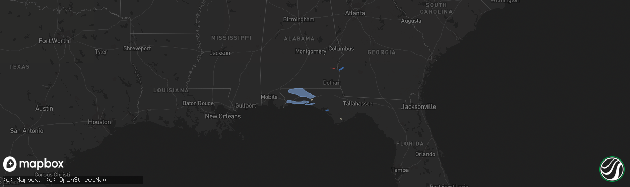
Hail Map in Alabama on November 30, 2022
The weather event in Alabama on November 30, 2022 includes Hail, Wind, and Tornado maps. 3 states and 31 cities were impacted and suffered possible damage. The total estimated number of properties impacted is 0.
Want more than just the map?
Turn this storm into a full workflow.
- Owner + property data so you know who to knock
- OnDemand branded weather history reports to win the "did we even have hail?" argument
- RoofTrace estimate so reps stop guessing numbers at the door
Bought this map? Upgrade within 7 days and we'll credit the $230. (10-15 min setup call)
Hail
Wind
Tornado
0
Estimated number of impacted properties by a 1.00" hail or larger0
Estimated number of impacted properties by a 1.75" hail or larger0
Estimated number of impacted properties by a 2.50" hail or largerStorm reports in Alabama
Alabama
| Date | Description |
|---|---|
| 11/30/20224:21 PM CST | A few trees were blown down between bexar and hackleburg in the northwest par tof marion county. |
| 11/30/20227:00 AM CST | Some roof damage reported to a carport in slocomb. |
| 11/30/20226:45 AM CST | Tree down in wicksburg. |
| 11/30/20226:42 AM CST | Brief ef1 tornado confirmed by storm survey. |
| 11/30/20226:32 AM CST | At 1232 AM CST, a severe thunderstorm was located near Smith Dam, or 13 miles north of Sumiton, moving east at 45 mph. HAZARD...60 mph wind gusts and quarter size hail. SOURCE...Radar indicated. IMPACT...Hail damage to vehicles is expected. Expect wind damage to roofs, siding, and trees. Locations impacted include... Hanceville, Good Hope, Dodge City, Garden City, Colony, Wilburn, Bremen, Arkadelphia, Black Bottom and Smith Lake. |
| 11/30/20226:30 AM CST | Trees down on a house in eufaula on monroe street via social media. |
| 11/30/20226:27 AM CST | At 1226 AM CST, severe thunderstorms were located along a line extending from near Smith Dam to near Binion Creek Landing, moving east at 55 mph. HAZARD...60 mph wind gusts. SOURCE...Radar indicated. IMPACT...Expect damage to roofs, siding, and trees. Locations impacted include... Birmingham, Hoover, Vestavia Hills, Bessemer, Homewood, Mountain Brook, Trussville, Hueytown, Gardendale, Irondale, Leeds, Moody, Fairfield, Fultondale, Oneonta, Cleveland, Dallas, Center Point, Pleasant Grove and Clay. |
| 11/30/20226:25 AM CST | Tree down on county road 72 near chancellor. |
| 11/30/20226:20 AM CST | At 1219 AM CST, severe thunderstorms were located along a line extending from near Ardmore to near Madison to near Decatur, moving east at 50 mph. HAZARD...60 mph wind gusts and penny size hail. SOURCE...Radar indicated. IMPACT...Expect damage to roofs, siding, and trees. Locations impacted include... Huntsville, Decatur, Madison, Athens, Moores Mill, Redstone Arsenal, Meridianville, Hazel Green, Priceville and Trinity. |
| 11/30/20226:15 AM CST | 4 chicken houses damaged near bakerhill near bud gary rd and alabama hwy 131. Tds on radar. |
| 11/30/20226:06 AM CST | Tree down at 684 east county road 36 blocking both lanes. |
| 11/30/20226:00 AM CST | Tree down blocking one lane of traffic at 1900 deese road in ozark. |
| 11/30/20226:00 AM CST | Tree down on highway 189 between elba and kinston. |
| 11/30/20221:22 AM CST | At 722 AM EST, severe thunderstorms were located along a line extending from near Lakepoint Resort State Park to 7 miles east of Richards Crossroads to near Abbeville, moving east at 40 mph. HAZARD...60 mph wind gusts. SOURCE...Radar indicated. IMPACT...Expect damage to roofs, siding, and trees. Locations impacted include... Fort Gaines, Morgan, Georgetown, Cuthbert, Dawson, Edison, Shellman, Parrott, Bellville, Bluffton, Wire Bridge, Parksville, Carnegie, Watson Crossroads, Ricks Place, Pecan, Chambliss, Hatcher, Morris and Bethel. |
| 11/30/202212:46 AM CST | At 646 AM CST, severe thunderstorms were located along a line extending from 11 miles east of Florala to near Crestview to 13 miles northwest of Wright to near Navarre Beach to near Oriole Beach, moving east at 45 mph. HAZARD...60 mph wind gusts. SOURCE...Radar indicated. IMPACT...Expect damage to roofs, siding, and trees. Locations impacted include... Santa Rosa Beach, De Funiak Springs, Bonifay, Eglin Air Force Base, Union, Liberty, Live Oak, Freeport, Paxton, Ponce De Leon, Caryville, Esto, Westville, Noma, Black, Oakwood Hills, Cluster Springs, Whitehead Crossroads, Villa Tasso and Cerrogordo. |
| 11/29/202211:38 PM CST | At 537 AM CST, severe thunderstorms were located along a line extending from 3 miles east of Loxley to near Silverhill to Fairhope to 7 miles west of Point Clear, moving east at 55 mph. HAZARD...60 mph wind gusts. SOURCE...Radar indicated. IMPACT...Expect damage to roofs, siding, and trees. Locations impacted include... Pensacola, Ferry Pass, Brent, West Pensacola, Ensley, Daphne, Warrington, Fairhope, Gulf Shores, Foley, Gulf Breeze, Orange Beach, Goulding, Robertsdale, Point Clear, Lillian, Myrtle Grove, Magnolia Springs, Bon Secour and Summerdale. |
| 11/29/202211:10 PM CST | At 510 AM CST, severe thunderstorms were located along a line extending from near Petrey to Brantley, moving east at 55 mph. HAZARD...60 mph wind gusts. SOURCE...Radar indicated. IMPACT...Expect damage to roofs, siding, and trees. Locations impacted include... Troy, Brundidge, Goshen, Banks, Antioch, Troy University, Tennille, Hamilton Crossroads, Monticello, Springhill, Tarentum, Brundidge Municipal Airport, Mossy Grove and Henderson. |
| 11/29/202211:02 PM CST | At 502 AM CST, severe thunderstorms were located along a line extending from near Petrey to 6 miles north of Dozier to 9 miles west of Red Level, moving east at 50 mph. HAZARD...70 mph wind gusts and penny size hail. SOURCE...Radar indicated. IMPACT...Expect considerable tree damage. Damage is likely to mobile homes, roofs, and outbuildings. Locations impacted include... Daleville, Elba, Enterprise, Fort Rucker, Ozark, Midland City, Level Plains, Newton, New Brockton, Ariton, Pinckard, Lee, Kinston, Mixons Crossroads, Hunt Field, Waterford, Curtis, Carl Folsom A/p, Hooper Stage Field and Gerald. |
| 11/29/202210:43 PM CST | At 443 AM CST, a severe thunderstorm was located over Wade, or 10 miles north of Escatawpa, moving east at 45 mph. HAZARD...60 mph wind gusts. SOURCE...Radar indicated. IMPACT...Expect damage to roofs, siding, and trees. Locations impacted include... Escatawpa, Hurley, Big Point, Vancleave, Wade and Latimer. |
| 11/29/202210:37 PM CST | At 436 AM CST, severe thunderstorms were located along a line extending from 5 miles southwest of Greenville to 3 miles northeast of Castleberry to 12 miles northwest of Poarch Creek Reservation, moving east at 55 mph. HAZARD...60 mph wind gusts. SOURCE...Radar indicated. IMPACT...Expect damage to roofs, siding, and trees. Locations impacted include... Andalusia, Greenville, Opp, Evergreen, Luverne, Frisco City, McCullough, Georgiana, Uriah, Brantley, McKenzie, River Falls, Castleberry, Excel, Red Level, Rutledge, Dozier, Repton, Heath and Gantt. |
| 11/29/20229:58 PM CST | At 357 AM CST, severe thunderstorms were located along a line extending from 6 miles west of Wagarville to 4 miles south of Deer Park, moving east at 40 mph. HAZARD...60 mph wind gusts. SOURCE...Radar indicated. IMPACT...Expect damage to roofs, siding, and trees. Locations impacted include... Frisco City, McCullough, Wagarville, Uriah, Calvert, Excel, McIntosh, I65 And AL 21 and Poarch Creek Reservation. |
| 11/29/20229:40 PM CST | At 340 AM CST, severe thunderstorms were located along a line extending from 11 miles northwest of Monroeville to 14 miles east of McIntosh, moving east at 45 mph. HAZARD...60 mph wind gusts and quarter size hail. SOURCE...Radar indicated. IMPACT...Hail damage to vehicles is expected. Expect wind damage to roofs, siding, and trees. Locations impacted include... Monroeville, Evergreen, Frisco City, Peterman, Georgiana, Uriah, McKenzie, Castleberry, Excel, Beatrice, Repton and I65 And US 84. |
| 11/29/20229:18 PM CST | At 318 AM CST, severe thunderstorms were located along a line extending from 6 miles northeast of Jackson to 5 miles northeast of McIntosh, moving east at 50 mph. HAZARD...60 mph wind gusts and quarter size hail. SOURCE...Radar indicated. IMPACT...Hail damage to vehicles is expected. Expect wind damage to roofs, siding, and trees. Locations impacted include... Monroeville, Jackson, Frisco City, Peterman, Leroy, Uriah, Excel and Repton. |
| 11/29/20227:48 PM CST | At 148 AM CST, a severe thunderstorm was located over Richton, moving east at 50 mph. HAZARD...60 mph wind gusts. SOURCE...Radar indicated. IMPACT...Expect damage to roofs, siding, and trees. Locations impacted include... Chatom, Tibbie, Millry, State Line, Buckatunna and Fruitdale. |
| 11/29/20227:34 PM CST | At 134 AM CST, severe thunderstorms were located along a line extending from near Ohatchee to near Lincoln to near Vincent, moving east at 35 mph. HAZARD...60 mph wind gusts. SOURCE...Radar indicated. IMPACT...Expect damage to roofs, siding, and trees. Locations impacted include... Anniston, Oxford, Talladega, Jacksonville, Cobb Town, West End-Cobb Town, Fort McClellan, Saks, Lincoln, Weaver, Riverside, Munford, Ohatchee, Hobson City, Waldo, Alpine Bay Resort, Talladega Superspeedway, Anniston Regional Airport, Blue Mountain and Alexandria. |
| 11/29/20227:25 PM CST | At 125 AM CST, a severe thunderstorm was located 4 miles northwest of Magnolia, or 9 miles southeast of Linden, moving northeast at 50 mph. HAZARD...60 mph wind gusts. SOURCE...Radar indicated. IMPACT...Expect damage to roofs, siding, and trees. This severe thunderstorm will remain over mainly rural areas of northwestern Wilcox County. |
| 11/29/20227:10 PM CST | At 110 AM CST, severe thunderstorms were located along a line extending from near Oneonta to Bluff Park, moving east at 60 mph. HAZARD...60 mph wind gusts. SOURCE...Radar indicated. IMPACT...Expect damage to roofs, siding, and trees. Locations impacted include... Hoover, Pell City, Leeds, Moody, Rainbow City, Springville, Odenville, Margaret, Argo, Ashville, Riverside, Vincent, Ragland, Ohatchee, Steele, Bald Rock, Vandiver, Harrisburg, Branchville and Greystone. |
Cities Impacted by Hail Map on November 30, 2022
- Defuniak Springs, FL
- Eastpoint, FL
- Shalimar, FL
- Milton, FL
- Pensacola, FL
- Fort Walton Beach, FL
- Niceville, FL
- Hurlburt Field, FL
- Valparaiso, FL
- Mary Esther, FL
- Eglin Afb, FL
- Gulf Breeze, FL
- Navarre, FL
- Wing, AL
- Crestview, FL
- Laurel Hill, FL
- Baker, FL
- Holt, FL
- Jay, FL
- Brewton, AL
- Destin, FL
- Santa Rosa Beach, FL
- Miramar Beach, FL
- Freeport, FL
- Panama City, FL
- Eufaula, AL
- Clayton, AL
- Fort Gaines, GA
- Coleman, GA
- Morris, GA
- Cuthbert, GA


