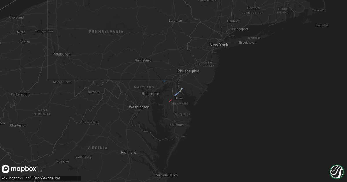
Hail Map in Maryland on November 30, 2020
Get this storm
November 30 map
$229
one time, instant access
Download today. No call, no setup
Keep the $229
Bought the map and want the full workflow? Apply the entire $229 to a subscription within 7 days. None of it is wasted.
Every map, not just this one
This buys you this map. Subscription and you get every map we run, in the markets you choose from a few cities to whole states to nationwide. Plus real-time alerts the moment a storm fires.
Contact data
Name, contact info, occupancy, even credit band for addresses in the footprint. You go from where it hit to who to call.
Become the source they trust
Unlimited branding weather history reports on demand. You already have the documented answer ready for the property owner, and you are the one who showed up with it.
Property data and RoofTrace estimates
Pull up any address you have got, its value and the exact code rules for that jurisdiction, straight from One Click Code. Then RoofTrace estimates the squares, pitch, and roof value, priced the way you price.
Storm reports in Maryland
Maryland
| Date | Description |
|---|---|
| 11/30/20202:17 PM CST | Downed tree and wires near shults road. Time estimated from radar. |
| 11/30/20202:13 PM CST | A tornado touched down along maryland state route 313 at 3:13 pm just south of the caroline-queen anne’s county border. Damage was sparse in this area... But a veloci |
| 11/30/20201:40 PM CST | Numerous large trees down in the 2100 block of hopewell road in port deposit. |
| 11/30/20201:38 PM CST | Tree down along bainbridge road. |
| 11/30/20201:37 PM CST | Ef-1 tornado confirmed on 30 nov 2020 in port deposit... Cecil county md. Path length 5.5 miles... Path width 75 yards. 2:37-2:42 pm est. Numerous hardwood trees uproot |
| 11/30/20201:37 PM CST | Large tree blocking the road in the 300 block of craigtown road. |
| 11/29/20209:01 PM CST | At 301 PM EST, a severe thunderstorm was located over Elkton, moving northeast at 70 mph. HAZARD...60 mph wind gusts. SOURCE...Radar indicated. IMPACT...Damage to roofs, siding, trees, and power lines is possible. Locations impacted include... Philadelphia, Camden, Wilmington, Newark, Middletown, West Chester, Norristown, Chester, West Norriton, East Norriton, Pennsville, Yeadon, Westtown, Carneys Point, Conshohocken, Folcroft, Ambler, Swarthmore, Elsmere and Paulsboro.This includes the following highways... Pennsylvania Turnpike between mile markers 320 and 340. Northeast Extension between mile markers 21 and 26. Interstate 95 in Pennsylvania between mile markers 0 and 15, andbetween mile markers 20 and 29. Interstate 95 in Delaware between mile markers 0 and 23. Interstate 76 in Pennsylvania between mile markers 327 and 349. Interstate 295 in New Jersey between mile markers 0 and 14. Interstate 676 in Pennsylvania between mile markers 0 and 1. Interstate 476 in Pennsylvania between mile markers 0 and 19. |
| 11/29/20208:41 PM CST | At 241 PM EST, a severe thunderstorm was located over West Nottingham, or 7 miles north of Havre De Grace, moving northeast at 55 mph. HAZARD...60 mph wind gusts. SOURCE...Radar indicated. IMPACT...Damage to roofs, siding, trees, and power lines is possible. Locations impacted include... Wilmington, Newark, West Chester, Chester, Coatesville, Yeadon, Westtown, Downingtown, Swarthmore, Elsmere, Kennett Square, Oxford, Parkesburg, West Grove, East Lansdowne, Honey Brook, Elverson, Newport, Arden and Glen Roy.This includes the following highways... Pennsylvania Turnpike between mile markers 300 and 323. Interstate 95 in Pennsylvania between mile markers 0 and 8. Interstate 95 in Delaware between mile markers 13 and 23. Interstate 476 in Pennsylvania between mile markers 0 and 13. |
| 11/29/20208:22 PM CST | At 222 PM EST, a severe thunderstorm was located over Riverside, or near Aberdeen, moving northeast at 45 mph. HAZARD...60 mph wind gusts. SOURCE...Radar indicated. IMPACT...Damaging winds will cause some trees and large branches to fall. This could injure those outdoors, as well as damage homes and vehicles. Roadways may become blocked by downed trees. Localized power outages are possible. Unsecured light objects may become projectiles. Locations impacted include... Aberdeen, Havre De Grace, Aberdeen Proving Ground, Calvert, Bel Air South, Riverside, North East, Rising Sun, Perryman, Charlestown, Zion, Blake, Barksdale, West Nottingham, Octoraro, Fair Hill, Glen Westover, Bay View, Lombard and Richardsmere. |
| 11/29/20207:38 PM CST | At 137 PM EST, a severe thunderstorm was located over Dunnsville, or over Tappahannock, moving northeast at 50 mph. HAZARD...60 mph wind gusts. SOURCE...Radar indicated. IMPACT...Expect damage to trees and powerlines. This severe thunderstorm will be near, Warsaw around 145 PM EST. Haynesville around 150 PM EST. Hague, Kinsale and Coles Point around 200 PM EST.Other locations impacted by this severe thunderstorm includeHowertons, Wellford, Ethel, Threeway, Upright, Mount Holly, Oldhams,Lyells, Naylors Beach and Kennard. |
| 11/29/20207:28 PM CST | At 128 PM EST, severe thunderstorms were located along a line extending from Andrews Air Force Base to near Clinton to Waldorf, moving northeast at 55 mph. HAZARD...60 mph wind gusts. SOURCE...Radar indicated. IMPACT...Damaging winds will cause some trees and large branches to fall. This could injure those outdoors, as well as damage homes and vehicles. Roadways may become blocked by downed trees. Localized power outages are possible. Unsecured light objects may become projectiles. Locations impacted include... Waldorf, Bowie, Severn, Annapolis, Clinton, Crofton, Forestville, Largo, Coral Hills, Mayo, Upper Marlboro, Fedex Field, Andrews Air Force Base, Glen Burnie, Severna Park, Odenton, Pasadena, Landover, Camp Springs and Ferndale. |


