Hail Map on November 30, 2020
Get this storm
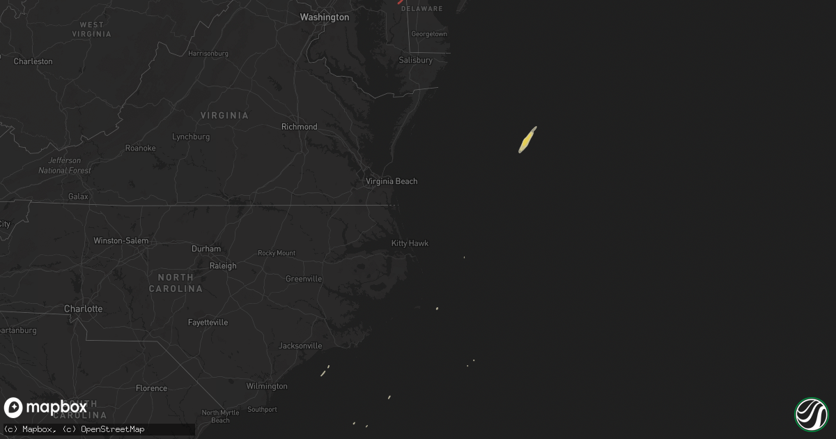
November 30 map
$229
one time, instant access
Download today. No call, no setup
Keep the $229
Bought the map and want the full workflow? Apply the entire $229 to a subscription within 7 days. None of it is wasted.
Every map, not just this one
This buys you this map. Subscription and you get every map we run, in the markets you choose from a few cities to whole states to nationwide. Plus real-time alerts the moment a storm fires.
Contact data
Name, contact info, occupancy, even credit band for addresses in the footprint. You go from where it hit to who to call.
Become the source they trust
Unlimited branding weather history reports on demand. You already have the documented answer ready for the property owner, and you are the one who showed up with it.
Property data and RoofTrace estimates
Pull up any address you have got, its value and the exact code rules for that jurisdiction, straight from One Click Code. Then RoofTrace estimates the squares, pitch, and roof value, priced the way you price.
States Impacted by Hail Map on November 30, 2020
Storm reports
Maryland
| Date | Description |
|---|---|
| 11/30/20202:17 PM CST | Downed tree and wires near shults road. Time estimated from radar. |
| 11/30/20202:13 PM CST | A tornado touched down along maryland state route 313 at 3:13 pm just south of the caroline-queen anne’s county border. Damage was sparse in this area... But a veloci |
| 11/30/20201:40 PM CST | Numerous large trees down in the 2100 block of hopewell road in port deposit. |
| 11/30/20201:38 PM CST | Tree down along bainbridge road. |
| 11/30/20201:37 PM CST | Large tree blocking the road in the 300 block of craigtown road. |
| 11/30/20201:37 PM CST | Ef-1 tornado confirmed on 30 nov 2020 in port deposit... Cecil county md. Path length 5.5 miles... Path width 75 yards. 2:37-2:42 pm est. Numerous hardwood trees uproot |
| 11/29/20209:01 PM CST | At 301 PM EST, a severe thunderstorm was located over Elkton, moving northeast at 70 mph. HAZARD...60 mph wind gusts. SOURCE...Radar indicated. IMPACT...Damage to roofs, siding, trees, and power lines is possible. Locations impacted include... Philadelphia, Camden, Wilmington, Newark, Middletown, West Chester, Norristown, Chester, West Norriton, East Norriton, Pennsville, Yeadon, Westtown, Carneys Point, Conshohocken, Folcroft, Ambler, Swarthmore, Elsmere and Paulsboro.This includes the following highways... Pennsylvania Turnpike between mile markers 320 and 340. Northeast Extension between mile markers 21 and 26. Interstate 95 in Pennsylvania between mile markers 0 and 15, andbetween mile markers 20 and 29. Interstate 95 in Delaware between mile markers 0 and 23. Interstate 76 in Pennsylvania between mile markers 327 and 349. Interstate 295 in New Jersey between mile markers 0 and 14. Interstate 676 in Pennsylvania between mile markers 0 and 1. Interstate 476 in Pennsylvania between mile markers 0 and 19. |
| 11/29/20208:41 PM CST | At 241 PM EST, a severe thunderstorm was located over West Nottingham, or 7 miles north of Havre De Grace, moving northeast at 55 mph. HAZARD...60 mph wind gusts. SOURCE...Radar indicated. IMPACT...Damage to roofs, siding, trees, and power lines is possible. Locations impacted include... Wilmington, Newark, West Chester, Chester, Coatesville, Yeadon, Westtown, Downingtown, Swarthmore, Elsmere, Kennett Square, Oxford, Parkesburg, West Grove, East Lansdowne, Honey Brook, Elverson, Newport, Arden and Glen Roy.This includes the following highways... Pennsylvania Turnpike between mile markers 300 and 323. Interstate 95 in Pennsylvania between mile markers 0 and 8. Interstate 95 in Delaware between mile markers 13 and 23. Interstate 476 in Pennsylvania between mile markers 0 and 13. |
| 11/29/20208:22 PM CST | At 222 PM EST, a severe thunderstorm was located over Riverside, or near Aberdeen, moving northeast at 45 mph. HAZARD...60 mph wind gusts. SOURCE...Radar indicated. IMPACT...Damaging winds will cause some trees and large branches to fall. This could injure those outdoors, as well as damage homes and vehicles. Roadways may become blocked by downed trees. Localized power outages are possible. Unsecured light objects may become projectiles. Locations impacted include... Aberdeen, Havre De Grace, Aberdeen Proving Ground, Calvert, Bel Air South, Riverside, North East, Rising Sun, Perryman, Charlestown, Zion, Blake, Barksdale, West Nottingham, Octoraro, Fair Hill, Glen Westover, Bay View, Lombard and Richardsmere. |
| 11/29/20207:38 PM CST | At 137 PM EST, a severe thunderstorm was located over Dunnsville, or over Tappahannock, moving northeast at 50 mph. HAZARD...60 mph wind gusts. SOURCE...Radar indicated. IMPACT...Expect damage to trees and powerlines. This severe thunderstorm will be near, Warsaw around 145 PM EST. Haynesville around 150 PM EST. Hague, Kinsale and Coles Point around 200 PM EST.Other locations impacted by this severe thunderstorm includeHowertons, Wellford, Ethel, Threeway, Upright, Mount Holly, Oldhams,Lyells, Naylors Beach and Kennard. |
| 11/29/20207:28 PM CST | At 128 PM EST, severe thunderstorms were located along a line extending from Andrews Air Force Base to near Clinton to Waldorf, moving northeast at 55 mph. HAZARD...60 mph wind gusts. SOURCE...Radar indicated. IMPACT...Damaging winds will cause some trees and large branches to fall. This could injure those outdoors, as well as damage homes and vehicles. Roadways may become blocked by downed trees. Localized power outages are possible. Unsecured light objects may become projectiles. Locations impacted include... Waldorf, Bowie, Severn, Annapolis, Clinton, Crofton, Forestville, Largo, Coral Hills, Mayo, Upper Marlboro, Fedex Field, Andrews Air Force Base, Glen Burnie, Severna Park, Odenton, Pasadena, Landover, Camp Springs and Ferndale. |
Pennsylvania
| Date | Description |
|---|---|
| 11/30/20203:15 PM CST | Downed trees and wires near mechanicsville road. Time estimated from radar. |
| 11/30/20203:12 PM CST | Fence and tree knocked down in chalfont... Pa. Time estimated by radar. |
| 11/30/20203:10 PM CST | Downed trees and wires near church school road and fell road in doylestown. Time estimated from radar. |
| 11/30/20203:06 PM CST | Downed tree and wires near sinkler road in neshaminy. Time estimated from radar. |
| 11/30/20202:59 PM CST | Downed utility on limekiln pike near fairway road. Time estimated from radar. |
| 11/30/20202:55 PM CST | Downed trees and wires near blackburn drive in chalfont. Time estimated from radar. |
| 11/30/20202:55 PM CST | Considerable damage observed around the costco in north wales/montgomeryville pa reported from multiple sources |
| 11/30/20202:53 PM CST | Downed tree in wires near roudenbush road. Time estimated from radar. |
| 11/30/20202:49 PM CST | Downed tree and wires near overhill road in springfield twp. Time estimated from radar. |
| 11/30/20202:49 PM CST | Downed tree in wires near the intersection of wood avenue and hackett avenue. Time estimated from radar. |
| 11/30/20202:47 PM CST | Downed tree on swamp creek road near the price road intersection. Road was closed. Time estimated from radar. |
| 11/30/20202:47 PM CST | Downed tree in wires near oak lane in upper milford twp. Time estimated from radar. |
| 11/30/20202:47 PM CST | An ef-0 tornado touched down immediately east of the route 309 |
| 11/30/20202:46 PM CST | Downed trees and wires near maple avenue in harleysville. Time estimated from radar. |
| 11/30/20202:46 PM CST | Corrects previous tstm wnd dmg report from north wales. Drone footage showing damage to what appears to be a couple hotels and cars shifted around in a parking lot. Tim |
| 11/30/20202:44 PM CST | Downed trees and wires near old morris road in lederach. Time estimated from radar. |
| 11/30/20202:44 PM CST | Downed wires near pleasant hill road in garden city. Time estimated from radar. |
| 11/30/20202:44 PM CST | Downed trees and wires near gaffney hill road and texas road. Time estimated from radar. |
| 11/30/20202:44 PM CST | Downed trees and wires near tyson road in skippack twp. Time estimated from radar. |
| 11/30/20202:43 PM CST | Downed wires near wilson street in south chester. Time estimated from radar. |
| 11/30/20202:41 PM CST | Downed trees and wires near trappe road in perkiomen twp. Time estimated from radar. |
| 11/30/20202:41 PM CST | Downed tree and wires near 7th avenue in trappe. Time estimated from radar. |
| 11/30/20202:40 PM CST | Multiple trees down... Siding... And shingle damage in trappe... Pa. Possible tornado. |
| 11/30/20202:36 PM CST | Downed wires near freemont street in phoenixville. Time estimated from radar. |
| 11/30/20202:33 PM CST | Wires down near the intersection of waterloo rd and highland ave. Time estimated from radar. |
| 11/30/20202:33 PM CST | Several trees down on dawson drive. Time estimated from radar. |
| 11/30/20202:32 PM CST | Corrects time of previous tstm wnd dmg report from 1 wsw collegeville. Downed tree and wires near clahor avenue. Time estimated from radar. |
| 11/30/20202:29 PM CST | Downed tree and wires near hilltop road in charlestown. Time estimated from radar. |
| 11/30/20202:28 PM CST | Downed tree and wires near woodland drive in malvern. Time estimated from radar. |
| 11/30/20202:28 PM CST | Downed tree and wires near woodview road in malvern. Time estimated from radar. |
| 11/30/20202:28 PM CST | Multiple large trees uprooted in phoenixville. Time estimated from radar. |
| 11/30/20202:26 PM CST | Downed tree and wires near pickwick lane in malvern. Time estimated from radar. |
| 11/30/20202:25 PM CST | Downed wires near exton square parkway. Time estimated from radar. |
| 11/30/20202:23 PM CST | Tree down on shetland drive. Time estimated from radar. |
| 11/30/20202:23 PM CST | Downed wires near ship road in exton. Time estimated from radar. |
| 11/30/20202:23 PM CST | Downed tree near the intersection of wilmington pike and west pleasant grove road. Time estimated from radar. |
| 11/30/20202:22 PM CST | Wires down near the intersection of pocopson rd and chandler rd. Time estimated from radar. |
| 11/30/20202:21 PM CST | Downed tree and wires on ashbridge street. Time estimated from radar. |
| 11/30/20202:21 PM CST | Wires down near the intersection of fairville rd and cossart dr. Time estimated from radar. |
| 11/30/20202:20 PM CST | Wires down near frame ave and mulberry dr. Time estimated from radar. |
| 11/30/20202:20 PM CST | Downed tree on montchanin road near twaddell mill road. Time estimated from radar. |
| 11/30/20202:20 PM CST | Downed tree and wires near williamsburg road in pocopson twp. Time estimated from radar. |
| 11/30/20202:19 PM CST | Downed trees and wires near lincoln avenue in downingtown. Time estimated from radar. |
| 11/30/20202:19 PM CST | Downed tree on route 1 near state route 52. Time estimated from radar. |
| 11/30/20202:19 PM CST | Large tree down on lucky hill road. Time estimated from radar. |
| 11/30/20202:19 PM CST | Downed tree and wires near lucky hill road. Time estimated from radar. |
| 11/30/20202:19 PM CST | Downed trees and wires near north creek road near east bradford twp. Time estimated from radar. |
| 11/30/20202:15 PM CST | Downed tree and wires near marlborough road in marlboro. Time estimated from radar. |
| 11/30/20202:15 PM CST | Wires down at the intersection of skelp level rd and spencer dr. Time estimated from radar. |
| 11/30/202011:49 AM CST | Delayed report via social media. Several trees and limbs down near the intersection of township line rd and mowere rd. Glass windows broken. Time estimated from radar. |
| 11/29/202010:45 PM CST | Downed tree and wires near clahor avenue. Time estimated from radar. |
| 11/29/20209:43 PM CST | At 343 PM EST, severe thunderstorms were located along a line extending from near Zionsville to Ambler, moving north at 70 mph. HAZARD...60 mph wind gusts. SOURCE...Radar indicated. IMPACT...Damage to roofs, siding, trees, and power lines is possible. Locations impacted include... Philadelphia, Allentown, Easton, Bethlehem, Lansdale, Forks, East Norriton, Emmaus, Northampton, Quakertown, Perkasie, Doylestown, Byram, Wilson, Hatboro, Souderton, Bedminster, Washington, Ambler and Hellertown.This includes the following highways... Pennsylvania Turnpike between mile markers 334 and 342. Northeast Extension between mile markers 21 and 57. Interstate 78 in Pennsylvania between mile markers 54 and 76. Interstate 78 in New Jersey between mile markers 0 and 23. Interstate 80 in Pennsylvania between mile markers 305 and 310. |
New Jersey
| Date | Description |
|---|---|
| 11/30/20205:20 PM CST | Downed trees and wires near harbourton rocktown road. Time estimated from radar. |
| 11/30/20203:13 PM CST | Downed trees and wires near ludlow station road and asbury west portal road. Time estimated from radar. |
| 11/30/20203:08 PM CST | Downed trees and wires near turkey hill road and bloomsbury road. Time estimated from radar. |
| 11/30/202012:35 PM CST | Delayed report. Multiple trees and power lines down in asbury. Report via social media. Time estimated from radar. |
| 11/30/202012:30 PM CST | Corrects time of previous tstm wnd dmg report from asbury. Downed trees and wires near ludlow station road and asbury west portal road. Time estimated from radar. |
| 11/30/202012:30 PM CST | Damage to trees and wires along asbury west portal road in bethlehem township. Time estimated from radar. |
| 11/29/202011:29 PM CST | At 529 PM EST, a severe thunderstorm was located over Lawrenceville, or near Trenton, moving northeast at 50 mph. HAZARD...60 mph wind gusts. SOURCE...Radar indicated. IMPACT...Damage to roofs, siding, trees, and power lines is possible. Locations impacted include... Trenton, New Brunswick, Somerville, Somerset, Edison, East Brunswick, Bridgewater, South Brunswick, North Brunswick, Ewing, Middlesex, Princeton, Bound Brook, Manville, Pennington, Hopewell, Far Hills, Rocky Hill, Millstone and Skillman.This includes the following highways... New Jersey Turnpike between exits 10 and 11. Interstate 78 in New Jersey between mile markers 32 and 41. Interstate 295 in New Jersey between mile markers 63 and 73. Interstate 287 in New Jersey between mile markers 0 and 20, andbetween mile markers 24 and 27. Garden State Parkway between mile markers 130 and 133. |
| 11/29/202010:49 PM CST | At 448 PM EST, a severe thunderstorm was located over Newport Meadows, or 8 miles west of Bridgeton, moving northeast at 50 mph. HAZARD...60 mph wind gusts. SOURCE...Radar indicated. IMPACT...Damage to roofs, siding, trees, and power lines is possible. Locations impacted include... Camden, Vineland, Bridgeton, Gloucester City, Deptford, Glassboro, Lindenwold, Bellmawr, Woodbury, Pitman, Clayton, Berlin, Magnolia, Westville, Woodstown, Alloway, Woodbury Heights, Quinton, Brooklawn and Chesilhurst.This includes the following highways... New Jersey Turnpike near exit 3. Interstate 76 in New Jersey between mile markers 0 and 1. Interstate 295 in New Jersey between mile markers 24 and 31. Interstate 676 in New Jersey near mile marker 0. Atlantic City Expressway between mile markers 32 and 44. |
South Carolina
| Date | Description |
|---|---|
| 11/30/202012:06 AM CST | At 606 AM EST, a severe thunderstorm was located over Midway, moving northeast at 55 mph. HAZARD...60 mph wind gusts. SOURCE...Radar indicated. IMPACT...Expect damage to trees and powerlines. Locations impacted include... Hinesville, Pooler, Bluffton, Richmond Hill, Tybee Island, Wilmington Island, Fort Pulaski National Monument, Bellinger Hill Area, Midtown Savannah, Downtown Savannah, Coffee Bluff, Hunter Army Airfield, McIntosh, Montgomery and Garden City.This warning includes... I-16 between mile markers 159 and 168. I-516 between mile markers 3 and 9. I-95 in Georgia between mile markers 70 and 98. |
Delaware
| Date | Description |
|---|---|
| 11/30/20202:30 PM CST | Corrects previous tstm wnd dmg report from 2 s kenton. Several trees down across the northern parts of kent county. Time estimated from radar. |
| 11/30/20202:22 PM CST | Trees down... Including one on a vehicle. |
| 11/30/20202:07 PM CST | Downed trees and wires closed wedgewood road between fox lane and wallace drive. Time estimated from radar. |
| 11/30/20202:07 PM CST | Downed trees and wires near welsh tract road. Time estimated from radar. |
| 11/30/20202:05 PM CST | Downed tree limbs at a residence in bear... Causing minor structural damage. Time confirmed by radar. |
| 11/29/20209:04 PM CST | At 303 PM EST, a severe thunderstorm was located over Hope, or near Centerville, moving northeast at 35 mph. HAZARD...60 mph wind gusts. SOURCE...Radar indicated. IMPACT...Damage to roofs, siding, trees, and power lines is possible. Locations impacted include... Dover, Middletown, Smyrna, Centreville, Camden, Clayton, Greensboro, Oakland, Ridgely, Cheswold, Church Hill, Millington, Sudlersville, Goldsboro, Hartly, Woodland Beach, Jumptown, Hazlettville, Delaney Corner and Crumpton. |
Florida
| Date | Description |
|---|---|
| 11/30/20209:54 AM CST | Public reported 3 inch tree limbs and power poles broken. Time estimated by radar. |
| 11/29/202011:29 PM CST | At 529 AM EST, a severe thunderstorm was located over Orange Heights, or 7 miles northwest of Melrose, moving northeast at 35 mph. HAZARD...60 mph wind gusts. SOURCE...Radar indicated. IMPACT...Expect damage to roofs, siding, and trees. Locations impacted include... Keystone Heights, Middleburg, Orange Heights, Kingsley, Lake Geneva, Camp Blanding, Waldo, Penney Farms and Hampton. |
| 11/29/202011:06 PM CST | At 506 AM EST, a severe thunderstorm was located over University Of Florida, or over Gainesville, moving northeast at 35 mph. HAZARD...60 mph wind gusts. SOURCE...Radar indicated. IMPACT...Expect damage to roofs, siding, and trees. Locations impacted include... Gainesville, Melrose, University Of Florida, Orange Heights, Gainesville Airport, Newnans Lake and Waldo. |
Georgia
| Date | Description |
|---|---|
| 11/29/202010:27 PM CST | At 426 AM EST, a severe thunderstorm was located 8 miles southwest of Nicholls, or 9 miles southeast of Douglas, moving northeast at 25 mph. HAZARD...60 mph wind gusts. SOURCE...Radar indicated. IMPACT...Expect damage to roofs, siding, and trees. Locations impacted include... Alma, Nicholls, New Lacy and Bickley. |
| 11/29/202010:17 PM CST | At 417 AM EST, a severe thunderstorm was located near Homerville, moving northeast at 30 mph. HAZARD...60 mph wind gusts. SOURCE...Radar indicated. IMPACT...Expect damage to roofs, siding, and trees. Locations impacted include... Waycross, Argyle, Boggy Bay, Pebble Hill, Manor, Braganza and Needham. |
| 11/29/20209:55 PM CST | At 355 AM EST, a severe thunderstorm was located over Statenville, moving northeast at 60 mph. HAZARD...60 mph wind gusts. SOURCE...Radar indicated. IMPACT...Expect damage to roofs, siding, and trees. Locations impacted include... Homerville, Fargo, Argyle, Statenville, Du Pont, Mayday, Needmore, Manor and Cogdell. |
| 11/29/20209:52 PM CST | At 352 AM EST, a severe thunderstorm was located near Willacoochee, moving northeast at 40 mph. HAZARD...60 mph wind gusts. SOURCE...Radar indicated. IMPACT...Expect damage to roofs, siding, and trees. Locations impacted include... Douglas, Pearson, Willacoochee, Nicholls, Millwood, Axson and Bickley. |
| 11/29/20209:10 PM CST | At 310 AM EST, Doppler radar indicated a severe thunderstorm capable of producing destructive winds in excess of 70 mph. This storm was located 10 miles northwest of Madison, and moving northeast at 45 mph. Locations impacted include... Lake Park, Valdosta, I-75 At Exit 16, Dasher, Naylor, Greenwood, Twin Lakes, Cherry Lake, Hamburg, Pinetta, Valdosta Regional Airport, Kinderlou, I-75 At Exit 5, Lovett, Nankin, Empress, Clyattville, Hanson, I-75 At Exit 11 and Stockton. |
| 11/29/20208:52 PM CST | At 252 AM EST, a severe thunderstorm was located 7 miles southeast of Monticello, moving east at 45 mph. HAZARD...60 mph wind gusts. SOURCE...Radar indicated. IMPACT...Expect damage to roofs, siding, and trees. Locations impacted include... Madison, Greenville, Dills, Lovett, Nankin, Empress, Aucilla, Cherry Lake, Hamburg, Hanson and Ashville. |