Hail Map in Alabama on October 25, 2019
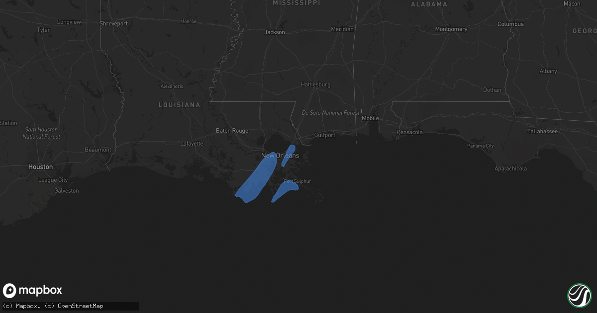
Get this storm
October 25 map
$229
one time, instant access
Download today. No call, no setup
Keep the $229
Bought the map and want the full workflow? Apply the entire $229 to a subscription within 7 days. None of it is wasted.
Every map, not just this one
This buys you this map. Subscription and you get every map we run, in the markets you choose from a few cities to whole states to nationwide. Plus real-time alerts the moment a storm fires.
Contact data
Name, contact info, occupancy, even credit band for addresses in the footprint. You go from where it hit to who to call.
Become the source they trust
Unlimited branding weather history reports on demand. You already have the documented answer ready for the property owner, and you are the one who showed up with it.
Property data and RoofTrace estimates
Pull up any address you have got, its value and the exact code rules for that jurisdiction, straight from One Click Code. Then RoofTrace estimates the squares, pitch, and roof value, priced the way you price.
Storm reports in Alabama
Alabama
| Date | Description |
|---|---|
| 10/25/20194:37 PM CDT | *** 1 inj *** tornado touched down near stone road and continued north-northwest... Intensifying as it reached jamaica road. Tornado continued north producing damage at |
| 10/25/20194:36 PM CDT | Picture via social media of tornado at lott rd and coleman dairy rd. Time estimated by radar. |
| 10/25/20194:34 PM CDT | Report of damage to homes with trees and powerlines down. Time estimated by radar. |
| 10/25/20194:25 PM CDT | Corrects previous tornado report from snow and tanner williams for corrected time. Trained spotter reports a multivortex tornado on the ground just north of snow road a |
| 10/25/20194:16 PM CDT | Roof damage reported by broadcast media via social media on gwinnett ct. Time estimated by radar. |
| 10/25/20194:12 PM CDT | Tornado first touched down just east of arlington oaks drive and intensified as it moved north-northwest. It reached peak intensity near scott dairy loop before weakeni |
| 10/25/20194:10 PM CDT | Corrects previous tstm wnd dmg report from hutchens elementary to a tornado. Broadcast media reports multiple homes with roof damage... Power lines down and video of to |
| 10/25/20197:38 AM CDT | At 1238 PM CDT, a severe thunderstorm was located near I65 And AL 158, or 4 miles west of Saraland, moving north at 30 mph. HAZARD...60 mph wind gusts. SOURCE...Radar indicated. IMPACT...Expect damage to roofs, siding, and trees. Locations impacted include... Saraland, Satsuma, Citronelle, Chunchula, Gulfcrest and I65 And AL 158. |
| 10/25/20196:46 AM CDT | At 1146 AM CDT, a severe thunderstorm was located over Midtown Mobile, moving north at 30 mph. Another severe thunderstorm was located near Fowl River Bridge and also moving north at 30 mph. HAZARD...60 mph wind gusts. SOURCE...Radar indicated. IMPACT...Expect damage to roofs, siding, and trees. Locations impacted include... Midtown Mobile, Downtown Mobile, Prichard, Tillmans Corner, Saraland, Theodore, Chickasaw, Satsuma, Chunchula, Semmes, I65 And I165, Mobile Regional Airport, I65 And AL 158 and I10 And I65. |
| 10/25/20194:59 AM CDT | At 959 PM CDT, a severe thunderstorm was located 8 miles north of Coffeeville, or 17 miles west of Thomasville, moving north at 25 mph. HAZARD...60 mph wind gusts. SOURCE...Radar indicated. IMPACT...Expect damage to roofs, siding, and trees. This severe thunderstorm will remain over mainly rural areas of northwestern Clarke County. |
| 10/25/20194:15 AM CDT | At 915 PM CDT, a severe thunderstorm was located 5 miles east of Coffeeville, or 13 miles west of Grove Hill, moving north at 55 mph. HAZARD...60 mph wind gusts. SOURCE...Radar indicated. IMPACT...Expect damage to roofs, siding, and trees. This severe thunderstorm will remain over mainly rural areas of north central Clarke County. |
| 10/25/20193:53 AM CDT | At 852 PM CDT, a cluster of severe thunderstorms was located 6 miles southwest of Coffeeville, or 16 miles north of Chatom, moving north at 25 mph. HAZARD...60 mph wind gusts. SOURCE...Radar indicated. IMPACT...Expect damage to roofs, siding, and trees. Locations impacted include... Coffeeville. |
| 10/25/20191:36 AM CDT | At 635 PM CDT, a severe thunderstorm was located 5 miles north of Lucedale, moving north at 35 mph. This storm also has increasing rotation and will be monitored closely. HAZARD...60 mph wind gusts. SOURCE...Radar indicated. IMPACT...Expect damage to roofs, siding, and trees. Locations impacted include... Lucedale and Leakesville. |
| 10/25/20191:23 AM CDT | At 622 PM CDT, a severe thunderstorm was located 6 miles north of Saint Stephens, or 12 miles northwest of Jackson, moving north at 30 mph. HAZARD...60 mph wind gusts. SOURCE...Radar indicated. IMPACT...Expect damage to roofs, siding, and trees. Locations impacted include... Coffeeville. |
| 10/24/201911:00 PM CDT | At 400 PM CDT, a severe thunderstorm was located 4 miles northwest of Coffeeville, or 19 miles south of Butler, moving north at 25 mph. HAZARD...60 mph wind gusts. SOURCE...Radar indicated. IMPACT...Expect damage to roofs, siding, and trees. Locations impacted include... Coffeeville. |
Cities Impacted by Hail Map on October 25, 2019
- Larose, LA
- Westwego, LA
- Marrero, LA
- Mathews, LA
- New Orleans, LA
- Luling, LA
- Paradis, LA
- Kenner, LA
- Destrehan, LA
- Ama, LA
- Metairie, LA
- Gheens, LA
- Des Allemands, LA
- Houma, LA
- Theriot, LA
- Boutte, LA
- Saint Rose, LA
- Lockport, LA
- Chauvin, LA
- Montegut, LA
- Raceland, LA
- Thibodaux, LA
- Cut Off, LA
- Bourg, LA
- Dulac, LA
- Grand Isle, LA
- Port Sulphur, LA
- Lafitte, LA
- Buras, LA
- Golden Meadow, LA
- Meraux, LA
- Belle Chasse, LA
- Braithwaite, LA
- Chalmette, LA
- Violet, LA
- Mobile, AL
- Wilmer, AL
- Semmes, AL


