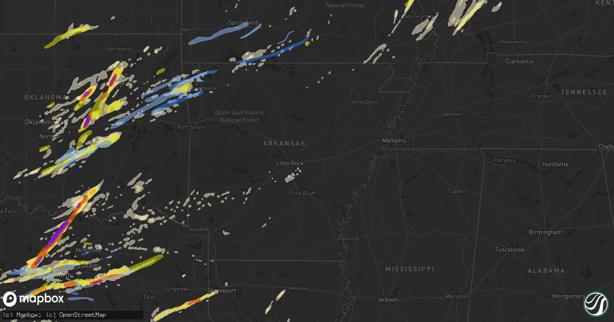
Hail Map in Arkansas on October 20, 2019
Get this storm
October 20 map
$229
one time, instant access
Download today. No call, no setup
Keep the $229
Bought the map and want the full workflow? Apply the entire $229 to a subscription within 7 days. None of it is wasted.
Every map, not just this one
This buys you this map. Subscription and you get every map we run, in the markets you choose from a few cities to whole states to nationwide. Plus real-time alerts the moment a storm fires.
Contact data
Name, contact info, occupancy, even credit band for addresses in the footprint. You go from where it hit to who to call.
Become the source they trust
Unlimited branding weather history reports on demand. You already have the documented answer ready for the property owner, and you are the one who showed up with it.
Property data and RoofTrace estimates
Pull up any address you have got, its value and the exact code rules for that jurisdiction, straight from One Click Code. Then RoofTrace estimates the squares, pitch, and roof value, priced the way you price.
Storm reports in Arkansas
Arkansas
| Date | Description |
|---|---|
| 10/20/20196:29 AM CDT | At 1128 PM CDT, severe thunderstorms were located along a line extending from 2 miles northwest of Muskogee to 4 miles south of Fort Gibson to near Warner to 3 miles west of Enterprise, moving east at 80 mph. HAZARD...70 mph wind gusts. SOURCE...Radar indicated. IMPACT...Expect considerable tree damage. Damage is likely to mobile homes, roofs, and outbuildings. Locations in or near the path include... Muskogee... Tahlequah... Sallisaw... Stilwell... Fort Gibson... Warner... Westville... Vian... Gore... Porum... Okay... Webbers Falls... Hulbert... Watts... Marble City... Braggs... Tamaha... Tullahassee... Brushy... Adair State Park...This includes Interstate 40 in Oklahoma between mile markers 271 and314. |
| 10/20/20195:52 AM CDT | An 18 wheeler semi truck blown over in tyronza. |
| 10/20/20195:50 AM CDT | *** 3 inj *** short track tornado with straight line wind damage surrounding the tornado. Primarily damage to a convenience store and elementary school. Several outbuil |
| 10/20/20195:15 AM CDT | A tree was blown down on county road 85 east. |
| 10/20/20194:59 AM CDT | At 959 PM CDT, a severe thunderstorm was located over Salina, moving northeast at 55 mph. HAZARD...60 mph wind gusts and quarter size hail. SOURCE...Radar indicated. IMPACT...Hail damage to vehicles is expected. Expect wind damage to roofs, siding, and trees. Locations in or near the path include... Jay... Pryor... Pryor Creek... Grove... Salina... Langley... Spavinaw... Disney... Pensacola... Hoot Owl... Honey Creek State Park... Cherokee State Park... Spavinaw State Park... Chloeta... Sportsmen Acres Community... Strang... Snowdale State Park... Disney Little Blue State Park... Zena... |
| 10/20/20194:56 AM CDT | A tree was blown down on highway 302 east. |
| 10/20/20194:46 AM CDT | Trees were downed at 17th and hazel streets in pine bluff. |
| 10/20/20194:40 AM CDT | Winds gusted to 58 mph at carlisle municipal airport |
| 10/20/20194:39 AM CDT | Large branches broken off trees near the intersection of columbia road 5 and columbia road 7. |
| 10/20/20194:38 AM CDT | Trees were downed at hardin-reed road and curly drive. |
| 10/20/20194:36 AM CDT | Tree uprooted along east columbia road 4. |
| 10/20/20194:35 AM CDT | Trees down across the southern part of the county from taylor to emerson. |
| 10/20/20194:35 AM CDT | Corrects previous tstm wnd dmg report from 8 wsw emerson. Large branches broken off trees along highway 19. |
| 10/20/20194:33 AM CDT | A few trees downed at a residence near the intersection of highway 160 and columbia road 205. |
| 10/20/20194:30 AM CDT | Tree down in monette. |
| 10/20/20194:30 AM CDT | A tree was blown down on highway 302 east. |
| 10/20/20194:27 AM CDT | 3-4 homes with roof damage north of springhill. |
| 10/20/20194:21 AM CDT | Tornado began near the intersection of county road 21 and highway 53 in far southeastern lafayette county and tracked slightly north of due east through southwestern co |
| 10/20/20194:20 AM CDT | Report from a fire chief of tin from a barn on ar 53 south in lafayette county at la state line was blown off of the roof and on the highway. Also a tree blown down blo |
| 10/20/20194:15 AM CDT | A large shed was blown over on highway 141 between beechgrove and hooker. |
| 10/20/20194:09 AM CDT | Law enforcement measured quarter sized hail 5 miles north of lewisville. |
| 10/20/20194:02 AM CDT | Numerous large trees and branches down covering road way on hwy160 between bloomburg and i-49. |
| 10/20/20193:55 AM CDT | A tree was blown down in a yard on tyler street. |
| 10/20/20193:35 AM CDT | Trees and power lines were downed on elliott trail. |
| 10/20/20192:55 AM CDT | Trees down along highway 32 between foreman and ashdown. |
| 10/20/20192:54 AM CDT | Trees were blown down. |
| 10/20/20192:49 AM CDT | A large branch was blown down onto east myrtle street. |
| 10/20/20192:33 AM CDT | A tree was blown down on 8th street. |
| 10/20/20192:04 AM CDT | A tree was blown down and blocking one lane at south reynolds and west sardis road. |
| 10/20/20191:59 AM CDT | A tree was blown down onto a house on rolling creek circle. There were no injuries. |
| 10/20/20191:55 AM CDT | A carport was blown over on east german lane in conway. |
| 10/20/20191:55 AM CDT | Wind snapped telephone poles and blew over fences in marshall. |
| 10/20/20191:48 AM CDT | A tree was blown down and damage occurred to metal roofing on two buildings. |
| 10/20/20191:45 AM CDT | A tree was blown down. |
| 10/20/20191:40 AM CDT | A roof was blown off a building. |
| 10/20/20191:38 AM CDT | A tree was blown down across york drive. |
| 10/20/20191:38 AM CDT | A tree was blown down onto the west bound side of interstate 30. |
| 10/20/20191:30 AM CDT | A tree was blown down. |
| 10/20/20191:30 AM CDT | Trees were reported down in jasper. |
| 10/20/20191:12 AM CDT | A tree was blown down on highway 314 off highway 7. |
| 10/20/20191:11 AM CDT | Storm survey concluded a swath of 65 to 75 mph thunderstorm winds felled softwood trees and caused minor roof damage to a structure in far northeastern garland county. |
| 10/20/20191:10 AM CDT | A tree was blown down. |
| 10/20/20191:07 AM CDT | Power lines were blown down in the 6000 block of highway 7. |
| 10/20/20191:00 AM CDT | A tree was blown down at highway 84 and rainbow road. |
| 10/20/201912:55 AM CDT | Trees down on highway 27 south near the nashville animal clinic. |
| 10/20/201912:50 AM CDT | A tree was blown over near the charlton recreation area. |
| 10/20/201912:35 AM CDT | Boats and docks damaged at prairie creek marina. |
| 10/20/201912:32 AM CDT | Picture on social media shows damage to a hotel just sw of rogers. |
| 10/20/201912:32 AM CDT | Several tree limbs down across springdale near the airport. |
| 10/20/201912:30 AM CDT | Significant tree damage to an apartment complex in sw rogers. |
| 10/20/201912:30 AM CDT | Trees down on holly street right before central in siloam springs. |
| 10/20/201912:29 AM CDT | *** 1 fatal *** large tree fell on home causing one fatality to occupant. Time estimated from radar. |
| 10/20/201912:23 AM CDT | Trained spotter reports trees down near the intersection of county road 23 and us 62 bypass. Car damage was reported as well. Winds were estimated to be 80mph. Time is |
| 10/20/201912:21 AM CDT | Public reports fences blown down... Trees blown down... And no power in cave springs. Time estimated from radar. |
| 10/20/201912:15 AM CDT | Quarter size hail was estimated from a public social media post. |
| 10/20/201912:08 AM CDT | A tornado removed the roof from a business...damaged homes...snapped power poles...and uprooted trees. |
| 10/20/201912:07 AM CDT | Multiple trees down and homes damaged in the forest hills subdivision. Possible tornado. |
| 10/19/201911:54 PM CDT | Trees down and blocking the road near apache and crosstrails. |
All States Impacted by Hail Map on October 20, 2019
Cities Impacted by Hail Map on October 20, 2019
- Glenallen, MO
- Patton, MO
- Marble Hill, MO
- Brookston, TX
- Okmulgee, OK
- Mounds, OK
- Bristow, OK
- Beggs, OK
- Eldorado, TX
- Tulsa, OK
- Earlsboro, OK
- Catoosa, OK
- Sapulpa, OK
- Prague, OK
- Sperry, OK
- Kellyville, OK
- Collinsville, OK
- Boley, OK
- Depew, OK
- Paden, OK
- Seminole, OK
- Haskell, OK
- Castle, OK
- Bixby, OK
- Ramona, OK
- Oologah, OK
- Claremore, OK
- Okemah, OK
- Shawnee, OK
- Skiatook, OK
- Sand Springs, OK
- Vera, OK
- Owasso, OK
- Talala, OK
- Hardy, AR
- Durant, OK
- Caddo, OK
- Venus, TX
- Alvarado, TX
- Harleton, TX
- Jefferson, TX
- Keller, TX
- Fort Worth, TX
- Junction, TX
- Sonora, TX
- Pecan Gap, TX
- Cooper, TX
- Justin, TX
- Rhome, TX
- Decatur, TX
- Boyd, TX
- Springtown, TX
- Dexter, KS
- Arkansas City, KS
- Maple City, KS
- Cedar Vale, KS
- Carrollton, TX
- Southlake, TX
- Addison, TX
- Lewisville, TX
- North Richland Hills, TX
- Grapevine, TX
- Irving, TX
- Colleyville, TX
- Dallas, TX
- Coppell, TX
- Roanoke, TX
- Flower Mound, TX
- Wasola, MO
- Noble, MO
- Antlers, OK
- Clayton, OK
- Moyers, OK
- Aledo, TX
- Azle, TX
- Millsap, TX
- Weatherford, TX
- Choudrant, LA
- Chatham, LA
- Eros, LA
- Rising Star, TX
- May, TX
- Brownwood, TX
- Mansfield, TX
- Smithville, TX
- Como, TX
- Menard, TX
- Elmore City, OK
- Vinita, OK
- Ada, OK
- Milburn, OK
- Wapanucka, OK
- Coleman, OK
- Tishomingo, OK
- Harviell, MO
- Naylor, MO
- Neelyville, MO
- Poplar Bluff, MO
- Broseley, MO
- Fisk, MO
- Gordon, TX
- Palo Pinto, TX
- Santo, TX
- De Berry, TX
- Beckville, TX
- Greenwood, LA
- Waskom, TX
- Carthage, TX
- Garnett, KS
- Maynard, AR
- Pocahontas, AR
- Plato, MO
- Bucyrus, MO
- Wellston, OK
- Troup, TX
- Shreveport, LA
- Jacksonville, TX
- Rusk, TX
- Henderson, TX
- Bethany, LA
- Keithville, LA
- Laneville, TX
- Dale, TX
- Cedar Creek, TX
- Granbury, TX
- Kingston, OK
- Madill, OK
- Cedar Hill, TX
- Ladonia, TX
- Van Alstyne, TX
- Springdale, AR
- Bentonville, AR
- Cave Springs, AR
- Mckinney, TX
- Arlington, TX
- Kennedale, TX
- Konawa, OK
- Stratford, OK
- Sasakwa, OK
- Wewoka, OK
- Barnsdall, OK
- Graford, TX
- Strawn, TX
- Stonefort, IL
- Era, TX
- Krum, TX
- Sanger, TX
- Gainesville, TX
- Valley View, TX
- Duncan, OK
- Puxico, MO
- Hulbert, OK
- Celeste, TX
- Greenville, TX
- Farmersville, TX
- Eola, TX
- Vancourt, TX
- Paint Rock, TX
- Gouldbusk, TX
- Voss, TX
- Millersview, TX
- Bangs, TX
- Coleman, TX
- San Angelo, TX
- Santa Anna, TX
- Eden, TX
- Fort McKavett, TX
- Joshua, TX
- Crowley, TX
- Luling, TX
- Kingsbury, TX
- Foster, OK
- Terrell, TX
- Kaufman, TX
- Seagoville, TX
- Forney, TX
- Crandall, TX
- Hamilton, TX
- Priddy, TX
- Pottsville, TX
- Comanche, TX
- Mullin, TX
- Goldthwaite, TX
- Dora, MO
- Zanoni, MO
- Broken Arrow, OK
- Westville, OK
- Summers, AR
- Sumner, TX
- Blossom, TX
- Powderly, TX
- Paris, TX
- Paducah, KY
- Brookesmith, TX
- Kenefic, OK
- Pottsboro, TX
- Atoka, OK
- Marietta, OK
- Ardmore, OK
- Mead, OK
- Gordonville, TX
- Lebanon, OK
- Whitesboro, TX
- Detroit, TX
- Rattan, OK
- Hico, TX
- Rochelle, TX
- Brady, TX
- Fischer, TX
- Wimberley, TX
- Spring Branch, TX
- Canyon Lake, TX
- Blanco, TX
- Godley, TX
- Coweta, OK
- Emory, TX
- Yantis, TX
- Sulphur Springs, TX
- Dustin, OK
- Holdenville, OK
- Lamar, OK
- Clarksville, TX
- Dodson, LA
- Cave In Rock, IL
- Smithland, KY
- Brookport, IL
- Salem, KY
- Metropolis, IL
- Elizabethtown, IL
- Golconda, IL
- Marion, KY
- Hampton, KY
- Cushing, OK
- Hugo, OK
- Grant, OK
- Mineral Wells, TX
- Mesquite, TX
- Pauls Valley, OK
- Wynnewood, OK
- England, AR
- Scott, AR
- Edgewood, TX
- Wills Point, TX
- Point, TX
- Rosanky, TX
- Harwood, TX
- Farmington, MO
- Webbers Falls, OK
- Warner, OK
- Norman, OK
- Bossier City, LA
- Haughton, LA
- Carlton, TX
- Rosiclare, IL
- Marlow, OK
- Tolar, TX
- Taft, OK
- Muskogee, OK
- Colbert, OK
- Lohn, TX
- Melvin, TX
- Protem, MO
- Wickes, AR
- Grannis, AR
- Eagletown, OK
- Gillham, AR
- De Queen, AR
- Squires, MO
- Ava, MO
- Thornfield, MO
- Caney, OK
- Jennings, OK
- Mannford, OK
- Stroud, OK
- Agra, OK
- Drumright, OK
- Denison, TX
- Tecumseh, NE
- Sterling, NE
- Alta Vista, KS
- Dwight, KS
- White City, KS
- Junction City, KS
- Richardson, TX
- Brixey, MO
- Stilwell, OK
- Welling, OK
- Bunch, OK
- Meridian, TX
- Jackson, MO
- Oak Ridge, MO
- Altenburg, MO
- Frohna, MO
- Uniontown, MO
- Millersville, MO
- Burfordville, MO
- Old Appleton, MO
- Choctaw, OK
- Oklahoma City, OK
- Newalla, OK
- Hollister, MO
- Branson, MO
- Lockhart, TX
- Cross Plains, TX
- Burkett, TX
- Evansville, IN
- Tamms, IL
- Willow Springs, MO
- Red Oak, TX
- Waxahachie, TX
- Midlothian, TX
- Bagwell, TX
- Wolfe City, TX
- Commerce, TX
- Tullos, LA
- Olla, LA
- Georgetown, LA
- Snow, OK
- Finley, OK
- Paradise, TX
- Ponder, TX
- Fayetteville, AR
- Elkville, IL
- Royalton, IL
- Sesser, IL
- Benton, IL
- Mulkeytown, IL
- De Soto, IL
- Sikeston, MO
- Bertrand, MO
- Thebes, IL
- Villa Ridge, IL
- Charleston, MO
- Ullin, IL
- Miller City, IL
- Cairo, IL
- Mounds, IL
- Pulaski, IL
- Dongola, IL
- Calhoun, LA
- Lindsay, TX
- Naval Air Station Jrb, TX
- Poolville, TX
- Simpson, IL
- Diana, TX
- Bennington, OK
- Mount Pleasant, TX
- Mount Vernon, TX
- Clifton, TX
- Zalma, MO
- Sturdivant, MO
- Telephone, TX
- Iredell, TX
- Walnut Springs, TX
- Sidney, TX
- Salem, MO
- Argyle, TX
- Dublin, TX
- De Leon, TX
- San Saba, TX
- Burleson, TX
- Whitney, TX
- Bonnie, IL
- Wetumka, OK
- Blue Ridge, TX
- Mountain View, MO
- Jonesboro, LA
- Cook, NE
- Festus, MO
- De Soto, MO
- Harrison, AR
- Yale, OK
- Ozona, TX
- Bolivar, MO
- Haworth, OK
- Giddings, TX
- Proctor, OK
- Watts, OK
- Tahlequah, OK
- Lincoln, AR
- Gentry, AR
- Siloam Springs, AR
- Mcloud, OK
- Chandler, OK
- Meeker, OK
- Desoto, TX
- Omaha, AR
- Lockesburg, AR
- Inola, OK
- Hensley, AR
- Sheridan, AR
- Walters, OK
- Seguin, TX
- La Grange, TX
- Waelder, TX
- Morganfield, KY
- Sturgis, KY
- Ridgway, IL
- Belknap, IL
- Burna, KY
- Shawneetown, IL
- Equality, IL
- Eddyville, IL
- Herod, IL
- Grantsburg, IL
- Kevil, KY
- Harrisburg, IL
- Carrier Mills, IL
- Grand Chain, IL
- Omaha, IL
- Ozark, IL
- West Paducah, KY
- New Haven, IL
- Junction, IL
- Bismarck, AR
- Arkadelphia, AR
- Muenster, TX
- Forestburg, TX
- Eufaula, OK
- Davis, OK
- Hanna, OK
- Byars, OK
- Mount Vernon, IL
- Waltonville, IL
- Du Quoin, IL
- Christopher, IL
- Murphysboro, IL
- Opdyke, IL
- Elkins, AR
- Hope, AR
- Lewisville, AR
- King City, MO
- Valley Mills, TX
- Crawford, TX
- West Plains, MO
- Gustine, TX
- Winfield, KS
- Newkirk, OK
- Haltom City, TX
- Edmond, OK
- Guthrie, OK
- Harrah, OK
- Jones, OK
- Pomona, MO
- Malvern, AR
- Donaldson, AR
- Idabel, OK
- Garvin, OK
- Mount Enterprise, TX
- Weleetka, OK
- Macomb, OK
- Bluff Dale, TX
- Lawton, OK
- Farmington, AR
- Prairie Grove, AR
- Campbell, MO
- Malden, MO
- Parker, KS
- The Colony, TX
- Peggs, OK
- Locust Grove, OK
- Park Hill, OK
- Vian, OK
- Cookson, OK
- Braggs, OK
- Gore, OK
- Aubrey, TX
- Lancaster, TX
- Grand Prairie, TX
- Duncanville, TX
- Cresson, TX
- Hurst, TX
- Winnsboro, TX
- Quinlan, TX
- Plano, TX
- Denton, TX
- Scroggins, TX
- Alba, TX
- Pickton, TX
- Lillian, TX
- Wylie, TX
- Haslet, TX
- Hutchins, TX
- Quitman, TX
- Wilmer, TX
- Ferris, TX
- Garland, TX
- Sachse, TX
- Euless, TX
- Bedford, TX
- Dixon, KY
- Clay, KY
- Benton, MO
- Redfield, AR
- Pryor, OK
- Ash Flat, AR
- Mountain Grove, MO
- Kansas, OK
- Colcord, OK
- Morgan, TX
- Rocksprings, TX
- Chandler, IN
- Mount Vernon, IN
- Elberfeld, IN
- Haubstadt, IN
- Henderson, KY
- Camden, AR
- Royse City, TX
- Maud, OK
- Valles Mines, MO
- Delight, AR
- Bokchito, OK
- Desdemona, TX
- Del Rio, TX
- Centerton, AR
- Fort Towson, OK
- Del Valle, TX
- Elgin, TX
- Bethany, OK
- Salina, OK
- Lindsay, OK
- Mill Creek, OK
- Mannsville, OK
- Omaha, TX
- Naples, TX
- Jenks, OK
- Glenpool, OK
- Kiefer, OK
- Fitzhugh, OK
- Luther, OK
- Lipan, TX
- Maysville, OK
- London, TX
- Kissee Mills, MO
- Cedarcreek, MO
- Forsyth, MO
- Green Forest, AR
- Oak Grove, AR
- Ridgedale, MO
- Powersite, MO
- Kirbyville, MO
- Greeley, KS
- Melbourne, AR
- Willard, MO
- Morrisville, MO
- Henryetta, OK
- Traskwood, AR
- Helena, MO
- Cosby, MO
- Huggins, MO
- Graff, MO
- Wayne, OK
- Purcell, OK
- Noble, OK
- Asher, OK
- Hennepin, OK
- Paoli, OK
- Calvin, OK
- Tioga, TX
- Wagoner, OK
- Bearden, AR
- Lead Hill, AR
- Saint Joseph, MO
- Pattonville, TX
- Roxton, TX
- Ben Franklin, TX
- Celina, TX
- Anna, TX
- Gunter, TX
- Linden, TX
- Atlanta, TX
- Whitewater, MO
- Lake Creek, TX
- Okolona, AR
- Chouteau, OK
- Ravenna, TX
- Ivanhoe, TX
- Zephyr, TX
- Early, TX
- Aquilla, TX
- Oktaha, OK
- Boynton, OK
- Morris, OK
- Blanchard, OK
- Murfreesboro, AR
- West, TX
- Abbott, TX
- Bluejacket, OK
- Shell Knob, MO
- Lampe, MO
- Marion, IL
- Thompsonville, IL
- Pittsburg, IL
- Everton, MO
- Broken Bow, OK
- Lavon, TX
- Nevada, TX
- Rockwall, TX
- Uniontown, KY
- Amity, AR
- Kirby, AR
- Elk City, KS
- Sedan, KS
- Berryville, AR
- Spencerville, OK
- Boswell, OK
- Providence, KY
- Porter, OK
- Iola, KS
- Colony, KS
- Welda, KS
- Seymour, MO
- Horatio, AR
- Ranger, TX
- Leopold, MO
- Newhope, AR
- Dierks, AR
- Eminence, MO
- Nashville, AR
- Olive Branch, IL
- Scott City, MO
- Oran, MO
- Huntsville, AR
- Benton, AR
- Yates Center, KS
- Afton, OK
- Chelsea, OK
- Rogers, AR
- Lowell, AR
- Pilot Point, TX
- Canehill, AR
- Little Rock, AR
- Oglesby, TX
- Overbrook, OK
- Thackerville, OK
- Coalgate, OK
- Gainesville, MO
- Gravette, AR
- Decatur, AR
- Gorman, TX
- Canton, TX
- Dike, TX
- Rose, OK
- Klondike, TX
- Lane, OK
- Novice, TX
- Calera, OK
- Lake Dallas, TX
- Little Elm, TX
- Spencer, OK
- Alvord, TX
- Wanette, OK
- Stephenville, TX
- Carmi, IL
- New Harmony, IN
- Poseyville, IN
- Hominy, OK
- Sparks, OK
- Saltillo, TX
- Bivins, TX
- Carbon, TX
- Foreman, AR
- Blue Eye, MO
- Bradleyville, MO
- Rueter, MO
- Arthur City, TX
- Ida, LA
- Checotah, OK
- Peel, AR
- Yellville, AR
- Lane, KS
- Princeton, TX
- Carney, OK
- Maramec, OK
- Terlton, OK
- Tryon, OK
- Arcadia, OK
- Glencoe, OK
- Pawnee, OK
- Meridian, OK
- Stillwater, OK
- Cleveland, OK
- Perkins, OK
- Prue, OK
- Ripley, OK
- Osage, OK
- Council Hill, OK
- Caddo, TX
- Caddo Mills, TX
- Comanche, OK
- Gonzales, TX
- Leesburg, TX
- Pittsburg, TX
- Valera, TX
- Melissa, TX
- Garfield, AR
- Eureka Springs, AR
- West Fork, AR
- Marionville, MO
- Nixa, MO
- Monett, MO
- Mount Vernon, MO
- Clever, MO
- Brookline, MO
- Granby, MO
- Stark City, MO
- Rogersville, MO
- Republic, MO
- Verona, MO
- Neosho, MO
- Springfield, MO
- Aurora, MO
- Billings, MO
- Pierce City, MO
- Highlandville, MO
- Sparta, MO
- Fordland, MO
- Ozark, MO
- Theodosia, MO
- Isabella, MO
- Vanzant, MO
- Drury, MO
- Deer Creek, OK
- Lamont, OK
- Nardin, OK
- Blackwell, OK
- Braman, OK
- Washington, OK
- Alex, OK
- Davenport, OK
- Spavinaw, OK
- Eucha, OK
- Mcalester, OK
- Rowlett, TX
- Campbell, TX
- Maypearl, TX
- Ennis, TX
- Allen, TX
- Frisco, TX
- Fort Gibson, OK
- Twin Oaks, OK
- Oaks, OK
- Barnhart, MO
- Crystal City, MO
- Pevely, MO
- Herculaneum, MO
- Jacob, IL
- Scheller, IL


