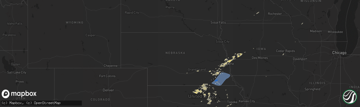
Hail Map in Nebraska on October 11, 2022
The weather event in Nebraska on October 11, 2022 includes Hail and Wind maps. 8 states and 281 cities were impacted and suffered possible damage. The total estimated number of properties impacted is 0.
Want more than just the map?
Turn this storm into a full workflow.
- Owner + property data so you know who to knock
- OnDemand branded weather history reports to win the "did we even have hail?" argument
- RoofTrace estimate so reps stop guessing numbers at the door
Bought this map? Upgrade within 7 days and we'll credit the $230. (10-15 min setup call)
Hail
Wind
0
Estimated number of impacted properties by a 1.00" hail or larger0
Estimated number of impacted properties by a 1.75" hail or larger0
Estimated number of impacted properties by a 2.50" hail or largerStorm reports in Nebraska
Nebraska
| Date | Description |
|---|---|
| 10/11/20226:24 AM CDT | At 1124 PM CDT, severe thunderstorms were located along a line extending from 3 miles east of Bennet to 3 miles south of Diller, moving east at 30 mph. HAZARD...60 mph wind gusts. SOURCE...Radar indicated. IMPACT...Expect damage to roofs, siding, and trees. Severe thunderstorms will be near... Bennet and Panama around 1130 PM CDT.Other locations in the path of these severe thunderstorms includeBarneston. |
| 10/11/20225:48 AM CDT | At 1048 PM CDT, severe thunderstorms were located along a line extending from 3 miles north of Wilber to 3 miles southeast of Reynolds, moving east at 40 mph. HAZARD...70 mph wind gusts. SOURCE...Radar indicated. IMPACT...Expect considerable tree damage. Damage is likely to mobile homes, roofs, and outbuildings. Severe thunderstorms will be near... Crete and Wilber around 1055 PM CDT. Clatonia around 1100 PM CDT. Hallam around 1105 PM CDT.Other locations in the path of these severe thunderstorms includeCortland, Sprague, Steele City, Hickman, Firth, Diller, Panama, Adamsand Odell. |
| 10/11/20224:55 AM CDT | At 955 PM CDT, a severe thunderstorm was located 3 miles northwest of Goehner, or 9 miles west of Seward, moving northeast at 40 mph. HAZARD...60 mph wind gusts and quarter size hail. SOURCE...Radar indicated. IMPACT...Hail damage to vehicles is expected. Expect wind damage to roofs, siding, and trees. This severe thunderstorm will be near... Seward and Staplehurst around 1010 PM CDT. Bee around 1015 PM CDT.Other locations in the path of this severe thunderstorm includeGarland and Malcolm.This includes Interstate 80 in Nebraska between mile markers 366 and388. |
| 10/10/202211:40 PM CDT | Time estimated based on radar. Walls blown out on a machine shed. |
| 10/10/202211:32 PM CDT | A local report indicates 68 MPH wind near LEWISTON |
| 10/10/202211:16 PM CDT | A local report indicates 66 MPH wind near 4 S ELMWOOD |
| 10/10/202211:15 PM CDT | A local report indicates 65 MPH wind near 2 NW FIRTH |
| 10/10/202211:11 PM CDT | A local report indicates 59 MPH wind near 2 N BEATRICE |
| 10/10/202211:00 PM CDT | A local report indicates 87 MPH wind near 2 E PLYMOUTH |
| 10/10/202210:58 PM CDT | A local report indicates 58 MPH wind near ROCA |
| 10/10/202210:57 PM CDT | A local report indicates 70 MPH wind near CRETE |
All States Impacted by Hail Map on October 11, 2022
Cities Impacted by Hail Map on October 11, 2022
- Aitkin, MN
- Wymore, NE
- Havensville, KS
- Malcolm, NE
- Lincoln, NE
- Kimball, MN
- Watkins, MN
- Munden, KS
- Manhattan, KS
- Ogden, KS
- Beaver Crossing, NE
- Waco, NE
- Utica, NE
- Walnut, KS
- Chester, NE
- Hebron, NE
- Hubbell, NE
- Iola, KS
- Humboldt, KS
- Fredonia, KS
- Fall River, KS
- Barnard, KS
- Lincoln, KS
- Manilla, IA
- Kimballton, IA
- Irwin, IA
- Audubon, IA
- Manning, IA
- Harlan, IA
- Kirkman, IA
- Mindenmines, MO
- Hallam, NE
- Pleasant Dale, NE
- Crete, NE
- Denton, NE
- Dorchester, NE
- Martell, NE
- Roca, NE
- Eden Valley, MN
- Cold Spring, MN
- Grove City, MN
- Richmond, MN
- Shelby, IA
- Miltonvale, KS
- Concordia, KS
- Clyde, KS
- Clifton, KS
- Morganville, KS
- Clay Center, KS
- Burlington, KS
- Waverly, KS
- Fort Calhoun, NE
- Blair, NE
- Bennington, NE
- Beatrice, NE
- Annandale, MN
- South Haven, MN
- Tamarack, MN
- Kettle River, MN
- Coon Rapids, IA
- Kennard, NE
- Cherryvale, KS
- Independence, KS
- Harveyville, KS
- Benton, KS
- Towanda, KS
- El Dorado, KS
- Earling, IA
- Arlington, NE
- Janesville, MN
- Pemberton, MN
- Kearney, NE
- Palmer, KS
- Cokato, MN
- Waverly, NE
- Gretna, NE
- Jamestown, KS
- Fort Scott, KS
- Garland, KS
- Defiance, IA
- Madison, KS
- Garland, NE
- Raymond, NE
- Republic, KS
- Neodesha, KS
- Elk City, KS
- Bennet, NE
- Spooner, WI
- Sarona, WI
- Richland Center, WI
- Hillsboro, WI
- Palmyra, NE
- Floodwood, MN
- Bronaugh, MO
- Franklin, KS
- Liberal, MO
- Pittsburg, KS
- Mulberry, KS
- Good Thunder, MN
- Orr, MN
- Burns, KS
- Riley, KS
- Paynesville, MN
- New London, MN
- Spicer, MN
- Atwater, MN
- Phillips, NE
- Doniphan, NE
- Aurora, NE
- Giltner, NE
- Grand Island, NE
- Elkhorn, NE
- Persia, IA
- Panama, IA
- Missouri Valley, IA
- Underwood, IA
- Omaha, NE
- Yutan, NE
- Memphis, NE
- Ashland, NE
- Wahoo, NE
- Portsmouth, IA
- Mead, NE
- Ceresco, NE
- Crescent, IA
- Ithaca, NE
- Neola, IA
- Honey Creek, IA
- Minden, IA
- Logan, IA
- Boys Town, NE
- Waterloo, NE
- Parsons, KS
- McCune, KS
- Amana, IA
- Homestead, IA
- Swanton, NE
- Davey, NE
- Ogden, IA
- Mankato, KS
- Epworth, IA
- Mahaska, KS
- Greenleaf, KS
- Barnes, KS
- Herington, KS
- Leon, KS
- Saint Paul, KS
- Erie, KS
- Glen Elder, KS
- Cawker City, KS
- Jewell, KS
- Esbon, KS
- Portis, KS
- Downs, KS
- Randall, KS
- Thayer, KS
- Nevada, MO
- Diller, NE
- Morrowville, KS
- Washington, KS
- Fort Riley, KS
- Junction City, KS
- Paola, KS
- Rantoul, KS
- Wellsville, KS
- Eureka, KS
- Maple Lake, MN
- Buffalo, MN
- Monticello, MN
- Milford, NE
- Wilber, NE
- La Vista, NE
- Papillion, NE
- Iron Belt, WI
- Cumberland, WI
- Rice Lake, WI
- Wright, MN
- Unionville, MO
- Willmar, MN
- Arma, KS
- Girard, KS
- Arcadia, KS
- Solomon, KS
- Salina, KS
- New Cambria, KS
- Minneapolis, KS
- Abilene, KS
- Longford, KS
- Piedmont, KS
- Emmett, KS
- Saint Marys, KS
- Ottawa, KS
- Florence, KS
- Peabody, KS
- Eskridge, KS
- Longton, KS
- Burdick, KS
- Daykin, NE
- Randolph, KS
- Green, KS
- Courtland, KS
- Adrian, MO
- Butler, MO
- Cook, MN
- Scandia, KS
- Rich Hill, MO
- Prescott, KS
- Hume, MO
- Yates Center, KS
- Glasco, KS
- Seward, NE
- York, AL
- Pennington, AL
- Elmdale, KS
- Amsterdam, MO
- Amoret, MO
- Belleville, KS
- Weston, NE
- Webber, KS
- Deshler, NE
- Formoso, KS
- Hardy, NE
- Byron, NE
- Ruskin, NE
- Centralia, KS
- Narka, KS
- Oronogo, MO
- Lamar, MO
- Asbury, MO
- Council Bluffs, IA
- Wakarusa, KS
- Auburn, KS
- Welch, OK
- Lake Nebagamon, WI
- Gaylord, KS
- Blue Springs, NE
- Moundville, MO
- Leonardville, KS
- Lake Lillian, MN
- Friend, NE
- Chelsea, OK
- Deweese, NE
- Adair, OK
- Cook, NE
- Sterling, NE
- Unadilla, NE
- Johnson, NE
- Clatonia, NE
- Syracuse, NE
- Lewiston, NE
- Douglas, NE
- Crab Orchard, NE
- Virginia, NE
- Steele City, NE
- Hickman, NE
- Eagle, NE
- Otoe, NE
- Jansen, NE
- Panama, NE
- Brock, NE
- Firth, NE
- Plymouth, NE
- Walton, NE
- Liberty, NE
- Nebraska City, NE
- Barneston, NE
- Lorton, NE
- De Witt, NE
- Burr, NE
- Julian, NE
- Talmage, NE
- Filley, NE
- Burchard, NE
- Adams, NE
- Odell, NE
- Dunbar, NE
- Tecumseh, NE
- Pickrell, NE
- Fairbury, NE
- Steinauer, NE
- Cortland, NE


