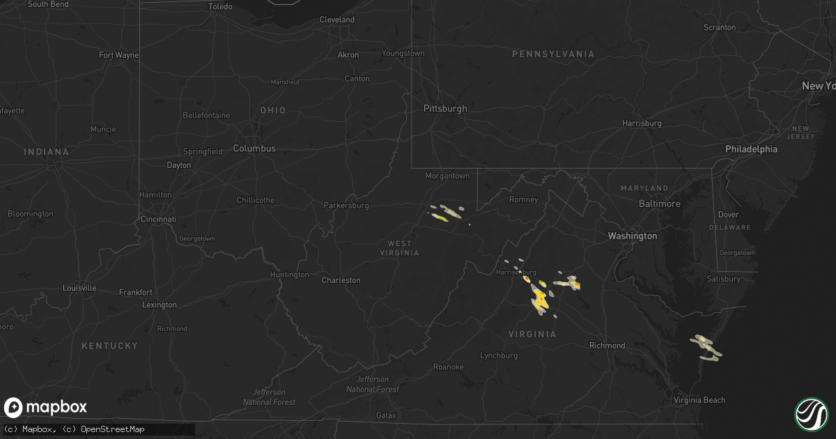
Hail Map in West Virginia on September 28, 2021
Get this storm
September 28 map
$229
one time, instant access
Download today. No call, no setup
Keep the $229
Bought the map and want the full workflow? Apply the entire $229 to a subscription within 7 days. None of it is wasted.
Every map, not just this one
This buys you this map. Subscription and you get every map we run, in the markets you choose from a few cities to whole states to nationwide. Plus real-time alerts the moment a storm fires.
Contact data
Name, contact info, occupancy, even credit band for addresses in the footprint. You go from where it hit to who to call.
Become the source they trust
Unlimited branding weather history reports on demand. You already have the documented answer ready for the property owner, and you are the one who showed up with it.
Property data and RoofTrace estimates
Pull up any address you have got, its value and the exact code rules for that jurisdiction, straight from One Click Code. Then RoofTrace estimates the squares, pitch, and roof value, priced the way you price.
Storm reports in West Virginia
West Virginia
| Date | Description |
|---|---|
| 09/28/20219:54 AM CDT | A few trees reported down along seneca trail/rte 219. |
| 09/28/20219:40 AM CDT | Spotter reported nickel to quarter sized hail and sent us a video along with a picture. |
| 09/28/20215:49 AM CDT | At 1049 AM EDT, a severe thunderstorm was located 8 miles northwest of Parsons, moving east at 30 mph. HAZARD...Quarter size hail. SOURCE...Radar indicated. IMPACT...Minor damage to vehicles is possible. Locations impacted include... Saint George and Pifer Moutain. |
| 09/28/20215:46 AM CDT | At 1046 AM EDT, a severe thunderstorm was located 8 miles northeast of Philippi, moving east at 25 mph. HAZARD...60 mph wind gusts and quarter size hail. SOURCE...Radar indicated. IMPACT...Hail damage to vehicles is expected. Expect wind damage to roofs, siding, and trees. Locations impacted include... Nestorville and Moatsville. |
| 09/28/20215:03 AM CDT | At 1003 AM EDT, a severe thunderstorm was located near Philippi, moving east at 35 mph. HAZARD...60 mph wind gusts and quarter size hail. SOURCE...Radar indicated. IMPACT...Hail damage to vehicles is expected. Expect wind damage to roofs, siding, and trees. Locations impacted include... Philippi, Belington, Montrose, Kerens, Volga and Nestorville. |
All States Impacted by Hail Map on September 28, 2021
Cities Impacted by Hail Map on September 28, 2021
- Belle Haven, VA
- Graford, TX
- Junction, TX
- Fredericksburg, TX
- Llano, TX
- Mason, TX
- Doss, TX
- Harper, TX
- Ruckersville, VA
- Stanardsville, VA
- Brady, TX
- Rochelle, TX
- Mullin, TX
- Weatherford, TX
- Lipan, TX
- Olney, TX
- Throckmorton, TX
- Newcastle, TX
- Evant, TX
- Bandera, TX
- Charlottesville, VA
- Scottsville, VA
- Dyke, VA
- Earlysville, VA
- Elkton, VA
- McGaheysville, VA
- Eagle Pass, TX
- La Pryor, TX
- Quemado, TX
- Crystal City, TX
- Sunset, TX
- Chico, TX
- Lometa, TX
- Philippi, WV
- Saint Jo, TX
- Nocona, TX
- Star, TX
- Hamilton, TX
- Goldthwaite, TX
- Overbrook, OK
- San Saba, TX
- Fredonia, TX
- Keswick, VA
- Granbury, TX
- Ranger, TX
- Burnet, TX
- Jacksboro, TX
- Strawn, TX
- Barboursville, VA
- Free Union, VA
- Ryan, OK
- Bluff Dale, TX
- Sweetwater, TX
- Roby, TX
- Sylvester, TX
- Wilson, OK
- Ringling, OK
- Bowie, TX
- Eldorado, TX
- Christoval, TX
- Henrietta, TX
- Windthorst, TX
- Quanah, TX
- Perrin, TX
- San Marcos, TX
- Wimberley, TX
- Fischer, TX
- Driftwood, TX
- Comanche, OK
- Odem, TX
- Terral, OK
- Moran, TX
- Cisco, TX
- Breckenridge, TX
- Woonsocket, RI
- Manville, RI
- North Smithfield, RI
- Plainville, MA
- Cumberland, RI
- Indiahoma, OK
- Cache, OK
- Bellevue, TX
- Foxboro, MA
- Mansfield, MA
- Montrose, WV
- Parsons, WV
- Grafton, WV
- Moatsville, WV
- Menard, TX
- North Windham, CT
- Canyon Lake, TX
- Spring Branch, TX
- Burneyville, OK
- Leon, OK
- Crozet, VA
- Sinton, TX
- Volga, WV
- Belington, WV
- San Antonio, TX
- Helotes, TX
- Graham, TX
- Tolar, TX
- Stephenville, TX
- Gustine, TX
- Dublin, TX
- Exmore, VA
- Rapidan, VA
- Radiant, VA
- Orange, VA
- Locust Dale, VA
- Duncan, OK
- Culpeper, VA
- Rhoadesville, VA
- Unionville, VA
- Hanksville, UT
- San Angelo, TX
- Baird, TX
- Cross Plains, TX
- Painter, VA
- Dilley, TX
- Colorado City, TX
- Kerrville, TX
- Taft, TX
- Mathis, TX
- Caddo, TX
- Boerne, TX
- Holliday, TX
- Coleman, TX
- North Attleboro, MA
- Wrentham, MA
- Lincoln, RI
- Snyder, OK
- Frederick, OK
- Palmyra, VA
- Troy, VA
- Muenster, TX
- Gordonsville, VA
- South Bend, TX
- Lampasas, TX
- Mitchells, VA
- Ardmore, OK
- Lawton, OK
- Brookesmith, TX
- Brownwood, TX
- Medina, TX
- Jermyn, TX
- Bryson, TX
- Bridgeport, TX
- Bronte, TX
- Harrisonburg, VA
- Vernon, TX
- Crowell, TX
- Richland Springs, TX
- Yorktown, TX
- Hunt, TX
- Hico, TX
- Salado, TX
- Gainesville, TX
- Marietta, OK
- Forestburg, TX
- Fulks Run, VA
- Lohn, TX
- Ringgold, TX
- Spicewood, TX
- Marble Falls, TX
- Leander, TX
- Loving, TX
- New Braunfels, TX
- Keezletown, VA
- Hacksneck, VA
- Leon, VA
- Reva, VA
- Brightwood, VA
- Aroda, VA
- Rochelle, VA
- Mount Clare, WV
- Ferron, UT
- Pontotoc, TX
- Voca, TX
- Robstown, TX
- Corpus Christi, TX
- Hockley, TX
- Broadway, VA
- Woodson, TX
- Bertram, TX
- Hendricks, WV
- Cape Charles, VA
- Machipongo, VA
- Locust Grove, VA
- Madison, VA
- Harrisville, RI
- Flemington, WV
- Bridgeport, WV
- Cedar Park, TX


