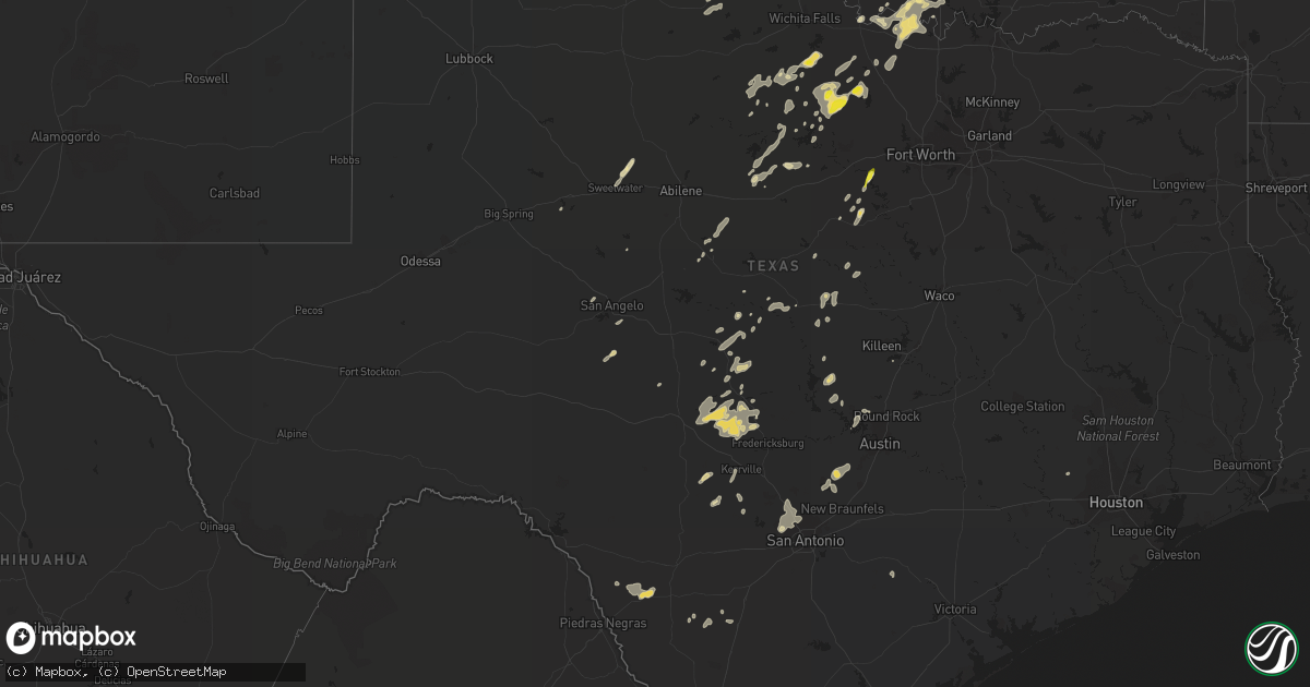
Hail Map in Texas on September 28, 2021
Get this storm
September 28 map
$229
one time, instant access
Download today. No call, no setup
Keep the $229
Bought the map and want the full workflow? Apply the entire $229 to a subscription within 7 days. None of it is wasted.
Every map, not just this one
This buys you this map. Subscription and you get every map we run, in the markets you choose from a few cities to whole states to nationwide. Plus real-time alerts the moment a storm fires.
Contact data
Name, contact info, occupancy, even credit band for addresses in the footprint. You go from where it hit to who to call.
Become the source they trust
Unlimited branding weather history reports on demand. You already have the documented answer ready for the property owner, and you are the one who showed up with it.
Property data and RoofTrace estimates
Pull up any address you have got, its value and the exact code rules for that jurisdiction, straight from One Click Code. Then RoofTrace estimates the squares, pitch, and roof value, priced the way you price.
Storm reports in Texas
Texas
| Date | Description |
|---|---|
| 09/28/20216:30 PM CDT | Media reports of 1 inch hail in odem. Time was estimated from radar. |
| 09/28/20212:45 AM CDT | At 745 PM CDT, a severe thunderstorm was located near Florence, or 9 miles north of Serenada, moving southeast at 25 mph. HAZARD...60 mph wind gusts. SOURCE...Radar indicated. IMPACT...Expect damage to roofs, siding, and trees. Locations impacted include... Georgetown, Taylor, Granger, Serenada, Bartlett, Jarrell, Florence, Weir, Granger Dam, Andice, Sun City, Theon, Waterloo, Walburg, Schwertner and Jonah. |
| 09/28/20211:37 AM CDT | At 637 PM CDT, a severe thunderstorm was located over Calallen, or near Robstown, and is nearly stationary. HAZARD...60 mph wind gusts and quarter size hail. SOURCE...Radar indicated. IMPACT...Hail damage to vehicles is expected. Expect wind damage to roofs, siding, and trees. Locations impacted include... Corpus Christi, Robstown, Sinton, Odem, San Patricio, Edroy, Annaville, Calallen and Tuloso.This includes the following highways... Interstate 37 between mile markers 7 and 25. US Highway 181 near mile marker 620. US Highway 77 between mile markers 646 and 658. |
| 09/28/20211:31 AM CDT | At 631 PM CDT, a severe thunderstorm was located 14 miles south of Dabney, or 14 miles west of La Pryor, moving northeast at 15 mph. HAZARD...Quarter size hail. SOURCE...Radar indicated. IMPACT...Damage to vehicles is expected. This severe thunderstorm will remain over mainly rural areas of northeastern Maverick and northwestern Zavala Counties. |
| 09/28/202112:53 AM CDT | The krnd asos reported a wind gust of 59 mph. |
| 09/27/202111:16 PM CDT | At 416 PM CDT, a severe thunderstorm was located near Jacksboro, moving northeast at 15 mph. HAZARD...60 mph wind gusts and quarter size hail. SOURCE...Radar indicated. IMPACT...Hail damage to vehicles is expected. Expect wind damage to roofs, siding, and trees. Locations impacted include... Jacksboro and Newport. |
| 09/27/202110:39 PM CDT | At 339 PM CDT, a severe thunderstorm was located near Oak Trail Shores, or 10 miles north of Granbury, moving northeast at 20 mph. HAZARD...60 mph wind gusts and quarter size hail. SOURCE...Radar indicated. IMPACT...Hail damage to vehicles is expected. Expect wind damage to roofs, siding, and trees. Locations impacted include... Weatherford, Willow Park, Aledo, Hudson Oaks, Annetta, Annetta South and Annetta North.This includes Interstate 20 between mile markers 404 and 420. |
All States Impacted by Hail Map on September 28, 2021
Cities Impacted by Hail Map on September 28, 2021
- Belle Haven, VA
- Graford, TX
- Junction, TX
- Fredericksburg, TX
- Llano, TX
- Mason, TX
- Doss, TX
- Harper, TX
- Ruckersville, VA
- Stanardsville, VA
- Brady, TX
- Rochelle, TX
- Mullin, TX
- Weatherford, TX
- Lipan, TX
- Olney, TX
- Throckmorton, TX
- Newcastle, TX
- Evant, TX
- Bandera, TX
- Charlottesville, VA
- Scottsville, VA
- Dyke, VA
- Earlysville, VA
- Elkton, VA
- McGaheysville, VA
- Eagle Pass, TX
- La Pryor, TX
- Quemado, TX
- Crystal City, TX
- Sunset, TX
- Chico, TX
- Lometa, TX
- Philippi, WV
- Saint Jo, TX
- Nocona, TX
- Star, TX
- Hamilton, TX
- Goldthwaite, TX
- Overbrook, OK
- San Saba, TX
- Fredonia, TX
- Keswick, VA
- Granbury, TX
- Ranger, TX
- Burnet, TX
- Jacksboro, TX
- Strawn, TX
- Barboursville, VA
- Free Union, VA
- Ryan, OK
- Bluff Dale, TX
- Sweetwater, TX
- Roby, TX
- Sylvester, TX
- Wilson, OK
- Ringling, OK
- Bowie, TX
- Eldorado, TX
- Christoval, TX
- Henrietta, TX
- Windthorst, TX
- Quanah, TX
- Perrin, TX
- San Marcos, TX
- Wimberley, TX
- Fischer, TX
- Driftwood, TX
- Comanche, OK
- Odem, TX
- Terral, OK
- Moran, TX
- Cisco, TX
- Breckenridge, TX
- Woonsocket, RI
- Manville, RI
- North Smithfield, RI
- Plainville, MA
- Cumberland, RI
- Indiahoma, OK
- Cache, OK
- Bellevue, TX
- Foxboro, MA
- Mansfield, MA
- Montrose, WV
- Parsons, WV
- Grafton, WV
- Moatsville, WV
- Menard, TX
- North Windham, CT
- Canyon Lake, TX
- Spring Branch, TX
- Burneyville, OK
- Leon, OK
- Crozet, VA
- Sinton, TX
- Volga, WV
- Belington, WV
- San Antonio, TX
- Helotes, TX
- Graham, TX
- Tolar, TX
- Stephenville, TX
- Gustine, TX
- Dublin, TX
- Exmore, VA
- Rapidan, VA
- Radiant, VA
- Orange, VA
- Locust Dale, VA
- Duncan, OK
- Culpeper, VA
- Rhoadesville, VA
- Unionville, VA
- Hanksville, UT
- San Angelo, TX
- Baird, TX
- Cross Plains, TX
- Painter, VA
- Dilley, TX
- Colorado City, TX
- Kerrville, TX
- Taft, TX
- Mathis, TX
- Caddo, TX
- Boerne, TX
- Holliday, TX
- Coleman, TX
- North Attleboro, MA
- Wrentham, MA
- Lincoln, RI
- Snyder, OK
- Frederick, OK
- Palmyra, VA
- Troy, VA
- Muenster, TX
- Gordonsville, VA
- South Bend, TX
- Lampasas, TX
- Mitchells, VA
- Ardmore, OK
- Lawton, OK
- Brookesmith, TX
- Brownwood, TX
- Medina, TX
- Jermyn, TX
- Bryson, TX
- Bridgeport, TX
- Bronte, TX
- Harrisonburg, VA
- Vernon, TX
- Crowell, TX
- Richland Springs, TX
- Yorktown, TX
- Hunt, TX
- Hico, TX
- Salado, TX
- Gainesville, TX
- Marietta, OK
- Forestburg, TX
- Fulks Run, VA
- Lohn, TX
- Ringgold, TX
- Spicewood, TX
- Marble Falls, TX
- Leander, TX
- Loving, TX
- New Braunfels, TX
- Keezletown, VA
- Hacksneck, VA
- Leon, VA
- Reva, VA
- Brightwood, VA
- Aroda, VA
- Rochelle, VA
- Mount Clare, WV
- Ferron, UT
- Pontotoc, TX
- Voca, TX
- Robstown, TX
- Corpus Christi, TX
- Hockley, TX
- Broadway, VA
- Woodson, TX
- Bertram, TX
- Hendricks, WV
- Cape Charles, VA
- Machipongo, VA
- Locust Grove, VA
- Madison, VA
- Harrisville, RI
- Flemington, WV
- Bridgeport, WV
- Cedar Park, TX


