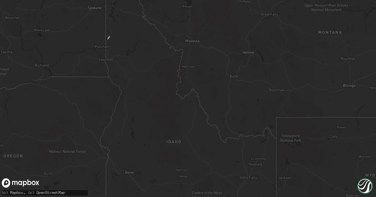
Hail Map in Idaho on September 25, 2024
Get this storm
September 25 map
$229
one time, instant access
Download today. No call, no setup
Keep the $229
Bought the map and want the full workflow? Apply the entire $229 to a subscription within 7 days. None of it is wasted.
Every map, not just this one
This buys you this map. Subscription and you get every map we run, in the markets you choose from a few cities to whole states to nationwide. Plus real-time alerts the moment a storm fires.
Contact data
Name, contact info, occupancy, even credit band for addresses in the footprint. You go from where it hit to who to call.
Become the source they trust
Unlimited branding weather history reports on demand. You already have the documented answer ready for the property owner, and you are the one who showed up with it.
Property data and RoofTrace estimates
Pull up any address you have got, its value and the exact code rules for that jurisdiction, straight from One Click Code. Then RoofTrace estimates the squares, pitch, and roof value, priced the way you price.
Storm reports in Idaho
Idaho
| Date | Description |
|---|---|
| 09/25/20246:40 PM CDT | Downed tree reported on social media. |
| 09/25/20246:30 PM CDT | Grain bin blown down and landed on van. |
| 09/25/20246:30 PM CDT | Large tree branches down from storm. Sent via social media. |
| 09/24/20248:30 PM CDT | Davis wx station recorded 57 mph gust. One large pine down and some aspen trees. |
| 09/24/20248:30 PM CDT | Perkins lake road is closed from perkins lake to solomon lake road due to multiple powerlines across the road and downed trees. |
| 09/24/20248:28 PM CDT | Roof was torn off a large barn. |
| 09/24/20248:15 PM CDT | Large fir tree downed in moyie springs across from the mill. |
| 09/24/20248:10 PM CDT | Fleming creek road from highway 95 to hagen road is closed due to power lines and trees on the road. |
| 09/24/20248:10 PM CDT | Numerous trees down at the fairgrounds. |
| 09/24/20248:09 PM CDT | Corrects previous non-tstm wnd gst report from 13 ese bayview. Mesonet station maei1 magee peak. |
| 09/24/20248:07 PM CDT | Report from mping: 1-inch tree limbs broken; shingles blown off. |
| 09/24/20248:05 PM CDT | 3328 power outages in shoshone county from storms. |
| 09/24/20248:01 PM CDT | 8193 power outages in latah county from storms. |
| 09/24/20248:01 PM CDT | 1710 power outages in benewah county from storms. |
| 09/24/20248:00 PM CDT | Facebook report of a downed tree in bonners ferry. |
| 09/24/20248:00 PM CDT | Bo80: trees uprooted or snapped off along deep creek road toward bonners ferry. Hail up to pea size. |
| 09/24/20248:00 PM CDT | 3413 outages in boundary county from storms. |
| 09/24/20248:00 PM CDT | 1019 power outages in kootenai county from storms. |
| 09/24/20248:00 PM CDT | 18...178 power outages in bonner county from storms. |
| 09/24/20247:56 PM CDT | Numerous power outages in bonner ferry... Moyie springs... And sandpoint from storms. |
| 09/24/20247:53 PM CDT | Report from mping: 1-inch tree limbs broken; shingles blown off. |
| 09/24/20247:45 PM CDT | Lots of trees down in the selle valley. Several trees in the picture were snapped half way. |
| 09/24/20247:35 PM CDT | Shingles ripped off roof. Several limbs ripped off a weeping willow. |
| 09/24/20247:30 PM CDT | Photo of snapped trees. Report of numerous trees down... All smaller than 12 inches dbh. Fences blown over. Time estimated from radar. |
| 09/24/20247:30 PM CDT | Bmx track damaged by falling trees in travers park in sandpoint... Id. Time estimated by radar. |
| 09/24/20247:30 PM CDT | 3 large trees down at city beach in sandpoint. |
| 09/24/20247:30 PM CDT | *** 1 fatal *** delayed report: local media reports of tree falling on 17 year old male. |
| 09/24/20247:00 PM CDT | Facebook report of tree blown town in oldtown. |
| 09/24/20247:00 PM CDT | Large ponderosa tree snapped near root from storms between 430-500pm. Sent via sm. |
All States Impacted by Hail Map on September 25, 2024
Cities Impacted by Hail Map on September 25, 2024
- Tamassee, SC
- Salem, SC
- Sunset, SC
- Portland, TN
- Gallatin, TN
- Bethpage, TN
- Westmoreland, TN
- Kingsport, TN
- Gate City, VA
- Edmond, OK
- Oklahoma City, OK
- Colfax, LA
- Dante, VA
- Cedartown, GA
- Piedmont, AL
- Cave Spring, GA
- Lindale, GA
- Clermont, GA
- Cleveland, GA
- Husser, LA
- Amite, LA
- Demorest, GA
- Clarkesville, GA
- Lakemont, GA
- Covington, LA
- Mandeville, LA
- Abita Springs, LA
- Long Creek, SC
- Ponchatoula, LA
- Madisonville, LA
- Mountain Rest, SC
- Westminster, SC
- Slidell, LA
- Lacombe, LA
- Port Lavaca, TX
- Pearl River, LA
- Bay Saint Louis, MS
- Tivoli, TX
- Lake Toxaway, NC
- Edna, TX
- Corpus Christi, TX
- Potlatch, ID
- Newport, WA
- Halifax, VA
- Mount Airy, GA
- Garwood, TX
- Hebbronville, TX
- Rio Grande City, TX
- Roma, TX
- Daufuskie Island, SC
- Bluffton, SC
- Blowing Rock, NC
- Waynesboro, GA
- Marietta, SC
- Roaring River, NC
- Stoneville, NC
- Rockbridge, OH


