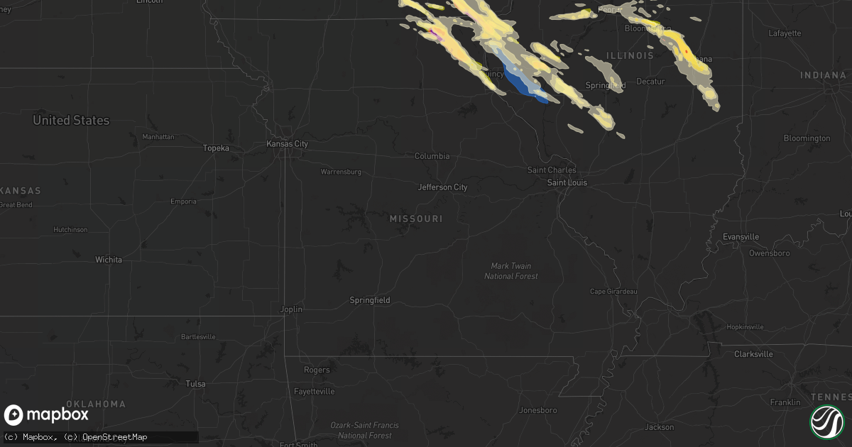
Hail Map in Missouri on September 18, 2022
Get this storm
September 18 map
$229
one time, instant access
Download today. No call, no setup
Keep the $229
Bought the map and want the full workflow? Apply the entire $229 to a subscription within 7 days. None of it is wasted.
Every map, not just this one
This buys you this map. Subscription and you get every map we run, in the markets you choose from a few cities to whole states to nationwide. Plus real-time alerts the moment a storm fires.
Contact data
Name, contact info, occupancy, even credit band for addresses in the footprint. You go from where it hit to who to call.
Become the source they trust
Unlimited branding weather history reports on demand. You already have the documented answer ready for the property owner, and you are the one who showed up with it.
Property data and RoofTrace estimates
Pull up any address you have got, its value and the exact code rules for that jurisdiction, straight from One Click Code. Then RoofTrace estimates the squares, pitch, and roof value, priced the way you price.
Storm reports in Missouri
Missouri
| Date | Description |
|---|---|
| 09/18/20226:02 AM CDT | At 1102 PM CDT, a severe thunderstorm was located 5 miles southwest of Bloomfield Municipal Airport, or 6 miles southwest of Bloomfield, moving southeast at 35 mph. HAZARD...Ping pong ball size hail and 60 mph wind gusts. SOURCE...Radar indicated. IMPACT...People and animals outdoors will be injured. Expect hail damage to roofs, siding, windows, and vehicles. Expect wind damage to roofs, siding, and trees. This severe thunderstorm will be near... Pulaski around 1120 PM CDT. |
| 09/18/20225:38 AM CDT | At 1038 PM CDT, a severe thunderstorm was located over Udell, or 6 miles northeast of Centerville, moving southeast at 35 mph. HAZARD...Quarter size hail. SOURCE...Radar indicated. IMPACT...Damage to vehicles is expected. This severe thunderstorm will be near... Moulton around 1050 PM CDT. Lake Wapello State Park around 1055 PM CDT.Other locations in the path of this severe thunderstorm includeDrakesville, Bloomfield and Bloomfield Municipal Airport. |
| 09/18/20225:15 AM CDT | At 1014 PM CDT, a severe thunderstorm was located over La Belle, moving southeast at 45 mph. HAZARD...60 mph wind gusts and quarter size hail. SOURCE...Radar indicated. IMPACT...Hail damage to vehicles is expected. Expect wind damage to roofs, siding, and trees. This severe thunderstorm will be near... Lewistown around 1020 PM CDT. |
| 09/18/20224:52 AM CDT | At 952 PM CDT, a severe thunderstorm was located near West Point, moving southeast at 25 mph. HAZARD...60 mph wind gusts and quarter size hail. SOURCE...Radar indicated. IMPACT...Hail damage to vehicles is expected. Expect wind damage to roofs, siding, and trees. This severe thunderstorm will be near... Mendon around 1005 PM CDT.Other locations in the path of this severe thunderstorm include CampPoint, Golden and Clayton. |
| 09/18/20224:30 AM CDT | At 930 PM CDT, a severe thunderstorm was located near South Gorin, or 13 miles southeast of Memphis, moving southeast at 30 mph. HAZARD...Two inch hail and 60 mph wind gusts. SOURCE...Radar indicated. IMPACT...People and animals outdoors will be injured. Expect hail damage to roofs, siding, windows, and vehicles. Expect wind damage to roofs, siding, and trees. This severe thunderstorm will be near... Fairmont around 935 PM CDT. Neeper around 950 PM CDT.Other locations in the path of this severe thunderstorm includeAntioch and St. Patrick. |
| 09/18/20224:30 AM CDT | At 929 PM CDT, a severe thunderstorm was located over Colony, moving southeast at 35 mph. HAZARD...Golf ball size hail and 60 mph wind gusts. SOURCE...Radar indicated. IMPACT...People and animals outdoors will be injured. Expect hail damage to roofs, siding, windows, and vehicles. Expect wind damage to roofs, siding, and trees. Locations impacted include... La Belle and Lewistown. |
| 09/18/20224:08 AM CDT | At 908 PM CDT, a severe thunderstorm was located near Memphis, moving southeast at 25 mph. THIS IS A DESTRUCTIVE STORM FOR NORTHERN KNOX COUNTY. HAZARD...Baseball size hail and 60 mph wind gusts. SOURCE...Radar indicated. IMPACT...People and animals outdoors will be severely injured. Expect shattered windows, extensive damage to roofs, siding, and vehicles. Locations impacted include... Colony. |
| 09/18/20223:45 AM CDT | At 845 PM CDT, a severe thunderstorm was located over Downing, or 9 miles west of Memphis, moving east at 45 mph. HAZARD...60 mph wind gusts and half dollar size hail. SOURCE...Radar indicated. IMPACT...Hail damage to vehicles is expected. Expect wind damage to roofs, siding, and trees. Locations impacted include... Downing. |
| 09/18/20223:30 AM CDT | At 829 PM CDT, a severe thunderstorm was located over Kilwinning, or 9 miles east of Lancaster, moving east at 45 mph. HAZARD...60 mph wind gusts and quarter size hail. SOURCE...Radar indicated. IMPACT...Hail damage to vehicles is expected. Expect wind damage to roofs, siding, and trees. This severe thunderstorm will be near... Crawford and Hitt around 835 PM CDT. Scotland County Fairgrounds and Memphis Memorial Airport around 840 PM CDT. Memphis and Brock around 845 PM CDT.Other locations in the path of this severe thunderstorm include Azen,Granger, Arbela, Prospect Grove, Wyaconda, Etna, Heath MemorialConservation Area, Luray, Ashton, Medill, Chambersburg and Anson. |
| 09/17/20229:49 PM CDT | A local report indicates 1.50 inch wind near LA BELLE |
| 09/17/20229:36 PM CDT | Farm outbuilding damaged. Facebook report. Time estimated from radar. |
| 09/17/20229:15 PM CDT | At 214 AM CDT, a severe thunderstorm was located over Bevier, or near Macon, moving east at 30 mph. HAZARD...60 mph wind gusts and quarter size hail. SOURCE...Radar indicated. IMPACT...Hail damage to vehicles is expected. Expect wind damage to roofs, siding, and trees. Locations impacted include... Macon, Bevier, Callao and Excello. |
| 09/17/20229:04 PM CDT | A local report indicates 1.25 inch wind near MEMPHIS |
| 09/17/20229:00 PM CDT | A local report indicates 2.00 inch wind near MEMPHIS |
All States Impacted by Hail Map on September 18, 2022
Cities Impacted by Hail Map on September 18, 2022
- Almont, MI
- Marseilles, IL
- Sheridan, IL
- Serena, IL
- Amboy, IL
- Morris, IL
- Princeton, IL
- Bloomfield, IA
- Floris, IA
- Plainwell, MI
- Fowlerville, MI
- Sheffield, IL
- Annawan, IL
- Mineral, IL
- Kalamazoo, MI
- Paw Paw, MI
- Portage, MI
- Mattawan, MI
- Carlock, IL
- Normal, IL
- Hudson, IL
- Danvers, IL
- Goodfield, IL
- Bloomington, IL
- Deer Creek, IL
- Kilbourne, IL
- Secor, IL
- El Paso, IL
- Douds, IA
- Keosauqua, IA
- Saint Anthony, ND
- Bangor, MI
- Bloomingdale, MI
- Gobles, MI
- South Haven, MI
- Grand Junction, MI
- Buda, IL
- Henry, IL
- Bradford, IL
- Putnam, IL
- Wyoming, IL
- Hampton, IL
- Blue Grass, IA
- Toulon, IL
- Stockton, IA
- Atkinson, IL
- Galva, IL
- Rock Island, IL
- Hillsdale, IL
- Tipton, IA
- Davenport, IA
- Princeton, IA
- Geneseo, IL
- Rapids City, IL
- West Branch, IA
- New Liberty, IA
- Cambridge, IL
- Carbon Cliff, IL
- Donahue, IA
- Moline, IL
- Colona, IL
- McCausland, IA
- Cordova, IL
- Albany, IL
- Osco, IL
- Andover, IL
- Dixon, IA
- Iowa City, IA
- Long Grove, IA
- West Liberty, IA
- Moscow, IA
- Camanche, IA
- Lynn Center, IL
- Bettendorf, IA
- Port Byron, IL
- Durant, IA
- Kewanee, IL
- Milan, IL
- Wilton, IA
- Atalissa, IA
- Eldridge, IA
- Bennett, IA
- Coal Valley, IL
- Neponset, IL
- Walcott, IA
- Silvis, IL
- Solon, IA
- Pleasant Valley, IA
- Le Claire, IA
- East Moline, IL
- Orion, IL
- Hampshire, IL
- Solen, ND
- Mandan, ND
- Warrenville, IL
- Naperville, IL
- West Chicago, IL
- Saint Charles, IL
- Maple Park, IL
- Winfield, IL
- Wheaton, IL
- North Aurora, IL
- Elburn, IL
- Glendale Heights, IL
- Aurora, IL
- Mooseheart, IL
- Hanover Park, IL
- Hinckley, IL
- Bloomingdale, IL
- Big Rock, IL
- Batavia, IL
- Carol Stream, IL
- Sugar Grove, IL
- Geneva, IL
- Illinois City, IL
- Taylor Ridge, IL
- Joy, IL
- Reynolds, IL
- Chenoa, IL
- Wheatland, IA
- Glen Ullin, ND
- Elgin, ND
- Mott, ND
- Carson, ND
- New Leipzig, ND
- Ely, IA
- Lisbon, IA
- Cedar Rapids, IA
- Mount Vernon, IA
- Mechanicsville, IA
- Oskaloosa, IA
- Eddyville, IA
- Kirkville, IA
- Cedar, IA
- Fremont, IA
- Washington, IL
- Moffit, ND
- Moravia, IA
- Moulton, IA
- Udell, IA
- Unionville, IA
- Centerville, IA
- Wayland, MO
- Kahoka, MO
- South Bend, IN
- New Carlisle, IN
- Wilmette, IL
- Kenilworth, IL
- Evanston, IL
- Munith, MI
- Stockbridge, MI
- Leslie, MI
- La Moille, IL
- Mendota, IL
- Ohio, IL
- Sublette, IL
- Van Orin, IL
- Elk Grove Village, IL
- Arlington Heights, IL
- Medinah, IL
- Itasca, IL
- Des Plaines, IL
- Mount Prospect, IL
- Dansville, MI
- Williamston, MI
- Webberville, MI
- Mason, MI
- Manlius, IL
- Wyanet, IL
- Walnut, IL
- Steward, IL
- Lee, IL
- Gridley, IL
- Hooppole, IL
- Prophetstown, IL
- Erie, IL
- Morrison, IL
- Sterling, IL
- Ottawa, IL
- Elmhurst, IL
- Berkeley, IL
- Oak Brook, IL
- Westchester, IL
- Hillside, IL
- Flasher, ND
- Park Ridge, IL
- Lincolnwood, IL
- Chicago, IL
- Skokie, IL
- Niles, IL
- Grass Lake, MI
- Pleasant Lake, MI
- Pinckney, MI
- Gregory, MI
- Three Rivers, MI
- Vicksburg, MI
- Amana, IA
- Swisher, IA
- North Liberty, IA
- Arenzville, IL
- Hickory Corners, MI
- Richland, MI
- Easton, IL
- Rushville, IL
- Memphis, MO
- Downing, MO
- Elmwood, IL
- Farmington, IL
- Yates City, IL
- Canton, IL
- Fairview, IL
- London Mills, IL
- Glasford, IL
- Norris, IL
- Trivoli, IL
- Ellisville, IL
- Avon, IL
- Pulaski, IA
- Milton, IA
- Farmersville, IL
- Heyworth, IL
- Wapella, IL
- Luray, MO
- Farmer City, IL
- Arrowsmith, IL
- Le Roy, IL
- Bonaparte, IA
- Donnellson, IA
- Farmington, IA
- Jacksonville, IL
- Concord, IL
- Franklin, IL
- Waverly, IL
- Camp Point, IL
- Clayton, IL
- Waggoner, IL
- Raymond, IL
- Queen City, MO
- Arbela, MO
- Montrose, IA
- Nauvoo, IL
- Keokuk, IA
- Argyle, IA
- Taylor, MO
- Palmyra, MO
- Virden, IL
- Girard, IL
- Harvel, IL
- Versailles, IL
- La Belle, MO
- Rutledge, MO
- Knox City, MO
- Lewistown, MO
- Gorin, MO
- Wyaconda, MO
- Bondville, IL
- Mahomet, IL
- Dewey, IL
- Champaign, IL
- Seymour, IL
- Mansfield, IL
- Auburn, IL
- Morrisonville, IL
- Downs, IL
- Sidney, IL
- Towanda, IL
- Congerville, IL
- Tolono, IL
- White Heath, IL
- Saybrook, IL
- Homer, IL
- Urbana, IL
- Ellsworth, IL
- Savoy, IL
- Broadlands, IL
- Cooksville, IL
- Foosland, IL
- Longview, IL
- Fisher, IL
- Bellflower, IL
- Philo, IL
- Saint Paul, IA
- West Point, IA
- Meredosia, IL
- Bluffs, IL
- Griggsville, IL
- Winchester, IL
- Ewing, MO
- Edina, MO
- Frederick, IL
- Mount Sterling, IL
- Littleton, IL
- Brocton, IL
- Hindsboro, IL
- Oakland, IL
- Mendon, IL
- Hamilton, IL
- Timewell, IL
- West Point, IL
- Eldon, IA
- Batavia, IA
- Carthage, IL
- Hillsboro, IA
- Dallas City, IL
- Elvaston, IL
- Salem, IA
- Loraine, IL
- Alexandria, MO
- Birmingham, IA
- Agency, IA
- Saint Patrick, MO
- Stockport, IA
- Niota, IL
- Fairfield, IA
- Libertyville, IA
- Ottumwa, IA
- Mount Sterling, IA
- Sutter, IL
- Fort Madison, IA
- Warsaw, IL
- Selma, IA
- Golden, IL
- La Harpe, IL
- Basco, IL
- Bowen, IL
- Sparland, IL
- East Peoria, IL
- Varna, IL
- Chapin, IL
- Modesto, IL
- Irving, IL
- Witt, IL
- Fillmore, IL
- Hillsboro, IL
- Camargo, IL
- Newman, IL
- Browning, IL
- Industry, IL
- Beardstown, IL
- Plymouth, IL
- Ortonville, MI
- Holly, MI
- Davisburg, MI
- Clarkston, MI
- Kansas, IL
- Tuscola, IL
- Villa Grove, IL
- Chesterfield, IL
- Huntsville, IL
- La Prairie, IL
- Camden, IL
- Hanna City, IL
- Mapleton, IL
- Rochester, IL
- Springfield, IL
- Riverton, IL
- Mechanicsburg, IL
- Sherman, IL
- Dawson, IL
- Durham, MO
- Maywood, MO
- Lexington, IL
- Astoria, IL
- Vermont, IL
- Elgin, IL
- Hoffman Estates, IL
- Muscatine, IA
- Glenwood, MO
- Unionville, MO
- Livonia, MO
- Colchester, IL
- Macomb, IL
- Lancaster, MO
- Hull, IL
- Hannibal, MO
- Baring, MO
- Monticello, MO
- Havana, IL
- Ipava, IL
- Bath, IL
- Lowpoint, IL
- Metamora, IL
- Rockbridge, IL
- Greenfield, IL
- Carlinville, IL
- Perry, IL
- Chambersburg, IL
- Regent, ND
- Ashmore, IL
- Arcola, IL
- Murdock, IL
- Roanoke, IL
- Paris, IL
- Peoria, IL
- Peoria Heights, IL
- Morton, IL
- Ivesdale, IL
- Pesotum, IL
- Charleston, IL
- Eureka, IL
- Creve Coeur, IL
- Sadorus, IL
- Monticello, IL
- Benson, IL
- Howell, MI
- Flanagan, IL
- Lockridge, IA
- Loda, IL
- Roberts, IL
- Sibley, IL
- Melvin, IL
- Murrayville, IL
- Augusta, IL
- Chandlerville, IL
- Virginia, IL
- Washburn, IL
- Lacon, IL
- La Rose, IL
- Minonk, IL
- Toluca, IL
- Buffalo, IL
- Athens, IL
- Petersburg, IL
- Elkhart, IL
- Williamsville, IL
- Middletown, IL
- Greenview, IL
- Cantrall, IL
- Edinburg, IL
- Oakford, IL
- Drakesville, IA
- Prairie City, IL
- Smithfield, IL
- Bushnell, IL
- Greentop, MO
- Baylis, IL
- Coatsburg, IL
- Williamstown, MO
- Ursa, IL
- La Grange, MO
- Fowler, IL
- Chillicothe, IA
- Paloma, IL
- Litchfield, IL
- Quincy, IL
- Liberty, IL
- Thayer, IL
- Butler, IL
- Melrose, IA
- Payson, IL
- Revere, MO
- Coatsville, MO
- New Salem, IL
- Alexander, IL
- Pittsfield, IL
- Barry, IL
- Plainville, IL
- Wayne, IL


