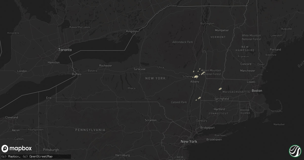
Hail Map in New York on September 13, 2022
Get this storm
September 13 map
$229
one time, instant access
Download today. No call, no setup
Keep the $229
Bought the map and want the full workflow? Apply the entire $229 to a subscription within 7 days. None of it is wasted.
Every map, not just this one
This buys you this map. Subscription and you get every map we run, in the markets you choose from a few cities to whole states to nationwide. Plus real-time alerts the moment a storm fires.
Contact data
Name, contact info, occupancy, even credit band for addresses in the footprint. You go from where it hit to who to call.
Become the source they trust
Unlimited branding weather history reports on demand. You already have the documented answer ready for the property owner, and you are the one who showed up with it.
Property data and RoofTrace estimates
Pull up any address you have got, its value and the exact code rules for that jurisdiction, straight from One Click Code. Then RoofTrace estimates the squares, pitch, and roof value, priced the way you price.
Storm reports in New York
New York
| Date | Description |
|---|---|
| 09/13/20224:04 PM CDT | Multiple trees reported down along farm road and route 7 in copake. |
| 09/13/20222:10 PM CDT | Downed tree. Time estimated from radar. |
| 09/13/20221:51 PM CDT | Trees down in easton. Time estimated from radar. |
| 09/13/20221:46 PM CDT | Law enforcement reported numerous trees down throughout the town of clifton park. Time estimated from radar. |
| 09/13/20221:42 PM CDT | Wires down along moe rd in clifton park. Time estimated from radar. |
| 09/13/20221:27 PM CDT | Pole down. |
| 09/13/20221:17 PM CDT | Wires down. |
| 09/13/202211:42 AM CDT | Several trees down in bellevue area of schenectady. |
| 09/13/202211:23 AM CDT | Tree down. |
| 09/12/20228:38 PM CDT | At 138 PM EDT, a severe thunderstorm was located near Saratoga Springs, moving northeast at 20 mph. HAZARD...60 mph wind gusts and quarter size hail. SOURCE...Radar indicated. IMPACT...Hail damage to vehicles is expected. Expect wind damage to roofs, siding, and trees. This severe thunderstorm will be near... Greenwich around 215 PM EDT. Fort Edward around 235 PM EDT. Hudson Falls around 245 PM EDT.Other locations impacted by this severe thunderstorm include DeansCorners, Cossayuna, Dunham Basin, Center Falls, Grangerville, WillowGlen, Northumberland, Coons, Wayville and Middle Falls. |
All States Impacted by Hail Map on September 13, 2022
Cities Impacted by Hail Map on September 13, 2022
- Cohoes, NY
- Waterford, NY
- Leupp, AZ
- Clewiston, FL
- Tombstone, AZ
- South Deerfield, MA
- Hatfield, MA
- North Hatfield, MA
- West Hatfield, MA
- Haydenville, MA
- Chino Valley, AZ
- Troy, NY
- San Simon, AZ
- Valley Falls, NY
- Elfrida, AZ
- Holbrook, AZ
- Nespelem, WA
- Jordan Valley, OR
- Paulden, AZ
- Winslow, AZ
- Joseph City, AZ
- Johnsonville, NY
- Buskirk, NY
- Eagle Bridge, NY
- Hoosick Falls, NY
- Douglas, AZ
- Schenectady, NY
- Greenwich, NY
- Ancram, NY
- Copake Falls, NY
- Copake, NY
- Hillsdale, NY
- East Wenatchee, WA
- Pine Plains, NY
- Mechanicville, NY
- Ballston Lake, NY
- Ballston Spa, NY
- Cambridge, NY
- Clifton Park, NY
- Latham, NY
- Melrose, NY
- Rexford, NY
- Schaghticoke, NY


