Hail Map on September 13, 2022
Get this storm
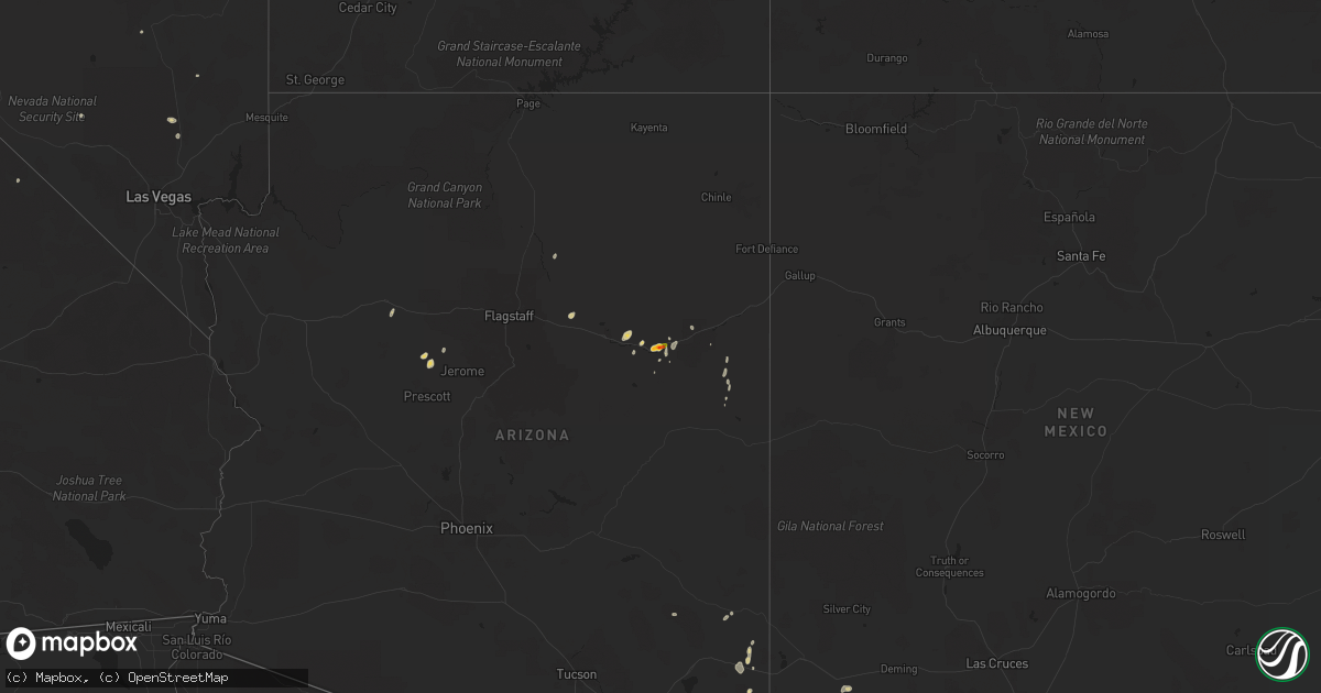
September 13 map
$229
one time, instant access
Download today. No call, no setup
Keep the $229
Bought the map and want the full workflow? Apply the entire $229 to a subscription within 7 days. None of it is wasted.
Every map, not just this one
This buys you this map. Subscription and you get every map we run, in the markets you choose from a few cities to whole states to nationwide. Plus real-time alerts the moment a storm fires.
Contact data
Name, contact info, occupancy, even credit band for addresses in the footprint. You go from where it hit to who to call.
Become the source they trust
Unlimited branding weather history reports on demand. You already have the documented answer ready for the property owner, and you are the one who showed up with it.
Property data and RoofTrace estimates
Pull up any address you have got, its value and the exact code rules for that jurisdiction, straight from One Click Code. Then RoofTrace estimates the squares, pitch, and roof value, priced the way you price.
States Impacted by Hail Map on September 13, 2022
Storm reports
New Hampshire
| Date | Description |
|---|---|
| 09/13/20226:44 PM CDT | Delayed report...large branches and a few small trees |
| 09/13/20226:40 PM CDT | Delayed report. Trees down on nh-124 near prescott road... And blocked both lanes of the road. Time estimated by radar. |
| 09/13/20223:43 AM CDT | At 843 PM EDT, a severe thunderstorm was located over New Boston, or 11 miles northwest of Merrimack, moving east at 15 mph. HAZARD...60 mph wind gusts and penny size hail. SOURCE...Radar indicated. IMPACT...Expect damage to roofs, siding, and trees. Locations impacted include... Manchester, Nashua, Derry, Merrimack, Bedford, Milford, Hooksett, Amherst, Litchfield, Hollis, New Boston, Epsom, Mont Vernon, Lyndeborough, Francestown, Mason, Goffstown, Mount Vernon, Weare and Hudson.This includes the following highways... Interstate 293 between mile markers 1 and 11. Interstate 93 between mile markers 9 and 34. |
| 09/13/20221:38 AM CDT | At 638 PM EDT, a severe thunderstorm was located over Whately, or near Amherst, moving northeast at 35 mph. HAZARD...60 mph wind gusts and quarter size hail. SOURCE...Radar indicated. IMPACT...Expect wind damage to trees and power lines. Minor hail damage to vehicles is possible. Locations impacted include... Amherst, Northampton, Orange, Deerfield, Athol, Montague, Templeton, Hadley, Sunderland, Hatfield, Northfield, Williamsburg, Conway, Leverett, Erving, Shutesbury, Phillipston, Whately, Pelham and Royalston. |
| 09/12/20227:35 PM CDT | Delayed report...report of 71mph wind gust from home weather station in mont vernon. Thunderstorm knocked down trees in the area. |
| 09/12/20227:14 PM CDT | Delayed report...trees and large branches down at woodland hill rd near zephyr lake. Time estimated by radar. |
| 09/12/20227:06 PM CDT | Trees and wires down. Time estimated by radar. |
Maryland
| Date | Description |
|---|---|
| 09/12/202211:08 PM CDT | At 408 AM EDT, a severe thunderstorm was located near Vienna, or 10 miles northwest of Salisbury, moving northeast at 35 mph. HAZARD...60 mph wind gusts and penny size hail. SOURCE...Radar indicated. IMPACT...Damage to roofs, siding, trees, and power lines is possible. Locations impacted include... Georgetown, Laurel, Delmar, Sycamore, Gumboro, Blades and Bethel. |
Arizona
| Date | Description |
|---|---|
| 09/13/20221:46 PM CDT | A local report indicates 1.75 inch wind near 3 NE HOLBROOK |
| 09/13/20221:45 PM CDT | Public report of quarter size hail just north of holbrook. A picture was provided on social media. |
| 09/13/20221:00 PM CDT | Landspout tornado observed to have briefly touched down south of the little colorado river where the dust was seen swirling. |
| 09/13/20227:01 AM CDT | At 1201 PM MST, a severe thunderstorm was located 8 miles east of Huachuca City, or 9 miles north of Sierra Vista, moving northeast at 10 mph. HAZARD...60 mph wind gusts and quarter size hail. SOURCE...Radar indicated. IMPACT...Hail damage to vehicles is expected. Expect wind damage to roofs, siding, and trees. Locations impacted include... Sierra Vista, Benson, Whetstone, Huachuca City, St. David, Tombstone, Kartchner Caverns State Park, Fairbank and Charleston. |
| 09/13/20226:36 AM CDT | At 1135 AM MST, a severe thunderstorm was located over Holbrook, or 31 miles east of Winslow, moving northeast at 10 mph. HAZARD...60 mph wind gusts and quarter size hail. SOURCE...Radar indicated. IMPACT...Hail damage to vehicles is expected. Expect wind damage to roofs, siding, and trees. Locations impacted include... Holbrook and Sun Valley. This includes the following highways... Business Interstate 40 between mile markers 286 and 289. Interstate 40 between mile markers 284 and 299. State Route 377 near mile marker 33. State Route 77 between mile markers 384 and 404. Highway 180 between mile markers 308 and 313. |
| 09/13/20225:27 AM CDT | At 1027 AM MST, a severe thunderstorm was located near Paulden, or near Chino Valley, moving north at 5 mph. HAZARD...Quarter size hail. SOURCE...Radar indicated. IMPACT...Damage to vehicles is expected. Locations impacted include... Chino Valley and Paulden. This includes State Route 89 between mile markers 328 and 344. |
| 09/12/20229:12 PM CDT | At 211 PM MST, a severe thunderstorm was located over Douglas, moving northeast at 15 mph. HAZARD...60 mph wind gusts and quarter size hail. SOURCE...Radar indicated. IMPACT...Hail damage to vehicles is expected. Expect wind damage to roofs, siding, and trees. Locations impacted include... Douglas, Bisbee-Douglas Airport and Pirtleville. |
| 09/12/20229:02 PM CDT | At 202 PM MDT, a severe thunderstorm was located 8 miles northwest of Joseph City, or 14 miles east of Winslow, moving northeast at 15 mph. HAZARD...60 mph wind gusts and quarter size hail. SOURCE...Radar indicated. IMPACT...Hail damage to vehicles is expected. Expect wind damage to roofs, siding, and trees. This severe thunderstorm will remain over mainly rural areas of Navajo County.This includes Interstate 40 between mile markers 263 and 274. |
| 09/12/20228:55 PM CDT | At 155 PM MST, a severe thunderstorm was located near Leupp, or 22 miles northwest of Winslow, moving northeast at 15 mph. HAZARD...60 mph wind gusts and quarter size hail. SOURCE...Radar indicated. IMPACT...Hail damage to vehicles is expected. Expect wind damage to roofs, siding, and trees. Locations impacted include... Rimmy Jims, Sunrise and Leupp. This includes State Route 99 between mile markers 63 and 71. |
| 09/12/20228:18 PM CDT | At 118 PM MST, a severe thunderstorm was located 11 miles southeast of Pearce-Sunsites, or 28 miles north of Bisbee, moving northeast at 15 mph. HAZARD...60 mph wind gusts and quarter size hail. SOURCE...Radar indicated. IMPACT...Hail damage to vehicles is expected. Expect wind damage to roofs, siding, and trees. Locations impacted include... Pearce-Sunsites, Elfrida, Sunizona and Kansas Settlement. |
| 09/12/20227:45 PM CDT | Gustnado observed to have formed and traveled along the leading edge of thunderstorm outflow. |
Delaware
| Date | Description |
|---|---|
| 09/12/202211:47 PM CDT | At 447 AM EDT, a severe thunderstorm was located near Millsboro, or near Georgetown, moving northeast at 35 mph. HAZARD...60 mph wind gusts and penny size hail. SOURCE...Radar indicated. IMPACT...Damage to roofs, siding, trees, and power lines is possible. Locations impacted include... Georgetown, Millsboro, Lewes, Henlopen Acres, Cape Henlopen State Park, Long Neck and Dewey Beach. |
Massachusetts
| Date | Description |
|---|---|
| 09/13/20226:14 PM CDT | Multiple trees down on wires on shutesbury road |
| 09/13/20226:11 PM CDT | Trees and power lines down on millers falls road |
| 09/13/20223:00 AM CDT | At 800 PM EDT, a severe thunderstorm was located over Sharon, or near Jaffrey, moving east at 20 mph. HAZARD...60 mph wind gusts and penny size hail. SOURCE...Radar indicated. IMPACT...Expect damage to roofs, siding, and trees. Locations impacted include... Nashua, Merrimack, Jaffrey, Bedford, Milford, Amherst, Hollis, Peterborough, New Boston, Mont Vernon, Greenfield, Lyndeborough, Dublin, Francestown, Bennington, Harrisville, Rindge, Hancock, Sharon and New Ipswich. |
| 09/13/20222:08 AM CDT | At 707 PM EDT, a severe thunderstorm was located near Richmond, or 15 miles southwest of Jaffrey, moving northeast at 30 mph. HAZARD...60 mph wind gusts and penny size hail. SOURCE...Radar indicated. IMPACT...Expect damage to roofs, siding, and trees. Locations impacted include... Jaffrey, Swanzey, Peterborough, Winchester, Antrim, Marlborough, Greenfield, Lyndeborough, Dublin, Bennington, Richmond, Harrisville, Rindge, Hancock, Sharon, New Ipswich, Greenville, Fitzwilliam, Troy and Temple. |
| 09/13/20221:53 AM CDT | At 652 PM EDT, a severe thunderstorm was located over Northfield, or 8 miles northwest of Orange, moving northeast at 55 mph. HAZARD...60 mph wind gusts. SOURCE...Radar indicated. IMPACT...Expect damage to trees and power lines. Locations impacted include... Northfield, Bernardston, Erving, Gill, Royalston and Warwick. |
| 09/13/202212:43 AM CDT | At 543 PM EDT, a severe thunderstorm was located near Otis, or 13 miles east of Great Barrington, moving east at 30 mph. HAZARD...60 mph wind gusts and quarter size hail. SOURCE...Radar indicated. IMPACT...Expect wind damage to trees and power lines. Minor hail damage to vehicles is possible. Locations impacted include... Holyoke, Northampton, South Hadley, Easthampton, Granby, Southampton, Hadley, Hatfield, Williamsburg, Huntington, Russell, Westhampton, Whately, Chester, Blandford, Chesterfield, Worthington, Goshen, Montgomery and Middlefield. |
| 09/13/202212:04 AM CDT | At 504 PM EDT, a severe thunderstorm was located near Copake, or 8 miles southwest of Great Barrington, moving east at 35 mph. HAZARD...60 mph wind gusts and nickel size hail. SOURCE...Radar indicated. IMPACT...Expect damage to roofs, siding, and trees. Locations impacted include... Great Barrington, Lee, Copake, Sheffield, Becket, Otis, Sandisfield, Housatonic, Ashley Falls, Hillsdale, New Marlborough, Monterey, Alford, Tyringham, Ancramdale, Hartsville, Konkapot, Gomorrah, Montville and Alander. |
| 09/12/20227:27 PM CDT | Trees down on jewett hill road and flint road |
Nevada
| Date | Description |
|---|---|
| 09/12/202211:05 PM CDT | Desert rock airport asos measured a gust of 64 mph from a nearby thunderstorm from 2105 to 2109. |
Virginia
| Date | Description |
|---|---|
| 09/13/20227:21 AM CDT | At 1221 AM EDT, a severe thunderstorm was located over Fork Union, moving northeast at 35 mph. HAZARD...60 mph wind gusts and quarter size hail. SOURCE...Radar indicated. IMPACT...Minor damage to vehicles is possible. Expect wind damage to trees and powerlines. This severe thunderstorm will be near... Fork Union around 1225 AM EDT. Palmyra and Columbia around 1230 AM EDT. Kents Store around 1245 AM EDT. Hadensville and Ferncliff around 1250 AM EDT. Louisa around 105 AM EDT. Mineral around 110 AM EDT. Bumpass around 115 AM EDT.Other locations impacted by this severe thunderstorm include Orchid,Louisa Airport, Green Springs, Shores, Central Plains, Bremo Bluff,Cohasset, Tabscott, Trevilians and Wilmington. |
Washington
| Date | Description |
|---|---|
| 09/13/20223:19 AM CDT | At 818 PM PDT, a severe thunderstorm was located 11 miles southeast of North Omak, or 13 miles southeast of Omak, moving north at 25 mph. HAZARD...60 mph wind gusts and quarter size hail. SOURCE...Radar indicated. IMPACT...Hail damage to vehicles is expected. Expect wind damage to roofs, siding, and trees. Locations impacted include... Disautel. |
Connecticut
| Date | Description |
|---|---|
| 09/13/202212:38 AM CDT | At 537 PM EDT, a severe thunderstorm was located near Trumbull, or 8 miles south of Newtown, moving northeast at 30 mph. HAZARD...60 mph wind gusts and quarter size hail. SOURCE...Radar indicated. IMPACT...Minor hail damage to vehicles is possible. Expect wind damage to trees and power lines. This severe thunderstorm will be near... Shelton and Monroe around 555 PM EDT. Derby around 600 PM EDT. Seymour and Orange around 605 PM EDT. Naugatuck and Beacon Falls around 615 PM EDT. Hamden and Prospect around 620 PM EDT. Cheshire and North Haven around 625 PM EDT. Wallingford and North Branford around 630 PM EDT. |
Utah
| Date | Description |
|---|---|
| 09/12/202210:24 PM CDT | At 324 PM MDT, a severe thunderstorm was located near Great Salt Lake North of the Causeway, or 39 miles west of Brigham City, moving north at 20 mph. HAZARD...60 mph wind gusts and quarter size hail. SOURCE...Radar indicated. IMPACT...Hail damage to vehicles is expected. Expect wind damage to roofs, siding, and trees. Locations impacted include... Great Salt Lake North of the Causeway. |
California
| Date | Description |
|---|---|
| 09/12/20229:30 PM CDT | At 229 PM PDT, a severe thunderstorm was located near Darwin, or 23 miles east of Olancha, moving east at 15 mph. HAZARD...60 mph wind gusts and nickle size hail. SOURCE...Radar indicated. IMPACT...Expect damage to roofs and trees. Locations impacted include... Panamint Springs and Darwin. |
New York
| Date | Description |
|---|---|
| 09/13/20224:04 PM CDT | Multiple trees reported down along farm road and route 7 in copake. |
| 09/13/20222:10 PM CDT | Downed tree. Time estimated from radar. |
| 09/13/20221:51 PM CDT | Trees down in easton. Time estimated from radar. |
| 09/13/20221:46 PM CDT | Law enforcement reported numerous trees down throughout the town of clifton park. Time estimated from radar. |
| 09/13/20221:42 PM CDT | Wires down along moe rd in clifton park. Time estimated from radar. |
| 09/13/20221:27 PM CDT | Pole down. |
| 09/13/20221:17 PM CDT | Wires down. |
| 09/13/202211:42 AM CDT | Several trees down in bellevue area of schenectady. |
| 09/13/202211:23 AM CDT | Tree down. |
| 09/12/20228:38 PM CDT | At 138 PM EDT, a severe thunderstorm was located near Saratoga Springs, moving northeast at 20 mph. HAZARD...60 mph wind gusts and quarter size hail. SOURCE...Radar indicated. IMPACT...Hail damage to vehicles is expected. Expect wind damage to roofs, siding, and trees. This severe thunderstorm will be near... Greenwich around 215 PM EDT. Fort Edward around 235 PM EDT. Hudson Falls around 245 PM EDT.Other locations impacted by this severe thunderstorm include DeansCorners, Cossayuna, Dunham Basin, Center Falls, Grangerville, WillowGlen, Northumberland, Coons, Wayville and Middle Falls. |
Vermont
| Date | Description |
|---|---|
| 09/13/20221:21 AM CDT | At 620 PM EDT, a severe thunderstorm was located over Colrain, or 8 miles northwest of Greenfield, moving northeast at 55 mph. HAZARD...60 mph wind gusts. SOURCE...Radar indicated. IMPACT...Expect damage to trees and power lines. Locations impacted include... Greenfield, Northfield, Bernardston, Buckland, Conway, Shelburne, Colrain, Gill, Charlemont, Warwick, Leyden, Heath and Rowe. |
| 09/12/202210:23 PM CDT | At 323 PM EDT, severe thunderstorms were located along a line extending from near Salem to near Arlington to near Hoosick Falls, moving northeast at 30 mph. HAZARD...60 mph wind gusts and quarter size hail. SOURCE...Radar indicated. IMPACT...Hail damage to vehicles is expected. Expect wind damage to roofs, siding, and trees. Locations impacted include... Arlington, Manchester, Shaftsbury, Dorset, Manchester Center, North Bennington, Sunderland, Rupert, Sandgate, Peru, Glastenbury, Paper Mill Village, Sodom, Beartown, Chiselville, South Shaftsbury, Barnumville, West Rupert, Hidden Valley and Bromley Village. |
| 09/12/20229:55 PM CDT | At 255 PM EDT, a severe thunderstorm was located over Greenwich, or 12 miles southwest of Salem, moving northeast at 20 mph. HAZARD...60 mph wind gusts and quarter size hail. SOURCE...Radar indicated. IMPACT...Hail damage to vehicles is expected. Expect wind damage to roofs, siding, and trees. Locations impacted include... Salem, Cambridge, Greenwich, Porter, White Creek, Cossayuna, Braymer School, Battenville, Center Falls, East Hebron, Rexleigh, Tiplady, Middle Falls, Eagleville, Anaquassacook, Fitch Point, Bald Mountain, Ash Grove, Shushan and Clarks Mills. |
| 09/12/20229:42 PM CDT | At 242 PM EDT, a severe thunderstorm was located near Latham, moving northeast at 20 mph. HAZARD...60 mph wind gusts and quarter size hail. SOURCE...Radar indicated. IMPACT...Hail damage to vehicles is expected. Expect wind damage to roofs, siding, and trees. Locations impacted include... Albany, Troy, Cohoes, Watervliet, Rensselaer, Colonie, Mechanicville, Hoosick Falls, Delmar, Latham, Guilderland, Menands, Green Island, Waterford, Loudonville, Center Brunswick, Wyantskill, Feura Bush, Wynantskill and Halfmoon. |
New Mexico
| Date | Description |
|---|---|
| 09/13/20223:54 PM CDT | Asos station krow roswell air center. |
| 09/13/202212:09 AM CDT | At 509 PM MDT, a severe thunderstorm was located 9 miles southeast of Separ, moving northeast at 15 mph. HAZARD...60 mph wind gusts and quarter size hail. SOURCE...Radar indicated. IMPACT...Hail damage to vehicles is expected. Expect wind damage to roofs, siding, and trees. Locations impacted include... Gage.This includes Interstate 10 in New Mexico between mile markers 48 and66. |
| 09/12/20229:07 PM CDT | At 207 PM MST, a severe thunderstorm was located 13 miles east of Bowie, or 16 miles northwest of Steins, moving north at 15 mph. HAZARD...60 mph wind gusts and quarter size hail. SOURCE...Radar indicated. IMPACT...Hail damage to vehicles is expected. Expect wind damage to roofs, siding, and trees. Locations impacted include... Bowie and San Simon. |
Cities Impacted by Hail Map on September 13, 2022
- Cohoes, NY
- Waterford, NY
- Leupp, AZ
- Clewiston, FL
- Tombstone, AZ
- South Deerfield, MA
- Hatfield, MA
- North Hatfield, MA
- West Hatfield, MA
- Haydenville, MA
- Chino Valley, AZ
- Troy, NY
- San Simon, AZ
- Valley Falls, NY
- Elfrida, AZ
- Holbrook, AZ
- Nespelem, WA
- Jordan Valley, OR
- Paulden, AZ
- Winslow, AZ
- Joseph City, AZ
- Johnsonville, NY
- Buskirk, NY
- Eagle Bridge, NY
- Hoosick Falls, NY
- Douglas, AZ
- Schenectady, NY
- Greenwich, NY
- Ancram, NY
- Copake Falls, NY
- Copake, NY
- Hillsdale, NY
- East Wenatchee, WA
- Pine Plains, NY
- Mechanicville, NY
- Ballston Lake, NY
- Ballston Spa, NY
- Cambridge, NY
- Clifton Park, NY
- Latham, NY
- Melrose, NY
- Rexford, NY
- Schaghticoke, NY