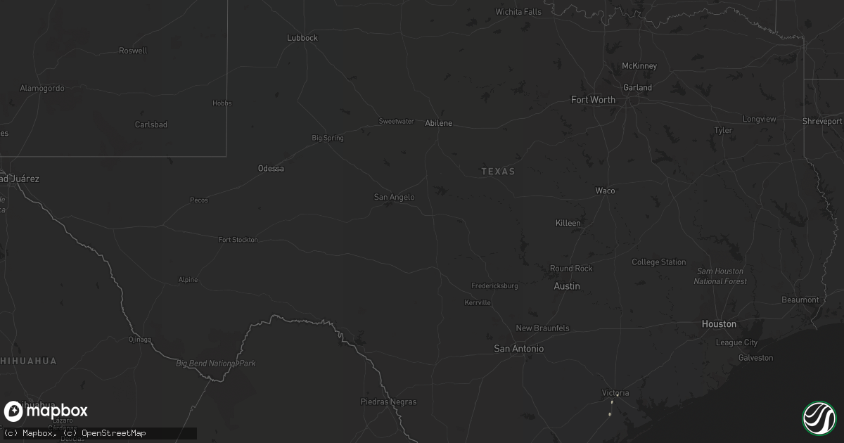
Hail Map in Texas on September 8, 2022
Get this storm
September 8 map
$229
one time, instant access
Download today. No call, no setup
Keep the $229
Bought the map and want the full workflow? Apply the entire $229 to a subscription within 7 days. None of it is wasted.
Every map, not just this one
This buys you this map. Subscription and you get every map we run, in the markets you choose from a few cities to whole states to nationwide. Plus real-time alerts the moment a storm fires.
Contact data
Name, contact info, occupancy, even credit band for addresses in the footprint. You go from where it hit to who to call.
Become the source they trust
Unlimited branding weather history reports on demand. You already have the documented answer ready for the property owner, and you are the one who showed up with it.
Property data and RoofTrace estimates
Pull up any address you have got, its value and the exact code rules for that jurisdiction, straight from One Click Code. Then RoofTrace estimates the squares, pitch, and roof value, priced the way you price.
Storm reports in Texas
Texas
| Date | Description |
|---|---|
| 09/08/20226:24 PM CDT | Report of trees down across the southside of taft. |
| 09/08/20221:30 AM CDT | At 629 PM CDT, a severe thunderstorm was located near Taft, moving south at 15 mph. HAZARD...60 mph wind gusts and quarter size hail. SOURCE...Radar indicated. IMPACT...Hail damage to vehicles is expected. Expect wind damage to roofs, siding, and trees. Locations impacted include... Corpus Christi, Portland, Taft, Corpus Christi International Airport, Gregory, Del Mar College Windward Campus, Corpus Christi North Beach, Cole Park, Driscoll Childrens Hospital, Del Mar College Heritage Campus, Clarkwood, Downtown Corpus Christi, Taft Southwest and Tuloso.This includes the following highways... Interstate 37 between mile markers 1 and 9. US Highway 181 between mile markers 628 and 648. |
| 09/08/20221:07 AM CDT | At 606 PM CDT, a severe thunderstorm was located near Taft, moving south at 15 mph. HAZARD...60 mph wind gusts and quarter size hail. SOURCE...Radar indicated. IMPACT...Hail damage to vehicles is expected. Expect wind damage to roofs, siding, and trees. Locations impacted include... Portland, Taft, Ingleside, Gregory and Taft Southwest. This includes US Highway 181 between mile markers 628 and 640. |
All States Impacted by Hail Map on September 8, 2022
Cities Impacted by Hail Map on September 8, 2022
- Tivoli, TX
- Mason, WI
- Seligman, AZ
- Lake Preston, SD
- Goodwin, SD
- Cushing, WI
- North Branch, MN
- Harris, MN
- Saint Croix Falls, WI
- Grantsburg, WI
- Spicer, MN
- Atwater, MN
- New London, MN
- Paynesville, MN
- Willmar, MN
- Elk River, MN
- Raymond, MN
- Kerkhoven, MN
- Benson, MN
- Dawson, MN
- Montevideo, MN
- Maynard, MN
- Madison, MN
- Watson, MN
- Milan, MN
- Murdock, MN
- Pennock, MN
- Danvers, MN
- Appleton, MN
- Strandburg, SD
- Cokato, MN
- Orlando, FL
- Howard Lake, MN
- Annandale, MN
- Cambridge, MN
- Cavour, SD
- Taft, TX
- Princeton, MN
- Becker, MN
- Victoria, TX
- Maple Lake, MN
- Monticello, MN
- Big Lake, MN
- Dassel, MN
- Litchfield, MN
- Grove City, MN
- Buffalo, MN
- Volga, SD
- Minong, WI
- Isanti, MN
- Saint Francis, MN
- Anoka, MN
- Cedar, MN
- Stacy, MN
- Wyoming, MN
- Bethel, MN
- South Haven, MN
- Darwin, MN
- Eden Valley, MN
- De Smet, SD
- Carthage, SD
- Watertown, SD
- Tampa, FL
- Thonotosassa, FL
- Wesley Chapel, FL
- Zephyrhills, FL
- Clear Lake, SD
- Portland, TX
- Oldham, SD
- Arlington, SD
- Iroquois, SD
- Artesian, SD
- Port Saint Lucie, FL
- Waverly, MN
- Watkins, MN
- Kimball, MN
- Sunburg, MN
- Gary, SD
- Kandiyohi, MN
- Revillo, SD
- Marietta, MN
- Clara City, MN
- Clear Lake, MN
- Saint Michael, MN
- Montrose, MN
- Clearwater, MN
- Andover, MN
- Zimmerman, MN
- Albertville, MN
- Luck, WI
- Brandt, SD
- Vienna, SD
- Kranzburg, SD
- Hazel, SD
- Castlewood, SD
- Canby, MN
- Hayti, SD
- Bayside, TX
- Rockport, TX


