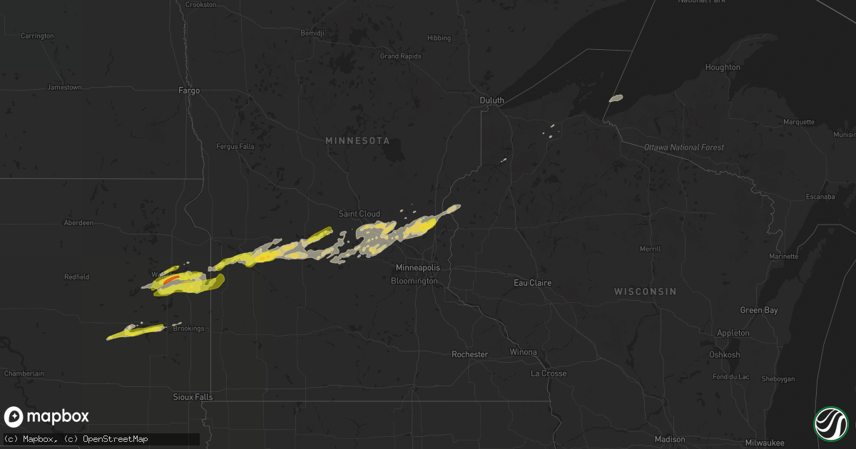
Hail Map on September 8, 2022
Get this storm
September 8 map
$229
one time, instant access
Download today. No call, no setup
Keep the $229
Bought the map and want the full workflow? Apply the entire $229 to a subscription within 7 days. None of it is wasted.
Every map, not just this one
This buys you this map. Subscription and you get every map we run, in the markets you choose from a few cities to whole states to nationwide. Plus real-time alerts the moment a storm fires.
Contact data
Name, contact info, occupancy, even credit band for addresses in the footprint. You go from where it hit to who to call.
Become the source they trust
Unlimited branding weather history reports on demand. You already have the documented answer ready for the property owner, and you are the one who showed up with it.
Property data and RoofTrace estimates
Pull up any address you have got, its value and the exact code rules for that jurisdiction, straight from One Click Code. Then RoofTrace estimates the squares, pitch, and roof value, priced the way you price.
Storm reports
Wyoming
| Date | Description |
|---|---|
| 09/08/20226:06 PM CDT | Time estimated from radar. |
Minnesota
| Date | Description |
|---|---|
| 09/08/20226:55 AM CDT | At 1155 PM CDT, a severe thunderstorm was located 8 miles northeast of Watson, or 8 miles north of Montevideo, moving east at 35 mph. HAZARD...Ping pong ball size hail. SOURCE...Radar indicated. IMPACT...People and animals outdoors will be injured. Expect damage to roofs, siding, windows, and vehicles. This severe thunderstorm will remain over mainly rural areas of northeastern Chippewa and southeastern Swift Counties. |
| 09/08/20226:10 AM CDT | At 1110 PM CDT, a severe thunderstorm was located over Brandt, or near Clear Lake, moving east at 45 mph. HAZARD...60 mph wind gusts and quarter size hail. SOURCE...Radar indicated. IMPACT...Hail damage to vehicles is expected. Expect wind damage to roofs, siding, and trees. This severe thunderstorm will be near... Lake Cochrane Rec Area around 1120 PM CDT. |
| 09/08/20225:46 AM CDT | At 1046 PM CDT, a severe thunderstorm was located near Madison, or 22 miles southeast of Ortonville, moving east at 35 mph. HAZARD...Ping pong ball size hail. SOURCE...Radar indicated. IMPACT...People and animals outdoors will be injured. Expect damage to roofs, siding, windows, and vehicles. This severe thunderstorm will be near... Madison around 1050 PM CDT. |
| 09/08/20225:34 AM CDT | At 1034 PM CDT, a severe thunderstorm was located near Pelican Lake, or near Castlewood, moving northeast at 40 mph. HAZARD...Ping pong ball size hail and 60 mph wind gusts. SOURCE...Radar indicated. IMPACT...People and animals outdoors will be injured. Expect hail damage to roofs, siding, windows, and vehicles. Expect wind damage to roofs, siding, and trees. This severe thunderstorm will be near... Kranzburg around 1045 PM CDT. Goodwin and Bemis around 1050 PM CDT.Other locations in the path of this severe thunderstorm includeSchool Lake, Bullhead Lake, Altamont, Tunerville, Lake Alice, LaBolt, Revillo and Albee. |
| 09/08/20225:00 AM CDT | At 958 PM CDT, a severe thunderstorm was located over Strandburg, or 14 miles southwest of Milbank, moving northeast at 40 mph. HAZARD...Half dollar size hail. SOURCE...Radar indicated. At 935 pm CDT, half dollar size hail was reported 3 mile ESE of Rauville. IMPACT...Damage to vehicles is expected. This severe thunderstorm will be near... Revillo and Albee around 1010 PM CDT. |
| 09/08/202212:45 AM CDT | A local report indicates 1.00 inch wind near PAYNESVILLE |
| 09/07/202210:51 PM CDT | Multiple reports of quarter size hail in madison. |
Florida
| Date | Description |
|---|---|
| 09/08/20226:17 AM CDT | At 1117 AM EDT, a severe thunderstorm was located over Ridgecrest, or over Largo, moving east at 15 mph. HAZARD...60 mph wind gusts. SOURCE...Radar indicated. IMPACT...Expect damage to roofs, siding, and trees. Locations impacted include... St. Petersburg, Largo, Pinellas Park, Seminole, Kenneth City, Belleair, Belleair Bluffs, South Highpoint, Saint Pete Clearwater Airport and Walsingham Park. |
| 09/07/202211:57 PM CDT | At 457 PM EDT, a severe thunderstorm was located south of Christmas in eastern Orange County, moving north at 30 mph. HAZARD...60 mph wind gusts. SOURCE...Radar indicated. IMPACT...Expect damage to roofs, siding, and trees. Locations impacted include... Wedgefield, Bithlo and Christmas. |
| 09/07/202211:20 PM CDT | At 420 PM EDT, a severe thunderstorm was located near Iona, or 12 miles northwest of Bonita Springs, moving northeast at 25 mph. HAZARD...60 mph wind gusts. SOURCE...Radar indicated. IMPACT...Expect damage to roofs, siding, and trees. Locations impacted include... Cape Coral, Saint James City, San Carlos Park, McGregor, Punta Rassa, Fort Myers Villas, Lovers Key State Park, Harlem Heights, Iona and Cypress Lake. |
Arizona
| Date | Description |
|---|---|
| 09/08/20222:32 AM CDT | At 731 PM MST, a severe thunderstorm was located 8 miles northwest of Dolan Springs, or 32 miles southeast of Boulder City, moving west at 35 mph. HAZARD...60 mph wind gusts. SOURCE...Radar indicated. IMPACT...Expect damage to roofs and trees. Locations impacted include... Katherine Landing, Windy Point Campground, Pierce Ferry And Antares Roads, Meadview, Hoover Dam, Packsaddle Campground, Chloride, New Kingman-Butler, Lake Mead National Recreation Area, Temple Bar Campground, Dolan Springs, South Cove, Golden Valley and Temple Bar. |
Georgia
| Date | Description |
|---|---|
| 09/07/20229:13 PM CDT | At 212 PM EDT, a severe thunderstorm was located near Little Saint Simons Island, or near Darien, moving north at 10 mph. HAZARD...60 mph wind gusts and penny size hail. SOURCE...Radar indicated. IMPACT...Expect damage to roofs, siding, and trees. Locations impacted include... St. Simons Island, Country Club Estates and Boys Estate. |
Texas
| Date | Description |
|---|---|
| 09/08/20226:24 PM CDT | Report of trees down across the southside of taft. |
| 09/08/20221:30 AM CDT | At 629 PM CDT, a severe thunderstorm was located near Taft, moving south at 15 mph. HAZARD...60 mph wind gusts and quarter size hail. SOURCE...Radar indicated. IMPACT...Hail damage to vehicles is expected. Expect wind damage to roofs, siding, and trees. Locations impacted include... Corpus Christi, Portland, Taft, Corpus Christi International Airport, Gregory, Del Mar College Windward Campus, Corpus Christi North Beach, Cole Park, Driscoll Childrens Hospital, Del Mar College Heritage Campus, Clarkwood, Downtown Corpus Christi, Taft Southwest and Tuloso.This includes the following highways... Interstate 37 between mile markers 1 and 9. US Highway 181 between mile markers 628 and 648. |
| 09/08/20221:07 AM CDT | At 606 PM CDT, a severe thunderstorm was located near Taft, moving south at 15 mph. HAZARD...60 mph wind gusts and quarter size hail. SOURCE...Radar indicated. IMPACT...Hail damage to vehicles is expected. Expect wind damage to roofs, siding, and trees. Locations impacted include... Portland, Taft, Ingleside, Gregory and Taft Southwest. This includes US Highway 181 between mile markers 628 and 640. |
South Dakota
| Date | Description |
|---|---|
| 09/08/20226:11 AM CDT | At 1111 PM CDT, a severe thunderstorm was located over Clear Lake, moving east at 40 mph. HAZARD...60 mph wind gusts and quarter size hail. SOURCE...Radar indicated. IMPACT...Hail damage to vehicles is expected. Expect wind damage to roofs, siding, and trees. This severe thunderstorm will be near... Gary around 1125 PM CDT.Other locations in the path of this severe thunderstorm includeCanby. |
| 09/08/20226:06 AM CDT | At 1106 PM CDT, a severe thunderstorm was located near Oldham, or 7 miles east of Lake Thompson State Recreation Area, moving east at 35 mph. HAZARD...Quarter size hail. SOURCE...Radar indicated. IMPACT...Damage to vehicles is expected. This severe thunderstorm will be near... Hetland around 1115 PM CDT. Arlington and Badger around 1120 PM CDT. Sinai around 1125 PM CDT.Other locations in the path of this severe thunderstorm includeOakwood State Park, Volga, Brookings and Bruce. |
| 09/08/20225:34 AM CDT | At 1034 PM CDT, a severe thunderstorm was located near Carthage, or 10 miles southwest of Lake Thompson State Recreation Area, moving east at 35 mph. HAZARD...Quarter size hail. SOURCE...Radar indicated. IMPACT...Damage to vehicles is expected. This severe thunderstorm will be near... De Smet around 1045 PM CDT. Lake Thompson State Recreation Area around 1050 PM CDT.Other locations in the path of this severe thunderstorm include LakePreston, Oldham, Hetland, Arlington and Badger. |
| 09/08/20225:07 AM CDT | At 1007 PM CDT, a severe thunderstorm was located over Naples, or 11 miles north of Bryant, moving northeast at 40 mph. HAZARD...Half dollar size hail. SOURCE...Radar indicated. IMPACT...Damage to vehicles is expected. This severe thunderstorm will be near... Hazel around 1015 PM CDT. Tinkertown around 1020 PM CDT. Goose Lake and Thomas around 1025 PM CDT.Other locations in the path of this severe thunderstorm include LakeKampeska, Sandy Shore Rec Area, Memorial Park Camping Site,Watertown, Pelican Lake, Watertown City Park, Rauville and Kranzburg. |
| 09/07/202211:15 PM CDT | Estimated dime to quarter size hail. |
| 09/07/202210:55 PM CDT | Estimated dime to quarter size hail. |
| 09/07/202210:31 PM CDT | Relayed via social media with photo. Approximate time and location. |
| 09/07/202210:00 PM CDT | Approximate time and location. |
| 09/07/20229:35 PM CDT | A local report indicates 1.25 inch wind near 3 ESE RAUVILLE |
| 09/07/20229:27 PM CDT | Radar-estimated time. |
Cities Impacted by Hail Map on September 8, 2022
- Tivoli, TX
- Mason, WI
- Seligman, AZ
- Lake Preston, SD
- Goodwin, SD
- Cushing, WI
- North Branch, MN
- Harris, MN
- Saint Croix Falls, WI
- Grantsburg, WI
- Spicer, MN
- Atwater, MN
- New London, MN
- Paynesville, MN
- Willmar, MN
- Elk River, MN
- Raymond, MN
- Kerkhoven, MN
- Benson, MN
- Dawson, MN
- Montevideo, MN
- Maynard, MN
- Madison, MN
- Watson, MN
- Milan, MN
- Murdock, MN
- Pennock, MN
- Danvers, MN
- Appleton, MN
- Strandburg, SD
- Cokato, MN
- Orlando, FL
- Howard Lake, MN
- Annandale, MN
- Cambridge, MN
- Cavour, SD
- Taft, TX
- Princeton, MN
- Becker, MN
- Victoria, TX
- Maple Lake, MN
- Monticello, MN
- Big Lake, MN
- Dassel, MN
- Litchfield, MN
- Grove City, MN
- Buffalo, MN
- Volga, SD
- Minong, WI
- Isanti, MN
- Saint Francis, MN
- Anoka, MN
- Cedar, MN
- Stacy, MN
- Wyoming, MN
- Bethel, MN
- South Haven, MN
- Darwin, MN
- Eden Valley, MN
- De Smet, SD
- Carthage, SD
- Watertown, SD
- Tampa, FL
- Thonotosassa, FL
- Wesley Chapel, FL
- Zephyrhills, FL
- Clear Lake, SD
- Portland, TX
- Oldham, SD
- Arlington, SD
- Iroquois, SD
- Artesian, SD
- Port Saint Lucie, FL
- Waverly, MN
- Watkins, MN
- Kimball, MN
- Sunburg, MN
- Gary, SD
- Kandiyohi, MN
- Revillo, SD
- Marietta, MN
- Clara City, MN
- Clear Lake, MN
- Saint Michael, MN
- Montrose, MN
- Clearwater, MN
- Andover, MN
- Zimmerman, MN
- Albertville, MN
- Luck, WI
- Brandt, SD
- Vienna, SD
- Kranzburg, SD
- Hazel, SD
- Castlewood, SD
- Canby, MN
- Hayti, SD
- Bayside, TX
- Rockport, TX