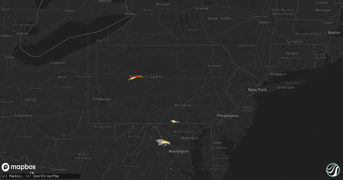
Hail Map in Pennsylvania on September 2, 2014
Get this storm
September 2 map
$229
one time, instant access
Download today. No call, no setup
Keep the $229
Bought the map and want the full workflow? Apply the entire $229 to a subscription within 7 days. None of it is wasted.
Every map, not just this one
This buys you this map. Subscription and you get every map we run, in the markets you choose from a few cities to whole states to nationwide. Plus real-time alerts the moment a storm fires.
Contact data
Name, contact info, occupancy, even credit band for addresses in the footprint. You go from where it hit to who to call.
Become the source they trust
Unlimited branding weather history reports on demand. You already have the documented answer ready for the property owner, and you are the one who showed up with it.
Property data and RoofTrace estimates
Pull up any address you have got, its value and the exact code rules for that jurisdiction, straight from One Click Code. Then RoofTrace estimates the squares, pitch, and roof value, priced the way you price.
Storm reports in Pennsylvania
Pennsylvania
| Date | Description |
|---|---|
| 09/02/20146:26 PM CDT | Trees and wires down |
| 09/02/20146:00 PM CDT | Tree down on leesbridge road. |
| 09/02/20145:45 PM CDT | Trees and wires down on quarry rd |
| 09/02/20144:59 PM CDT | Trees down |
| 09/02/20144:56 PM CDT | Trees down on main st harrison twp |
| 09/02/20144:34 PM CDT | Trees down on oklahoma salem rd sr 4011 |
| 09/02/20144:33 PM CDT | Trees down |
| 09/02/20144:15 PM CDT | Trees down along bendingo rd sr 1004 |
| 09/02/20144:13 PM CDT | Tree and large limbs down on mountain view golf course. |
| 09/02/20144:10 PM CDT | Trees down. Time estimated from radar. |
| 09/02/20144:10 PM CDT | Trees down along rt 30 and sr 233 |
| 09/02/20144:02 PM CDT | Wires down |
| 09/02/20144:00 PM CDT | Trees down |
| 09/02/20143:57 PM CDT | Nmrs trees down along stanley bottom rd |
| 09/02/20143:53 PM CDT | Numerous trees down on sykesville road extension all oriented in the same direction |
| 09/02/20143:45 PM CDT | Trees down along stanley bottom road just east of the town...time estimated from radar |
| 09/02/20143:42 PM CDT | Trees down near 139 bottom road. Time estimated by radar. |
| 09/02/20143:42 PM CDT | Trees down in the area of 475 shaffer road near barnett township |
| 09/02/20143:10 PM CDT | Trees down in conewango twp |
| 09/02/20143:05 PM CDT | Trees down in elk twp |
| 09/02/20142:45 PM CDT | Two trees uprooted and several buildings damaged |
All States Impacted by Hail Map on September 2, 2014
Cities Impacted by Hail Map on September 2, 2014
- Olpe, KS
- Hartford, KS
- Nickerson, KS
- Hutchinson, KS
- Wharncliffe, WV
- Okemah, OK
- Holly Springs, NC
- Apex, NC
- Debord, KY
- Live Oak, FL
- Tampa, KS
- Gettysburg, PA
- Littlestown, PA
- Arlington, KS
- Partridge, KS
- Troy, NC
- Middle River, MN
- Mahnomen, MN
- Harpers Ferry, WV
- Millville, WV
- Portland, TN
- Burlington, KS
- Lebo, KS
- Lancaster, MN
- Ellsworth, KS
- Lorraine, KS
- Osawatomie, KS
- Parker, KS
- Marion, NC
- Old Fort, NC
- Dorrance, KS
- Wilson, KS
- Leesburg, VA
- Waynesboro, MS
- Laurel, MS
- Shubuta, MS
- Dickerson, MD
- Ramona, KS
- McMillan, MI
- Germfask, MI
- Berryton, KS
- Estill, SC
- Elgin, SC
- Columbia, SC
- Bunker Hill, KS
- Hanover, PA
- Hamilton, VA
- Paeonian Springs, VA
- Waterford, VA
- Rush, KY
- Herington, KS
- Gould City, MI
- Gulliver, MI
- High Springs, FL
- Strathcona, MN
- Grygla, MN
- Butler, MO
- Kershaw, SC
- Moran, KS
- Beech Island, SC
- Aiken, SC
- Camden, SC
- Lane, KS
- Sparks, OK
- Paden, OK
- Prague, OK
- Stroud, OK
- Depew, OK
- Chandler, OK
- Fuquay Varina, NC
- Monee, IL
- Asheboro, NC
- Dawson, MN
- Boyd, MN
- Clarkfield, MN
- Westphalia, KS
- Garnett, KS
- Oakland, KY
- Smiths Grove, KY
- Gordon, GA
- Jeffersonville, GA
- Sophia, NC
- Amarillo, TX
- Chatsworth, GA
- Burnside, KY
- Cheraw, SC
- Beallsville, MD
- Poolesville, MD
- Purcellville, VA
- Raeford, NC
- Blue Mound, KS
- Mapleton, KS
- Fulton, KS
- Redfield, KS
- Fort Scott, KS
- Geneseo, KS
- Du Bois, PA
- Troutville, PA
- Reynoldsville, PA
- Luthersburg, PA
- Sykesville, PA
- Punxsutawney, PA
- Mayo, FL
- Cameron, NC
- Delia, KS
- Topeka, KS
- Pikeville, KY
- Prestonsburg, KY
- Stanville, KY
- Jesup, GA
- Durham, KS
- Sterling, KS
- Rockwell, NC
- Mount Pleasant, NC
- Gold Hill, NC
- Concord, NC
- Haven, KS
- Charles Town, WV
- Round Hill, VA
- Lovettsville, VA
- Gallatin, TN
- Meeker, OK
- Mcloud, OK
- Bronston, KY
- Monticello, KY
- Rebecca, GA
- Broadway, NC
- Sanford, NC
- Ivel, KY
- Allen, KY
- Banner, KY
- Varney, KY
- Martin, KY
- Ripley, OK
- McEwen, TN
- Centerville, KS
- Mound City, KS
- Gunlock, KY
- Carthage, NC
- Hurley, VA
- Crandall, GA
- Fort Bragg, NC
- Guyton, GA
- Mount Juliet, TN
- Brandon, MS
- Kimper, KY
- Raccoon, KY
- Fayetteville, NC
- Booneville, KY
- Hinesville, GA
- Holyrood, KS
- Townsend, GA
- Springfield, TN
- Newton, KS
- Whitewater, KS
- Cedar Point, KS
- Americus, KS
- Allen, KS
- Lexington, KY
- Amherst, MA
- Belchertown, MA
- Lyons, KS
- Gatzke, MN
- Loranger, LA
- Braxton, MS
- Lake Bronson, MN
- Chunchula, AL
- Greensboro, GA
- Union Point, GA
- Sarasota, FL
- Glasgow, KY
- Oak Harbor, WA
- Coupeville, WA
- Raven, KY
- Dema, KY
- Topmost, KY
- Kite, KY
- Pippa Passes, KY
- Garner, KY
- Strandquist, MN
- O'Brien, FL
- Wellston, OK
- Carney, OK
- Tarboro, NC
- Pinetops, NC
- Stanwood, WA
- Hope, KS
- Lost Springs, KS
- Prichard, WV
- Catlettsburg, KY
- Louisa, KY
- Ashland City, TN
- Chapmansboro, TN
- Greensburg, KY
- Center, KY
- Carbondale, KS
- Cushing, OK
- Agra, OK
- Lake City, FL
- Branford, FL
- Kentwood, LA
- Stafford, VA
- Greeley, KS
- Burkesville, KY
- Sunflower, AL
- Madison, MN
- Karlstad, MN
- Greenbush, MN
- Rantoul, KS
- La Cygne, KS
- Fontana, KS
- Dallas, GA
- Denton, NC
- Uniontown, KS
- Thomasville, GA
- Twin Valley, MN
- Gary, MN
- Latta, SC
- Perry, KS
- Grantville, KS
- Morton, MS
- Seminole, FL
- Lindsborg, KS
- Marquette, KS
- Sycamore, GA
- Pitkin, LA
- Red Springs, NC
- Crete, IL
- Beecher, IL
- Ranson, WV
- Vincent, KY
- Beattyville, KY
- Bryceville, FL
- Kincaid, KS
- Bronson, KS
- Wray, GA
- Brooklet, GA
- Burlingame, KS
- Bluemont, VA
- Norman, OK
- Hope Mills, NC
- Frenchburg, KY
- Omar, WV
- Delbarton, WV
- Sarah Ann, WV
- Clinton, MO
- Chesterfield, SC
- Chiefland, FL
- Abilene, KS
- Garnett, SC
- Lenoir, NC
- Pleasant View, TN
- Ashburn, GA
- Tallahassee, FL
- Lugoff, SC
- Ludowici, GA
- Mooresboro, NC
- Macomb, OK
- Arlington, SD
- Buffalo Junction, VA
- Tecumseh, KS
- Maple Hill, KS
- Waverly, KS
- Pleasanton, KS
- Prescott, KS
- Mayetta, KS
- Harrisburg, PA
- Waverly, TN
- Matewan, WV
- Mohawk, WV
- Majestic, KY
- Stopover, KY
- Mendenhall, MS
- Ruffin, SC
- Brunson, SC
- Bethpage, TN
- Crockett, TX
- Mount Vernon, AL
- Emmett, KS
- Tillman, SC
- Clyo, GA
- Wallace, SC
- Fort Stewart, GA
- Chatom, AL
- Lancaster, SC
- Heath Springs, SC
- Appalachia, VA
- Silver Lake, KS
- Williamsburg, KS
- Pomona, KS
- Patrick, SC
- Luray, SC
- Warner Robins, GA
- Bonaire, GA
- Zirconia, NC
- Saluda, NC
- Flat Rock, NC
- Pilgrim, KY
- Round O, SC
- Cottageville, SC
- Paxico, KS
- Belvue, KS
- Rossville, KS
- Saint Marys, KS
- Callahan, FL
- Bowling Green, KY
- Celina, TN
- Fargo, GA
- Hoyt, KS
- Springfield, GA
- Grundy, VA
- Mcpherson, KS
- Ridgeway, SC
- Eagle Springs, NC
- Folkston, GA
- Cisco, GA
- Burns, KS
- Claflin, KS
- Engadine, MI
- Curtis, MI
- Smithfield, NC
- Galva, KS
- Little River, AL
- Ottawa, KS
- Princeton, KS
- Clayton, NC
- Kanopolis, KS
- Little River, KS
- Roseland, LA
- Pointblank, TX
- Rocky Face, GA
- Dalton, GA
- Statesboro, GA
- Augusta, GA
- Knoxville, MD
- Iola, KS
- Humboldt, KS
- Adrian, GA
- Almo, KY
- Dexter, KY
- Foster, MO
- Camano Island, WA
- Tennessee Ridge, TN
- Wakarusa, KS
- Indian Mound, TN
- East Point, KY
- Hagerhill, KY
- Elk Horn, KY
- Campbellsville, KY
- Alma, KS
- Pegram, TN
- Richmond, KS
- Charlotte, TN
- Harleyville, SC
- Manor, GA
- Cassatt, SC
- Bethune, SC
- Acworth, GA
- Kite, GA
- Panhandle, TX
- Anita, PA
- Rockton, PA
- Penfield, PA


