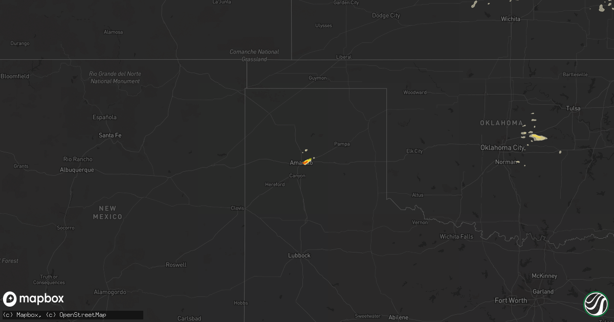
Hail Map on September 2, 2014
Get this storm
September 2 map
$229
one time, instant access
Download today. No call, no setup
Keep the $229
Bought the map and want the full workflow? Apply the entire $229 to a subscription within 7 days. None of it is wasted.
Every map, not just this one
This buys you this map. Subscription and you get every map we run, in the markets you choose from a few cities to whole states to nationwide. Plus real-time alerts the moment a storm fires.
Contact data
Name, contact info, occupancy, even credit band for addresses in the footprint. You go from where it hit to who to call.
Become the source they trust
Unlimited branding weather history reports on demand. You already have the documented answer ready for the property owner, and you are the one who showed up with it.
Property data and RoofTrace estimates
Pull up any address you have got, its value and the exact code rules for that jurisdiction, straight from One Click Code. Then RoofTrace estimates the squares, pitch, and roof value, priced the way you price.
States Impacted by Hail Map on September 2, 2014
Storm reports
Texas
| Date | Description |
|---|---|
| 09/02/20146:59 PM CDT | A local report indicates 1.25 inch wind near 7 ENE AMARILLO |
| 09/02/20146:53 PM CDT | A local report indicates 1.00 inch wind near 7 ENE AMARILLO |
| 09/02/20146:52 PM CDT | Dime to half dollar size |
| 09/02/20146:43 PM CDT | A local report indicates 1.00 inch wind near 3 SE AMARILLO |
| 09/02/20146:42 PM CDT | Dime to quarter size hail |
| 09/02/20146:41 PM CDT | Dime to quarter size hail currently falling. |
| 09/01/20147:10 PM CDT | Half dollar to golf ball hail |
| 09/01/20147:08 PM CDT | Quarter size hail continues to fall |
| 09/01/20147:03 PM CDT | Quarter size hail ongoing. Peak wind gust at kama asos so far is 50 mph. |
Massachusetts
| Date | Description |
|---|---|
| 09/02/20142:45 PM CDT | Tree and wires down on powpow street and fern ave |
| 09/02/20142:10 PM CDT | Tree down on newell hill road |
| 09/02/201412:35 PM CDT | A local report indicates 1.00 inch wind near PELHAM |
Virginia
| Date | Description |
|---|---|
| 09/02/20144:40 PM CDT | 5 trees down along route 687 just north of falling springs. |
| 09/02/20142:35 PM CDT | 2 trees down on old waterford rd |
| 09/01/20148:55 PM CDT | Tree down on route 705. Time of occurrence based on radar. |
| 09/01/20148:48 PM CDT | Tree down across sinking creek road. Time of occurrence based on radar velocity signature. |
Minnesota
| Date | Description |
|---|---|
| 09/02/20146:20 PM CDT | A local report indicates 1.25 inch wind near 6 E MIDDLE RIVER |
| 09/02/20146:15 PM CDT | Several quarters mixed in with smaller diameter hail. |
West Virginia
| Date | Description |
|---|---|
| 09/02/20145:20 PM CDT | 7 to 8 large trees down along route 219 between union and pickaway west virginia. |
| 09/02/20144:00 PM CDT | Three 8 to 10 inch oak trees down on butler mountain road. Time from radar. |
| 09/02/20143:24 PM CDT | Tree down in the 2100 block of householder road. |
| 09/02/20143:24 PM CDT | Large tree down across householder rd near poole rd. |
| 09/02/20143:16 PM CDT | Tree down blocking road in the 200 block of sir johns run road. |
| 09/02/20143:16 PM CDT | Two foot diameter tree limb down - knocked fence over - johnson mill road |
| 09/02/20143:16 PM CDT | Tree down on a house in the 2400 block of mesner road. |
| 09/02/20143:16 PM CDT | Tree down in 3800 block of spohrs road |
| 09/02/20143:16 PM CDT | 2 trees down in the 1900 block of mesner road. |
| 09/02/20143:15 PM CDT | One foot diameter tree limb down - mable lane |
| 09/02/20143:07 PM CDT | Tree down in the 3000 block of cold run valley road. |
| 09/02/20142:48 PM CDT | Trees down on bloomery pike. |
| 09/02/20142:37 PM CDT | Tree down along jersey mountain road. |
| 09/02/20142:27 PM CDT | Trees and powerlines down near route 28 and the woodland inn. |
| 09/02/20142:26 PM CDT | Trees and powerlines down on route 46 across from frankfort dr. |
| 09/02/20142:00 PM CDT | Numerous trees down across the road near the intersection of hartsmansville rd and rt 42 |
| 09/02/20141:29 PM CDT | Numerous trees down from rowlesburg to route 50 towards the preston/garrett county border |
Tennessee
| Date | Description |
|---|---|
| 09/02/20146:35 PM CDT | One tree down on highway 31 near sneedville. |
| 09/02/20146:35 PM CDT | Dispatch reported 1 tree downed. |
| 09/02/20146:30 PM CDT | Trees down on palmer road west of lebanon |
| 09/02/20145:30 PM CDT | One tree down on niggs creek road and one tree down on williams creek road. |
Michigan
| Date | Description |
|---|---|
| 09/02/20144:31 PM CDT | Twitter report from 7&4 news. Time estimated from radar. |
| 09/02/20144:23 PM CDT | Delayed report. Hail size estimated between 1.50 and 1.75 inches. Hail was nearly covering the ground. |
New Hampshire
| Date | Description |
|---|---|
| 09/02/201412:40 PM CDT | Tree and wires down route 12a |
| 09/02/201412:38 PM CDT | Tree and wires down on dover street |
Vermont
| Date | Description |
|---|---|
| 09/01/20148:45 PM CDT | Partial roof/door overhang collapse... Shingles torn... Chimney damage and some trees downed. After interviews... Radar and picture reviews... Determined to be straight |
Maryland
| Date | Description |
|---|---|
| 09/02/20146:46 PM CDT | Tree down at the intersection of mayfield avenue and meadowridge road. |
| 09/02/20146:41 PM CDT | Large tree limbs down at the intersection of seneca and groveleigh. |
| 09/02/20146:34 PM CDT | Two trees down on houses causing significant damage near each other...one on the 1000 block of evergreen ave and one on the 6400 block of bellview ave. |
| 09/02/20146:25 PM CDT | Numerous trees down across elkton. |
| 09/02/20146:16 PM CDT | Trees and powerlines down near intersection of bradford and norbeck rd. |
| 09/02/20144:36 PM CDT | Tree down across mayberry rd |
| 09/02/20144:28 PM CDT | Tree down across road near the intersection of bullfrog rd and mcmullen rd |
| 09/02/20144:08 PM CDT | Tree down on road in the 4500 block of elmer derr road. |
| 09/02/20144:00 PM CDT | Large tree down blocking road |
| 09/02/20143:44 PM CDT | At least 25 trees down - many 1.5 to 2 feet in diameter |
| 09/02/20143:44 PM CDT | Large tree down blocking road. |
| 09/02/20143:40 PM CDT | Tree and powerlines down at church st and west side ave. |
| 09/02/20143:32 PM CDT | Numerous trees down off norbeck road between md200 and georgia avenue |
| 09/02/20143:00 PM CDT | Two large tree branches down |
| 09/02/20143:00 PM CDT | Large tree down at the intersection of routes 109 and 107. |
| 09/02/20142:17 PM CDT | Trees and powerlines down. |
| 09/02/20141:52 PM CDT | Trees down around the town of oakland...time estimated from radar |
| 09/01/20147:22 PM CDT | Tree down across road near the intersection of abingdon rd and rt 40 |
New York
| Date | Description |
|---|---|
| 09/02/20146:56 PM CDT | Trees down |
| 09/02/20146:55 PM CDT | A local report indicates 60 MPH wind near 2 NE FOSTER |
| 09/02/20146:44 PM CDT | Trees down |
| 09/02/20146:15 PM CDT | Damage to two homes and two barns. Many trees down. Mainly along federal road in baldwin. Time estimated from radar. |
| 09/02/20146:15 PM CDT | Trees and wires down on north chemung road |
| 09/02/20146:10 PM CDT | Ef1 tornado touched down just east of elston hollow road with a path length of 6 miles and maximum path width of 150 yards. This tornado produced 100 mph winds and snap |
| 09/02/20145:35 PM CDT | Multiple trees down |
| 09/02/20145:14 PM CDT | Trees and wires across road |
| 09/02/20144:47 PM CDT | Multiple trees down |
| 09/02/20143:51 PM CDT | South barry st. Tree and wires down on a house. |
| 09/02/20143:49 PM CDT | Garden ave tree and wires down. |
| 09/02/20143:46 PM CDT | West river side drive tree down. |
| 09/02/20143:44 PM CDT | Tree down on main street. |
| 09/02/20143:38 PM CDT | Nolan dr. Trees and wires down. |
| 09/01/20148:00 PM CDT | Wires down |
| 09/01/20147:54 PM CDT | Tree down on route 206 |
| 09/01/20147:45 PM CDT | Trees down |
| 09/01/20147:35 PM CDT | *** 1 inj *** motorcycle rider injured by downed tree. Report via wbng-tv. |
| 09/01/20147:32 PM CDT | An ef1 tornado with estimated wind speeds of 100 mph... Path length of 0.1 miles and path width of 50 yards touches down about 300 yards west of saint johns road near t |
| 09/01/20147:30 PM CDT | A microburst with maximum wind speeds of 90 mph... A path length of 6 miles and a path width of 0.5 miles uprooted numerous trees near the afton area. The microburst ov |
| 09/01/20147:20 PM CDT | Trees down... One on a trailer. |
| 09/01/20147:10 PM CDT | Uprooted trees on front street |
| 09/01/20147:10 PM CDT | Trees and lines down on watson blvd |
| 09/01/20147:05 PM CDT | Straight line winds between 50 to 60 mph snapped trees and branches with trees snapped off at mid to high trunk level. One tree fell on a trailer. |
Connecticut
| Date | Description |
|---|---|
| 09/02/20141:01 PM CDT | Tree and wires across rte 83 near strawberry road |
Pennsylvania
| Date | Description |
|---|---|
| 09/02/20146:26 PM CDT | Trees and wires down |
| 09/02/20146:00 PM CDT | Tree down on leesbridge road. |
| 09/02/20145:45 PM CDT | Trees and wires down on quarry rd |
| 09/02/20144:59 PM CDT | Trees down |
| 09/02/20144:56 PM CDT | Trees down on main st harrison twp |
| 09/02/20144:34 PM CDT | Trees down on oklahoma salem rd sr 4011 |
| 09/02/20144:33 PM CDT | Trees down |
| 09/02/20144:15 PM CDT | Trees down along bendingo rd sr 1004 |
| 09/02/20144:13 PM CDT | Tree and large limbs down on mountain view golf course. |
| 09/02/20144:10 PM CDT | Trees down along rt 30 and sr 233 |
| 09/02/20144:10 PM CDT | Trees down. Time estimated from radar. |
| 09/02/20144:02 PM CDT | Wires down |
| 09/02/20144:00 PM CDT | Trees down |
| 09/02/20143:57 PM CDT | Nmrs trees down along stanley bottom rd |
| 09/02/20143:53 PM CDT | Numerous trees down on sykesville road extension all oriented in the same direction |
| 09/02/20143:45 PM CDT | Trees down along stanley bottom road just east of the town...time estimated from radar |
| 09/02/20143:42 PM CDT | Trees down in the area of 475 shaffer road near barnett township |
| 09/02/20143:42 PM CDT | Trees down near 139 bottom road. Time estimated by radar. |
| 09/02/20143:10 PM CDT | Trees down in conewango twp |
| 09/02/20143:05 PM CDT | Trees down in elk twp |
| 09/02/20142:45 PM CDT | Two trees uprooted and several buildings damaged |
Florida
| Date | Description |
|---|---|
| 09/02/20145:30 PM CDT | Trained spotter and county officials both reported scattered tree limbs down across the county between 6 pm and 7 pm. |
| 09/02/20142:10 PM CDT | 911 call center reported one tree down on u.s. Highway 301 near meadows lane. |
New Jersey
| Date | Description |
|---|---|
| 09/01/20147:10 PM CDT | Tree down on nj 70 eastbound of nj41 and cr154. |
South Carolina
| Date | Description |
|---|---|
| 09/02/20145:10 PM CDT | Sc hwy patrol reported trees down on i-20 at mile marker 83 east bound. |
| 09/02/20145:07 PM CDT | Sc hwy patrol reported trees down at jacobs millpond rd. And sandy oaks rd. |
| 09/02/20145:01 PM CDT | Chesterfield county dispatch reported trees down on hwy 1 near the national guard armory. |
| 09/02/20144:45 PM CDT | Tree down at potter rd and pink plyler rd... And another tree down near sc hwy 9 and hwy 522. |
| 09/02/20144:15 PM CDT | Quarter size hail reported on hwy 278 west of new ellenton via facebook. |
| 09/02/20144:10 PM CDT | Sc hwy patrol reported trees down on storm branch rd. At boyd pond rd. |
| 09/02/20141:33 PM CDT | Cheraw state park golf course reported several trees down along with dime size hail. |
Kentucky
| Date | Description |
|---|---|
| 09/02/20145:55 PM CDT | Four trees down on hwy 221. |
| 09/02/20145:52 PM CDT | Five trees down on hwy 66. |
| 09/02/20145:40 PM CDT | Tree down on rt. 899 between mile markers 7 and 11. |
| 09/02/20145:25 PM CDT | Tree down on hwy 52 w. |
| 09/02/20145:20 PM CDT | Tree across ky 979. |
| 09/02/20145:11 PM CDT | Tree down...partially blocking highway 511. |
| 09/02/20145:10 PM CDT | Tree across ky 122. |
| 09/02/20145:05 PM CDT | Power lines down near pizza hut. Report from facebook. |
| 09/02/20144:55 PM CDT | Tree across road on hwy 52 east on tunnel hill. |
| 09/02/20144:45 PM CDT | Tree across hwy 587 at farmers ridge. |
| 09/02/20144:45 PM CDT | Storm spotter reported roof and gutter damage to the vfw hall in whitley city on main street. |
| 09/02/20144:45 PM CDT | Two trees across road. |
| 09/02/20144:41 PM CDT | Tree blown across norfolk southern train track at train track marker 187. A train ran into the tree a short time later. No injuries. |
| 09/02/20144:37 PM CDT | Trees down across hwy 3630 and moore road. Delayed report...time estimated by radar. |
| 09/02/20144:35 PM CDT | Several trees down along rush creek rd. Possible small downburst. |
| 09/02/20144:35 PM CDT | Tree down across hwy 3630. Delayed report...time estimated by radar. |
| 09/02/20144:15 PM CDT | Two trees down. |
| 09/02/20144:10 PM CDT | Tree across hwy 52. |
| 09/02/20144:10 PM CDT | Tree across hwy 499. |
| 09/02/20144:00 PM CDT | Tree down on kentucky highway 2001. Time estimated from radar. |
| 09/02/20143:57 PM CDT | Tree across hwy 89. |
| 09/02/20143:05 PM CDT | Tree across road. |
| 09/02/20142:56 PM CDT | Tree down blocking fox hollow road. |
| 09/02/20142:55 PM CDT | Tree down on highway 11. Time estimated from radar. |
| 09/02/20142:50 PM CDT | Two trees down on ky 11 near the lee county line. |
| 09/02/20142:42 PM CDT | Tree across rt. 299. |
| 09/02/20142:30 PM CDT | Trailer blown over on harp road. |
Delaware
| Date | Description |
|---|---|
| 09/01/20148:02 PM CDT | A few wires down |
Georgia
| Date | Description |
|---|---|
| 09/02/20146:15 PM CDT | Several trees were reported down on a local farm northeast of myricks mill. |
| 09/02/20145:15 PM CDT | Three trees were downed in bonaire. One tree and live powerlines fell onto a vehicle...entrapping the occupant. |
| 09/02/20144:20 PM CDT | Four structures with wind damage. A mobile home was blown off cinder blocks and rolled...the roof of a hay barn was blown off...shingles were blown off a home. |
| 09/02/20142:20 PM CDT | Two trees were blown down along blue jay road near the blandford road intersection. Time was estimated from radar data. |
| 09/02/20142:11 PM CDT | Tree down on road near hwy 32. |
| 09/02/20141:25 PM CDT | Two trees were blown down near the intersection of old dixie highway and dewitt road. Time was estimated from radar data. |
| 09/02/20141:22 PM CDT | A large tree was blown down onto oak street near the palm drive intersection. The tree was blocking both lanes. Time was estimated from radar data. |
| 09/02/20141:19 PM CDT | A tree was blown down onto power lines. Time was estimated from radar data. |
Mississippi
| Date | Description |
|---|---|
| 09/02/20146:27 PM CDT | Utility lines downed at marquette road and mark dr |
| 09/02/20146:10 PM CDT | Tree fell on powerline causing power outages in the south gate subdivision. |
| 09/02/20145:58 PM CDT | Large limbs and power lines downed in south jackson |
| 09/02/20145:42 PM CDT | Trees downed at ms highway 18 at wright rd. |
| 09/02/20145:40 PM CDT | Trees downed at ms highway 18 and oakley palestine rd |
| 09/02/20144:40 PM CDT | Roof blown off trailer and shed severely damaged. Trees blown down. |
Louisiana
| Date | Description |
|---|---|
| 09/02/20143:02 PM CDT | Sheriff office and public reports trees down in the village of castor. |
| 09/02/20143:02 PM CDT | Public reports trees down across the village of jamestown. |
| 09/02/20142:55 PM CDT | Sheriff office reports trees down across the town of ringgold. |
| 09/02/20142:21 PM CDT | This is a continuation of the ef-1 tornado from desoto parish. This tornado continued east across mainly open pasture north of highway 509...snapping several trees as i |
| 09/02/20142:09 PM CDT | An ef-1 tornado touched down on la coupe road...where it peeled back the metal roof of a barn. This tornado also snapped numerous large limbs...some of which landed on |
North Carolina
| Date | Description |
|---|---|
| 09/02/20144:35 PM CDT | Several trees were reported down along lucky drive off of ten ten road. |
| 09/02/20143:50 PM CDT | Tree down on welsh place |
| 09/02/20143:45 PM CDT | Tree down on rosehill drive |
| 09/02/20143:44 PM CDT | Tree down on reilly road near southgate road. |
| 09/02/20143:30 PM CDT | Tree down on power lines on joel road. |
| 09/02/20143:15 PM CDT | Tree down on power lines on joel road. Time estimated. |
| 09/02/20143:15 PM CDT | Tree and powerlines down on vass-carthage road |
| 09/02/20143:05 PM CDT | Tree down on route 24 27 near route 22. |
| 09/02/20142:50 PM CDT | Broadcast media reports that emergency management reported a tree down in downtown marion with several trees down along interstate 40...likely near mile marker 82. Time |
| 09/02/20142:40 PM CDT | Several trees down on clinton road and adjacent railroad track. |
| 09/02/20142:35 PM CDT | Trree down on river road |
| 09/02/20142:30 PM CDT | 2 trees down along the spartanburg highway. |
| 09/02/20141:30 PM CDT | Tree down on cedar creek road |
| 09/01/201410:07 PM CDT | Trees down along interstate 40 at the intersection with parker padgett road. One lane of the interstate was blocked due to a tree in the road as reported by the emergen |
| 09/01/20147:40 PM CDT | Randolph co 911 received report of tree down across road at n main and presnell st in randleman. |
| 09/01/20147:25 PM CDT | Tree blown down near the intersection of williams farm rd and nc134. |
| 09/01/20147:25 PM CDT | Property owner reported that a couple pine trees were downed. |
Cities Impacted by Hail Map on September 2, 2014
- Olpe, KS
- Hartford, KS
- Nickerson, KS
- Hutchinson, KS
- Wharncliffe, WV
- Okemah, OK
- Holly Springs, NC
- Apex, NC
- Debord, KY
- Live Oak, FL
- Tampa, KS
- Gettysburg, PA
- Littlestown, PA
- Arlington, KS
- Partridge, KS
- Troy, NC
- Middle River, MN
- Mahnomen, MN
- Harpers Ferry, WV
- Millville, WV
- Portland, TN
- Burlington, KS
- Lebo, KS
- Lancaster, MN
- Ellsworth, KS
- Lorraine, KS
- Osawatomie, KS
- Parker, KS
- Marion, NC
- Old Fort, NC
- Dorrance, KS
- Wilson, KS
- Leesburg, VA
- Waynesboro, MS
- Laurel, MS
- Shubuta, MS
- Dickerson, MD
- Ramona, KS
- McMillan, MI
- Germfask, MI
- Berryton, KS
- Estill, SC
- Elgin, SC
- Columbia, SC
- Bunker Hill, KS
- Hanover, PA
- Hamilton, VA
- Paeonian Springs, VA
- Waterford, VA
- Rush, KY
- Herington, KS
- Gould City, MI
- Gulliver, MI
- High Springs, FL
- Strathcona, MN
- Grygla, MN
- Butler, MO
- Kershaw, SC
- Moran, KS
- Beech Island, SC
- Aiken, SC
- Camden, SC
- Lane, KS
- Sparks, OK
- Paden, OK
- Prague, OK
- Stroud, OK
- Depew, OK
- Chandler, OK
- Fuquay Varina, NC
- Monee, IL
- Asheboro, NC
- Dawson, MN
- Boyd, MN
- Clarkfield, MN
- Westphalia, KS
- Garnett, KS
- Oakland, KY
- Smiths Grove, KY
- Gordon, GA
- Jeffersonville, GA
- Sophia, NC
- Amarillo, TX
- Chatsworth, GA
- Burnside, KY
- Cheraw, SC
- Beallsville, MD
- Poolesville, MD
- Purcellville, VA
- Raeford, NC
- Blue Mound, KS
- Mapleton, KS
- Fulton, KS
- Redfield, KS
- Fort Scott, KS
- Geneseo, KS
- Du Bois, PA
- Troutville, PA
- Reynoldsville, PA
- Luthersburg, PA
- Sykesville, PA
- Punxsutawney, PA
- Mayo, FL
- Cameron, NC
- Delia, KS
- Topeka, KS
- Pikeville, KY
- Prestonsburg, KY
- Stanville, KY
- Jesup, GA
- Durham, KS
- Sterling, KS
- Rockwell, NC
- Mount Pleasant, NC
- Gold Hill, NC
- Concord, NC
- Haven, KS
- Charles Town, WV
- Round Hill, VA
- Lovettsville, VA
- Gallatin, TN
- Meeker, OK
- Mcloud, OK
- Bronston, KY
- Monticello, KY
- Rebecca, GA
- Broadway, NC
- Sanford, NC
- Ivel, KY
- Allen, KY
- Banner, KY
- Varney, KY
- Martin, KY
- Ripley, OK
- McEwen, TN
- Centerville, KS
- Mound City, KS
- Gunlock, KY
- Carthage, NC
- Hurley, VA
- Crandall, GA
- Fort Bragg, NC
- Guyton, GA
- Mount Juliet, TN
- Brandon, MS
- Kimper, KY
- Raccoon, KY
- Fayetteville, NC
- Booneville, KY
- Hinesville, GA
- Holyrood, KS
- Townsend, GA
- Springfield, TN
- Newton, KS
- Whitewater, KS
- Cedar Point, KS
- Americus, KS
- Allen, KS
- Lexington, KY
- Amherst, MA
- Belchertown, MA
- Lyons, KS
- Gatzke, MN
- Loranger, LA
- Braxton, MS
- Lake Bronson, MN
- Chunchula, AL
- Greensboro, GA
- Union Point, GA
- Sarasota, FL
- Glasgow, KY
- Oak Harbor, WA
- Coupeville, WA
- Raven, KY
- Dema, KY
- Topmost, KY
- Kite, KY
- Pippa Passes, KY
- Garner, KY
- Strandquist, MN
- O'Brien, FL
- Wellston, OK
- Carney, OK
- Tarboro, NC
- Pinetops, NC
- Stanwood, WA
- Hope, KS
- Lost Springs, KS
- Prichard, WV
- Catlettsburg, KY
- Louisa, KY
- Ashland City, TN
- Chapmansboro, TN
- Greensburg, KY
- Center, KY
- Carbondale, KS
- Cushing, OK
- Agra, OK
- Lake City, FL
- Branford, FL
- Kentwood, LA
- Stafford, VA
- Greeley, KS
- Burkesville, KY
- Sunflower, AL
- Madison, MN
- Karlstad, MN
- Greenbush, MN
- Rantoul, KS
- La Cygne, KS
- Fontana, KS
- Dallas, GA
- Denton, NC
- Uniontown, KS
- Thomasville, GA
- Twin Valley, MN
- Gary, MN
- Latta, SC
- Perry, KS
- Grantville, KS
- Morton, MS
- Seminole, FL
- Lindsborg, KS
- Marquette, KS
- Sycamore, GA
- Pitkin, LA
- Red Springs, NC
- Crete, IL
- Beecher, IL
- Ranson, WV
- Vincent, KY
- Beattyville, KY
- Bryceville, FL
- Kincaid, KS
- Bronson, KS
- Wray, GA
- Brooklet, GA
- Burlingame, KS
- Bluemont, VA
- Norman, OK
- Hope Mills, NC
- Frenchburg, KY
- Omar, WV
- Delbarton, WV
- Sarah Ann, WV
- Clinton, MO
- Chesterfield, SC
- Chiefland, FL
- Abilene, KS
- Garnett, SC
- Lenoir, NC
- Pleasant View, TN
- Ashburn, GA
- Tallahassee, FL
- Lugoff, SC
- Ludowici, GA
- Mooresboro, NC
- Macomb, OK
- Arlington, SD
- Buffalo Junction, VA
- Tecumseh, KS
- Maple Hill, KS
- Waverly, KS
- Pleasanton, KS
- Prescott, KS
- Mayetta, KS
- Harrisburg, PA
- Waverly, TN
- Matewan, WV
- Mohawk, WV
- Majestic, KY
- Stopover, KY
- Mendenhall, MS
- Ruffin, SC
- Brunson, SC
- Bethpage, TN
- Crockett, TX
- Mount Vernon, AL
- Emmett, KS
- Tillman, SC
- Clyo, GA
- Wallace, SC
- Fort Stewart, GA
- Chatom, AL
- Lancaster, SC
- Heath Springs, SC
- Appalachia, VA
- Silver Lake, KS
- Williamsburg, KS
- Pomona, KS
- Patrick, SC
- Luray, SC
- Warner Robins, GA
- Bonaire, GA
- Zirconia, NC
- Saluda, NC
- Flat Rock, NC
- Pilgrim, KY
- Round O, SC
- Cottageville, SC
- Paxico, KS
- Belvue, KS
- Rossville, KS
- Saint Marys, KS
- Callahan, FL
- Bowling Green, KY
- Celina, TN
- Fargo, GA
- Hoyt, KS
- Springfield, GA
- Grundy, VA
- Mcpherson, KS
- Ridgeway, SC
- Eagle Springs, NC
- Folkston, GA
- Cisco, GA
- Burns, KS
- Claflin, KS
- Engadine, MI
- Curtis, MI
- Smithfield, NC
- Galva, KS
- Little River, AL
- Ottawa, KS
- Princeton, KS
- Clayton, NC
- Kanopolis, KS
- Little River, KS
- Roseland, LA
- Pointblank, TX
- Rocky Face, GA
- Dalton, GA
- Statesboro, GA
- Augusta, GA
- Knoxville, MD
- Iola, KS
- Humboldt, KS
- Adrian, GA
- Almo, KY
- Dexter, KY
- Foster, MO
- Camano Island, WA
- Tennessee Ridge, TN
- Wakarusa, KS
- Indian Mound, TN
- East Point, KY
- Hagerhill, KY
- Elk Horn, KY
- Campbellsville, KY
- Alma, KS
- Pegram, TN
- Richmond, KS
- Charlotte, TN
- Harleyville, SC
- Manor, GA
- Cassatt, SC
- Bethune, SC
- Acworth, GA
- Kite, GA
- Panhandle, TX
- Anita, PA
- Rockton, PA
- Penfield, PA