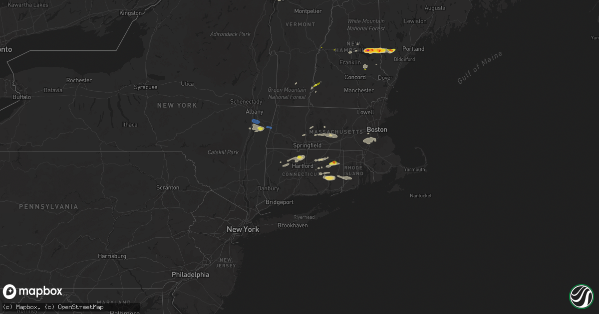
Hail Map on August 26, 2022
Get this storm
August 26 map
$229
one time, instant access
Download today. No call, no setup
Keep the $229
Bought the map and want the full workflow? Apply the entire $229 to a subscription within 7 days. None of it is wasted.
Every map, not just this one
This buys you this map. Subscription and you get every map we run, in the markets you choose from a few cities to whole states to nationwide. Plus real-time alerts the moment a storm fires.
Contact data
Name, contact info, occupancy, even credit band for addresses in the footprint. You go from where it hit to who to call.
Become the source they trust
Unlimited branding weather history reports on demand. You already have the documented answer ready for the property owner, and you are the one who showed up with it.
Property data and RoofTrace estimates
Pull up any address you have got, its value and the exact code rules for that jurisdiction, straight from One Click Code. Then RoofTrace estimates the squares, pitch, and roof value, priced the way you price.
States Impacted by Hail Map on August 26, 2022
Storm reports
Massachusetts
| Date | Description |
|---|---|
| 08/26/20223:52 PM CDT | Large tree fell on a house on sanford dr in hingham. Relayed by amateur radio. Report time estimated by radar. |
| 08/26/20223:50 PM CDT | Tree down on lincoln st near hingham. Relayed by amateur radio. Report time estimated by radar. |
| 08/26/20223:47 PM CDT | Trees down on coolidge rd near weymouth. Relayed by trained spotters. Report time estimated by radar. |
| 08/26/20223:46 PM CDT | Trees down on presidents rd near weymouth. Report time estimated by radar. |
| 08/26/20223:10 PM CDT | Tree down on house on frost street... Wires down on perry street. |
| 08/26/20222:42 PM CDT | Tree down onjames street. |
| 08/26/20222:42 PM CDT | Tree down on winch st near framingham. Relayed by amateur radio. |
| 08/26/20222:33 PM CDT | Large tree down on fahey st near marlborough. Relayed by amateur radio. Report time estimated by radar. |
| 08/26/20222:32 PM CDT | Several branches... A couple of trees and a couple of tents were blown down at 181 boston post rd west in marlborough. Relayed by amateur radio. Report time estimated b |
| 08/26/20222:25 PM CDT | Tree down closing road on lovell sreet. Power lines down on boston ave. |
| 08/26/20222:20 PM CDT | Trees down on goddard drive... Scandanavia ave and main street. |
| 08/26/20222:20 PM CDT | Trees down on rawon at burncoast street... Tree down on wire chapel street. |
| 08/26/20222:20 PM CDT | Tree down on house at ludlow and main street. |
| 08/26/20222:20 PM CDT | Trees down on rawon at bburncoast street... Tree down on wire chapel street. |
| 08/26/20222:17 PM CDT | Several trees down on plains road. |
| 08/26/20222:15 PM CDT | Reported by trained spotter. |
| 08/26/20221:04 PM CDT | Tree and powerlines downed on sheldon rd in barre. Relayed by amateur radio. Report time estimated by radar. |
| 08/26/20221:02 PM CDT | Trees and powerlines downed on old dana rd near barre. Relayed by amateur radio. Report time estimated by radar. |
| 08/26/20221:00 PM CDT | Trees and wires down on lenox rd. Time radar estimated. |
| 08/26/202212:59 PM CDT | Trees and wires down on swamp rd. Time radar estimated. |
| 08/25/202211:27 PM CDT | At 427 PM EDT, severe thunderstorms were located along a line extending from Lynn to Mansfield, moving east at 40 mph. HAZARD...60 mph wind gusts. SOURCE...Radar indicated. IMPACT...Expect damage to trees and power lines. Locations impacted include... Boston, Cambridge, Brockton, Quincy, Lynn, Somerville, Malden, Brookline, Taunton, Weymouth, Revere, Peabody, Everett, Salem, Braintree, Chelsea, Randolph, North Attleborough, Norwood and Milton. |
| 08/25/202210:42 PM CDT | At 341 PM EDT, a severe thunderstorm was located over East Granby, or near Windsor, moving east at 50 mph. HAZARD...60 mph wind gusts and quarter size hail. SOURCE...Radar indicated. IMPACT...Expect wind damage to trees and power lines. Minor hail damage to vehicles is possible. Locations impacted include... Enfield, Windsor, Simsbury, Bloomfield, Suffield, East Longmeadow, Ellington, Windsor Locks, Stafford, Somers, Granby, East Windsor, Canton, Monson, East Granby, Hampden, Brimfield, Holland, Wales and Union. |
| 08/25/202210:06 PM CDT | At 306 PM EDT, a severe thunderstorm was located near Pine Plains, or 9 miles northeast of Rhinebeck, moving east at 20 mph. HAZARD...60 mph wind gusts and penny size hail. SOURCE...Radar indicated. IMPACT...Expect damage to roofs, siding, and trees. Locations impacted include... Pine Plains, Ancram, Millerton, Bethel, Whitehouse Crossing, Pachin Mills, Ancramdale, Barton Corners, Boston Corner, Northeast Center, Gallatinville, Spencer Corners, Hammertown, Mount Riga, Mount Ross, Coleman Station, Shekomeko, Silvernails, Jackson Corners and Pulvers Corners. |
| 08/25/202210:03 PM CDT | At 302 PM EDT, a severe thunderstorm was located over Princeton, or near Leominster, moving east at 25 mph. HAZARD...60 mph wind gusts and quarter size hail. SOURCE...Radar indicated. IMPACT...Expect wind damage to trees and power lines. Minor hail damage to vehicles is possible. Locations impacted include... Lowell, Leominster, Marlborough, Chelmsford, Westford, Acton, Hudson, Concord, Sudbury, Holden, Northborough, Clinton, Wayland, Weston, Groton, Maynard, Lunenburg, Littleton, Lancaster and Rutland. |
| 08/25/20229:28 PM CDT | At 228 PM EDT, a severe thunderstorm was located over Petersham, or 13 miles southeast of Orange, moving east at 20 mph. HAZARD...60 mph wind gusts and quarter size hail. SOURCE...Radar indicated. IMPACT...Expect wind damage to trees and power lines. Minor hail damage to vehicles is possible. Locations impacted include... Gardner, Holden, Templeton, Rutland, Sterling, West Boylston, Westminster, Ashburnham, Barre, Hubbardston, Princeton, Hardwick, Oakham, Phillipston, Petersham and New Braintree. |
| 08/25/20229:27 PM CDT | At 227 PM EDT, a severe thunderstorm was located over Ware, or 11 miles southeast of Amherst, moving east at 50 mph. HAZARD...60 mph wind gusts and nickel size hail. SOURCE...Radar indicated. IMPACT...Expect damage to trees and power lines. Locations impacted include... Worcester, Framingham, Marlborough, Shrewsbury, Natick, Acton, Ludlow, Hudson, Westborough, Grafton, Concord, Sudbury, Holden, Ashland, Auburn, Hopkinton, Belchertown, Wilbraham, Northborough and Oxford. |
| 08/25/20228:41 PM CDT | At 140 PM EDT, a severe thunderstorm was located over Canton, or 10 miles east of Torrington, moving northeast at 30 mph. HAZARD...60 mph wind gusts and quarter size hail. SOURCE...Radar indicated. IMPACT...Expect wind damage to trees and power lines. Minor hail damage to vehicles is possible. Locations impacted include... Springfield, Enfield, Windsor, Agawam, West Springfield, Simsbury, Ludlow, Bloomfield, Longmeadow, Suffield, East Longmeadow, Wilbraham, Windsor Locks, Stafford, Somers, Granby, East Windsor, Canton, Southwick and Burlington. |
| 08/25/20228:15 PM CDT | At 114 PM EDT, a severe thunderstorm was located over Amherst, moving northeast at 35 mph. HAZARD...60 mph wind gusts and quarter size hail. SOURCE...Radar indicated. IMPACT...Expect wind damage to trees and power lines. Minor hail damage to vehicles is possible. Locations impacted include... Amherst, Orange, Gardner, Athol, Winchendon, Templeton, Westminster, Ashburnham, Barre, Hadley, Hubbardston, Princeton, Hatfield, Leverett, Shutesbury, Phillipston, Pelham, Royalston, Petersham and New Salem. |
| 08/25/20228:02 PM CDT | At 102 PM EDT, a severe thunderstorm was located over Selkirk, or 7 miles south of Delmar, moving east at 40 mph. HAZARD...60 mph wind gusts and nickel size hail. SOURCE...Radar indicated. IMPACT...Expect damage to roofs, siding, and trees. Locations impacted include... Pittsfield, East Greenbush, Rensselaer, Chatham, Nassau, Delmar, Lenox, New Baltimore, Ravena, Stephentown, Coxsackie, New Lebanon, Valatie, Castleton-On-Hudson, Kinderhook, Hancock, West Sand Lake, Averill Park, Selkirk and Feura Bush. |
New York
| Date | Description |
|---|---|
| 08/26/20222:06 PM CDT | Trees snapped or uprooted. |
| 08/26/202212:42 PM CDT | Tree down on seven bridges road. Radar estimated. |
| 08/26/202212:42 PM CDT | Tree and wires down on highland rd. |
| 08/26/202212:35 PM CDT | Tree and wires down between garner rd and snyder rd in town of ghent. |
| 08/26/202212:29 PM CDT | Tree down on wires on falls rd town of ghent. |
| 08/26/202212:13 PM CDT | Tree on power lines on sunset rd. Time estimated by radar. |
| 08/26/202212:12 PM CDT | Trees down and small shed destroyed. |
| 08/26/202212:12 PM CDT | Around a dozen trees down and small shed destroyed. |
| 08/26/202212:05 PM CDT | Tree down on ny 9j between brickyard and river rd. |
| 08/26/202211:25 AM CDT | Tree and wires down on old schuylerville rd. |
| 08/25/20228:43 PM CDT | At 142 PM EDT, a severe thunderstorm was located over Chatham, moving east at 40 mph. HAZARD...60 mph wind gusts and quarter size hail. SOURCE...Radar indicated. IMPACT...Hail damage to vehicles is expected. Expect wind damage to roofs, siding, and trees. Locations impacted include... Pittsfield, Chatham, Nassau, Claverack, Lee, Lenox, Stephentown, New Lebanon, Valatie, Becket, Austerlitz, Philmont, Kinderhook, Hancock, Claverack-Red Mills, Housatonic, Berkshire, Dalton, Ghent and Lanesborough. |
South Carolina
| Date | Description |
|---|---|
| 08/25/202210:18 PM CDT | Partial roof damage to a home on marett rd. |
North Dakota
| Date | Description |
|---|---|
| 08/25/20229:23 PM CDT | Facebook report and picture. |
Nevada
| Date | Description |
|---|---|
| 08/25/202210:23 PM CDT | At 322 PM PDT/322 PM MST/, a severe thunderstorm was located near Mohave Valley, or 15 miles south of Bullhead City, moving southeast at 15 mph. HAZARD...60 mph wind gusts. SOURCE...Radar indicated. IMPACT...Expect damage to roofs and trees. Locations impacted include... Needles, Mesquite Creek, Arizona Village, Mojave Ranch Estates, Mohave Valley and Willow Valley.This includes Interstate 40 in California between mile markers 134and 152. |
Tennessee
| Date | Description |
|---|---|
| 08/26/20222:03 PM CDT | Wood power pole snapped on buffalo road. Time estimated based on radar. |
Colorado
| Date | Description |
|---|---|
| 08/25/20227:38 PM CDT | Asos station klaa lamar airport. |
Connecticut
| Date | Description |
|---|---|
| 08/26/20225:45 PM CDT | Multiple small trees |
| 08/26/20224:43 PM CDT | 12 downed trees near tyler drive. Time estimated by radar. |
| 08/26/20224:38 PM CDT | Trees down on route 207 near spafford drive and levita road. Time estimated from radar. |
| 08/26/20224:35 PM CDT | In hebron state police reported tree down on church street |
| 08/26/20223:42 PM CDT | Tree and wires down on north school rd. Relayed by amateur radio. Time estimated by radar. |
| 08/26/20223:37 PM CDT | Tree down on wires on goose lane near rockville. Relayed by amateur radio. |
| 08/26/20223:30 PM CDT | Tree and wires down on corner of spring and main street in rockville. Relayed by amateur radio. Time estimated by radar. |
| 08/26/20223:30 PM CDT | Large tree down on stone st in windsor. Relayed by amateur radio. |
| 08/26/20223:28 PM CDT | Report from mping: 3-inch tree limbs broken; power poles broken. |
| 08/26/20223:26 PM CDT | Trees down on sweetbrier st. Relayed by amateur radio. |
| 08/26/20223:22 PM CDT | 12 to 14 inch diameter trees were blown down in the median of hartford pike near dayville... Ct. Relayed by amateur radio. |
| 08/26/20223:10 PM CDT | Trees down on bridge st near enfield. Relayed by by amateur radio. |
| 08/26/20223:02 PM CDT | In east windsor numerous trees and wires were down... Particularly in broad brook section of town. The damage occurred from 402 to 426 pm. |
| 08/26/20222:53 PM CDT | In east granby... Trees were down on power lines on holcomb street. Also... Trees were down on metacomet drive and pond lane. Reports per ct state police. |
| 08/26/20222:50 PM CDT | Tree down and primary wires down at vineyard rd and belden rd. |
| 08/26/20222:50 PM CDT | Pole snapped and wires down on sandbank hill rd and claire hill road. |
| 08/26/20222:45 PM CDT | Wires down on lake road. |
| 08/26/20222:40 PM CDT | Tree and wires down; on smith lane at intersection of rt. 4. |
| 08/26/20222:09 PM CDT | Large branch fell on car on stephanie circle. |
| 08/26/20221:45 PM CDT | In east windsor a tree down on a house on pleasant street. |
| 08/26/20221:28 PM CDT | Reported by amateur radio. |
| 08/26/20221:28 PM CDT | Tree and wires down on mahoney rd. Relayed by amateur radio. |
| 08/26/20221:24 PM CDT | Tree down on winkler rd making road impassable. Relayed by amateur radio. |
| 08/26/20221:16 AM CDT | At 616 PM EDT, severe thunderstorms were located along a line extending from near Voluntown to Lisbon to near Colchester, moving east at 30 mph. HAZARD...60 mph wind gusts. SOURCE...Radar indicated. IMPACT...Expect damage to trees and power lines. Severe thunderstorms will be near... Jewett City and Lisbon around 620 PM EDT. Griswold around 625 PM EDT. Lebanon and Sprague around 630 PM EDT. Preston around 640 PM EDT. |
| 08/26/202212:27 AM CDT | At 526 PM EDT, a severe thunderstorm was located near Colchester, moving east at 30 mph. HAZARD...60 mph wind gusts and quarter size hail. SOURCE...Radar indicated. IMPACT...Minor hail damage to vehicles is possible. Expect wind damage to trees and power lines. This severe thunderstorm will be near... Salem around 535 PM EDT. Lebanon and Bozrah around 540 PM EDT. Sprague around 545 PM EDT. Norwich and Preston around 555 PM EDT. Jewett City and Lisbon around 600 PM EDT. Griswold around 605 PM EDT. Voluntown around 615 PM EDT. |
| 08/26/202212:06 AM CDT | At 505 PM EDT, a severe thunderstorm was located over Pomfret, or 12 miles northeast of Mansfield, moving east at 30 mph. HAZARD...60 mph wind gusts. SOURCE...Radar indicated. IMPACT...Expect damage to trees and power lines. Locations impacted include... Johnston, Smithfield, Killingly, Webster, Burrillville, Uxbridge, North Smithfield, Scituate, Glocester, Putnam, Thompson, Douglas, Brooklyn, Woodstock, Foster, Ashford, Pomfret, Millville, Chaplin and Hampton. |
| 08/25/202211:25 PM CDT | At 424 PM EDT, a severe thunderstorm was located near Brooklyn, or near Plainfield, moving east at 30 mph. HAZARD...60 mph wind gusts and quarter size hail. SOURCE...Radar indicated. IMPACT...Expect wind damage to trees and power lines. Minor hail damage to vehicles is possible. Locations impacted include... Cranston, Johnston, Plainfield, Smithfield, Killingly, Burrillville, North Smithfield, Scituate, Glocester, Brooklyn, Canterbury, Foster, Pomfret and Sterling. |
| 08/25/202211:24 PM CDT | At 424 PM EDT, severe thunderstorms were located along a line extending from Somers to Vernon to East Hartford, moving east at 30 mph. HAZARD...60 mph wind gusts and quarter size hail. SOURCE...Radar indicated. IMPACT...Expect wind damage to trees and power lines. Minor hail damage to vehicles is possible. Locations impacted include... Hartford, New Britain, Manchester, East Hartford, Enfield, Glastonbury, Newington, Vernon, Wethersfield, Mansfield, South Windsor, Windham, Willimantic, Southbridge, East Longmeadow, Ellington, Tolland, Charlton, Coventry and Stafford. |
| 08/25/202210:39 PM CDT | At 338 PM EDT, a severe thunderstorm was located over Burlington, or 7 miles east of Torrington, moving east at 25 mph. HAZARD...60 mph wind gusts and quarter size hail. SOURCE...Radar indicated. IMPACT...Expect wind damage to trees and power lines. Minor hail damage to vehicles is possible. Locations impacted include... Hartford, West Hartford, Manchester, East Hartford, Enfield, Windsor, South Windsor, Farmington, Simsbury, Bloomfield, Avon, Windsor Locks, East Windsor, Canton, Burlington and East Granby. |
| 08/25/202210:24 PM CDT | At 324 PM EDT, severe thunderstorms were located along a line extending from near Framingham to Douglas to Columbia, moving east at 35 mph. HAZARD...60 mph wind gusts and nickel size hail. SOURCE...Radar indicated. IMPACT...Expect damage to trees and power lines. Locations impacted include... Boston, Worcester, Cambridge, Quincy, Lynn, Newton, Somerville, Framingham, Waltham, Malden, Brookline, Manchester, Medford, Revere, Peabody, Arlington, Everett, Salem, Woonsocket and Marlborough. |
| 08/25/20229:58 PM CDT | At 257 PM EDT, a severe thunderstorm was located near Weston, or 8 miles northwest of Bridgeport, moving northeast at 25 mph. HAZARD...60 mph wind gusts and quarter size hail. SOURCE...Radar indicated. IMPACT...Minor hail damage to vehicles is possible. Expect wind damage to trees and power lines. This severe thunderstorm will be near... Trumbull around 310 PM EDT. Stratford around 315 PM EDT. Milford and Shelton around 320 PM EDT. Derby around 325 PM EDT. Seymour and Orange around 330 PM EDT. Woodbridge around 335 PM EDT. Naugatuck and Beacon Falls around 340 PM EDT. Hamden and Bethany around 345 PM EDT. |
North Carolina
| Date | Description |
|---|---|
| 08/26/20226:46 PM CDT | Eastern band of cherokee indians reported 5-7 trees blown down. Also... A one-lane service gravel road was washed out. |
| 08/26/20222:30 PM CDT | Tree fell across road and powerline. |
Vermont
| Date | Description |
|---|---|
| 08/26/20222:46 PM CDT | Corrected location. Large willow tree down at the intersection of mountain view road and 2a. |
| 08/26/20222:46 PM CDT | Tree down by the on ramp to i-89 off williston road |
| 08/26/20222:46 PM CDT | Large willow tree down at the intersection of essex road and industrial avenue |
| 08/26/20227:53 AM CDT | At 1252 PM EDT, severe thunderstorms were located along a line extending from near Hanover to 11 miles northwest of Claremont, moving east at 20 mph. HAZARD...60 mph wind gusts and quarter size hail. SOURCE...Radar indicated. IMPACT...Hail damage to vehicles is expected. Expect wind damage to roofs, siding, and trees. Locations impacted include... Lebanon, Grafton, Hanover, Enfield, Canaan, Groton, Grantham, Lyme, Cornish, Croydon, Dorchester, Plainfield, Orange, Wentworth, Rumney and Springfield.This includes Interstate 89 between mile markers 43 and 60. |
| 08/26/20227:45 AM CDT | At 1244 PM EDT, severe thunderstorms were located along a line extending from near Hartford to near Hoosick Falls, moving north at 25 mph. HAZARD...60 mph wind gusts and nickel size hail. SOURCE...Radar indicated. IMPACT...Expect damage to roofs, siding, and trees. Locations impacted include... Bennington, Hoosick Falls, Arlington, Salem, Manchester, Shaftsbury, Dorset, Cambridge, Manchester Center, Hoosick, Porter, Lee, Pittstown, White Creek, North Bennington, Sunderland, Rupert, Woodford, Sandgate and Old Bennington. |
| 08/26/20227:17 AM CDT | At 1216 PM EDT, severe thunderstorms were located along a line extending from near Sharon to South Reading, moving east at 25 mph. HAZARD...60 mph wind gusts and penny size hail. SOURCE...Radar indicated. IMPACT...Expect damage to trees and powerlines. Locations impacted include... White River Junction, Woodstock, Hartland Four Corners, Woodstock Village, Sharon, Thetford Hill State Park, Thetford Center, Quechee, Pomfret, Norwich, Thetford, Hartland, Reading, West Windsor, Hartford, Windsor, Strafford, Royalton, Tunbridge and Queechee State Park. |
| 08/25/202210:45 PM CDT | At 345 PM EDT, a severe thunderstorm was located over Burlington International Airport, moving east at 20 mph. HAZARD...60 mph wind gusts and quarter size hail. SOURCE...Radar indicated. IMPACT...Minor hail damage to vehicles is possible. Expect wind damage to trees and powerlines. Locations impacted include... Essex Junction, South Burlington, Burlington International Airport, Burlington, Winooski, Stowe, Waterbury Village, Essex Junction Village, Williston, Bolton, Richmond, Jericho, Hinesburg, St. George, Huntington, Duxbury, Essex, Moretown, Jericho Village and Waterbury. |
| 08/25/20227:08 PM CDT | Barn collapsed and about a dozen trees down. Location provided by em/fire and time estimate based on radar. |
Idaho
| Date | Description |
|---|---|
| 08/26/20226:00 PM CDT | Kettle butte us-20 itd. |
| 08/26/202212:08 AM CDT | At 508 PM MDT, a severe thunderstorm was located 11 miles northwest of Shelley, or 11 miles west of Idaho Falls, moving east at 30 mph. HAZARD...60 mph wind gusts. SOURCE...Radar indicated. IMPACT...Expect damage to roofs, siding, and trees. Locations impacted include... Idaho Falls, Ammon, Shelley, Iona and Osgood. |
| 08/25/202210:28 PM CDT | At 328 PM MDT, a severe thunderstorm was located 9 miles northwest of Pleasantview, or 11 miles northwest of Malad, moving east at 10 mph. HAZARD...Quarter size hail. SOURCE...Radar indicated. IMPACT...Damage to vehicles is expected. Locations impacted include... Malad, Pleasantview, Malad Pass and Daniels Reservoir. |
| 08/25/202210:00 PM CDT | At 300 PM MDT, a severe thunderstorm was located 8 miles northeast of Thatcher, or 11 miles south of Soda Springs, moving east at 15 mph. HAZARD...Ping pong ball size hail. SOURCE...Radar indicated. IMPACT...People and animals outdoors will be injured. Expect damage to roofs, siding, windows, and vehicles. Locations impacted include... Georgetown, Bern, Georgetown Summit, Niter, Liberty and Emmigrant Summit. |
| 08/25/20229:58 PM CDT | At 258 PM MDT, a severe thunderstorm was located 9 miles northwest of Malad, moving east at 15 mph. HAZARD...Quarter size hail. SOURCE...Radar indicated. IMPACT...Damage to vehicles is expected. Locations impacted include... Malad, Daniels Reservoir and Malad Pass. |
| 08/25/20229:52 PM CDT | At 252 PM MDT, a severe thunderstorm was located 7 miles northeast of Lava Hot Springs, moving east at 10 mph. HAZARD...Quarter size hail. SOURCE...Radar indicated. IMPACT...Damage to vehicles is expected. Locations impacted include... Grace and Bancroft. |
| 08/25/20229:29 PM CDT | At 229 PM MDT, a severe thunderstorm was located 14 miles north of Holbrook Summit, or 16 miles northwest of Malad, moving east at 20 mph. HAZARD...Quarter size hail. SOURCE...Radar indicated. IMPACT...Damage to vehicles is expected. Locations impacted include... Daniels Reservoir and Malad Pass. |
Wyoming
| Date | Description |
|---|---|
| 08/26/20226:30 PM CDT | A lot of nickel to quarter size hail on the ground. |
| 08/26/20226:06 PM CDT | Time estimated via radar |
| 08/26/20226:00 PM CDT | Garden damage from hail. Time estimated by radar. |
| 08/26/20225:40 PM CDT | A local report indicates 1.00 inch wind near 15 NNW ALVA |
| 08/26/20221:12 AM CDT | At 611 PM MDT, severe thunderstorms were located along a line extending from 2 miles southwest of Colony to near Bear Lodge Campground to 7 miles west of Cook Lake, moving southeast at 35 mph. HAZARD...70 mph wind gusts and quarter size hail. SOURCE...Radar indicated. IMPACT...Hail damage to vehicles is expected. Expect considerable tree damage. Wind damage is also likely to mobile homes, roofs, and outbuildings. Severe thunderstorms will be near... Colony around 615 PM MDT. Aladdin around 620 PM MDT. Warren Peak around 625 PM MDT.Other locations in the path of these severe thunderstorms includeSundance, Beulah, Belle Fourche, Crow Peak, Fruitdale, Bridal VeilFalls, Spearfish, Saint Onge, Cement Ridge Lookout and SpearfishCanyon.This includes... Interstate 90 in South Dakota between Mile Markers 1 and 28. Interstate 90 in Wyoming between Mile Markers 185 and 207. |
| 08/26/202212:41 AM CDT | At 541 PM MDT, a severe thunderstorm was located 11 miles southwest of Oshoto, or 23 miles northeast of Gillette, moving east at 30 mph. HAZARD...60 mph wind gusts and quarter size hail. SOURCE...Radar indicated. IMPACT...Hail damage to vehicles is expected. Expect wind damage to roofs, siding, and trees. This severe thunderstorm will be near... Oshoto around 600 PM MDT.Other locations in the path of this severe thunderstorm includeCarlile, Devils Tower National Monument and Devils Tower Junction. |
| 08/26/202212:22 AM CDT | At 522 PM MDT, severe thunderstorms were located along a line extending from 10 miles north of Alva to 7 miles northwest of New Haven to 11 miles northwest of Oshoto, moving east at 35 mph. HAZARD...70 mph wind gusts and quarter size hail. SOURCE...Radar indicated. IMPACT...Hail damage to vehicles is expected. Expect considerable tree damage. Wind damage is also likely to mobile homes, roofs, and outbuildings. Locations impacted include... Colony, Hulett and Alva. |
| 08/26/202212:10 AM CDT | At 510 PM MDT, severe thunderstorms were located along a line extending from 2 miles south of Rockypoint to 13 miles northwest of Oshoto to 5 miles south of Weston, moving east at 20 mph. HAZARD...60 mph wind gusts and quarter size hail. SOURCE...Radar indicated. IMPACT...Hail damage to vehicles is expected. Expect wind damage to roofs, siding, and trees. Severe thunderstorms will be near... Rockypoint around 515 PM MDT. |
| 08/25/202211:41 PM CDT | At 440 PM MDT, a severe thunderstorm was located 4 miles southwest of Oshoto, or 30 miles northeast of Gillette, moving east at 10 mph. HAZARD...Ping pong ball size hail. SOURCE...Radar indicated. IMPACT...People and animals outdoors will be injured. Expect damage to roofs, siding, windows, and vehicles. This severe thunderstorm will be near... Oshoto around 500 PM MDT.Other locations in the path of this severe thunderstorm includeCarlile and Devils Tower National Monument. |
| 08/25/202211:25 PM CDT | At 424 PM MDT, severe thunderstorms were located along a line extending from 11 miles west of Alzada to 14 miles north of Hulett to 7 miles southeast of Rockypoint, moving east at 30 mph. HAZARD...60 mph wind gusts and quarter size hail. SOURCE...Radar indicated. IMPACT...Hail damage to vehicles is expected. Expect wind damage to roofs, siding, and trees. Locations impacted include... Colony. |
| 08/25/20227:42 PM CDT | A local report indicates 63 MPH wind near BEULAH |
| 08/25/20227:36 PM CDT | A local report indicates 62 MPH wind near BEULAH |
South Dakota
| Date | Description |
|---|---|
| 08/26/20226:12 AM CDT | At 1112 PM CDT, severe thunderstorms were located along a line extending from 8 miles northeast of Kirley to near Belvidere, moving east at 55 mph. HAZARD...60 mph wind gusts and penny size hail. SOURCE...Radar indicated. IMPACT...Expect damage to roofs, siding, and trees. Severe thunderstorms will be near... Sansarc around 1020 PM MDT. Okaton around 1125 PM CDT.Other locations in the path of these severe thunderstorms includeMurdo, Westover and Draper. |
| 08/26/20223:51 AM CDT | At 851 PM MDT, severe thunderstorms were located along a line extending from 7 miles northwest of Wall to Badlands National Park to 8 miles north of Rockyford, moving east at 40 mph. HAZARD...60 mph wind gusts. SOURCE...Radar indicated. IMPACT...Expect damage to roofs, siding, and trees. Severe thunderstorms will be near... Wall around 855 PM MDT. Pinnacles Ranger Station around 900 PM MDT. Quinn around 905 PM MDT.Other locations in the path of these severe thunderstorms includeGrindstone, Interior, Cedar Pass, Delta 1 Launch Facility, PotatoCreek, Cactus Flat, Minuteman Missile Visitors Center and Philip.This includes Interstate 90 in South Dakota between Mile Markers 91and 149. |
| 08/26/20223:10 AM CDT | At 809 PM MDT, severe thunderstorms were located along a line extending from 4 miles west of Fairpoint to 4 miles northwest of Union Center to 3 miles southeast of Hereford, moving east at 45 mph. Wind gusts of 60 to 70 mph were recently reported 6 miles north-northwest of Hereford. HAZARD...70 mph wind gusts. SOURCE...Trained weather spotters. IMPACT...Expect considerable tree damage. Damage is likely to mobile homes, roofs, and outbuildings. Severe thunderstorms will be near... Union Center around 815 PM MDT. Enning around 820 PM MDT. Elm Springs, Red Owl and Stoneville around 825 PM MDT.Other locations in the path of these severe thunderstorms includeWhite Owl, Opal, Marcus, Plainview, Howes, Durkee Lake, Faith,Bridger and Red Scaffold. |
| 08/26/20222:19 AM CDT | At 719 PM MDT, a severe thunderstorm was located 3 miles southwest of Newell, or 18 miles north of Sturgis, moving east at 25 mph. HAZARD...60 mph wind gusts and quarter size hail. SOURCE...Radar indicated. IMPACT...Hail damage to vehicles is expected. Expect wind damage to roofs, siding, and trees. This severe thunderstorm will be near... Newell around 725 PM MDT.Other locations in the path of this severe thunderstorm include OwlButte. |
| 08/26/20221:56 AM CDT | At 655 PM MDT, a severe thunderstorm was located over Saint Onge, or 9 miles northeast of Spearfish, moving east at 50 mph. THIS IS A DESTRUCTIVE STORM FOR SAINT ONGE AND BEAR BUTTE STATE PARK. HAZARD...80 mph wind gusts and penny size hail. SOURCE...Radar indicated. IMPACT...Flying debris will be dangerous to those caught without shelter. Mobile homes will be heavily damaged. Expect considerable damage to roofs, windows, and vehicles. Extensive tree damage and power outages are likely. This severe thunderstorm will be near... Sturgis around 705 PM MDT. Vale and Bear Butte State Park around 710 PM MDT.Other locations in the path of this severe thunderstorm includeHereford.This includes Interstate 90 in South Dakota between Mile Markers 11and 39. |
| 08/25/202211:12 PM CDT | A local report indicates 59 MPH wind near 9 ENE BELVIDERE |
| 08/25/20229:36 PM CDT | A local report indicates 61 MPH wind near 3 NNW SCENIC |
| 08/25/20229:10 PM CDT | A local report indicates 71 MPH wind near 3 W UNION CENTER |
| 08/25/20229:07 PM CDT | A local report indicates 65 MPH wind near 6 NNW HEREFORD |
| 08/25/20229:05 PM CDT | A local report indicates 64 MPH wind near 3 W UNION CENTER |
| 08/25/20228:04 PM CDT | A local report indicates 58 MPH wind near 2 SSW SAINT ONGE |
| 08/25/20227:46 PM CDT | Shelf cloud with visible rotation |
Maryland
| Date | Description |
|---|---|
| 08/25/202210:25 PM CDT | At 325 PM EDT, a severe thunderstorm was located near Deale, moving east at 10 mph. HAZARD...60 mph wind gusts and nickel size hail. SOURCE...Radar indicated. IMPACT...Damage to roofs, siding, trees, and power lines is possible. Locations impacted include... Talbot, St. Michaels and Tilghman Island. |
Arizona
| Date | Description |
|---|---|
| 08/26/20226:50 PM CDT | Photos show damage to fully-framed house under construction... With garage area blown down. |
| 08/26/20226:00 PM CDT | Photo shows patio roof damage near rivers edge golf course. Part of the patio roof looks to be flipped onto the roof of the house. |
| 08/26/20227:06 AM CDT | At 1205 PM MST, a severe thunderstorm was located 12 miles east of Sunset Crater Volcano National Monument, or 22 miles northeast of Flagstaff, moving east at 15 mph. HAZARD...60 mph wind gusts and half dollar size hail. SOURCE...Radar indicated. IMPACT...Hail damage to vehicles is expected. Expect wind damage to roofs, siding, and trees. This severe thunderstorm will remain over mainly rural areas of Coconino County near Grand Falls. |
| 08/26/20226:46 AM CDT | At 1145 PM MST, a severe thunderstorm was located near Florence, moving southeast at 5 mph. HAZARD...60 mph wind gusts. SOURCE...Radar indicated. IMPACT...Expect damage to roofs, siding, and trees. Locations impacted include... Florence.This includes AZ Route 79 between mile markers 129 and 146. |
| 08/26/20222:26 AM CDT | Power pole |
| 08/26/20221:59 AM CDT | Mesonet station mamf 6.3 n florence |
| 08/25/202211:28 PM CDT | At 427 PM PDT/427 PM MST/, a severe thunderstorm was located near Topock, moving south at 15 mph. HAZARD...60 mph wind gusts. SOURCE...Radar indicated. IMPACT...Expect damage to roofs and trees. Locations impacted include... Lake Havasu City and Desert Hills. This includes Interstate 40 in Arizona near mile marker 5. |
| 08/25/202210:56 PM CDT | At 356 PM MST, a severe thunderstorm was located near Taylor, moving east at 15 mph. HAZARD...60 mph wind gusts and quarter size hail. SOURCE...Radar indicated. IMPACT...Hail damage to vehicles is expected. Expect wind damage to roofs, siding, and trees. Locations impacted include... Taylor, Shumway, Snowflake and White Mountain Lake. |
Ohio
| Date | Description |
|---|---|
| 08/25/202210:36 PM CDT | At 334 PM EDT, a severe thunderstorm was located near Tuppers Plains, or near Forked Run State Park, moving southeast at 25 mph. HAZARD...60 mph wind gusts and quarter size hail. SOURCE...Radar indicated. IMPACT...Hail damage to vehicles is expected. Expect wind damage to roofs, siding, and trees. Locations impacted include... Forked Run State Park, Ravenswood, Sandyville, Tuppers Plains, Chester, Portland, Belleville and Reedsville.This includes Interstate 77 in West Virginia between mile markers 147and 161, and near mile marker 164. |
| 08/25/20229:51 PM CDT | At 250 PM EDT, a severe thunderstorm was located near Seaman, moving east at 10 mph. HAZARD...60 mph wind gusts. SOURCE...Radar indicated. IMPACT...Expect damage to trees and power lines. Locations impacted include... Peebles, Winchester, Seaman, Emerald, May Hill, Serpent Mound, Locust Grove and Smoky Corners. |
California
| Date | Description |
|---|---|
| 08/26/20226:00 PM CDT | Photos show tree damage and street light blown over in needles over due to thunderstorm winds. |
New Hampshire
| Date | Description |
|---|---|
| 08/26/20222:32 PM CDT | Reported by weather spotter: st144 reported trees and branches down and blocking merrymeeting rd. Time estimated by radar. |
| 08/26/20222:32 PM CDT | Observed 1.25 inch hail in barnstead. Time estimated by radar. |
| 08/26/20222:20 PM CDT | Delayed report. Multiple trees reported down off rt 107 near sawyer lake rd. Time estimated from radar. |
| 08/26/20222:16 PM CDT | Reported by weather spotter: golfball-size hail currently falling on e. Wakefield. Hail accumulating in places. Time estimated by radar. |
| 08/26/20222:15 PM CDT | 1.75 inch measured hail north of wolfeboro and lake wentworth on highway 28. Dented vehicle hood. Time estimated by radar. |
| 08/26/20221:48 PM CDT | Reported by amateur radio: social media photo showing two-inch hail near mirror lake. Time estimated by radar. |
| 08/26/20221:34 PM CDT | Reported by weather spotter: large branches and two trees down on rte 123 west of marlow. |
| 08/26/20221:34 PM CDT | Tree reported down on rt. 101 near oliver rd. |
| 08/26/20221:30 PM CDT | Tree and wires down. Time estimated by radar. |
| 08/26/20221:28 PM CDT | Spotter me87 reported trees down in sunapee. |
| 08/26/20221:17 PM CDT | Multiple trees down in newport off of unity springs rd. Time estimated from radar. |
| 08/26/20221:10 PM CDT | Reported by amateur radio: report of half dollar sized hail damaging a vehicle on homestead road south of alstead. Time estimated by radar. |
| 08/26/20221:08 PM CDT | Tree and wires down. Time estimated by radar. |
| 08/26/20221:00 PM CDT | Delayed report. Social media reports of trees down across walpole along with hail. Relayed by amateur radio. Time estimated from radar. |
| 08/26/202212:58 PM CDT | Tree down on bowen crossing rd. |
| 08/26/202212:55 PM CDT | Delayed report. Measured hail between ping pong and golfball-sized just south of walpole on nh 12. Appeared to damage crops. Time estimated by radar. |
| 08/26/202212:28 PM CDT | Tree reported down on wires off of ranch rd. Time approximated from radar. |
| 08/26/202212:24 PM CDT | Corrects previous hail report from canaan. Hail of at least quarter size fell for approximately 4 minutes. |
| 08/26/202212:13 PM CDT | Numerous branches and a few trees reported down on canaan st. Time estimated by radar. |
| 08/26/202212:13 PM CDT | Hail of at least quarter size fell for approximately 4 minutes. |
| 08/26/202212:02 PM CDT | Reported by weather spotter. A few trees and branches down on may st and other streets on east side of lebanon. Largest diameter tree was 6 inches. Time estimated by ra |
| 08/26/202211:52 AM CDT | Delayed report: large branches scattered across high road. Time estimated by radar. |
| 08/25/202210:12 PM CDT | At 311 PM EDT, a severe thunderstorm was located near Ossipee, moving east at 25 mph. HAZARD...Ping pong ball size hail and 60 mph wind gusts. SOURCE...Radar indicated. IMPACT...People and animals outdoors will be injured. Expect hail damage to roofs, siding, windows, and vehicles. Expect wind damage to roofs, siding, and trees. Locations impacted include... Alfred, Buxton, Hollis, Cornish, Waterboro, Standish, Lyman, Limington, Limerick, Acton, Parsonsfield, Newfield, Shapleigh and Dayton. |
| 08/25/20229:49 PM CDT | At 248 PM EDT, a severe thunderstorm was located near Wolfeboro, or near Ossipee, moving east at 20 mph. HAZARD...60 mph wind gusts and half dollar size hail. SOURCE...Radar indicated. IMPACT...Hail damage to vehicles is expected. Expect wind damage to roofs, siding, and trees. Locations impacted include... Ossipee, Moultonborough, Alton, Effingham, Wolfeboro, Gilford, Acton, Brookfield, Wakefield, Tuftonboro, Newfield and New Durham. |
| 08/25/20229:29 PM CDT | At 229 PM EDT, a severe thunderstorm was located over Gilsum, or near Keene, moving northeast at 40 mph. HAZARD...60 mph wind gusts and quarter size hail. SOURCE...Radar indicated. IMPACT...Hail damage to vehicles is expected. Expect wind damage to roofs, siding, and trees. Locations impacted include... Keene, Jaffrey, Henniker, Peterborough, Antrim, Greenfield, Lyndeborough, Bradford, Dublin, Francestown, Bennington, Richmond, Harrisville, Nelson, Marlborough, Gilsum, Windsor, Hancock, Deering and Hillsborough. |
| 08/25/20229:27 PM CDT | At 227 PM EDT, severe thunderstorms were located along a line extending from 6 miles northeast of Claremont to near New London to Bradford, moving northeast at 60 mph. HAZARD...60 mph wind gusts and nickel size hail. SOURCE...Radar indicated. IMPACT...Expect damage to roofs, siding, and trees. Locations impacted include... Claremont, Franklin, New London, Plymouth, Meredith, Grafton, Enfield, Canaan, Holderness, Ashland, Bradford, Danbury, Groton, Warner, Newport, Belmont, Boscawen, Bristol, Grantham and Andover.This includes the following highways... Interstate 89 between mile markers 20 and 50. Interstate 93 between mile markers 55 and 80. |
| 08/25/20229:12 PM CDT | At 211 PM EDT, a severe thunderstorm was located near Ashland, or near Meredith, moving east at 20 mph. HAZARD...60 mph wind gusts and quarter size hail. SOURCE...Radar indicated. IMPACT...Hail damage to vehicles is expected. Expect wind damage to roofs, siding, and trees. Locations impacted include... Laconia, Meredith, Moultonborough, Holderness, Ashland, Sandwich, Wolfeboro, Tamworth, Gilford, Center Harber, New Hampton, Tuftonboro and Sanbornton.This includes Interstate 93 between mile markers 65 and 74. |
| 08/25/20228:52 PM CDT | At 152 PM EDT, severe thunderstorms were located along a line extending from 12 miles northwest of Charlestown to near Westmoreland to 12 miles west of Chesterfield, moving east at 25 mph. HAZARD...60 mph wind gusts and quarter size hail. SOURCE...Radar indicated. IMPACT...Hail damage to vehicles is expected. Expect wind damage to roofs, siding, and trees. Locations impacted include... Keene, Claremont, Charlestown, Nelson, Newport, Gilsum, Marlow, Walpole, Sullivan, Alstead, Westmoreland, Surry, Grantham, Cornish, Lempster, Acworth, Goshen, Croydon, Langdon and Washington.This includes Interstate 89 mile marker 43 and near mile marker 45. |
| 08/25/20228:38 PM CDT | At 135 PM EDT, a severe thunderstorm was located over mainly rural areas of Northern Windham County, moving east at 40 mph. HAZARD...60 mph wind gusts and quarter size hail. SOURCE...Radar indicated. IMPACT...Hail damage to vehicles is expected. Expect wind damage to roofs, siding, and trees. Locations impacted include... Bellows Falls, Londonderry, Townshend, Putney, Saxtons River, Westminster, Newfane, West Wardsboro, Windham, Rockingham, Jamaica, Wardsboro, Grafton, Brookline, Athens, North Westminster, Wardsboro Center, Goose City, East Putney and Brockways Mills. |
| 08/25/20228:24 PM CDT | At 123 PM EDT, severe thunderstorms were located along a line extending from 10 miles southeast of Piermont to Canaan, moving east at 25 mph. HAZARD...60 mph wind gusts and nickel size hail. SOURCE...Radar indicated. IMPACT...Expect damage to roofs, siding, and trees. Locations impacted include... Lincoln, Plymouth, Meredith, Moultonborough, Grafton, Enfield, Canaan, Holderness, Ashland, Groton, Woodstock, Sandwich, Bristol, Center Harber, Hebron, Benton, Dorchester, Ellsworth, Orange and Thornton.This includes Interstate 93 between mile markers 68 and 102. |
Virginia
| Date | Description |
|---|---|
| 08/26/20224:29 PM CDT | Two trees down near miller school road and i-64. Numerous small and large branches down as well. |
| 08/26/20221:13 AM CDT | At 613 PM EDT, a severe thunderstorm was located 8 miles southeast of Afton, or 12 miles southeast of Waynesboro, moving east at 10 mph. HAZARD...60 mph wind gusts and quarter size hail. SOURCE...Radar indicated. IMPACT...Damaging winds will cause some trees and large branches to fall. This could injure those outdoors, as well as damage homes and vehicles. Roadways may become blocked by downed trees. Localized power outages are possible. Unsecured light objects may become projectiles. Locations impacted include... Covesville and North Garden. |
| 08/26/202212:30 AM CDT | At 530 PM EDT, a severe thunderstorm was located over Crozet, or 11 miles west of Charlottesville, moving southeast at 10 mph. HAZARD...60 mph wind gusts and quarter size hail. SOURCE...Radar indicated. IMPACT...Damaging winds will cause some trees and large branches to fall. This could injure those outdoors, as well as damage homes and vehicles. Roadways may become blocked by downed trees. Localized power outages are possible. Unsecured light objects may become projectiles. Locations impacted include... Crozet, Ivy, Esmont, Overton, Alberene, Damon, North Garden, Batesville, Covesville and Keene. |
Maine
| Date | Description |
|---|---|
| 08/26/20223:34 PM CDT | Two 20 inch in diameter trees on road. Reported by cumberland county dispatch. Time estimated by radar. |
| 08/26/20223:30 PM CDT | Delayed report. Wgme social media pictures show a few downed trees in eastern promenade. Time of damage estimated from radar. |
| 08/26/20223:25 PM CDT | Delayed report. Tree reported down on woodford st. Time of event based on radar. |
| 08/26/20222:57 PM CDT | Delayed report. Hollis fire department reports 2 trees down on river road between bean street and saco road. Time of damage estimated from radar data. |
| 08/25/202210:55 PM CDT | At 355 PM EDT, a severe thunderstorm was located near Hollis, or 12 miles west of Westbrook, moving east at 30 mph. HAZARD...60 mph wind gusts and half dollar size hail. SOURCE...Radar indicated. IMPACT...Hail damage to vehicles is expected. Expect wind damage to roofs, siding, and trees. Locations impacted include... South Portland, Westbrook, Saco, Gorham, Buxton, Hollis, Standish, Scarborough, Waterboro, Limington and Windham.This includes Interstate 95 between mile markers 42 and 43. |
| 08/25/202210:31 PM CDT | At 331 PM EDT, a severe thunderstorm was located near Barnstead, or 13 miles north of Northwood, moving east at 35 mph. HAZARD...60 mph wind gusts and half dollar size hail. SOURCE...Radar indicated. IMPACT...Hail damage to vehicles is expected. Expect wind damage to roofs, siding, and trees. Locations impacted include... Rochester, Sanford, Northwood, Barrington, Berwick, Farmington, Lebanon, Alton, Barnstead, Gilmanton, Acton, Brookfield, Strafford, New Durham, Middleton, Milton, Shapleigh, North Berwick and Wakefield. |
| 08/25/202210:08 PM CDT | At 308 PM EDT, a severe thunderstorm was located near Hiram, or 7 miles southwest of Naples, moving east at 25 mph. HAZARD...60 mph wind gusts and quarter size hail. SOURCE...Radar indicated. IMPACT...Hail damage to vehicles is expected. Expect wind damage to roofs, siding, and trees. Locations impacted include... Bridgton, Naples, Hiram, Raymond, Standish, Casco, Denmark, Frye Island, Sebago and Baldwin. |
Georgia
| Date | Description |
|---|---|
| 08/26/20226:18 AM CDT | At 1117 PM EDT, a severe thunderstorm was located 9 miles south of Seneca, or 5 miles northeast of Tugaloo State Park, moving southeast at 10 mph. HAZARD...60 mph wind gusts and quarter size hail. SOURCE...Radar indicated. IMPACT...Minor hail damage to vehicles is expected. Expect wind damage to trees and power lines. Locations impacted include... Hartwell, Reed Creek, Lake Hartwell, Townville, Fair Play, Sadlers Creek State Park and Oakway. |
| 08/25/202210:30 PM CDT | Numerous trees and powerlines down in tugaloo state park and in the city of lavonia. One tree fell on a vehicle. Power outages reported. Time estimated from radar. |
Rhode Island
| Date | Description |
|---|---|
| 08/26/20225:54 PM CDT | Large tree fell on top of a shed... Destroying the shed. Relayed by amateur radio. Time estimated by radar. |
Pennsylvania
| Date | Description |
|---|---|
| 08/25/202211:33 PM CDT | At 433 PM EDT, a severe thunderstorm was located 8 miles east of Meadowood, or 8 miles east of Butler, moving east at 15 mph. HAZARD...60 mph wind gusts and penny size hail. SOURCE...Radar indicated. IMPACT...Expect damage to trees and power lines, resulting in some power outages. Locations impacted include... Kittanning, Ford City, West Kittanning, Worthington, West Hills, Manorville, Ford Cliff, Applewold, and Lenape Heights. |
Missouri
| Date | Description |
|---|---|
| 08/26/20224:21 PM CDT | A tree fell onto a house. Another house had shingles blown off. The roof was blown off of one business. Power lines down in at least 6 different locations in town. 3500 |
Montana
| Date | Description |
|---|---|
| 08/26/20225:00 PM CDT | Reported 65 mph wind gust between 4-5 pm. |
| 08/26/20224:00 PM CDT | Reported 60 mph wind gust between 3-4 pm. |
| 08/26/20224:00 PM CDT | Reported 60 mph wind gust between 3-4 pm. |
| 08/26/20225:29 AM CDT | At 1029 PM CDT, a severe thunderstorm was located 5 miles southwest of Bonetrail, or 21 miles northwest of Williston, moving northeast at 20 mph. HAZARD...60 mph wind gusts and half dollar size hail. SOURCE...Radar indicated. IMPACT...Hail damage to vehicles is expected. Expect wind damage to roofs, siding, and trees. This severe thunderstorm will be near... Bonetrail around 1045 PM CDT.Other locations impacted by this severe thunderstorm include Zahl,Hanks, Blacktail Lake and Appam. |
| 08/25/202211:51 PM CDT | At 450 PM MDT, a severe thunderstorm was located 9 miles northwest of Alzada, or 46 miles northwest of Belle Fourche, moving northeast at 30 mph. HAZARD...60 mph wind gusts and quarter size hail, along with very heavy rainfall. SOURCE...Radar indicated. IMPACT...Hail damage to vehicles is expected. Expect wind damage to roofs, siding, and trees. Locations impacted include... Albion. |
| 08/25/20229:29 PM CDT | At 228 PM MDT, a severe thunderstorm was located 12 miles north of Ranchester, or 24 miles northwest of Sheridan, moving east at 15 mph. HAZARD...60 mph wind gusts and half dollar size hail, along with very heavy rain. SOURCE...Radar indicated. IMPACT...Hail damage to vehicles is expected. Expect wind damage to roofs, siding, and trees. Locations impacted include... Tongue River Reservoir. |
Cities Impacted by Hail Map on August 26, 2022
- Prestonsburg, KY
- Pikeville, KY
- Stanville, KY
- Flaxville, MT
- Milesville, SD
- Lakeside, MT
- Plentywood, MT
- Duchesne, UT
- Downey, ID
- Beattyville, KY
- Froid, MT
- Hudson, NY
- Chatham, NY
- Schodack Landing, NY
- Ghent, NY
- Valatie, NY
- Old Chatham, NY
- Stuyvesant, NY
- Coxsackie, NY
- West Coxsackie, NY
- East Chatham, NY
- Kinderhook, NY
- Stuyvesant Falls, NY
- Spartanburg, SC
- Redstone, MT
- Columbia, TN
- Kenna, WV
- Gandeeville, WV
- Sandyville, WV
- Reedy, WV
- Gay, WV
- Le Roy, WV
- Jamaica, VT
- Onamia, MN
- Hillman, MN
- Pierz, MN
- Grenora, ND
- Williston, ND
- Nashua, MT
- Moultonborough, NH
- Center Harbor, NH
- Heber, AZ
- Show Low, AZ
- Belchertown, MA
- Windsor, CT
- Bloomfield, CT
- East Granby, CT
- Simsbury, CT
- Tariffville, CT
- Saint Onge, SD
- Vale, SD
- Aladdin, WY
- Sundance, WY
- Union Center, SD
- Spearfish, SD
- New Underwood, SD
- Belle Fourche, SD
- Whitewood, SD
- Beulah, WY
- Newell, SD
- Alva, WY
- Sturgis, SD
- Nisland, SD
- Wolfeboro, NH
- Center Tuftonboro, NH
- Mirror Lake, NH
- Lebanon, TN
- Metropolis, IL
- Oak Park, MN
- Needham, MA
- Wellesley Hills, MA
- Needham Heights, MA
- Lebanon, CT
- Baltic, CT
- North Franklin, CT
- Cleveland, MN
- Madison Lake, MN
- Taylor, AZ
- Snowflake, AZ
- North Brookfield, MA
- South Burlington, VT
- Shelburne, VT
- Burlington, VT
- Montgomery, MN
- Lonsdale, MN
- Clear Lake, MN
- Bainville, MT
- Mora, MN
- Hays, MT
- Hulett, WY
- Park Rapids, MN
- Menahga, MN
- Custer, SD
- Ekalaka, MT
- Rozet, WY
- Gillette, WY
- Weston, WY
- Devils Tower, WY
- Moorcroft, WY
- Fort Pierre, SD
- Westby, MT
- Wyola, MT
- Aitkin, MN
- Climax, NY
- Malta, MT
- Meredith, NH
- Sanbornville, NH
- East Wakefield, NH
- Dodson, MT
- Philip, SD
- Lindstrom, MN
- Center City, MN
- Chapel Hill, TN
- Lewisburg, TN
- Fenelton, PA
- Cabot, PA
- Butler, PA
- Ware, MA
- New Braintree, MA
- Spencer, MA
- East Brookfield, MA
- Leicester, MA
- West Brookfield, MA
- Brockton, MT
- New Hampton, NH
- Fair Play, SC
- Westminster, SC
- Hampton, CT
- Pomfret Center, CT
- Mansfield Center, CT
- Danielson, CT
- Brooklyn, CT
- Chaplin, CT
- North Windham, CT
- Alzada, MT
- Decker, MT
- Chester, ID
- Ashton, ID
- Allen, SD
- Wanblee, SD
- Amherst, MA
- Winona, MN
- Antelope, MT
- Hayes, SD
- Hermosa, SD
- Keystone, SD
- Rapid City, SD
- West Kingston, RI
- Hope Valley, RI
- Voluntown, CT
- Exeter, RI
- Rockville, RI
- Jewett City, CT
- Wyoming, RI
- Fort Scott, KS
- Putney, VT
- Easthampton, MA
- Holyoke, MA
- Foreston, MN
- East Waterboro, ME
- Waterboro, ME
- Ossipee, NH
- Hollis Center, ME
- North Waterboro, ME
- West Newfield, ME
- Acton, ME
- Limerick, ME
- Shapleigh, ME
- Spring Hill, TN
- Whitetail, MT
- Lower Brule, SD
- Farmington, NH
- Raton, NM
- Gann Valley, SD
- Frazer, MT
- Weatogue, CT
- Windsor Locks, CT
- West Simsbury, CT
- Canton, CT
- New Hartford, CT
- Granby, CT
- Eastford, CT
- Ashford, CT
- Willington, CT
- Tolland, CT
- Faribault, MN
- Kilkenny, MN
- Buckhorn, KY
- Booneville, KY
- College Grove, TN
- Arrington, TN
- Nolensville, TN
- Alstead, NH
- Fort Thompson, SD
- Foley, MN
- Center Barnstead, NH
- Gilmanton Iron Works, NH
- Barnstead, NH
- Gilmanton, NH
- Needles, CA
- Hagerhill, KY
- East Point, KY
- Torrington, CT
- Bozrah, CT
- Taftville, CT
- Norwich, CT
- Preston, CT
- Yantic, CT
- Walpole, NH
- Flagstaff, AZ
- Hardwick, MA
- Burlington, CT
- Litchfield, CT
- Harwinton, CT
- Maxwell, NM
- Medicine Lake, MT
- Wolf Point, MT
- Wessington Springs, SD
- Dagmar, MT
- Soda Springs, ID
- Hinsdale, MT
- Opheim, MT
- Sanbornton, NH
- River Falls, WI
- Hastings, MN
- Princeton, MN
- Columbia, CT
- Andover, CT
- Gilman, CT
- Spencer, WV
- Medfield, MA
- Milton, MA
- Randolph, MA
- Norwood, MA
- Norfolk, MA
- Millis, MA
- Walpole, MA
- Dover, MA
- East Walpole, MA
- Dedham, MA
- Canton, MA
- Westwood, MA
- Sharon, MA
- Parsonsfield, ME
- Maple Lake, MN
- Annandale, MN
- Coventry, CT
- Becker, MN
- Monticello, MN
- Clearwater, MN
- Greer, SC
- Greenville, SC
- Pomeroy, OH
- Long Bottom, OH
- Interior, SD
- Hebron, CT
- Northfield, MN
- Selkirk, NY
- Ravena, NY
- Castleton On Hudson, NY
- Nassau, NY
- Canaan, NY
- Richmond, MA
- Pittsfield, MA
- Canaan, NH
- Pittsfield, NH
- Beach, ND
- Leupp, AZ
- White Owl, SD
- Howes, SD
- Enning, SD
- Scenic, SD
- Kyle, SD
- Kadoka, SD
- Pine Ridge, SD
- Quinn, SD
- Caputa, SD
- Wall, SD
- Midland, SD